
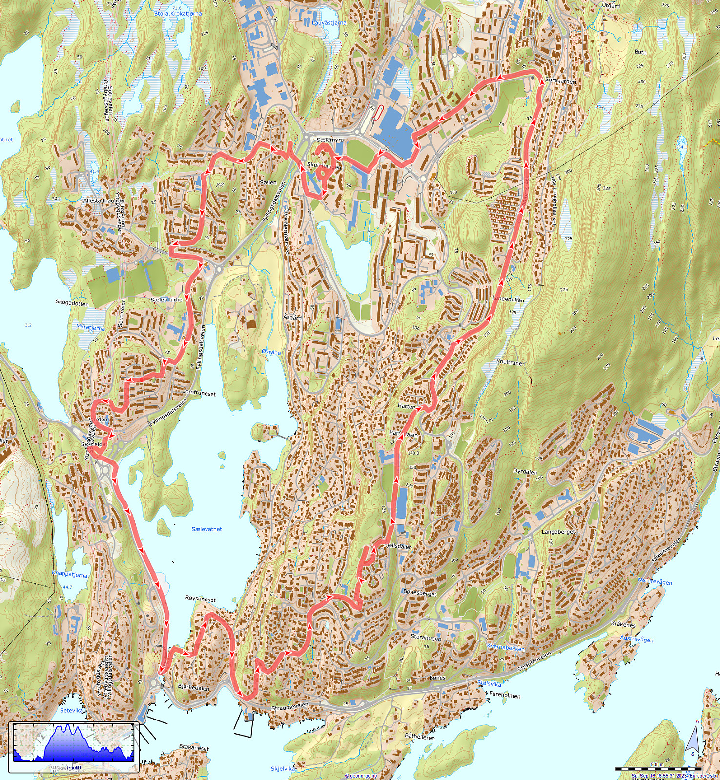
Biking detour in Fyllingsdalen (16.09.2023)

Geschrieben von HHauser (Helwig Hauser)

| Startpunkt | Varden (45m) |
|---|---|
| Endpunkt | Varden (45m) |
| Tourcharakter | Fahrradtour |
| Tourlänge | 1h 00min |
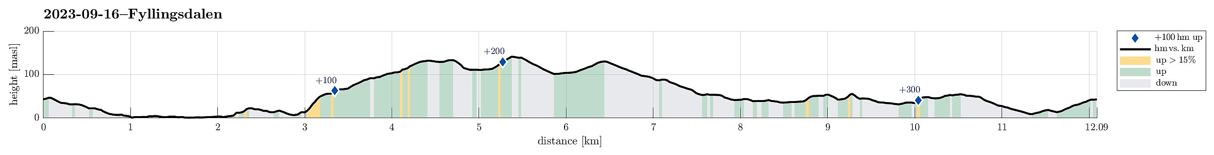
| Entfernung | 12,1km |
| Höhenmeter | 362m |
| GPS |
|
| Besteigungen | Skulehaugen (58m) | 16.09.2023 |
|---|---|---|
| Besuche anderer PBE | Bøneshallen p-plass (110m) | 16.09.2023 |
| Fyllingsdalstunnelen - Oasensiden (34m) | 16.09.2023 | |
| Sælen kirke p-plass (15m) | 16.09.2023 |
Note that this track has been created from memory, i.e., it was not recorded automatically.
Trip Summary
While en route to a local supermarket for some shopping, I decided to bike a little detour. First, I surrounded Sælevatnet in its south. I then took the steep way up to Bønes/Fjellsdalen. I then cycled around Lyshovden in its northeast. After passing by Oasen, I decided to make a brief exploration of Skulehaugen -- kind of strange to passing by this little hill (almost) every day, but never actually making it up to its "top". After that, it was mostly to the shop and then back home -- so not so much to write, today...
Useful Resources
See also the related FB-page Hiking around Bergen, Norway.


Benutzerkommentare