
Gjenekletten and Søre Sandknappen on Blomøyna (19.06.2023)

Geschrieben von HHauser (Helwig Hauser)

| Startpunkt | Blomøyvegen (20m) |
|---|---|
| Endpunkt | Blomøyvegen (20m) |
| Tourcharakter | Wanderung |
| Tourlänge | 3h 00min |
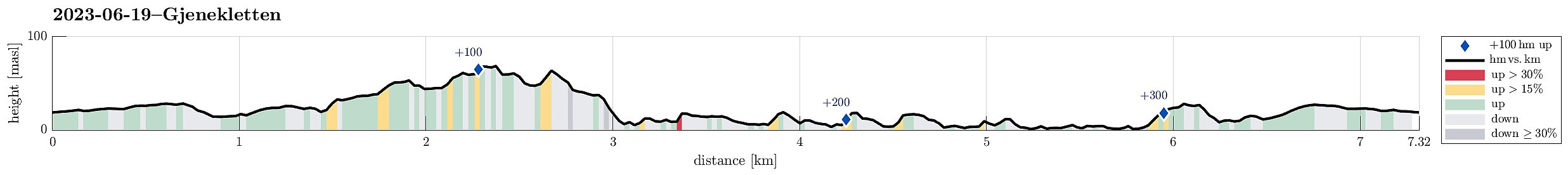
| Entfernung | 7,3km |
| Höhenmeter | 343m |
| GPS |
|
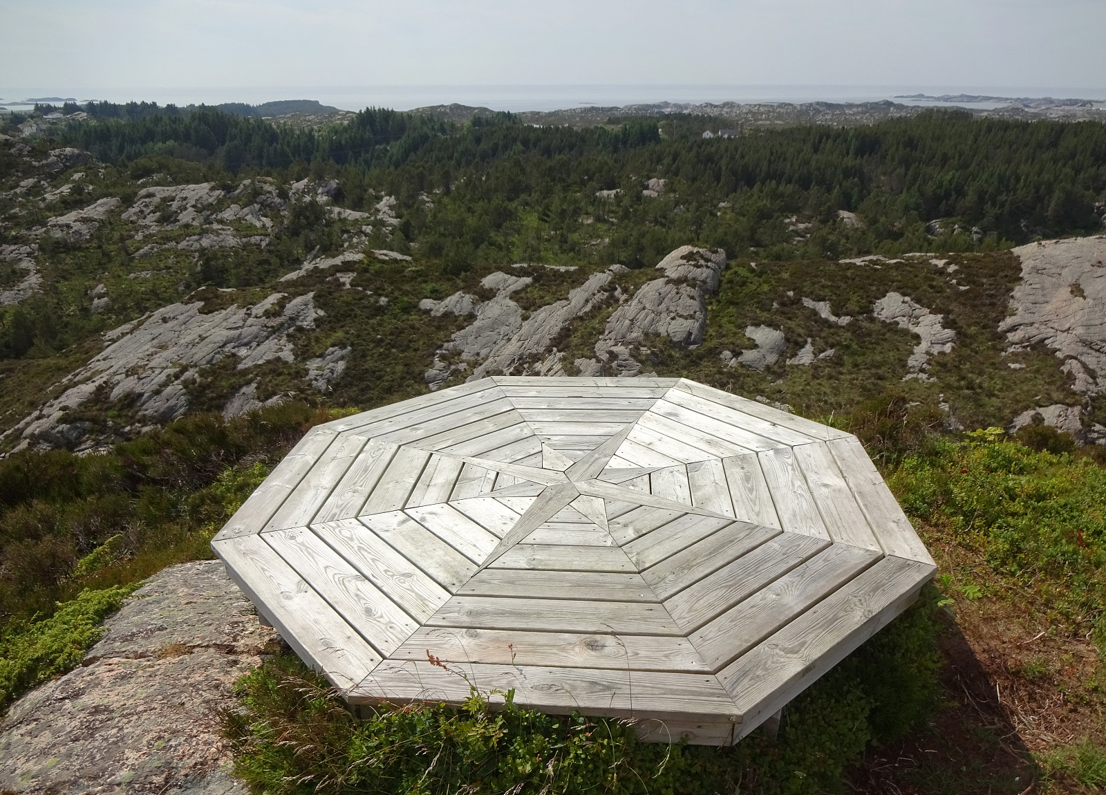
| Besteigungen | Gjenekletten (71m) | 19.06.2023 |
|---|
Trip Summary
We were up for another trip to Øygarden and chose Blomøyna for a short hike. We left Bergen towards the west and turned right (northwards) on Sotra near Kolltveit. We then followed road #561 until we passed Rong and arrived at Blomøyna via the bridge over Ulvsundet. We then parked right next to road Blomøyvegen (south of Søre Sæle). From there, we first walked along the road (northwards) for a bit (until we had walked around Blomvatnet on our left). There, at Blom, we then left the road towards the right (north) in order to find a connection to Gjenekletten. We first found a proper trail, leading to house #255. Before getting there, we then left this trail and crossed over a little ditch in the northwest of this house. Further north, however, we couldn't see any nice continuation of this trail, which lead to us ending up in a small but thick patch of island forest there. After "fighting" through some trees, we quickly made it out into the open on the north of this little forest. From there, we first went up a little hill in the south of Åsen, before then connecting to the trail that leads to Gjenekletten. From Gjenekletten, we enjoyed some good views, before then starting our way back towards more southern parts of Blomøyna. To get there, we first crossed over Åsen (from the northwest, which required a bit of climbing on the northwestern side of Åsen) and then continuing further in a southeastern direction. This brought us down into a part of Blomøyna (northeast of house #255), which is kind of cut deeply into its surrounding. There, we got onto a trail that then brought us along the southeastern cliff (in southwestern direction) towards a narrow opening in this cliff through which it was well possible to ascend up to some higher grounds near Gongstøåsen. Via some nice meadow, we then connected to Blomåsen and from there to Blomgangstø. Just a few meters further into the northeast, however, we left Blomgangstø again (kind of surrounding house #13 there) and followed another nice meadow (now in southern direction) into another small valley (in the southeast of Blomgangstø). On the southeastern side of this valley, we first walked along an old stone wall (in northeastern direction), hoping to find a reasonable spot for getting over the ridge in the southeast and to the trail that we expected on the other, southeastern side. To really do that, however, we had to improvise a little (not too difficult). We then walked along this trail (in northeastern direction) until we came to the little bay in the west of Gardskråneset and Torkjellknappen. Due to some cliffs "falling" directly into the sea there, we had to get up to higher ground (in the southwest of Torkjellknappen), again. Also there, one faces some rather thick island forest and getting through it is not just fun. :-) We still managed to get down towards the sea (south of Torkjellknappen) -- just to find another cliff disallowing further progress along the shore. So: back up into the forest and some more "bush war". After getting around also this obstacle, we "finally" made it to the shore in the northwest of Søre Sandknappen. A few minutes later, we arrived at a little building in a small bay in the west of Søre Sandknappen. There, we had to ascend once again a few meters before we could walk down to Søre Sandknappen from there. We then explored these interesting two little peninsulae (Søre Sandknappen) with their very particular shape, before enjoying a short break near the bay that is enclosed by the two peninsulae. After this nice break, we then decided to simply walk back (in western direction), first walking up to Gongstøklubben. In the south of it, we then connected to a simple trail, which brought us down in the west of Gongstøklubben and over to Bruberget from there. Then, it wasn't far to walk back to our car. All in all, it is not clear whether one should recommend this round (with all its details), even though Gjenekletten is certainly worth a visit, as well as Søre Sandknappen.
Photos
Selected photos are available as Google photo album.
Useful Resources
See also the related FB-page Hiking around Bergen, Norway.
Web page UT.no from the Norwegian Trekking Association recommends another hike that includes Gjenekletten.


User comments