
Ulvenfjellet and Vardafjellet (18.02.2023)

Written by HHauser (Helwig Hauser)

| Start point | Drangsvegen (50m) |
|---|---|
| Endpoint | Drangsvegen (50m) |
| Characteristic | Hike |
| Duration | 2h 30min |
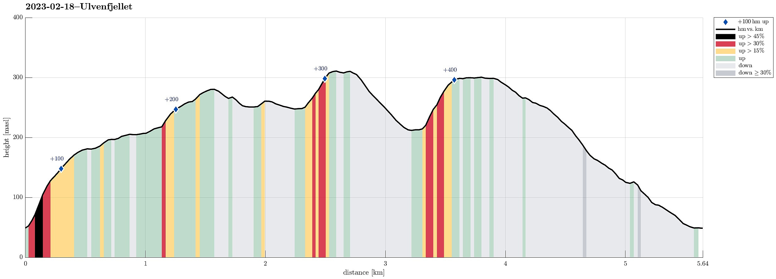
| Distance | 5.7km |
| Vertical meters | 416m |
| GPS |
|
| Ascents | Ulvenfjellet (316m) | 18.02.2023 |
|---|---|---|
| Vardafjellet (305m) | 18.02.2023 | |
| Visits of other PBEs | Nordøst for Vardafjellet (301m) | 18.02.2023 |
Trip Summary
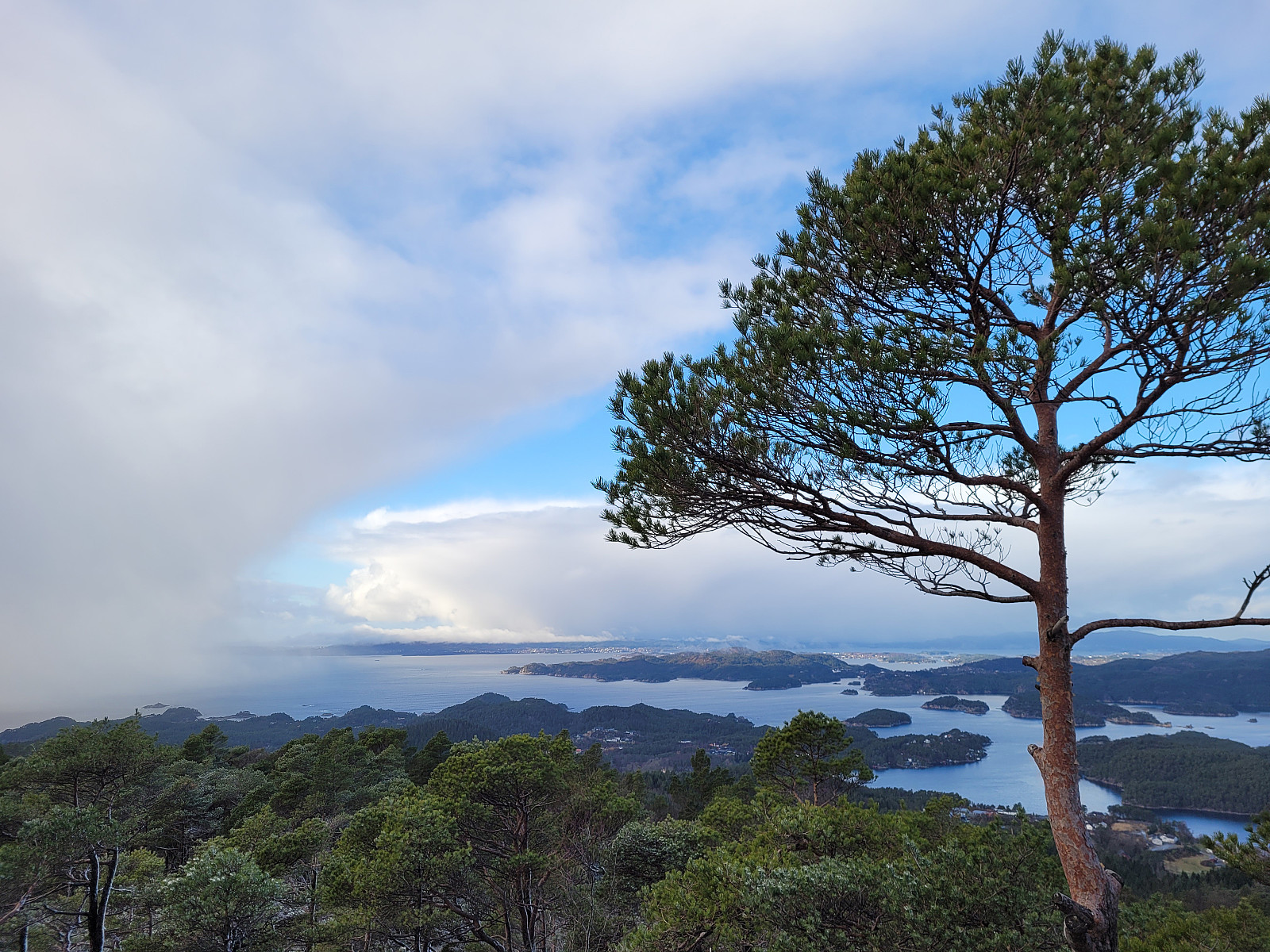
It had been a (quite long) while since we last had visited Ulvenfjellet near Os (almost 15 years). This time, we considered an ascent from its northside, starting at Drangsvegen. We found a suitable place for parking near the bridge over Vikelva. From there, the first goal was to get up to Søvikfjellet. We ascended more or less directly up towards Søvikfjellet (without a trail and across relatively steep terrain). Doing so, we also crossed over a forest road that comes up from Helleskaret, providing another (less adventurous) way up. Once on the heights of Søvikfjellet, we aimed at Gaddhaugen as our next goal. While heading there, we connected (for a short stretch of our hike) with the trail, which is the extension of the forest road that we had crossed a bit further down. To get up to Gaddhaugen, however, we left this trail after a relatively short stretch again. From Gaddhaugen, we then continued into the direction of Ulvenfjellet. The southeast of Gaddhaugen is steep for some 25 height meters, or so, and a bit of care was needed to find a good place for descending towards the saddle between Gaddhaugen and Ulvenfjellet. Crossing over to Ulvenfjellet was then nice and easy. The north of Ulvenfjellet is then steep, again, but finding a suitable route for ascending up to the top was no problem at all. After visiting the top of Ulvenfjellet (not really much to see due to all the trees), we continued without much delay, now into the direction of Vardafjellet (in the west). We first followed a trail (or so) that leads down to Mikkelsvatnet in the northwest of Ulvenfjellet. There we crossed to the other, western side of the valley and started our ascent to Vardafjellet, following a simple trail. This brought us, first, to a vista-point in the northeast of Vardafjellet with nice views towards Lysefjorden. From there, we then walked across the heights to the actual top of Vardafjellet (a bit further to the southwest). The southwest of Vardafjellet is steep, again, and we first followed a trail that stays a bit further up in the northeast of Hovlandsvatnet, leading eventually down towards Setret in the northwest of Hovlandsvatnet. Instead of descending to Setret, however, we decided to descend via the northwestern slope of Vardafjellet (in northern direction and without a trail) towards Vikelva. Hitting the direction pretty well, we connected with the forest road on the western side of Vikelva, which then brought us back down to where we had parked. While mostly without any trail, this hike still was nice and enjoyable. We did not have the impression that this northern side of Ulvenfjellet and Vardafjellet is seeing all too many hikers, maybe...
Photos
Selected photos are available as Google photo album.
Useful Resources
See also the related FB-page Hiking around Bergen, Norway.
Petter Bjørstad has a useful page about Ulvenfjellet and also web page WestCoastPeaks.com provides useful information about Ulrvenfjellet.
Web page UT.no from the Norwegian Trekking Association recommends another round including Ulvenfjellet.


User comments