
To Mount Zuqualla in Oromia, Ethiopia (13.11.2022)

Geschrieben von Solan (Atle Solholm)

| Startpunkt | Onebirr village (2.020m) |
|---|---|
| Endpunkt | Onebirr village (2.020m) |
| Tourcharakter | Bergtour |
| Tourlänge | 5h 55min |
| Entfernung | 17,5km |
| Höhenmeter | 1.345m |
| GPS |
|
| Besteigungen | Zuqualla Mountain (3.019m) | 13.11.2022 |
|---|
We had been in Addis Ababa for about a week for a cardiology and cardiac surgery mission at the Black Lion Hospital, when we finally had this one day off, as it was weekend, and there were not any procedures scheduled for Sunday. I had booked the trip through a guy called Johnny Gondar, whom I had met for the first time shortly after I arrived in Addis. I asked some of my colleagues whether they would like to join me for the hike. When I first asked, there were three people that were interested; but when the day finally arrived, only one of them came along, however, namely Bjørg Anita, who proved to be very well fitted for mountaineering. For me, this hike was all about altitude acclimatisation, as I was planning to ascend Mount Kilimanjaro in Tanzania [5985 m.a.m.s.l.] less than two weeks later. The key to a successful ascent on mountains with such elevations is usually careful planning, and I believe it might be essential to have a good strategy as to how you're gonna get used to the high altitude.
We were picked up at our hotel in Addis in early morning by Johnny and a driver that he had hired for the day; and they even brought with them a guide that was originally from Oromia, and who was familiar with Mount Zuqualla. This guy, whose name was Thomas, had even been working as a guide in the Simian Mountains in the north of Ethiopia, they told us, but he had now moved to Addis Ababa, due to lack of tourists in the Simian's, as a result of the Covid-19 pandemic and the civil war that had been raging for the last two years. Tourism had in fact been virtually absent in all of Ethiopia during this period, but both Thomas and Johnny were quite optimistic that tourists would now start coming back, as the pandemic and the war had both come to an end. From Addis Ababa we drove to the town of Bishoftu. The distance from Addis to Bishoftu is not more than 53 kilometers, but due to heavy morning traffic it took us quite some time to get out of Addis. Once out of the city, however, we found ourselves on a modern day highway, and it was then possible to speed up a bit. In Bishoftu we stopped at a restaurant, that was, according to Johnny, the best restaurant in Bishoftu. We were not going to eat there, but Johnny had ordered lunch boxes for me and Bjørg Anita from this restaurant; and so we just had a brief stop there in order to pic up these boxes. We also had a brief stop at a local shop in order to buy some bananas and some beverage, i.e. some bottles of Fanta and Coke.
![Image #6: View of Mount Werabēcha Terara [2490 m.a.m.s.l.]. The town of Bishoftu is located just behind the mountain. Mount Yarar is seen in the background to the left.](https://images2.peakbook.org/images/14939/Solan_20221225_63a8c73eb274b.jpg?p=xtralarge)
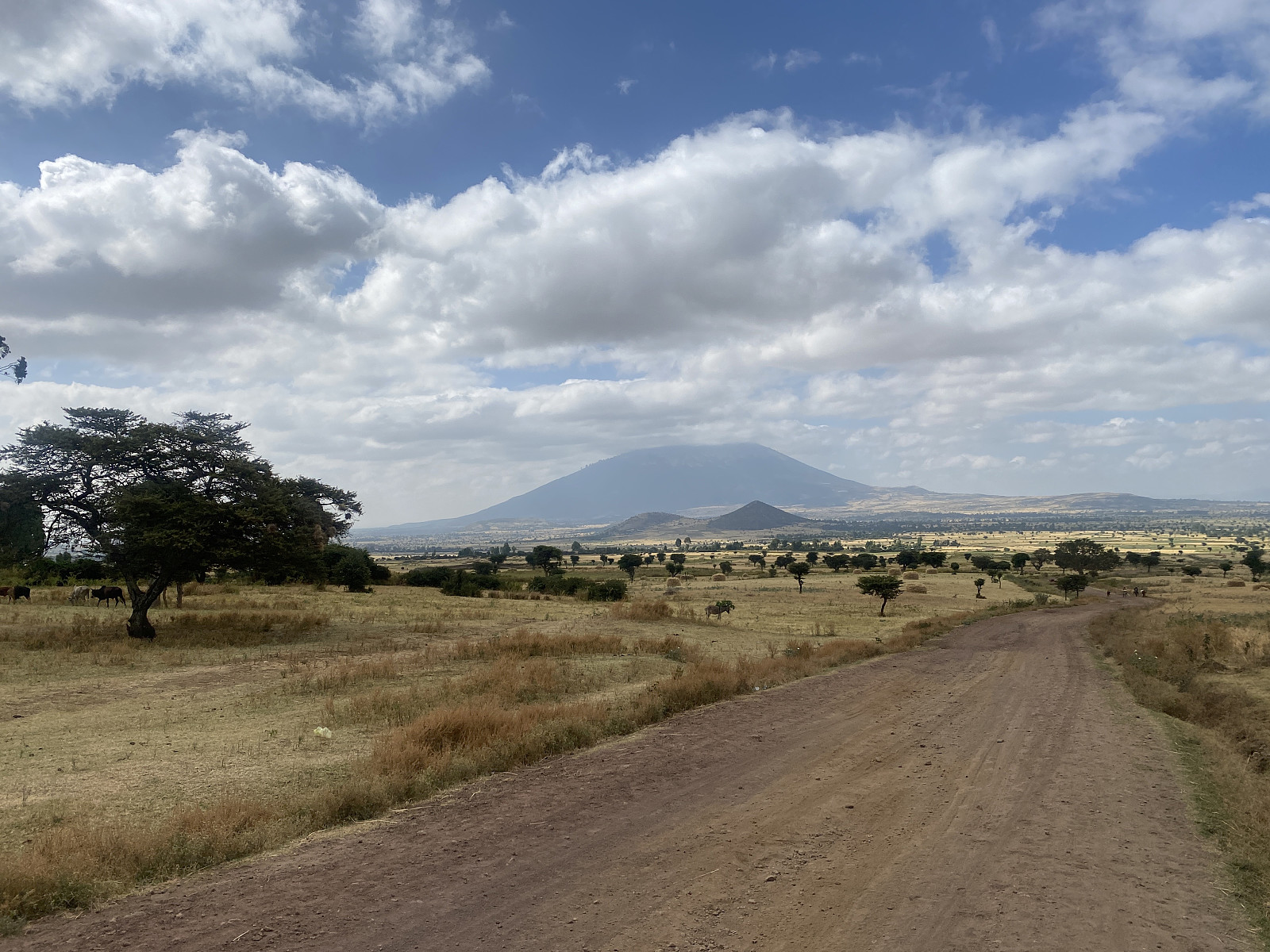
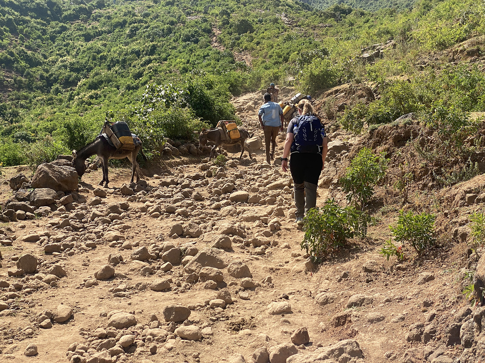
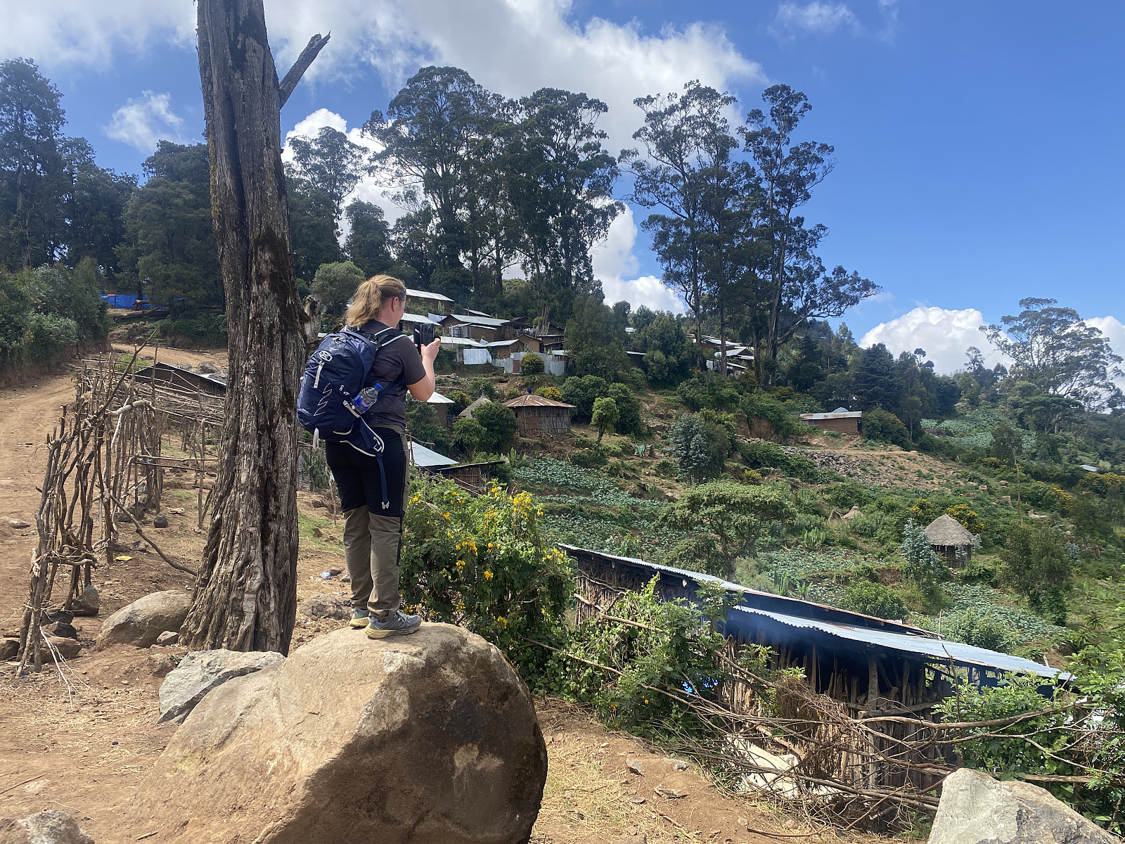
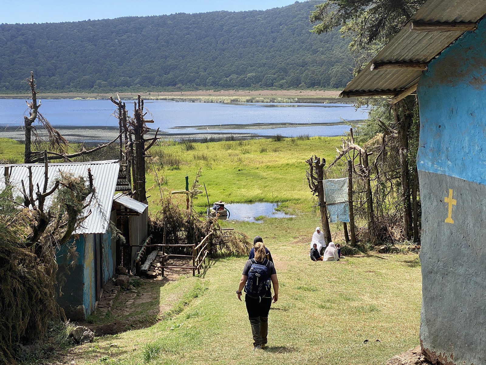
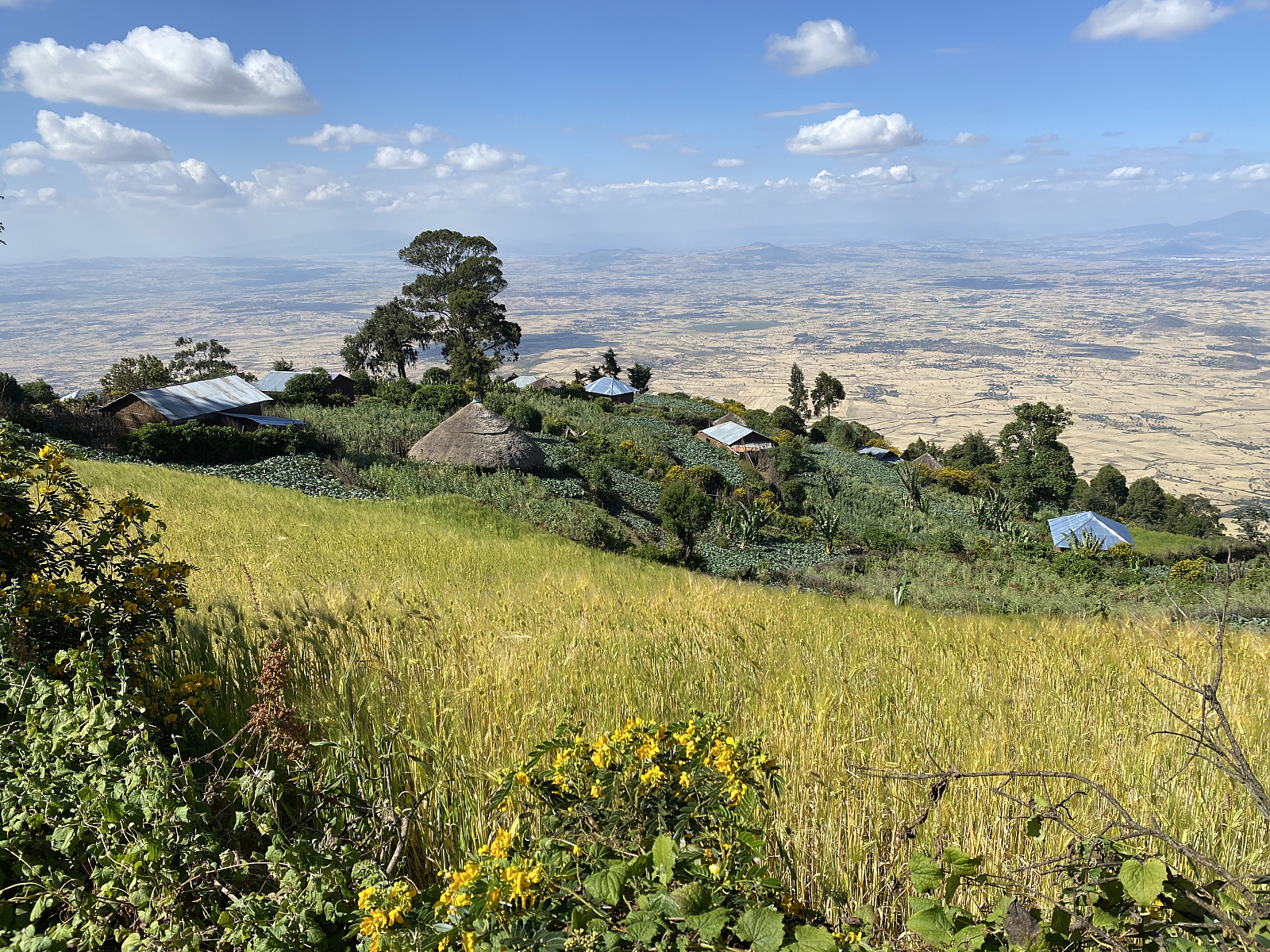
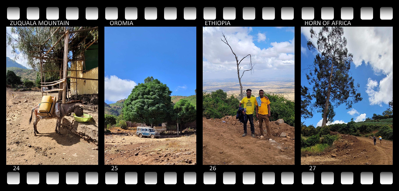
From Bishoftu we drove to the village of Onebirr (Image #5), witch is located just north of Mount Zuqualla, and actually by the foot of the mountain. As we were navigating out of Bishoftu, it proved useful to have an Oromic-speaking guide with us. Hopefully, this will ease up as time goes on, but there has lately been some tension between the Oromians and the Amharic-speaking people of Addis Ababa. And so, whenever we stopped and asked people for the way to Mount Zuqualla, if Johnny asked them in Amharic, the people along the road tended to give us misleading guidance; whereas, if Thomas, or the driver, asked them in Oromic, we got correct directions towards the mountain. When we finally arrived at Onebirr Village, we met with a local guide that was going to join us for the climb. Johnny explained to us, that as a tourist, you can't climb Mount Zuqualla without a local guide, as there is this concept, that even the local community at the spot should have some benefit from the tourism. The payment for this local guide was already included in the amount that I had payed to Johnny, however; and so we only had to give him a tip after the climb, in addition to the payment that Johnny was going to pay him.
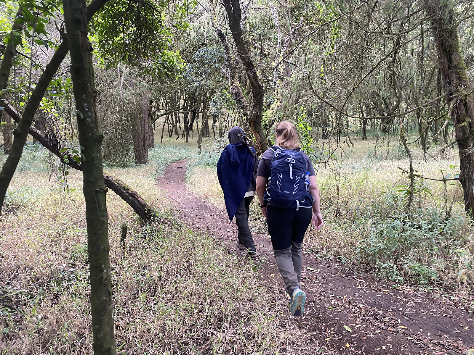
The local guide proved to be a nice and likeable guy, and also well fitted when it comes to mountaineering. As we headed up the mountain, he was leading the way, followed by Bjørg Anita, who was again followed by me; with Thomas at the rear of our little group. Johnny did not feel quite well this day, so he had decided to remain with the driver, and not ascend the mountain along with the rest of us. When we realised how well fitted the local guide was, Bjørg Anita asked him whether he climbs this mountain often; upon which he answered that he climbs this mountain three times a week. We didn't inquire any further, but Ethiopians are generally speaking a very religious people; so it's most likely that he goes up there this frequently in order to pray at the monastery that is located up there. The one that impressed me more than the local guide, however, was my colleague, Bjørg Anita. She had mentioned that she and her husband frequently do go on mountain trekking in Norway. Trekking from 2000 to 3000 meters above sea level is, however, substantially different from trekking in the range between 1000 and 1500 meters; and so I was quite impressed by the speed that she was able to keep up with, and I don't think I would've been able to go much faster, even though I had been in Addis (at 2400 m.a.m.s.l.) three days longer than she had.
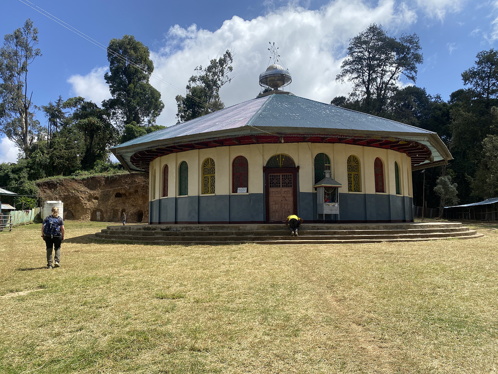
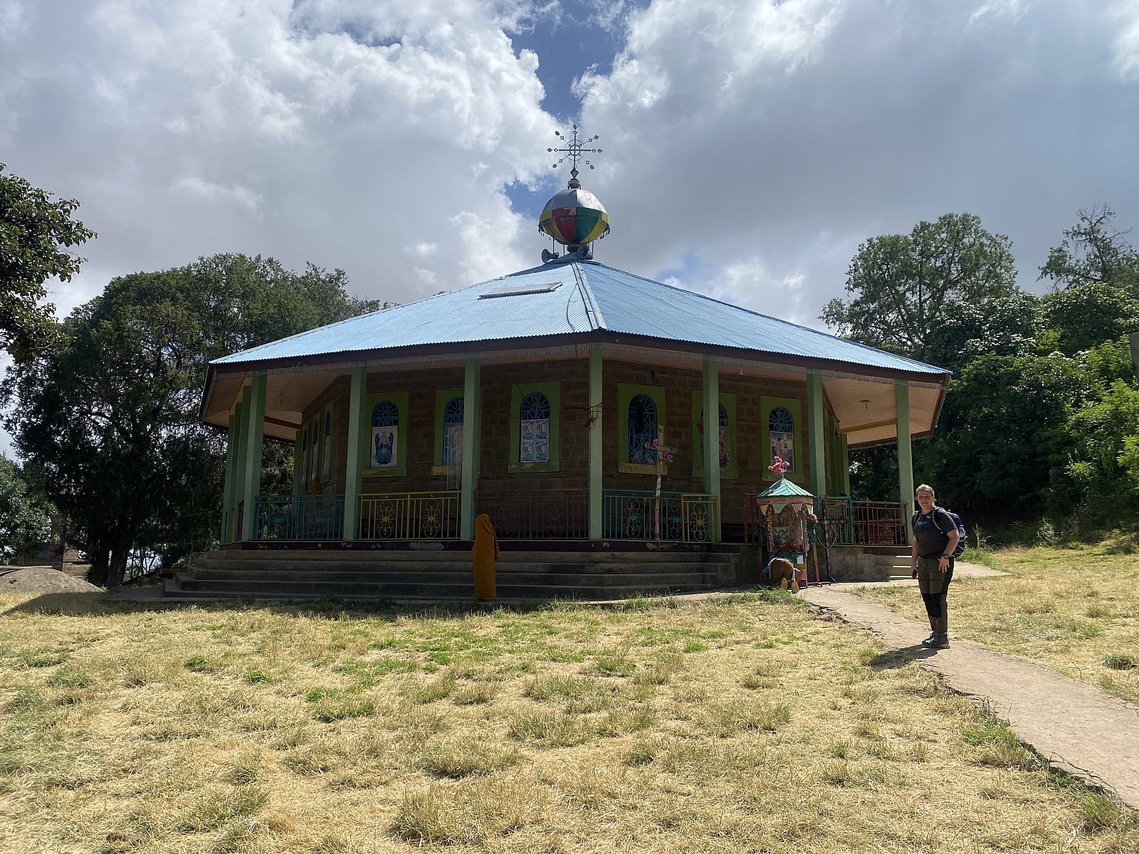
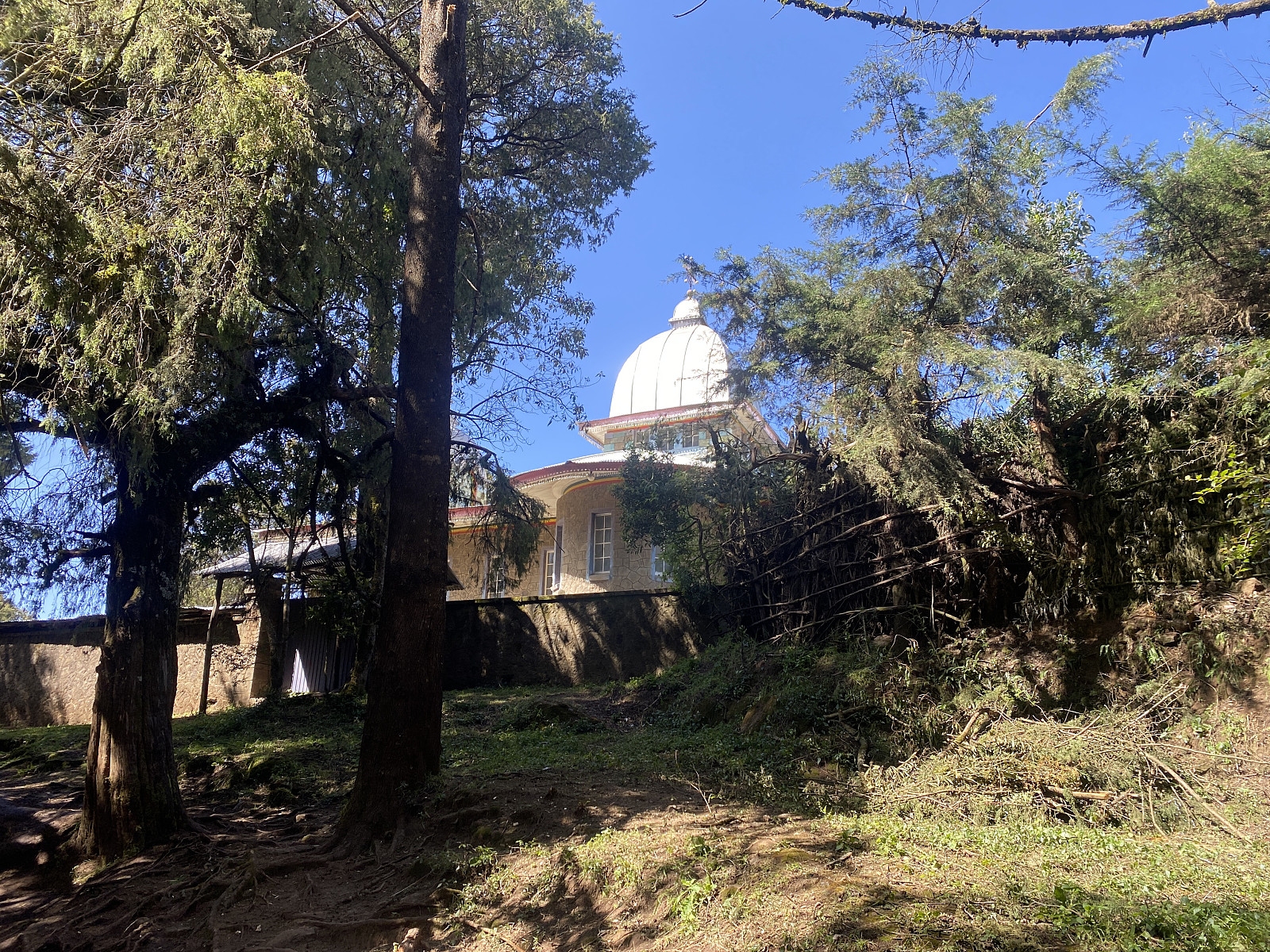
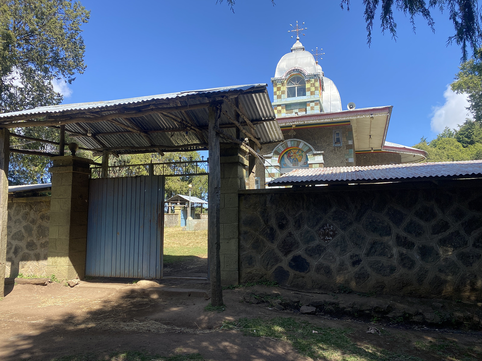
After about 1 kilometer's walk, we came to a spot where a traditional, Ethiopian Orthodox Church, was located, i.e. the Wenber Maryam Church Ziquala (image #3). To be quite honest, we actually wanted to just push on with our trek, but our two guides both insisted on showing us the church, and so, in order not to turn down their hospitality and kindness; we had to encircle the church once, in order to se it, with all it's paintings and ornaments from all sides, before we could continue. When we came out of the church yard, and back onto the trail, there was a beggar sitting there. Fortunately, I had a small amount of money that I could give him, before we continued our ascent of the mountain. Tourists that do visit Ethiopia should, generally speaking, expect to encounter old people, as well as crippled people, or people with other ailments, outside the churches asking for alms; and it is, therefore, always wise to bring along some money in small bills, in order to have something to give them.
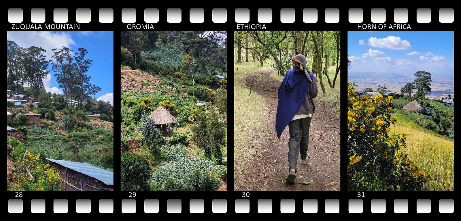
The hike from our start point [2020 m.a.m.s.l.] up to the monastery and the church on the northern rim of the crater [2900 m.a.m.s.l.] took us exactly 2 hours. At this point, however, we had to wait for another local guide to take over, as the entire top of the mountain, including the crater and the lake, is regarded as the property of the Ethiopian Orthodox Church. Moreover, there were quite strict regulations pertaining to the Abune Gebre Menfes Kidus Church; i.e., you were not allowed to enter the perimeter of the church if you were not an Orthodox Christian; and a woman also needed to cover her head before she could enter; even if she was an Orthodox Christian. Unfortunately, our two guides were not aware of this, but an orthodox priest soon showed up, and admonished us to stay outside of the gate of the churchyard; and a few minutes later, our new guide showed up; who seemed to be some sort of a monk and a ranger combined.
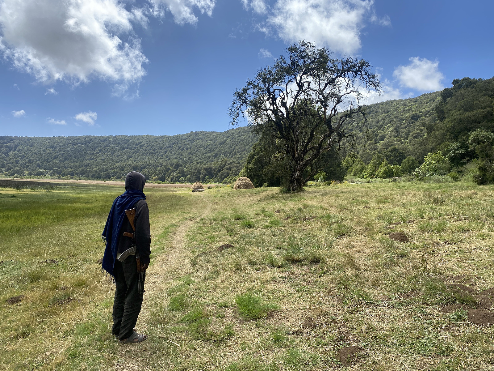
The guide from the monastery was carrying a rifle, but he didn't speak any English, so we never got to know whether the gun was for protection agains wild animals, or against bad people (robbers etc.). The entrance fee for the crater and the summit was 400 ETB. Shortly before arriving at the church compound, we had noticed a brand new, huge concrete building, that we were told was going to their new monastery; and so I was thinking the amount that we payed was probably going into that building project. After our crater and summit tour, I offered this guy a tip of 200 ETB in addition to the 400 birr to the Church, but he refused to receive anything more than the 400 that was the actual entrance fee; and afterwords he gave us a receipt for the amount, with the logo of the monastery in print on top, and the signature of one of the priests below.
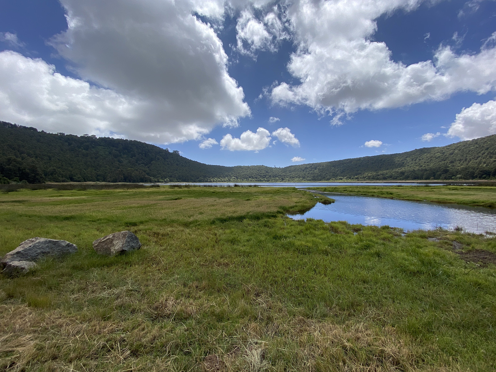
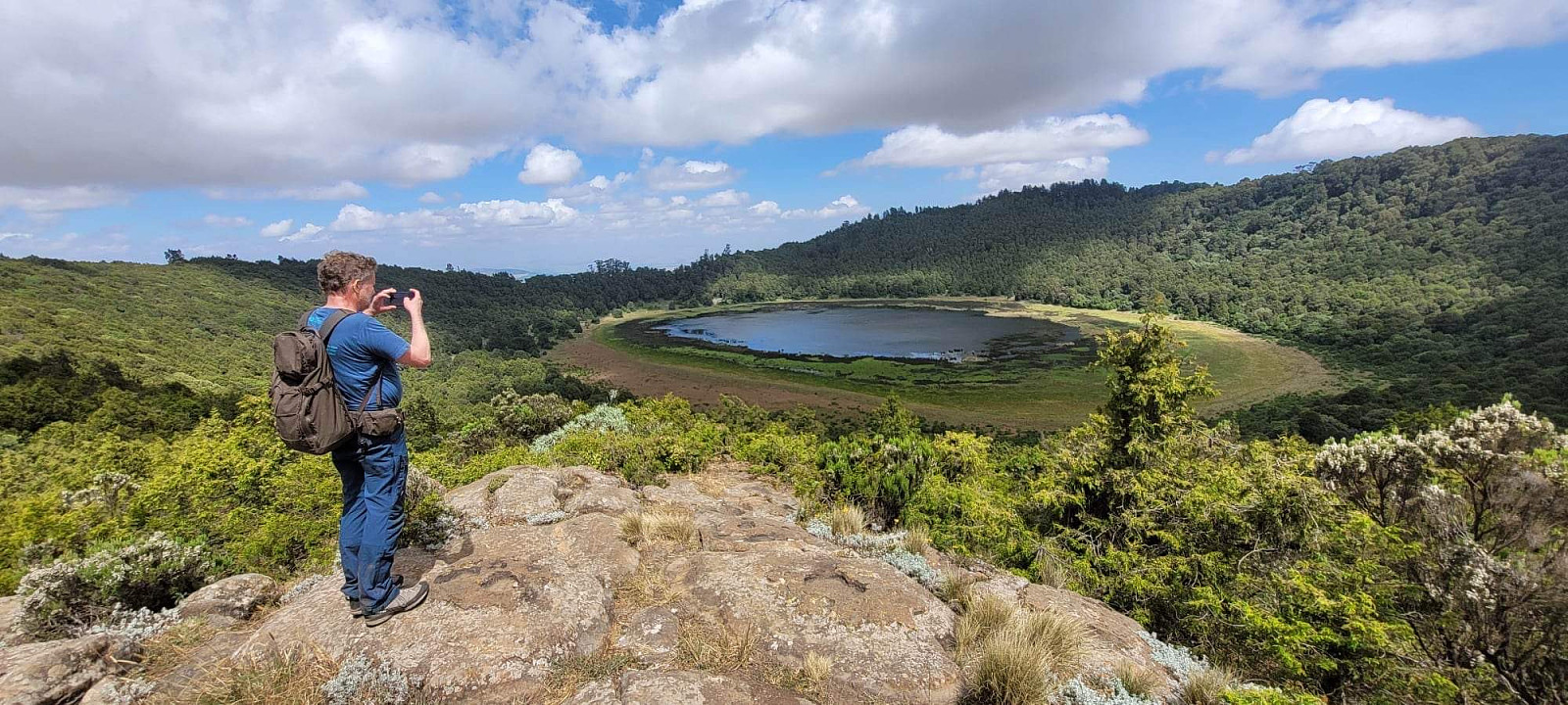
![Image #15: An overview of most of the crater with Lake Dembel [2835 m.a.m.s.l.] within it. The lake is also frequently referred to as Lake Zuqualla.](https://images2.peakbook.org/images/14939/Solan_20221226_63a992610cfbe.jpg?p=xtralarge)
Our two previous guides decided to remain by the monastery, as the monk-guide took us down to the lake within the crater(image #11); they said we had tired them out by our speed up to the monastery, and they didn't quite see the point in continuing up to the summit. To them, the monastery, and the lake, which is considered holy by the Ethiopian Orthodox Church, was the ultimate goal of this ascent, and they couldn't quite understand that the summit of the mountain could be more important than the holy sites below. The lake has no visible river outlet, and most of the water that collects in it probably disseminates into the ground, contributing to the ground water level, and the fertile fields on the sides of the mountain. As we came down to the shores of the lake, there was some kind of an entrance gate that we had to go through, and we noticed there were some pilgrims sitting there by the gate. From what the other two guides had explained to us, they were probably afflicted by some kind of illness, and had travelled to the site hoping that the holy water of the lake would heal them.
We tried to explain to our new guide that we wanted to go up to the summit, and we pointed eagerly up to the highest point on the rim surrounding us. The guide responded, however, by shaking his head saying "no copy", and he continued to repeat "no copy" as we continued to insist upon going up to the summit. He then pointed up at the southwest part of the mountain rim, and said "copy", before he pointed towards the summit and said "only tree, no copy". It then finally dawned upon us that he was talking about photographing. He didn't speak English, and we didn't speak either Amharic or Oromic, and the two guys that would've been able to translate to us, were currently back at the monastery. But "copy" was this guide's word for "photo", so what he was trying to explain to us, was that on the east side of the crater, there was too much forrest, so you couldn't have a nice picture of the lake and the crater; whereas on the southwest rim, you could.
Video #1: An overview of Mount Zuqualla vith its surroundings, as seen from the viewpoint on the southwest rim of the extinct volcano.
![Image #17: Bjørg Anita and me on the viewpoint from where the Lake Dembel [2835,3 m.a.m.s.l.] is visible.](https://images2.peakbook.org/images/14939/Solan_20221226_63a9950b26bd4.jpg?p=xtralarge)
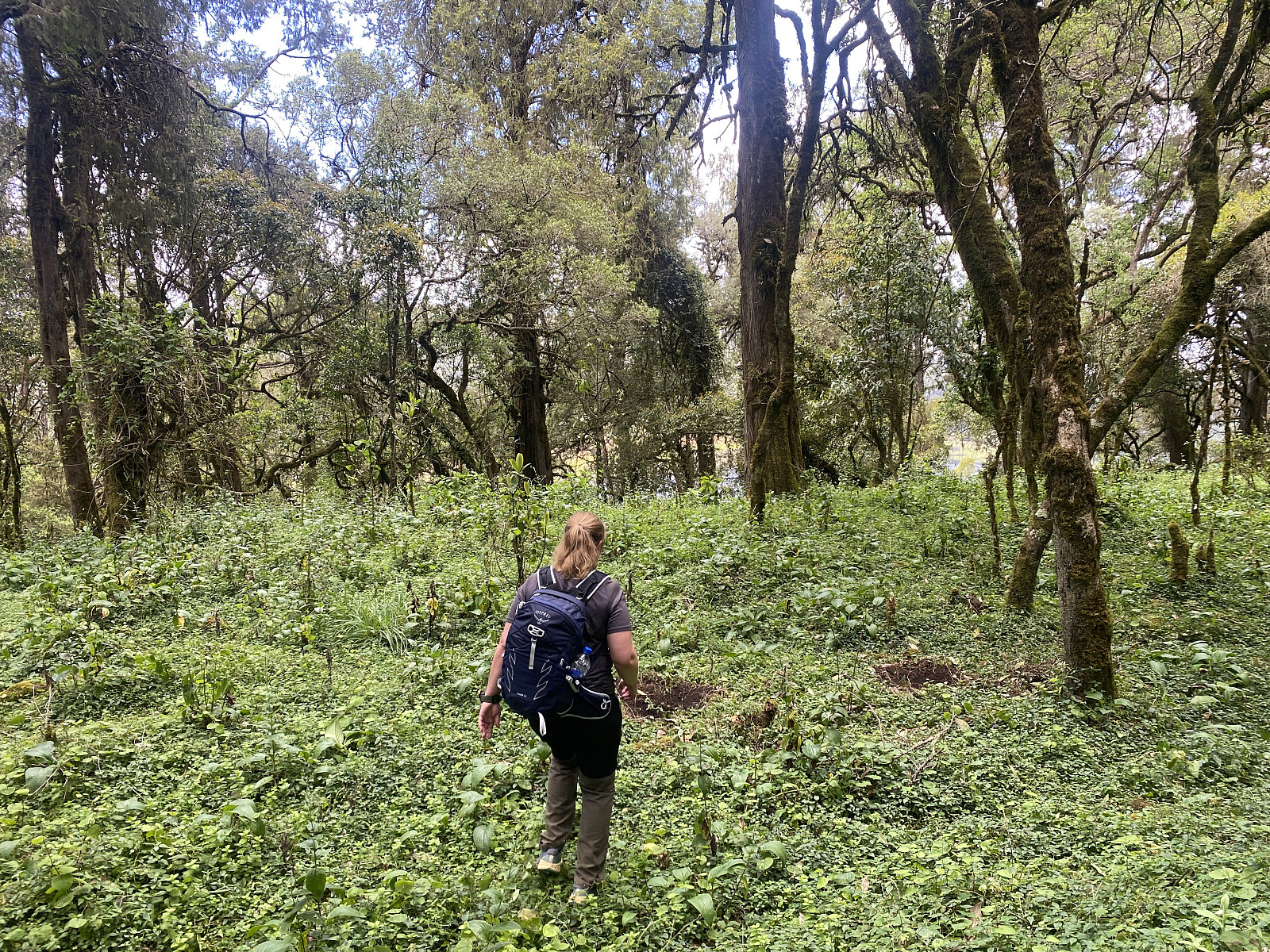
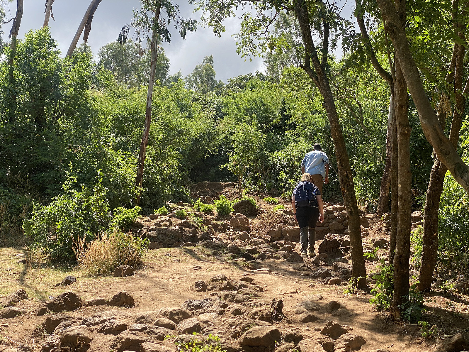
We finally agreed, therefore, to come with him to the viewpoint that he wanted to show us, but insisted that afterwards, he had to take us to the summit. We followed him into the forest (image #14), and then upwards on the inside of the crater rim, along a trail that led all the way up to the rim. From there we had a pretty nice view towards the south, i.e. on the outside of the crater, whereas towards the inside of the crater, the view was obscured by the forrest. We next followed our guide westwards along a trail on top of the crater rim, until we came to the viewpoint seen in images ##15-17. At this spot we admired the view, and shot a number of images, before we said to the guide that we now wanted to go to the summit. He had by now an idea about what we wanted, and since it was easy to see the summit from here, we eagerly pointed to it as we tried to explain where we wanted to go.
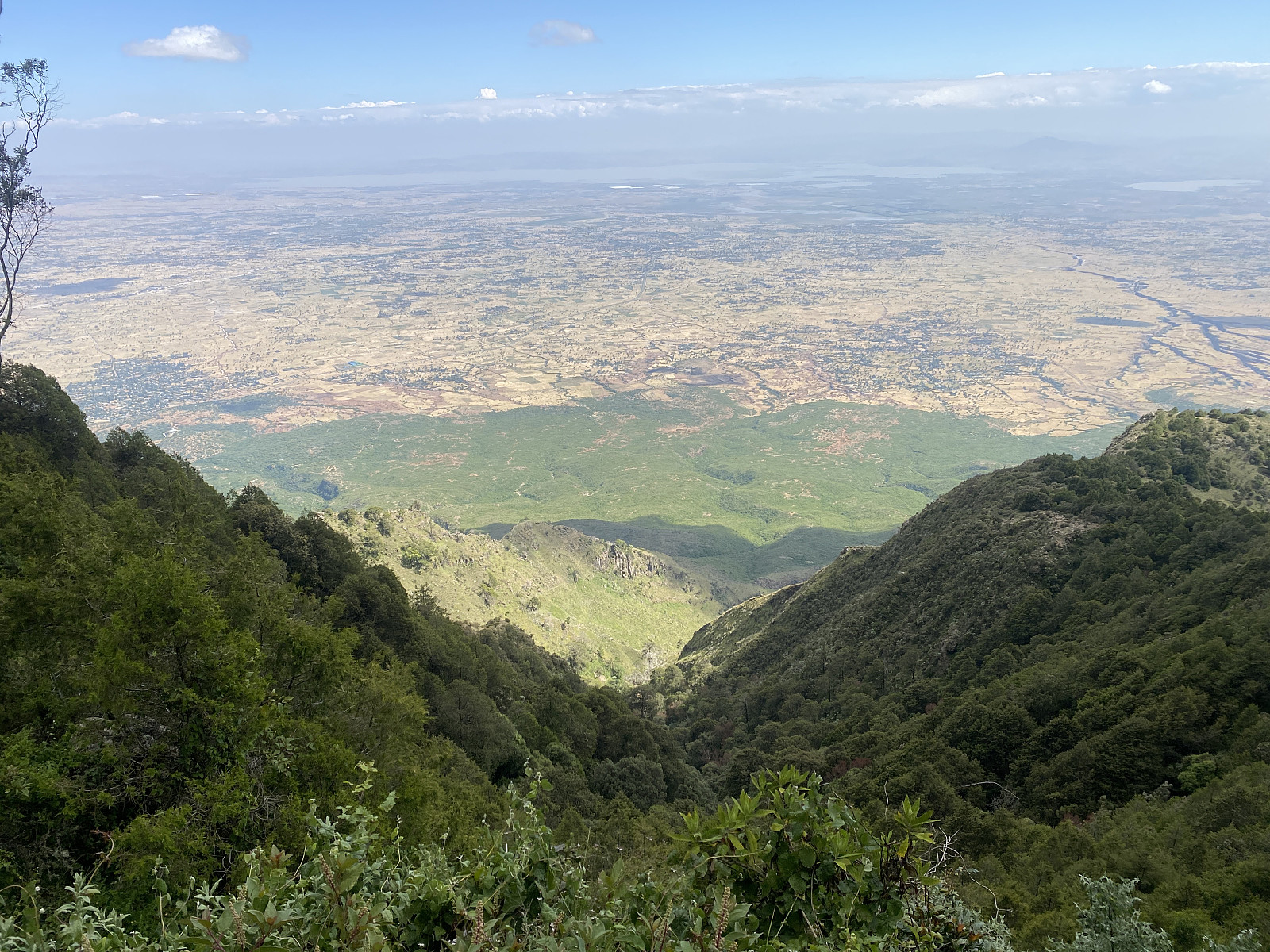
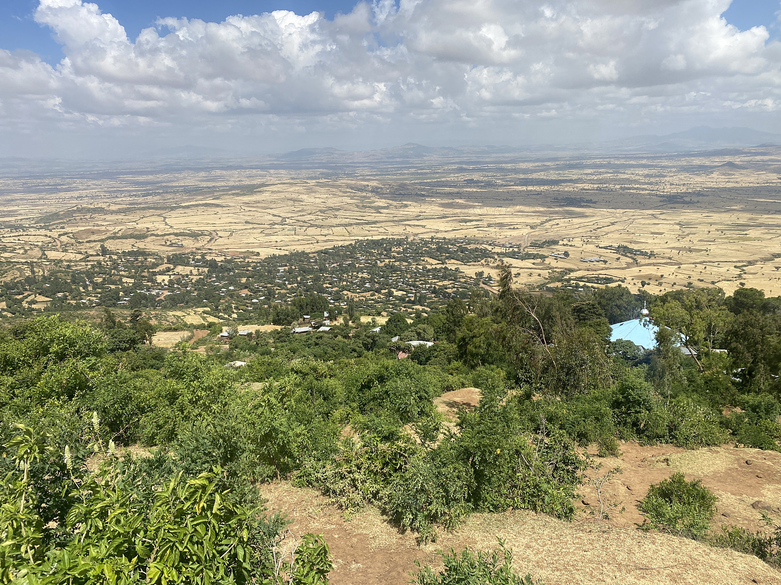
We arrived at the summit at 1:50 pm, i.e. 3 1/2 hour after we started out from Onebirr Village. According to various websites, the elevation of the summit is 2989 m.a.m.s.l. On modern maps, however, you do cross the 3000 meter contour line as you approach the summit, and on TripAdviser the elevation of the mountain is given as 3013 m.a.m.s.l. Our guide was quite right, anyway; the summit was covered by trees to such an extent that there was really no view into the crater or down to the lake. From the summit he took us to a nearby viewpoint on the outside of the crater rim, thought, and from there we had a fabulous view into the African Rift Valley, and especially towards the southeast (image #19), in which direction we could see all the way to Lake Gelila, a dam, or reservoir built on the Awash river, and therefore also called the Koka Reservoir.
From the southeast viewpoint, we headed back towards the monastery, along a trail that followed the crater rim in a northward, and then nortwest direction. The forrest was quite dense at some places along this route, and it was a bit longer than I had imagined, but after a while we came down to a church building, which proved to be the Zuquala Kidane Mihret Church (images ##20-21), i.e. a second Orthodox Church, which was located just behind and above the other one (see map with GPS tracking). Be passed on the left side of both churches, and then arrived at the entrance of the first one, where Thomas and the other guide were still waiting for us. We didn't remain long at the site, but started our descent from the mountain as soon as we had payed the church-guide the entrance fee and received our receipt.
On our descent from the mountain, Thomas and the guide from Onebirr talked us into a local bar, in order to taste a traditional local beer that is brewed from local grains. I was definitely not the best beer that I've tasted, but polite as we were, we pretended that we liked it, and after finishing a cup each, we continued our hike back down to Onebirr Village where Johnny, the driver, and the car were waiting for us.


Benutzerkommentare