
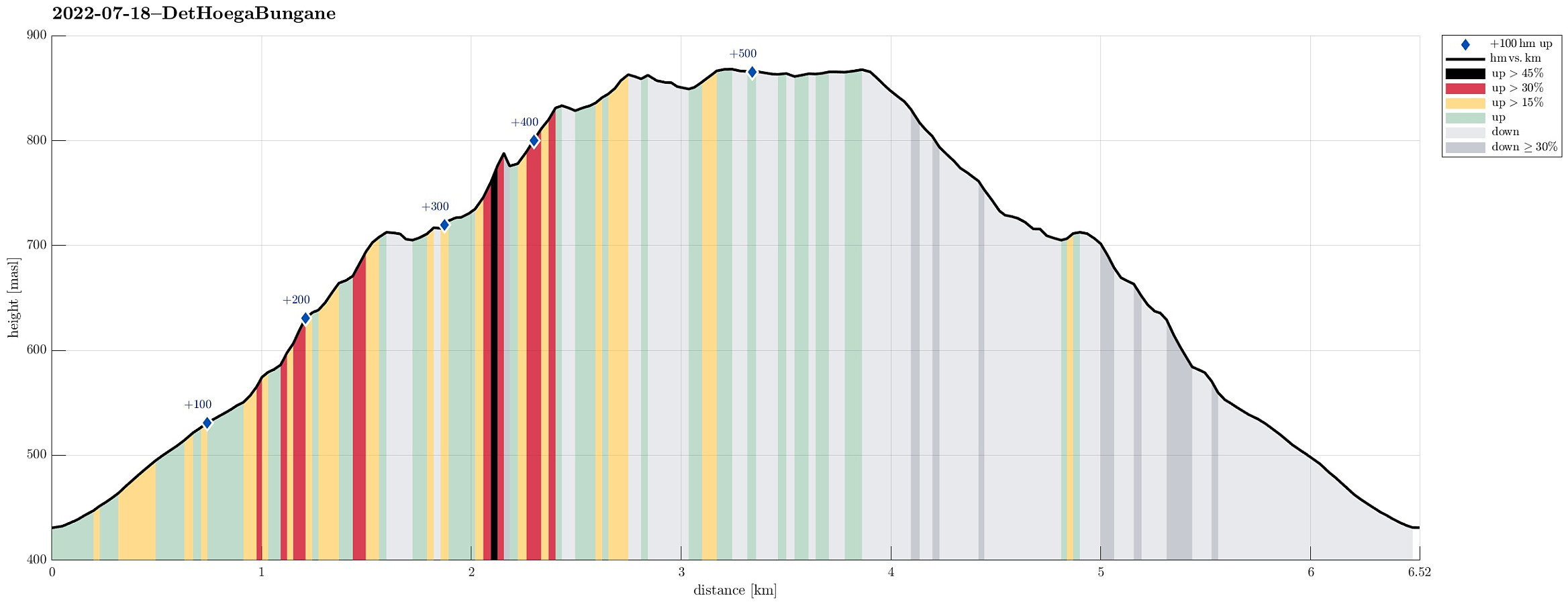
Det Høga Bungane from Haugen (18.07.2022)

Skrevet av HHauser (Helwig Hauser)

| Startsted | Haugen (430moh) |
|---|---|
| Sluttsted | Haugen (430moh) |
| Turtype | Fottur |
| Turlengde | 2t 00min |
| Distanse | 6,5km |
| Høydemeter | 520m |
| GPS |
|
| Bestigninger | Det høga (874moh) | 18.07.2022 |
|---|
Trip Summary
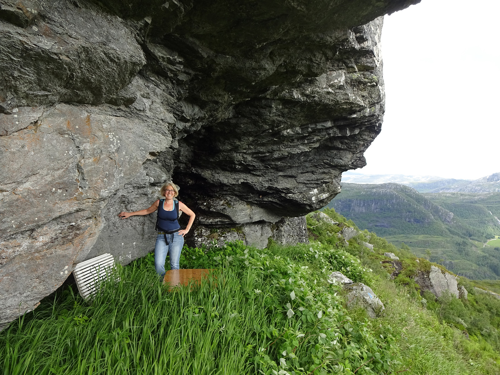
After some driving, we ended up in Lavik, Eksingedalen, in the early evening. We decided that it was still enough time for a short walk and followed a recommendation from one we had talked to in Lavik, driving up to Haugen in Fagerdalen, just northeast of Lavik. From there, we started walking, reaching Lavikstølen at the end of the gravel road leading up there from Haugen. At Lavikstølen, we still wished to include a bit more and so we continued along a trail that leads upwards (in western direction) from Lavikstølen. First, we thought that this trail would lead up to Nipa, just to find out rather quickly that the trail tended more and more into southwestern direction, instead. Once above 700mosl, it became clear that this trail would lead around some pronounced cliffs in the south of Nipa (where also the water from Nipevatnet comes down). Once around the southernmost point, we started to ascend parallel to the cliff (and into the direction of Nipevatnet). Just up a short stretch, we discovered a cave-like spot right underneath the cliff, with a bench and a table, ready for hikers and their break. After continuing further upwards from there for a bit, we came to the little lake right underneath Nipevatnet. Enjoying the area and not wanting to extend this unplanned hike any further (without extra clothes and no water etc.), we decided to just make a short round across Det Høga Bungane (in the southwest of the cliff) before returning back, basically along the same trail. All in all, a very nice, unplanned evening hike! :-)
Photos
Selected photos are available as Google photo album.
Useful Resources
See also the related FB-page Hiking around Bergen, Norway.
Web page UT.no from the Norwegian Trekking Association recommends another hike to Lavikstølen.


Kommentarer