
Skavlandsfjellet from Søyleplasset and Totlandsfjellet (15.05.2022)

Geschrieben von HHauser (Helwig Hauser)

| Startpunkt | Hardangervegen (75m) |
|---|---|
| Endpunkt | Hardangervegen (75m) |
| Tourcharakter | Wanderung |
| Tourlänge | 4h 00min |
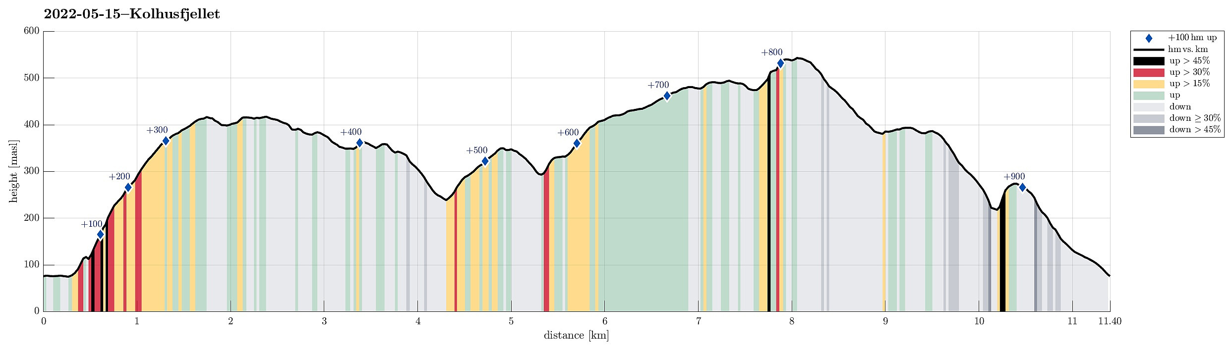
| Entfernung | 11,4km |
| Höhenmeter | 905m |
| GPS |
|
| Besteigungen | Kolhusfjellet (353m) | 15.05.2022 |
|---|---|---|
| Rislikampen (397m) | 15.05.2022 | |
| Nordre Skavdalsfjellet (419m) | 15.05.2022 | |
| Søre Skavdalsfjellet (420m) | 15.05.2022 | |
| Totlandsfjellet (546m) | 15.05.2022 | |
| Besuche anderer PBE | Speiderhytten, Totland (363m) | 15.05.2022 |
| Søylen p-lomme (85m) | 15.05.2022 |
Trip Summary
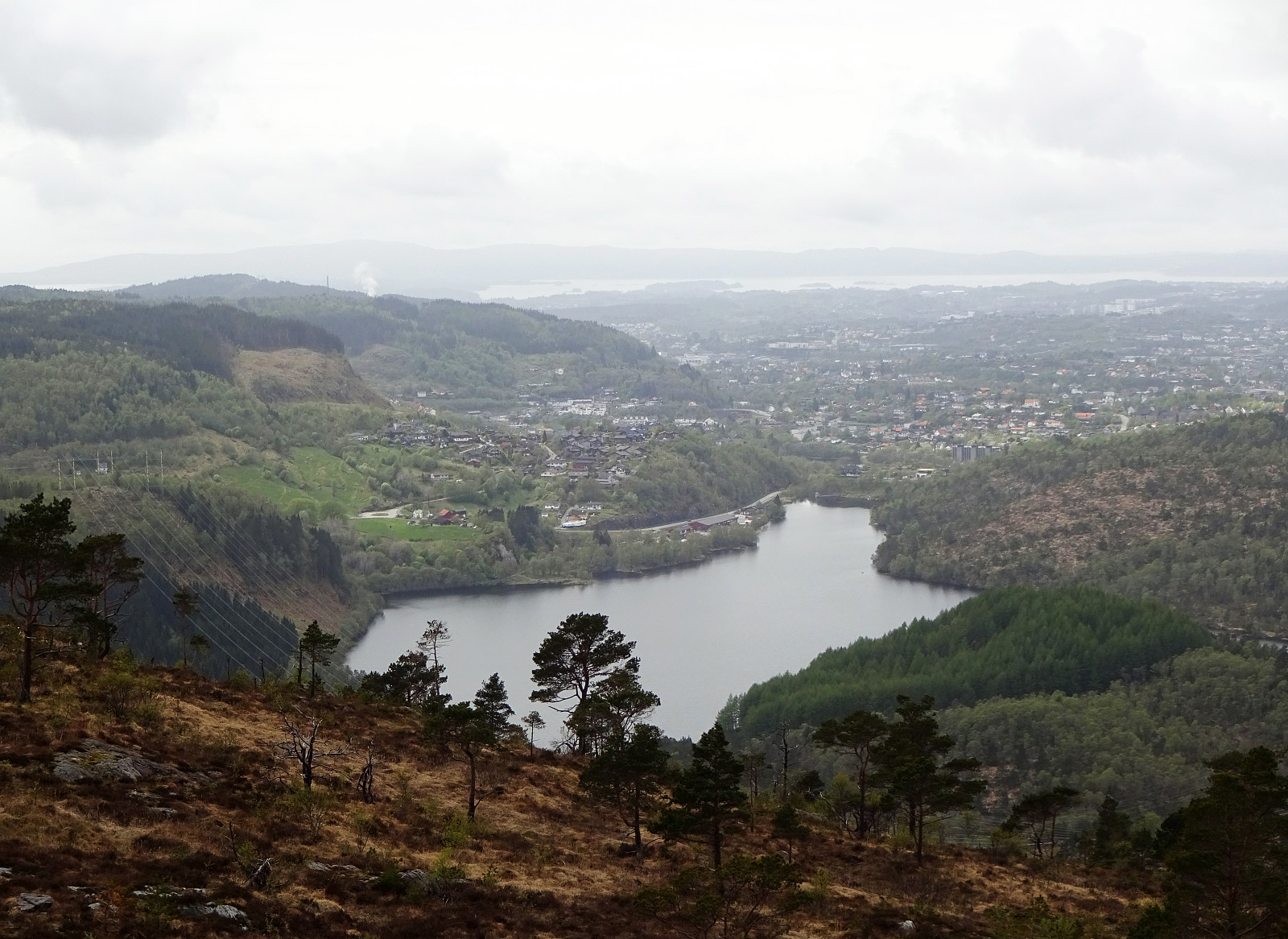
Ascending to Brattlandsfjellet from Brattland -- a long time plan! :-) We parked in the south of Søylevatnet, where the trail from Furedalen comes down from the south. After walking around Søyleplasset along the main road, we started our ascent to Dansebakken in the southwest of Søylevatnet. While we first were quite a bit unsure regarding how challenging this ascent would be, we then found out that a nice, minor trail actually leads up via Dansebakken! :-) Steadily ascending further upwards, we arrived at Skavdalsfjellet without any difficulties. We then crossed over Skavdalsfjellet, without including Flåfjellet further in the west, surrounding Fjellklovevatnet in its east. We then descended into Furedalen via the eastern hillside of Stordalsfjellet. There, we crossed the stream at the point where the northern ridge of Kolhusfjellet comes down. It was then this ridge that we took up to the top of Kolhusfjellet. From there, we then crossed over to Totlandsfjellet via Gråsmoget. Passing by Speiderhytten at Totland, we started to ascend further up to Totlandsfjellet. This time, however, we walked most of this ascent on a minor ridge in the west of the main ridge of Totlandsfjellet. Instead of connecting directly to Rislikampen from there, however, we nonetheless included the top of Totlandsfjellet, also. The descent from Totlandsfjellet to Rislikampen was a tiny little bit challenging, mostly because of the lack of a trail and the rather wet terrain. Traversing Rislikampen, however, was then easy and straight forward, again. Our goal was to find the trail that would lead back diagonally into Furedalen from Rislikampen and finding this trail is important, since the very north of Rislikampen is way too steep for any realistic descent. Still, we managed to first overlook this trail, desceding too much along the ridge, first, before understanding that we had missed the trail. It was then not very difficult, fortunately, to back-track and connect back to the trail. Once there, returning down to Furedalen and walking Furedalen out to our car was easy again. :-)
Photos
Selected photos are available as Google photo album.
Useful Resources
See also the related FB-page Hiking around Bergen, Norway.
Petter Bjørstad has a useful page about Skardalsfjellet and also web page WestCoastPeaks.com provides useful information about Skardalsfjellet.


Benutzerkommentare