
Storsåta and Stangelifjellet from Flaktveit (06.03.2022)

Skrevet av HHauser (Helwig Hauser)

| Startsted | Flaktveit (90moh) |
|---|---|
| Sluttsted | Flaktveit (90moh) |
| Turtype | Fottur |
| Turlengde | 4t 00min |
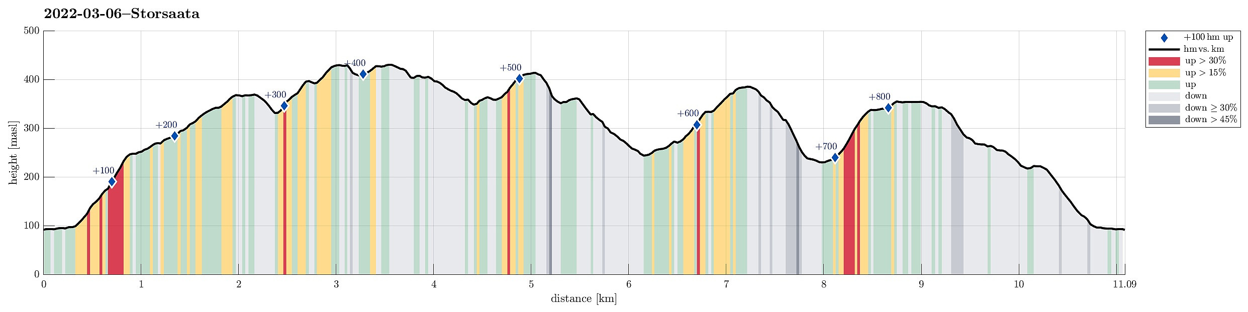
| Distanse | 11,1km |
| Høydemeter | 837m |
| GPS |
|
| Bestigninger | Nukane (373moh) | 06.03.2022 |
|---|---|---|
| Raunfjellet (389moh) | 06.03.2022 | |
| Stangelifjellet (372moh) | 06.03.2022 | |
| Storsåta (434moh) | 06.03.2022 | |
| Øst for Stangelifjellet (418moh) | 06.03.2022 | |
| Andre besøkte PBE'er | Austefjellet søyle (345moh) | 06.03.2022 |
Trip Summary
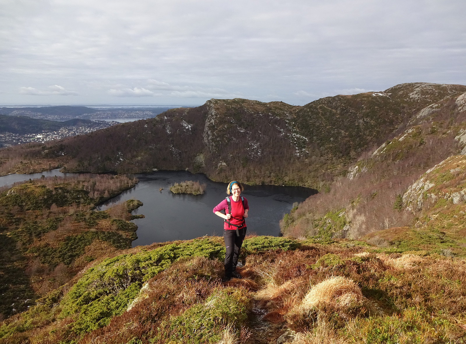
Hike to Storsåta and Vinddalen from Flaktveit. We parked where Hjortlandsvegen forks off Flaktveitsvingane and walked a little along Hjortlandsvegen, also crossing over the stream running down there in parallel to the path, until we found the trail that leads up to Storsåta at the lower end of Gjelet. This trail leads all the way up to the saddle at the upper end of Gjelet, right above Øvstebotn, on the western side of Gjelet. Instead of going directly to the saddle and then over and further to Storsåta, we first include a short excursion to Nukane right in the west of the saddle. From Nukane, it was then right over the saddle and up to Storsåta. Further, we then walked along the high ridge in the southeast of Storsåta until we came to Stangelifjellet, separating Setervatnet in the north from Vinddalen in the south. Descending along the western ridge of Stangelifjellet, we shortly later arrived at the dam of Setervatnet. To get back, at large, we headed northwards again, ascending Raunfjellet next. From Raunfjellet, the easiest way back would have been to cross over to Storsåta again and follow the trail down that we had taken up first. Instead, we were up for some additional exploration and thus we decided to descend into Traudalen instead. While not really problematic, it's worth noting that the northern slopes of Raunfjellet are quite steep and we descended into Traudalen without a trail. From the bottom of Traudalen, we ascended to Nukane (instead of going up Ullskargjelet). To round off this hike, we walked northwards across Austefjellet first. Once back down in the forest, we then followed minor trails and/or deer tracks to get back to the lowest end of Gjelet (and Hjortlandsvegen).
Photos
Selected photos are available as Google photo album.
Useful Resources
See also the related FB-page Hiking around Bergen, Norway.
Web page WestCoastPeaks.com provides useful information about Storsåta, Raunfjellet, Nukane, and Slettafjellet.
Web page UT.no from the Norwegian Trekking Association recommends a similar hike.


Kommentarer