
Høgstefjellet (25.12.2021)

Skrevet av HHauser (Helwig Hauser)

| Startsted | Salhusvegen (135moh) |
|---|---|
| Sluttsted | Salhusvegen (135moh) |
| Turtype | Fottur |
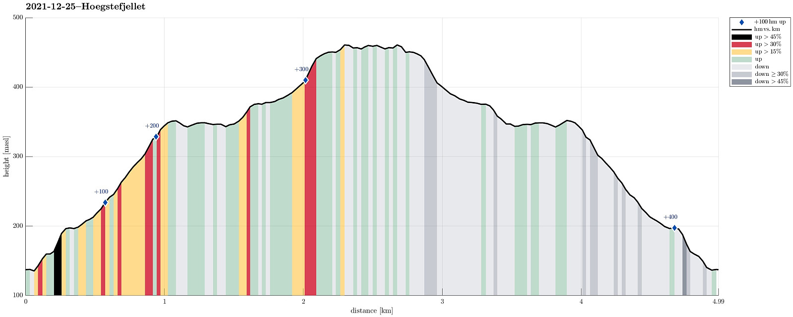
| Turlengde | 2t 00min |
| Distanse | 5,0km |
| Høydemeter | 406m |
| GPS |
|
| Bestigninger | Høgstefjellet (464moh) | 25.12.2021 |
|---|---|---|
| Vardfjellet i Åsane (355moh) | 25.12.2021 |
Note that this track has been created from memory, i.e., it was not recorded automatically.
Trip Summary
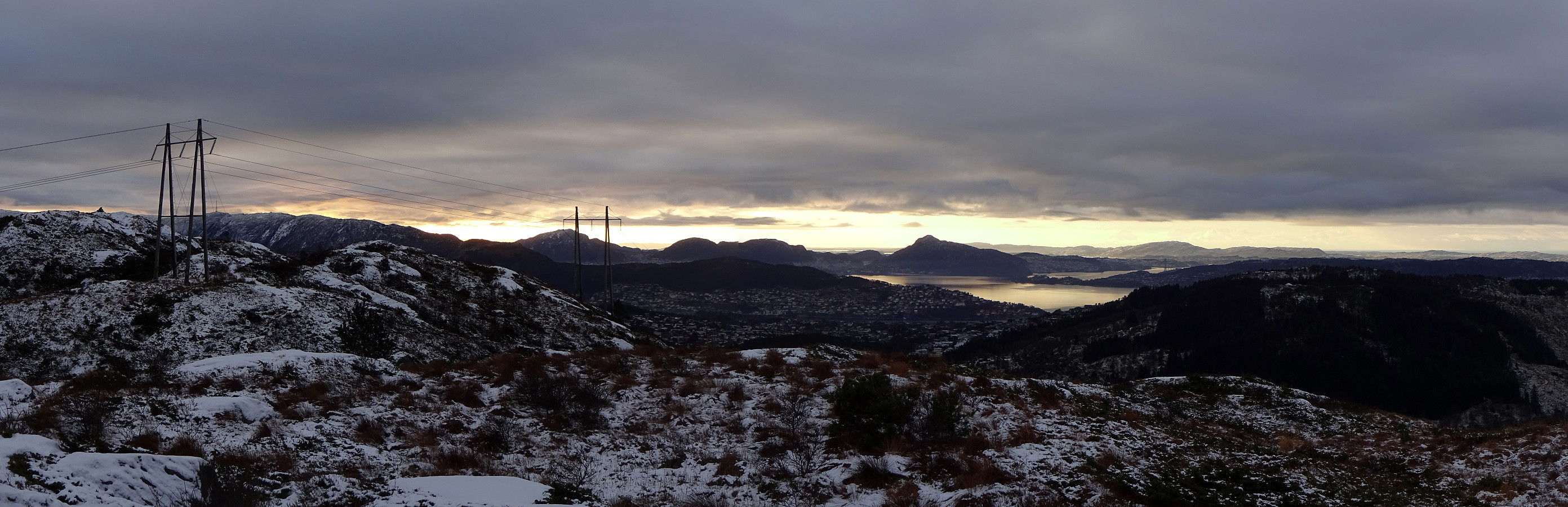
A nice winter hike up to Høgstefjellet in the north of Åsane, starting from the recycling station along Salhusvegen and via Bruknappen right northeast of the starting point. Up and down (via Vardfjellet i Åsane) the same trail.
Photos
Selected photos are available as Google photo album.
Useful Resources
See also the related FB-page Hiking around Bergen, Norway.
Petter Bjørstad has a useful page about Høgstefjellet and another one about Veten i Åsane, and also web page WestCoastPeaks.com provides useful information about Håstefjellet (Høgstefjellet), Tellevikafjellet, and Nordgardsfjellet as well as about Veten i Åsane.


Kommentarer