
The Coledale classic (13.12.2012)


Skrevet av hmsv1 (Hannah Vickers)
| Startsted | Braithwaite |
|---|---|
| Sluttsted | Braithwaite |
| Turtype | Fjelltur |
| Turlengde | 5t 00min |
| Distanse | 16,0km |
| Kart |
|
| Bestigninger | Causey Pike (637moh) | 13.12.2012 |
|---|---|---|
| Crag Hill (839moh) | 13.12.2012 | |
| Grisedale Pike (791moh) | 13.12.2012 | |
| Hobcarton Crag (739moh) | 13.12.2012 | |
| Hopegill Head (770moh) | 13.12.2012 | |
| Sail (773moh) | 13.12.2012 | |
| Sand Hill (756moh) | 13.12.2012 |
Only one day after I thought I'd had the best welcome back to Lakeland, I was treated to yet another cracking day out on the fells with more unbelievably good weather and views which were very pleasing on the eye! There were of course so many of my favourite routes I could have chosen to do, but this hike was a bit closer to the youth hostel I was staying at and quite conveniently had a free parking place at the start of the route. I first did the route 11 years ago and on all occasions I have been back and repeated it, it has never failed to bring a smile to the face even though it isn't much of a strenuous walk. It takes in 6 tops in a 16km circuit around Coledale which lies a few miles outside of Keswick in the northern end of the Lake District. There are several other tops which can be 'bagged' along the way to make the walk a little longer, but the views are usually not that much different from the main route, so I don't often bother with the extra tops unless I have masses of time on my hands!
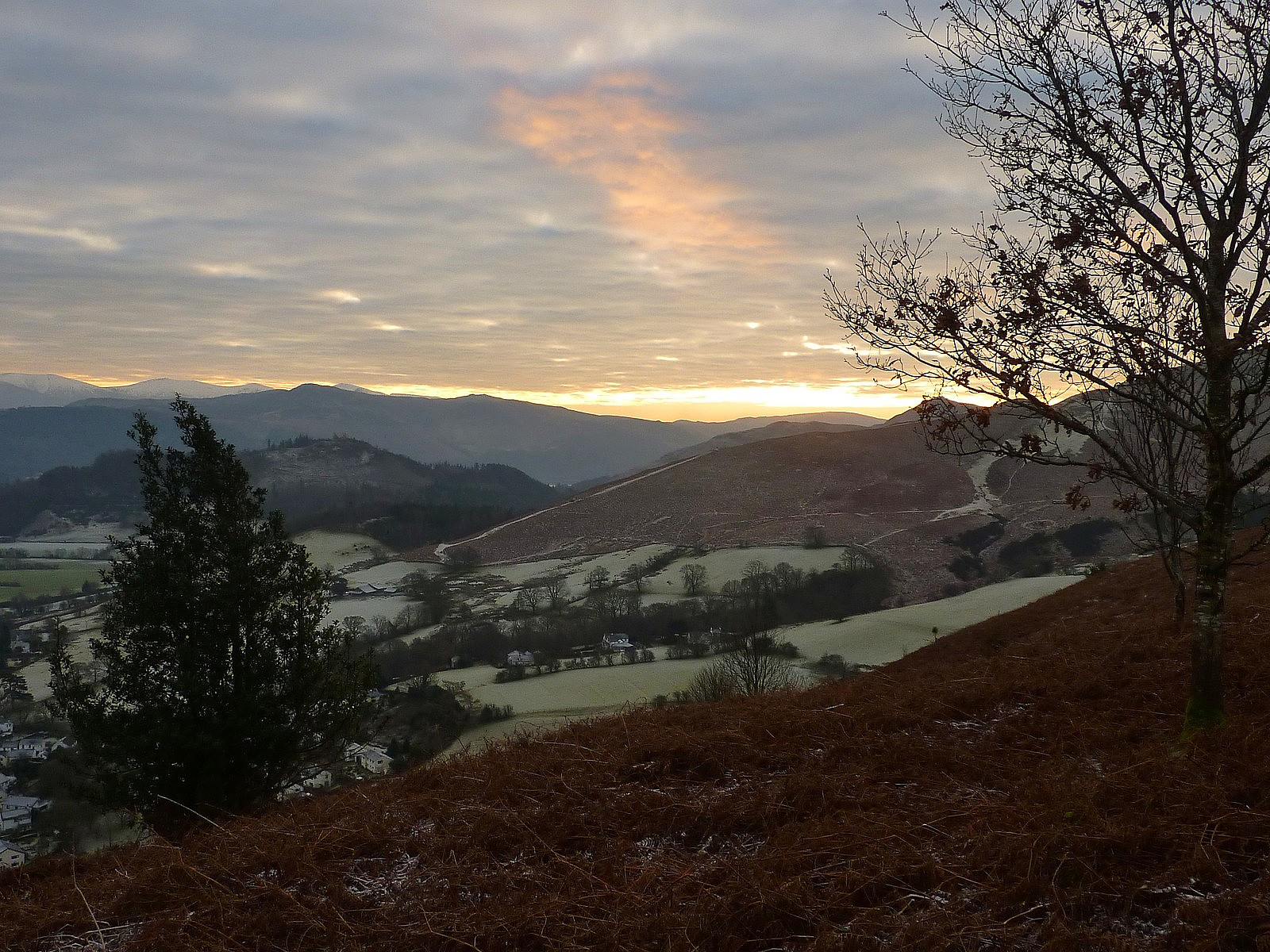
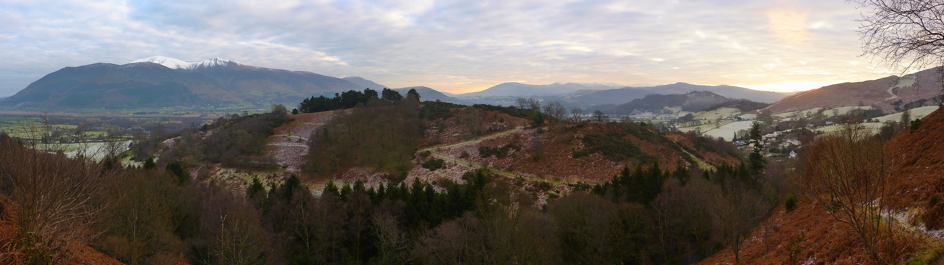
After a slightly late departure from the youth hostel I finally got started on the hike from the car park in Braithwaite at around 9.45am. The sky was a little overcast, but there was a weather forecast for sun later in the morning and I could already see the cloud clearing from the south, so I was confident that there was still much to look forward to. The path leading up to Grisedale Pike was in good hiking condition, mainly because it was frozen turf and not muddy or icy and the gradient rose quite gently for much of the way with a good view westwards over the Coledale valley. There wasn't much wind until the final slopes to the summit, at which point I really did have to pull on my shell jacket again. I met two other ladies at the top, who appeared to be in a much more festive mood than me (one was sporting a bit of tinsel over the top of her jacket) but they were not staying out on the hill for long and heading back to the cars after this summit, which I thought was a bit of a shame given how fantastic the weather and the views had turned out to be! Anyway, after taking a few dozen photos I carried on across Hobcarton Crag toward the next top (Hopegill Head) and that took around 20 minutes from Grisedale Pike.
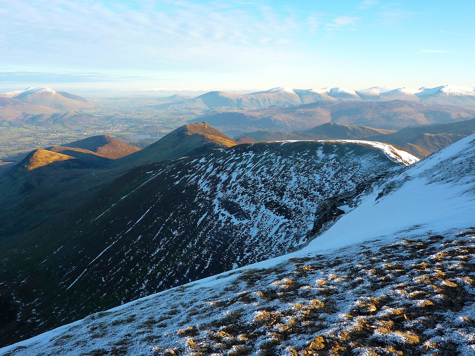
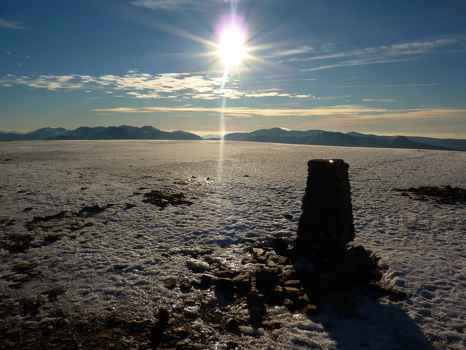
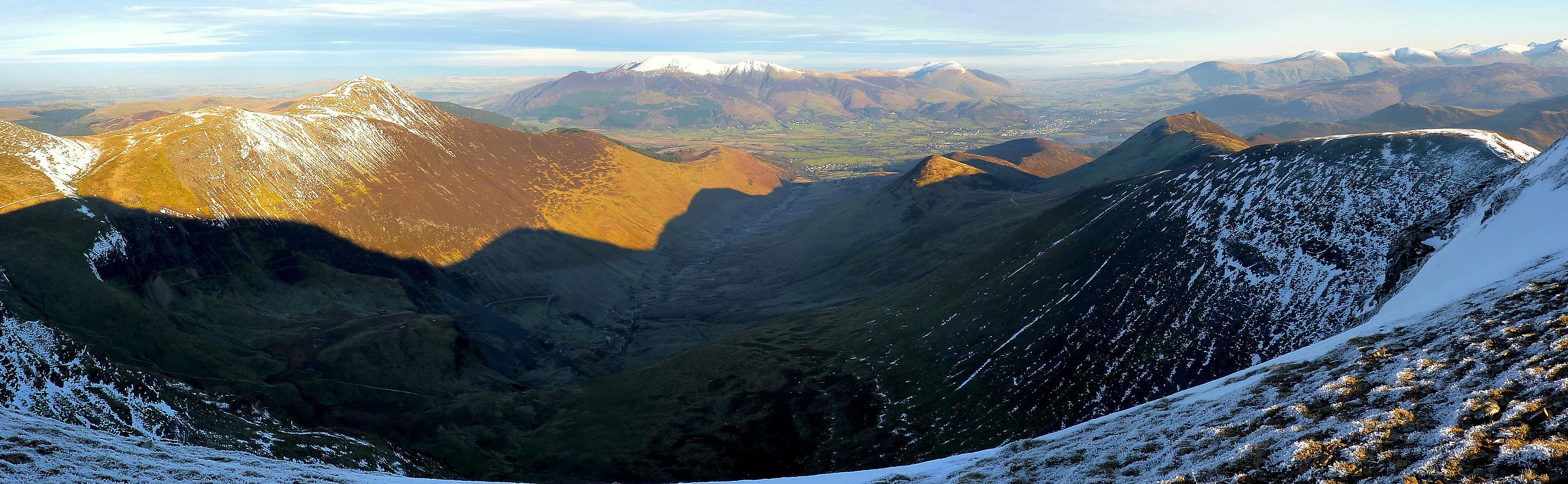
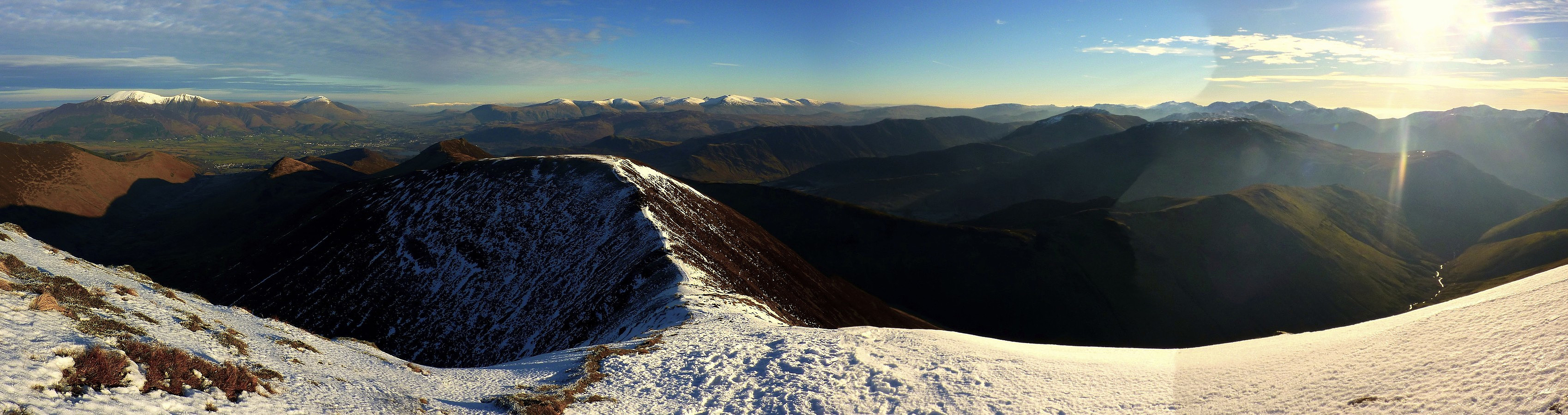
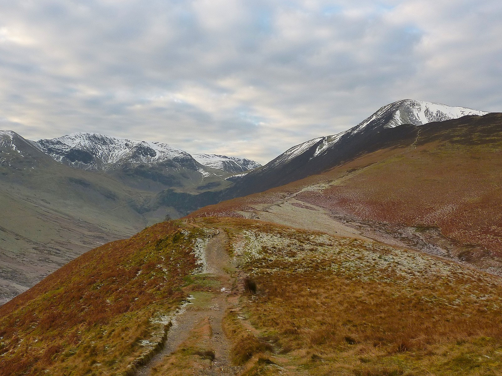
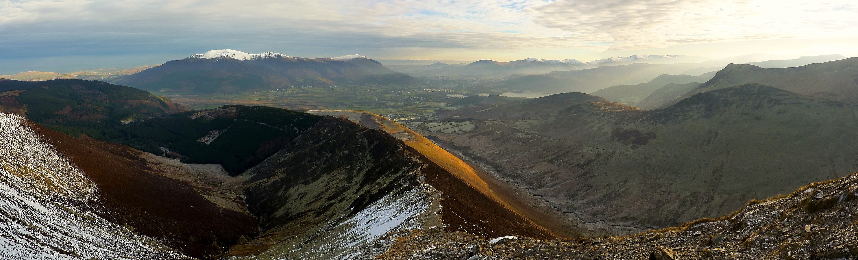
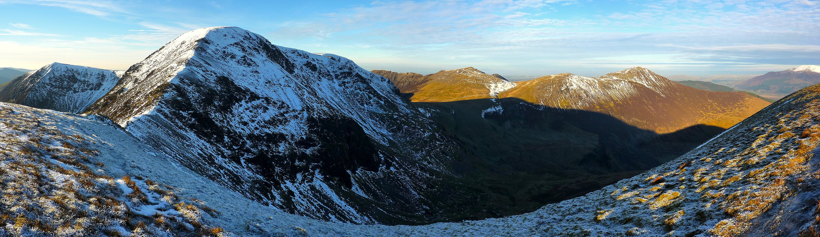
The wind had increased again by the time I reached that summit, so I didn't hang around and went straight across Sand Hill towards Coledale Hause. Usually the valley that separates Crag Hill and Grasmoor makes a good spot to stop and have something to eat because it is often sheltered, and that was also the case today. I was quite glad because it was around lunchtime and I was getting hungry! After eating an apple and some sweets, I headed a little further up the valley before bearing eastwards and straight up to the summit of Crag Hill. It isn't a particularly small summit, so I had to walk a little bit towards the northeastern edge to get a good view over Coledale and beyond. The surrounding fells were really glowing a lush orangey-brown colour in the winter sunlight, especially since there was so little snow. It still felt like early autumn here!
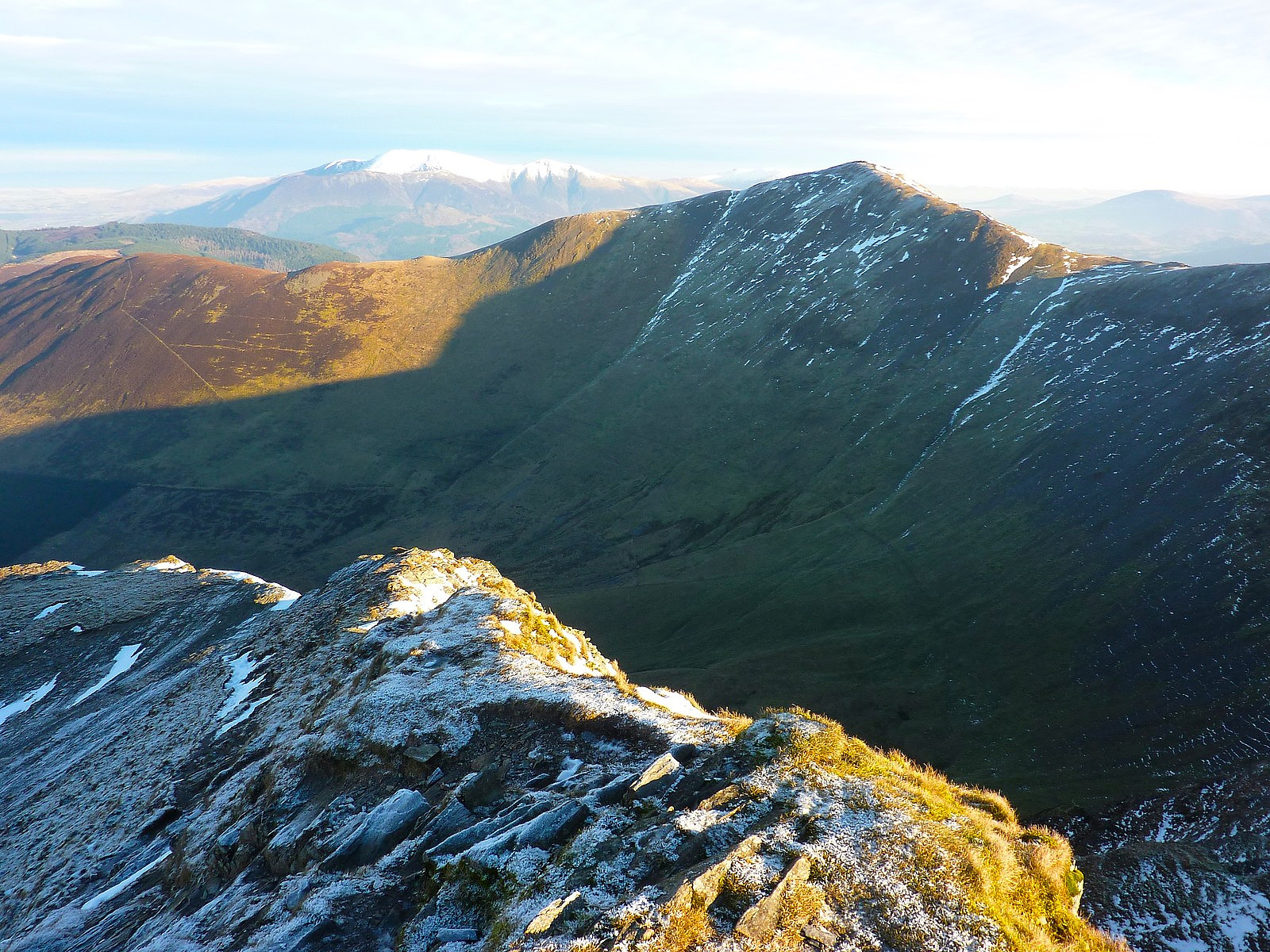
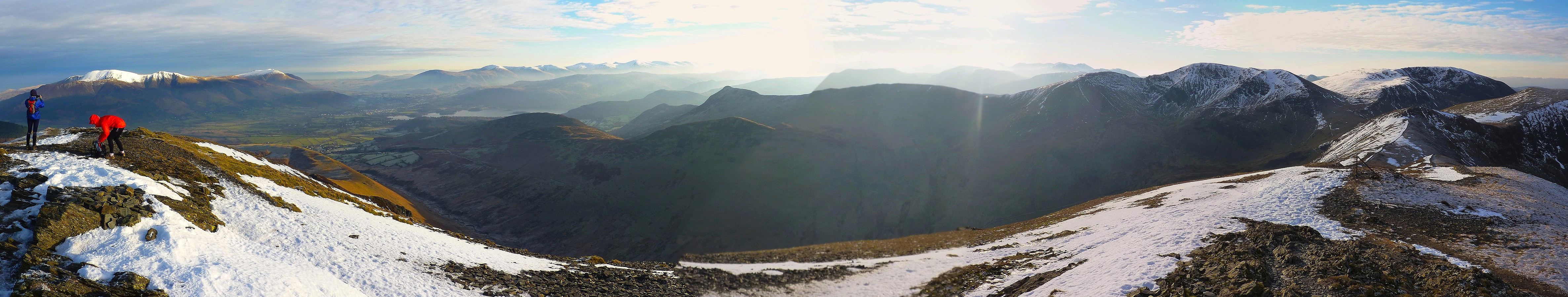
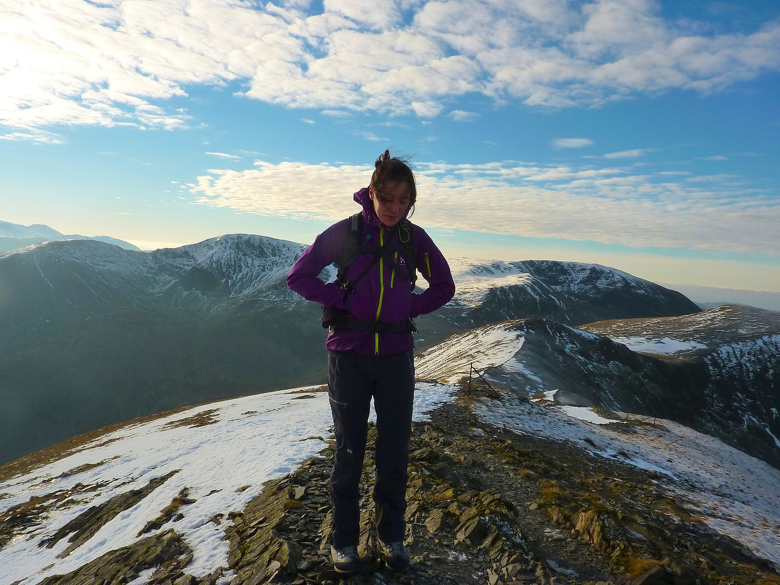
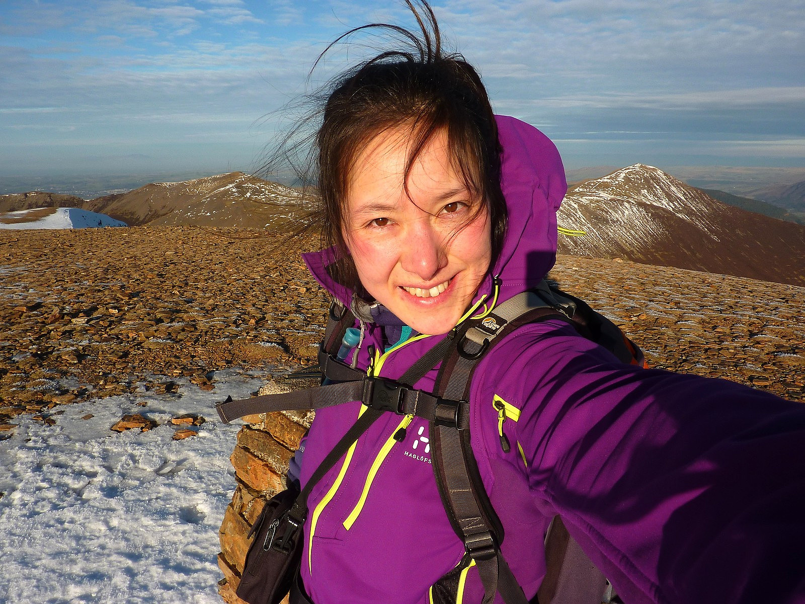
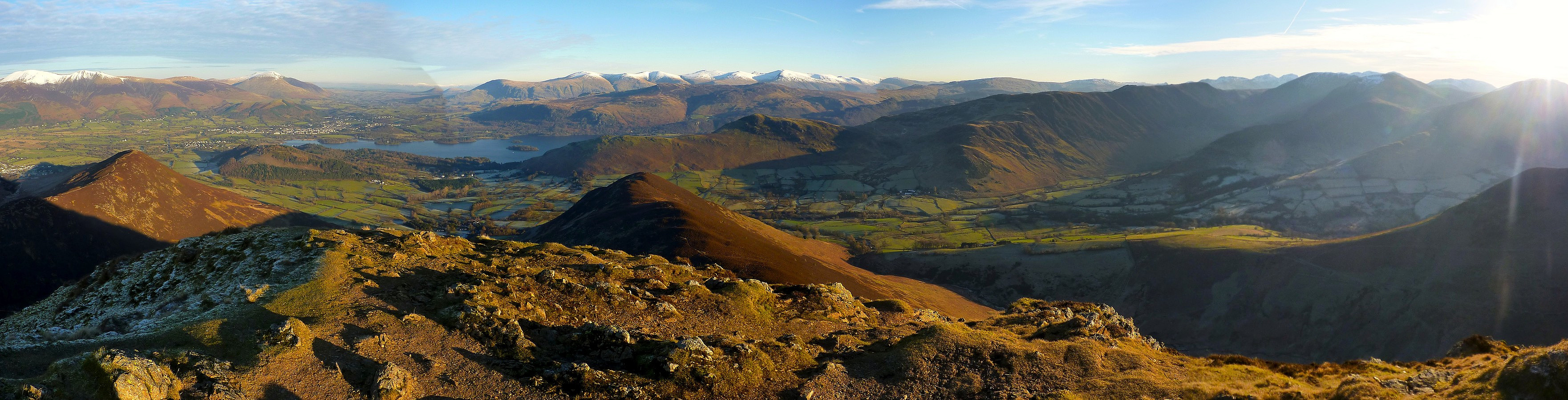
The next stage of the route took me down a short (but in my opinion quite elegant) ridge linking Crag Hill to Sail, with a few rocky bits to take care on because of ice cover. From Sail there was a small descent of around 150m on what appeared to be a completely-reconstructed path which I wasn't impressed by, mainly because it didn't look at all natural and stood out like a sore thumb. That was the only disappointment though. There was a small re-ascent from the pass and after that was a relatively flat walk to the last top of the route, Causey Pike. From here it was quite satisfying to look across the valley and northwest towards the rest of the tops I'd passed over earlier. To the east was a nice view of the Helvellyn range, and immediately southwards the fells separating the Newlands valley and Buttermere. I only regretted not having brought a flask with hot drinks, otherwise it would have been super-cosy to sit and watch the views for longer.....So after the final top was ticked off, there was only the descent down towards Stoneycroft left to do, and after that followed a few kilometers of walking along a quiet Lakeland road to get me back into Braithwaite again. Superb day on superb Lakeland paths with equally superb views. A top walk all round and a good finish to my short excursion up north of the country :-)


Kommentarer