
Les Droites (30.06.2022)

Written by hmsv1 (Hannah Vickers)
| Start point | Couvercle hut (2,688m) |
|---|---|
| Characteristic | Alpine climbing |
| Duration | 13h 29min |
| Distance | 10.9km |
| Vertical meters | 1,530m |
| GPS |
|
| Ascents | Les Droites (4,000m) | 30.06.2022 |
|---|
Les Droites was a bit unlike some of the other 4000m peaks in the sense that it wasn't one that I have really wanted to do for years – but one that is on the list of the 50 principal 4000m peaks in Martin Moran’s guidebook. But it kind of fitted in nicely as a 3-day trip with Dave after a couple of days of bad weather and we’d found out that the normal route up the south ridge of the East summit was still “doable” according to a German guide who’d been there the previous week, even though conditions were very dry for the time of year and the access couloir no longer had a decent snow cover.
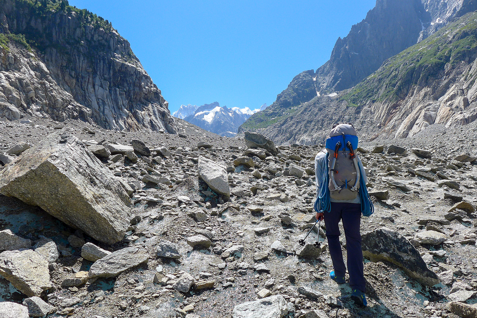
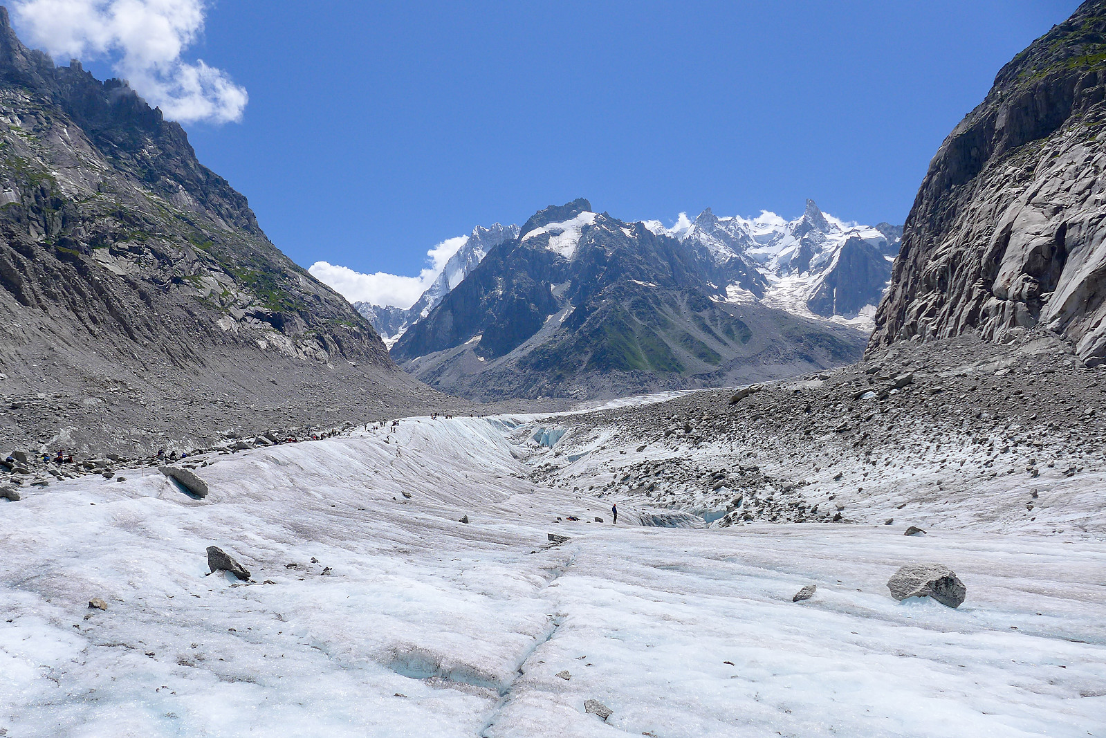
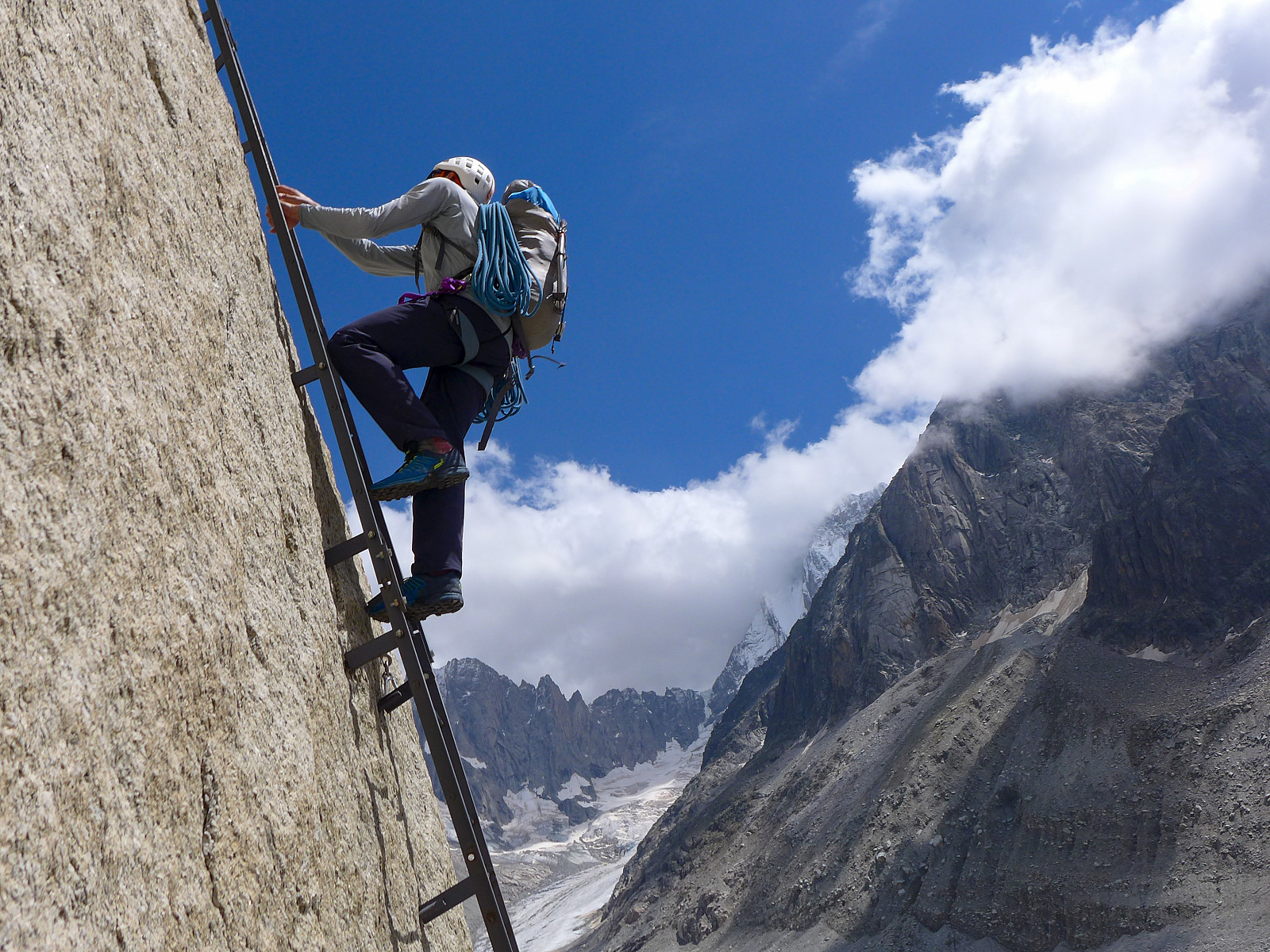
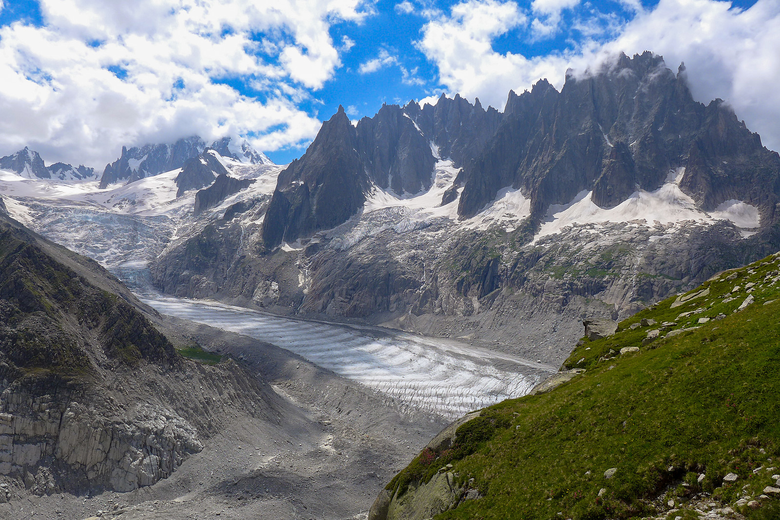
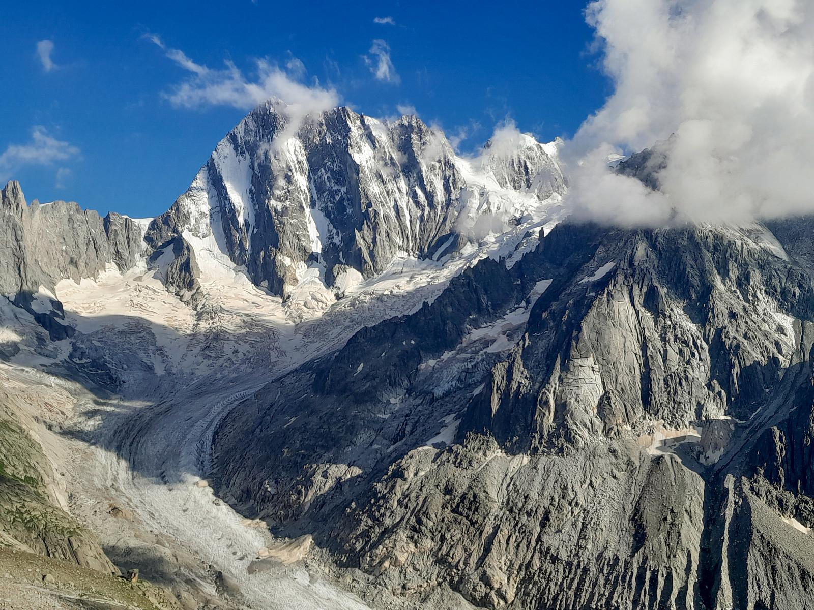
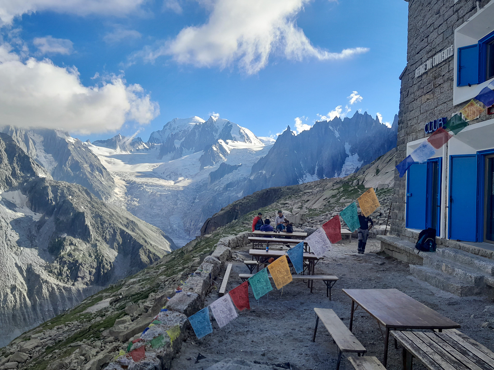
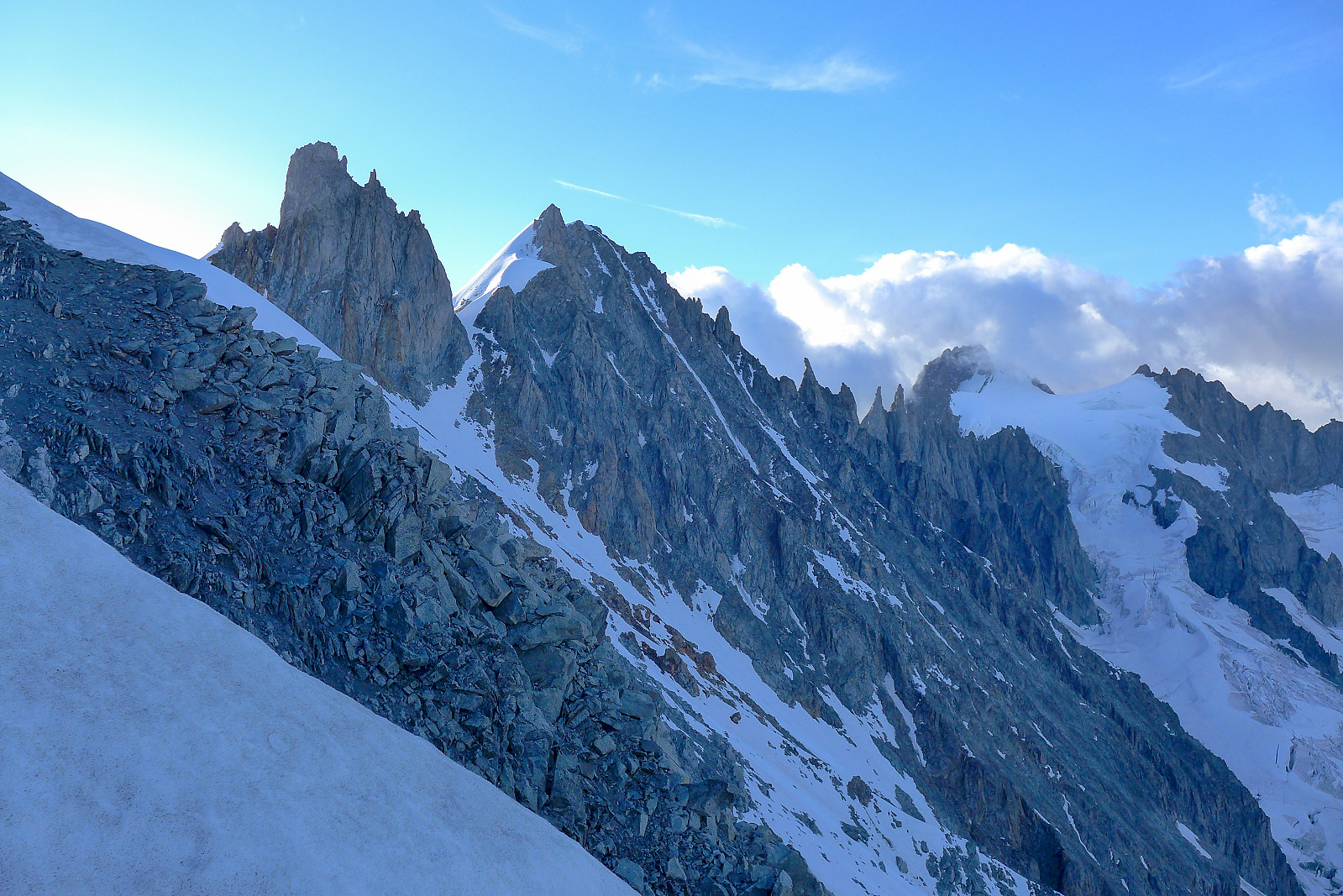
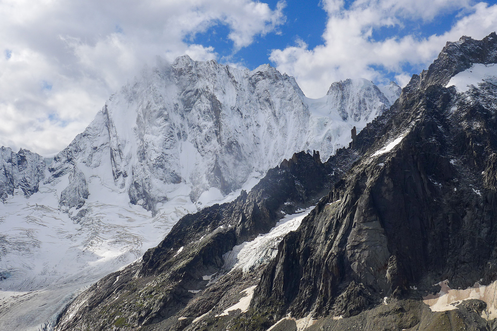
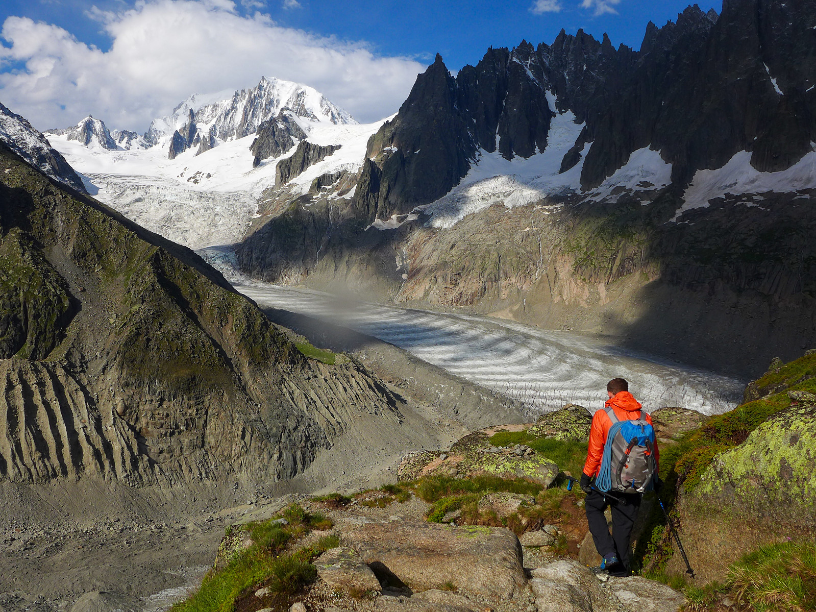
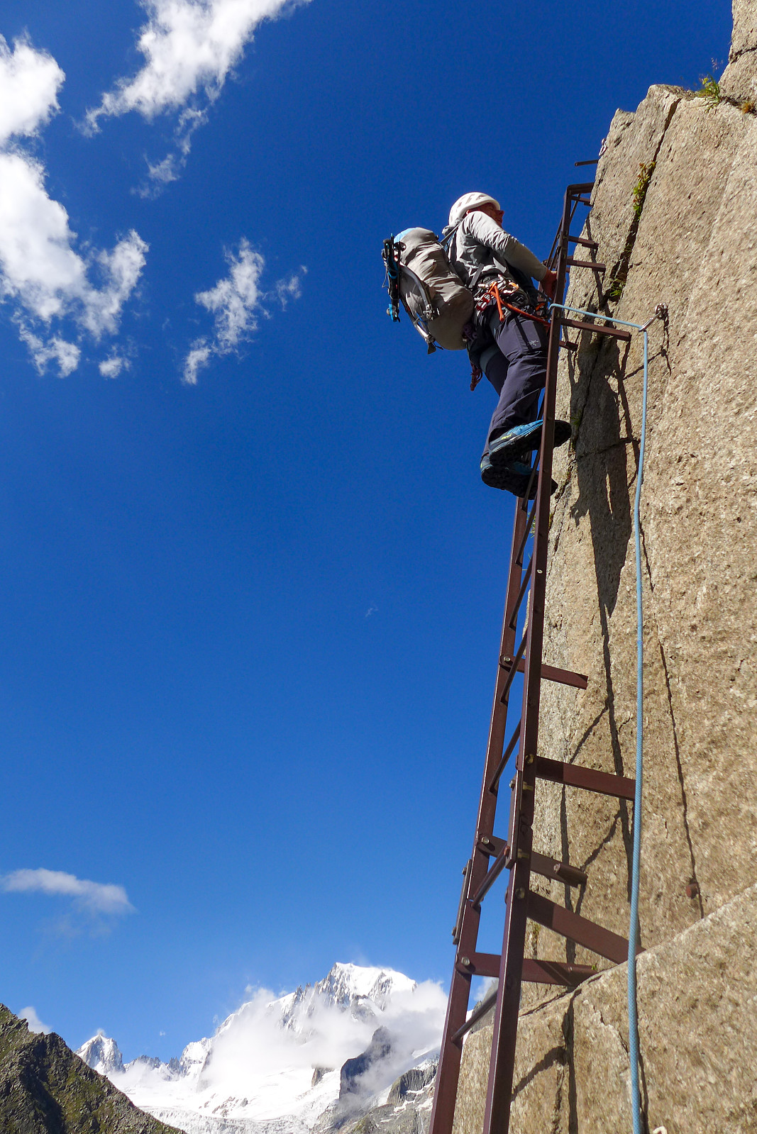
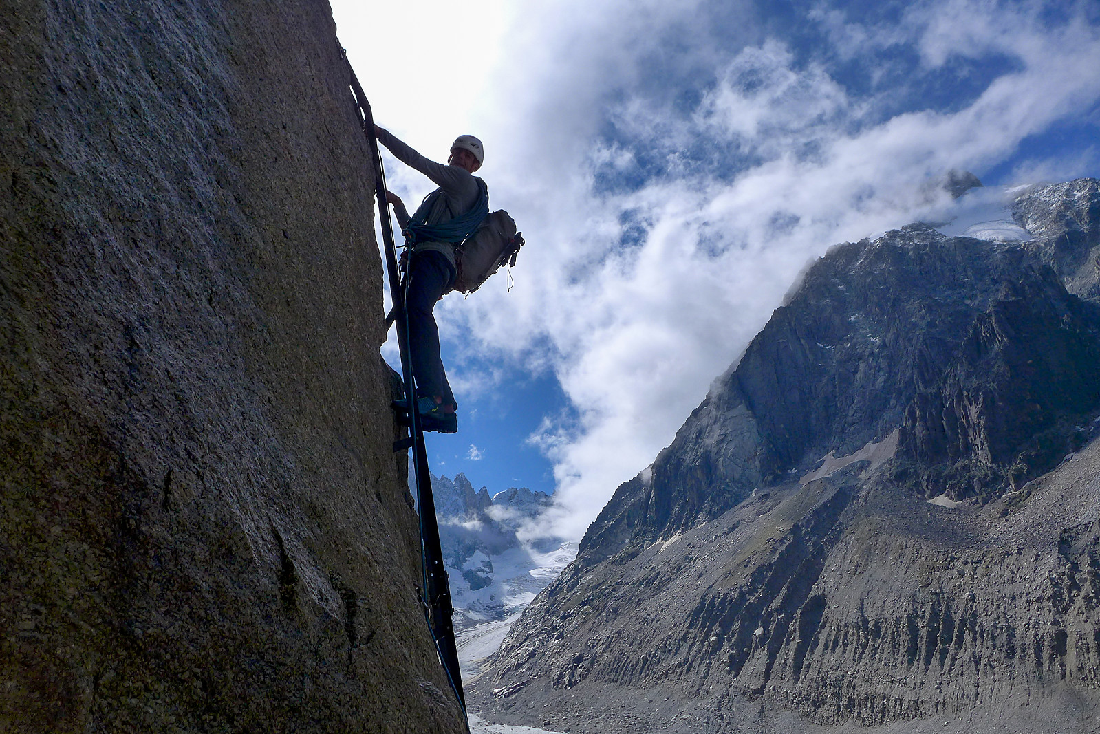
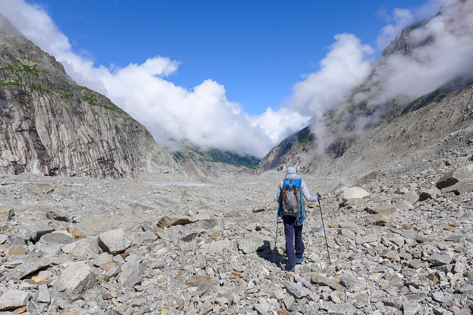
We headed up to the Couvercle hut, the starting point for the normal route by taking the train up to Montenvers from Chamonix, then used the telecabine to join the long series of stairs that lead down to the Mer de Glace. Along the stairs there are mounted several plaques on the rock indicating the level of the glacier at various years. This was the first time I’d been anywhere near the Mer de Glace since 2005 so it was pretty eye opening – and a bit tragic to see how much the level of the glacier has dropped since then compared with now. Even the change since 2018 has been pretty dramatic. As a result all that has been left behind is a load of loose rock, so this turned out to be yet another hut approach that heavily featured a lot of walking over rubble! Nevertheless trail shoes proved suitable enough and we took a very comfortable slow pace up the glacier, eventually emerging onto a nice strip of ice which was a lot more pleasant to walk on. A lot of people were out on the glacier doing what looked like cramponing skills, so it was far busier than I expected it to be. After about 3 km we found a spot amongst the rubble to stop for lunch before continuing on towards Les Egralets, where the series of steep ladders leading up to the Couvercle hut started. The loose slopes below the ladders are probably more daunting to walk up compared with the exposure of the ladders themselves. In total there were about 6 (?) ladders to climb, as well as a few scrambling-type passages that were protected with rails on one or both sides. It was definitely a more direct way to gain height compared with the long and gradual walk up the glacier. Once above these though, there was a nice path leading all the way up to the Couvercle hut. Its location has to be one of the best I’ve experienced, offering first class views of the Himalayan-scale north face of the Grandes Jorasses from the benches outside of the hut. I’d heard the Couvercle hut been described as quite “rustic” with very basic facilities but since it had just been newly renovated, the interior was in fact very modern, minimal and spacious, and there were even showers installed in the toilets. Fortunately the hut was far from being busy, and we got an entire dormitory to ourselves :-) Despite that though, I still didn’t manage to get a very good nights’ sleep before the alarm rang at 1.50am.
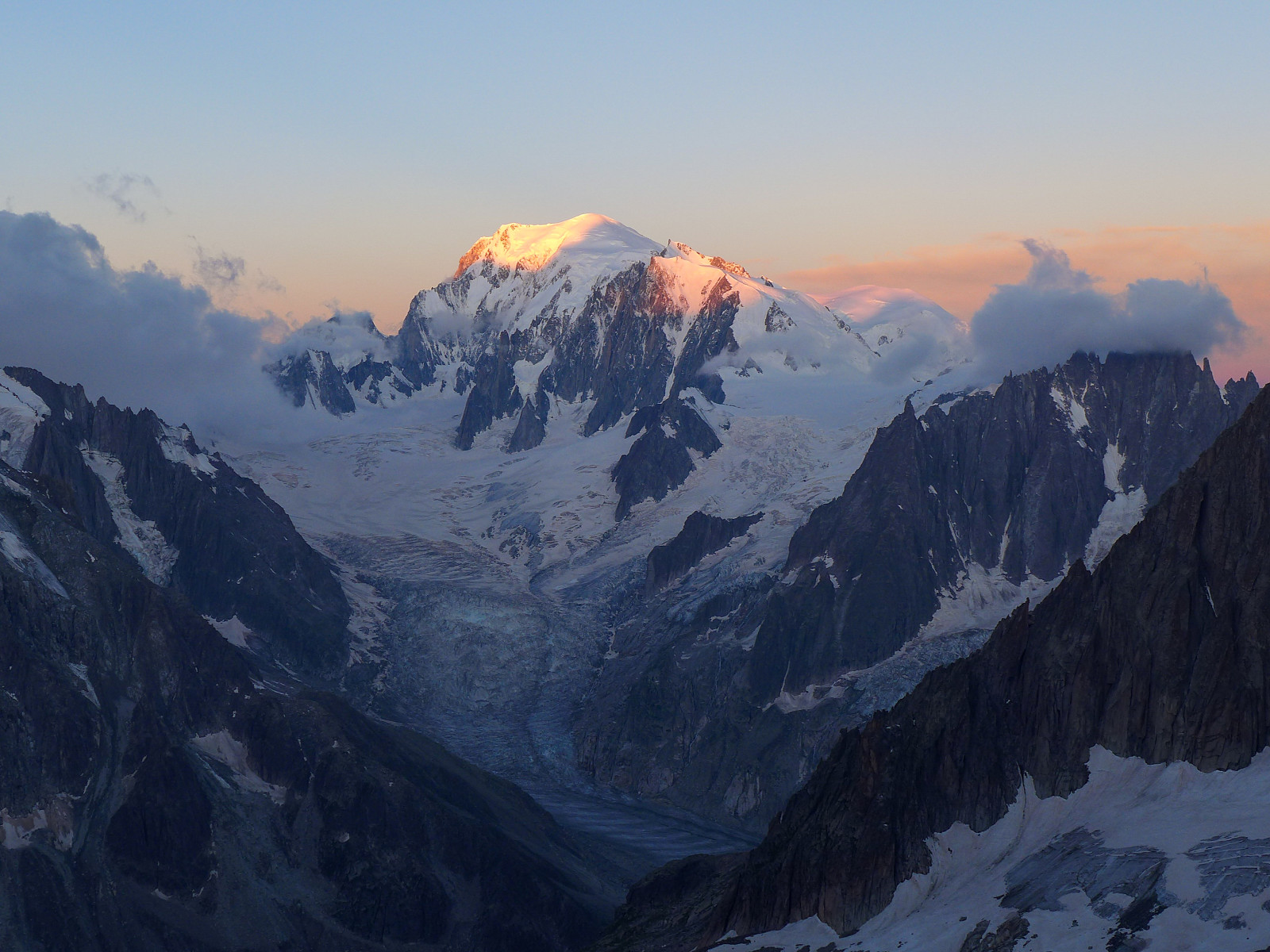
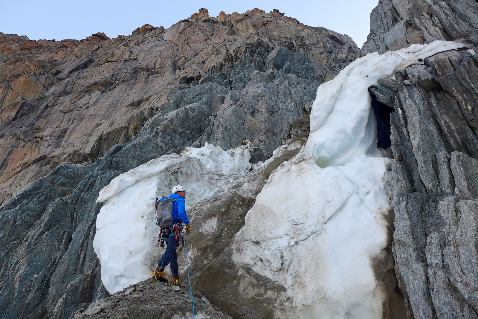
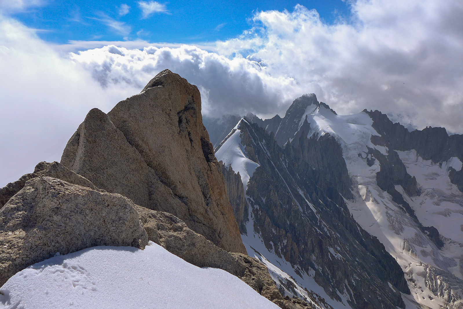
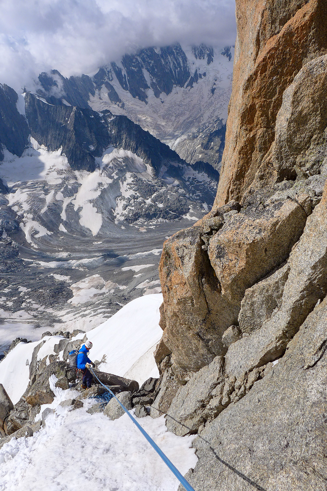
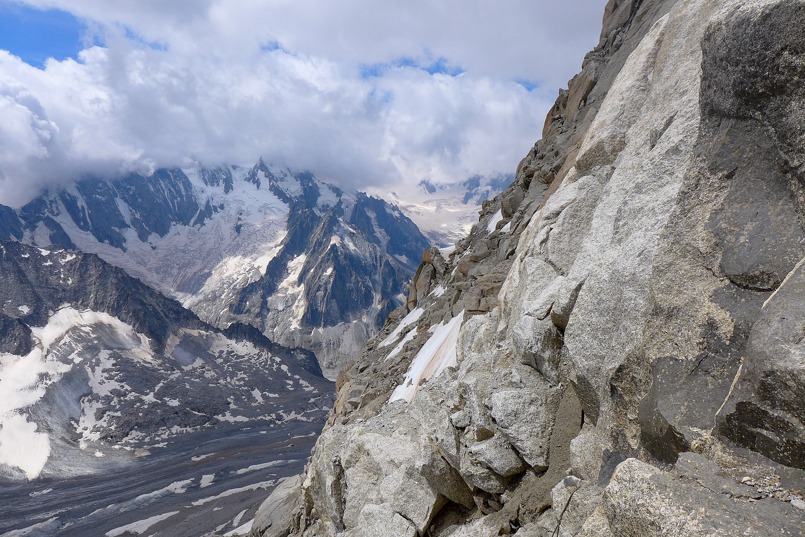
Apart from us, there was only another group of 5 eating breakfast at 2am, so it was overall pretty quiet and we left the hut just after 2.30am. The approach to the foot of the access couloir below the south ridge of Les Droites is via a kind of upwards traverse of the Talefre glacier in a more or less northeast direction, passing below the Aiguille Verte and Grand Rocheuse. From the Couvercle hut theres a vague path that leads up to the glacier, which took about 20 minutes to reach. The snow hadn’t completely refrozen overnight, but it was still very firm and I actually found it more pleasant to walk on this kind of snow compared with very icy hard snow. The next 2 hours or so were spent in silence making our way slowly across to the access couloir – it actually took a fair bit longer than I’d expected and by the time we’d stopped to have a quick break and get ready to ascend the couloir the first rays of sun had already hit the summit of Mont Blanc. The entrance to the couloir wasn’t a particularly inviting place and was filled with a mixture of compacted old snow and covered in rockfall debris. Under better conditions it would have been a straightforward 200m climb on 45 degree snow slopes. But since it was completely free of snow and composed of really terrible loose rock we climbed only partway up the couloir before Dave found a suitable point to cross out and onto the rock bounding the right hand side of the couloir. We managed to ascend part of this on some remaining snow cover, but it didn’t last all the way to the ridge at the top of the couloir, so we had to cover the remaining height on some pretty terrible (loose) rock. It was a bit of a relief to emerge onto some solid snow at the upper end of the couloir.
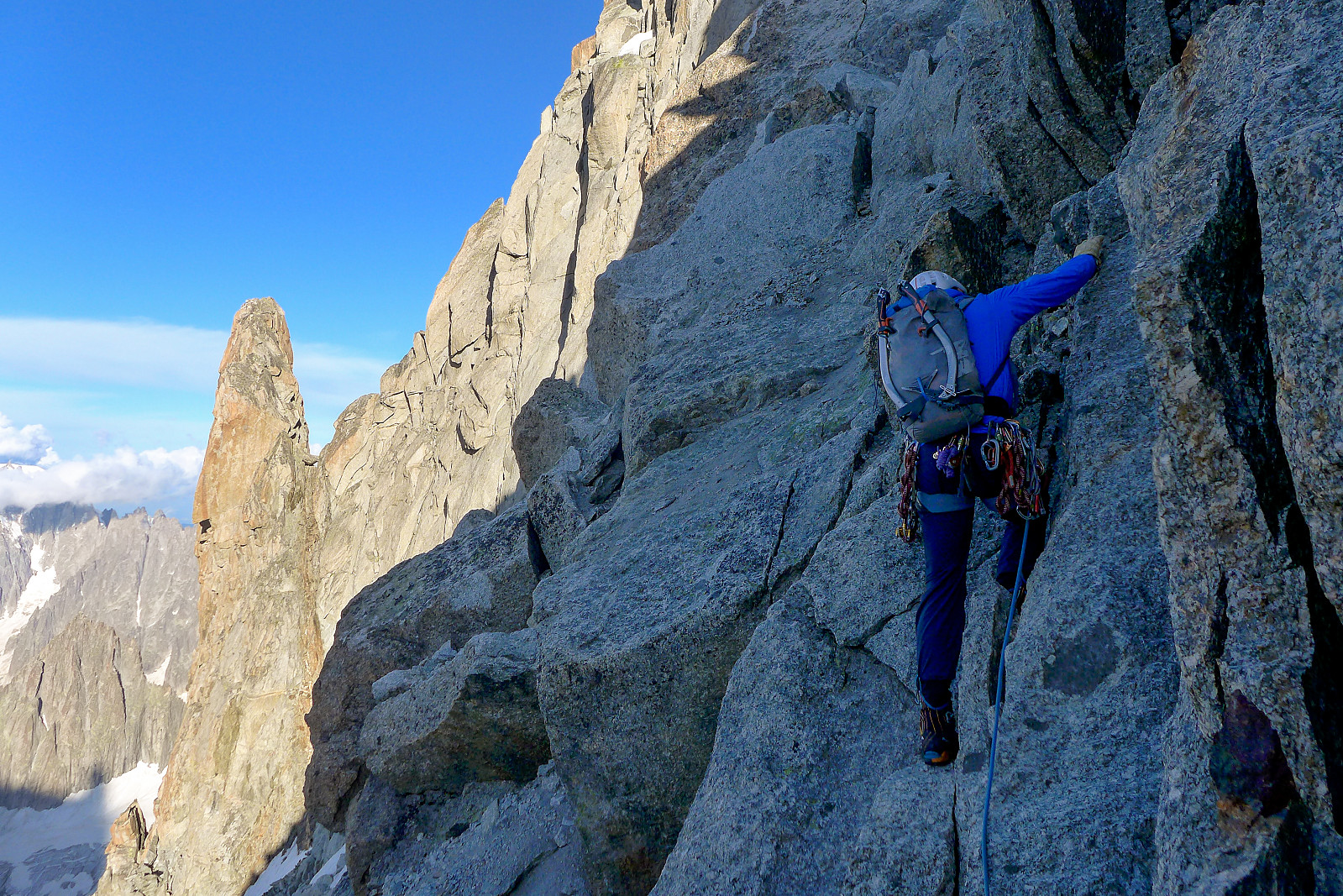
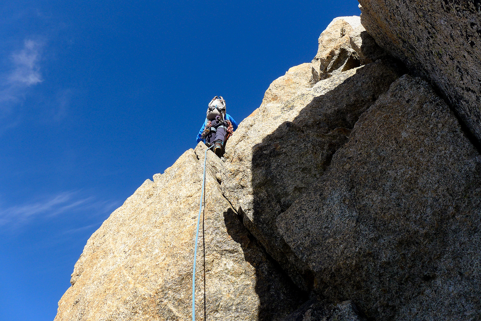
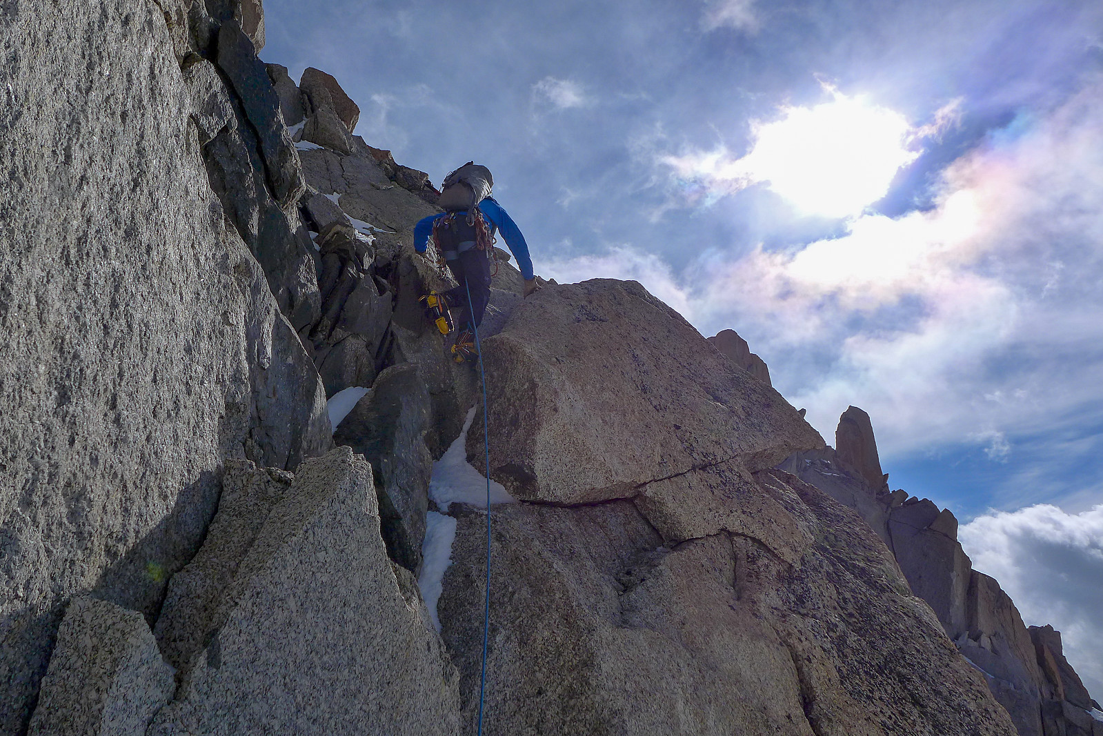
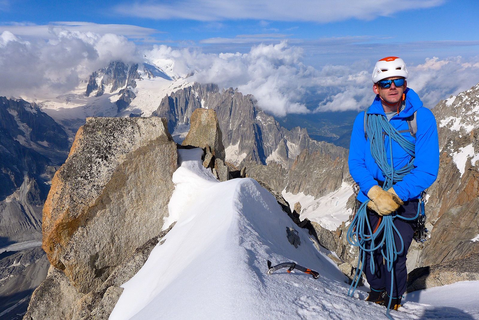
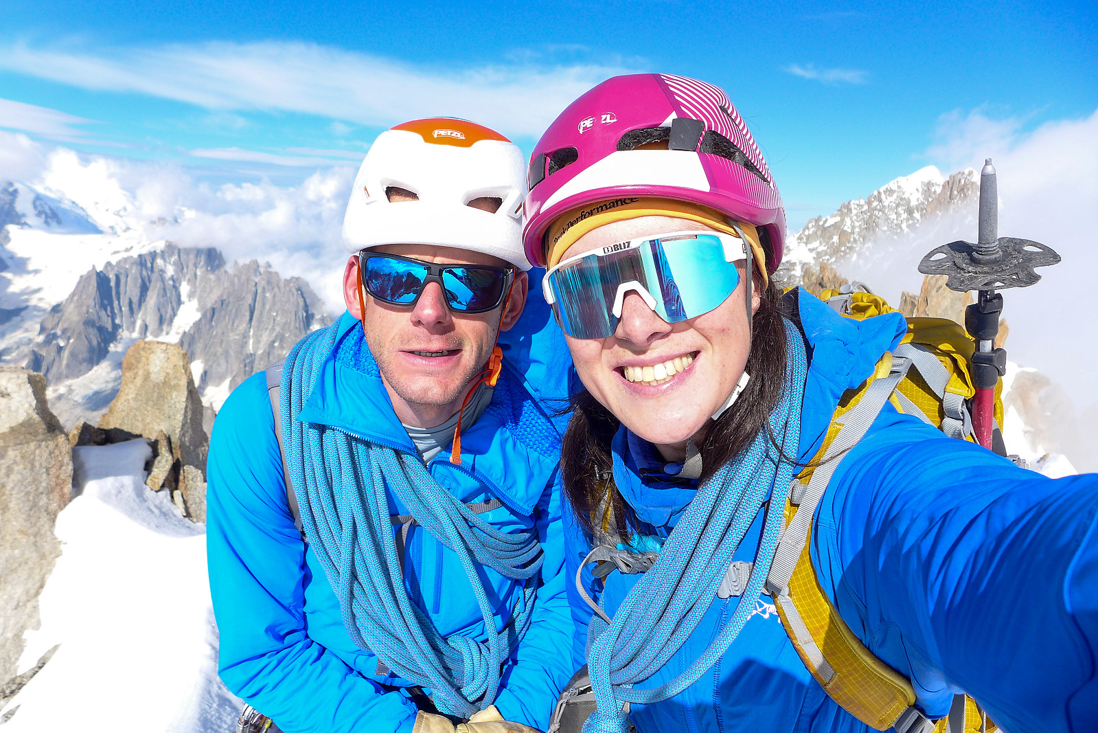
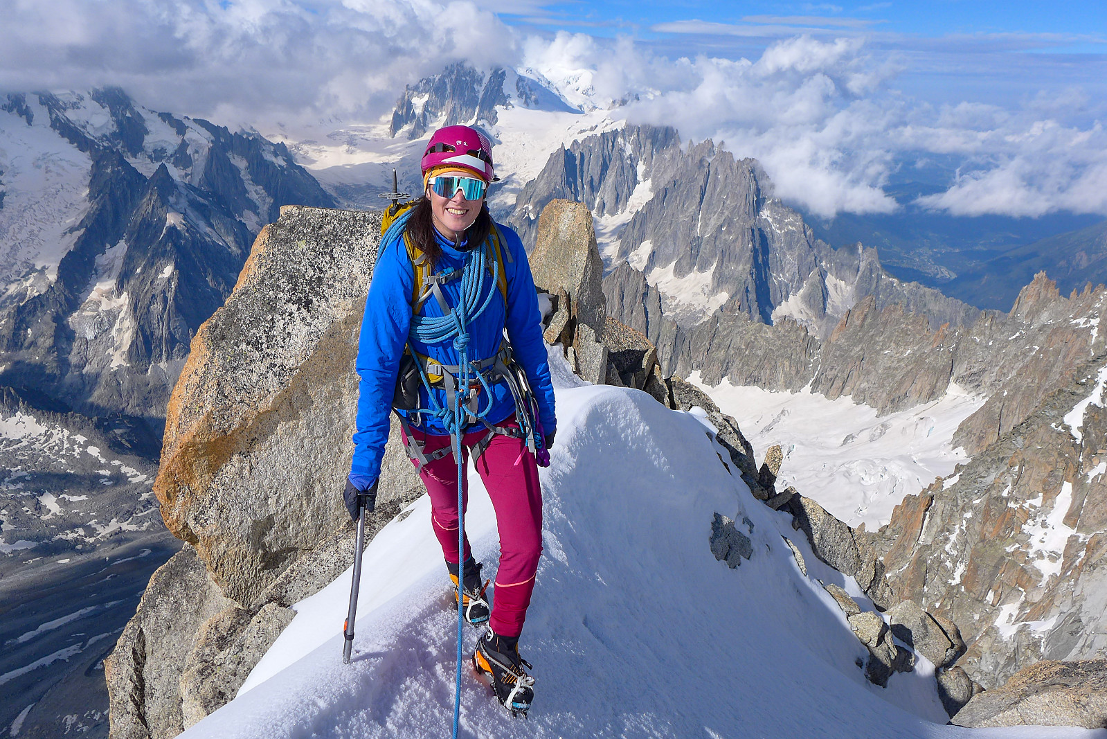
From the upper end of the couloir we followed the ridge crest on snow for a few minutes, eventually traversing out to the right in the direction of the Col des Droites to ascend a slightly steeper snow (35-40 degrees ish?); when the snow ended we crossed over to the broad south ridge on the left again and climbed/scrambled up some easier terrain which was interspersed with some slightly more strenuous moves on decent hand/footholds and solid rock.... It wasn’t a particularly narrow ridge with an obvious crest, so route finding didn’t seem entirely straightforward, but there were old slings around rocks in places which seemed to indicate we were on some sort of previously travelled route ;-) Unfortunately we discovered at the end of the rock difficulties that a part of the rope had somehow got core shot and was quite badly damaged over about a 2cm part of its length. Dave reckoned it would still be OK to abseil off though.... Anyway, once the rock ended there was only some 50m of steep snow to ascend to get to the base of the summit rock tower; here it was pretty straightforward scrambling (maybe grade II?) on mixed rock/snow up to the summit ridge, then a short traverse around the north side on surprisingly soft snow to finally gain the summit of the Les Droites! We’d seen there was a weather front closing in while on the way up and the summits of both Mont Blanc and the Grandes Jorasses had already been obscured by cloud for some time, so we didn’t spend very long at the top before starting to make our way back down again. Just long enough to put a jacket on, eat an energy gel and take a few photos.... Dave had got some info about an alternative descent route down the southeast couloir below the summit tower, which would basically mean we could avoid having to descend the loose approach couloir and all the other unattractive parts of the ascent route from earlier in the day. We decided to give it a go and hoped the rope would hold out until we were out of the couloir!
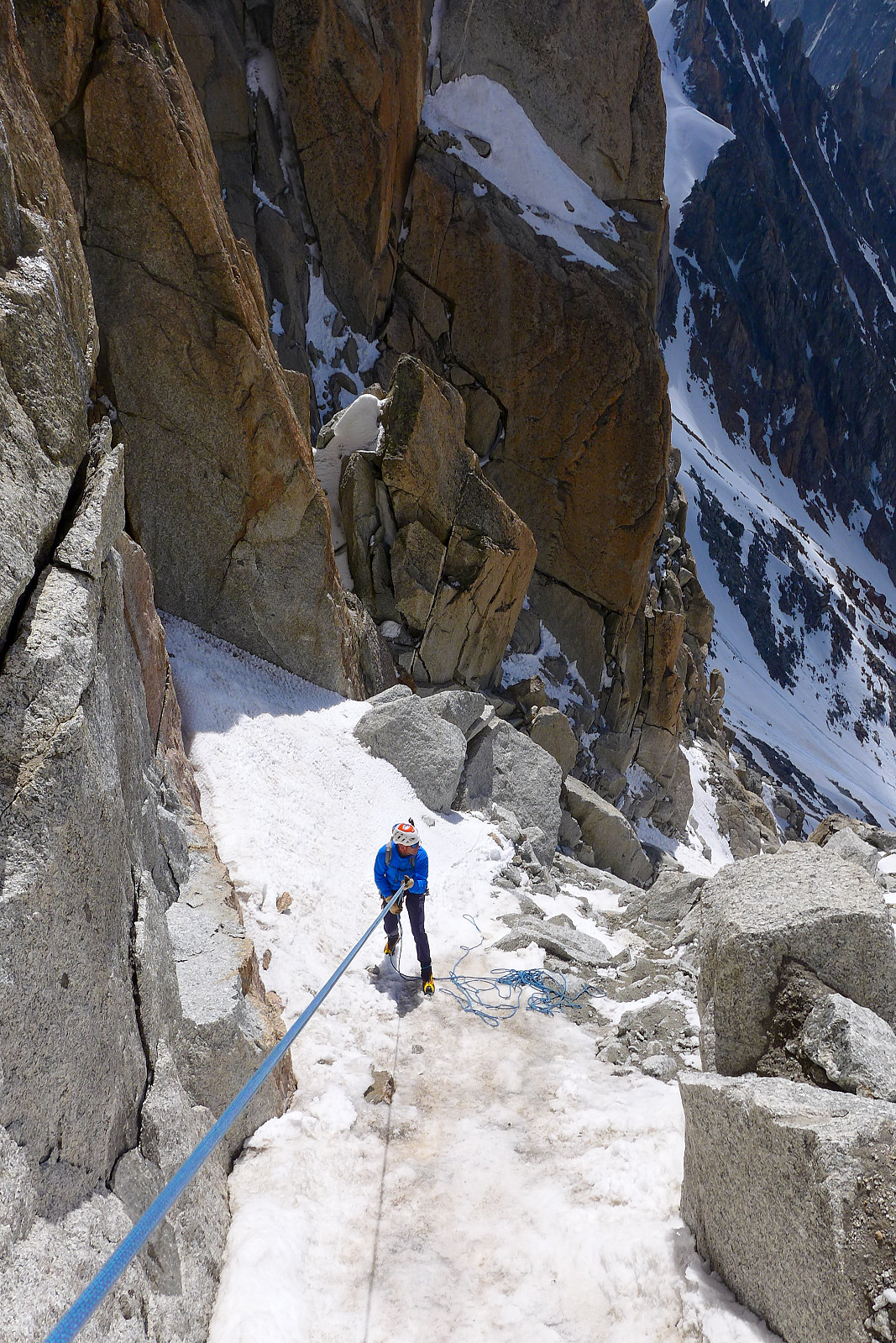
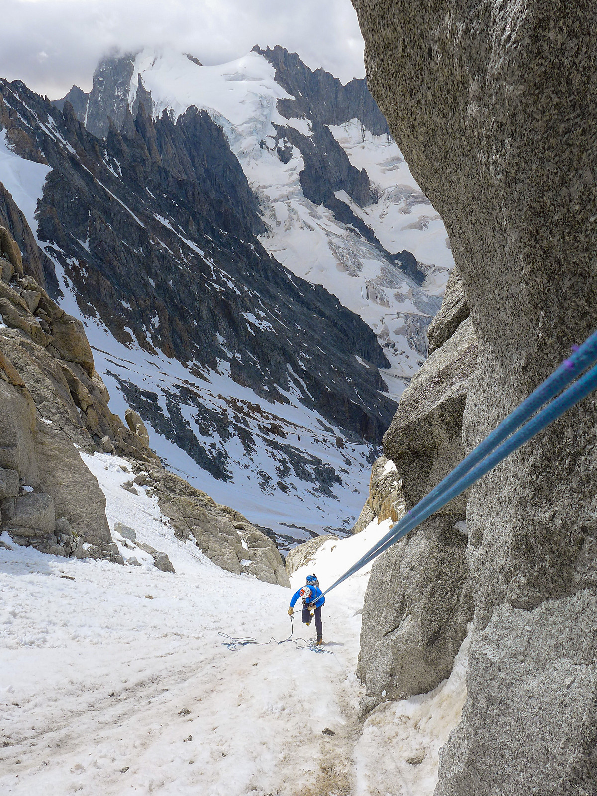
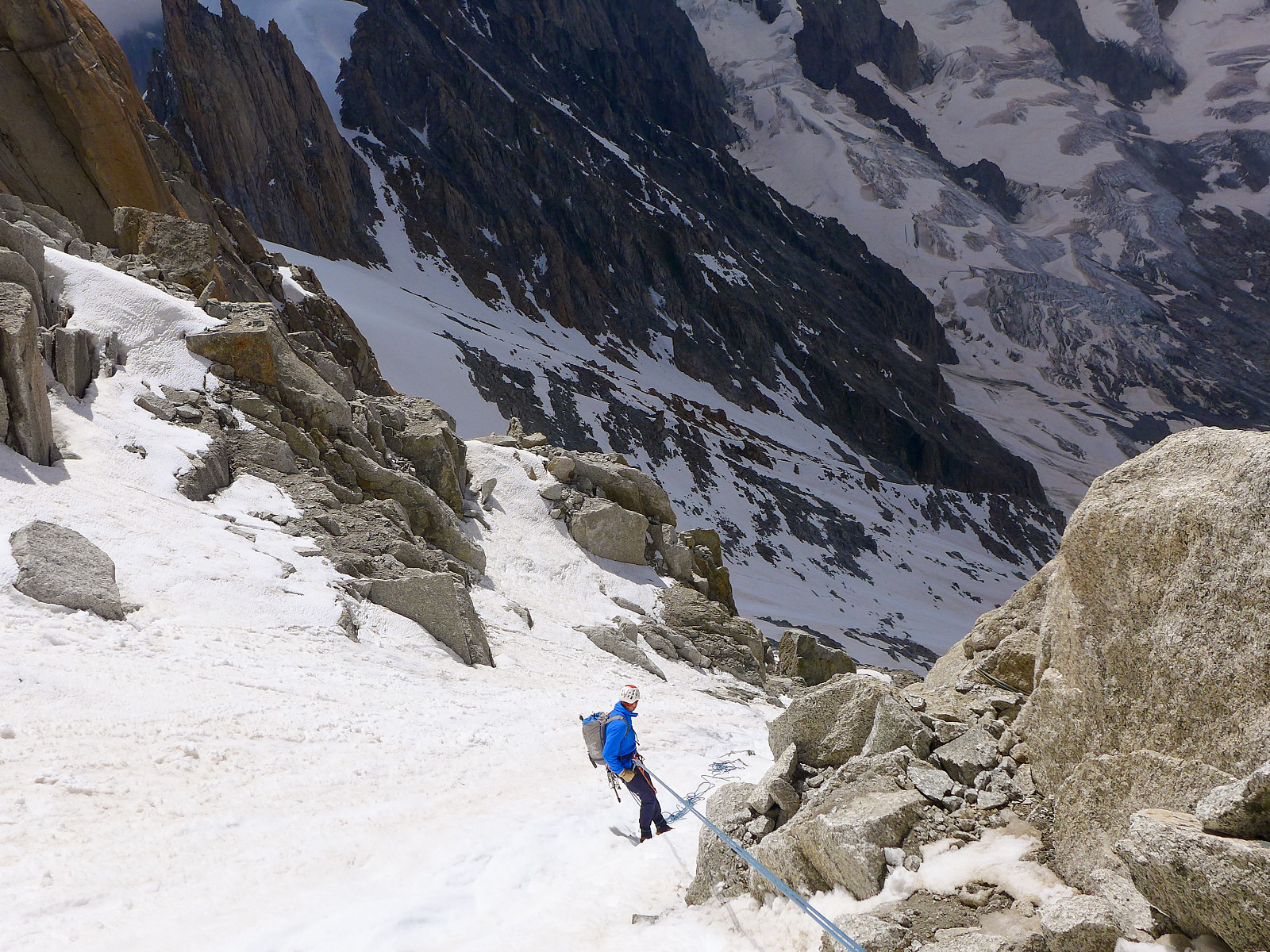
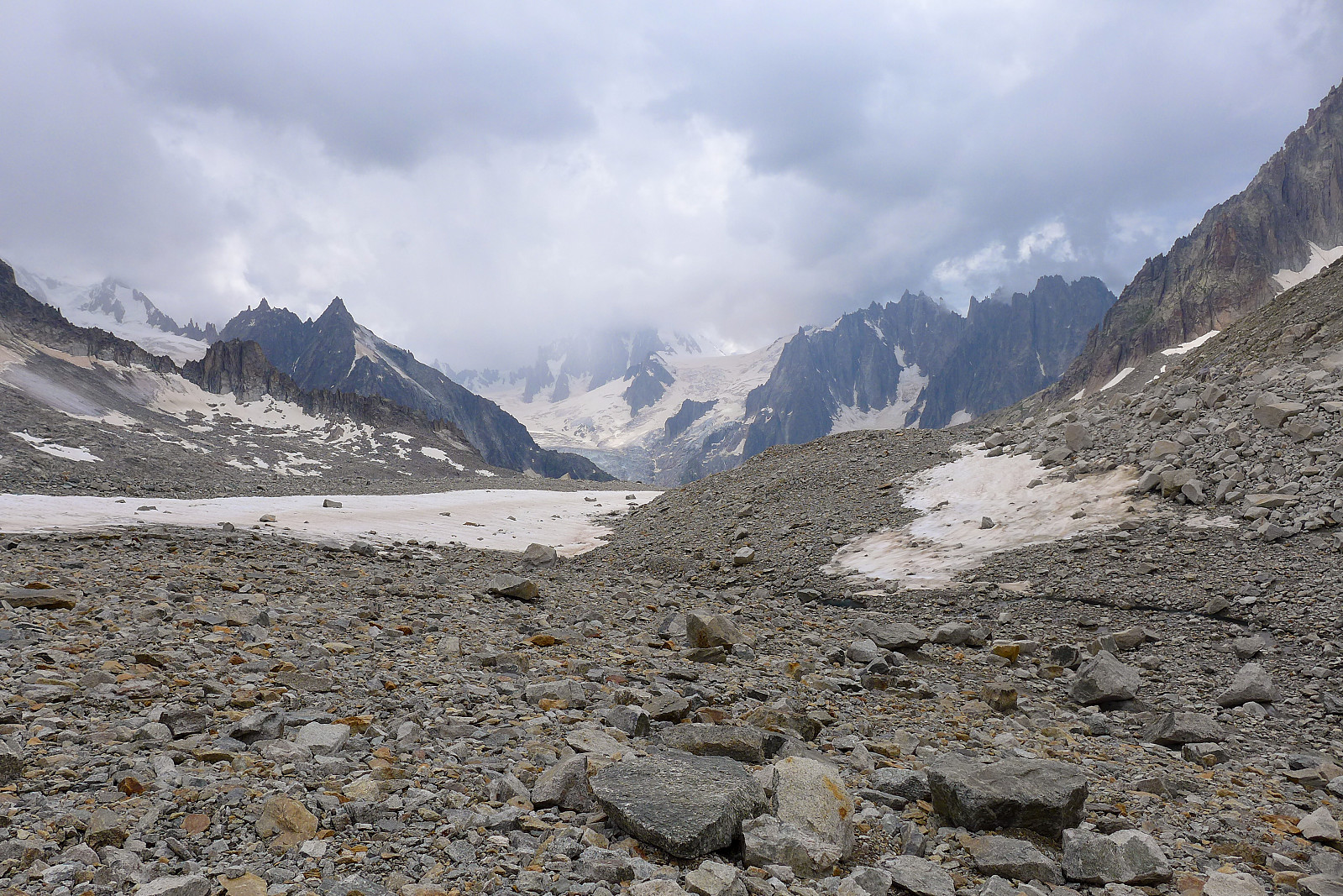
The descent down the southeast couloir was actually quite well equipped with slings and a 60m rope appeared to be just about long enough to abseil between the consecutive abseil points which were distributed on both sides of the couloir. There was still a good deal of loose rock around though and I spent a lot of time feeling nervous about either catching the rope on something loose above me or stepping on something loose while abseiling down, especially since Dave had abseiled first and was always below. Anyway, it took some time to abseil our way out of the couloir and out into snow covered flanks east of the couloir since we were essentially only covering at most 30m on each abseil. In a way it was quite fortunate that there had been some cloud cover from late morning, as the snow in the 40-degree slopes below the Col des Droites was actually not too terrible (soft but no more than ankle-deep), despite it being about midday/early afternoon by the time we had to downclimb there. From here we continued downclimbing as quickly as possible to regain the tracks leading to below the Jardin de Talefre which the other group had made on their way up to the Col des Droites. The clouds above were looking decidedly dark by this point but it was really quite hot when the sun managed to squeeze through the odd crack between the clouds every now and then. I was feeling much too hot and extremely thirsty for much of the downclimbing, but on the plus side having to only kick steps into soft snow was pretty easy on the legs. Once the snow cover disappeared we walked a bit on rubble in a westerly direction toward the hut for a little distance and luckily found a ribbon of old snow at the edge of the moraine to continue down on.
However, by the time we’d reached the low point on the glacier below the hut we couldn’t see any obvious path leading up the steep slopes and slabs below the hut even though there was an alpine trail marked on in the fatmap app Dave was using. We could see a big yellow square painted on one of the boulders at the side of the glacier, but it wasn’t clear where to go from there. Anyway, to cut a long story short we walked a bit down and then back up the glacier looking for signs of a marked path before resorting to calling the Couvercle hut to get some tips on how to get back up to the hut. Turned out that we did indeed have to walk up the rubble above the yellow marker, and then look for a rope, which we eventually found in a little gully at the side of the obvious band of slabs. By this point I was super dehydrated and my legs were feeling pretty tired, so progress went pretty slow up the final 100-200m for my part. Meanwhile Dave was still cruising away uphill like we’d not just already spent 13 hours moving.... It was definitely a very good feeling to arrive back on the steps of the Couvercle hut at around 4pm that afternoon and start drinking lots of water straight away! Dinner came about an hour later than planned, but copious quantities of rice and some sort of spicy sausage casserole proved to be worth the extra waiting time :-)
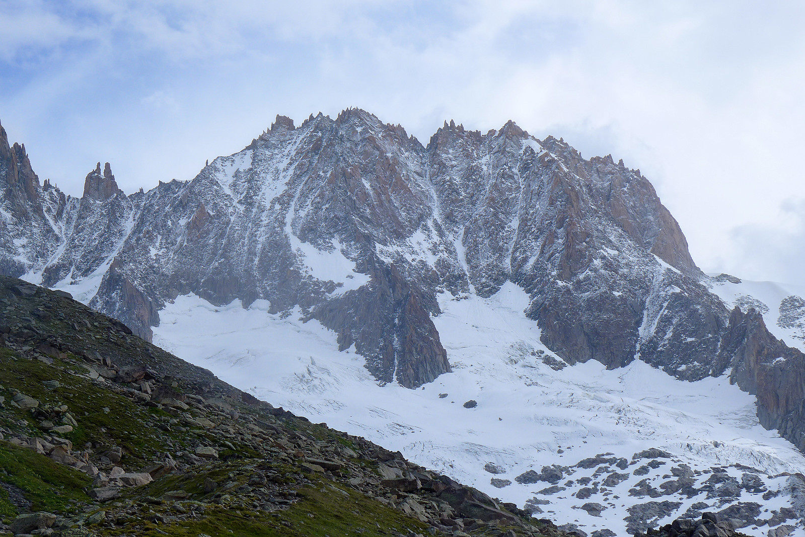
Had a bit of a lie-in until 6.30am the next morning before taking a very long breakfast and trying to postpone our departure from the hut to as late as possible to avoid spending too long walking in the leftover rain from the previous night's storms. We appeared to have timed it just about right though because about 10 minutes after leaving the hut, the skies cleared and gave way to some lovely morning sunshine for the rest of the walk back to Montenvers! On reflection I guess we’d not been on the mountain under optimal conditions, and it probably would have been a nicer experience had there been more snow cover, but it was still a cool adventure, another mountain where we’d not met anyone else on the route, plus we’d had two really lovely nights at the Couvercle hut without the usual crowded dormitories. I’d definitely go back there if - and when I ever get the chance to climb the Aiguille Verte!


User comments