
Lauteraarhorn (17.06.2022)

Skrevet av hmsv1 (Hannah Vickers)
| Startsted | Aar bivouac hut (2731moh) |
|---|---|
| Sluttsted | Summerloch |
| Turtype | Alpin klatring |
| Turlengde | 18t 00min |
| Distanse | 30,0km |
| Høydemeter | 1800m |
| Kart |
|
| Bestigninger | Lauteraarhorn (4042moh) | 17.06.2022 |
|---|
The Lauteraarhorn has been sitting on my to-do list for the last few years, or basically ever since climbing the Schreckhorn but not continuing to do the traverse across to the Lauteraarhorn. Rather than going back from the Schreckhorn side, the other alternative was to approach it from the Grimsel Hospice to the east and ascend the Lauteraarhorn via its south face couloir and southeast ridge. However, with the length of the walk-in to this route being of the typical Oberland expedition type (i.e. LONG!) I’d sort of hoped that it might have ended up being an approach that I could do on skis. Of course the one year that I manage to get to the Alps with skis it turns out to be one of the driest winter/spring seasons ever, so there was basically too little snow to bother with a ski-in to the Aar bivouac now and it would have to be done by foot. After consulting Martin Moran’s guidebook for the 4000m peaks it turned out the approach to the Aar Bivouac was «only» 15 km and would take 6-7 hours, so basically it was a good day’s walk and didn’t seem too daunting after all.
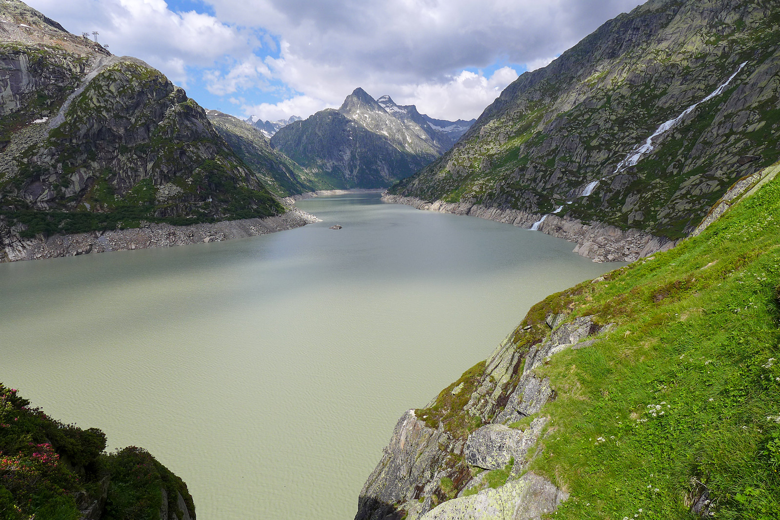
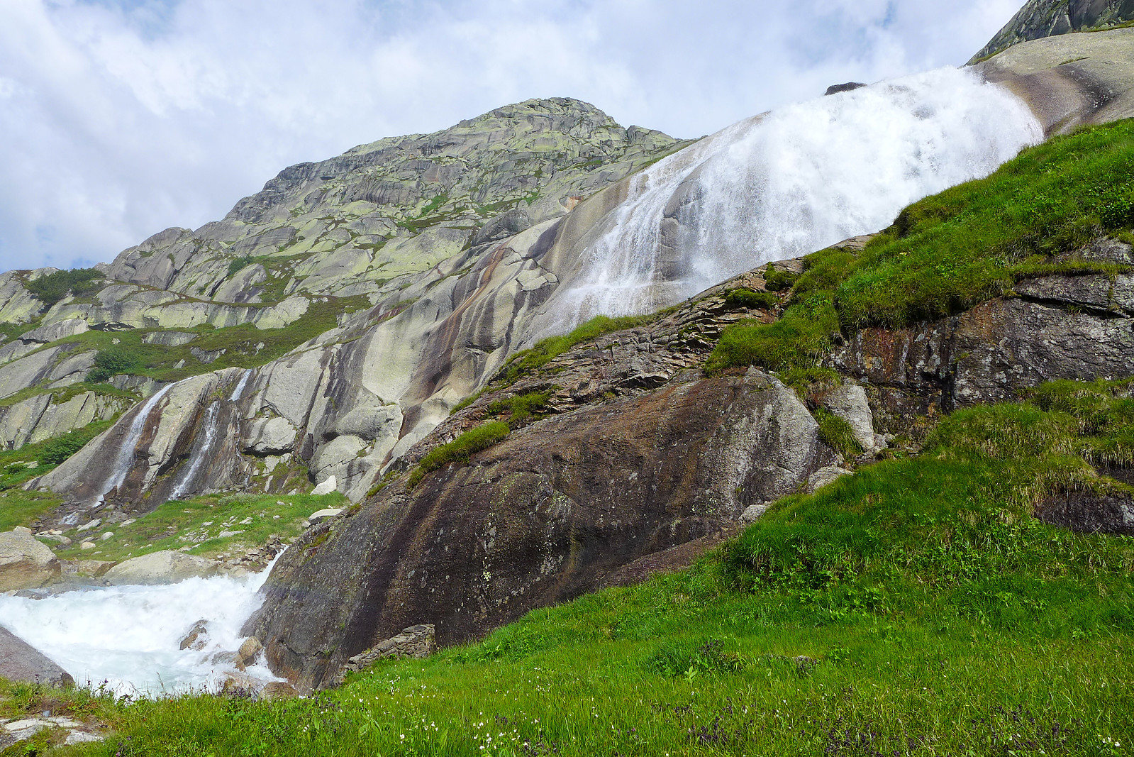
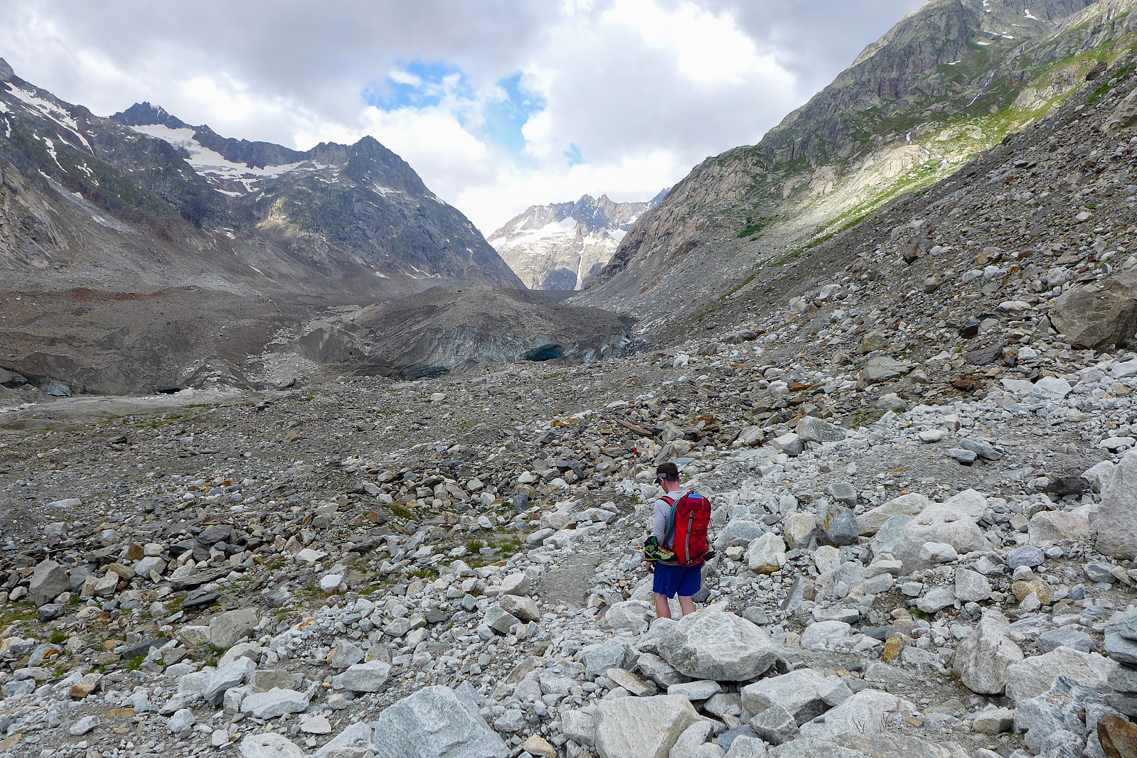
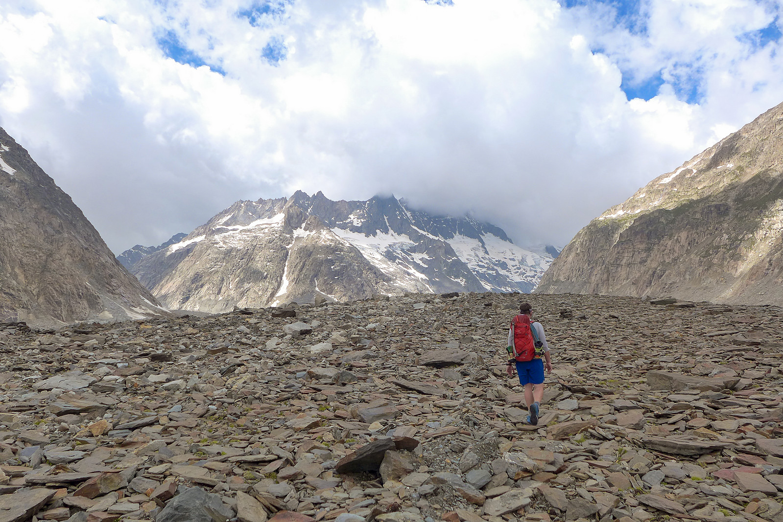
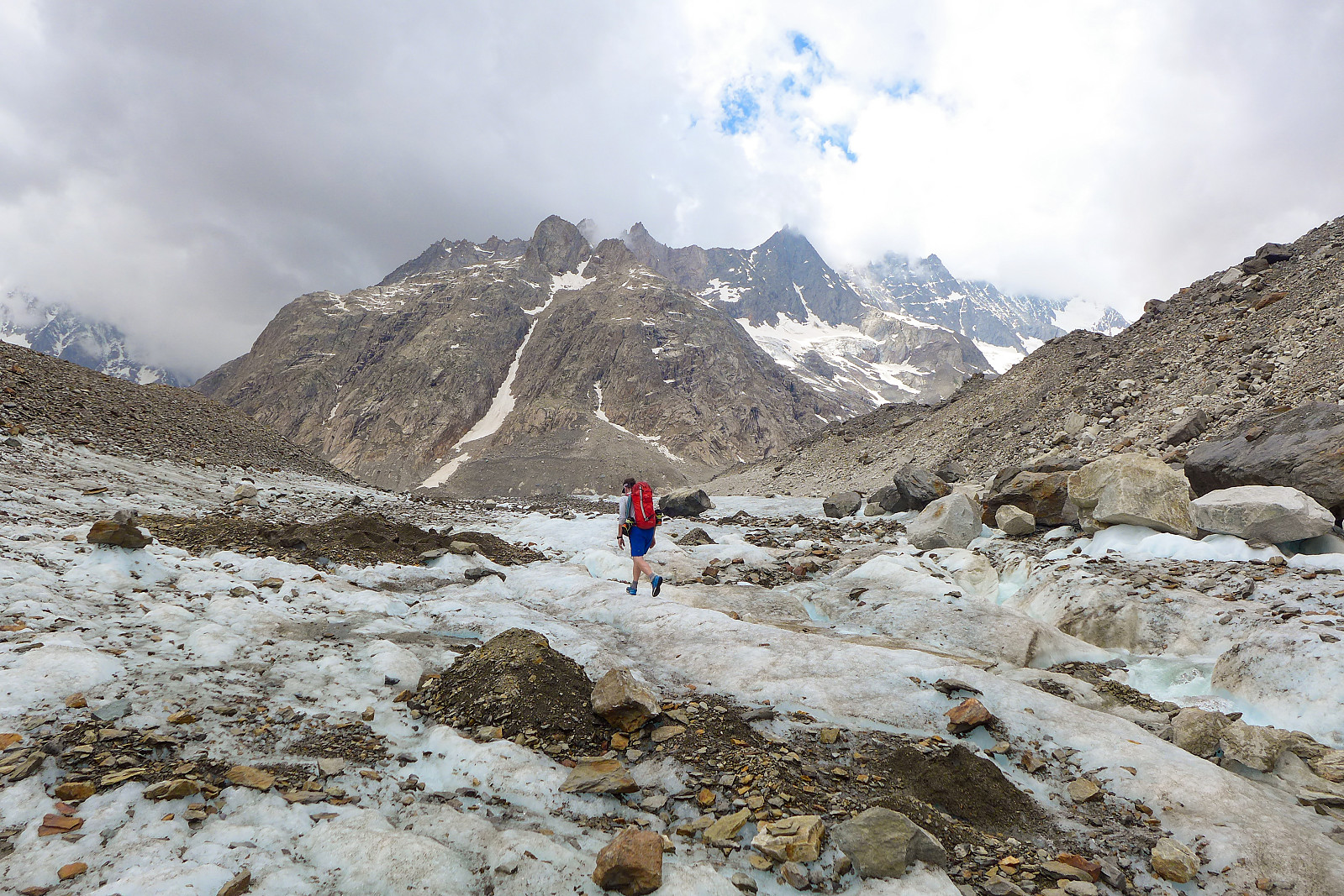
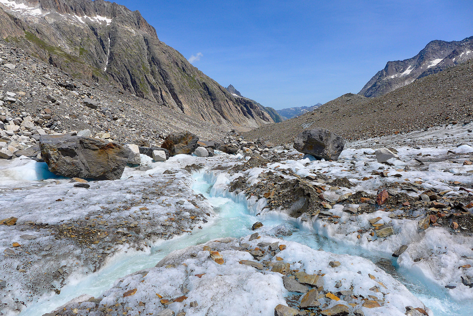
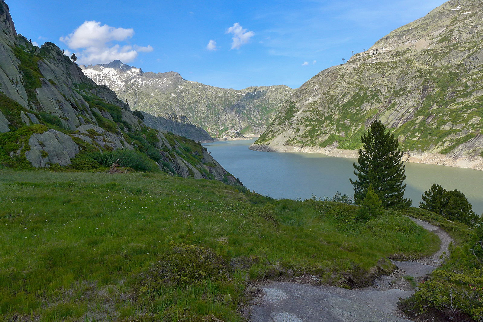
After having spent near a week in the UK I arrived back in Switzerland to a forecast for an entire week of sunshine, but needed some express acclimatisation to have any chance of getting up another 4000m peak again. Two nights at the Cabane de Bertol at around 3300m seemed like a good solution and after a day’s rest (working) in the valley, we headed off to the Grimsel pass early on the Thursday morning, ready for a 2-day expedition into the Bernese Oberland again. Since there was some construction work going on at the dam at Grimselsee, we couldn’t walk from there and ended up having to drive down over the other side of the Grimsel pass to Summerloch to start the approach from there instead. It was probably another 200m lower than the dam, but in the grand scheme of things didn’t really add on a lot of extra time to the already mega long walk-in. My rucksack was feeling familiarly heavy again now with a lot of food to keep us going for 2 long days, so took it really slowly going up the series of steps from Summerloch. Once we joined the trail from the Grimsel Hospice the trail became more undulating as we made our way along the entire length of Grimselsee. It was a pretty scenic walk on a good path, and we passed a really impressive waterfall that poured out into the lake below, but it was still a bit of a nuisance to be losing and gaining height so often! Once we approached the western end of the lake the trail descended down to the valley bottom and we continued on a mix of sandy ground and gravel path toward the snout of the Unteraargletscher. The route description on the SAC website advises to keep a bit of height, on the north side of the glacier to find a reasonable way up onto the lateral moraine, so after leaving the path we made our way over some pretty rough terrain consisting of loose rock and boulders and traversed across the slopes until we could see some way to get up onto the crest of the moraine. It was time consuming and a major test of patience, but once we’d got up onto the lateral moraine the hardest part was done and we soon found cairns and markers all over the place, making it relatively straightforward to stay on the route. I’d counted around 4.5-5km of rubble-type terrain before we would join the Finsteraargletscher, so I was eagerly counting down the kilometres until we’d finally reach some rough but easy ice to walk on. The walk up the moraine was actually not that bad, but it was really the stuff at both ends – getting on and off the Unteraargletscher, which was most patience-testing; it seemed like there were endless piles of loose rock to have to cross over before we could reach the ice, and none of it was particularly attractive for wearers of trail shoes! Fortunately Graham managed to spot some cairns here and there, so we basically aimed for those and hoped they might lead us on a sensible route to the Finsteraargletscher, which we did finally reach after nearly 5 hours of walking.
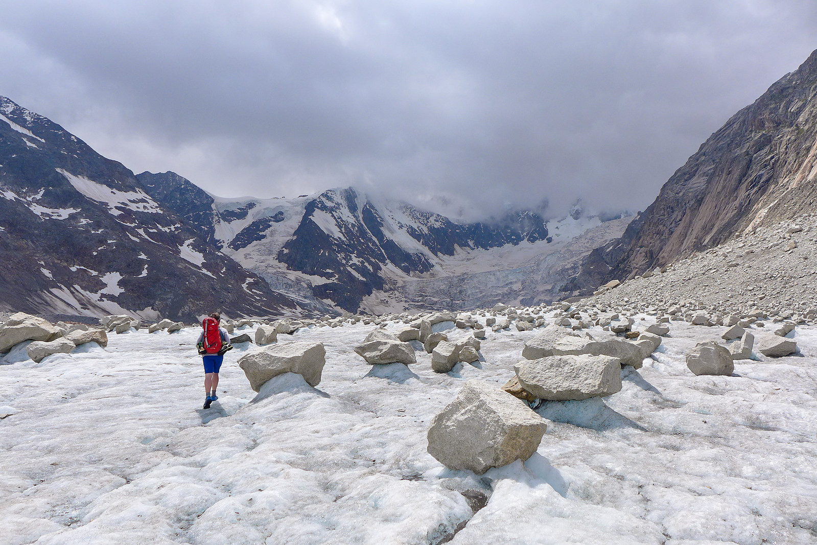
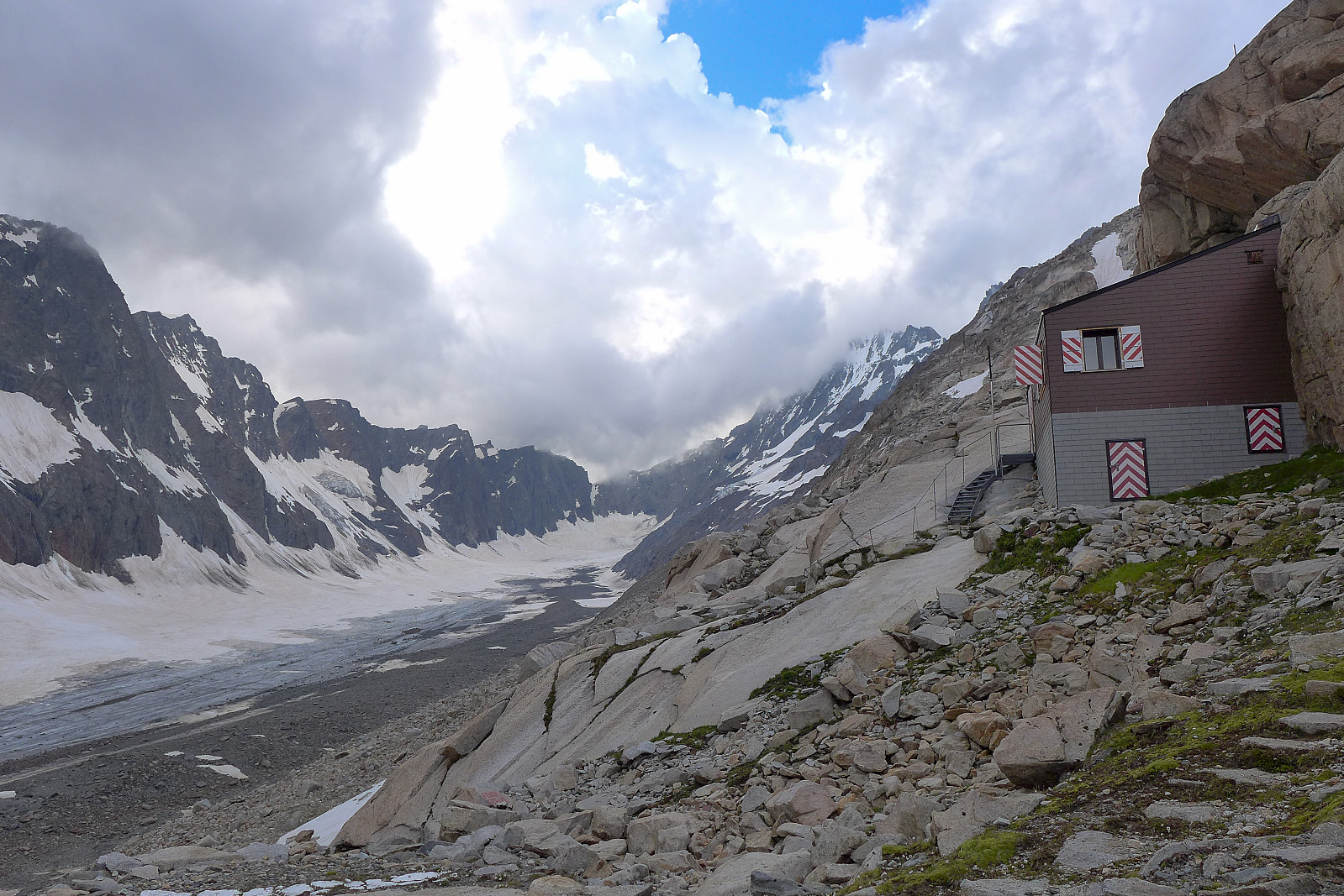
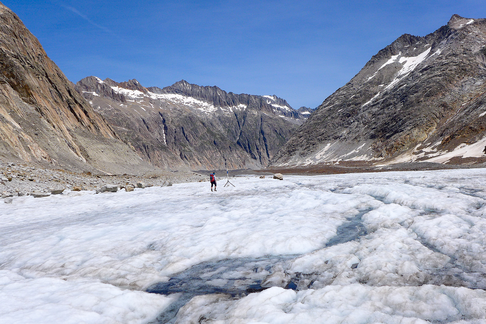
From where we got onto the Finsteraargletscher, it was a comparatively easy walk on grippy ice in a southwesterly direction for about another 4 km, aiming for the corner where the Finsteraargletscher meets the Strahlegg-gletscher. Some very visible posts were mounted quite regularly along the northern side of the glacier as we got closer to the Strahlegg-gletscher, and these led us up the rocky slopes in the direction of the Aar Bivouac hut. We discovered that the hut itself was actually tucked away a little way above the moraine we’d been walking on, and there was another 10 minutes of clambering up more loose rock to get to it – but in retrospect it wasn’t any worse than what we’d already encountered on the Unteraargletscher! After 6h 45 we finally arrived at the entrance to a completely empty hut at the relatively low altitude of 2731m and were pretty glad to be able to sit down and relax for more than 5 minutes. In total we’d walked some 17.5km and done about 1200m elevation from the car park at Summerloch. It was a really cosy place inside, with 3 sleeping levels (about 5 bed spaces on each level) and a table plus a very well stocked cupboard with everything you’d need (extra gas, toilet paper, mint tea bags, cups, bowls etc). If staying in a bivouac hut is always this comfortable then I definitely need to stay in more of them – even if it does mean having to carry up extra food and gas! The remainder of the afternoon was spent drinking and eating snacks, then having some rice for dinner at 6pm. After much pondering over what would be the best time to wake up we settled on a 1.30am breakfast, since we needed to complete the route and be back down on the glacier before midday before the snow in the south facing couloir deteriorated into a hopeless mush (memories of the terrible snow on the Aletschhorn were still fresh!). Even more important now since there was a heatwave forecasted to arrive the following day…….
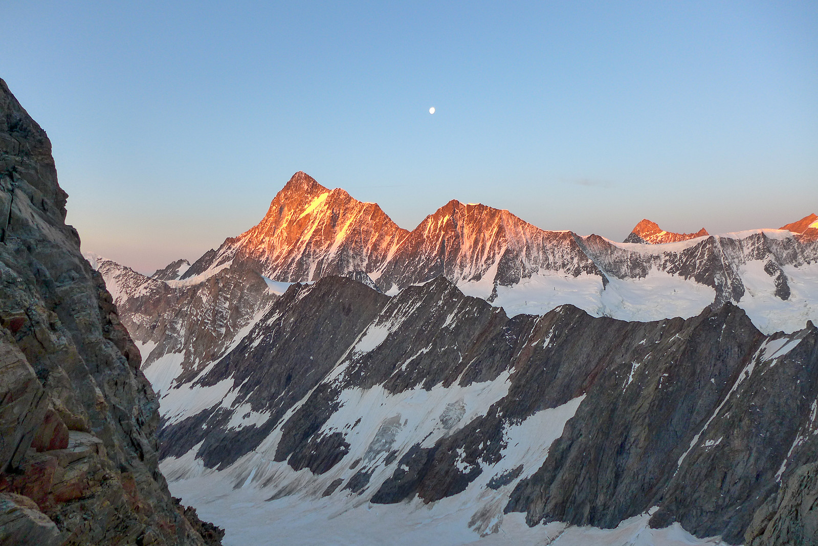
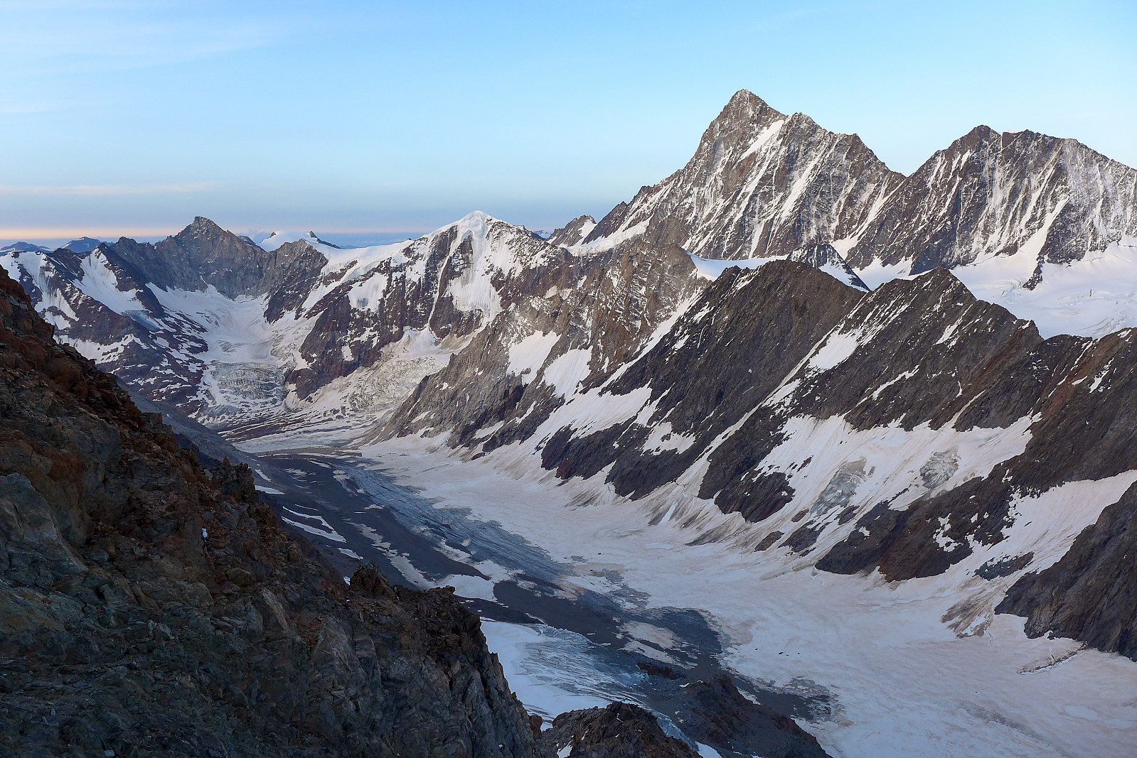
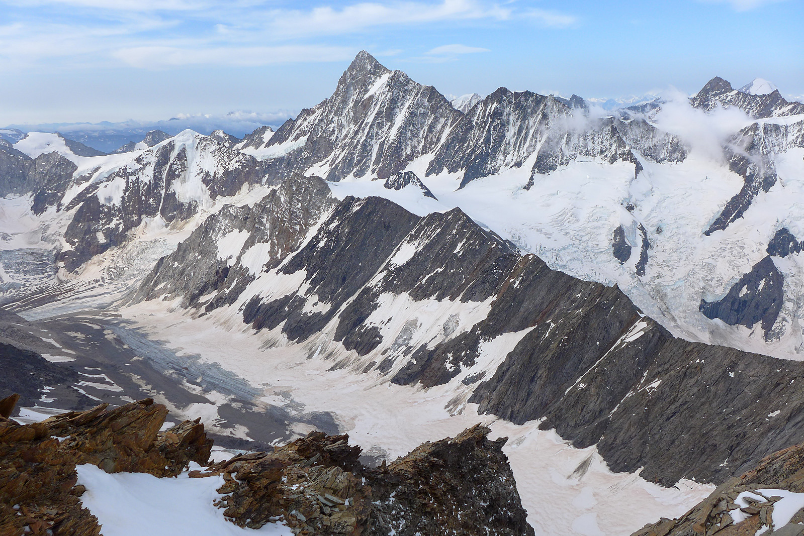
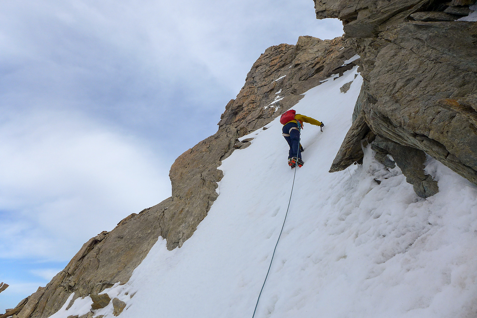
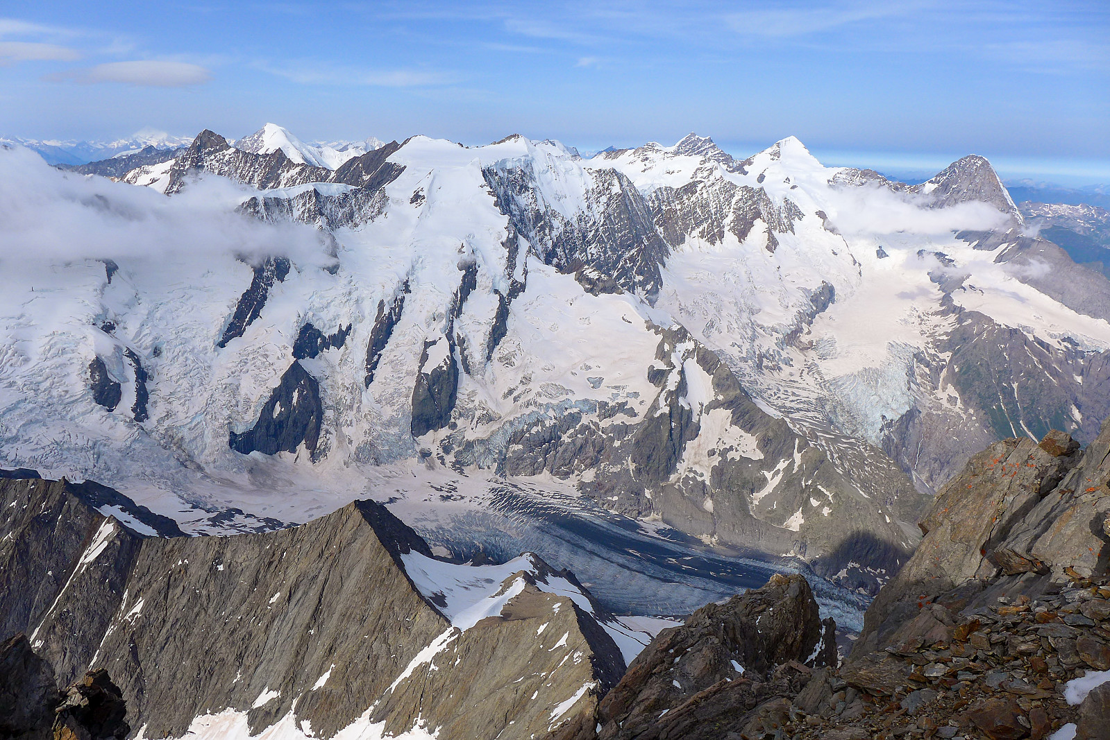
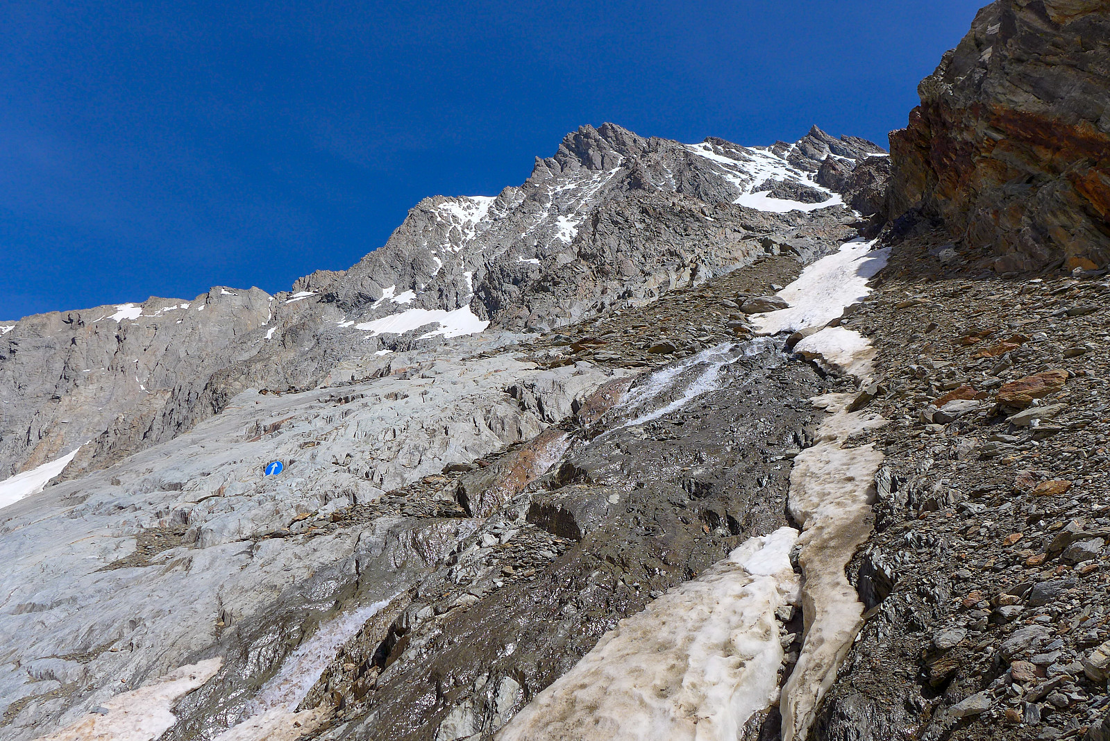
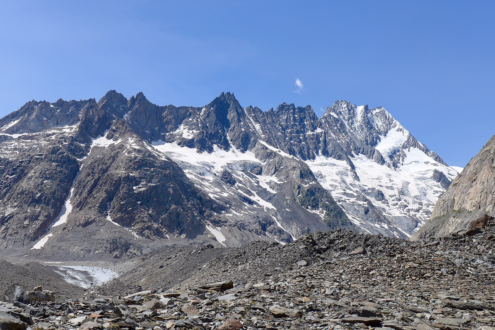
I’d not really slept much during the night so the 1.30am alarm call was a bit brutal, but after forcing down some half-decent instant coffee and some bread, I was starting to feel a bit more awake and excited about the prospects of climbing the Lauteraarhorn. Graham’s worries over not getting a proper refreeze overnight were put to rest once we saw clear skies outside and walked on some pretty well frozen snow down on the glacier. The approach walk up the Strahlegg-gletscher to the entrace to the couloir was only 2.5km, but it took just over an hour until we reached a sensible point to put on climbing gear and crampons. The entrance to the couloir was marked by a pretty reflective arrow on the rock, so it was easier to spot with the headtorches. Some snow cover on the initial slopes led up to an open stream and rocks, so we took off crampons for a small section until we’d reached more continuous snow cover a little further up. And so we had another 700-800m of cramponing up steep hard snow ahead of us, which I found pretty tiring this morning. My legs were heavy and my muscles were protesting at every step up. I was pretty disappointed as I’d been feeling good during the last few days and had been optimistic of having a summit day where I didn’t feel tired the whole time. We made use of the rock spurs at the left edge of the couloir every now and again, but it was never really steep enough to need to scramble so it just ended up being steep hiking on rock rather than hard snow. But the view behind us of the orange sunlit east face of the Finsteraarhorn was a good consolation for the effort :-) The last few hundred metres up to the southeast ridge seemed like a never ending nightmare for my burning calf muscles, and I was pretty glad for every patch of snow that was vaguely soft enough to kick a decent step into. It really made a difference to plant the front half of my boot into snow compared with only the front points of the crampons!
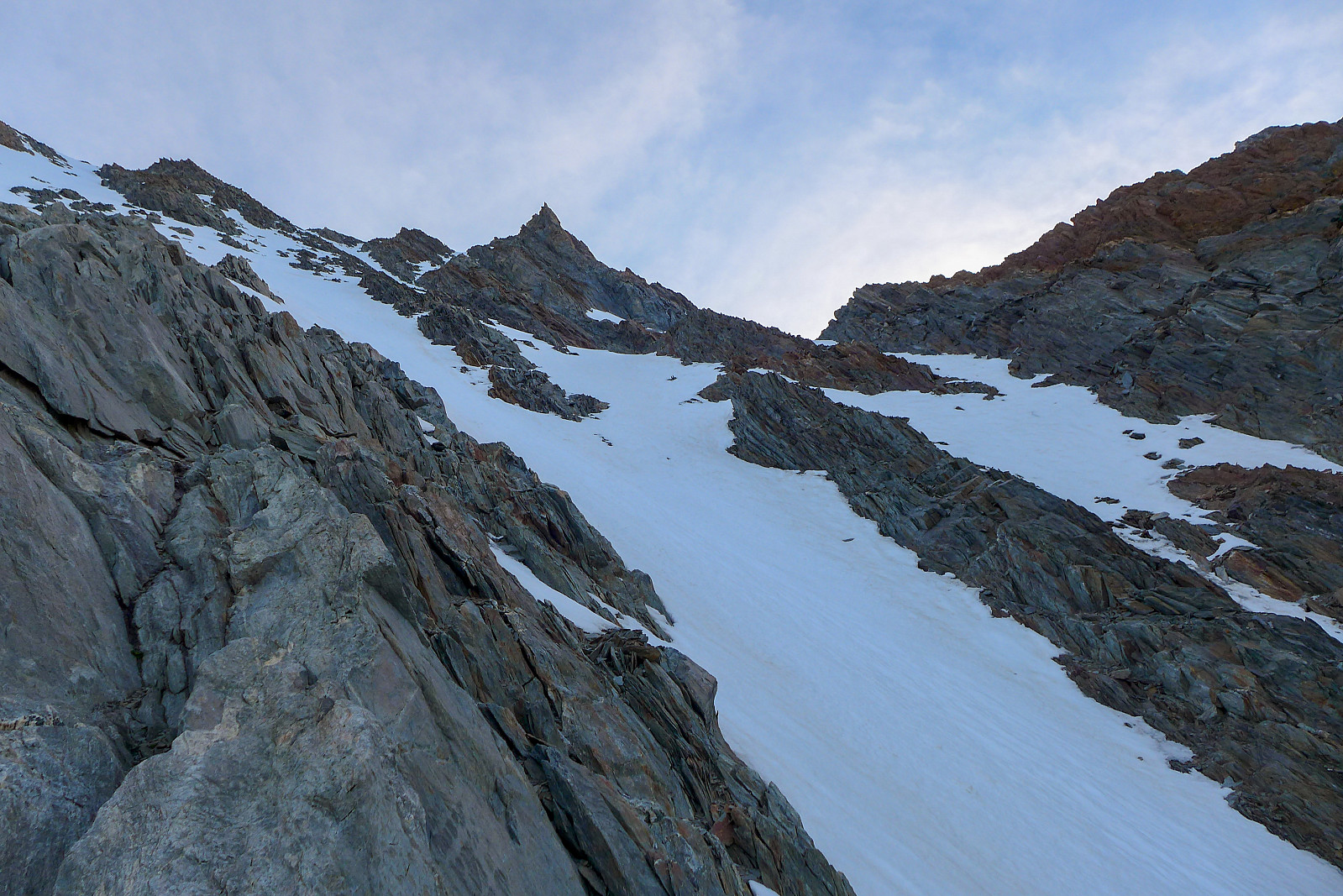
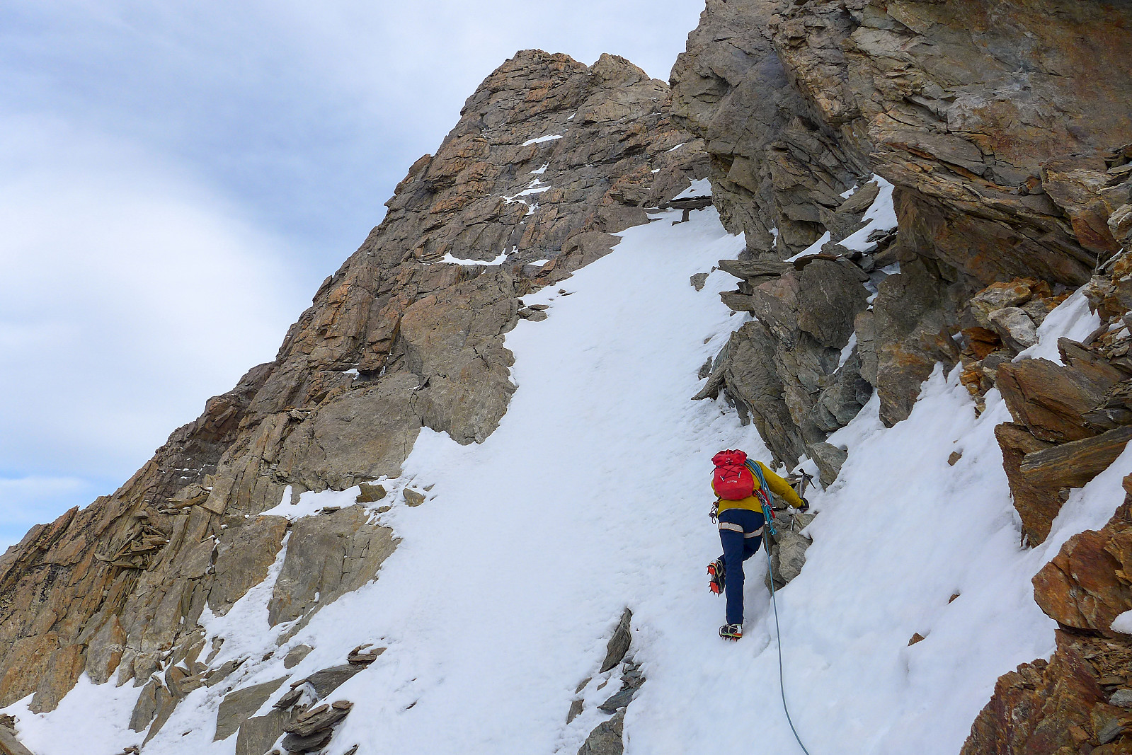
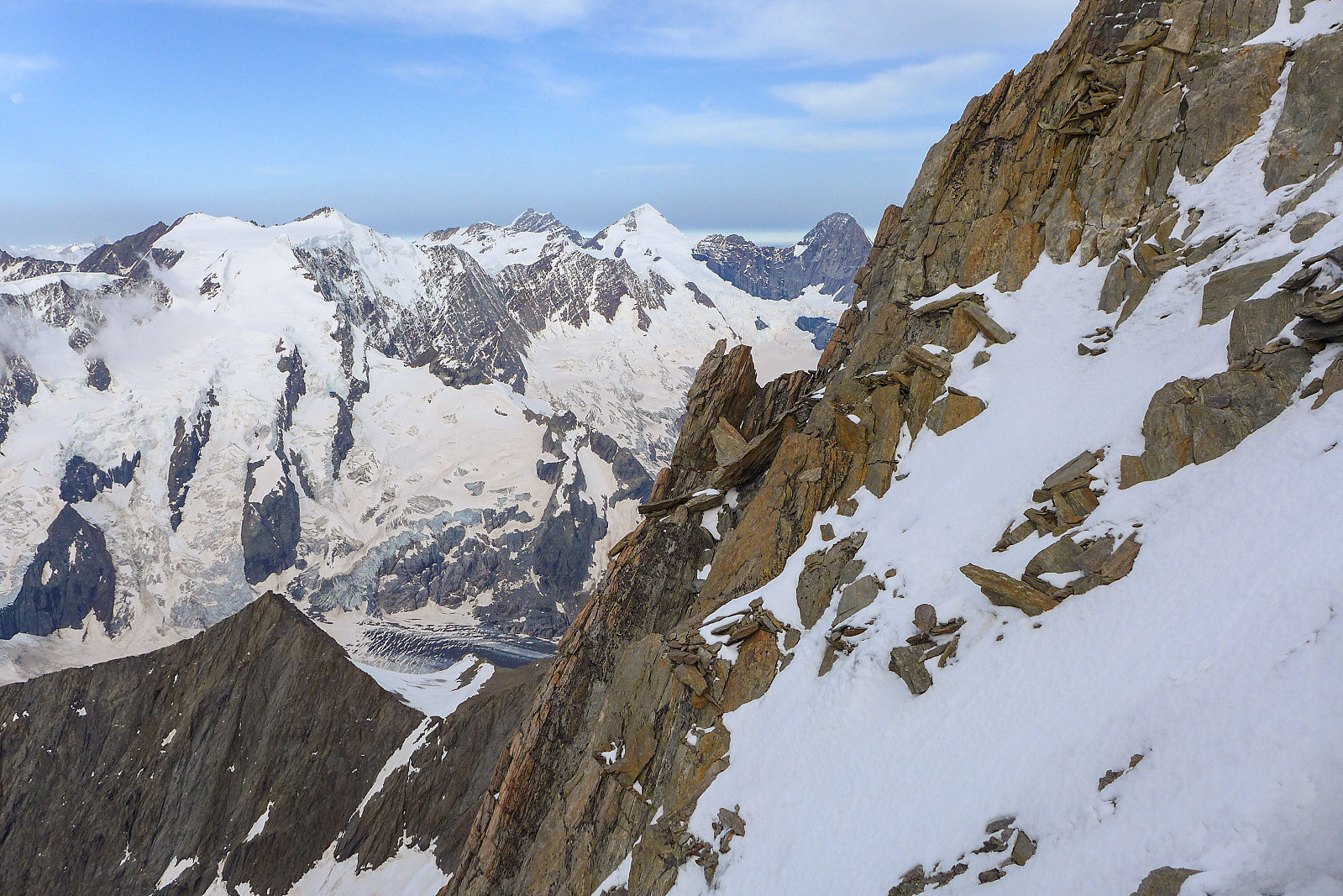
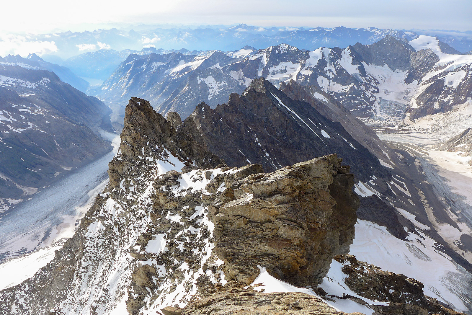
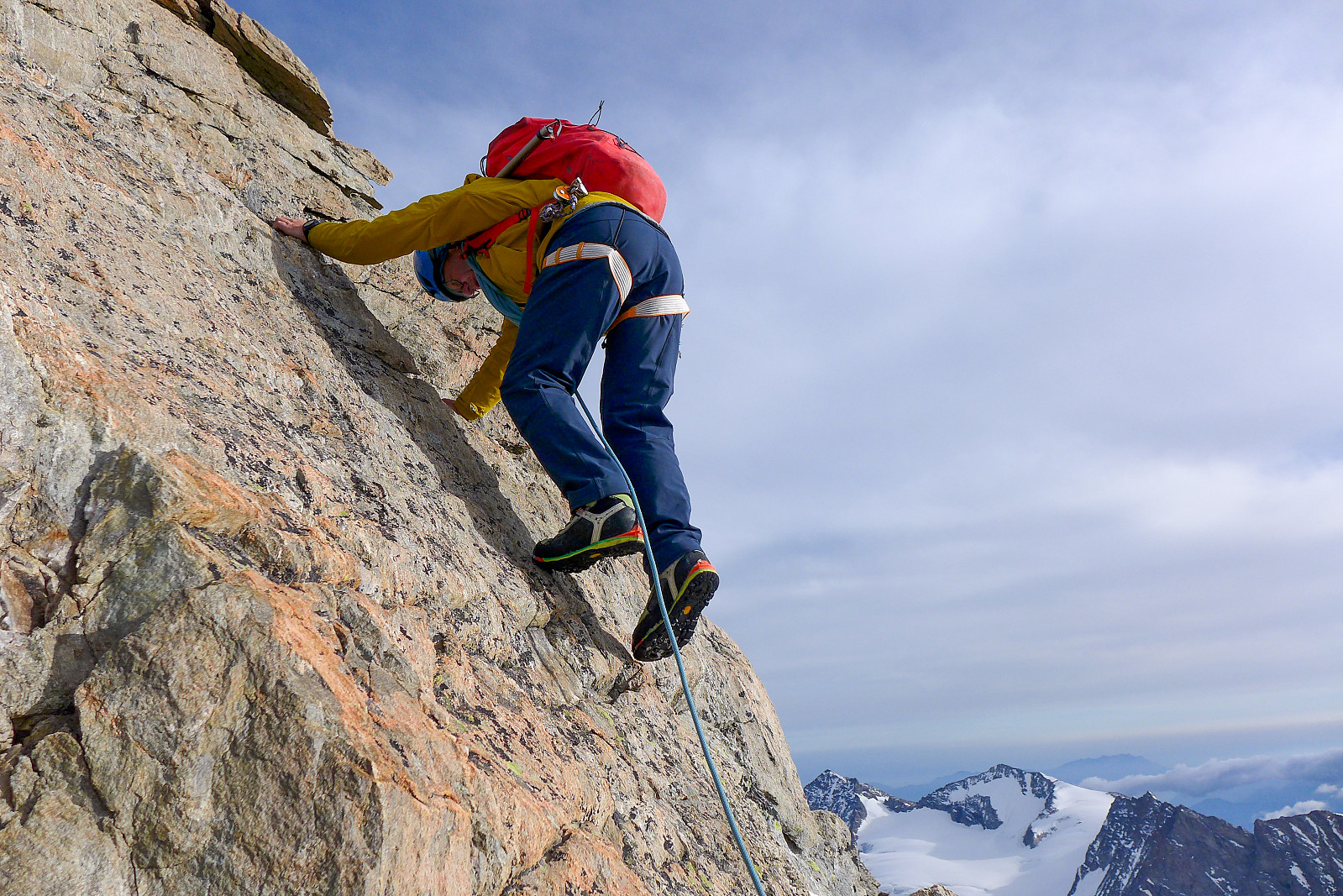
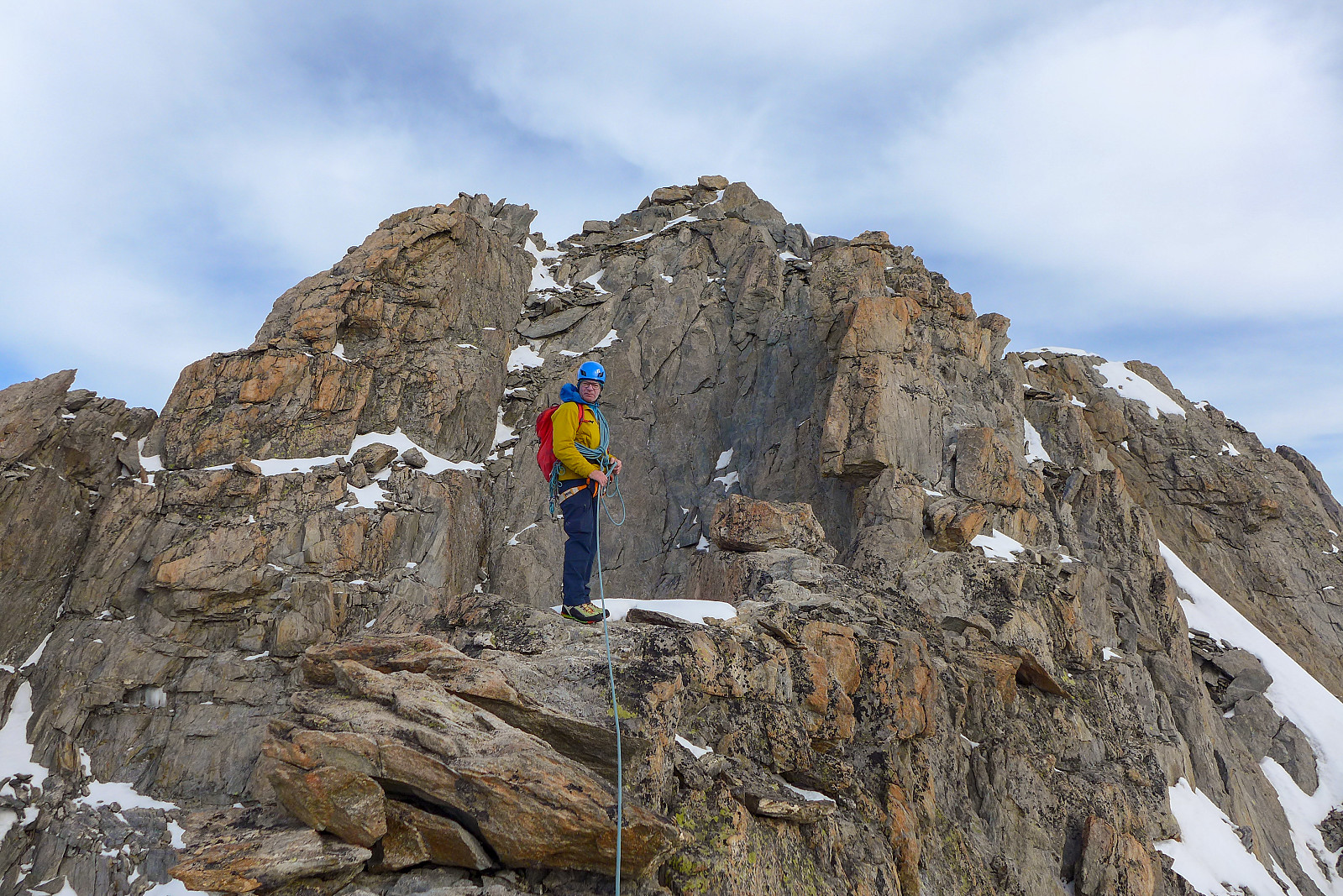
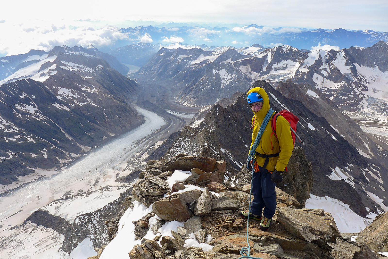
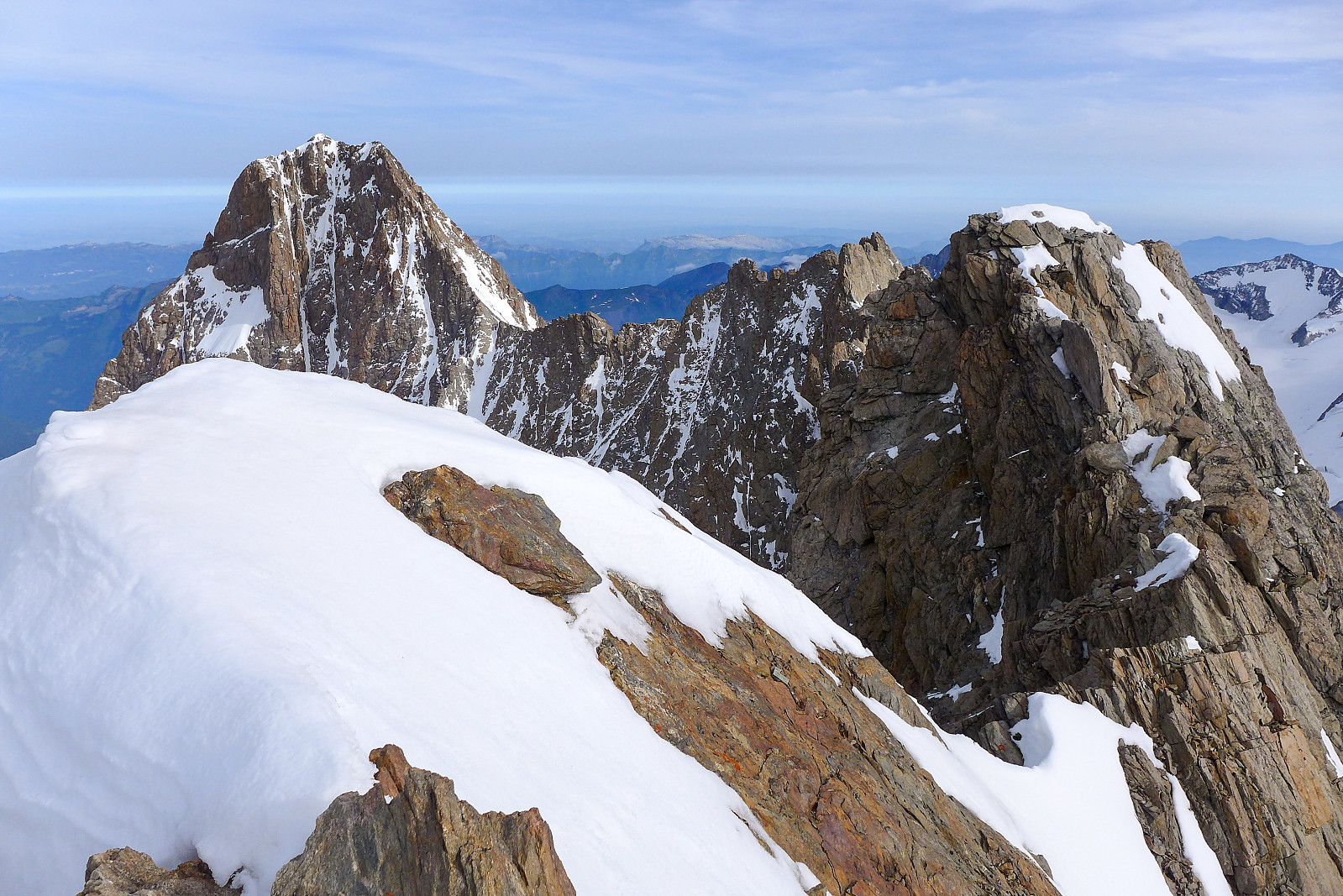
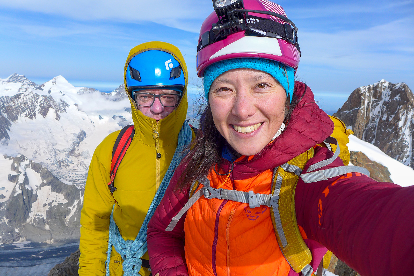
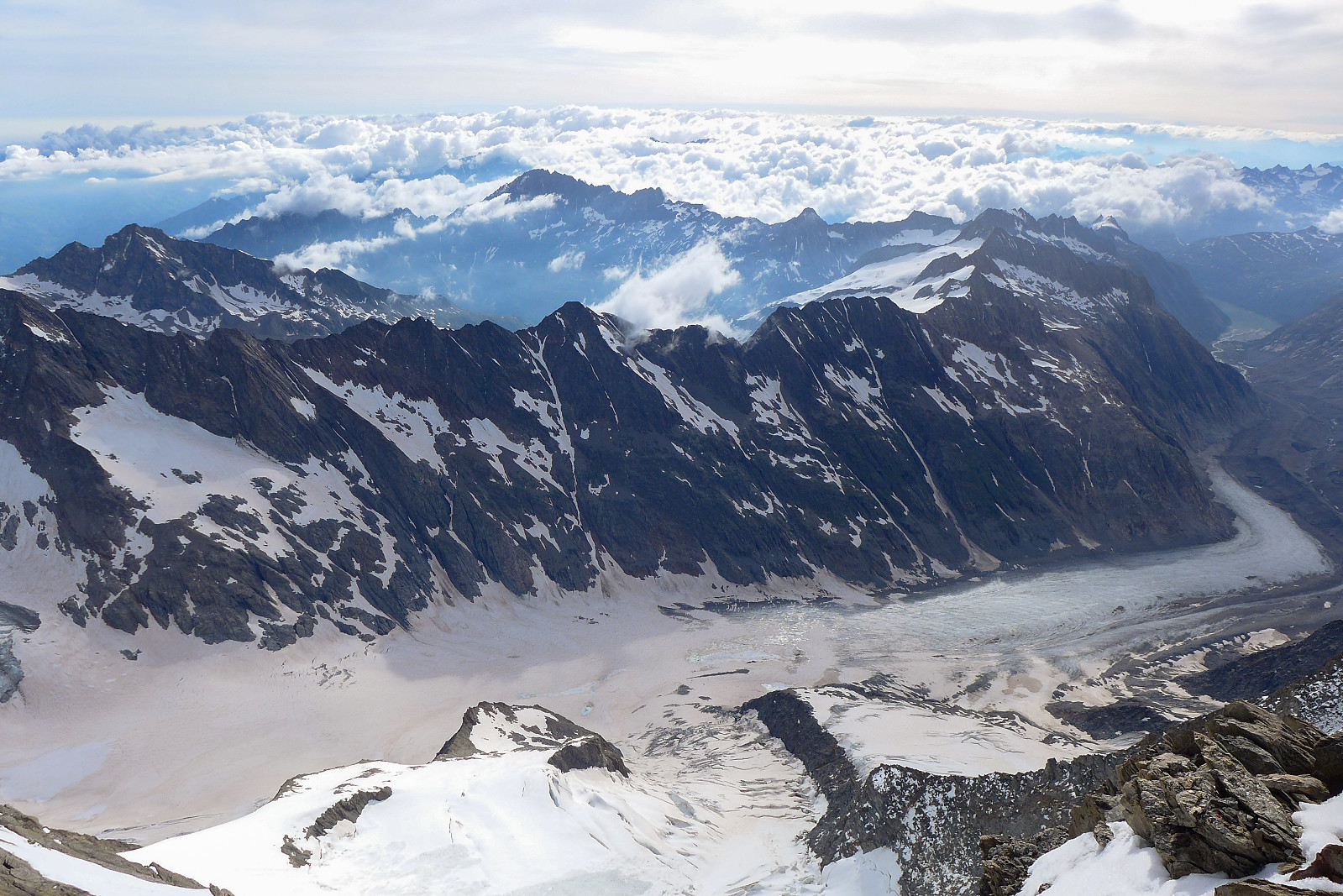
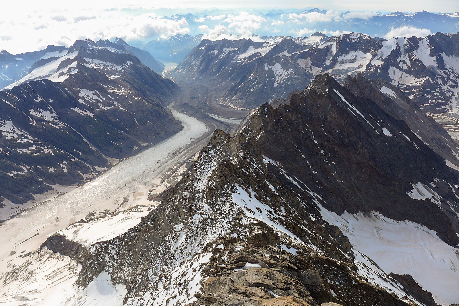
Just before reaching the top of the couloir we headed off left over some rock to traverse across some more steep snow, thereby skipping the inital part of the ridge which (according to the guidebook) had some awkward downclimbing over a tower, so we saved a bit of time and climbed the rest of the southeast ridge. This was I think my favourite part of the route – good solid rock, much like we’d ha don the Schreckhorn a few years ago. Unfortunately – like the last part of the Aletschhorn, the amount of climbing we got to do on the good rock was rather insignificant compared with the amount of time we’d spent reaching it! But it was good to be out in the sun with terrific views both sides of the ridge, and know that it wasn’t far to the summit from there. In total we used about 5h 45 to the summit (mostly slowed down by me) but still within the guidebook time of 5-6 hours. Looking back down the Unteraargletscher we could just about see the eastern end of Grimselsee in the far distance…. It was going to be a long way back from the top! We took about a 10 minute break to enjoy the views and have a quick snack, but there wasn’t really a lot of time to hang around since it was now 8.30 and we needed to be out of the couloir before midday. Retracing our steps back down the ridge required a bit of care, but once we were back down at the start of the main couloir it was really just a matter of downclimbing more or less the entire couloir. I can’t remember the last time I spent so much time frontpointing my way down a mountain, but this must surely have been the longest I’ve done?!! Initially the snow in the upper part of the couloir had softened just nicely that it made the descent quite quick to start with, but it seemed like as we descended lower down the snow hadn’t had as much sun and we were back to frontpointing on hard snow again, although my calves protested less against this compared with going up. Had to take a number of 10 second breaks every now and then as I was feeling pretty tired by now but by 11.30 we were finally completely out of the couloir and back down on the moraine on the Strahlegg-gletscher again. It already felt like a long day up until that point!
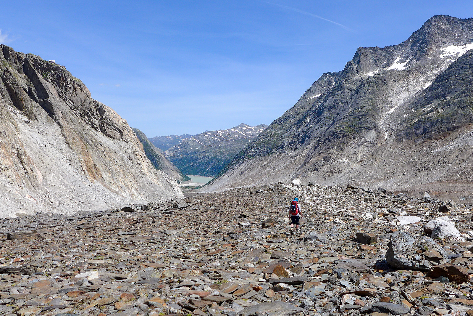
Anyway, we took a really decent long break to pack away climbing gear and sit on some rocks to eat lunch. From here it would be another hour to get back to the Aar bivouac and then at least another 5 or 6 hours to the car park at Summerloch. But after our lunch break I was feeling pretty revived again and not dreading the long walk back too much – at that point! We picked up some stuff we’d stashed under a rock near the bivouac hut earlier in the day and then began our way back down the Finsteraargletscher, then finally clambering over endless rubble to get onto the moraine of the Unteraargletscher again. It was roasting hot by this point, but Graham had run out of drink and was pretty keen to keep the pace up to try and get to the nearest stream which was at the other end of the Unteraargletscher. I could quite happily have taken another long break to get changed into shorts by that point… Anyway, it felt like we spent a ridiculously long time negotiating the heaps of rubble at the side of the moraine just to get back across to the path, and this was quite possibly the most testing point of the walk back as my patience was starting to wear thin after now having been moving for 13.5 hours – and knowing we still had som 9 or 10km left to walk. But knowing that water wasn’t far away – and that the rubble would definitely come to an end at some point was a motivation to just keep moving despite the thirst and general tiredness. It was a dream come true once we’d made it past the worst of the rubble and found a stream to fill up water bottles at! Here we took another long break, changed into shorts and were soon back on a proper path again. It was a relief to know now that we would have a decent path all the way back to Summerloch, we just had to put one foot in front of the other.
After another 3km we were above Grimselsee again and it seemed like we were well on our way back to the car. However, when I took a quick stop to take a drink I discovered that both my phone and watch (which had been attached to my powerbank) had somehow disappeared from the top lid of my rucksack, and realised they must have dropped out when I stopped for an earlier break just after joining the path again. I saw no other option than to turn around and walk back to look for it. I was so sure I knew where they had dropped out that I just couldn’t return to the car without them – even though I realised it meant that it would add at least another 1.5-2 hours onto an already very long day :-( So I basically dumped my rucksack at the side of the path and took only my water bottle with me on my way back down to the river, while Graham continued onwards to the car in the hope of getting some sleep before the long drive back to Evolene. It didn’t seem like a long way back to where I thought I’d dropped the phone, but I was still in a bit of an angry mood with myself for being careless enough to leave it behind. I never found it though. Even after walking back and forth and going further than where I thought it would be I never saw any sign of it lying in the grass. Such a disappointment. Walking back up the hill again I just felt immensely tired and pretty sad to be returning without a phone and my watch (and no GPS tracks of our mega long day!!). At least my rucksack was still beside the path though. After having another snack I plodded on at a rather slow pace the rest of the way back. It was a small consolation that the entire trail was now in shade and a very pleasant temperature to walk in! But all the uphills on the way back just seemed evil and it seemed like an endless number of them before the final series of steps going all the way downhill to the car.
Without any way to know what the time was I’d lost track of the time a bit, and when I arrived back at the car it was already 8.30pm, making it basically 18 hours on the move with only 2 decent breaks during the whole day (decent meaning 15 minutes!). Probably the longest mountain day since I’d been on Ama Dablam – but I was kind of fascinated by the fact that I felt like I could probably have kept going for a while longer by the time I got back. Without the watch to tell me how much distance we’d walked I estimated that we’d done about 7 km from the hut and back, plus 17.5 km to the car and another 6 km for me with my detour back to the river to find my phone. So around 30 km plus some 1400 m in elevation up to the summit and probably another 300-400 m on the way back, and roughly 2700m down. Long enough for one day :-) Anyway, despite not having felt great and having lost my phone and watch on the way back it still felt like we’d had a truly memorable 2 days on a remote and very cool mountain. And had the pleasure of staying in a lovely bivouac hut without anyone else!


Kommentarer
As always
Skrevet av mortenh 23.06.2022 01:21As always, your reports are pure delight. Beautiful images and detailed texts.
Re: As always
Skrevet av hmsv1 23.06.2022 07:53Thanks Morten. I mostly write the reports for my own benefit so I can reminisce about these great trips several years later, but its nice to hear you enjoy reading them too!