
Aletschhorn (27.05.2022)

Geschrieben von hmsv1 (Hannah Vickers)
| Startpunkt | Oberaletsch hut (2.641m) |
|---|---|
| Tourcharakter | Alpinklettern |
| Tourlänge | 13h 06min |
| Entfernung | 12,3km |
| Höhenmeter | 2.005m |
| GPS |
|
| Besteigungen | Aletschhorn (4.193m) | 27.05.2022 |
|---|
Until now I’d only really seen the north side of the Aletschhorn, which rises more than 1000m steeply up from the Grosser Aletschfirn below and connects to the Dreieckhorn to the east of it. Still, it gives the impression that it would be a really cool mountain to climb, and moreso since most of the routes up it involve some sort of long approach. Hard-won summits are the best type :-) After having irritated one of my hip flexors while skinning up to the Vignettes hut earlier in the week, and Rachel was still suffering from painful blisters in ski boots, we were both feeling like it would be a nice change to ditch the skis and climb something in alpine boots. Hence the original idea to do a ski ascent of Nordend got binned and the idea of climbing the Aletschhorn via its southwest rib was discussed instead. I’d done some «research» on camptocamp to try and check out the latest conditions on the route (most of the recent ascents had been done with skis) but according to the Oberaletsch hut homepage the entire hut walk-in was more or less snow-free now so it seemed like conditions were looking OK for a ski-free ascent. (I also found out from searching #aletschhorn on instagram than a pair of climbers had posted pictures from their ascent without skis the same weekend we’d been up at the Vignettes hut, so it appeared to be doable via that route). The weather forecast was also finally looking good from Thursday onwards, so we decided we’d head up to the Oberaletsch hut on the Thursday, try and climb the Aletschhorn on the Friday and then either walk all the way back to Belalp the same day (if we weren’t too tired) or stay at the hut again for another night. The main hut was actually closed until the start of the summer season now, but the winter room was still open and had beds for up to 8 people, but it would mean that we’d need to take all the food we needed for up to 3 days.
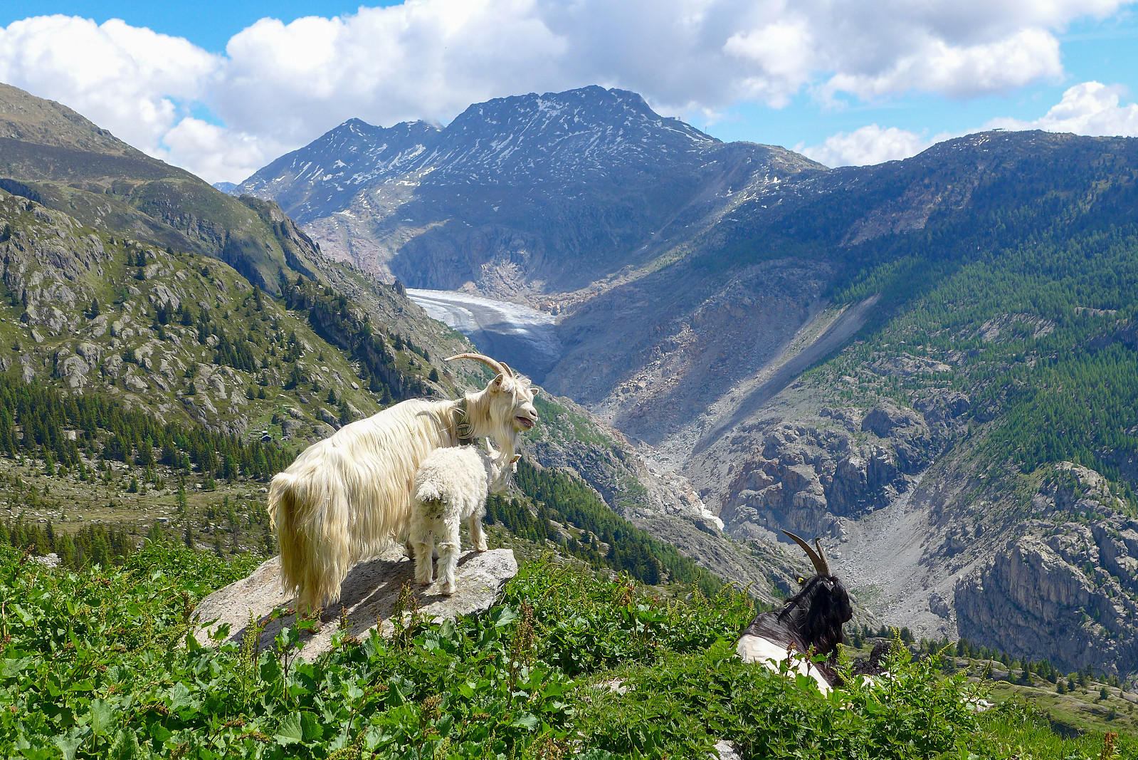
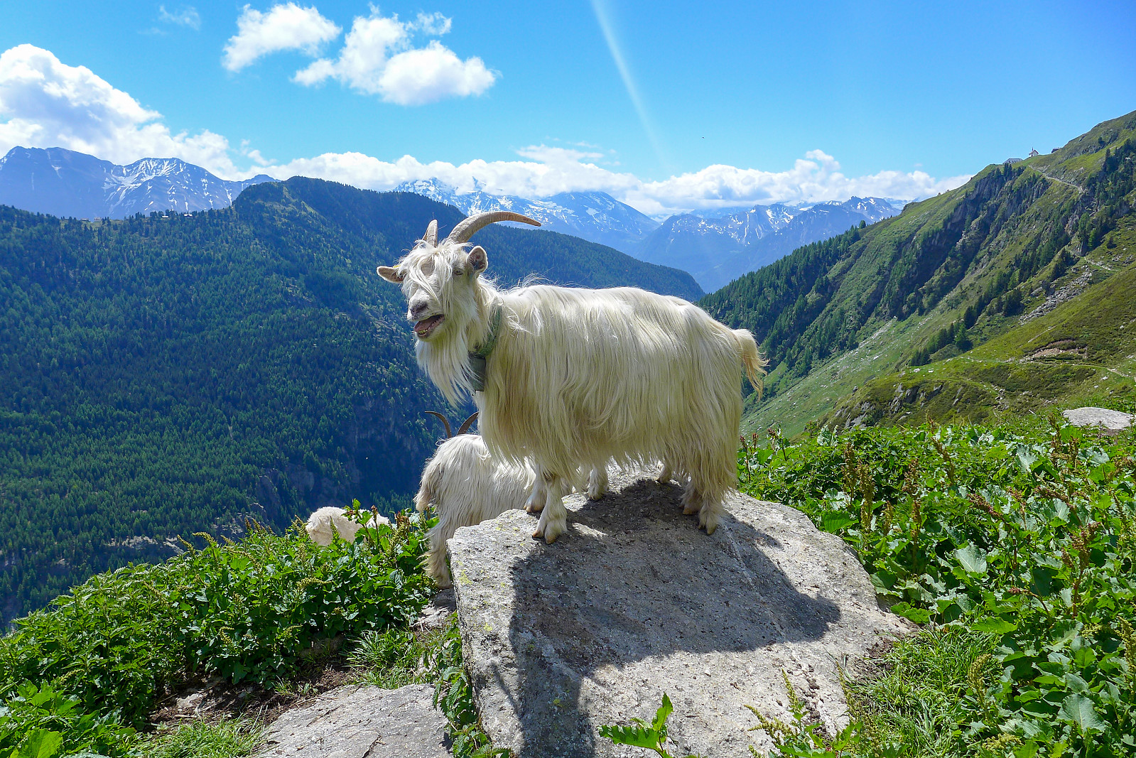
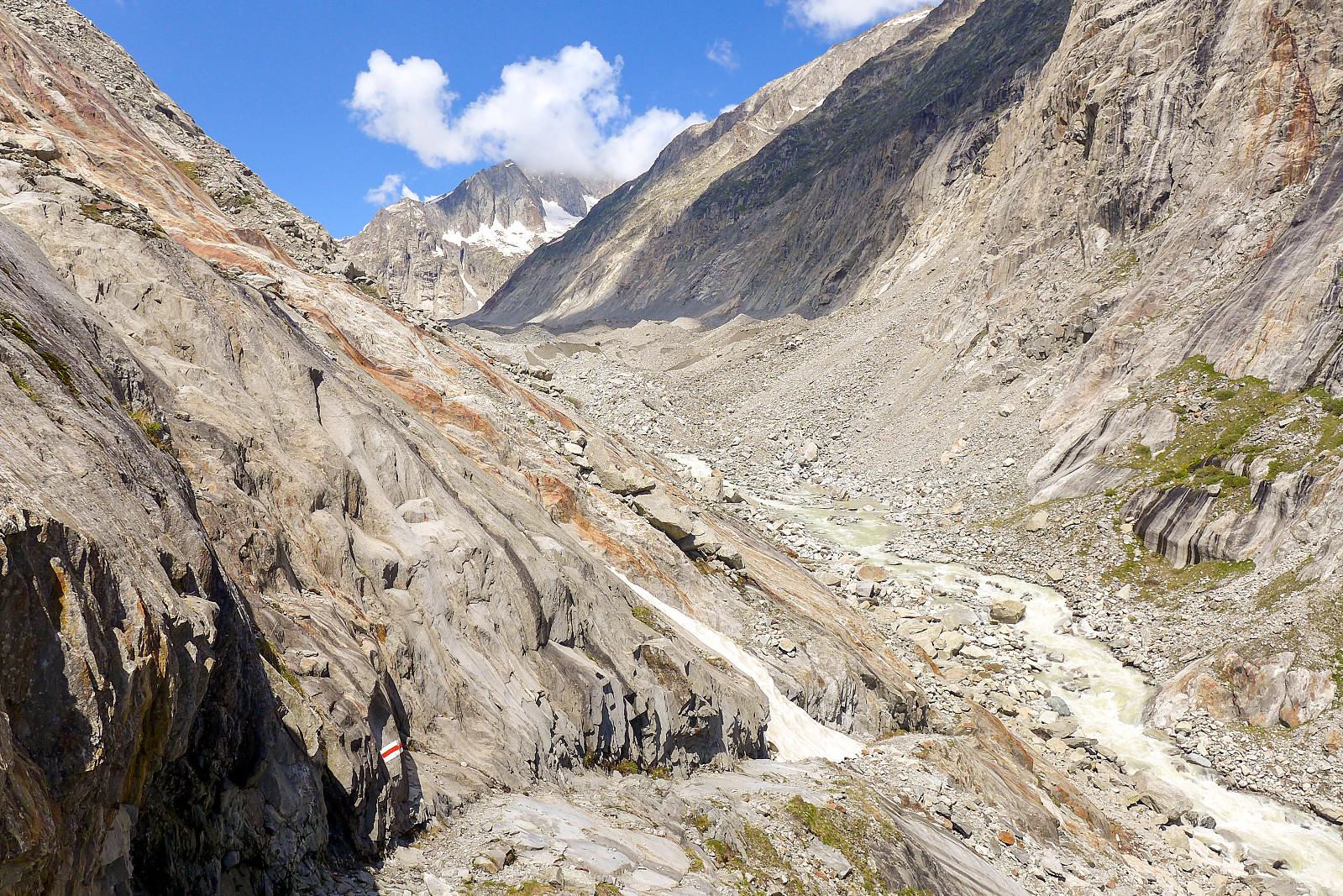
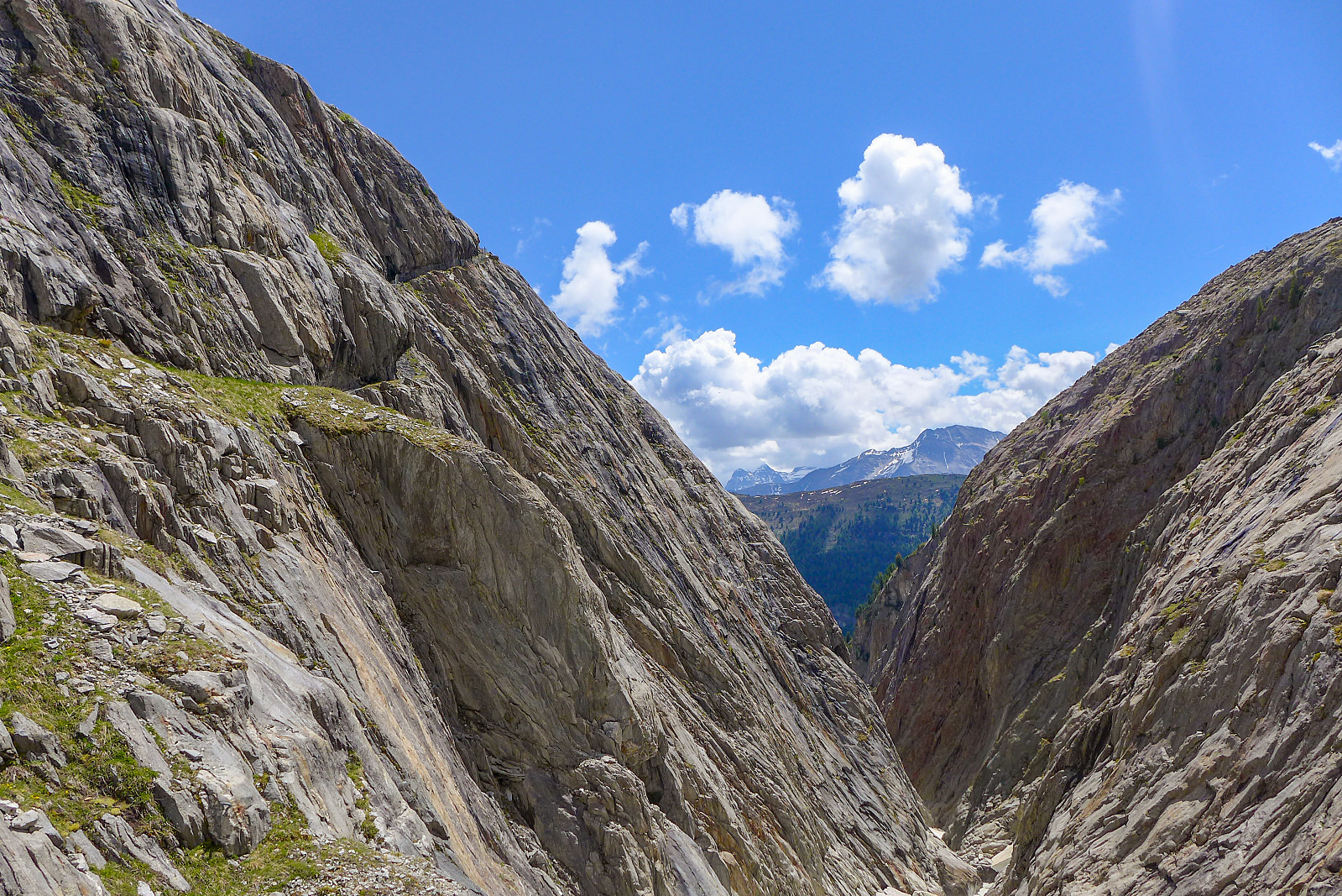
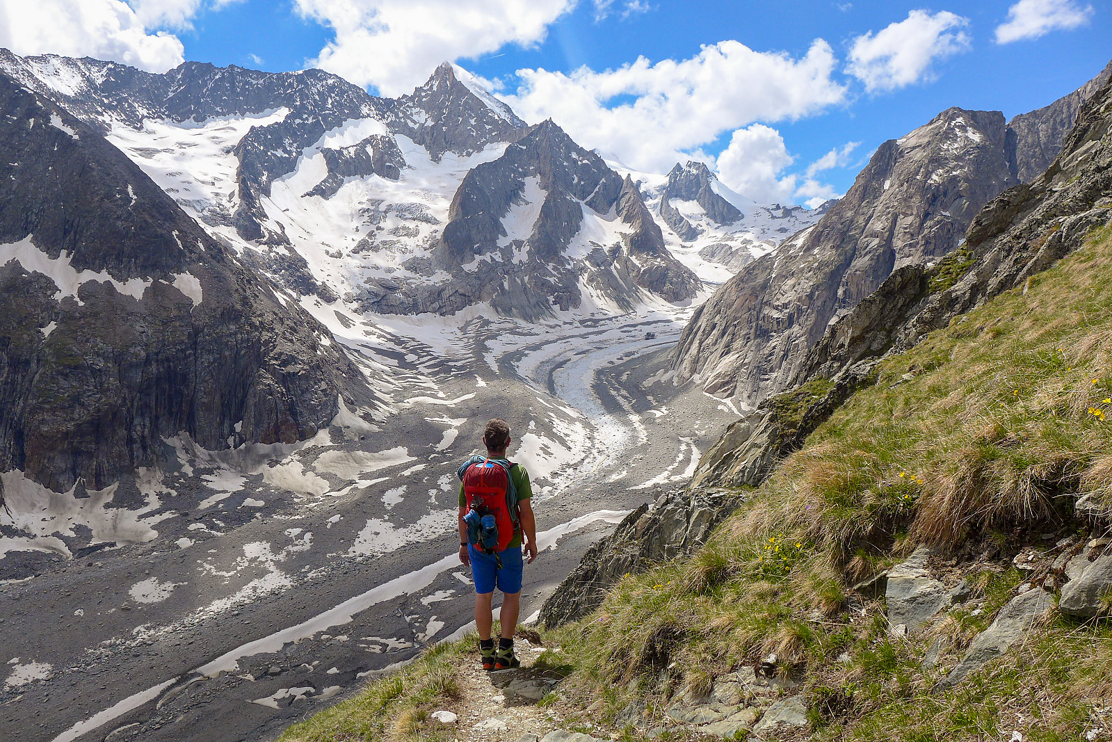
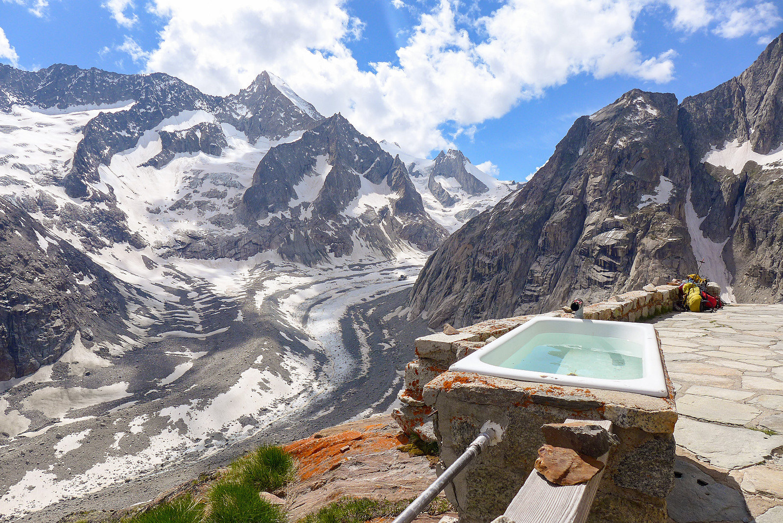
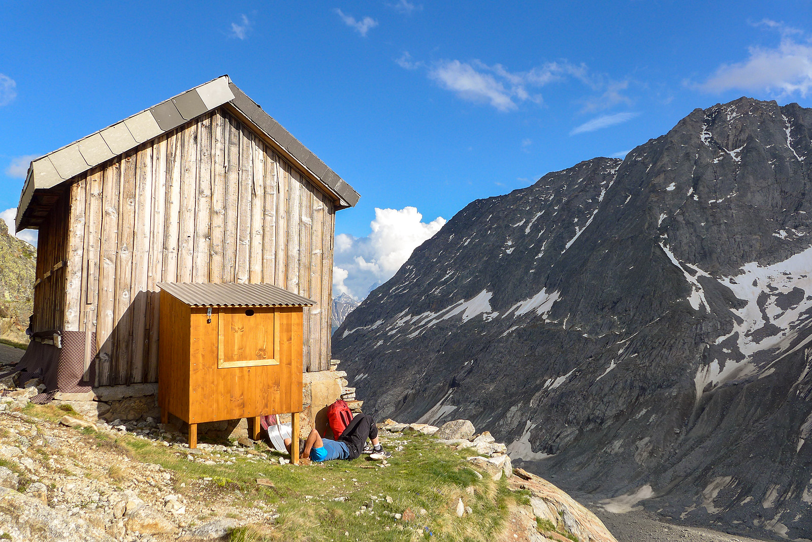
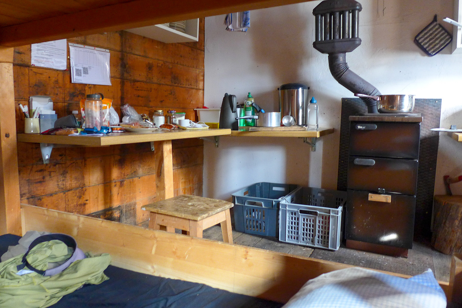
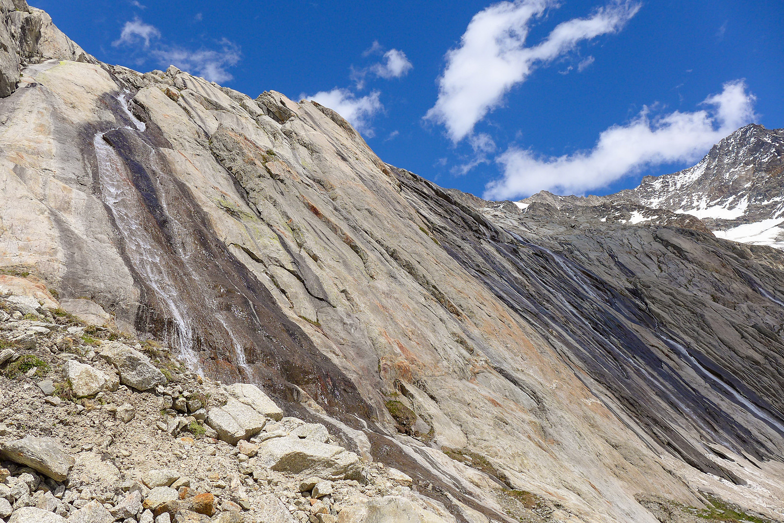
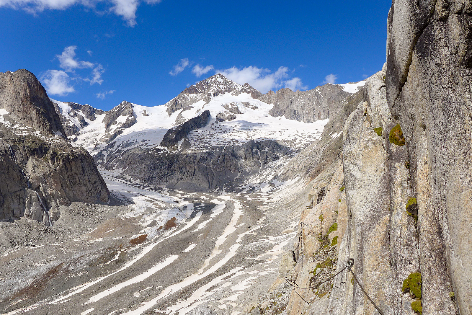
We drove up to the small picturesque village of Blatten to get the lift to Belalp, but didn’t actually get up to Belalp before about 11.15am so it was a very warm start to the 4 hour hut walk. The start of the approach was along a flat track, first passing Hotel Belalp and then it eventually descended down about 200m before traversing across some grassy hillside meadows where we passed some a group of happy goats. It also gave a good view straight up the Aletchgletscher, where we’d skied down the week before. The Aletschgletscher continues a lot further than where we’d left it at Märjelensee though! The path continued around the snout of the Oberaletschgletscher until we reached a kind of gorge, where the main stream/river from the glacier flows down into the Rhone valley. It was quite a stunning place to cross over, with a cool path rising up the opposite side and following a sort of ridge formation. According to the maps the path going to the Oberaletsch hut would traverse along the steep rocky cliffs on the lower part of the Gross Fusshorn, but it seemed like the path leading up from the gorge kept going up forever! But once it did flatten out the views westwards, up the Oberaletschgletscher were pretty spectacular and it felt really remote – especially so since we’d met only 1 other person along the trail so far. Its impressive that a path was even made in this terrain at all – we were basically walking across a load of steep rocky cliffs several hundred metres above the glacier. From where we stopped ascending, the remaining few kilometres to the hut were mostly over undulating ground. There were a couple of old snow patches we had to cross – and we changed to alpine boots as it was a bit safer to kick in good steps with stiffer boots than with trainers on. There were several streams along the way too, so we did a last fill up of our water bottles before arriving at the hut, just in case there wasn’t much running water around. In total we had used around 4.5 hours from Belalp, for the 11km and about 1000m of elevation gain. The winter hut was located about 50m below the main hut, and it felt like we were truly in the middle of nowhere. The hut is situated on steep slopes above the Oberaletschgletscher and surrounded by equally steep peaks that all drop down to the glacier. It was a nice surprise to find that the toilets were not only open – but also fully equipped with toilet paper and air freshner :-) The winter room was also well equipped with a stove, wood, pans and everything needed to eat and drink with. I was very impressed! Nice too that we were the only people staying there that night. As it turned out there was a decent water supply from a pipe located behind the main hut, so there was no problem getting water to drink. We had an early(ish) dinner around 6pm and got things ready for a 2am breakfast the following morning.
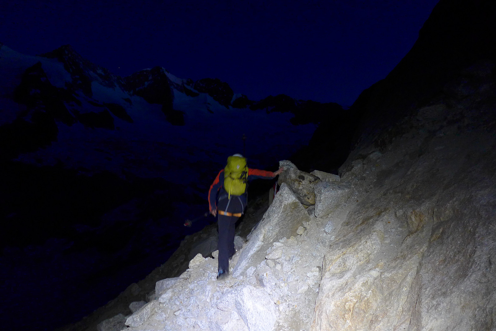
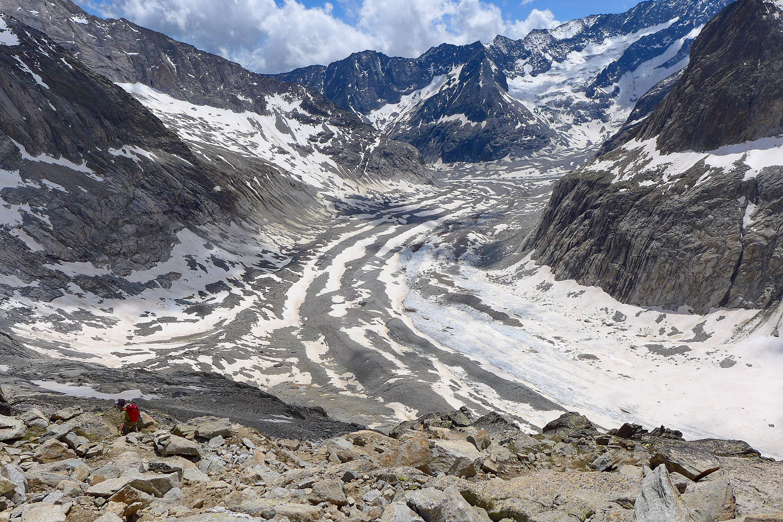
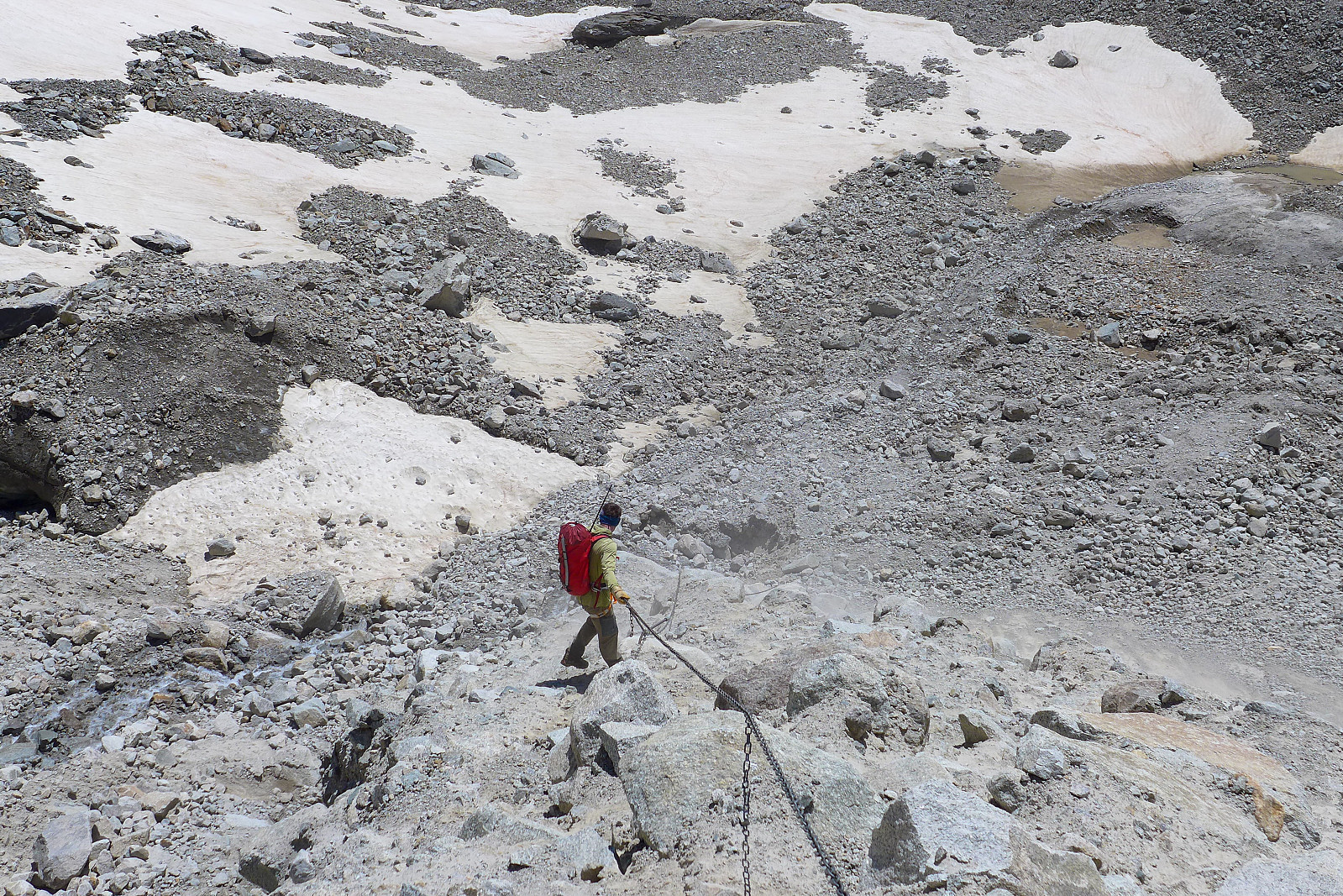
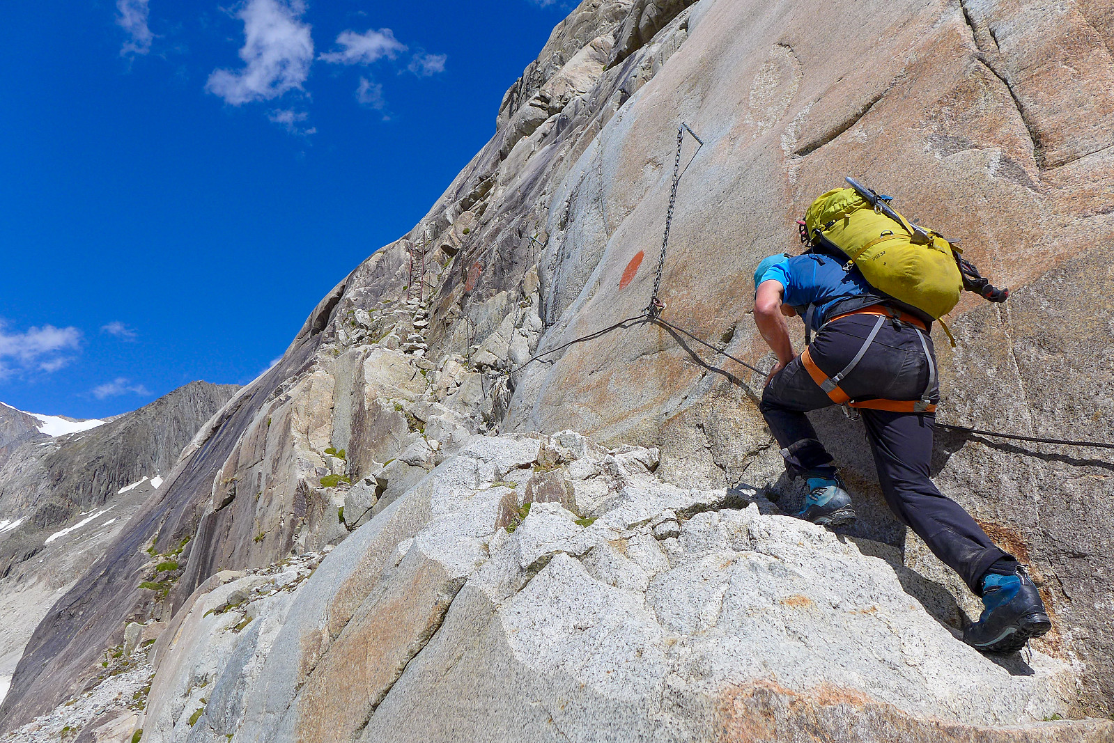
I slept surprisingly well until the alarm clock rang at 2am, so I was feeling in a pretty good mood when we woke up. Obviously would have been nice to sleep for a little longer, but at least the quality was good. By the time we’d heated up water for coffee, ate a little breakfast and got dressed it was already about 2.45am when we were ready to get going. The first part of the approach to the Aletschhorn was to get down to the glacier from the hut. There are a series of chains and ladders installed on the steep rock face we had to descend, which made things quite easy – but doing this in the dark for 250m of elevation still takes some time. I don’t recall how long we used to get down, but it wasn’t quite as quick as walking down the stairs from the Konkordia hut! But anyway once on the glacier there was a mix of hard snow patches and rubble to walk across in order to get to the point where we were supposed to start ascending up to join the southwest rib. There were some poles with reflectors on along the way, which helped keep us on track, otherwise it would have been like searching for a needle in a haystack. We’d also heard from the hut guardian that there was a possibility that not all the reflectors marking the start of the route up from the glacier, had been reinstalled after the winter, but from route descriptions and topos we knew it was just left of a prominent stream. It took just less than 1.5 hours to get to the stream, but we didn’t see any sign of reflectors… After some searching around we still didn’t find the start of the route up to the southwest rib (we found it later on the descent) and resorted to some early morning ghyll scrambling up the stream. This turned out to be by far the most terrifying part of the day from my perspective as it seemed like every rock I touched was loose and would set off a chain reaction by loosening all the other rocks beneath. Several times I was certain I would end up being taken down by the moving rocks, but fortunately I never did and survived to catch up with both Graham and Rachel who seemed to have emerged untraumatised from the whole experience. Luckily, from the point where I found them we spotted some reflectors in the distance off to the left of us, and it was fairly straightforward to get back on route again. A big relief.
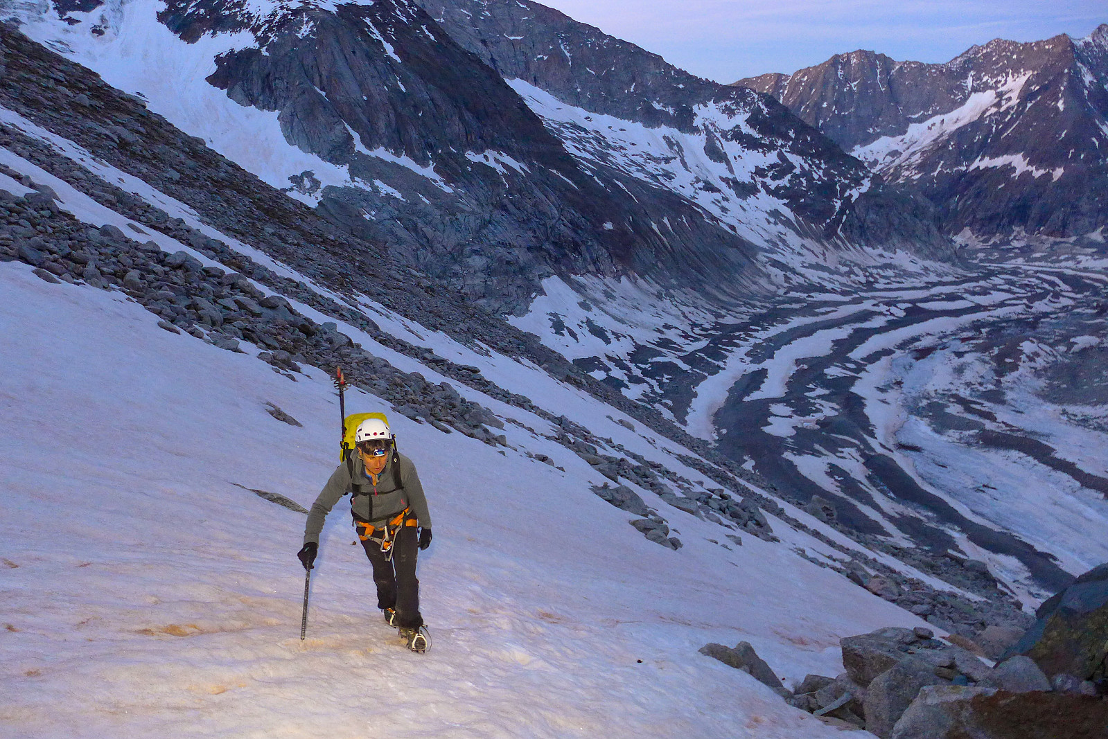
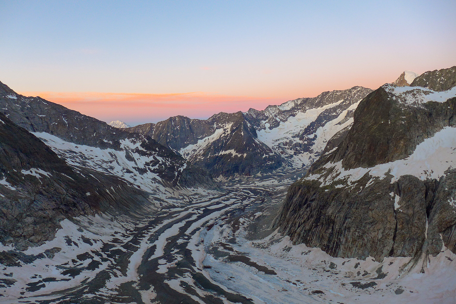
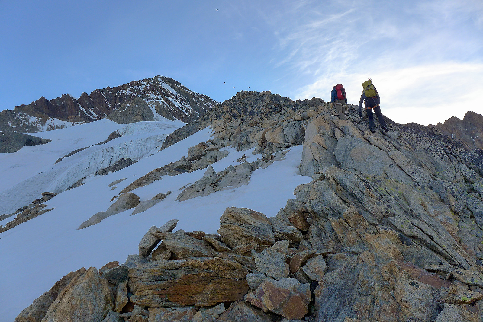
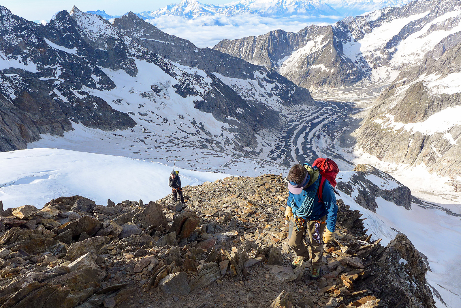
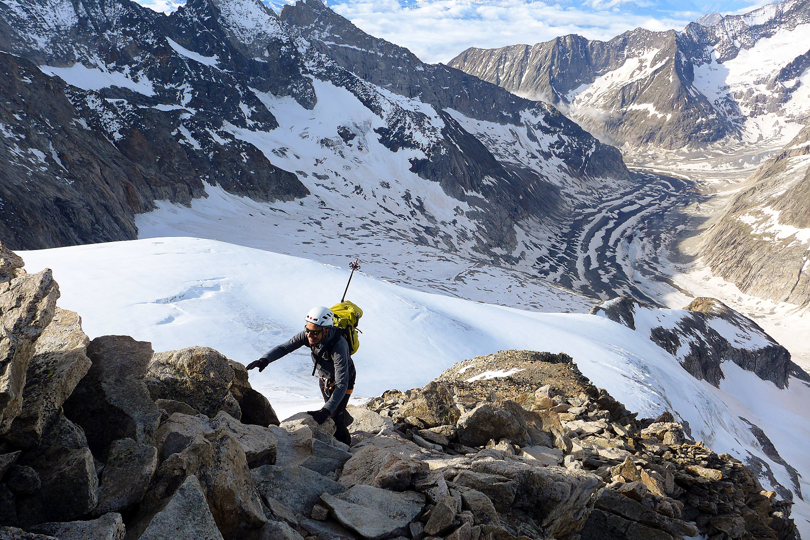
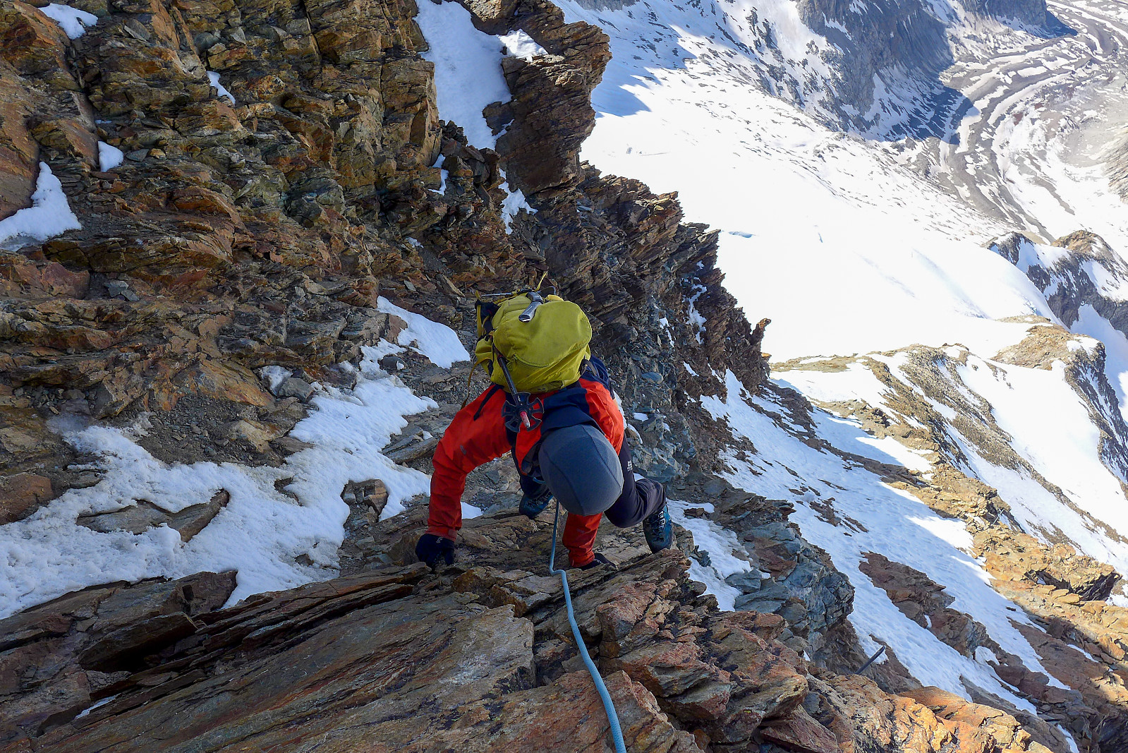
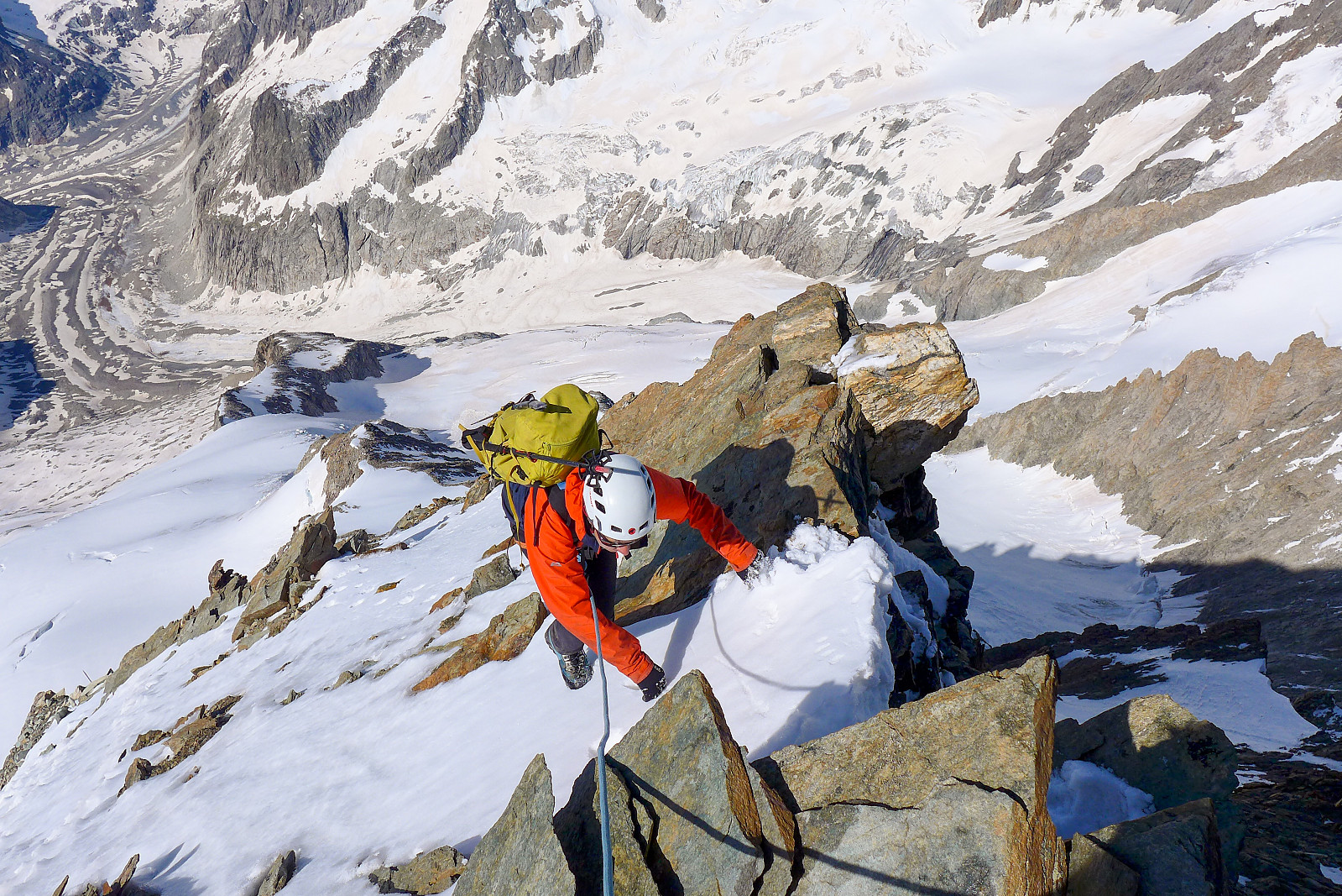
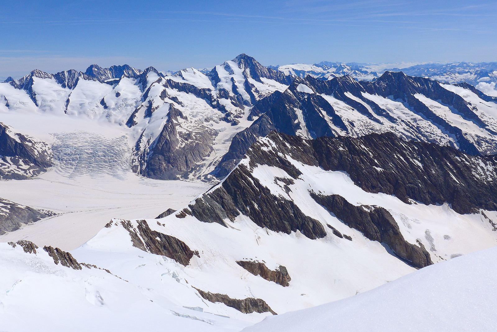
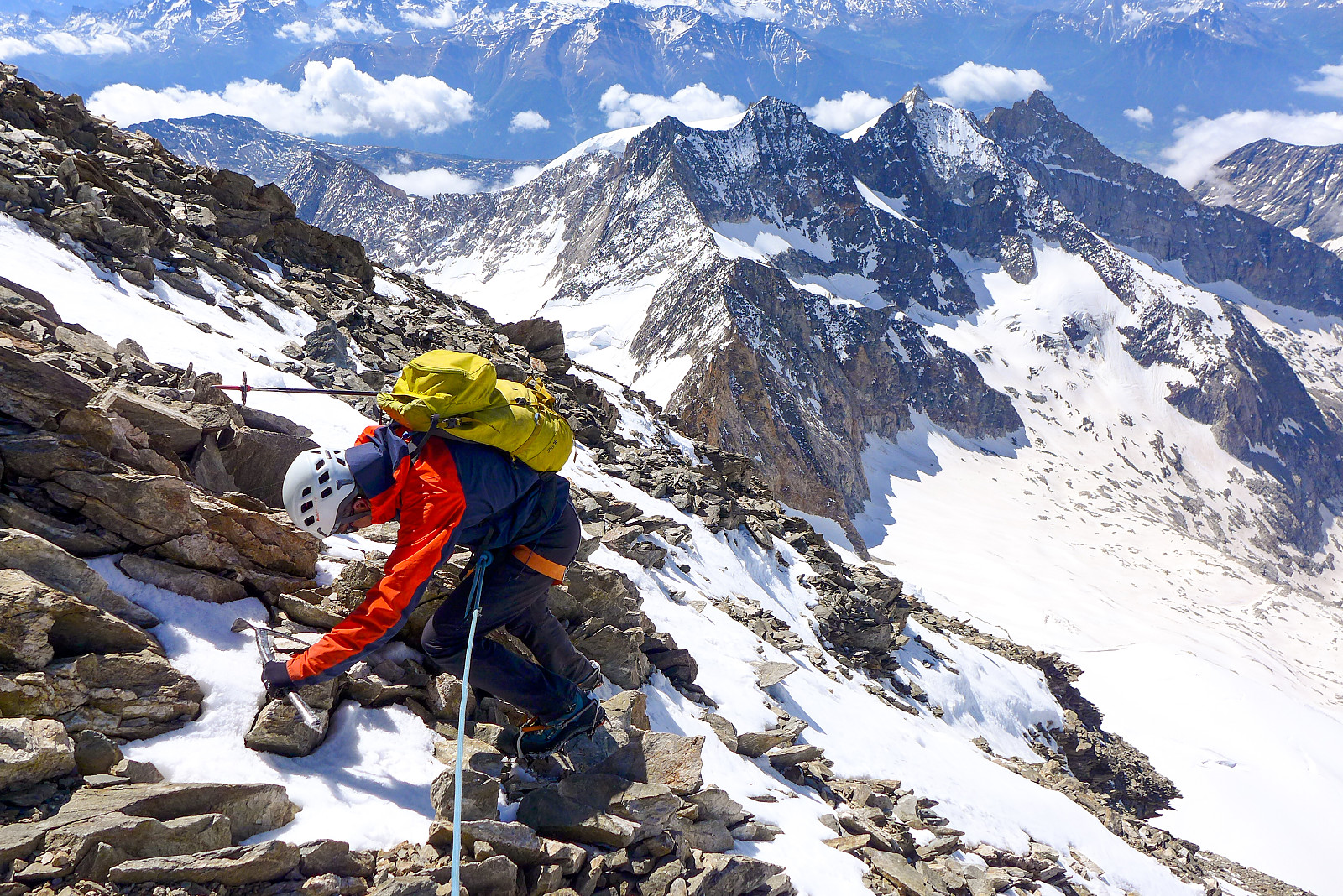
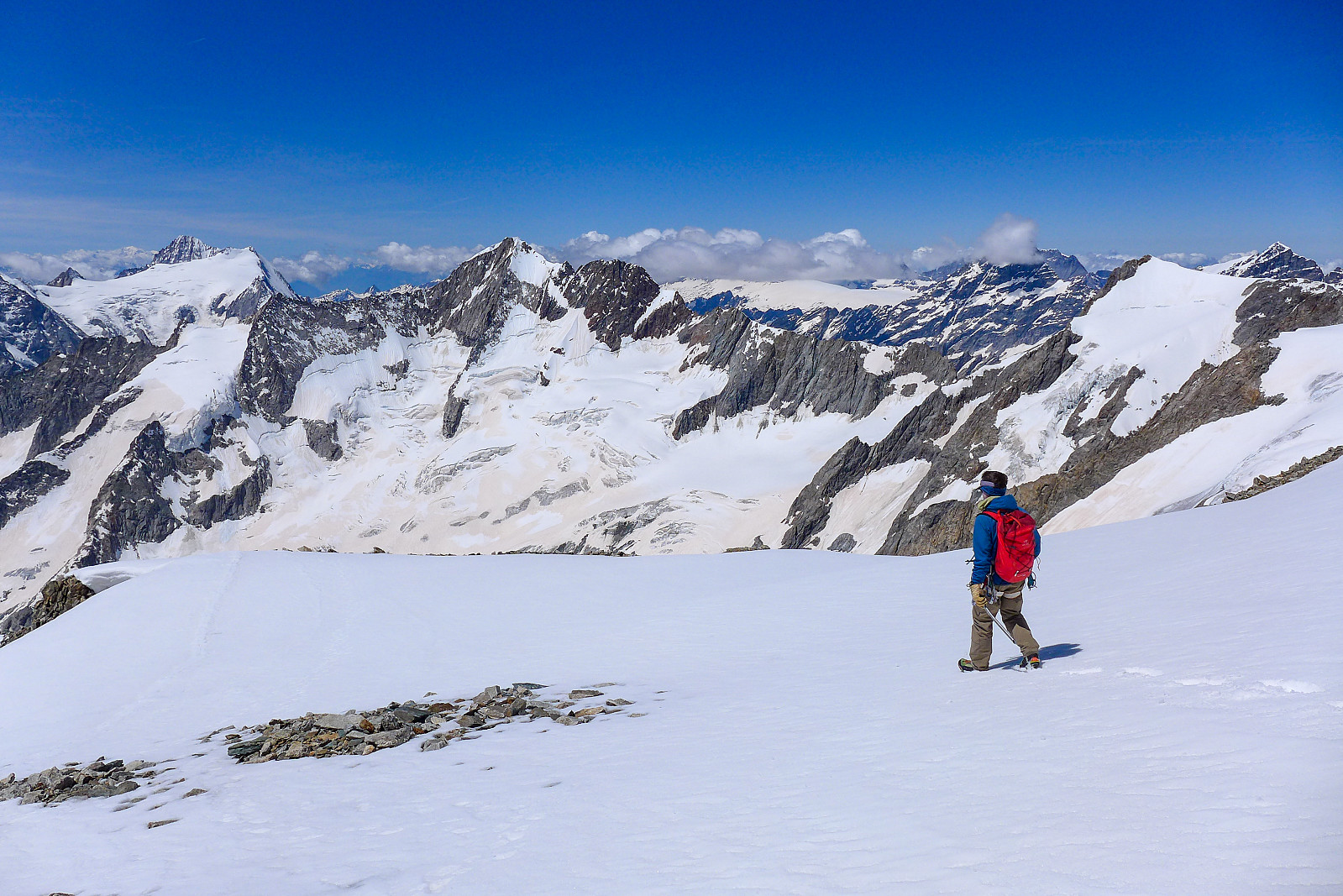
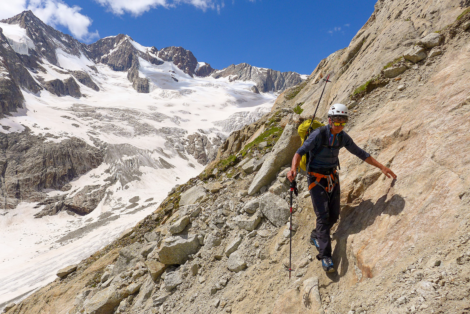
We followed the reflectors across some varied ground, parts with grass, rock and some very terrible sandy stuff. Eventually this led up to a patch of hard snow which we had to crampon up to reach the rock ridge on its left side. It had just started to get a little bit light by now and there were some beautiful views down the Oberaletschgletscher behind us. The vague path at edge of the ridge was also marked by a reflector which was helpful. From there we had a bit of steep hiking up the gravelly path until the ground became more bouldery in nature. It was easy scrambling over boulders for much of the entire length of the rock ridge, though my hip flexor was still protesting every time I lifted my leg up, so I made my way up in a slower pace behind Graham and Rachel, trying to take as small steps up as possible. It seemed like I was having to put in a lot more effort with a leg that wasn’t fully functioning! After about another hour though, we’d finally reached the end of the ridge at around 3400m and now had some 150m of snow to crampon up to reach the upper part of the southwest rib. It was actually a bit chilly hiking up the snow, and a bit more frustrating to look at the sun shining down on the mountains south of us while we were still in the shade. However, as we emerged off the snow and onto the southwest rib, we finally got some much needed sunshine too. Somehow the terrible start scrambling up the loose streambed several hours earlier seemed like a very long time ago!
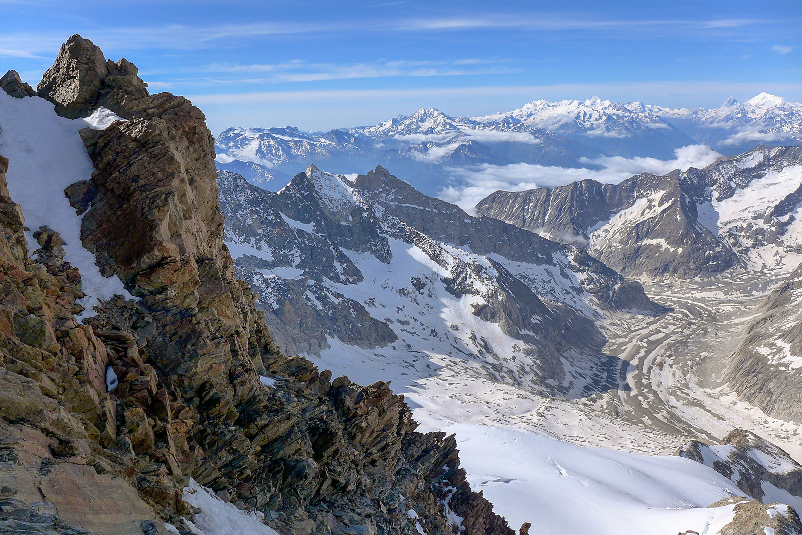
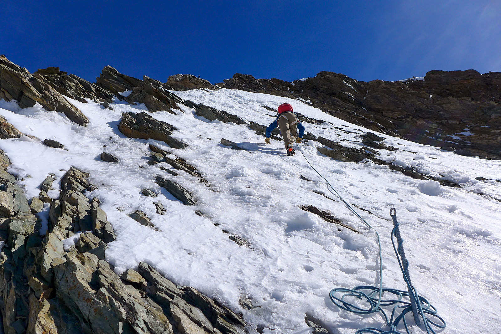
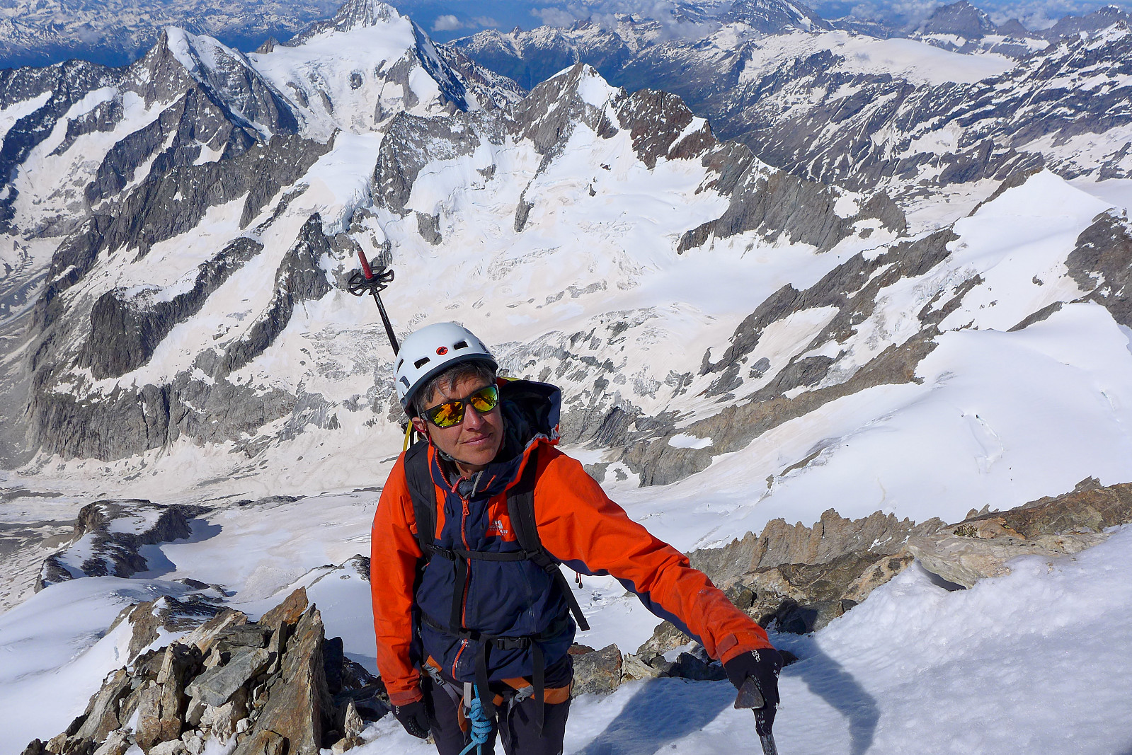
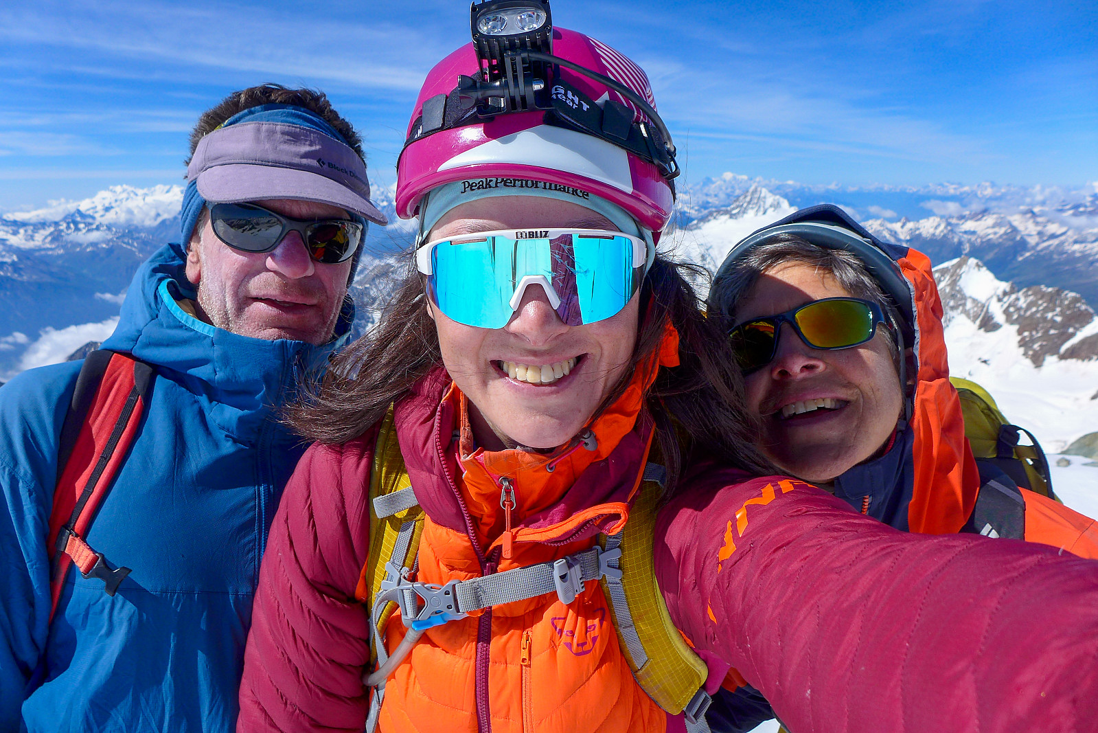
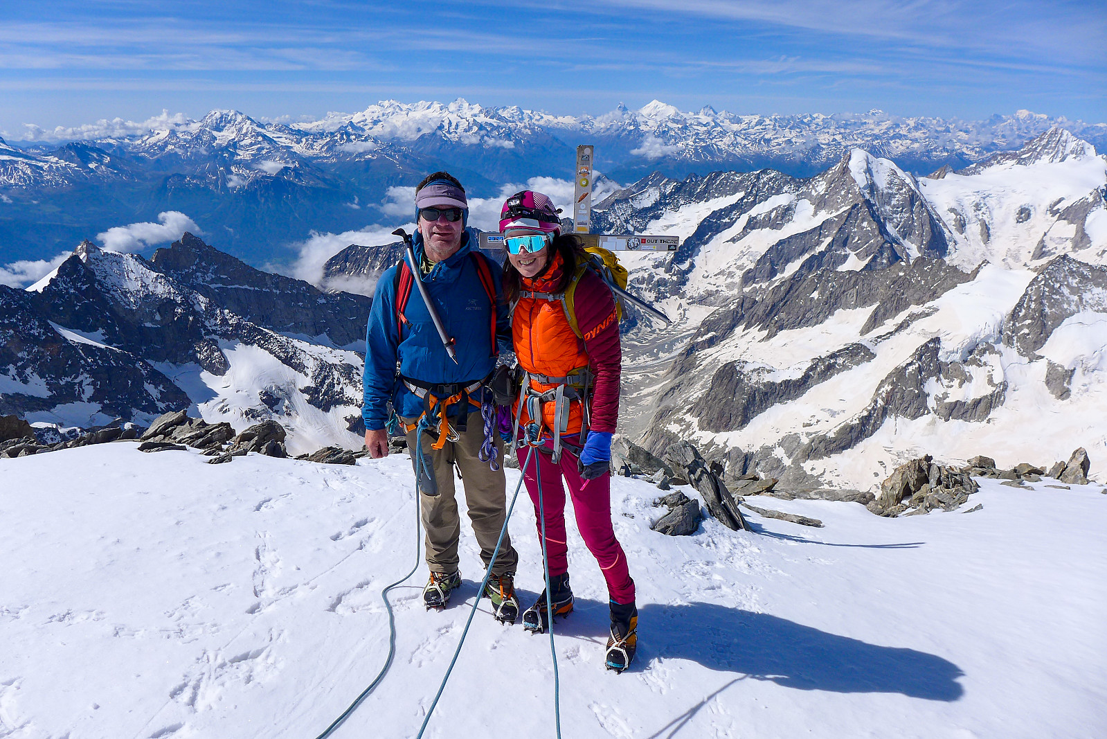
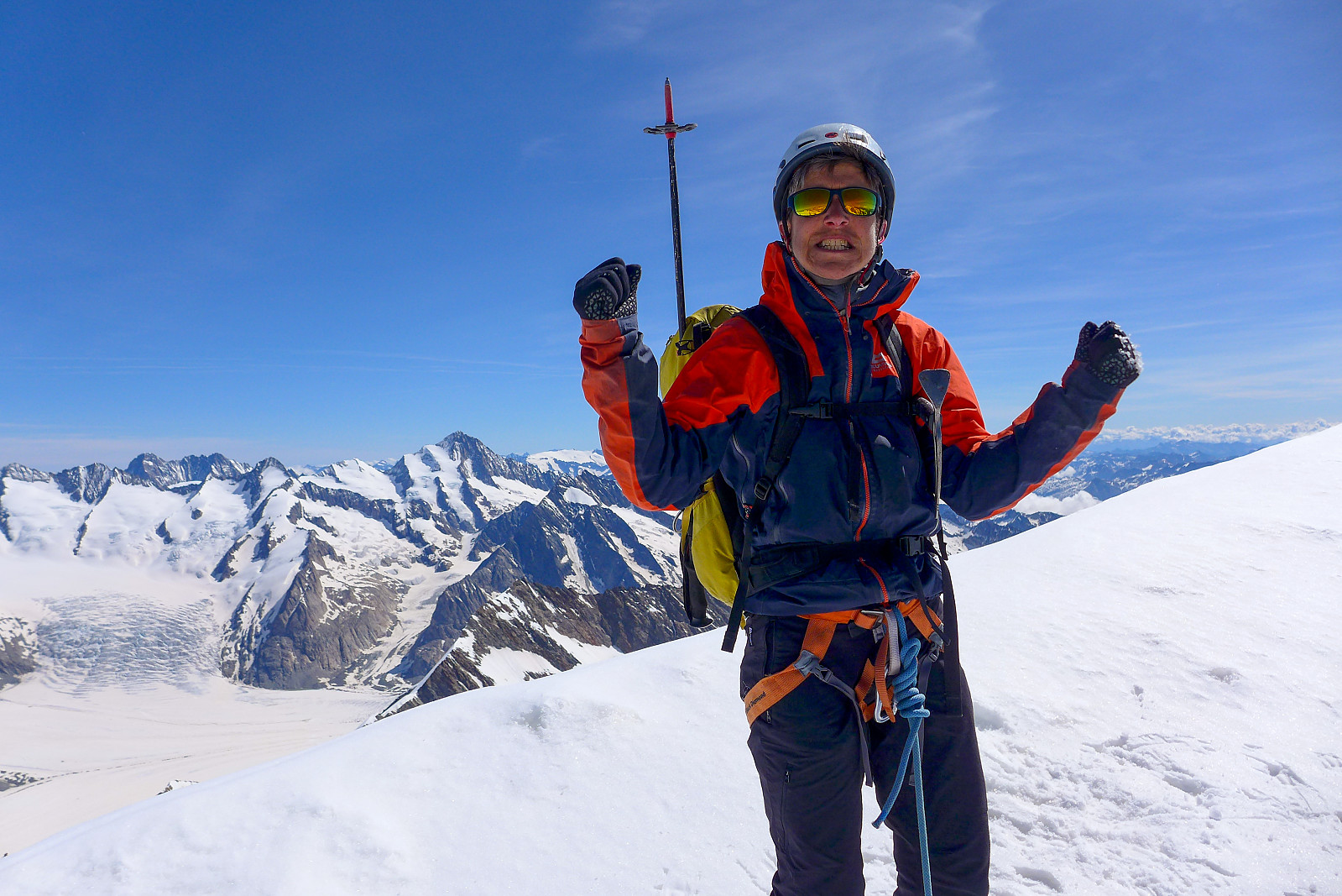
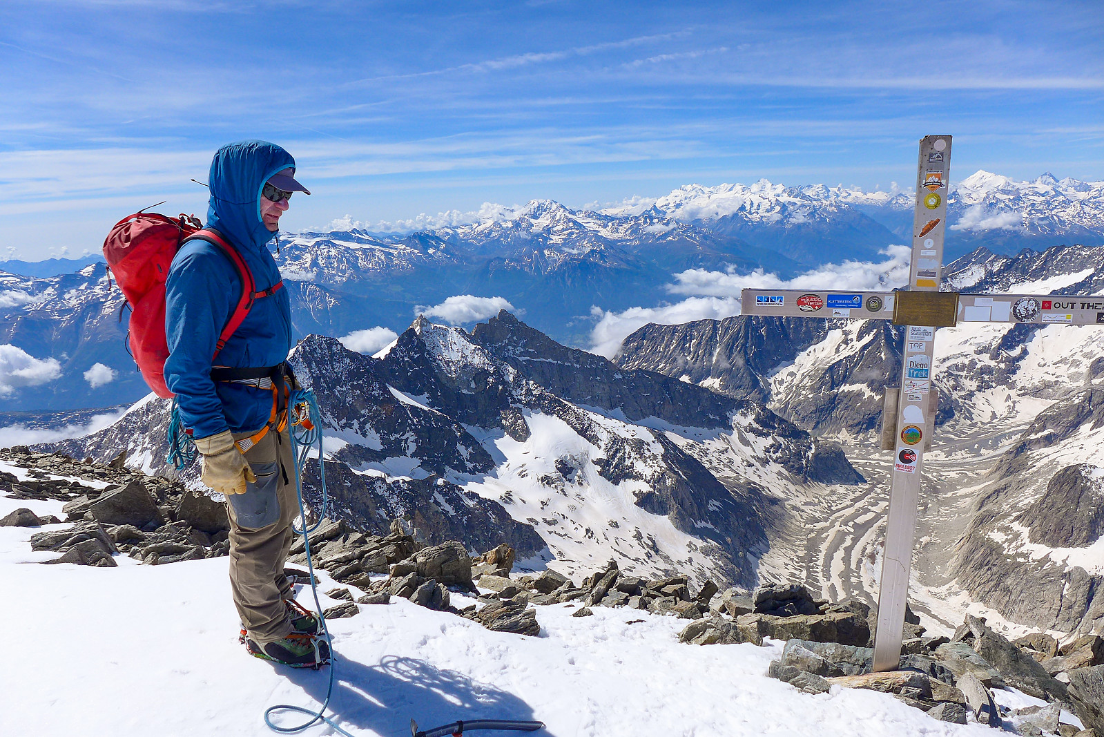
However, from here the rock quality deteoriorated again and we were back to making our way up some rubble again, and for quite a while too. We’d de-roped after getting off the glacier since it was much easier to move at our own speeds over the loose, easy ground. Once we’d reached about 3900m though, after some 1500m of ascent, we arrived at the start of the good rock – and the only good quality easy climbing along the whole route. The rock itself had a bit of a red colour to it, and loads of spikes that made good hand- and footholds. It was sort of similar to some of the climbing on the Rotgrat on Alphubel, but with a better view behind us! Unfortunately it didn’t last that long, and the single fun part of the day was over already. The last 100m or so up to the summit was climbed on snow, solid and icy in places but also a bit loose and sugary in other places. I think we climbed about 3 individual pitches on snow, making use of the stanchions along the way. The summit cross was always in sight, but never seemed to get any nearer – but finally – and after 8 hours since we left the hut, we all arrived at the summit of the Aletschhorn. I was so out of breath I more or less collapsed onto it! Well, it was a brilliant feeling to have finally have got there and earned the fantastic views around us. Graham had never been there either so it was a new summit for him too. We took a decent break here and sat down to refuel ourselves for the long way back down which I was personally not really looking forward to, but knew that it would at least be less effort and easier on my hip than going up. I also had my headphones in my rucksack just in case motivational music was needed to get me back down the glacier and up the final 250m back to the hut, probably the only part I was truly dreading ;-)
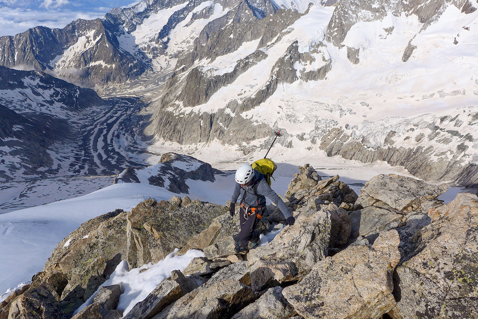
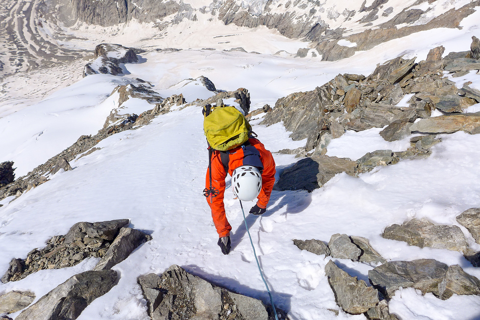
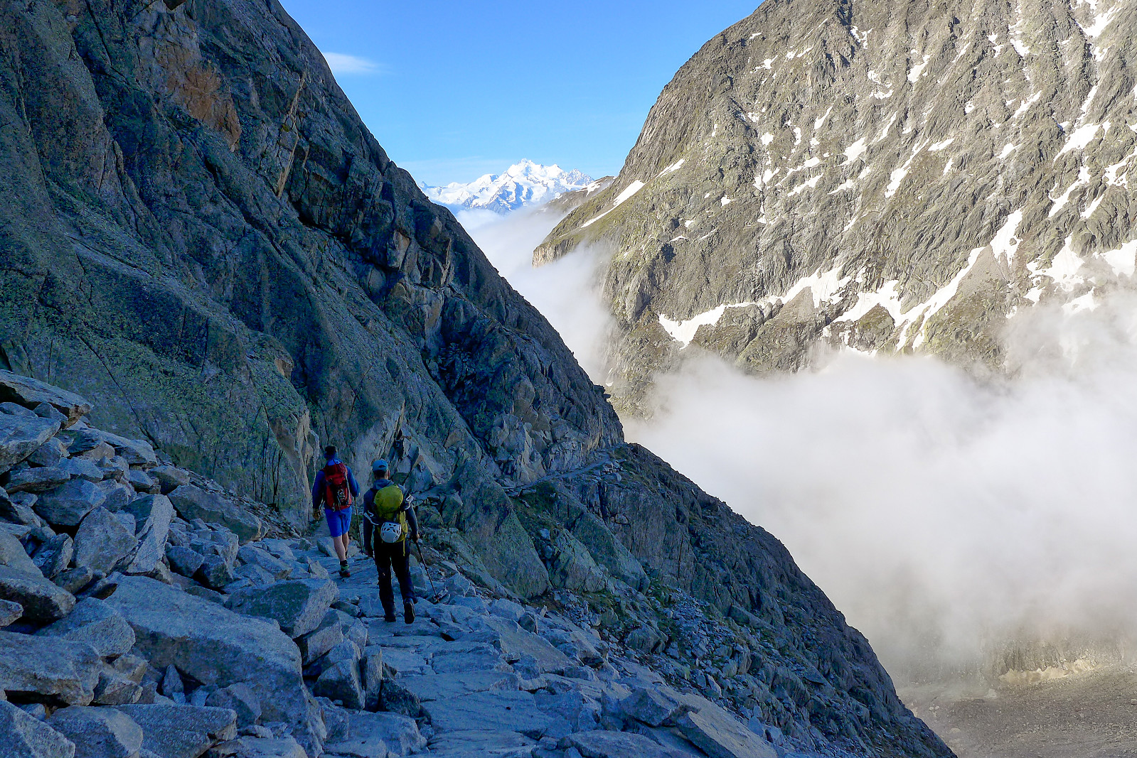
Downclimbing the nice rock was probably the slowest part of the descent, but since there was really only about 200m in elevation to downclimb it didn’t take up a massive part of the day. The walk back down to the glacier also was relatively efficient, though not much fun since the ground was so loose. But the snow on the glacier between about 3400-3600m had really transitioned into a nightmare slush in the space of only a few hours, and now we were wading through knee/thigh deep wet snow, deeper in places where we found holes. It seemed pretty hopeless trying to get anywhere, and as a last resort we turned to bum sliding in an effort to try and get back down to the rock again. Even this proved not to be that fast either since I found my bum sinking into the snow all the time! After a good deal of patience and persistence with the bum sliding though, we did finally reach solid ground again, much to our relief. I’d underestimated how terrible the snow would become after the sun had hit it…. We de-roped at the rock ridge and made our way down over the boulders again. It somehow seemed to go by quickly, yet it took forever to get back down to the start of the ridge. At least the rocks were big and solid though and it was quite a pleasant descent, all things considered. By the time we’d got back to the reflectors and followed them as far as possible, we eventually found ourselves on the route which we should have ascended from the glacier, though the final part which was equipped with chains – was no more pleasant than the stream scrambling. Much of the ground was basically sand, with loose rocks scattered around ready to be fired downslope by anyone descending. It was a relief to be finished with that too! In retrospect I am not entirely sure whether it would have been better to ascend that part or scramble up the stream. Both are not particularly nice routes of ascent! By the time we got back down to the glacier I had concluded that I would probably never come back up the Aletschhorn by this route again!
Despite having dreaded the final slog back down the glacier to the start of the ladders and chains, it really did not turn out to be that awful at all. I guess listening to a bit of music and using my hiking poles helped. By now it was mid afternoon anyway so it was obvious we would probably spend another night at the hut anyway and I didn’t mind the extra walk. It took forever to get back up to the hut from the glacier though. There was one other friendly Swiss guy who’d turned up at the hut when we got back, but luckily no one else. We had one bag of Uncle Bens rice left to share between 3 of us, so it didn’t exactly replace anywhere near the 7000 calories (according to my watch) I’d burned during the 13 hours we were out on the mountain, but it was at least enough to fill a craving for some proper food and get us back to Belalp the next morning! Well, what a way to finish the 2 weeks ski mountaineering – there had probably been more mountaineering than skiing, but it was awesome to have ended it with a proper outing. Thanks to Graham for the guiding and Rachel for her excellent company and keeping us all humoured!
| Startzeitpunkt | 27.05.2022 02:48 (UTC+01:00 SZ) |
| Endzeitpunkt | 27.05.2022 15:54 (UTC+01:00 SZ) |
| Gesamtzeit | 13h 06min |
| Zeit in Bewegung | 13h 06min |
| Pausenzeit | 0h 0min |
| Gesamtschnitt | 1,7km/h |
| Bewegungsschnitt | 1,7km/h |
| Entfernung | 22,6km |
| Höhenmeter | 3.153m |


Benutzerkommentare