
Gjømmertinden (14.10.2012)


Skrevet av hmsv1 (Hannah Vickers)
| Startsted | Lakselvbukt skole |
|---|---|
| Turtype | Fottur |
| Turlengde | 7t 00min |
| Distanse | 14,5km |
| Kart |
|
| Bestigninger | Gjømmertinden (1101moh) | 14.10.2012 |
|---|
Once again I found myself on a solo trip again because friends were either busy with other things or had problems with ankles/knees etc. Which seemed like a huge shame because the weather was so beautiful on this Sunday morning. Anyway, I had several ideas in mind about which mountain to visit next, but after some reading on toppturmania and kugo.no, I finally settled on a trip to Gjømmertinden. From what I could make out from the trip descriptions on both websites, there was a well-marked path for most of the way up, and that appealed above all! And there was the advantage too that it was easy to get to, being on a 45-minute drive along the very quick E6 through Lavangsdalen. With my decision made, I took a leisurely start from Tromsø and didn't actually leave until 10:00, but I thought I should have enough time to be up and down the mountain before dark, given that it wasn't supposed to be a complex route. But I also expected that some winter gear might be necessary too, what with the new snow which had fallen on both Friday and Saturday, so with that also to think about I packed a pair of crampons and one ice axe into my rucksack too. By the time I actually started walking it was about 11:00 and people were filtering into the church at Lakselvbukt as I left the car.
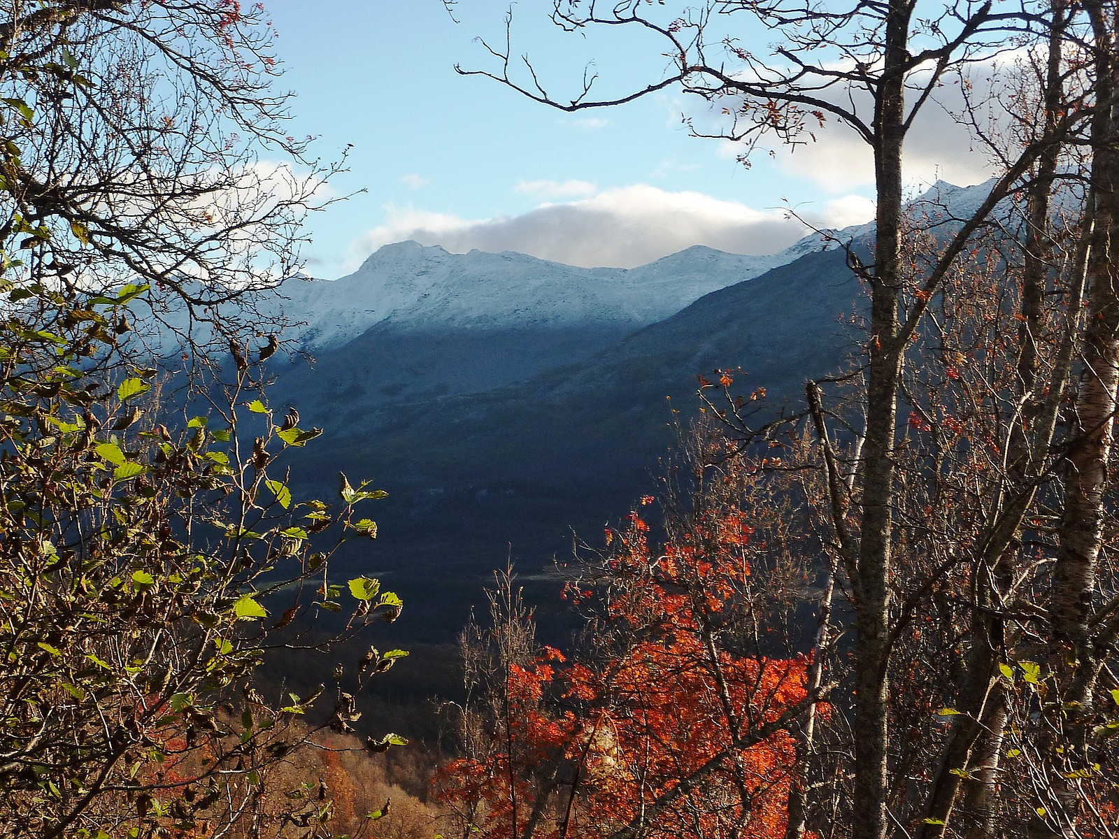
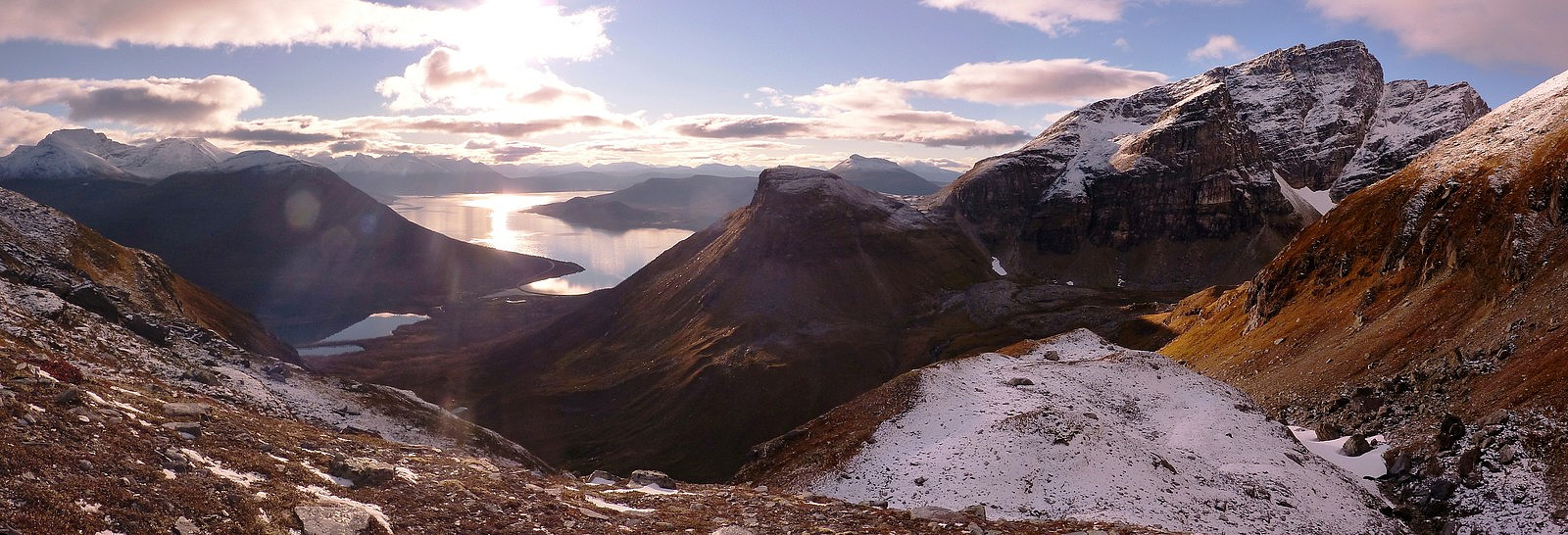
The route which seemed to be most used basically followed part of the lysløypa which started from behind the football ground and I followed this for a few hundred metres to where the path and the lysløypa split off in different directions. The path I took carried on ascending very gradually through the forest, being a bit damp and overgrown in places but I was generally impressed with how easy it was to follow. There was a little bit of autumn left in the trees, but most of them were bare now and a more wintery feel was starting to take over, especially with the amount of snow dusting the mountain tops too....It took me perhaps about half an hour to get up through the forest, and then once above the treeline there was a nice view of the valley ahead (Gjømmerdalen) with Hatten and Blåtinden guarding the western side and Tverrfjellet and Gjømmertinden to the northern and eastern ends. I hadn't quite realised quite how impressive the north-eastern face of Blåtinden was until coming into this valley, but there was definitely a lot of wow factor there.
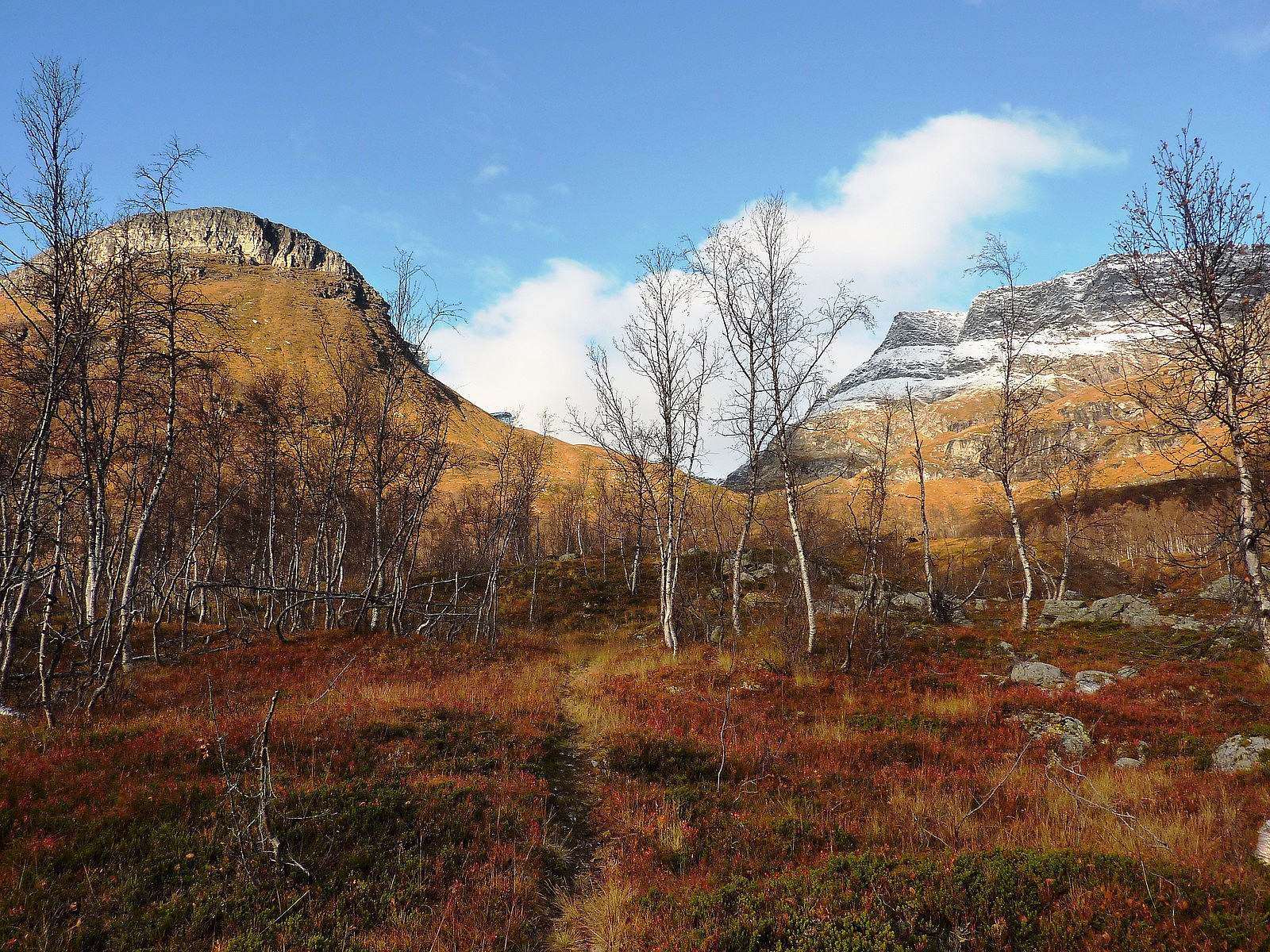
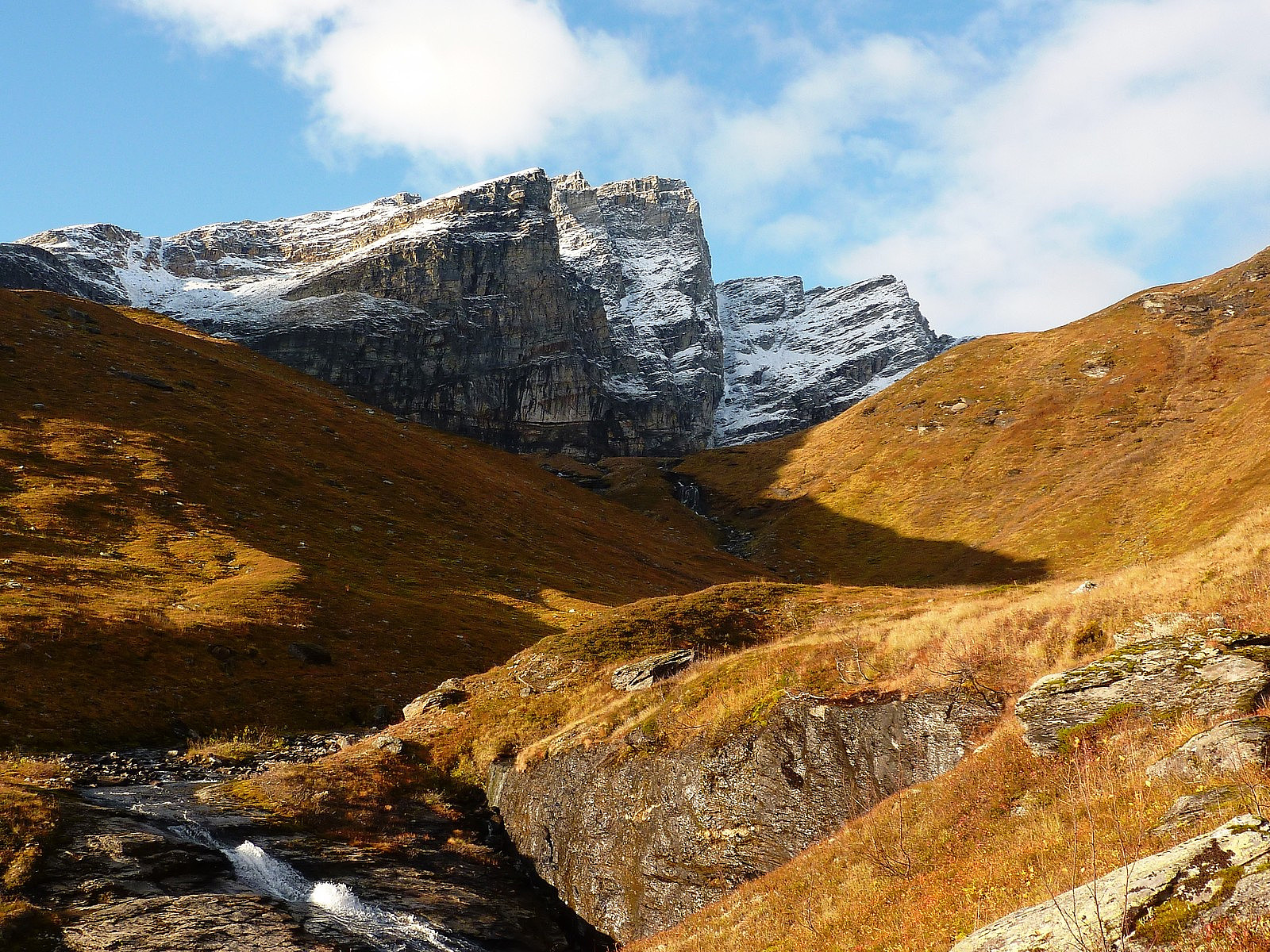
The path continued rising steadily for a little while until I came across a bridge to cross Storelva, and from the other side it followed the course of the river up to the foot of a broad grassy ridge below Tverrfjellet. It was about midday when I had reached the ridge, and even though the temperature had been close to freezing when I left the car, I was now looking decidedly sweaty and wearing only a vest top. I suspect the extra weight equipment and extra drink must have been making me work a little harder, which is of course always good training! The path continued to be very well-marked all the way up the ridge, offering great views over Gjømmerdalen and across to the other side of the Lakselv valley towards Rasmustinden, but after nearly 2 hours of walking, I took a stop for lunch at the top of the ridge where the path promptly disappeared underneath the snow. And since I still had a full sky of sunshine overhead, it seemed like a nice place to stop for a while.

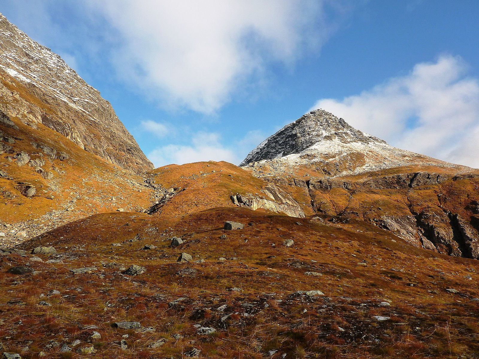
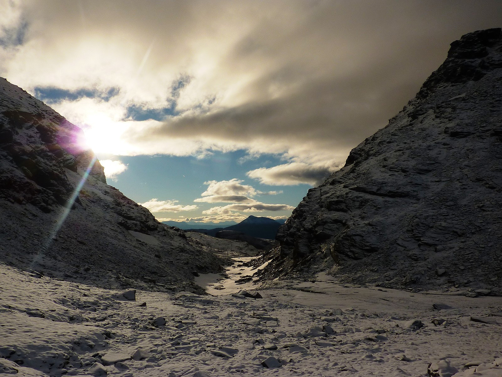
After this point the gradient also eased off and once I was done with my lunch stop I tried to follow the river bed as best I could up to the saddle between Gjømmerdalsbreen and the bottom of Gjømmertinden's northern end. It was a little tricky to walk over the snow-covered rocks and took a little while to get used to after several months of summer hiking, but it went fine and I didn't slip down into the river :-) It was quite a spectacular view back down the river valley once I'd reached the northern end of it. From this point, the route marked on the map should have traversed around the northern side of the mountain to gain the east ridge, although there was by now no obvious track to follow. All I could see was a jumbled mess of boulders over which to cross. Since I didn't fancy tackling the north ridge under this dusting of snow, I decided to stick to the regular summer route which took far longer than I had anticipated. It was actually quite tough work to clamber up and down and then eventually across this boulder field, especially with the new snow not making it very easy to get grip on the rocks.
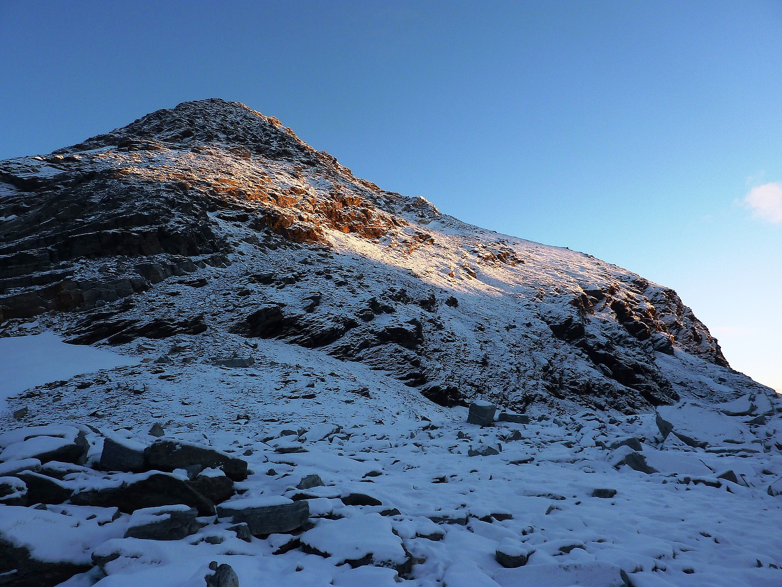
At least with an ice axe I had better balance. But the ascent up to the east ridge was testing on the knees, and it steepened up as I got nearer the ridge. I'd managed OK to hike without the crampons, but it got to the point where I was sliding so frequently on snow-covered slabs that I finally made the decision to get the crampons on, knowing quite well that even though I would have better grip, it would still be quite hard work on the knees and ankles to ascend over the rocks with them on. I could see that time was ticking by pretty fast too, so I hoped that it would speed things up a bit if I wasn't having to take so much care with my foot placements. Fortunately, quite soon after getting the crampons on, I spotted a nice patch of old hard snow lining the crest of the ridge, which looked like it went most of the way towards the summit, so I made it my aim to get myself over to this bit as soon as possible and avoid prematurely blunting my crampons.
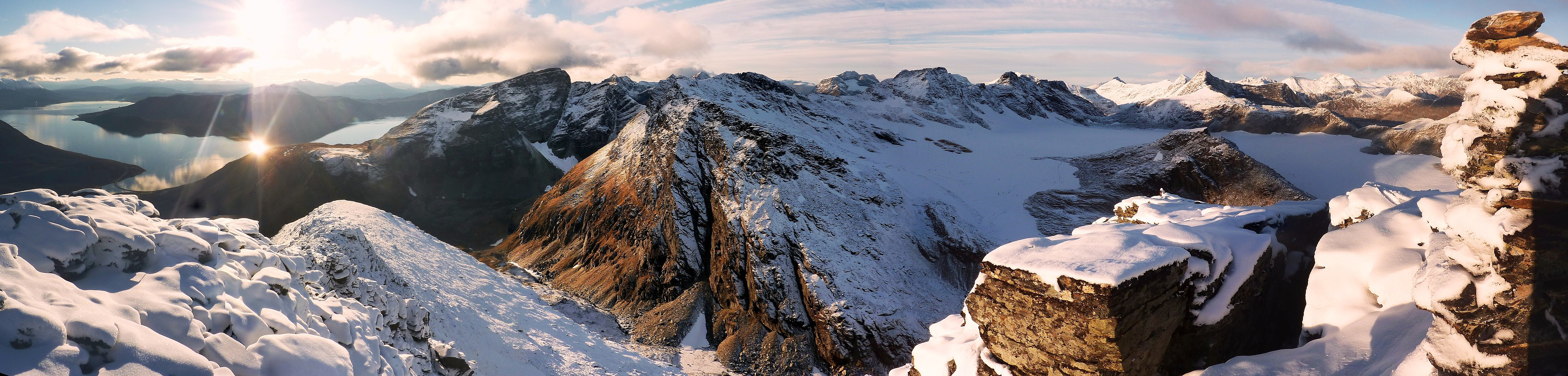
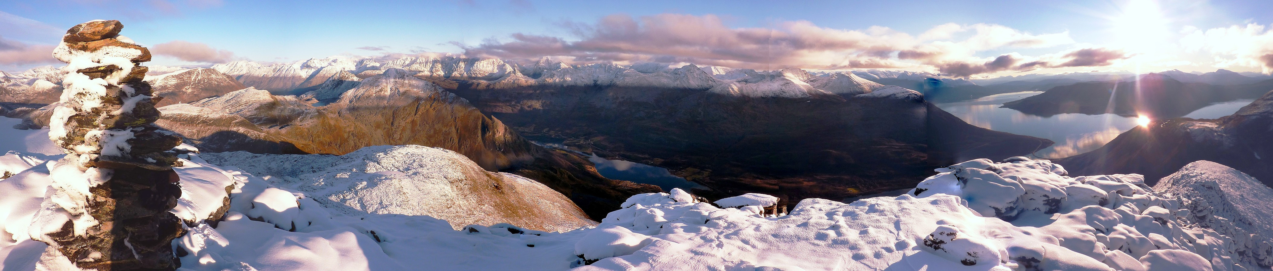
The gradient on this little snow 'arete' was probably in the region of 40-45 degrees, and I think I just about got away with the one ice axe. Had the snow been much icier than it was, or if it had been a few degrees steeper, I think two axes would have been a bit more comfortable! It was a great feeling to be front pointing up some good quality snow though, so I quite enjoyed that :-) After coming to the top end of this hard snow, there was only another 50 metres of height to gain to the summit, which went over rocks. It didn't feel too exposed though, and being on the ridge gave me some very fine views in all directions. I was actually more stunned when the summit popped up in front of me, I thought there was never going to be an end to the snow/rock torture! But what can I say for the views? Well, I was pretty speechless myself, as I hadn't quite expected to get such a magnificent 360-degree view all around me. In one direction was the Lyngen peninsula, to the south and west all the Balsfjord peaks and to the north the rest of the mountains along Lavangsdalen. It was a fine mountain day pretty much everywhere and I was very pleased with the choice of trip destination for today!
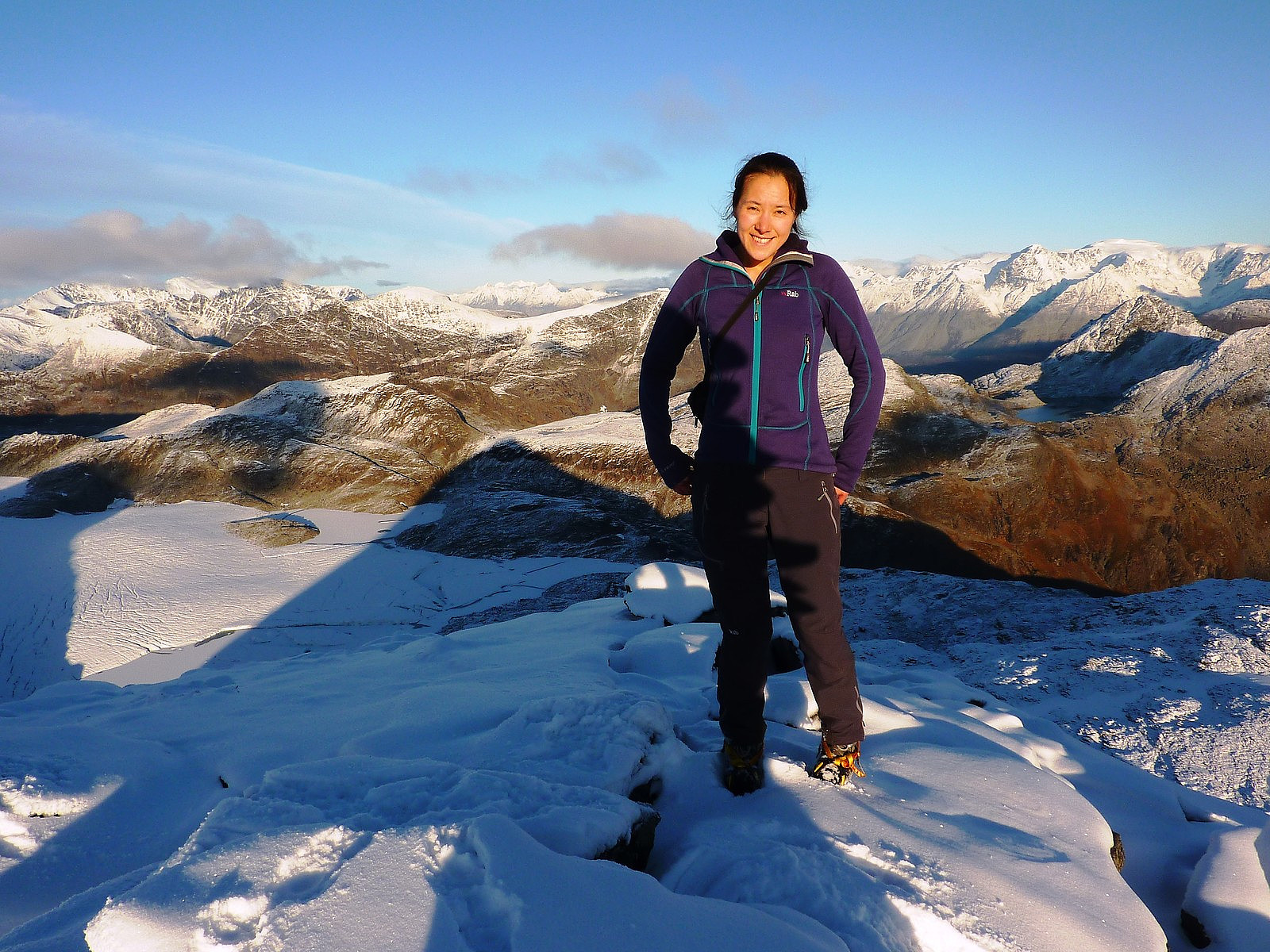
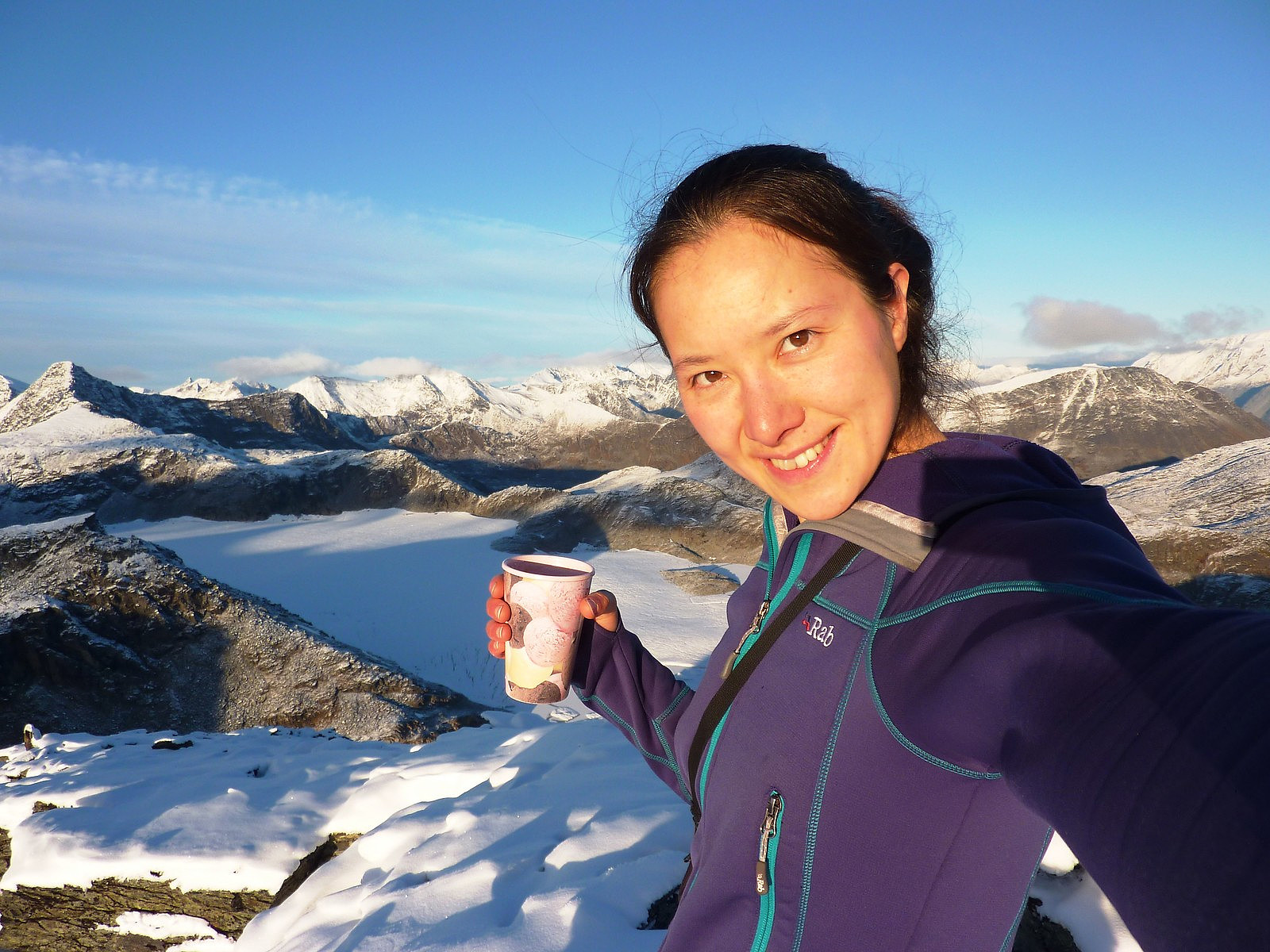
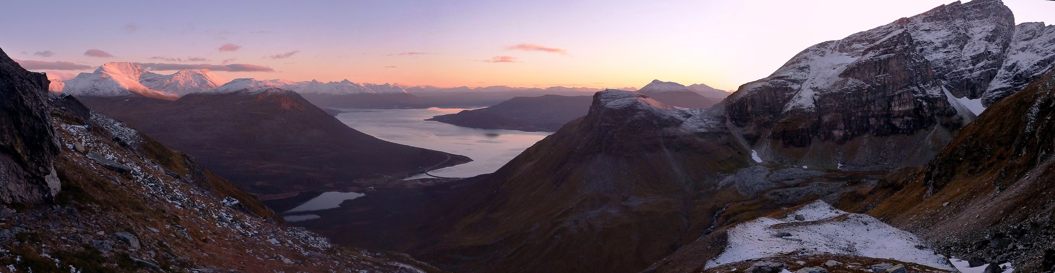
But I had really only just got to the summit on time, because it was almost 3 pm and I had already decided that I would turn around wherever I got to by this time, because I already had a feeling that the descent back down to the river valley was going to take some care, whether I went down with crampons on or off. So, after taking pictures and having a quick hot drink and the rest of my lunch, I packed up the rucksack again and started on the way down. The rocks were a nightmare for my crampons (they were squealing in objection for most of the way) although they were a lot happier too once I was back onto the snow arete. Once the angle eased off though, I took off the crampons again and was able to make quicker progress back across the boulder field towards the start of the river valley. It was starting to feel late though! No more sunshine now, and the sky was turning purple. Definitely a sign to get some speed on and make it back to at least where I had lunch before it got too dark. I knew that at least after that point the path should be fine to follow with a headtorch, and at least not terribly slippery from being covered in snow. As things turned out, I made it back to the lunch place by 4.45pm and down to the bottom of the broad ridge again by 5pm. After that it was very easy going in comparison and I didn't feel the need to rush too much. Fortunately I was reunited with my car by 6pm, by which time it was properly dark. But it had been in my opinion, a proper adventure and good use of the day!


Kommentarer