
Bentsjordtinden (30.09.2012)


Written by hmsv1 (Hannah Vickers)
| Start point | Bentsjorda |
|---|---|
| Endpoint | Bentsjorda |
| Characteristic | Hike |
| Duration | 5h 30min |
| Map |
|
| Ascents | Store Bentsjordtinden (1,168m) | 30.09.2012 |
|---|
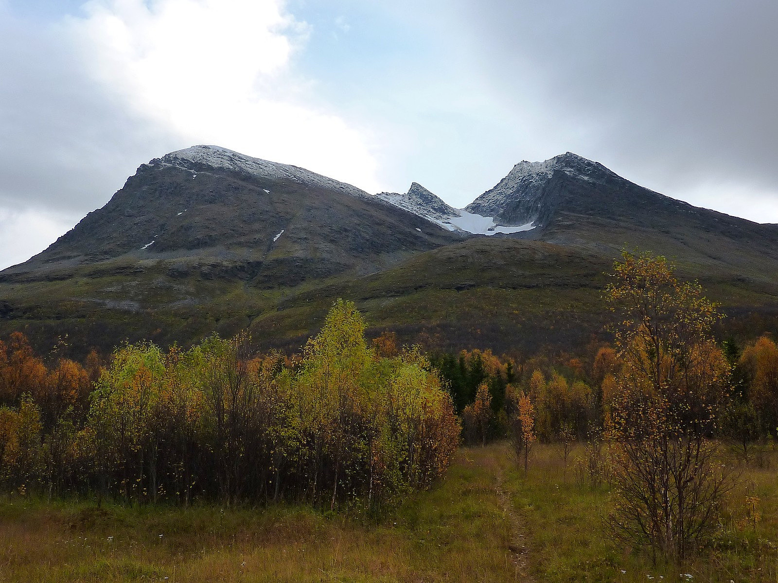
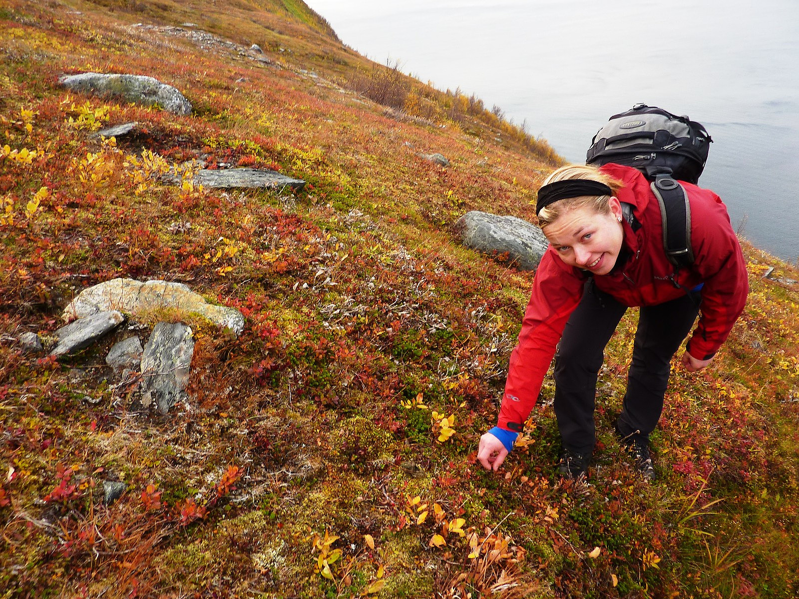
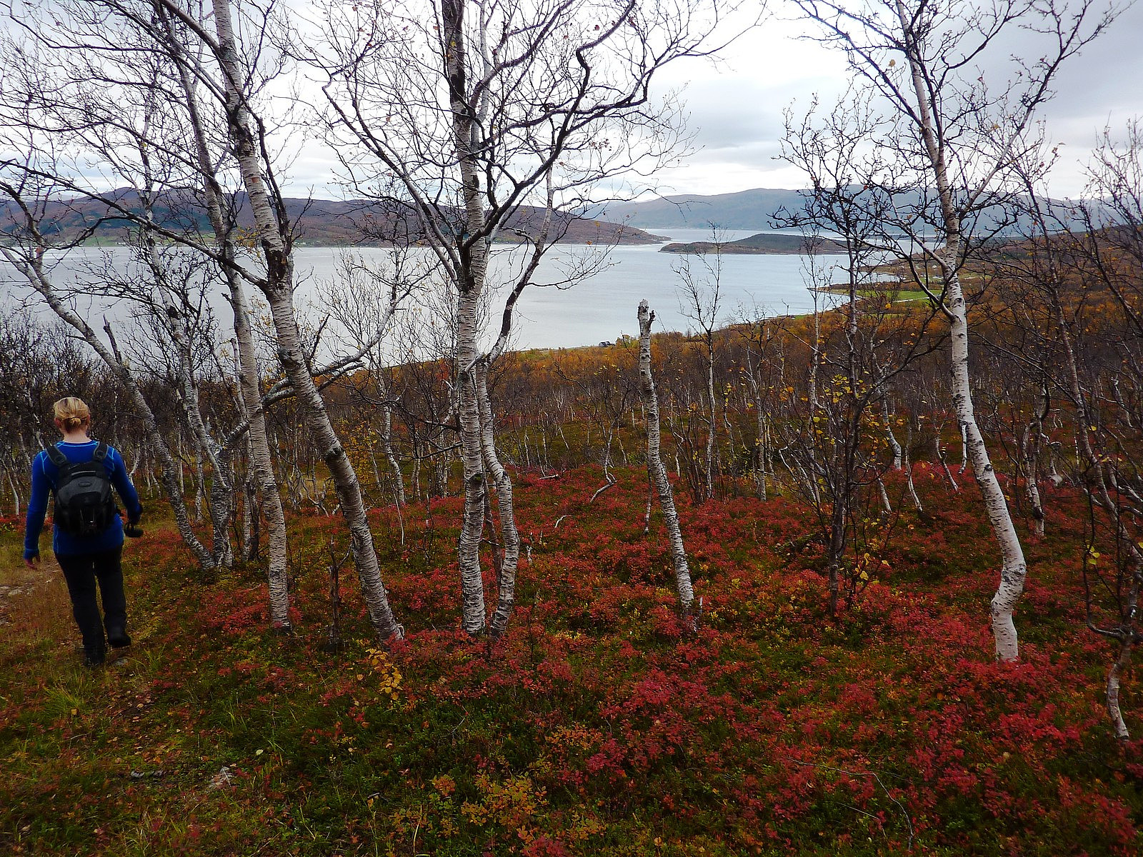
Wonderful day out on a mountain number 2 for this week: Bentsjordtinden. Probably also one of the mountains I have most wanted to visit since moving to Tromsø and one which I photograph numerous times, because of its very elegant silhouette against the Tromsø skyline. With me for this trip was my fjellsportgruppa friend Ilona. It had been a while since we have both found a good day to get out on a trip together, but fortunately today it happened. After collecting Ilona from town at kl.10, we drove out to Malangen via the Ryaforbindelsen under slightly cloudy sky but with no sign of rain, and it was a quick travel time to park up just after reaching Bentsjorda. It was a little tricky to figure out where the path(s) started from to go up the mountain, but luckily I had 'insider information' about it being behind a white house (there are several) just across from the layby along the road. There we found a very obvious sign saying 'Til Bentsjordtinden'. This made the way up through the forest a very pleasant affair, especially passing by the golden trees once again, which were now much less thickly-spread with leaves than earlier in the month.
Anyway, we came up above the treeline very quickly and got a good view up the mountain, looking directly at the North, South and main peaks. Having had such a well-marked path to follow through the forest, we kept to the trail as it skirted towards the west for a while but our luck didn't last and it disappeared quite soon. It wasn't a big deal though because visibility was excellent and we could see the skyline ridge we should be walking up to, which would lead us up to the pass between the main peak Store Bentsjordtinden and the satellite peak just a little to the south. We didn't cross all the way over to the foot of the ridge before climbing it though, we more or less decided it would be shorter and more direct to go straight up and hit the ridge at it's upper end, and even though it was steeper, the ground was a mix of soft vegetation interspersed with small but solid rocks and it was actually not too demanding to hike straight up there. Looking behind us we had some good views to the southern side of Kvaløya, and were pretty much opposite Gråtinden and Nattmålstuva, both of which had some gentle-looking and broad ridges leading up to their summits.
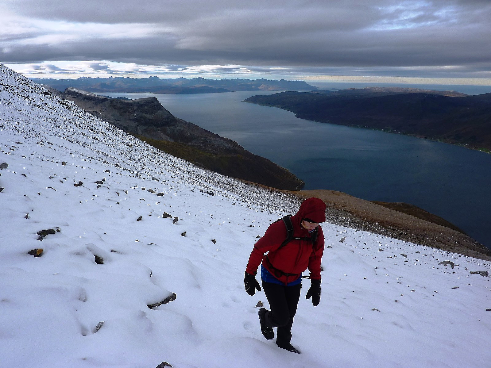
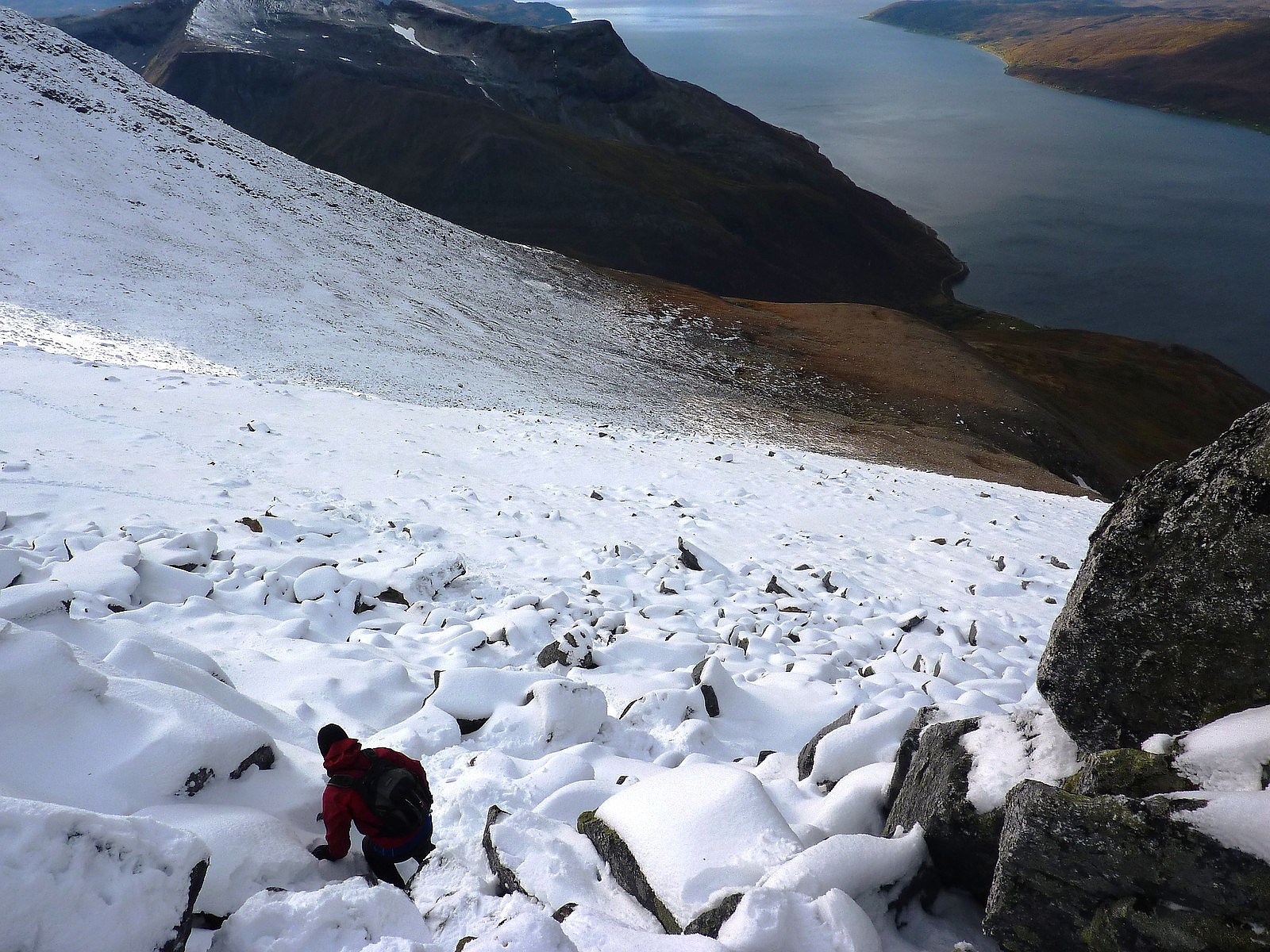
Both of us were actually wearing t-shirts or vest tops at this point, but as we approached the ridge crest, we were greeted with increasing amounts of wind blowing down the mountainside from the summits. We got dressed again and carried on steadily until we could find a decent-sized boulder to take a break and have some lunch at. By the time we found somewhere suitable to stop and eat I think we were more or less 200-250m below the summit, which also marked the snowline as well. Ilona was looking chilly, and although I was warm, it was not all that easy to eat sandwiches and apples with gloves on so I had to take them off and bear with having cold fingers for a few minutes! I was glad to have brought a thermos flask of hot water to make cappuccino though, that warmed up the extremities a bit better :-)
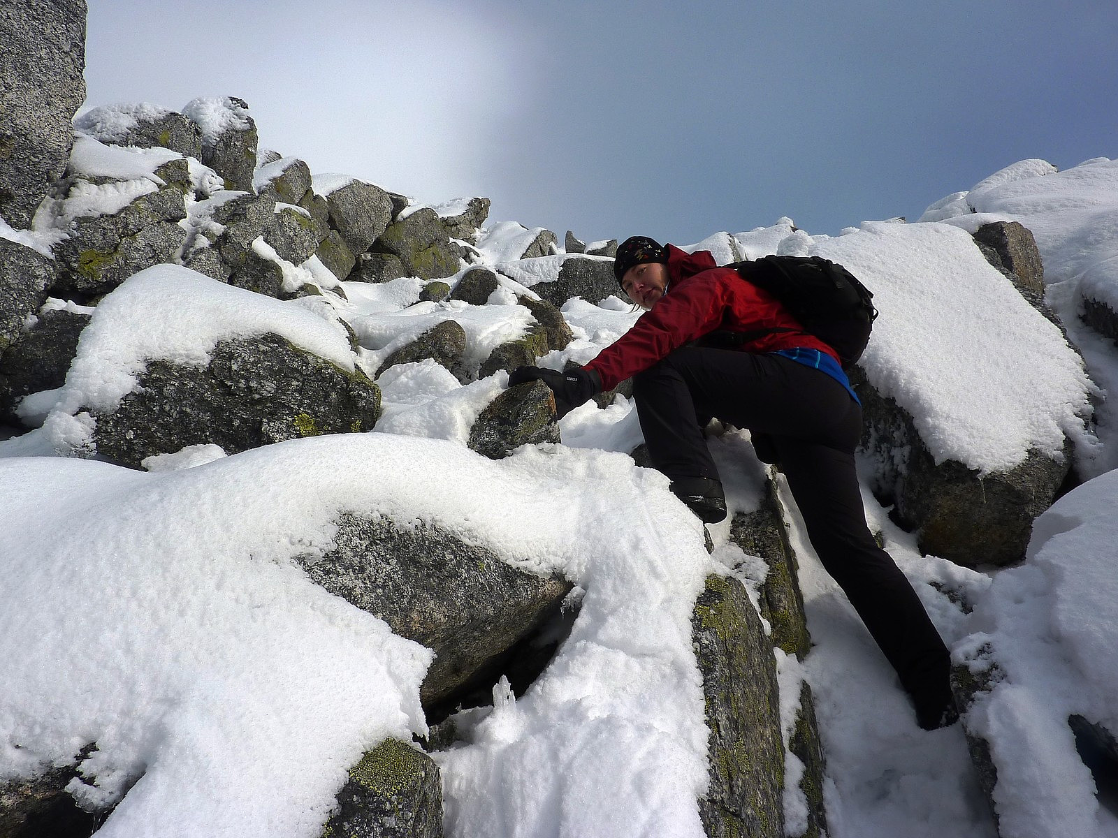
After our rather speedy snack break, we continued again, stamping some nice footsteps into the new snow as we crossed diagonally up to the summit ridge. We were quite surprised to see a group of 3 other guys descending from the top though, as we'd not seen any other cars parked down in Bentsjorda earlier in the morning. It was nice to know we weren't the only ones on the mountain though! The wind was quite persistent and at times a little fierce but strangely, as we got closer and closer to the ridge it disappeared altogether. Almost simultaneously the sun peeked out from behind some very pretty fluffy clouds and we found ourselves scrambling on snow-covered rocks on the last part of the hike feeling much warmer!
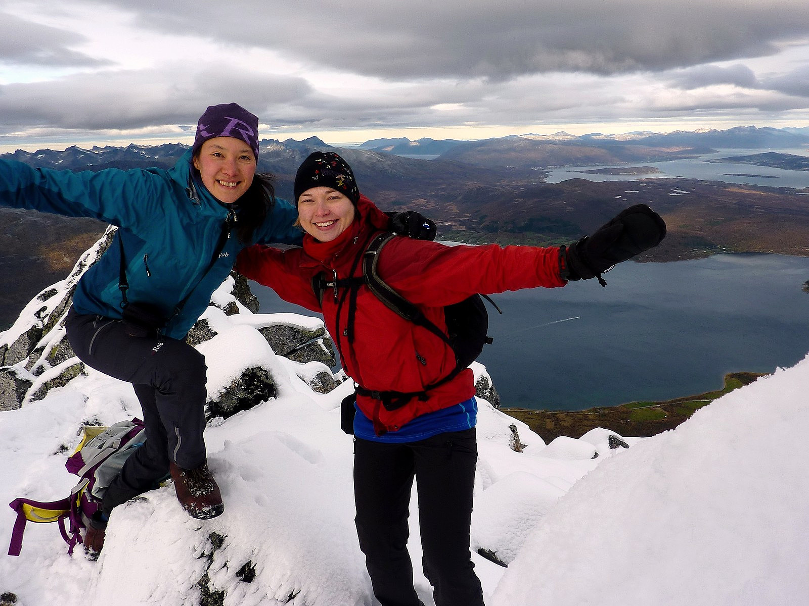
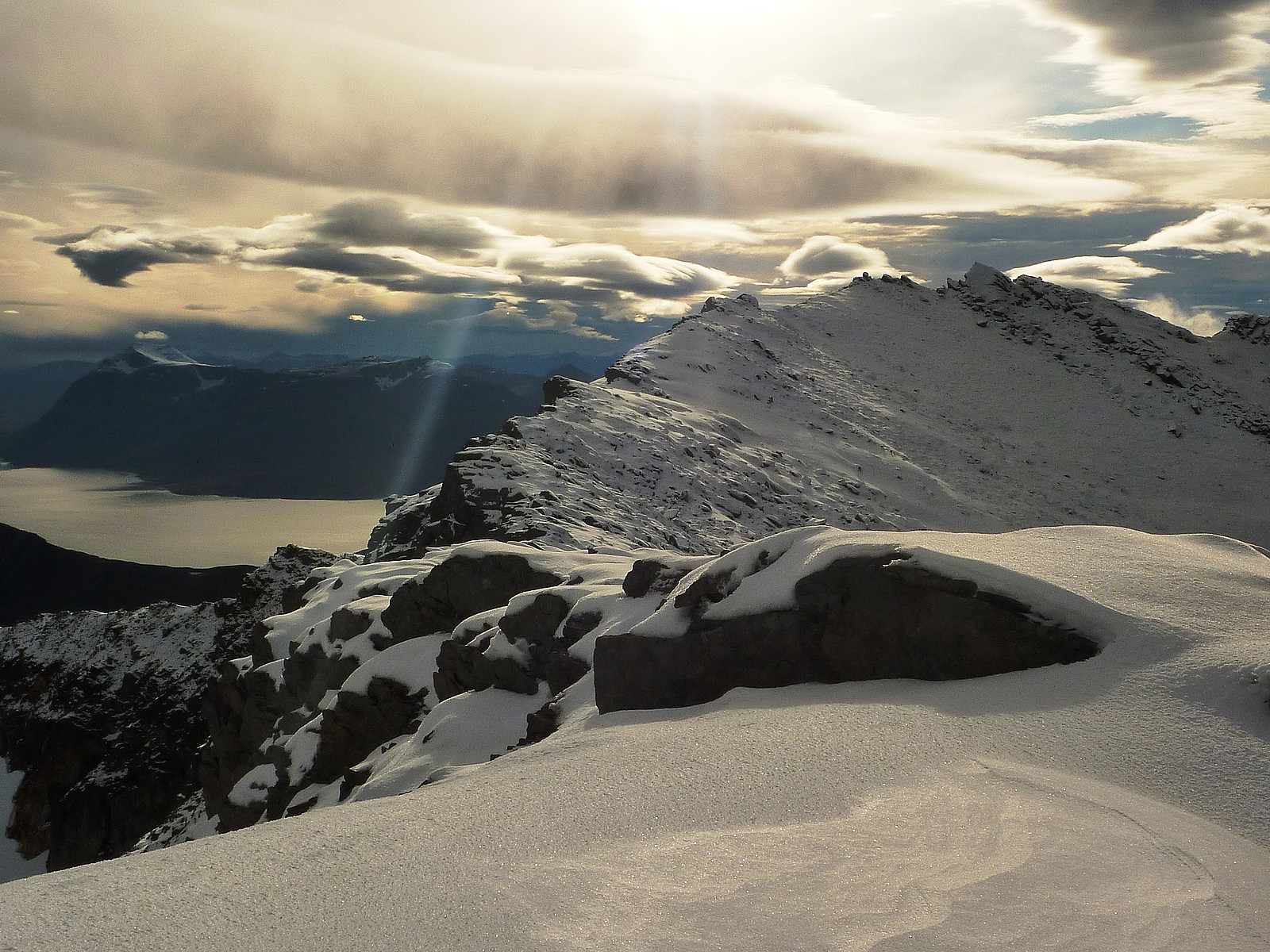
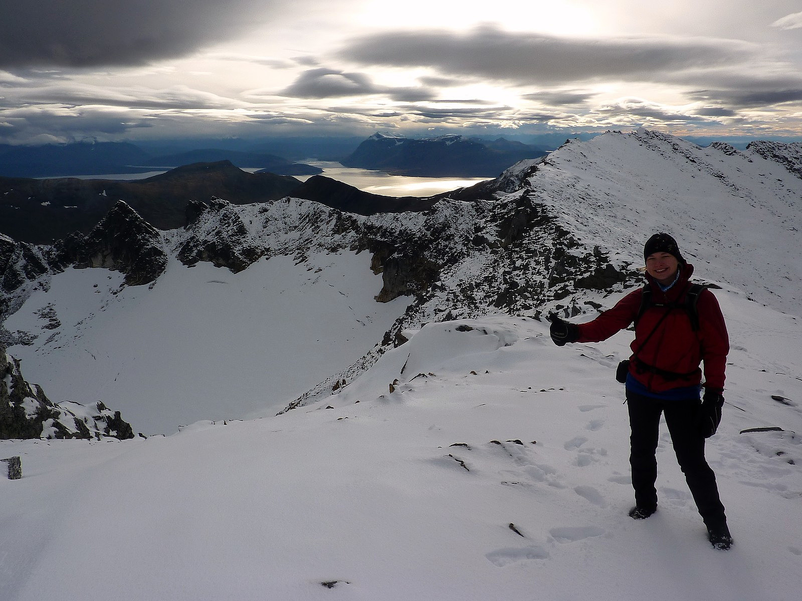
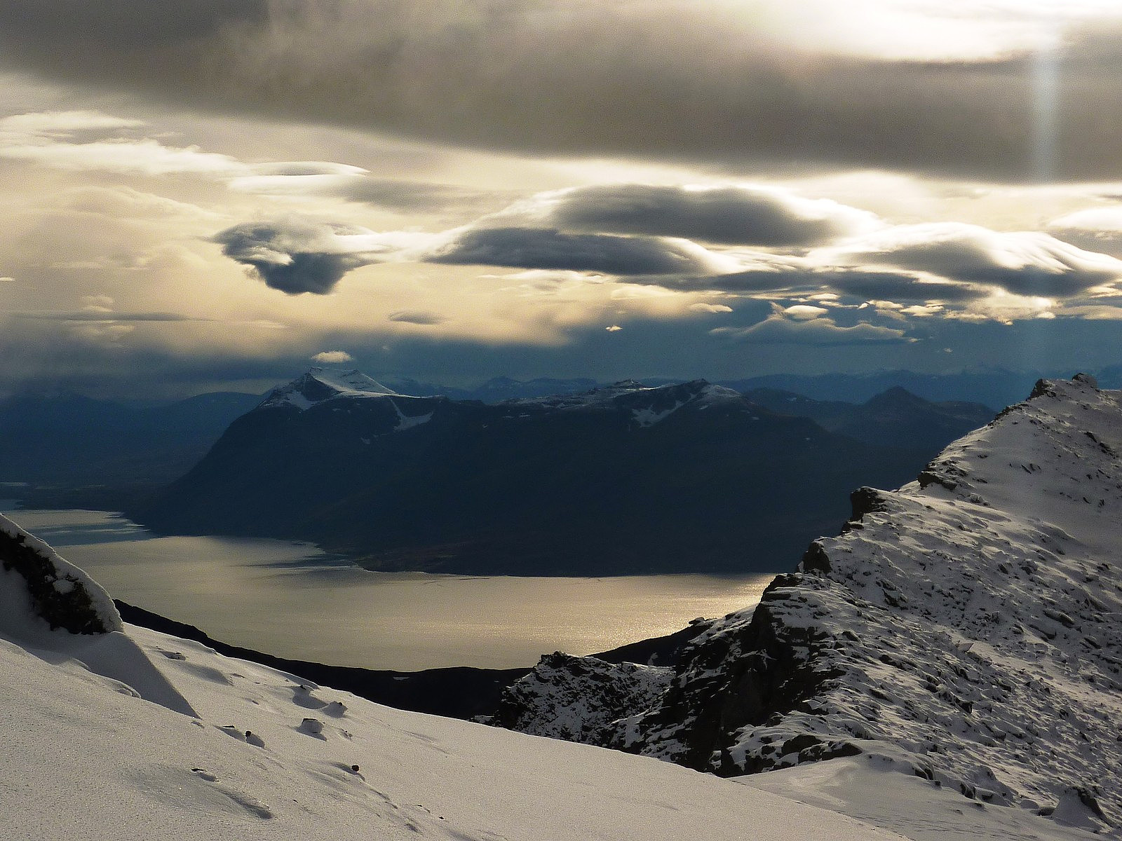
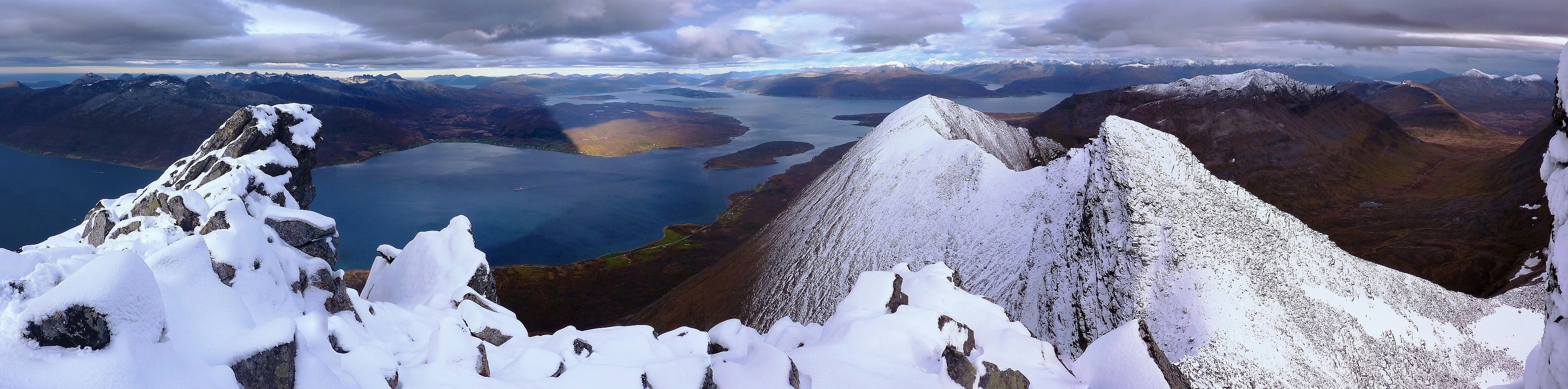
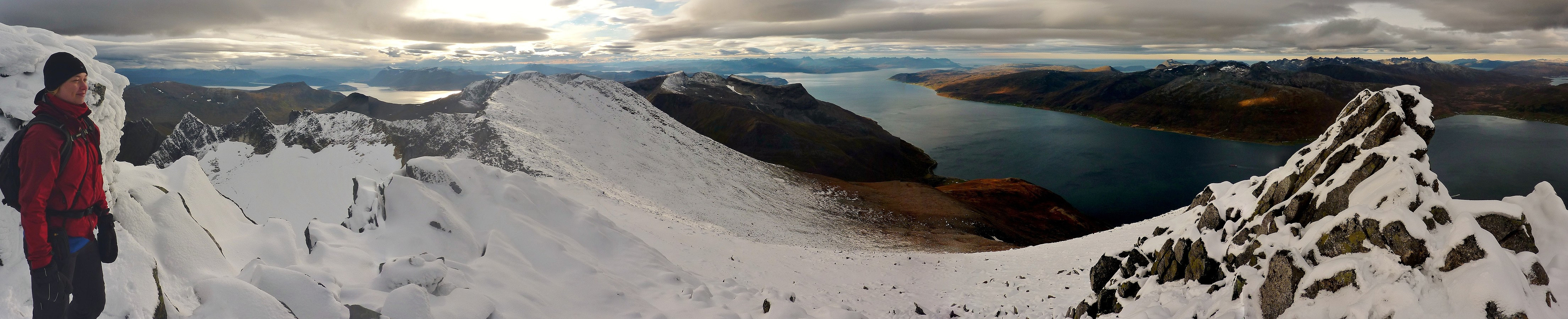
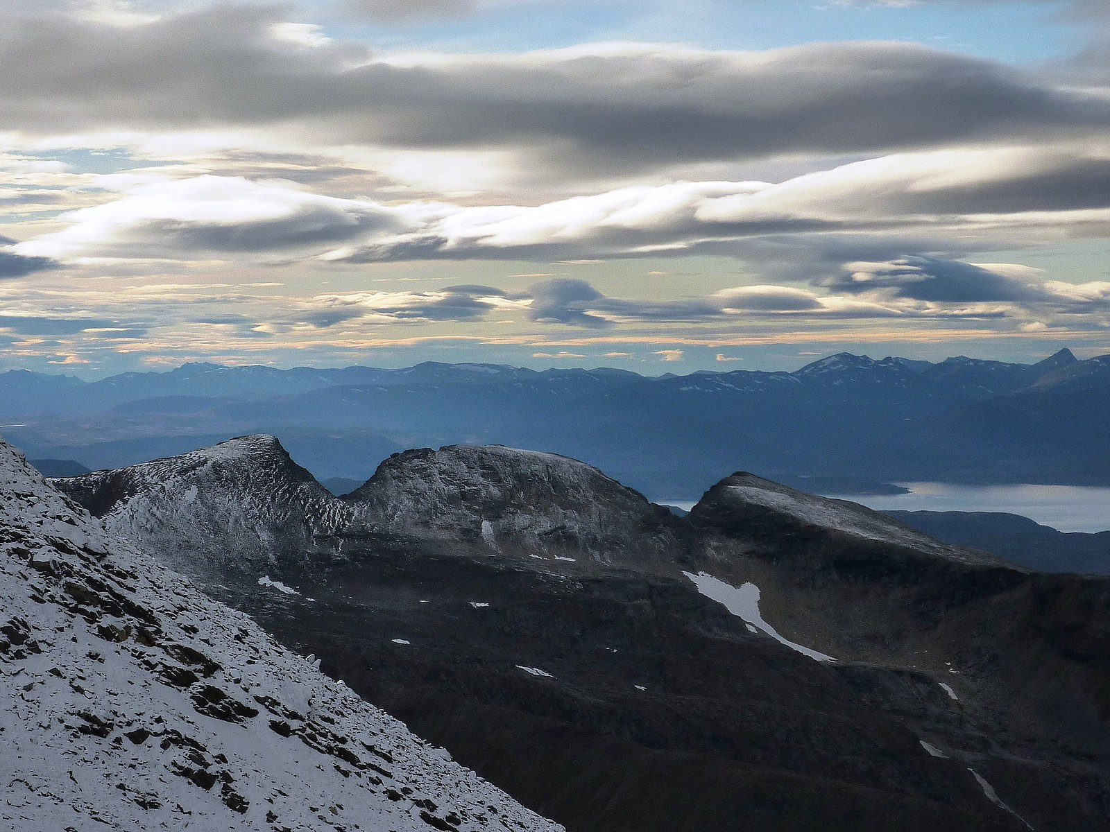
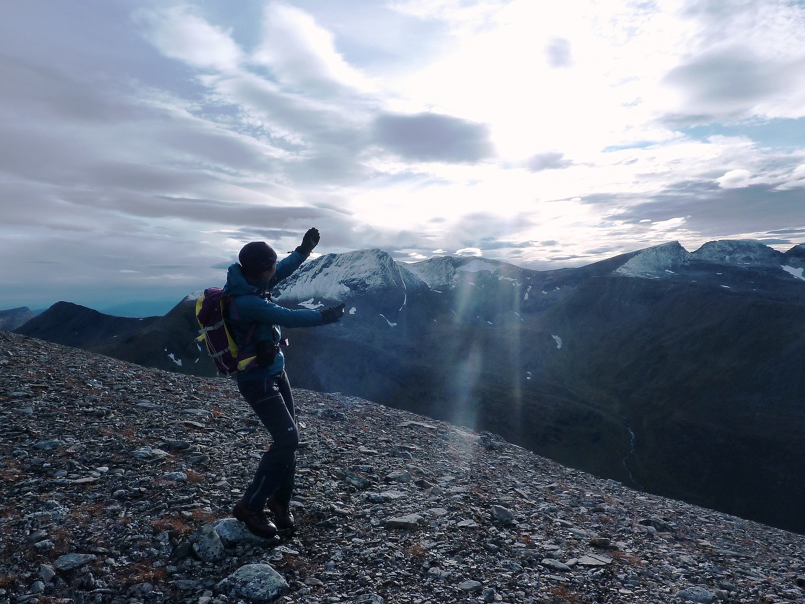
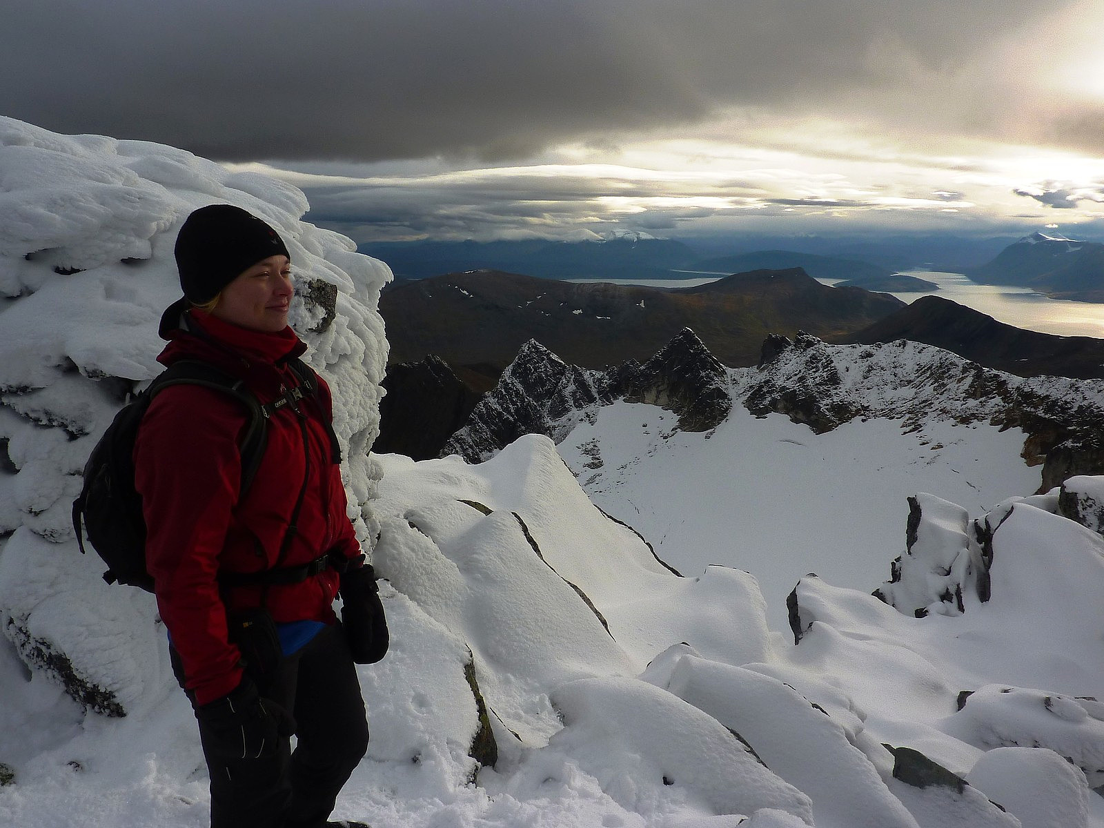
On the ridge, a whole new 360-degree panorama of stunning mountains and fjord opened up around us, and we got some really great views straight down the other side of the ridge towards the north peak. We had been blessed with some quite special light and cloud formations, which made us feel like we were on some alpine summit. Or maybe it was so beautiful I was just dreaming. Whatever, it was just like a dream come true - the views, the company and the mountain which had been on my 'wish list' for so long. Seriously though, it felt like a very special time to be up on the top at that moment and we spent almost half an hour admiring everything around us with the benefit of still air and weak sunshine breaking through the clouds.
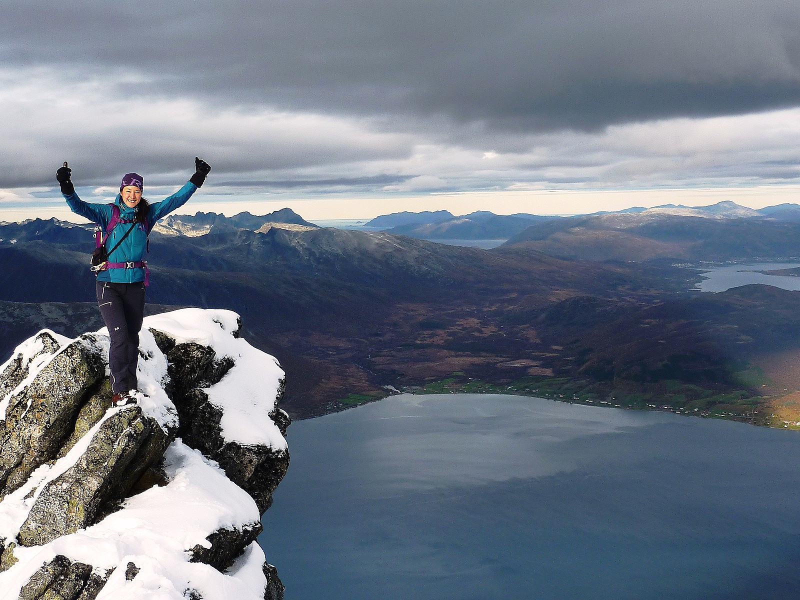
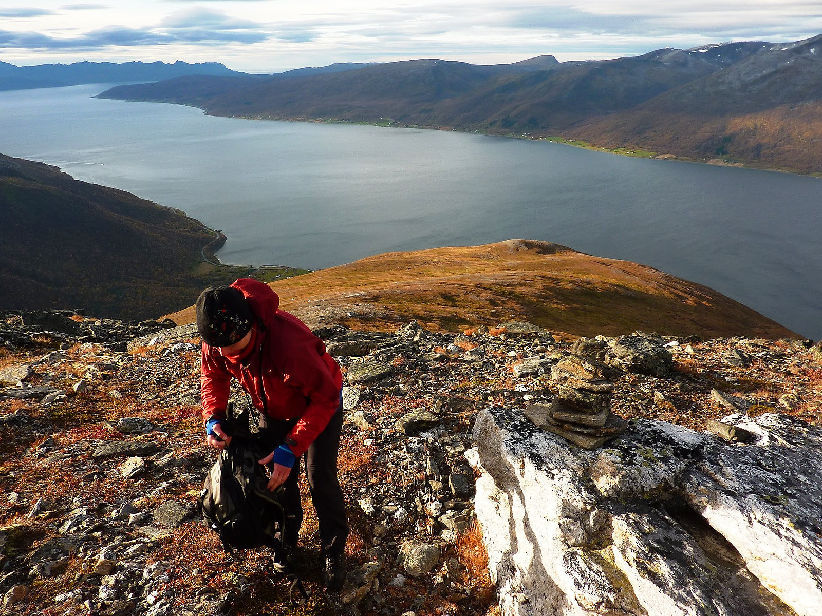
But like most trips, we had to leave the summit and start the way back down again. It was a longer route that we took, since we decided to use the very nice path going all the way down the ridge for as long as possible. Somewhere at the foot of the ridge where we reached the vegetation again, the path did a disappearing act (as we expected) and we just resorted to hiking straight across the mountain in an easterly direction to where we met the top of the forest again. It was a lovely walk down though, especially with the warm afternoon sunlight on us, and the views across to Blåruttinden and Klemmartinden to the west of us. Somehow (and I'm not sure how we managed this) we successfully located the same path back down the forest as we had taken up in the morning, despite having had nothing to follow between the foot of the ridge and the forest. So that was very fortunate, and no tree-bashing was necessary to make our way back down to the car. In all, we used a very leisurely 5.5 hours up and down, and arrived back at the car feeling very happy and very satisfied with the trip. Takk for turen, Ilona!
More pictures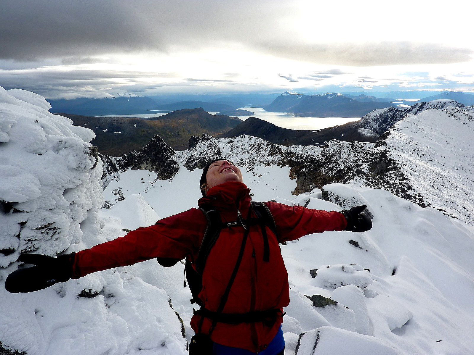


User comments
Dette var fint
Written by otto 02.10.2012 20:55Praktfulle bilder og det ser ut som en glimrende tur.. Er herved notert på ønskelista.
Re: Dette var fint
Written by hmsv1 02.10.2012 23:31Takk for kommentarer. Turen var kjempefint, spesielt med den utsikten vi fikk på toppen! Det er også ikke langt, men vi brukte mye tid for å ta bilder, prate med hverandre, spise..... things that girls do :-) Jeg tror du kunne være opp og ned i 3 timer!
Missing title
Written by Mayhassen 01.10.2012 19:04Nice panorama towards Tromsø!