
Approaching Ulriken from Fyllingsdalen (17.10.2021)

Written by HHauser (Helwig Hauser)

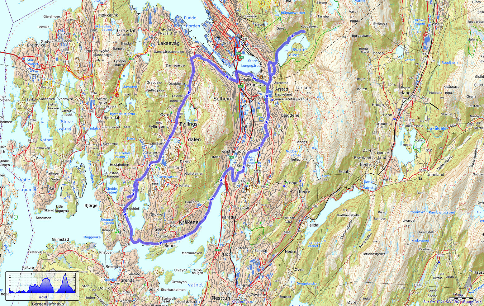
| Start point | Varden (45m) |
|---|---|
| Endpoint | Varden (45m) |
| Characteristic | Bike trip |
| Duration | 2h 00min |
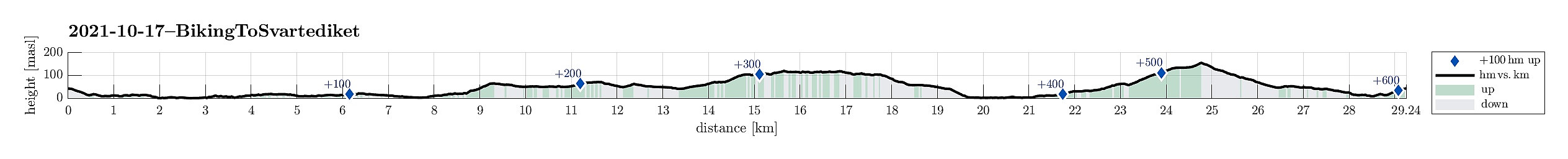
| Distance | 29.3km |
| Vertical meters | 610m |
| GPS |
|
| Visits of other PBEs | Solhaugen søyle (107m) | 17.10.2021 |
|---|---|---|
| Sælen kirke p-plass (15m) | 17.10.2021 |
Trip Summary
With a nice Sunday ahead of us, we decided to approach our hike by bike (eBike). Starting from Varden in Fyllingsdalen, we first biked around Bønes (along Nordåsvatnet) towards Fjøsanger. From there, we connected to the heights in the south of Storetveit kirke. Following Storetveitvegen, Hagerups vei (around Tveitevannet), and then Birkeveien, we made it to Haukelandsveien, which we followed to the northern side of th hospital. From Årstadveien we then biked along Stemmeveien and Lappen to Tarlebøveien. To focus our hike on higher grounds, we then cycled a little further along Svartediket, before we then left our bikes behind for a nice hike over Vidden. Once back from this hike, we then took the bikes out, again. To get back to Fyllingsdalen, we then chose to take the route via Melkeplassen, biking first along Store Lungegårdsvannet through Møllendalen, and then up Lien to connect to Øvre Fyllingsdalsveien on the northern side of Melkeplassen. Once over Melkeplassen, it was then just down through Fyllingsdalen to get back to Varden. Eventually, we had returned home after a really nice day with a good biking trip and a really nice hike! :-)
Useful Resources
See also the related FB-page Hiking around Bergen, Norway.


User comments