
Crossing Gullsteinen to Fyllingsdalen (13.10.2021)

Skrevet av HHauser (Helwig Hauser)

| Startsted | Fjøsangerveien (25moh) |
|---|---|
| Sluttsted | Varden (45moh) |
| Turtype | Fjelltur |
| Turlengde | 2t 00min |
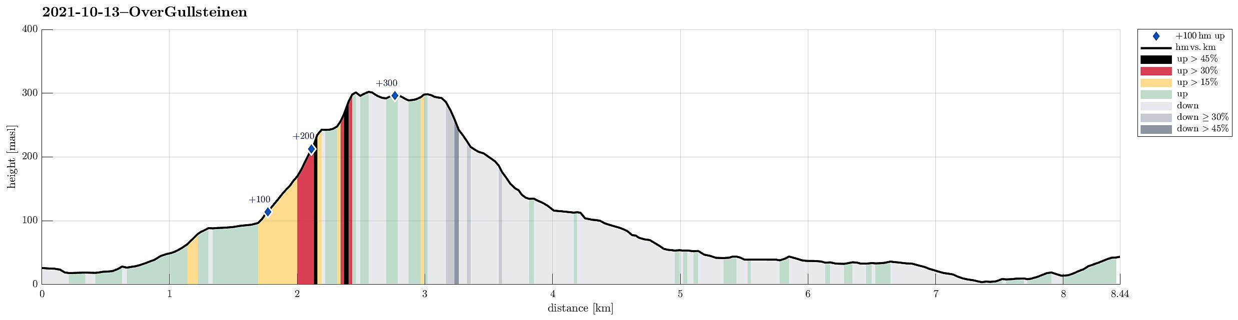
| Distanse | 8,5km |
| Høydemeter | 382m |
| GPS |
|
| Andre besøkte PBE'er | Sælen kirke p-plass (15moh) | 13.10.2021 |
|---|
Trip Summary
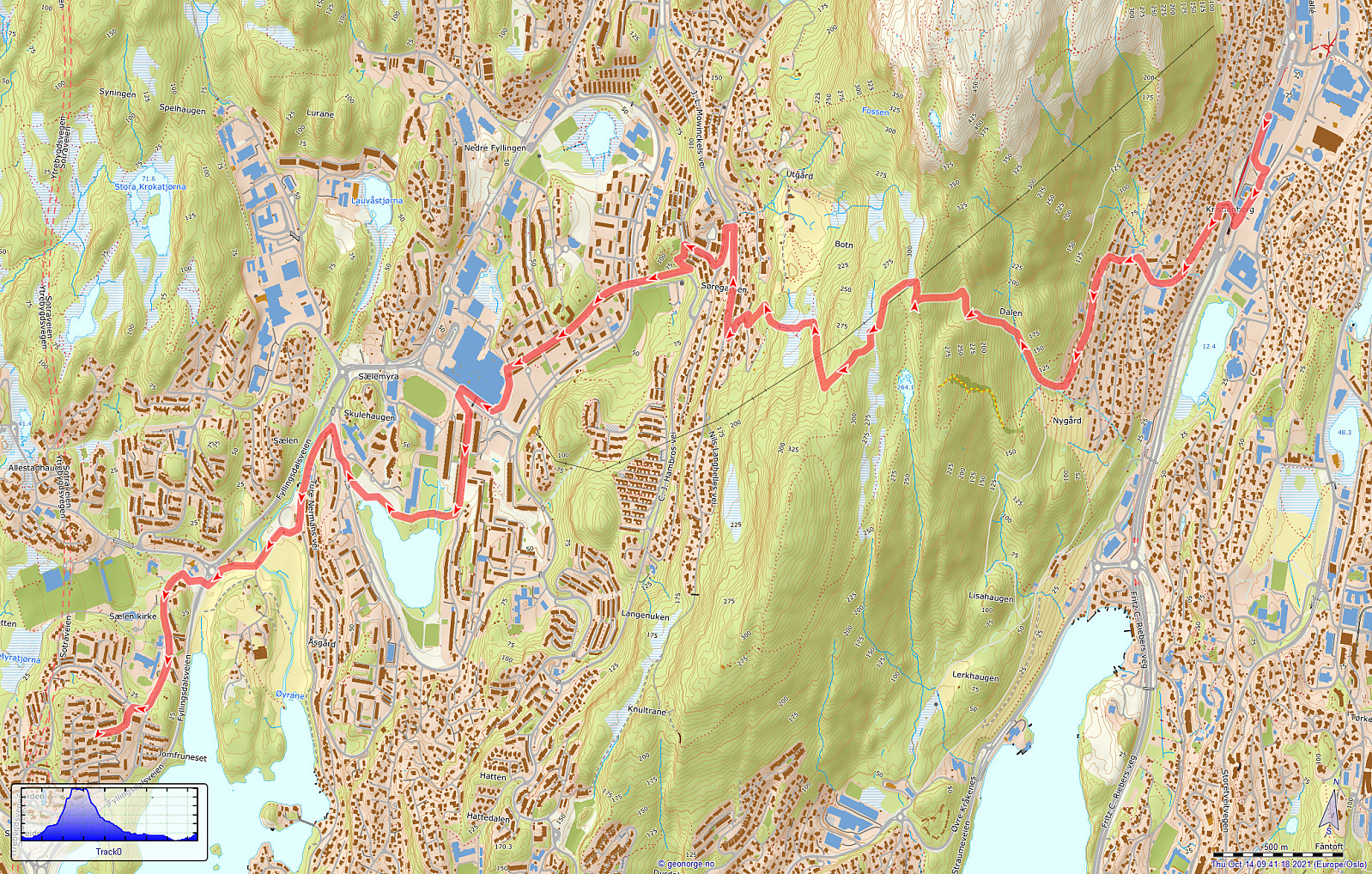
After dropping off my bike for a service I head back to Fyllingsdalen. After crossing Fjøsangerveien near the near tunnel portal (for Bybanen and cyclists), I walked up Grønestølsveien to find a way into the green above the houses. After getting to Grønnestølslien, I could not see an immediate opportunity to continue further up. Accordingly, I first followed Grønnestølslien in southern direction until it ends near a littl stream that is coming down from Løvstakken there. There, I connected to a proper trail that leads upwards; first on the eastern side of the stream. At about 160mosl, I crossed the stream and continued further upwards in western direction. After crossing over an old stone wall, I arrived at a somewhat flat spot at about 250mosl. From there, I continued further upwards in western direction (this stretch then without a trail). This brought me to a little ridge at about 300mosl (in the north of Langatjørna). Walking just a little bit further upwards and into northern direction brought me to the trail to Gullsteinen (then in southwestern direction). After following this trail for a short stretch, I left it for Nils Langhelles vei down in the west of the ridge between Løvstakken in the north and Gullsteinen a bit further in the south. While the trail down to Nils Langhelles vei was easy to find, it still was a little slippery in all the rain. At least I was satisfied that I had managed to get down from the ridge before it had turned completely dark. From Nils Langhelles vei, I then connected to J. L. Mowinckels vei. Passing by Benshaugen, I then continued along Nedre Krohnegården into the direction of Oasen. From there, it was then to pass by Orrtuvatnt and down to Sælen, before I arrive at Varden (thoroughly wet).
Useful Resources
See also the related FB-page Hiking around Bergen, Norway.


Kommentarer