
Helldalssåta via Helldal (29.08.2021)

Skrevet av HHauser (Helwig Hauser)

| Startsted | Sanddalen (20moh) |
|---|---|
| Sluttsted | Sanddalen (20moh) |
| Turtype | Fottur |
| Turlengde | 3t 30min |
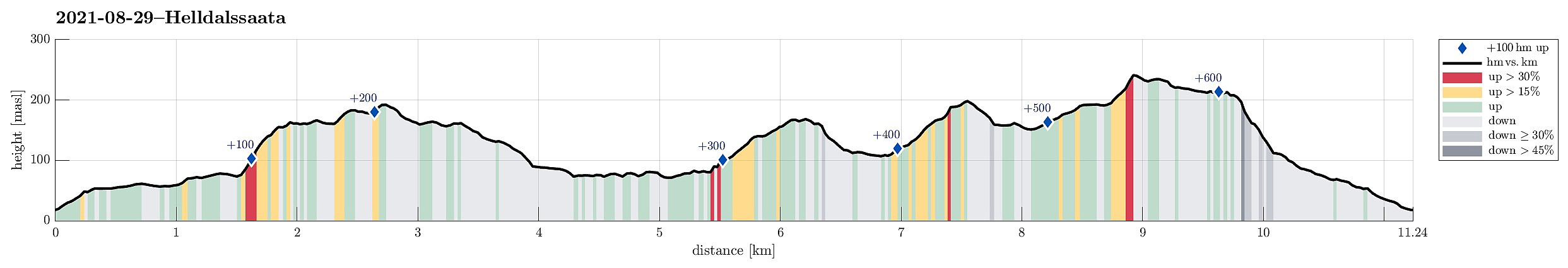
| Distanse | 11,2km |
| Høydemeter | 614m |
| GPS |
|
| Bestigninger | Dyngelandsåsen (196moh) | 29.08.2021 |
|---|---|---|
| Helldalssåta (250moh) | 29.08.2021 | |
| Helldalsåsen (170moh) | 29.08.2021 | |
| Andre besøkte PBE'er | Storesåta (215moh) | 29.08.2021 |
| Tårnnebben (168moh) | 29.08.2021 |
Trip Summary
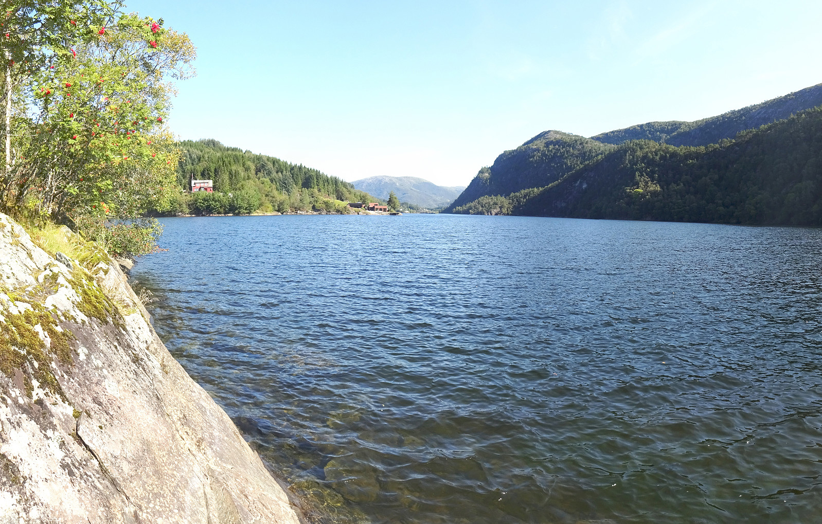
I had taken my bike to Sanddalen (via Nesttun in the south of Bergen) and started my hike in southern direction on Sandbrekkevegen. This brought me across Hardangervegen to Ulsmåg on the other, southern side. My first hiking-goal was to walk across Oksla in the northwest of Dyngeland, following most of its long ridge. Walking up Ulsmågvegen, I watched out for a suitable place, where I could leave the road and start hiking in the terrain. At this southwestern end of the Oksla-ridge, its northwestern face is quite a bit steep, leaving it unclear, while studying the map up-front at home, whether an ascent from this side would be reasonable at all, or whether I would have to go all around to Stallavegen, first. Luckily, I did find a good spot to pass by Ulsmågvegen number 28 (some car rental company there) on the northern side of the building, and finding a trail there that made the ascent to the ridge easy and straight-forward (first in southern direction, then turning into northeastern direction, leading up to the ridge). Once on the ridge, progress was easy, again, and I crossed over Tårnnebben, enjoying some nice views over Ulsmåg in the northwest. Following the ridge in northeastern direction, I cam by the little station on Oksla before continuing further into the direction of Utlebøen. Staying mostly on the ridge, I found some minor trails (or "trails") there, which made hiking there a pleasant experience. Once I had come close to Ottskarstigen, I had the impression that I would get into the way of the houses there. Therefore, I left the ridge about there, connecting down to Dyngelandsvegen a little further east. After walking a short stretch on that road, I then found a just so visible "trail", leaving from the road in the north of house number 113. This brought me down to Mundalsvika (of Grimevatnet). From there, it was straight-forward and quite nice, actually, to walk along Grimevatnet in northern direcion to eventually connect to Helldal. Once on Helldalshaugen, I crossed under the old railway line, where also Midtunelva does so, crossing over the stream just a few meters further north. I then walked out to Helldalsneset until the road is blocked (at its end) by a substantial private property. There, one can continue along a proper trail that leads around the property towards the north (and upwards). My next little goal was to walk over Helldalsåsen from its southwestern end to its northeastern one. While this was nice and easy first, it really became a struggle, once I had reached the heights of the ridge. A large number of trees is lying in all directions and often over each other, making progress there very hard (and no fun!). After some "fight", however, I was back in the forest on Helldalsåsen, heading down to the little road that serves the few houses on the northeastern end of Helldalsåsen, still quite a few heights meters above Grimevatnet. Walking down this road, I got to Hardangervegen. After crossing the main road, I walked in parallel to it "backwards" (in western direction) to get to the starting point of a trail that I had spotted on the map, leaving Hardangervegen towards the north more or less right at the saddle there. I had thought to take this trail to get up to Helldalslia. Following this trail, I got to about 160mosl, where the trail "swings back" (then in northeastern direction), probably leading further up to Søre Gløvrevatnet. About 25 heights meters further up (and "back"), I got close to the saddle of Løypingsbrotet, where I left the trail and started searching for a suitable connection towards the west, again. After stepping over the top of Løypingsbrotet, I avoided the steepest, western slope of it, heading further south to connect to Helldalslia. This worked well and could find a way to connect down to the road (Helldalslia), which I then followed "out" (mostly northwards) until it connects to Sanddalsringen. Crossing over that (major) road there, I continued along Bakkedalen to get closer to Helldalssåta. All in all, finding my way through the houses there was straight forward and soon later, I had come to the top of Helldassåta from where I enjoyed some really nice views (unexpectedly nice views, I have to admit!). From there, I then followed the southwestern ridge, crossing over Midtsåta along the way, getting to Storesåta soon after. From there, the goal was to descend to Sanddalen. Getting down to Kringlebotn proved to be easy to find, then also, and walking out the little (westwards oriented) valley from there to get "all the way down" to Sanddalen, also. Eventually, I ended up exactly at the point, where I had parked my bike -- nice! :-)
Photos
Selected photos are available as Google photo album.
Useful Resources
See also the related FB-page Hiking around Bergen, Norway.


Kommentarer