
Skulgamtinden (30.08.2012)


Geschrieben von hmsv1 (Hannah Vickers)
| Startpunkt | Storneset |
|---|---|
| Tourcharakter | Bergtour |
| Tourlänge | 6h 30min |
| Karte |
|
| Besteigungen | Skulgamtinden Nørdre (940m) | 30.08.2012 |
|---|
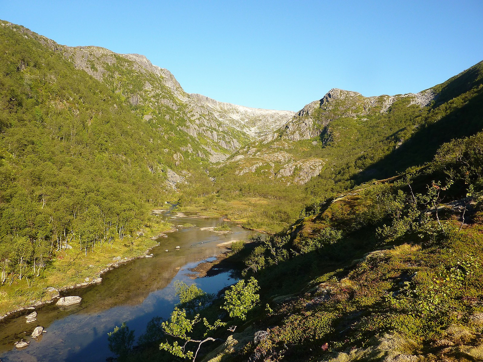
After leaving Tromsø more or less around 9am, I drove the 40 minutes across to the starting point which was about 7km after exiting the Kvalsundtunnelen and located in a big parking space on the left side of the road just before the bridge at Skulgambukta. It was warm and it was sunny. It was perfect, like many of my trips have started this summer! Just after crossing the bridge, there was a fairly obvious footpath I could see to the left and I took this to be the one to follow up the valley (Stordalen, I think).
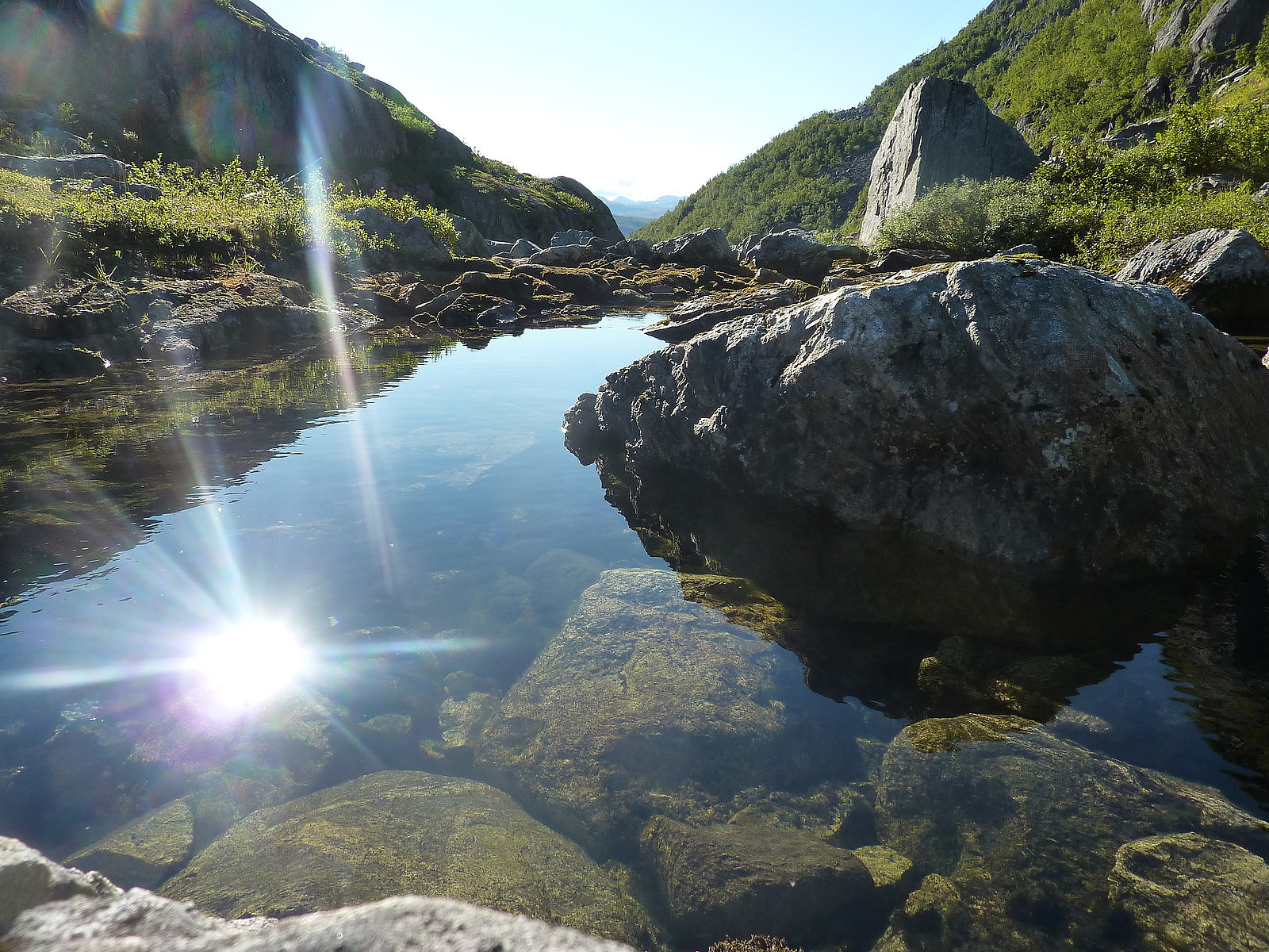
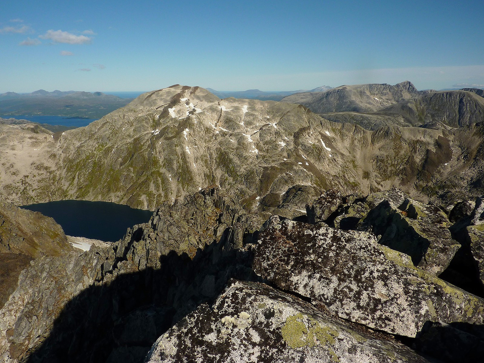
The path continues up to several lakes along the route to Skulgamtinden. Fortunately, some of the red Ti på Topp marks from a few years earlier were also still very visible, as was the footpath through the forest - at least for the first 10 minutes or so of the hike. After this, the path seemed to be less and less distinct, mainly as the result of some very tall bushes which covered up the trail. Otherwise, I was fairly happy that the forest was not disastrously thick to have to drag myself through. The route I followed rose quite gently up the valley, first passing Andrevatnet and then quickly on to Tredjevatnet. It was quite nice to take a short break here because the trees were behind and now I got a view of Skulgamtinden at the far end of the valley. The late morning sun was dancing off the water and gave it a very impressive colour which I probably spent much too long admiring. Anyway, after Tredjevatnet, I caught sight of a few more red marks on the rocks every now and then - just enough to lead me up to Fjerdevatnet, at which point both the well-trodden trail and the red marks stopped existing altogether. The usual route is I think, supposed to go around the eastern side of Fjerdevatnet, passing over a small rise above the water. Then you continue even further up the valley, over sometimes loose rocks and sometimes very solid slabs, past numerous streams and waterfalls (very pleasant if you have the patience to stop and take notice) before eventually coming towards Femtevatnet. But actually, I think if you find yourself at the shores of Femtevatnet itself, then you've wandered too far into the middle of the valley........ I don't like to complain, but even though there are lots of these beautiful, glacial-type lakes to gaze at and admire, the main dislike I had with the walk was that the height is ot gained quickly t all; even after walking some 5 km up the valley to Femtevatnet, you are still at only about 550m above sea level, with another 400m to do before you can actually find yourself at the summit of Skulgamtinden. I think I'd much prefer a route that ascend quickly at the beginning and then goes along a nice high ridge a for some distance. I have decided that valley walks just don't do anything for me.
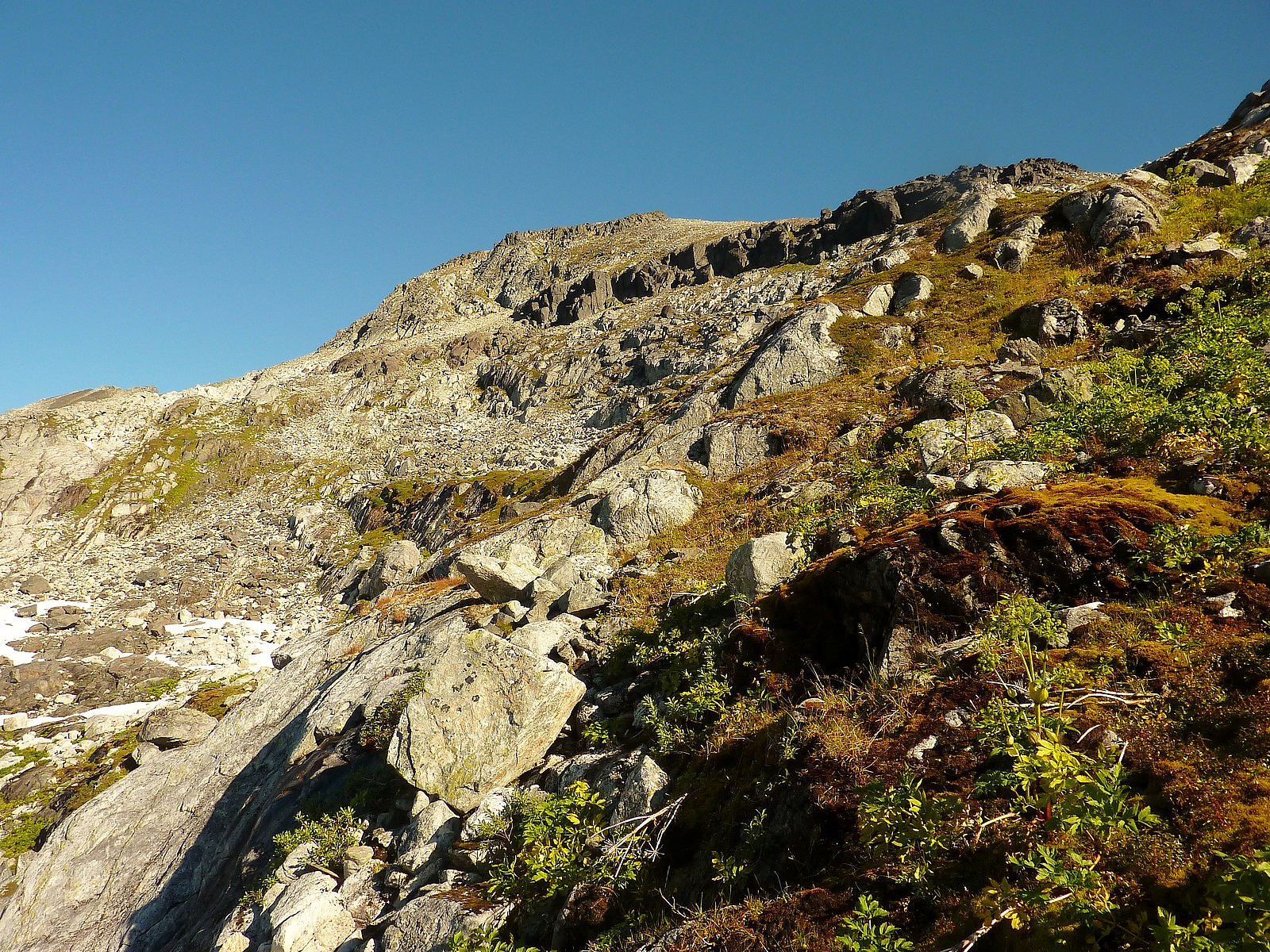
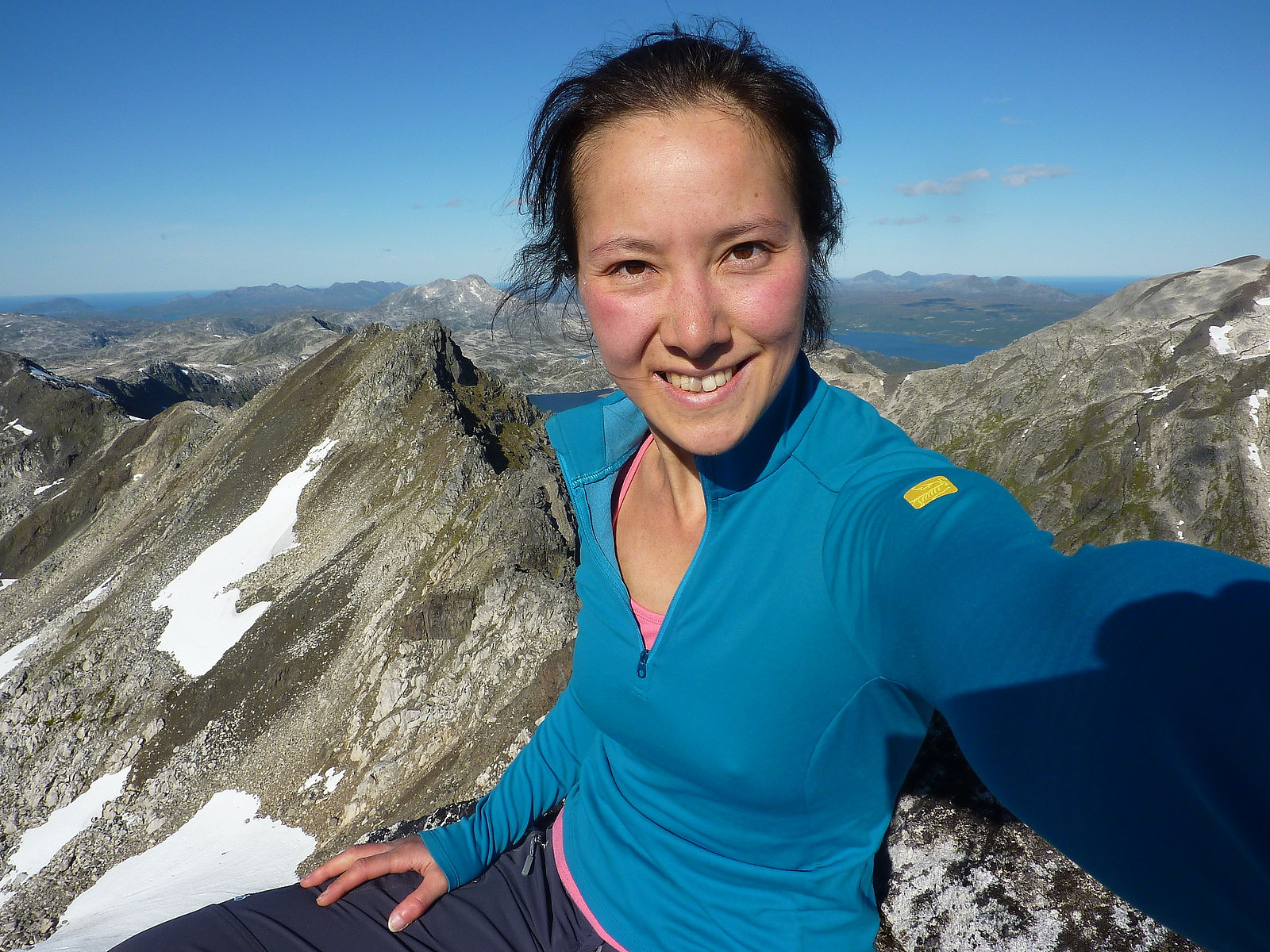
Nevertheless, if you have the perseverence to have reached Femtevatnet, then by this point, the top of Skulgamtinden is much nearer than you think. The route I took from around this point, was a sort of natural-looking ridge rising northeastwards, and it skirts past yet another small lake above Femtevatnet (there are in fact many, many small lakes above Femtevatnet, so I can't be precise at describing which of these lakes I skirted around the top of!) and follows the southern side of the stream coming down from the dip in the ridge at the top, which separates Skulgamtinden from Stortinden. It was in fact not too bad when I found a route that worked, but mainly it is a straightforward mixture of rocks and vegetation underfoot. I found the rocks to be more reliable simply because they were drier and actually fairly stable. By the time I got to the top of the ridge though, it was nearly 3 hours since I'd began walking. My interest had started to take a slight plunge, but now that I had some pretty great views to the eastern side of the summit ridge, it helped to increase my motivation again and it was only another 20 minutes or half hour to the summit. It dragged on a bit though, and it was really only the final 100m in distance that was the best part of the trip.
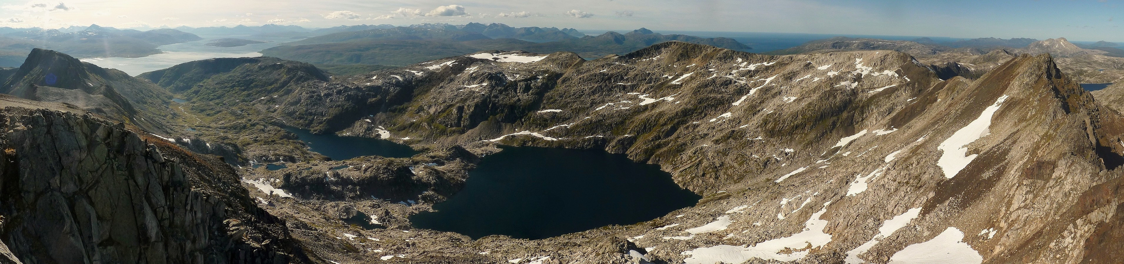
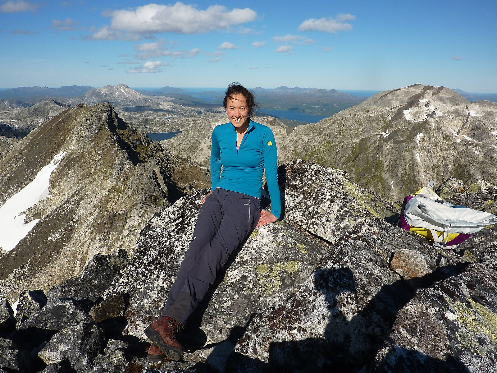
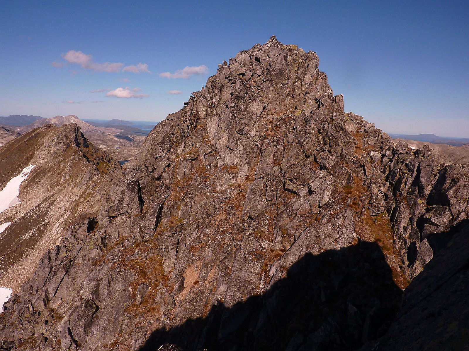
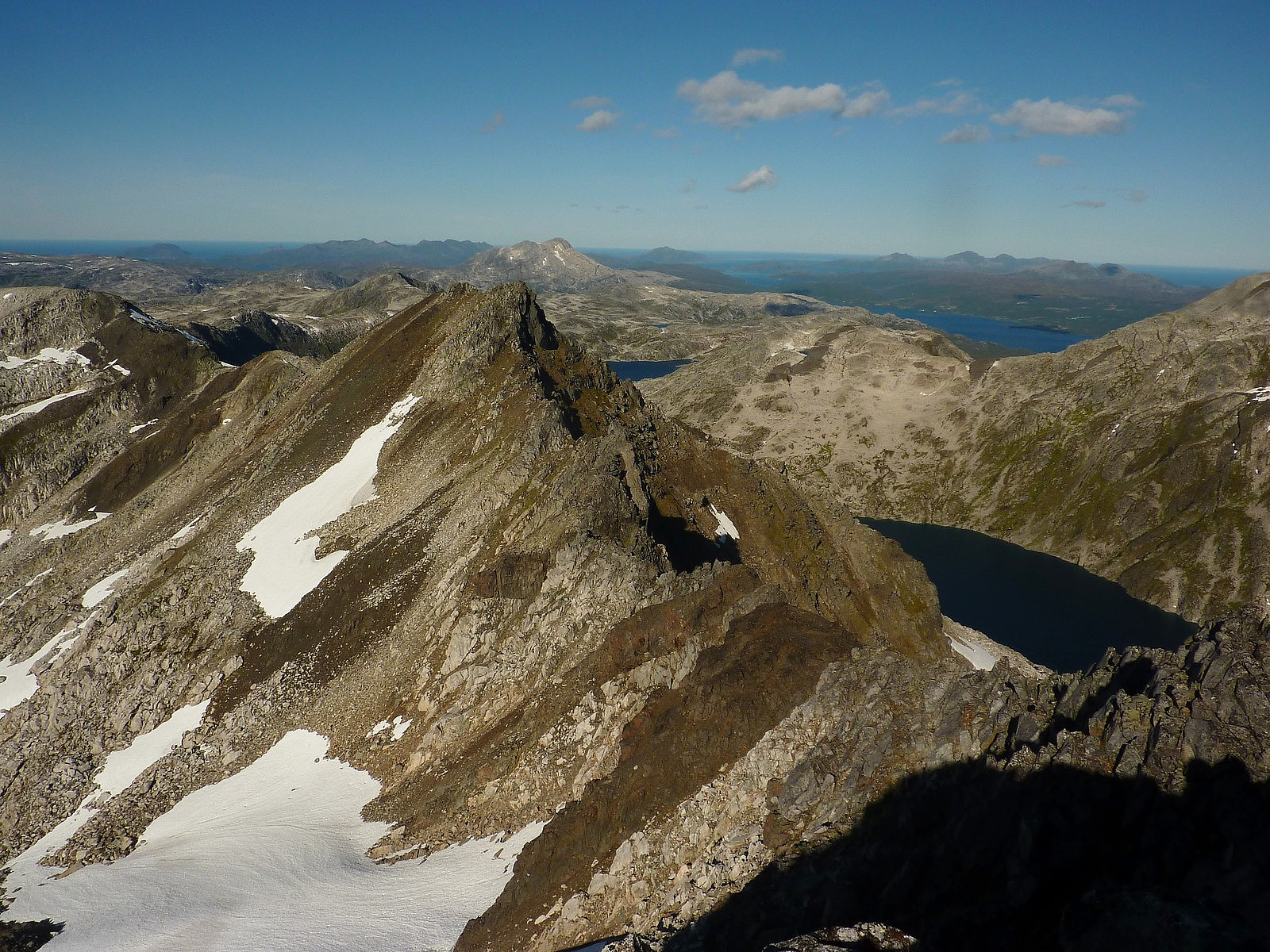
You basically walk fromø the fortoppen, down a little way along a slightly narrow edge, and then you have about 15m of fun scrambling to the proper top - from which you get the most magnificent views in all directions; Breitinden to the west above Sjettevatnet (the largest of all the lakes in Stordalen), Istinden and Nordfjellet directly to the east, and to the south you get a view of many many peaks on the mainland, including I think part of the Lyngen Alps. Looking to the south-east towards Tromsø was more hazy, so I couldn't make out as many distinct peaks in that direction. Kløfftetippen was the next peak along the ridge from Skulgamtinden, and one which I would like to go to on another visit, simply for it's very elegant south ridge. All in all, I was left with a good impression of Ringvassøya, and after some lunch on the top I made my way back down. It wasn't the same route as I'd taken up, but it worked out fine.....so long as you stick to the eastern side of the lakes, then I think it's pretty easy to pick up a vague trail that gets you back to the forest path again. And that's all that mattered to me!

In the end, I think I did appreciate a route like this, even if the gradient through the valley was a little bit too gentle and didn't gain height very quickly. But it's also quite a scenic walk-in and add to that the good quality, solid rocks to clamber up..... plus a little more excitement and fantastic views at the final summit, and you get a decent day of exercise out in the mountains. Definitely a worthwhile trip if (and when) you can follow the path!


Benutzerkommentare