
Aiguille de Bionnassay (20.07.2021)

Written by hmsv1 (Hannah Vickers)
| Start point | Gonella hut (3,044m) |
|---|---|
| Characteristic | Alpine trip |
| Duration | 6h 25min |
| Distance | 11.7km |
| Vertical meters | 1,152m |
| GPS |
|
| Ascents | Aiguille de Bionnassay (4,052m) | 20.07.2021 |
|---|
The Aiguille de Bionnassay is an elegant peak lying at the western end of the Mont Blanc massif, and like the Lyskamm traverse is known for its narrow snow ridges – in particular the “standard” route up the east ridge, accessed from the Gonella hut on the Italian side of the mountain. Since most snowy routes were in excellent condition this summer it seemed like a good choice to finish off my month in the Alps, so we headed there after spending a night in Chamonix after coming back from the Ecrins. We had a somewhat delayed start because of long queues to get through the Mont Blanc tunnel into Courmayeaur, so by the time we had made it up the Val Veny road as far as we could get to La Visaille it was around midday and we still had at least 5 hours of walking ahead of us to get to the hut. We gave the Gonella hut a call to let them know that we were definitely coming but there was a small chance we might arrive late for dinner!
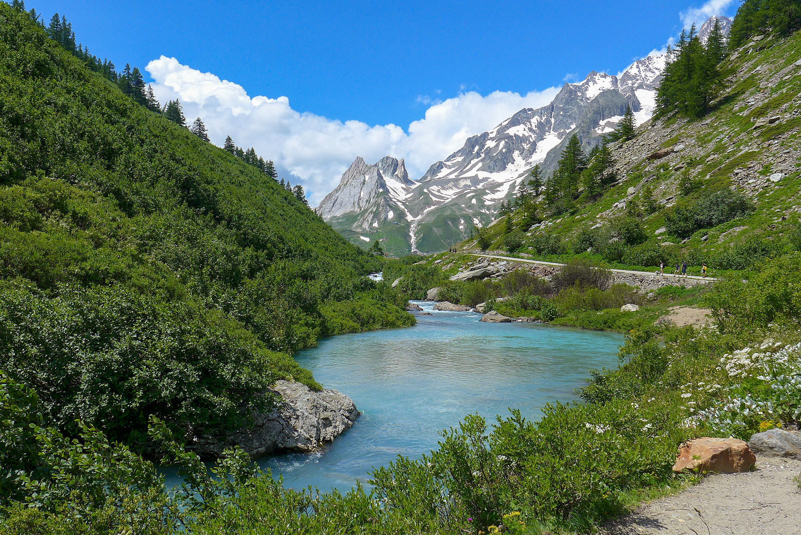
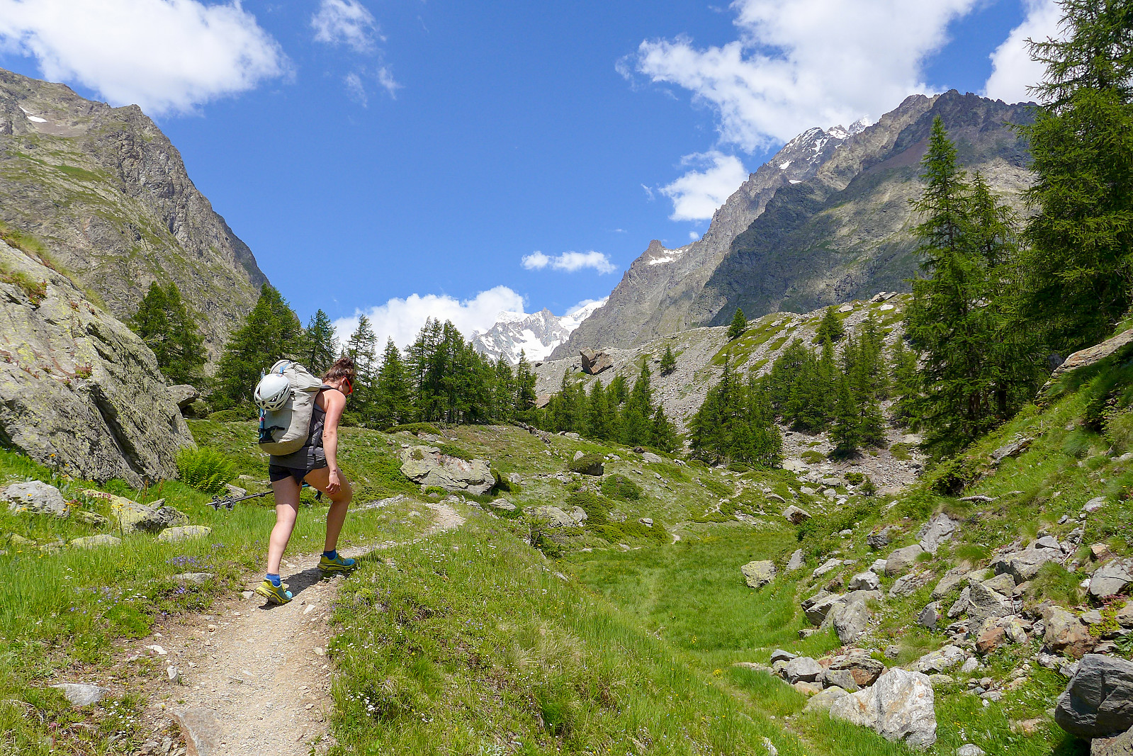
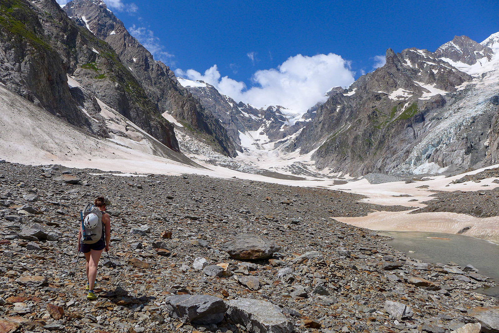
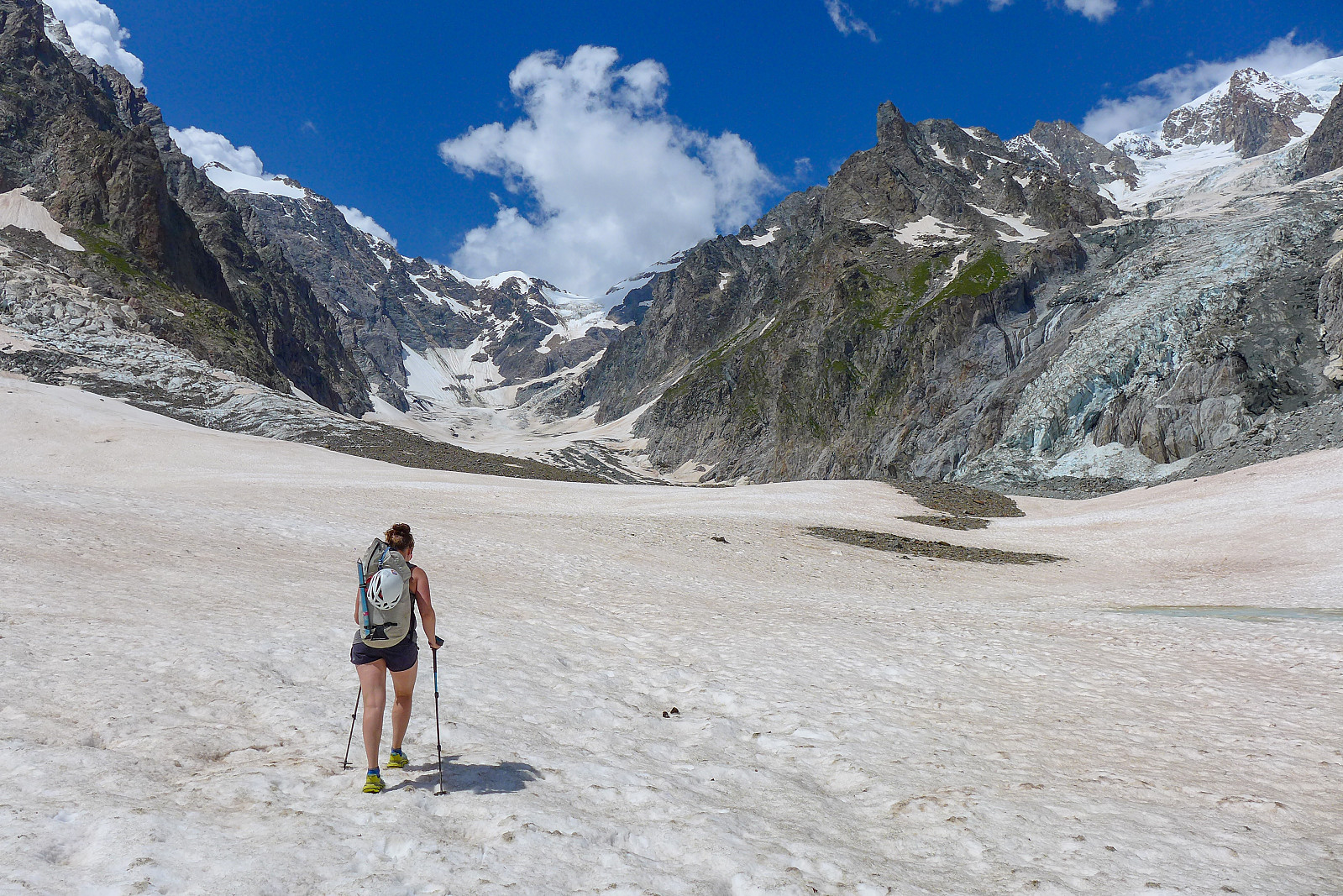
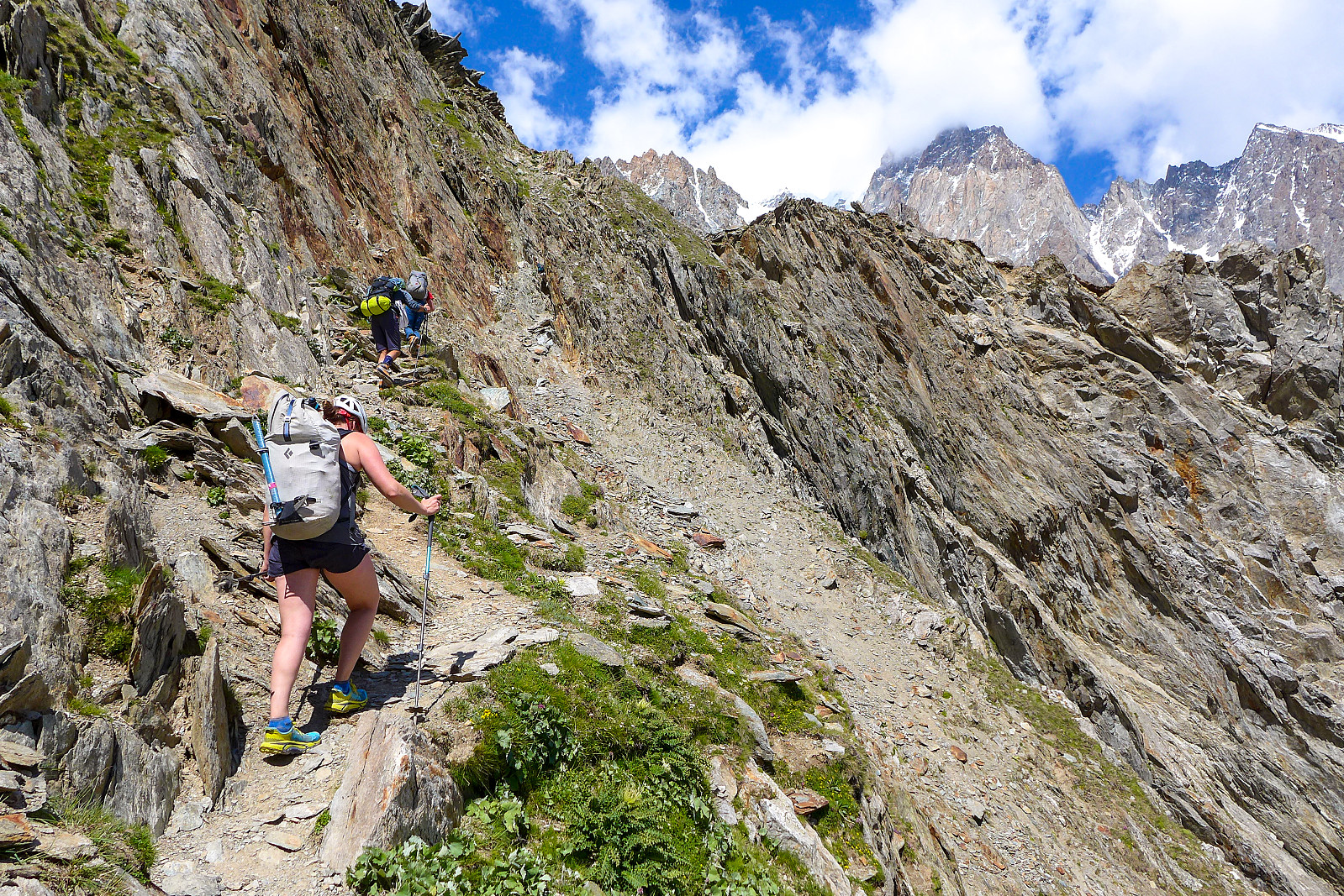
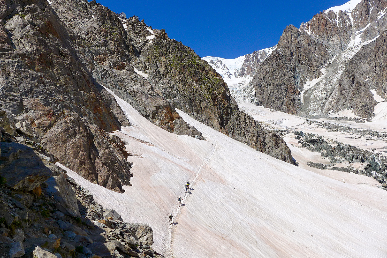
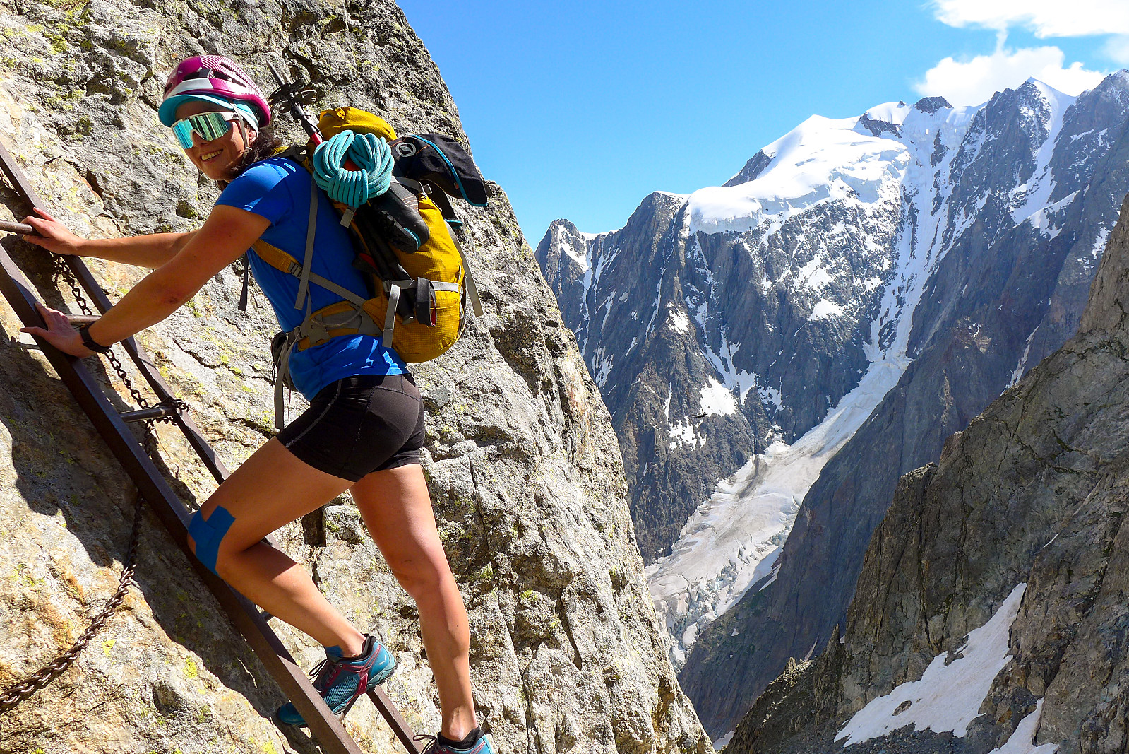
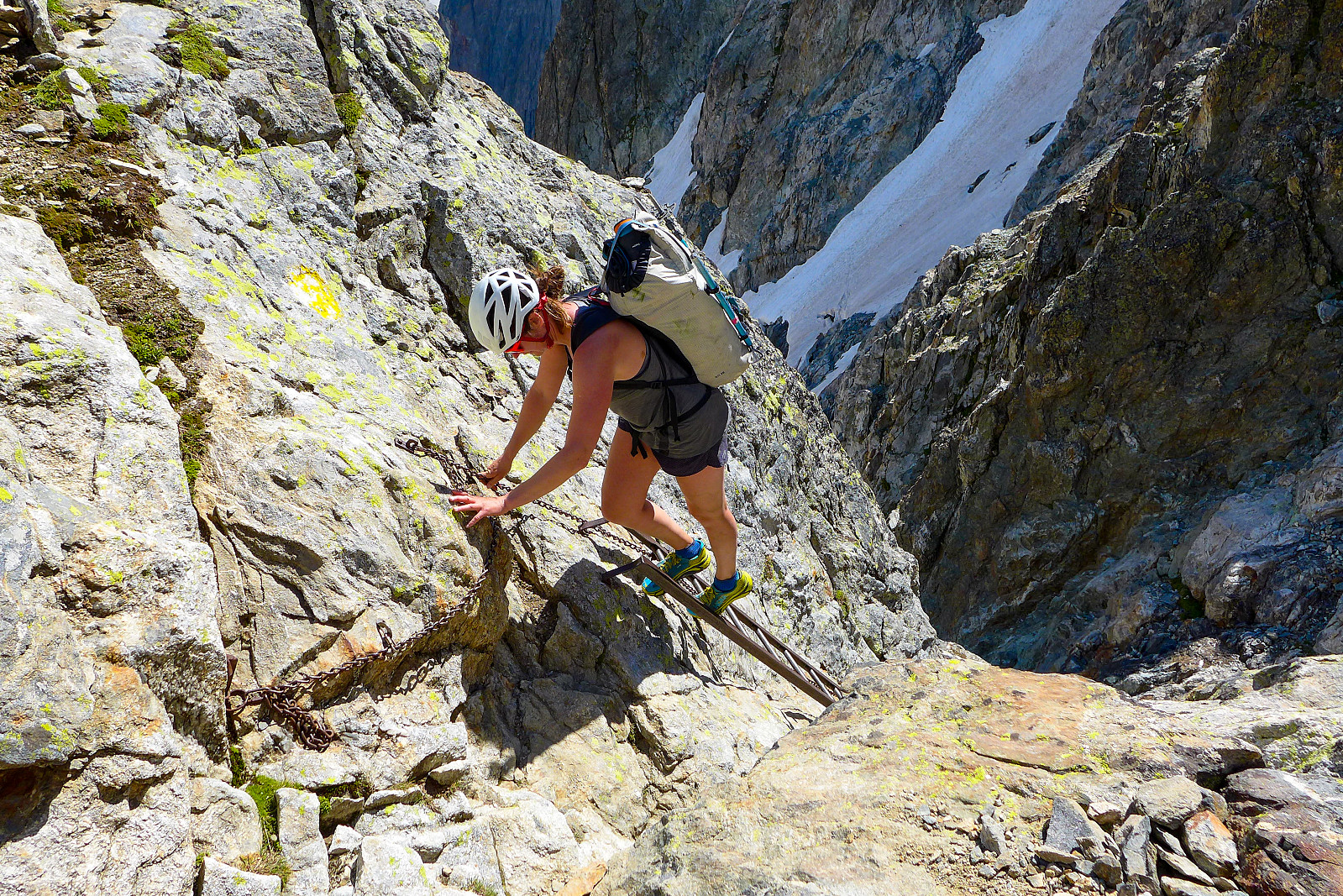
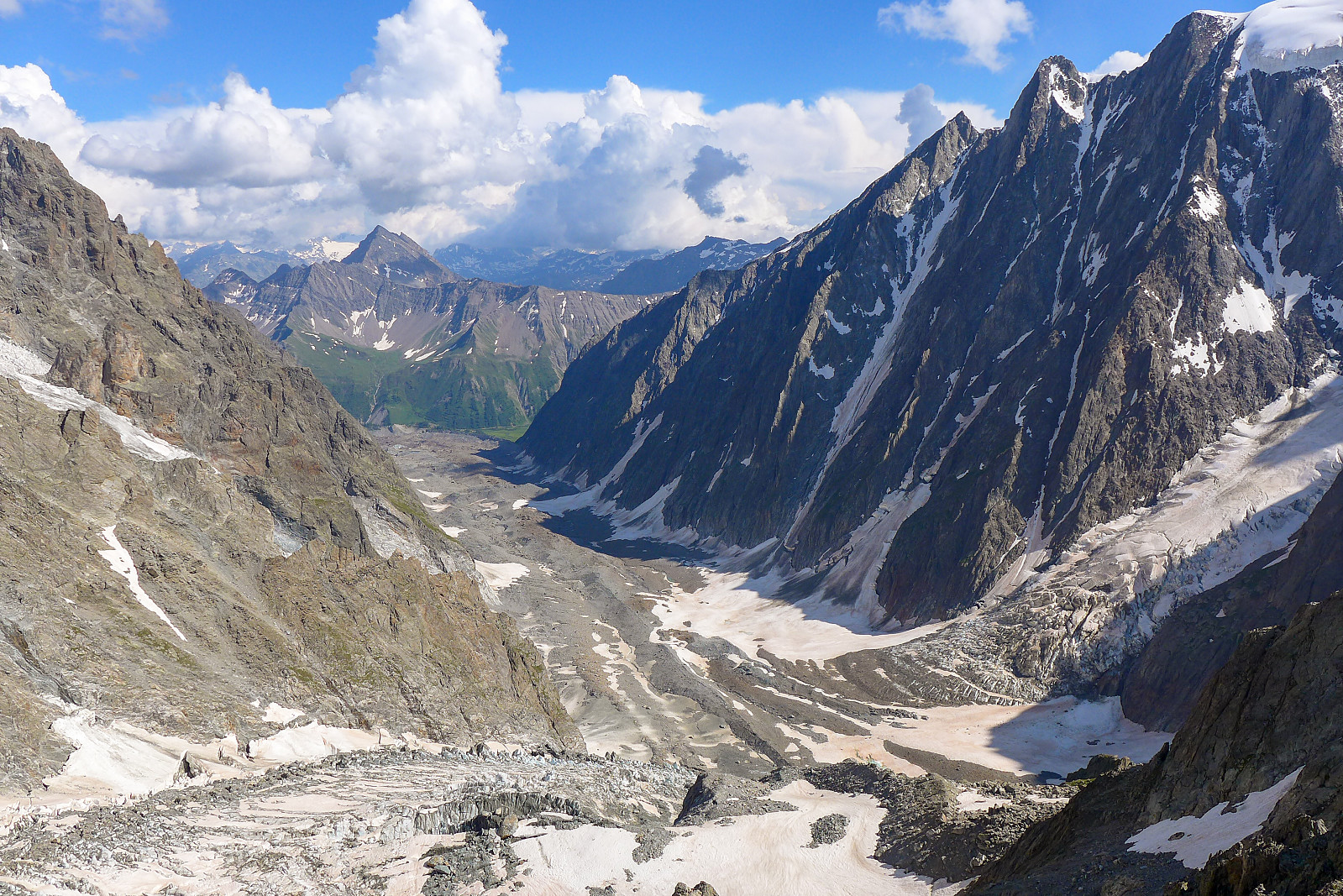
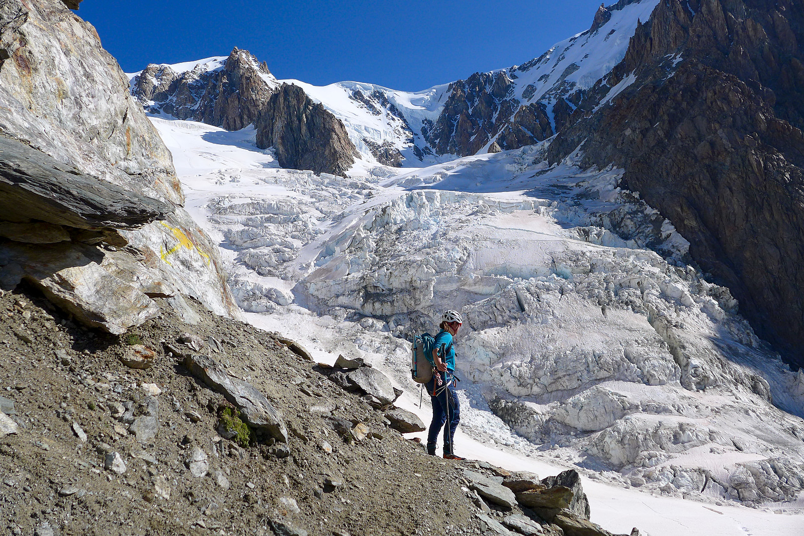
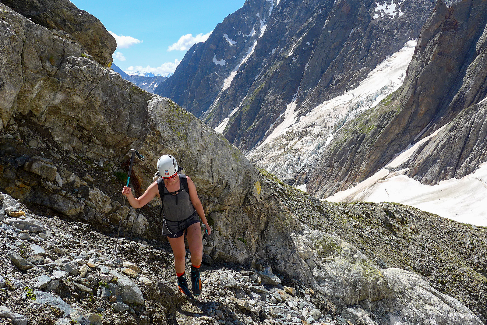
The approach walk for the Gonella hut doesn’t get the most inspiring description in Martin Moran’s guidebook for the 4000m peaks of the Alps, being described in the opening sentence as “An impressive but tiring walk with more than its fair share of boulder moraine and a stiff scramble to finish”. Martin Moran doesn’t seem to be a big fan of the majority of hut walks that are described in his guidebook, but I’ve generally found that they never turn out to be quite as horrendous as his descriptions might imply, so I assumed this hut walk would probably turn out to be a nice little expedition. It did. From La Visaiile there was a couple of kilometers to cover on a road/track which ends at the Cabane du Combal. Initially it felt a bit hard to get going again (moreso since I’d offered to carry the rope today) but the 45 minutes of easy walking made it a very pleasant start to get the legs stretched and warmed up again. The large majority of hikers we met on the track were only going up to the Lac du Miage so we left the crowds behind after a short break at the Cabane du Combal. From here a nice path leads up into a small woodland area before ascending out of the trees and following a moraine ridge on the south side of the Glacier du Miage. Here we got our first glimpse of the miles of rubble which had to be negotiated before reaching the snow covered part of the glacier later on. It initially appeared disheartening but once we actually got down onto the moraine it wasn’t actually that awful to walk on. There were some cairns placed here and there which proved helpful for finding our way through the rubble, but Tamsin had also recently hiked up to the Gonella hut so was at least partly familiar with the best route across the moraine. After some perservering we soon reached the start of the snow, which made the rest of the hike up the glacier much more pleasant. It was about 10km of hiking before we begun to cut across the glacier to reach the foot of the Aiguilles Grises at around 2600m. From here we followed a steep path which rose diagonally toward the right side of the rock buttresses. In places there was a bit of scrambling required while other places there were some chains installed in steeper sections. In any case it made it somewhat easier with a heavy rucksack! The final part of the ascent to the Gonella hut crossed over a snowfield before a series of via ferrata chains, ladders and rungs took us the fun way up the final rock section below the hut. If only all hut walks like this – it was like a longer and wilder version of the walk up to the Boccalatte hut, and I really enjoyed it all. The 12 km and 1500 m of elevation gain made it a dinner-earning hut walk in any case! From the heli pad outside the hut there was a really fantastic view down the Glacier du Miage, with the impressive steep walls of the Petit Mont Blanc guarding the right side of the glacier and the lower part of the Brouillard ridge on the left. The southern side of Mont Blanc is really an amazing place to visit.
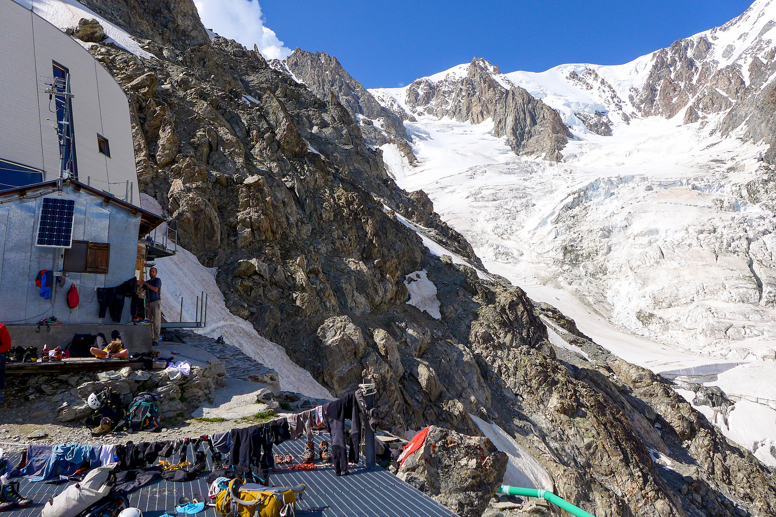
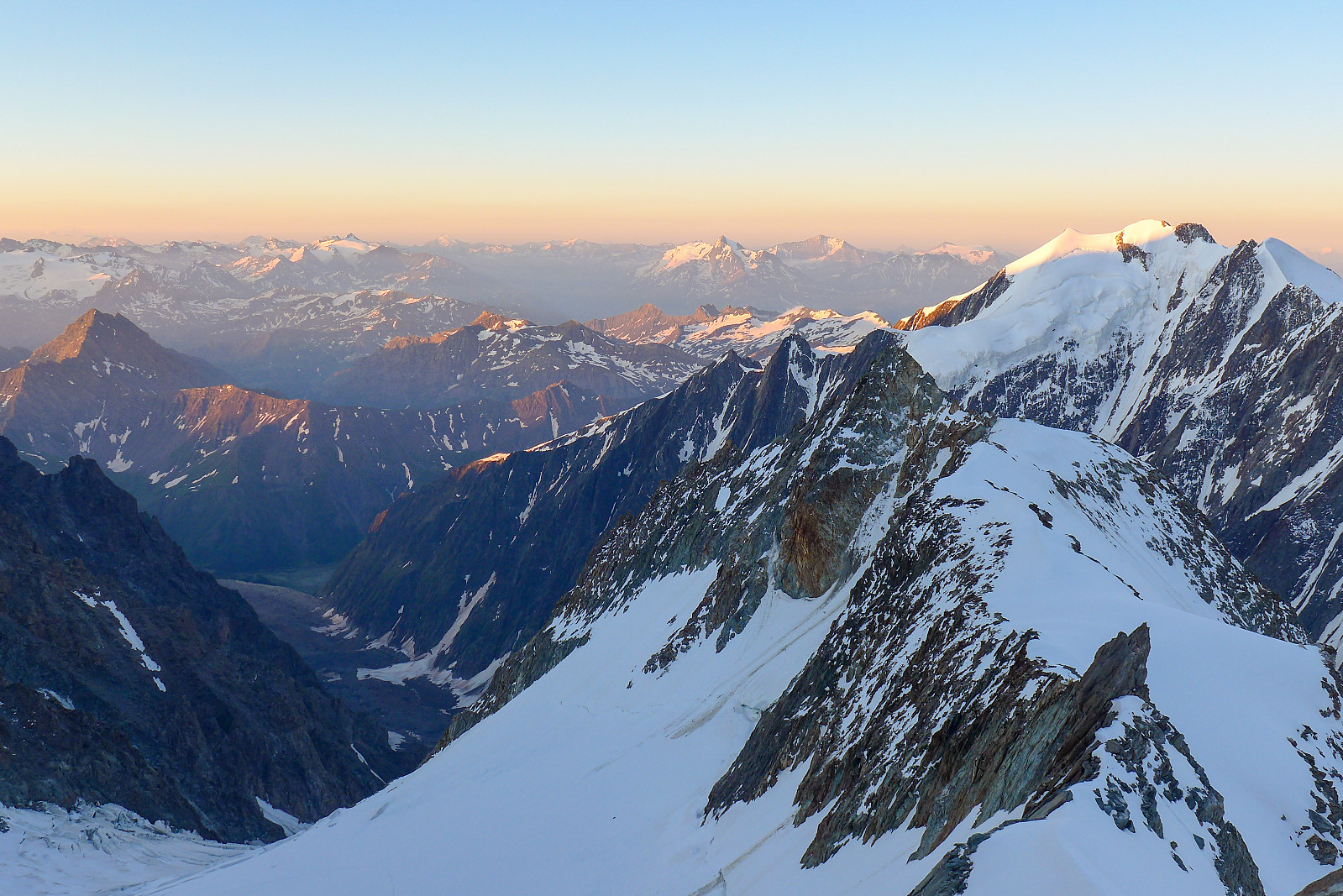
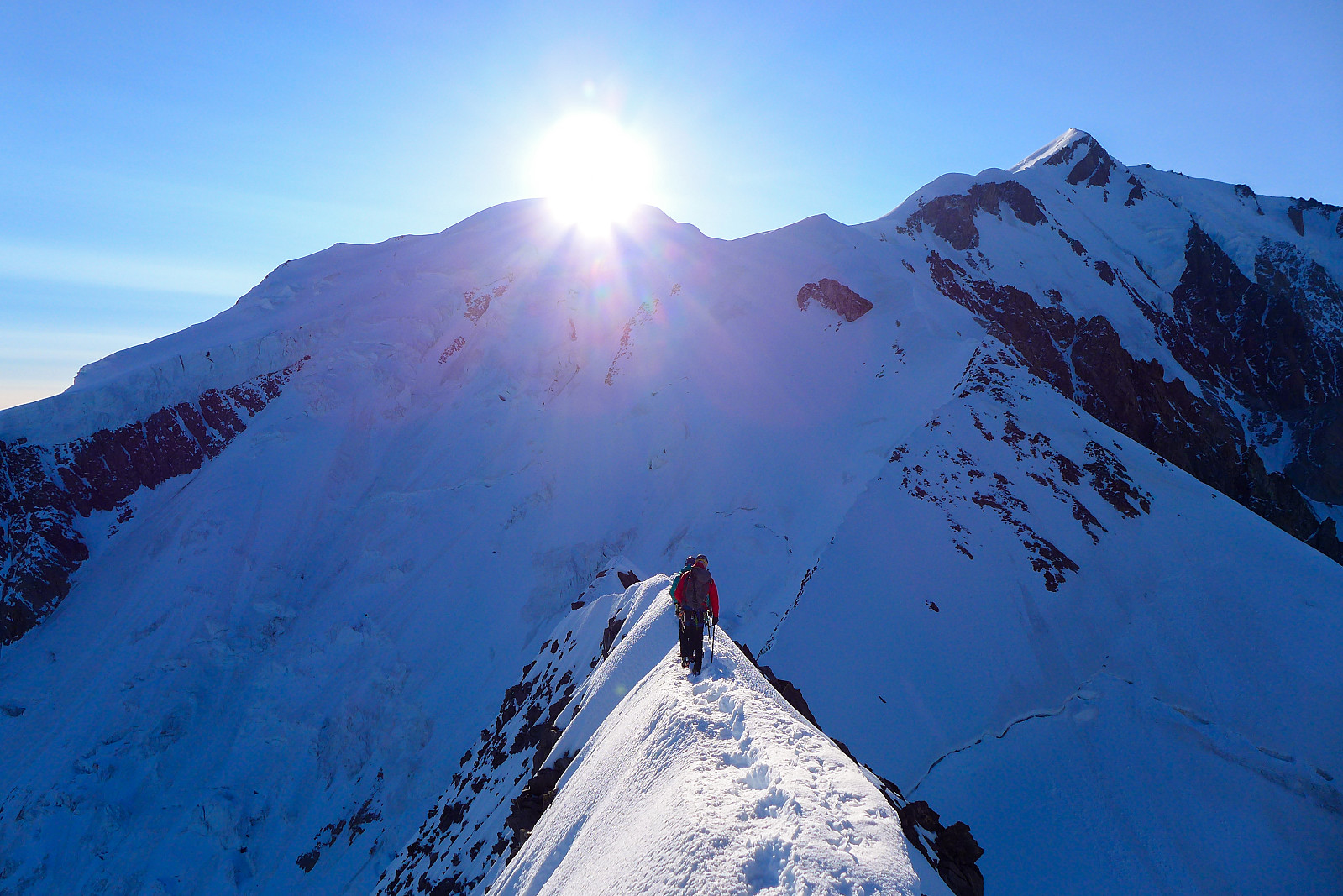
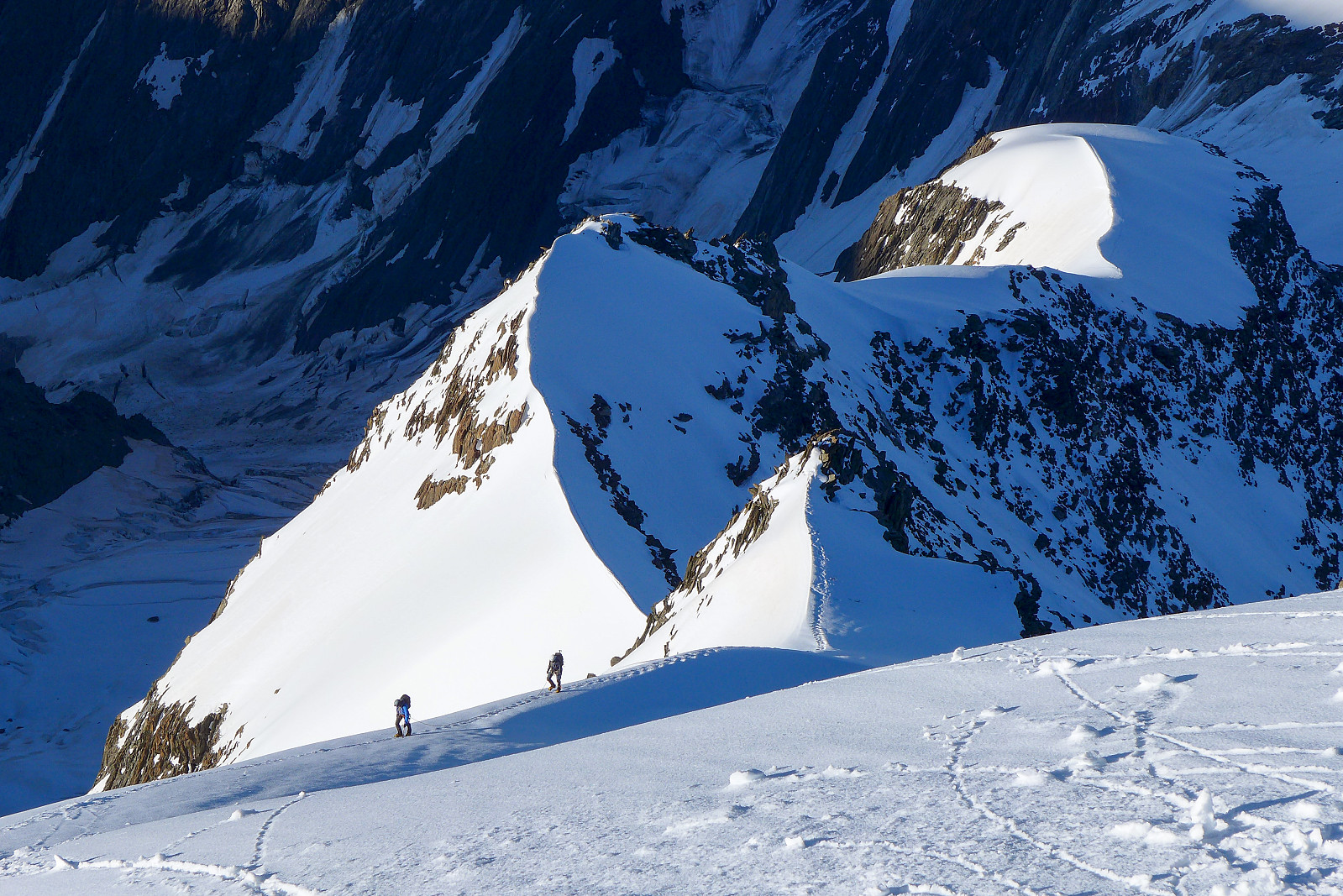
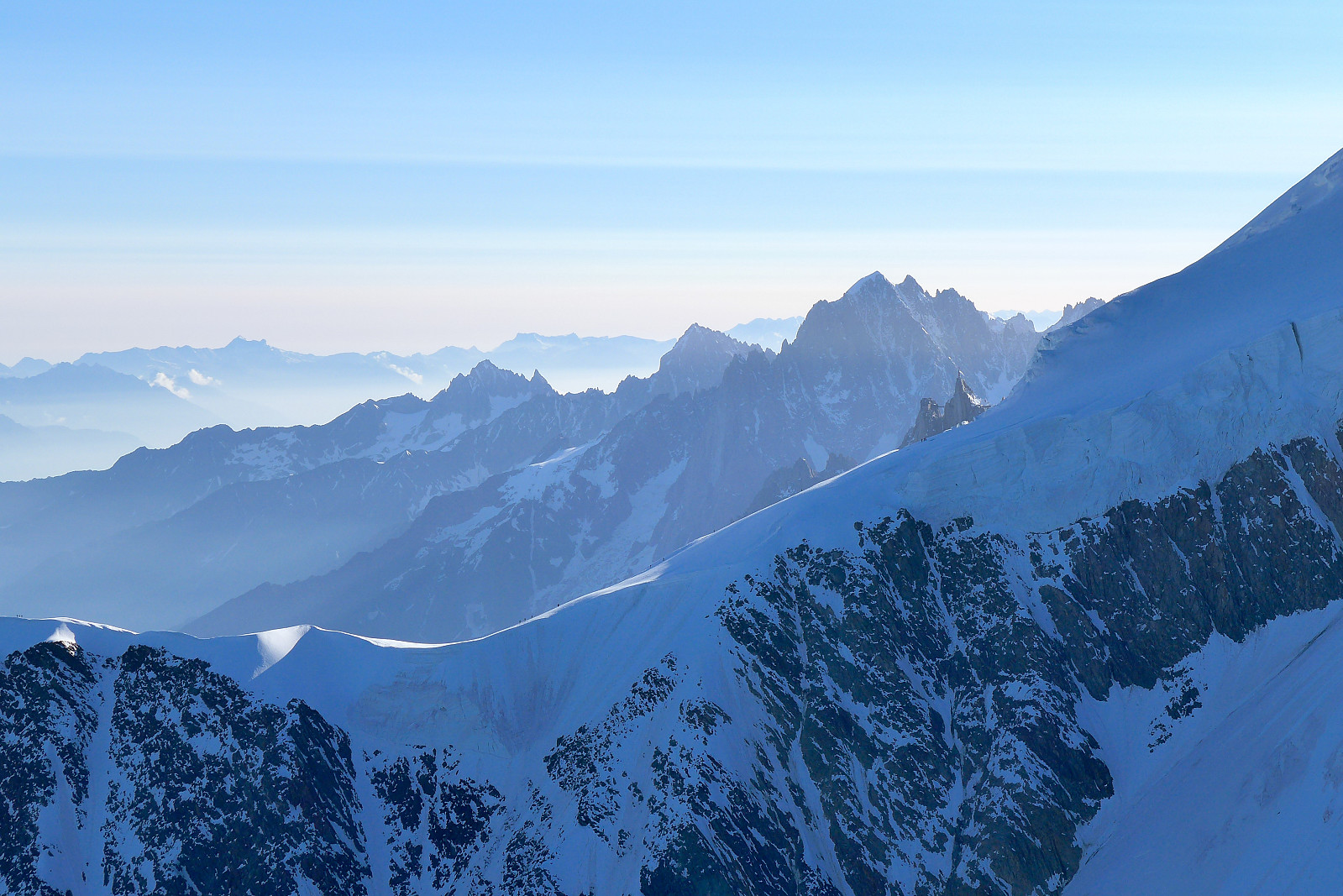
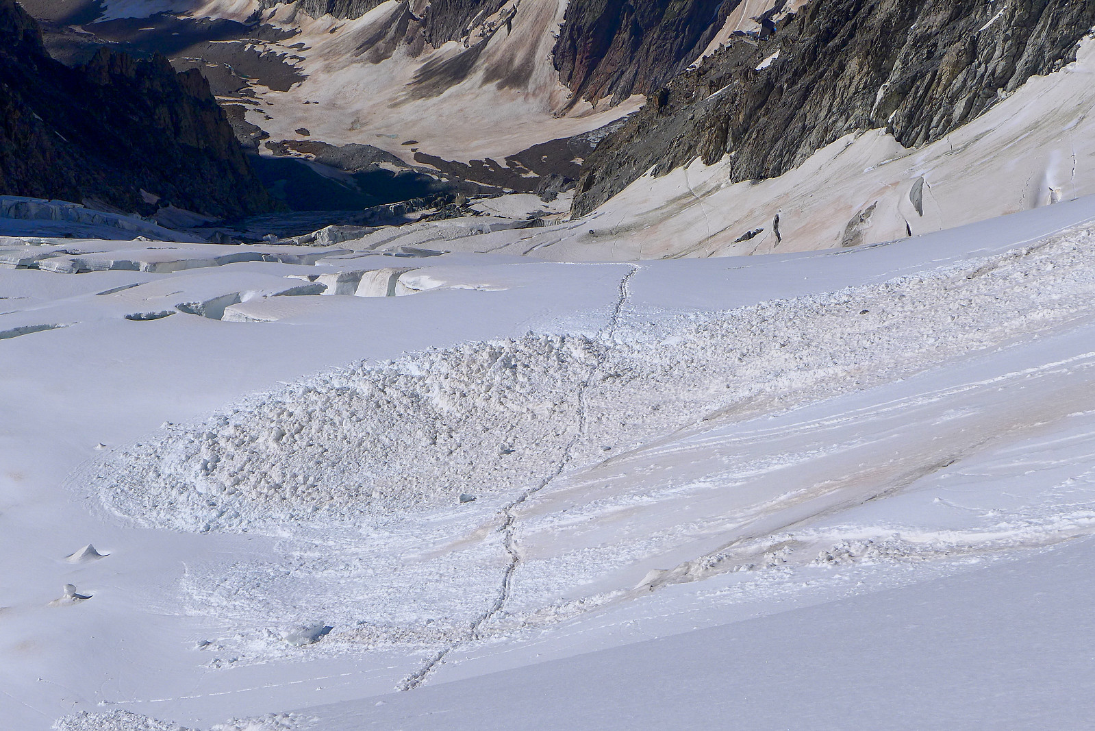
The dining room was fairly full with climbers who were planning on doing the Pope Route up Mont Blanc the following morning so we were probably going to have a quiet breakfast by ourselves the following morning since we didn’t need to get up as early as the Mont Blanc-ers. Unfortunately we didn’t get much more sleep than those going to Mont Blanc anyway since some inconsiderate old dudes decided it would be OK to talk for half an hour with the light on while there were clearly other people still trying to sleep. It almost sent me into a rage! We eventually pulled ourselves out of bed at 2.30am, ate breakfast and got ourselves ready to go. The main consolation for such a crap night’s sleep was the clear starry sky outside, promising a day of fine weather ahead. To reach the start of the east ridge of the Aiguille de Bionnassay we were basically following the same track up the Glacier du Dome to the Pitons des Italiens as those going to Mont Blanc, but at the Pitons des Italiens we would head down and west to the Col de Bionnassay and then up the East ridge. It would be yet another route with nearly 1000m of height gain plodding up a glacier to get to the start of the route! Seemed to be a common theme for most of the routes I’d done this summer……… The glacier plod went surprisingly quick, thanks to the well trodden track which all the Mont Blanc teams had made. There was some clear evidence of the recent avalanche cycle following the large dump of new snow from the previous week though, and I counted at least two lots of avalanche debris that the track crossed over. By the time we’d reached the rock ridge just below the Pitons des Italiens the first rays of sun had hit the Aiguilles de Tre la Tete on the south side of the Miage glacier and it was a stunning sunrise to watch. Plenty of photos were taken here! We continued up to the Pitons des Italiens, where a cold wind kept us keen to keep moving, and then descended diagonally right, downclimbing some steeper snow sections before eventually meeting an existing track going to the Col de Bionnassay. From here it was actually possible to see people heading up the Gouter ridge to the Dome de Gouter. It didn’t look nearly as cool as our route ;-)
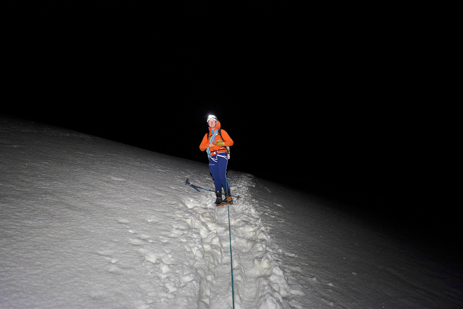
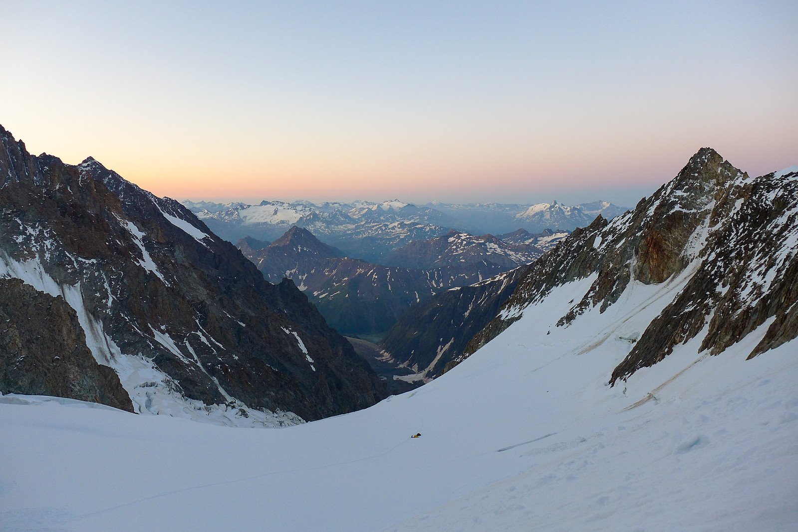
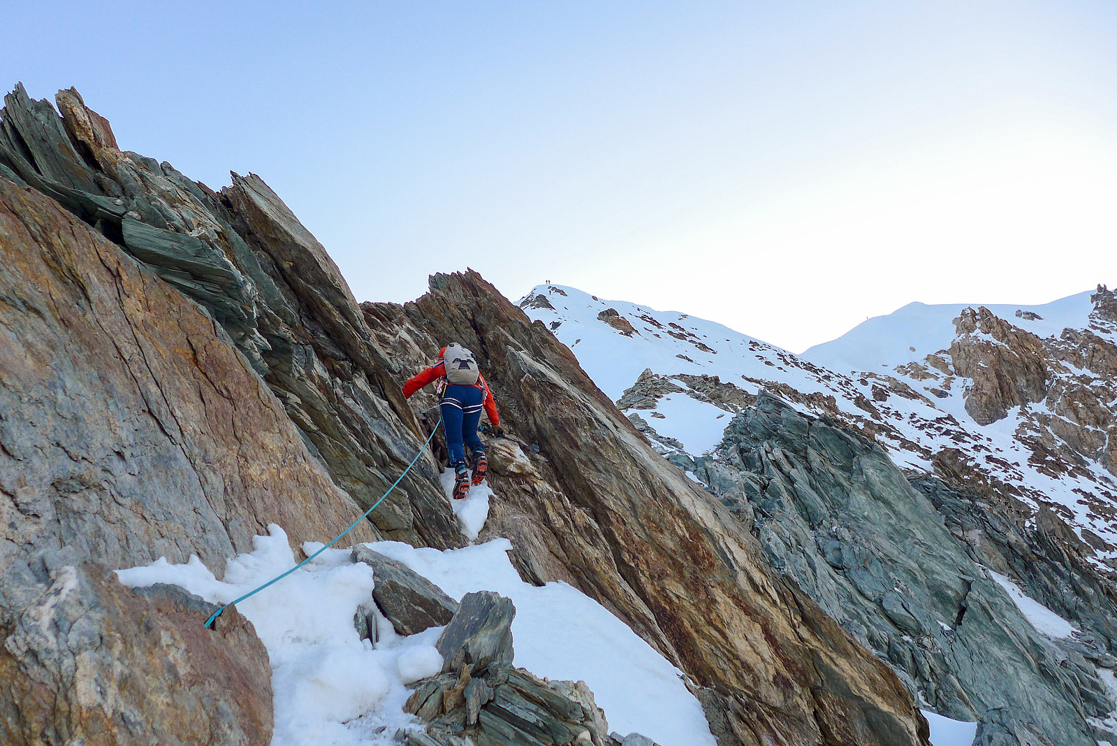
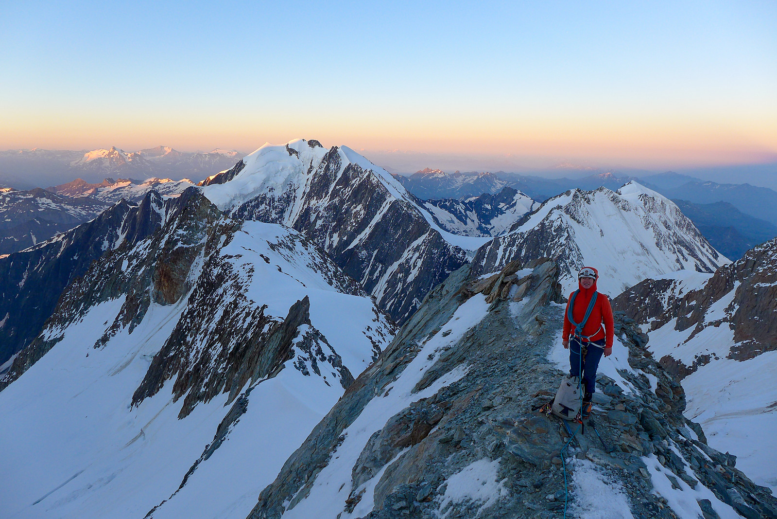
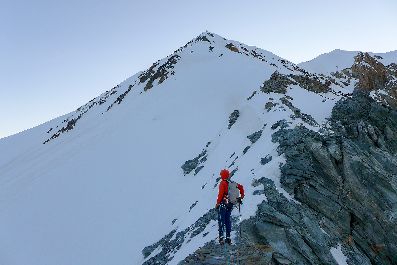
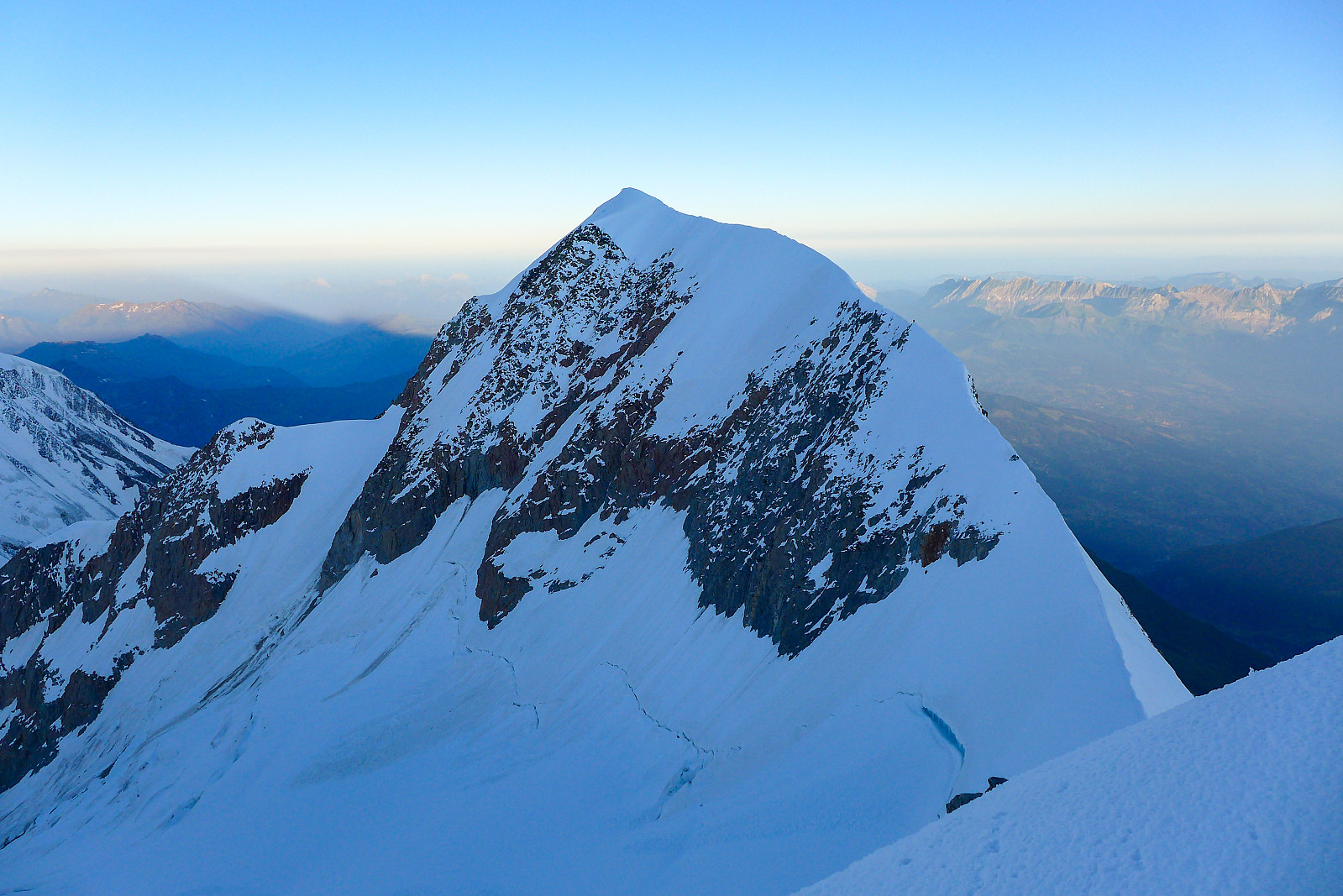
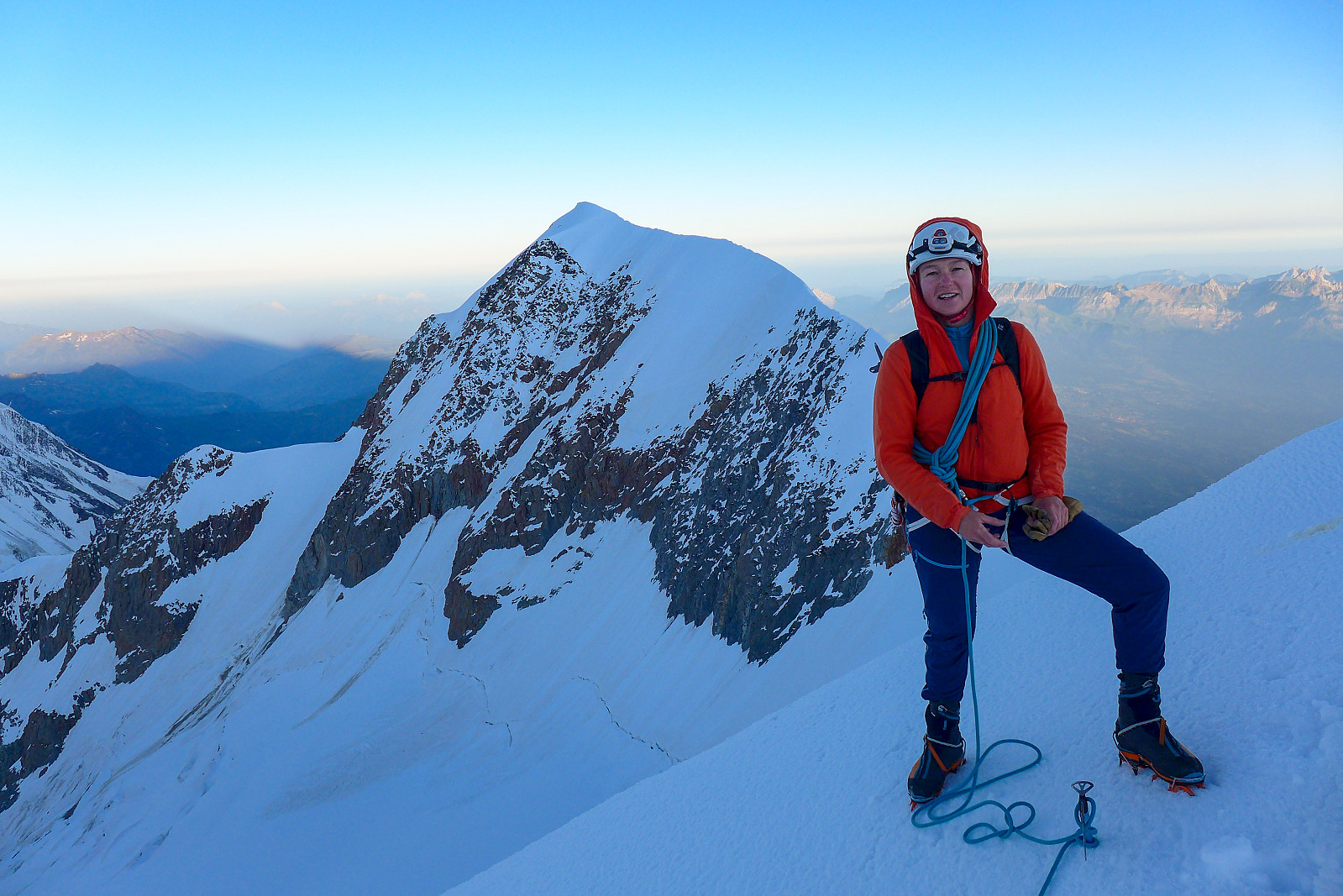
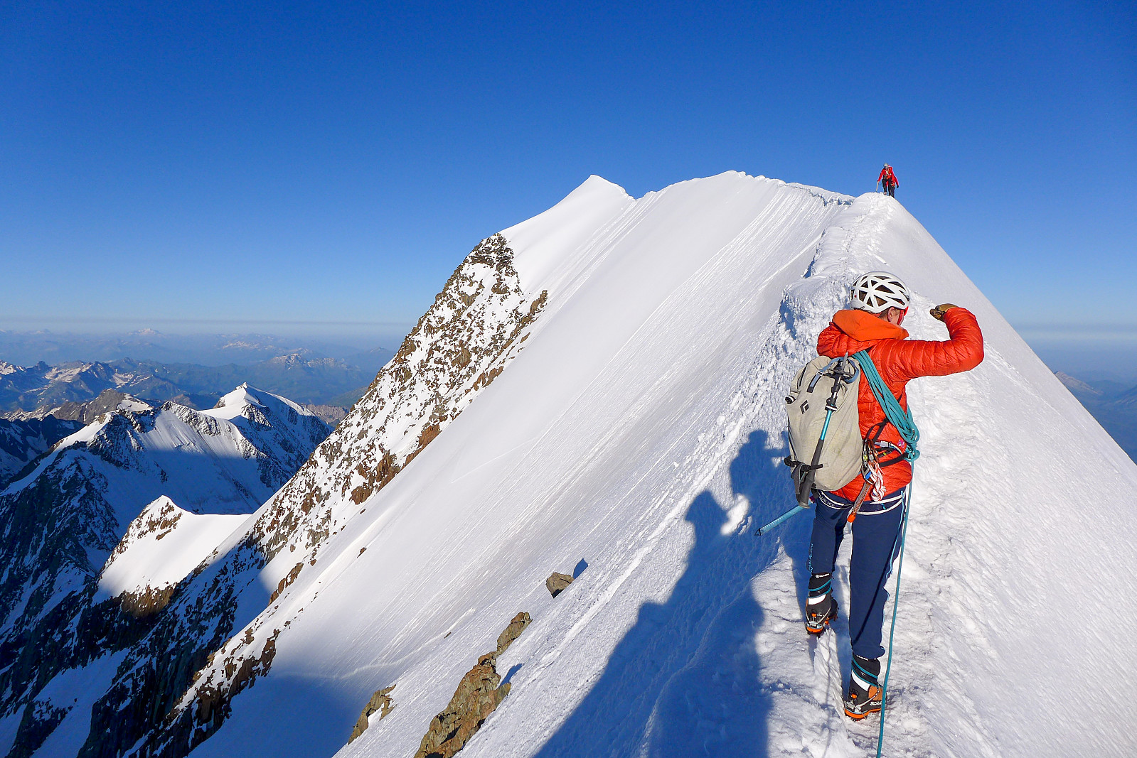
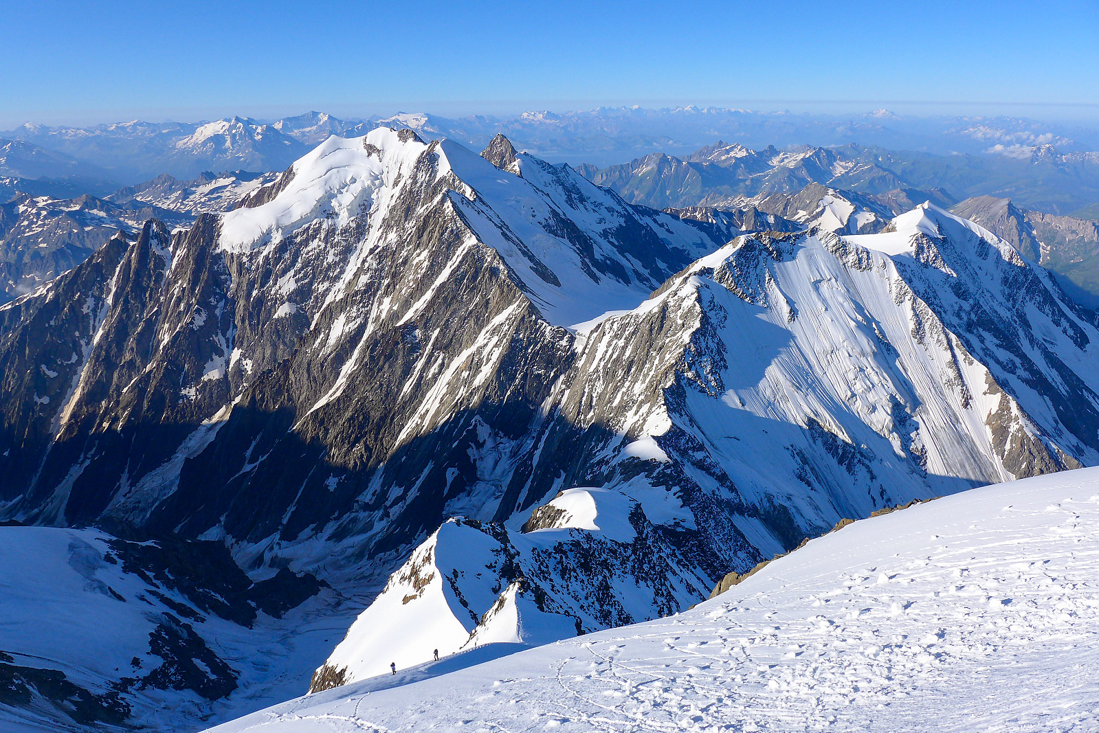
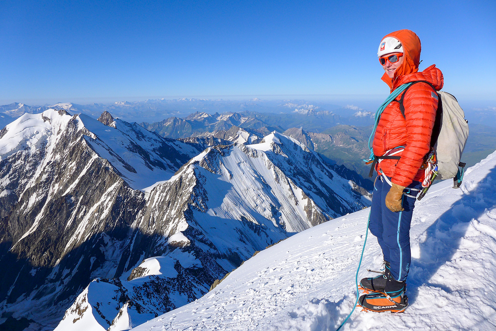
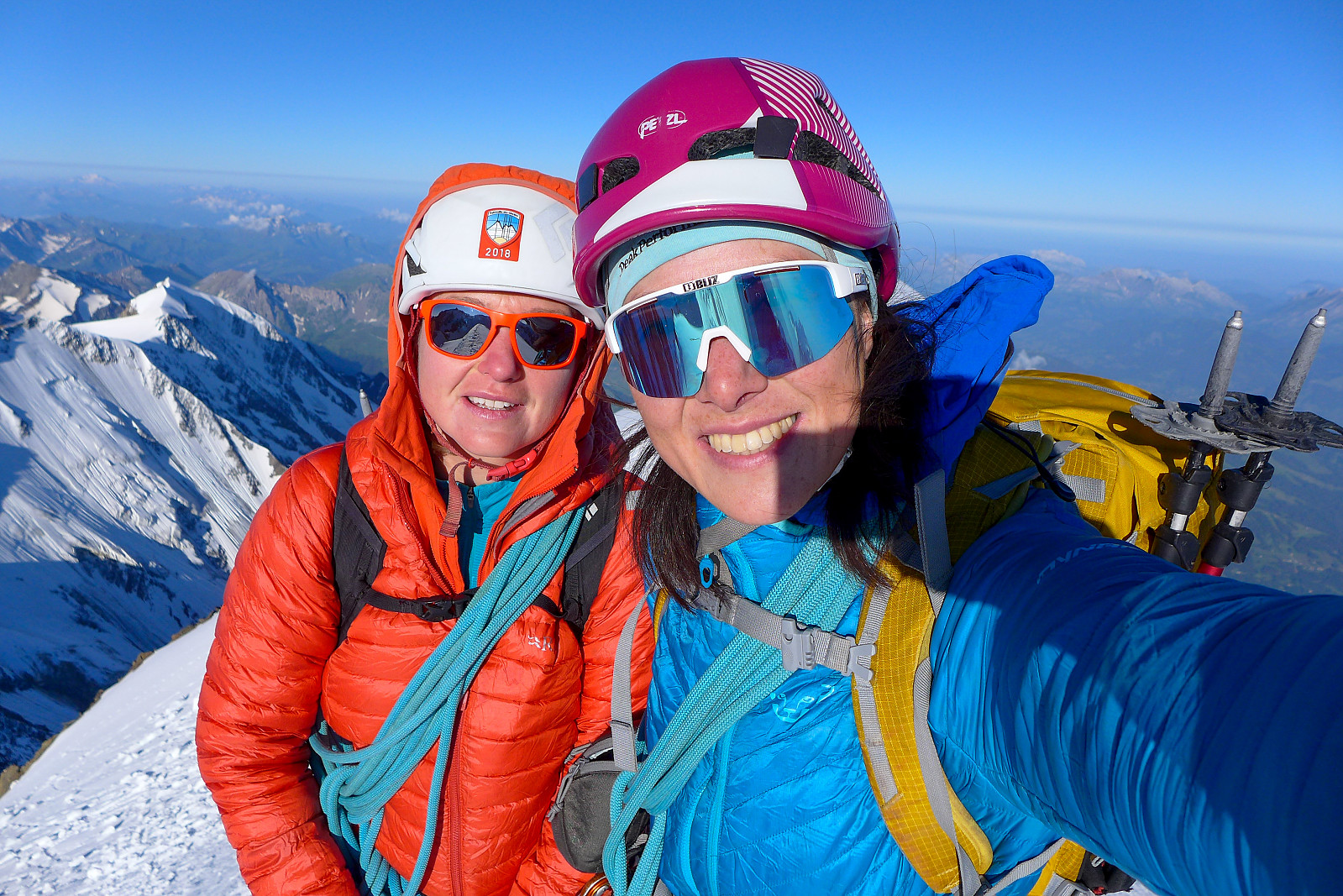
From the Col de Bionnassay it was a straightforward walk up the beautiful snowy East ridge. The snow conditions were top notch and the exposure was never too uncomfortable. But I like narrow ridges with a decent drop on both sides anyway, so it was perfect! We met one or two other teams who’d come up the south ridge from the Durier hut to traverse the mountain, so they were going in the opposite direction but other than that it wasn’t exactly busy fortunately. There wouldn’t have been much room to squeeze past on some parts of the ridge since it was literally only about 30cm wide at its narrowest…. The atmosphere was great though and Tamsin was pleased to be guiding on a mountain she hadn’t been up yet, so it was a bonus for us both. The summit itself was a little unexciting, but the views southwards were really terrific and probably my favourite. Eastwards we could see at least as far as the Aiguille Verte, with the silhouette of the Cosmiques lift and the Gouter ridge in front. Toward the north it was a bit more green and boring, but I guess looking towards Geneva is never going to provide a jawdropping view! Despite having walked in what seemed like a pretty slow pace, it had only taken 4h 15 to reach the summit from the Gonella hut, which is less than Martin Morans guidebook time, so we were both pretty pleased with our efficiency this morning. The excellent snow conditions and tracks probably helped a good deal though. It was a bit disappointing to have to turn around and head back down again, but we still had a long 1500m descent back down to the Val Veny to do from the hut so getting down to the hut earlier rather than later was ideal.
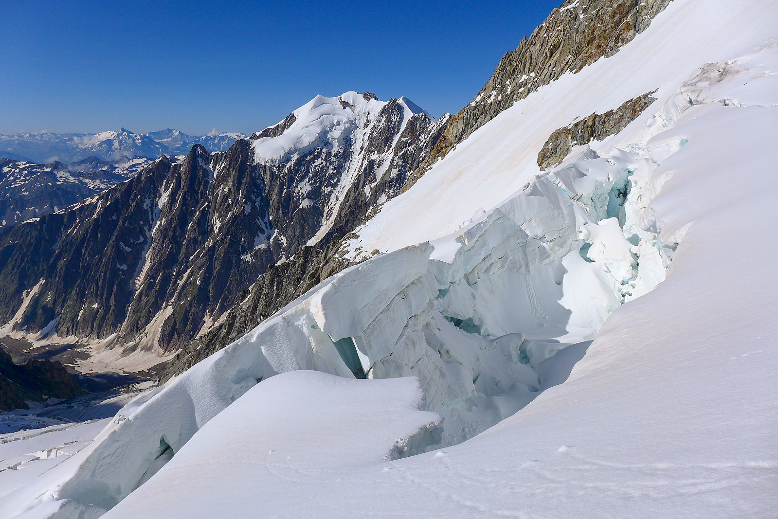
The excellent conditions made it a pretty rapid descent back down the ridge first to the Col de Bionnassay, and from there we made a sort of shortcut across some icy slopes below the Pitons de Italiens so we met the ridge again without having to go back up to the Pitons des Italiens and then back down. I actually found it annoying to walk across this part since it was steep and icy and the feet always end up rolling a bit sideways to get maximum crampon contact, so I decided instead to face in toward the slope and front point sideways for most of the way across. Other than that, no complaints :-) The remainder of the descent plodding back down the glacier was pretty easy, though being still early in the day (8am-ish) the snow hadn’t yet been softened by the sun so it was a bit harder on the knees than some of the other glacier descents of this holiday! It was also a bit of an eye-opener to see just how much avalanche activity there had been during the previous few days when we’d been in the Ecrins. There were both slab avalanches and pretty large wet loose snow avalanches which had also taken a fair amount of rock down from the mountainside with them. It was good that we’d not come here any sooner!
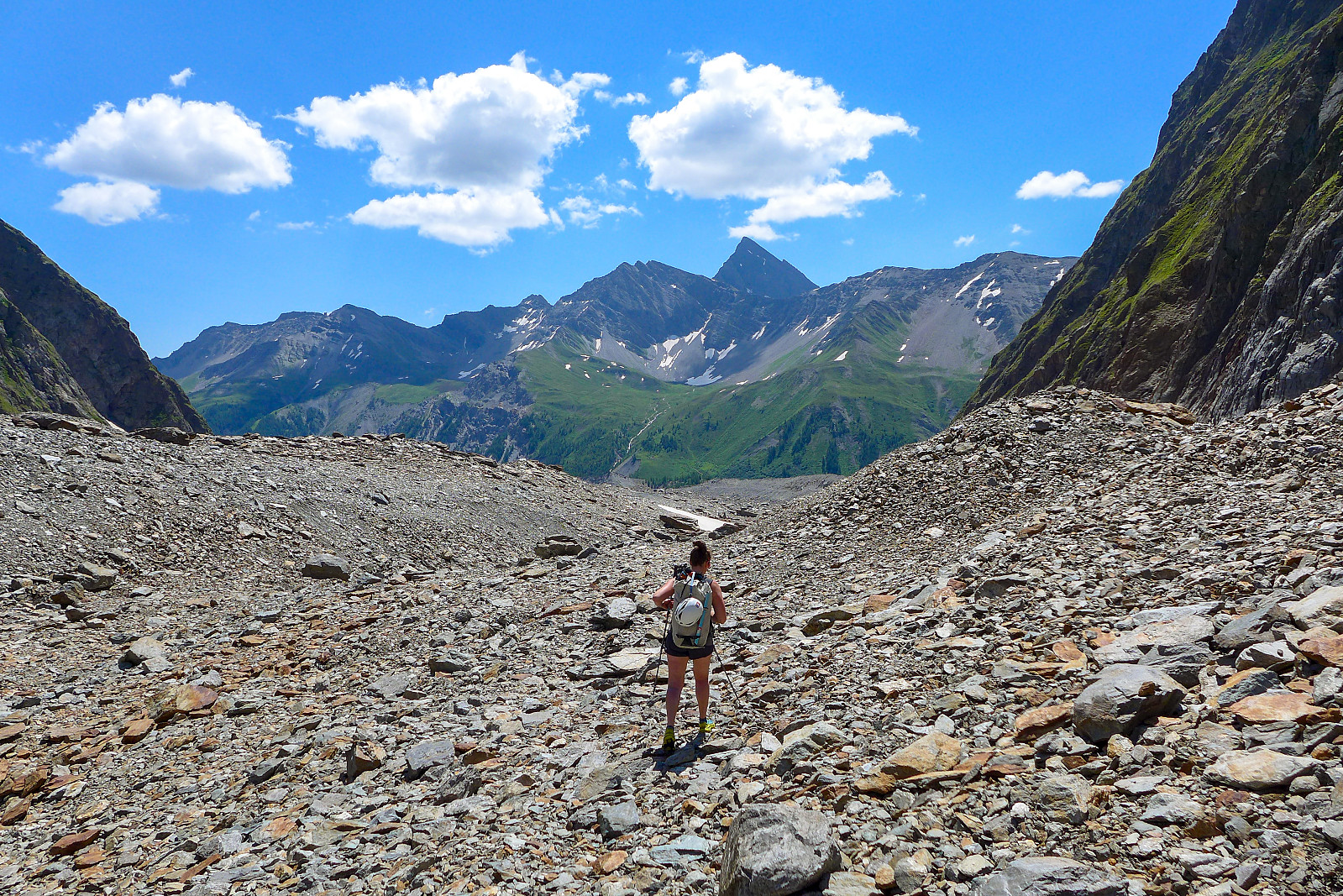
The descent took only 2 hours to get back to the Gonella hut, so we had ample time to relax in the sun and have a well deserved cold drink, as well as for repacking rucksacks and changing into shorts for the walk back down to Val Veny. In some ways it felt like we’d not had a proper summit day as it had been so quick both up and down to the hut…… We left after about an hour at the hut, first descending the via ferrata down to the snowfield, then crossing the snow to get back onto the path, and carefully descending the steep path back down to the glacier. We’d both kept our winter boots on for the snow, so it made surfing down the snow-covered part of the glacier very quick and a lot of fun. It felt like we’d covered loads of distance running down the snow, but we took a break I checked my watch and saw that we’d only moved about 3.5 km from the hut, which meant we had about another 9 km to go! Once we’d passed the snow for good though we changed back into trail shoes for the long walk across the rubble. This felt like a lot longer than when we’d gone up it the day before, but eventually the moraine ridge came into sight again and I felt mostly happy to have survived walking down the rubble without twisting any ankles! At least once we were back on the moraine ridge we could chill out a bit and know that there would be a good path and track all the way down to the car park. In all it had taken just a bit less than 4 hours to walk the 12 km back down from the hut, so it did end up being around a decent 10 hour summit day after all :-) Thanks to Tamsin for the top company, humour and guiding for the last two 4000m peaks of this summer!
| Start date | 20.07.2021 03:26 (UTC+01:00 DST) |
| End date | 20.07.2021 09:51 (UTC+01:00 DST) |
| Total Time | 6h 25min |
| Moving Time | 6h 21min |
| Stopped Time | 0h 3min |
| Overall Average | 1.8km/h |
| Moving Average | 1.8km/h |
| Distance | 11.7km |
| Vertical meters | 1,151m |


User comments
Super pretty!!!
Written by Skippy 30.08.2021 01:03T - 6 years until I can afford to come! Already counting down the days hahah
Re: Super pretty!!!
Written by hmsv1 30.08.2021 07:54Haha, I'm counting down the days til you're going to join me to the Alps too. How many years until you can afford to come to the Himalayas then? ;-)
Sv: Re: Super pretty!!!
Written by Skippy 30.08.2021 11:2616 unless I find a sugar daddy! Hahaha