
Gross Grünhorn & Grunegghorn (10.07.2021)

Written by hmsv1 (Hannah Vickers)
| Start point | Konkordia hut (2,781m) |
|---|---|
| Endpoint | Finsteraarhorn hut (3,024m) |
| Characteristic | Alpine trip |
| Duration | 11h 07min |
| Distance | 19.9km |
| Vertical meters | 1,996m |
| GPS |
|
| Ascents | Grünhorn (4,042m) | 10.07.2021 |
|---|---|---|
| Visits of other PBEs | Konkordiahütte (2,850m) | 10.07.2021 |
I haven’t spent much time exploring the Bernese Oberland previously, and the only two peaks I’ve climbed there before now – the Eiger and Schreckhorn sit more on the outskirts of the region rather than in the central part of the area. I’d always imagined my next visit to the Bernese Oberland would be on a pair of skis, having heard so much about how big the glaciers are and with rather large distances between the huts and 4000m peaks. Summer 2021 had other plans for me, with each sunny weather window being followed by a new big dump of snow in the mountains, which rendered a lot of steep snow routes avalanche-prone and the usually-dry ridges plastered in snow. However, a new weather window had appeared in the forecast and this time it looked like there might even be 3 full days of sunshine, which were beckoning to be used to the full! South-facing ridges were likely to be the best option since the new snow would clear quickest, so we eventually opted to head into the Bernese Oberland on a 4-day trip with a plan to climb the Gross Grunhorn via its southwest ridge and the Grunegghorn and then head over to the Finsteraarhorn to have a go at its southeast ridge, if most of the new snow had cleared after two days of sun. To get to the Konkordia hut, we could either get there by taking the world’s most expensive train up to the Jungfraujoch and then walk down the Jungfraufirn to the hut, or by approaching from Fiesch, which would save a lot of driving time and a lot of money, but also add several hours of walking to reach the hut. I insisted on the latter option because I object to paying extortionate amounts of money for uplift (especially if there are alternatives) and because I just like walking a lot :-)
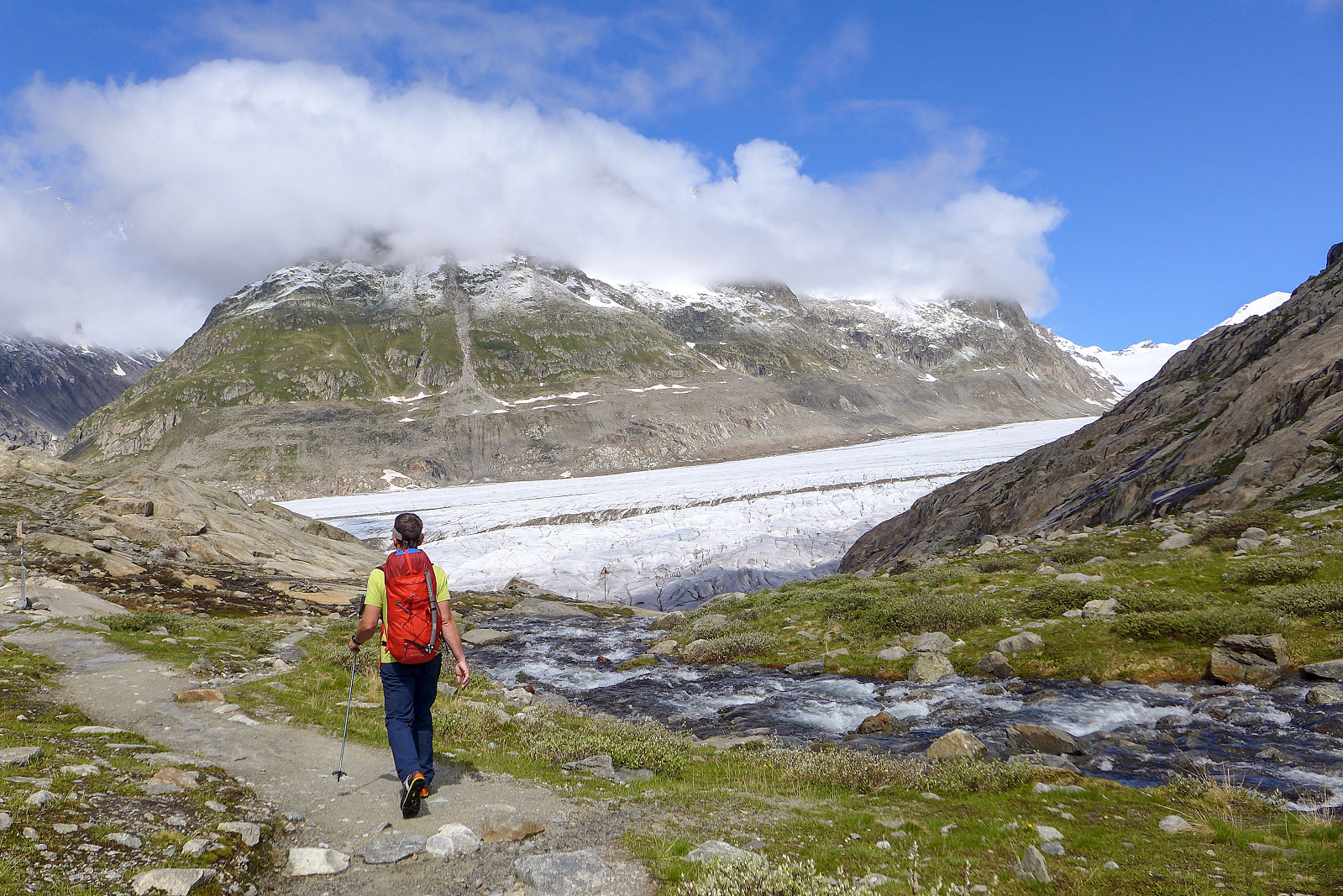
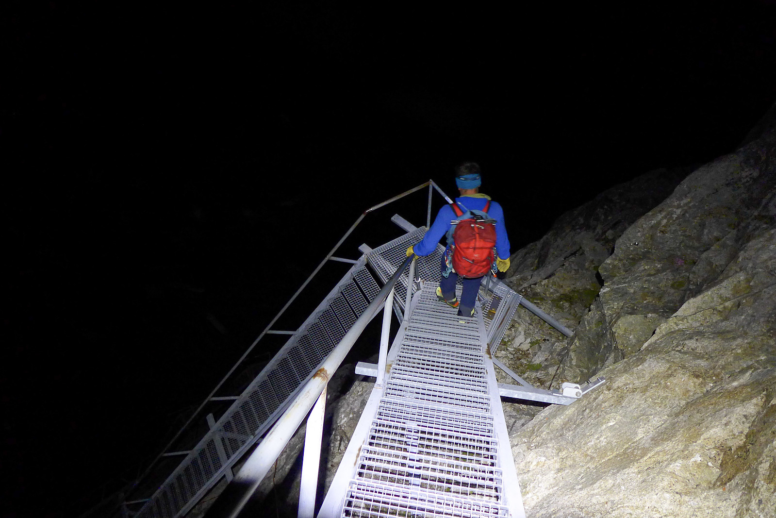
We made an early start to drive to Fiesch in anticipation of a 5 hour walk to reach the Konkordia hut. The cable car at Fiesch whizzed us 1000m up to Fiescheralp in virtually no time at all, where we got off into a thick layer of fog. We kept faith in the meteoswiss forecast though and expected the sun to burn it off at some point in the morning! The first part of the walk took us around the eastern side of the Eggishorn on what appeared to be a popular bike track. We were aiming for the small lake called Märjelensee which was on the north side of the Eggishorn and just east of the huge Aletschgletscher, but the little valley in which the lake was situated would basically be the entry point onto the glacier, at around 2200m. To get to the other side of the Eggishorn there was a 1km long tunnel which goes straight through the Talligrat. I’d never imagined walking through a tunnel as a shortcut to get to a glacier, but Switzerland probably has thought of everything to make mountain access more convenient... It was a bit of a dark, wet and chilly 15 minutes between entering the tunnel and emerging at the other side into the sunshine, and it was a relief to feel some dry warm air again and to finally see some snow-plastered mountains on the other side of the Aletschgletscher. We followed the path westwards and downwards, eventually reaching a very full river (not surprising since there was a flood warning issued for the Jungfraujoch area after the previous days’ torrential rain) which had to be crossed. Boots with integrated overgaiters turned out to be a very good choice of footwear at that point and I made it to the other side with dry feet! Getting onto the glacier was less of a challenge and the ice was very rough and grippy, which made it quite easy to walk on in stiff boots without needing to put on crampons. In fact by the time we’d hopped over dozens of crevasses and got onto the middle of the glacier we didn’t need to use crampons at all since the glacier was virtually flat. It was basically dry glacier and moraine for most of the distance up to the Konkordia hut, and any crevasses that we did have to cross were visible, so we walked unroped until the last ca. 1 km when we did meet some suspicious snow-covered areas which were probably covering up some crevasses. Here we put on harnesses and roped up for glacial travel to cross the final part of the glacier leading to the steep cliffs below the Konkordia hut, just in case the snow bridges turned out to be weak and one (or both) of us went through! Fortunately none of that happened though and we arrived at the start of a long series of stairs going up the 150m of cliff face to the Konkordia hut. As already mentioned, the Swiss have everything figured out when it comes to accessibility in the mountains!
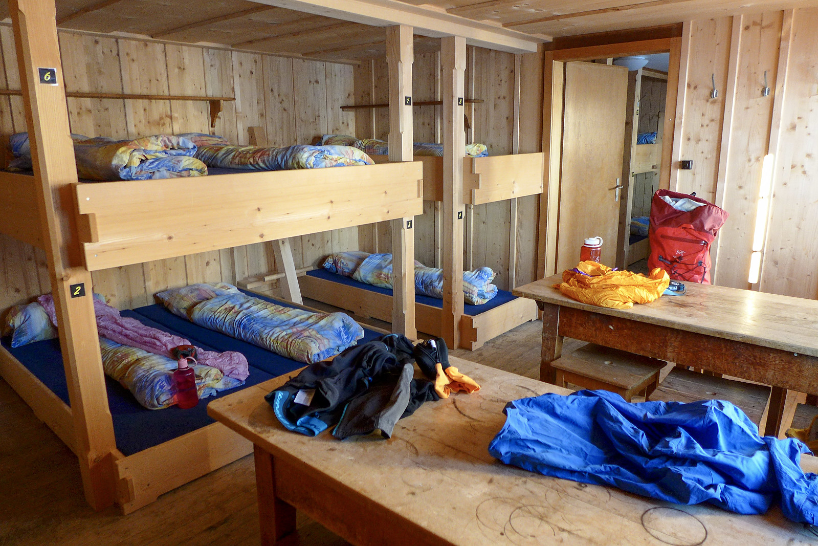
We’d made quite efficient progress up the dry part of the glacier, but the final kilometer or so tip toeing carefully across the snow covered crevasses had taken a fair bit of time, so by the time we’d slogged up the stairs to the hut it had taken nearly 5 hours to get there from Fiesch, and about 13 kilometers of walking. It was still only mid afternoon though, and the views across the Aletchgletscher to the surrounding peaks were incredible. Outside the hut there were benches with parasols and a bar, so there was everything anyone could ever need to enjoy the afternoon having a cold drink in the hot sunshine whilst soaking up the views. The interior of the hut is also pretty modern and the dormitories weren’t huge, and it looked like we’d only have the company of one other French couple in ours. However, having identified that there was also a winter hut adjacent to the main hut which was not being used we thought we might as well ask the hut staff nicely if we could move into there anyway (the excuse being that we were planning a 2.30am start and didn’t want to wake up the others in the dormitory who weren’t planning to get up early)…. which worked surprisingly well and they actually said yes to the request, so we ended up having the whole winter hut to ourselves :-) The approach to the Grunegghorn was visible from behind the hut, but despite much squinting up at the south facing slopes we still couldn’t see any sign of a track. Just a lot of snow to break trail in! After dinner we headed down to the winter hut to go to bed, though I thought I would try and hang around outside for a while to get some pictures of a nice sunset. This plan was never going to work though since the sun disappeared behind the mountains on the other side of the glacier long before the sun actually set.

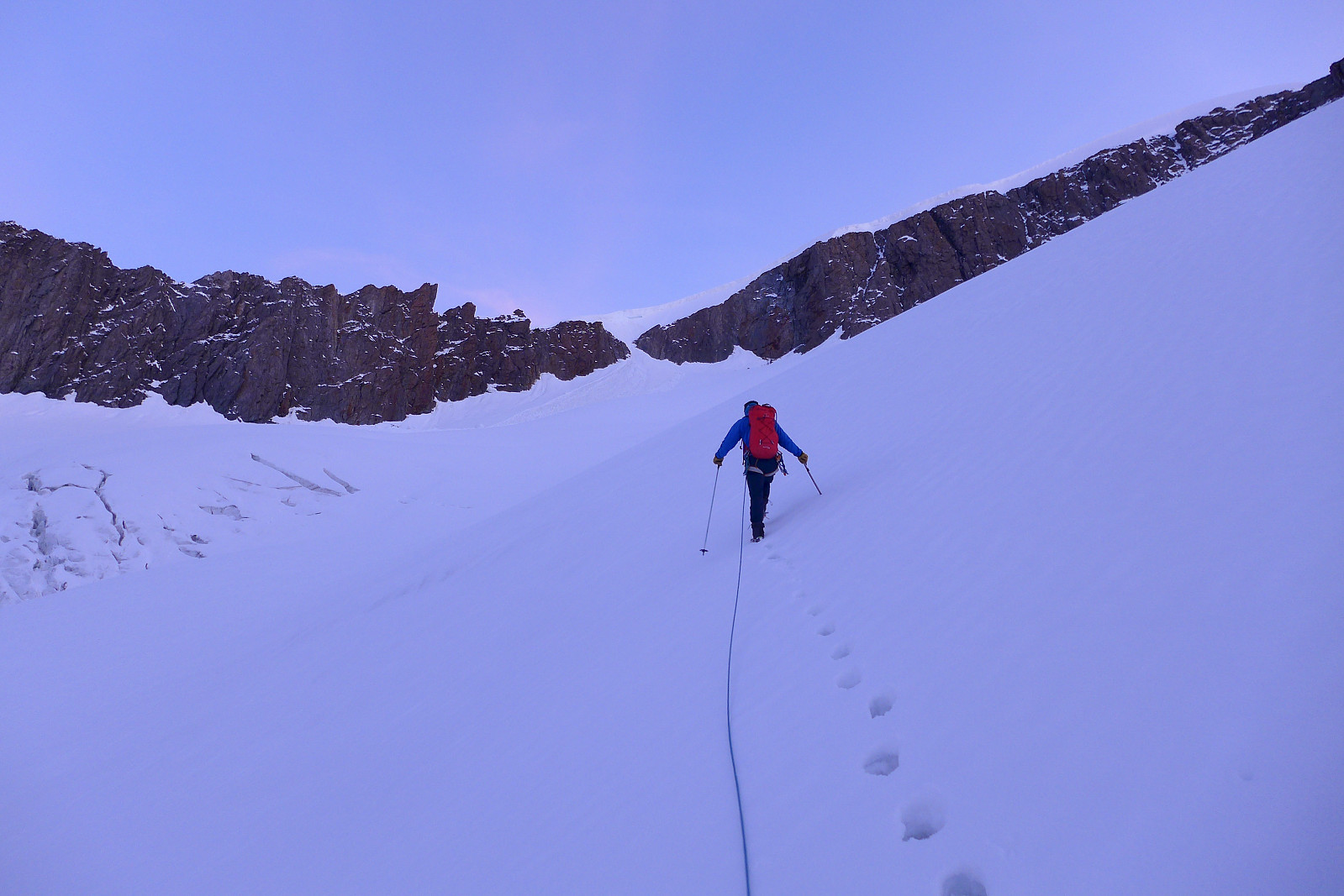
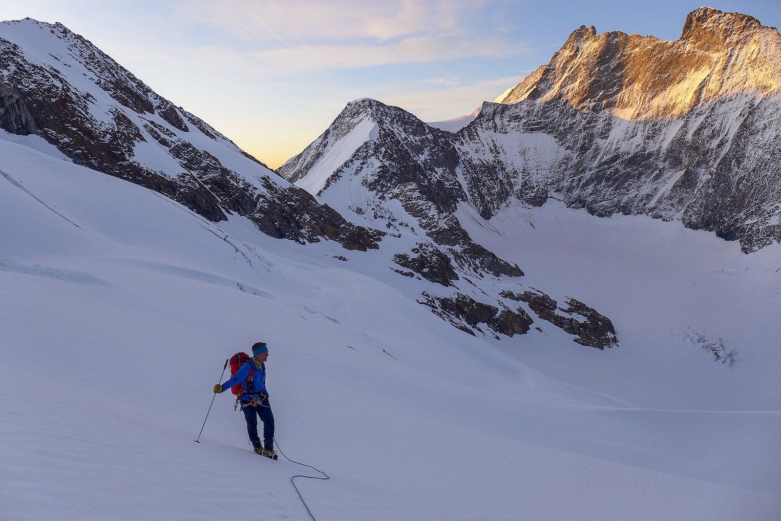
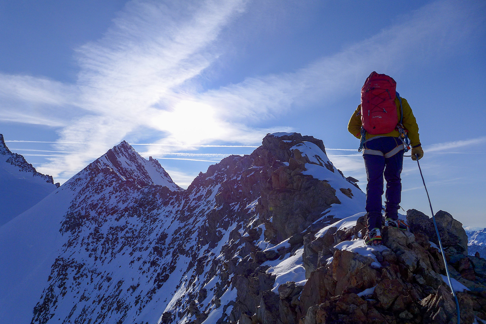
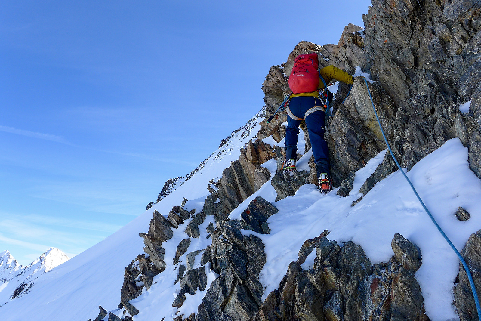
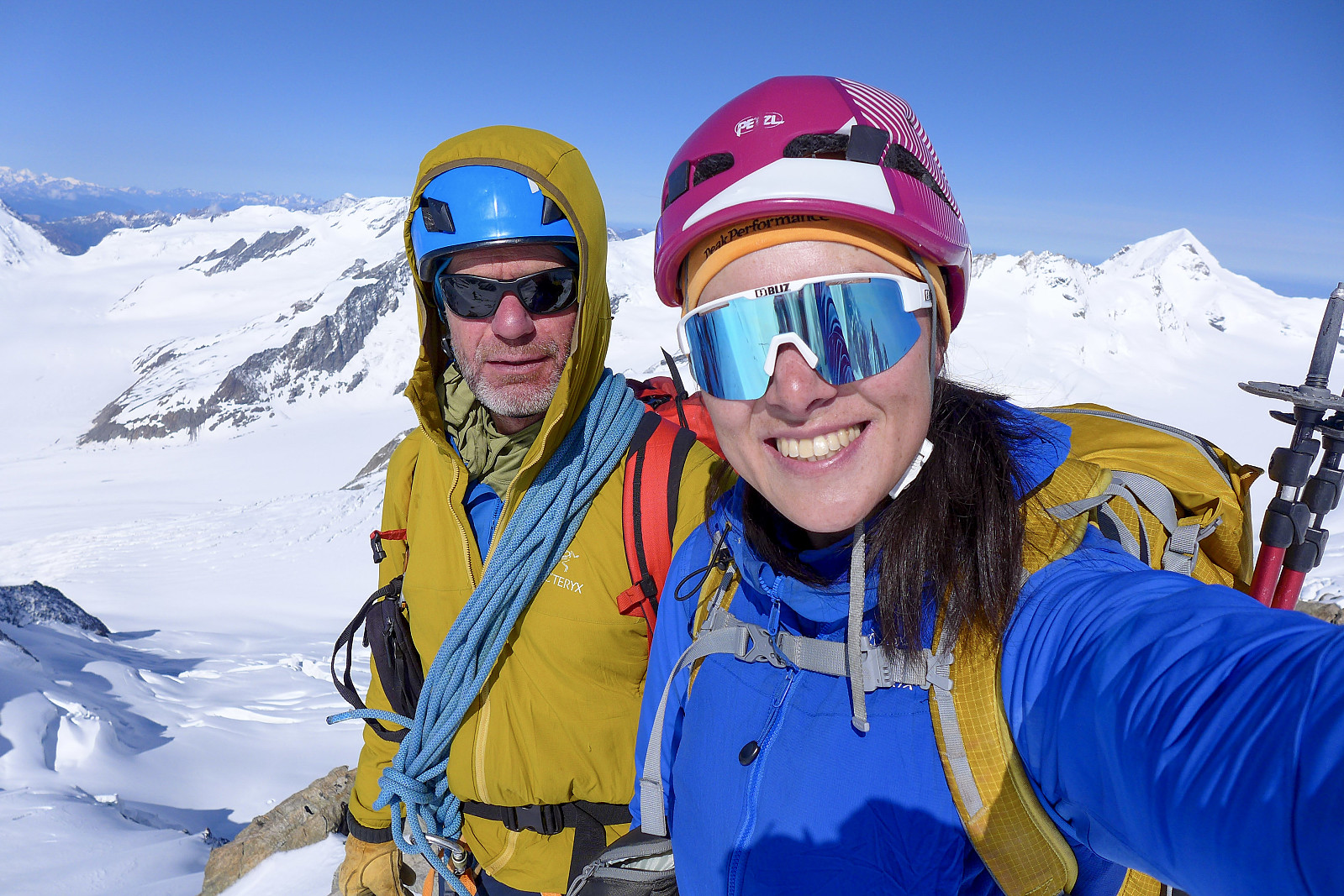
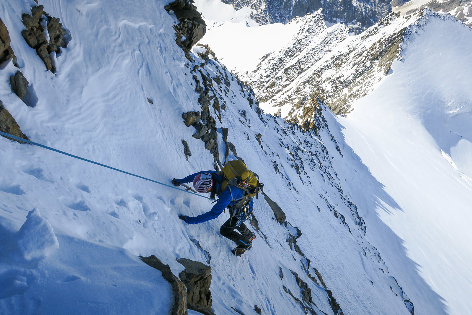
It was a chilly night in the hut and it was almost a relief to have to get up at 2.30am and have breakfast in the main hut. I’d spotted to guys already leaving just as we were heading up to the main hut for breakfast so I was secretly hoping that they were also planning to go to the Gross Grunhorn and would start off the trail breaking ;-) We left soon after 3am and began the walk back down the stairs to get back down to the glacier where we began the 2km plod up the Gruneggfirn. The air was still but fresh and the slow walk to approach the south facing slopes of the Grunegghorn was a rather nice way to wake up. The snow down here was nicely frozen and firm to walk on, so progress was efficient and at around 1 km from the Grunhornlucke we left the main track and headed off toward the north to continue the approach to the southwest ridge of the Grunegghorn. Not so long after leaving the track it became obvious that the snow conditions weren’t going to be optimal though, since only the surface had frozen but the snow beneath was still soft. Breakable crust hell had just begun.... There was some 500m of height gain to reach a small couloir which would lead to the upper slopes of the southwest ridge, and basically all 500 of these metres were on breakable crust. I offered to take over the trail breaking for a bit so Graham could have a break, but soon found out that there was a critical weight threshold for breaking through the crust. It appeared that I was below the threshold and didn’t actually break through, while Graham behind was still having to break trail for himself, so my offer of trailbreaking was clearly not helping here! The views of the Aletschhorn and the Fiescher Gabelhorn behind us were second to none though, so it was a nice consolation for putting up with the hopeless snow conditions. Just before the couloir we could spot the two other guys who’d left the hut before us and we soon caught them up. They’d clearly taken a different line of approach to us since we didn’t find their tracks! Once we’d surmounted the steep wall to the right of the couloir we took a new break to have a drink and something to eat since it was about time for a second breakfast now anyway. From here we could see the start of the ridge, but there was still more snow to plod up to get to it, and the conditions hadn’t improved. In some places we sunk up to the knees in snow, but the distribution of the crap snow was a bit random. There would be stretches of more consolidated snow where we walked on the surface, then suddenly we’d hit a new patch of breakable crust again which was pretty demoralising. Still, perseverence paid off and we got onto the ridge at the earliest opportunity!
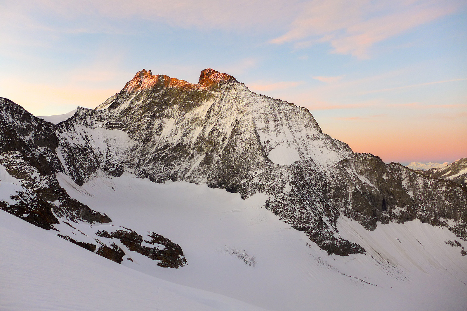
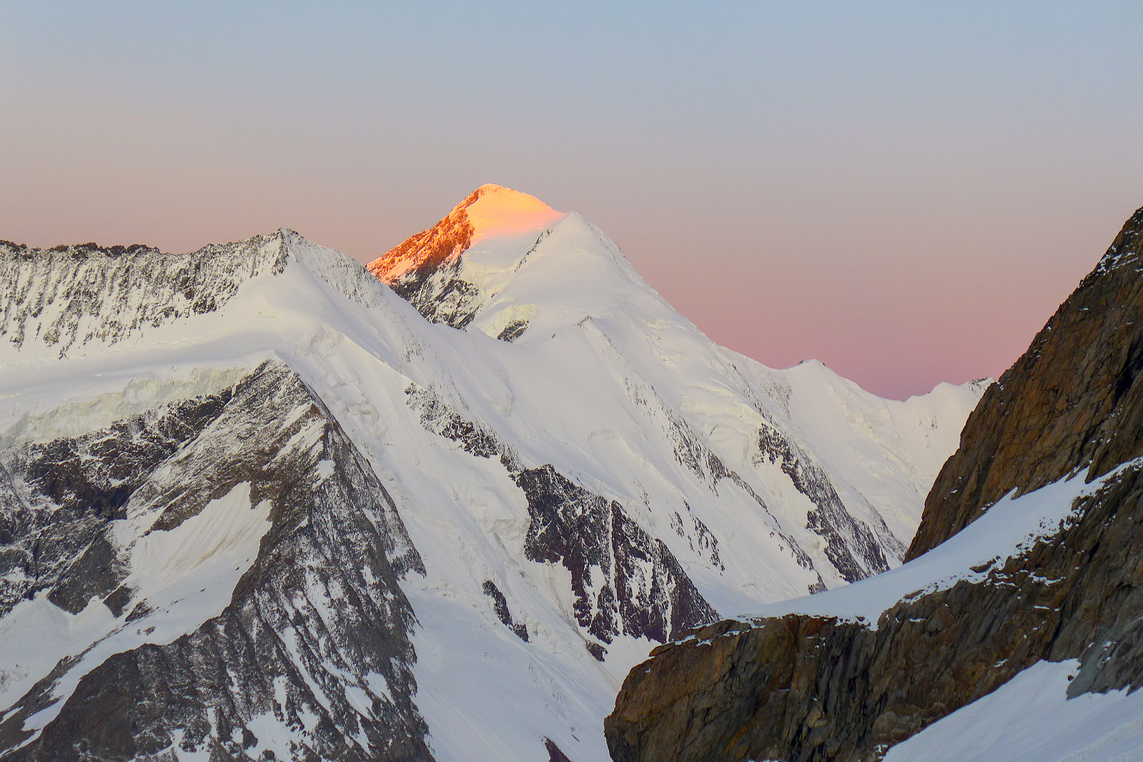
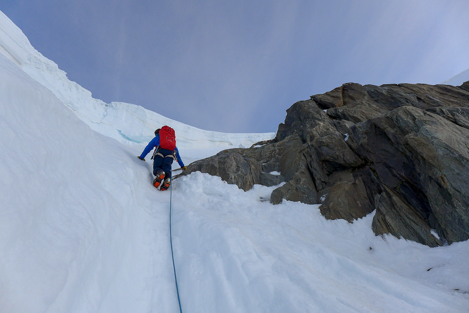
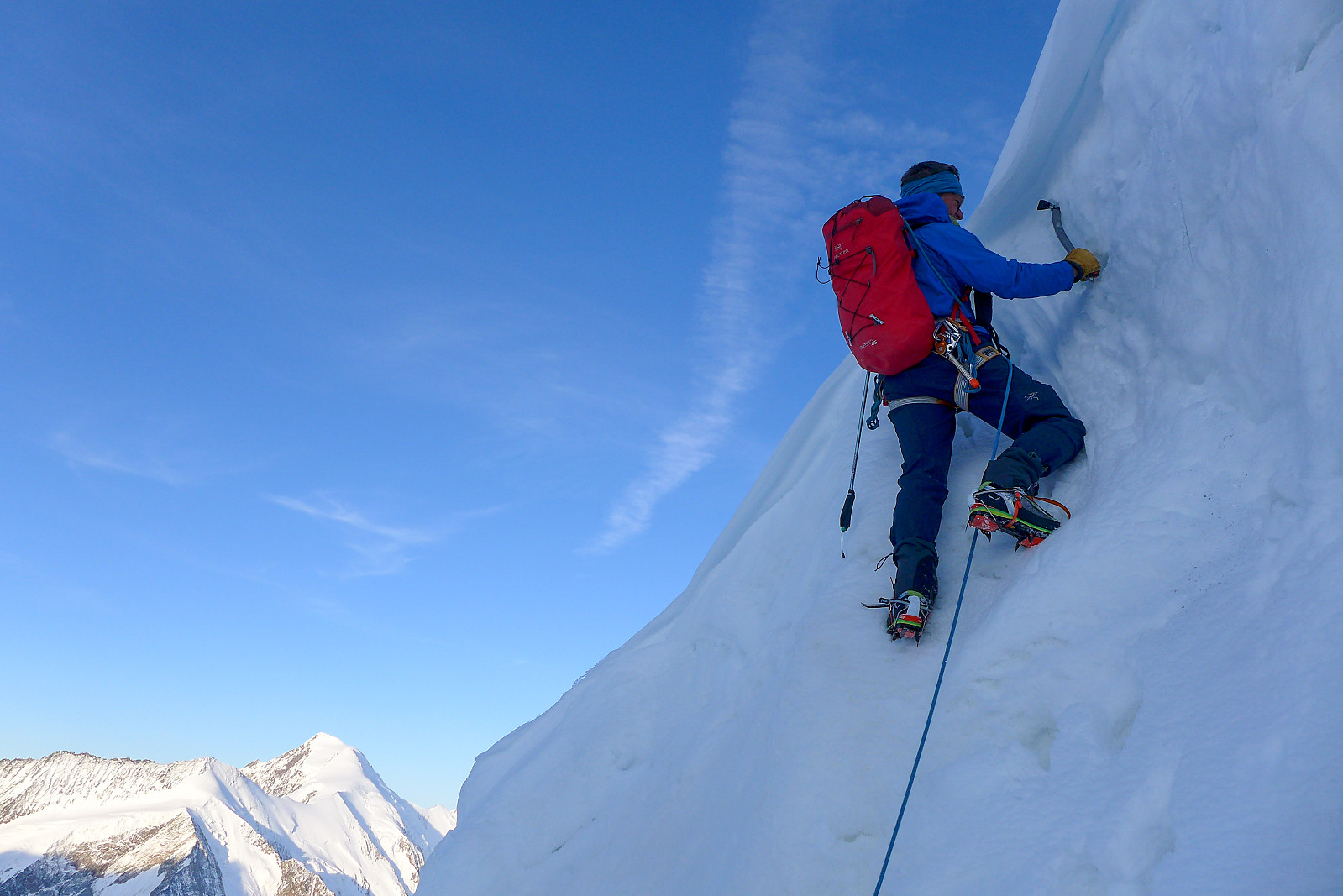

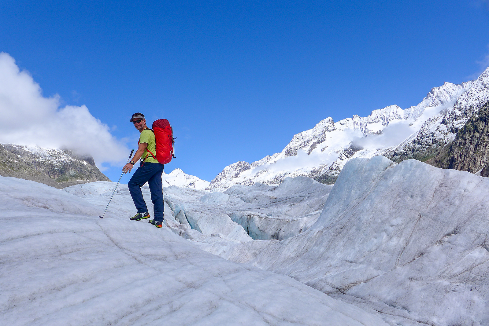
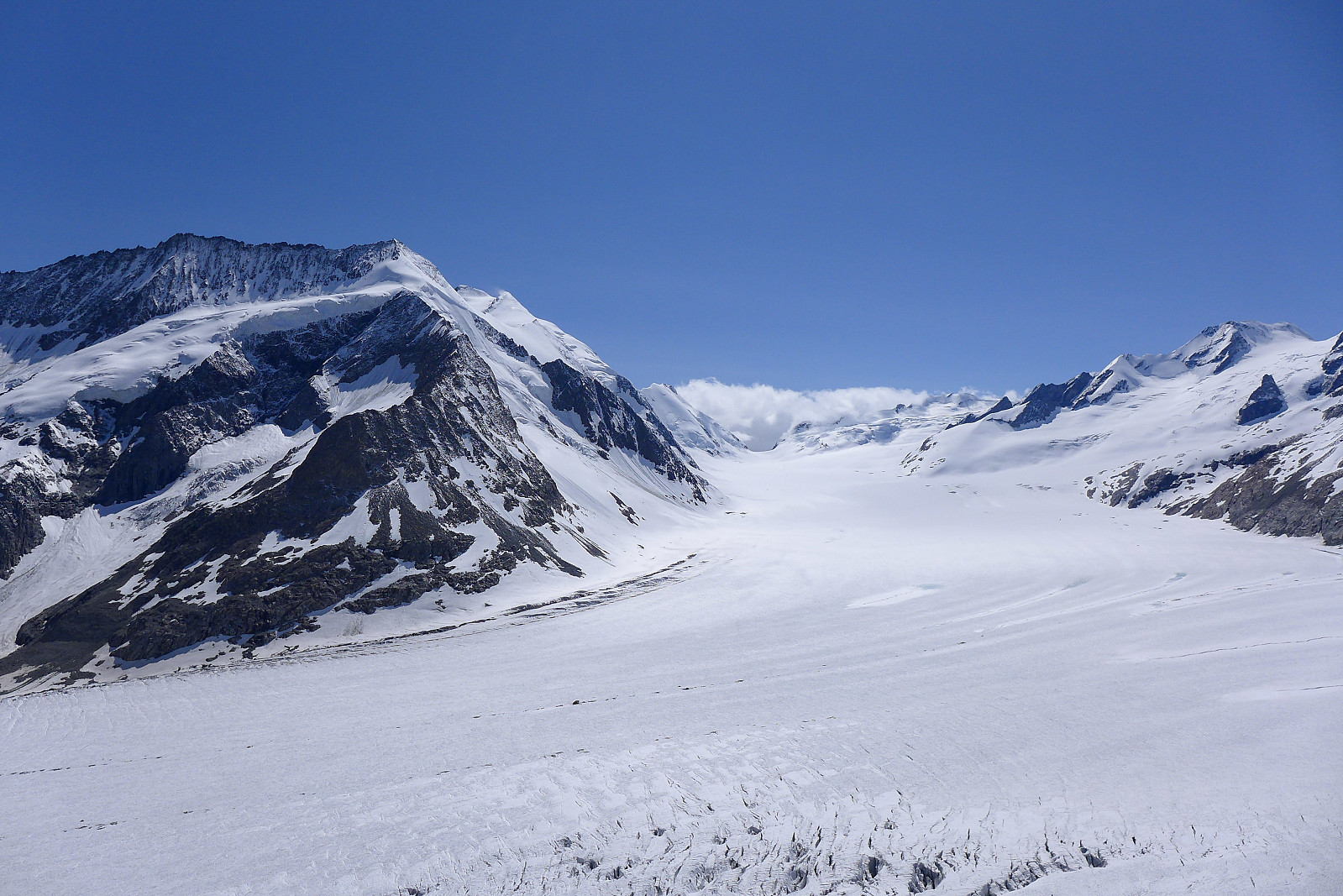
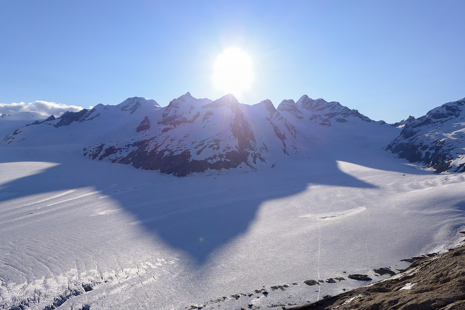
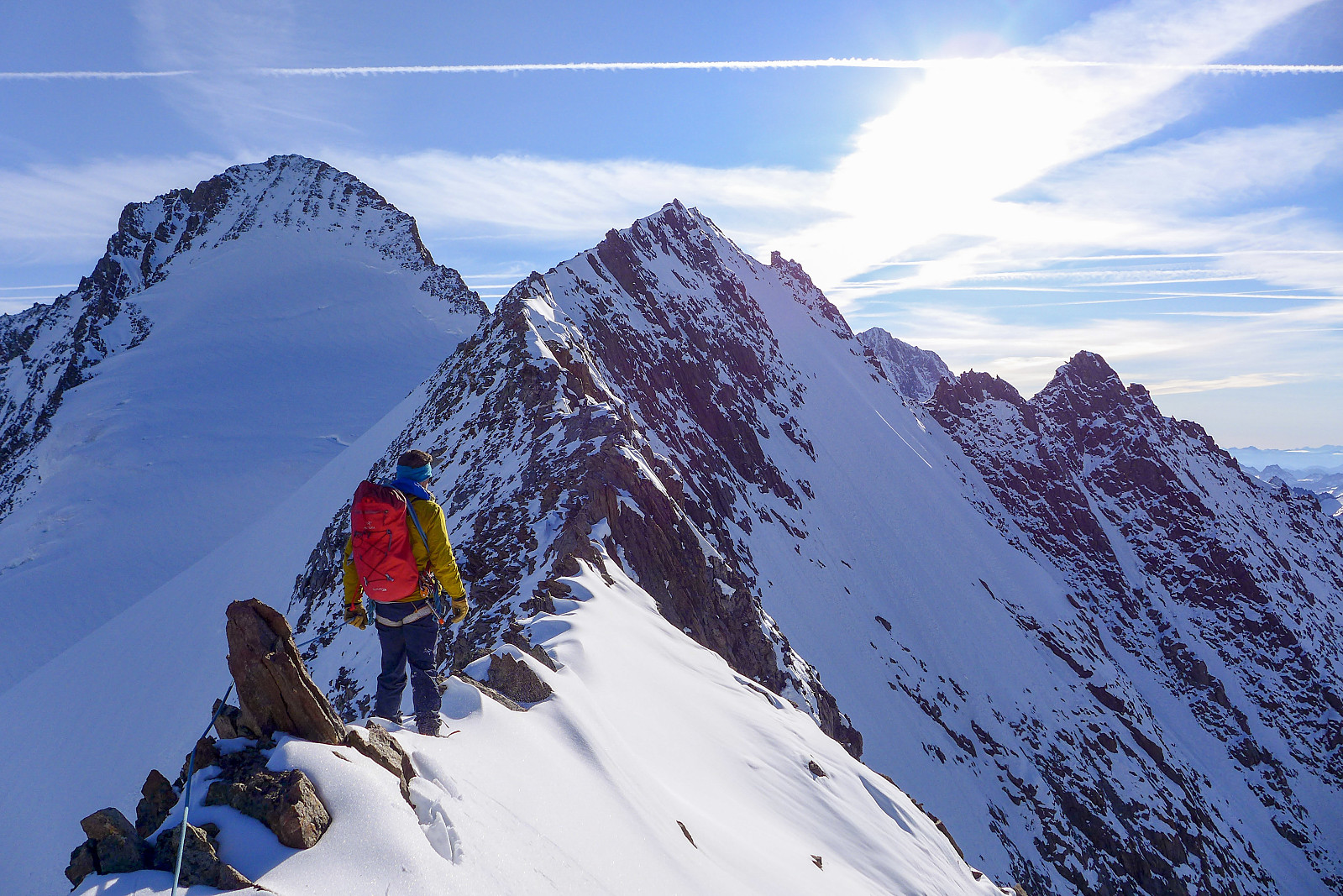
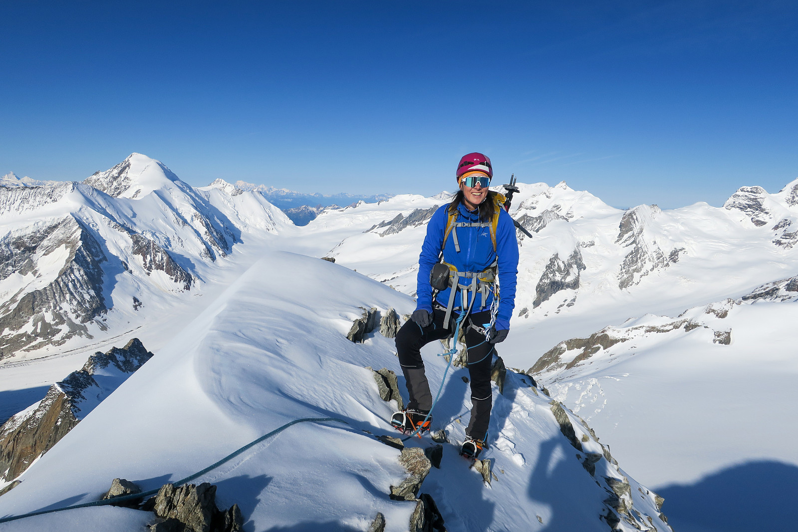
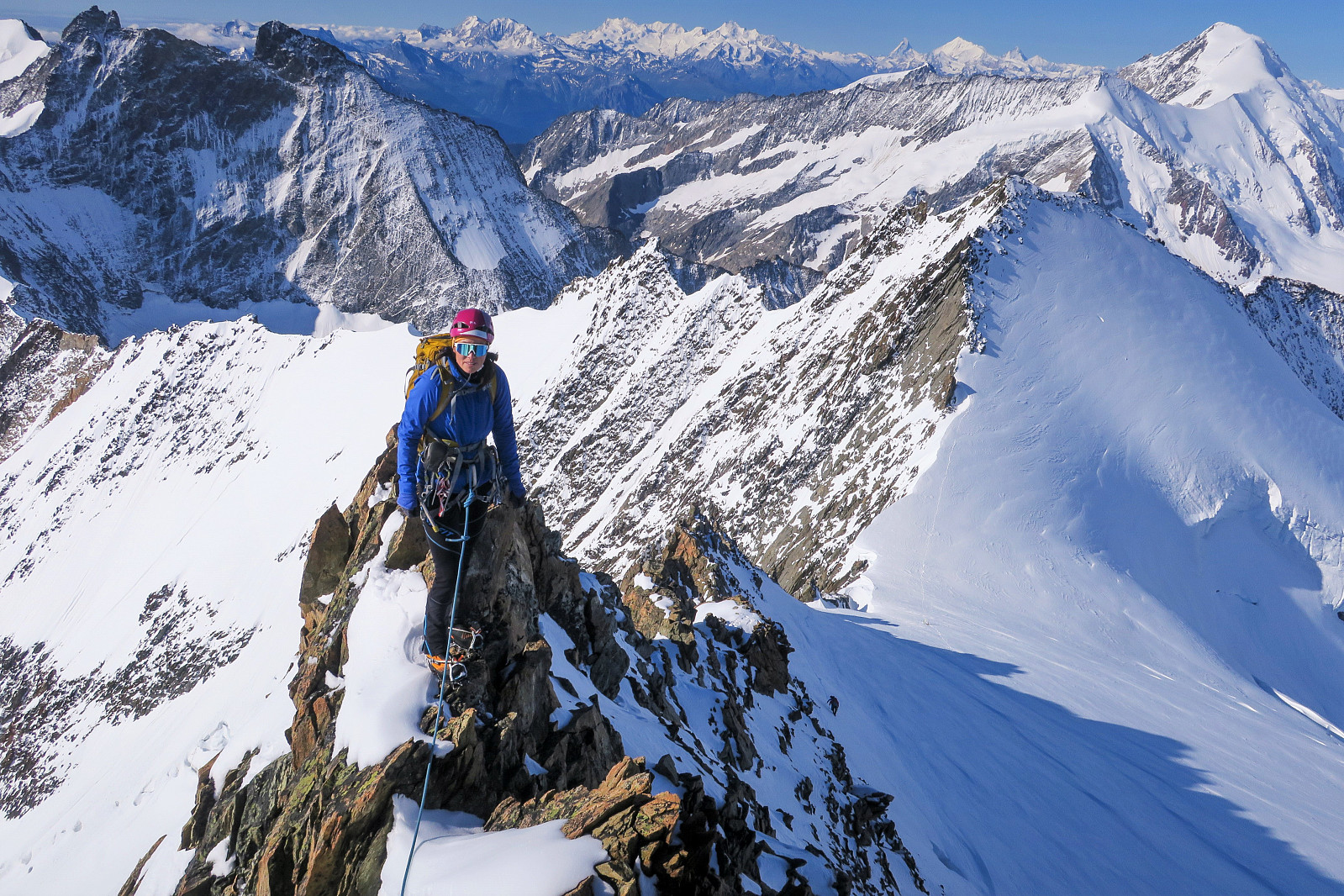
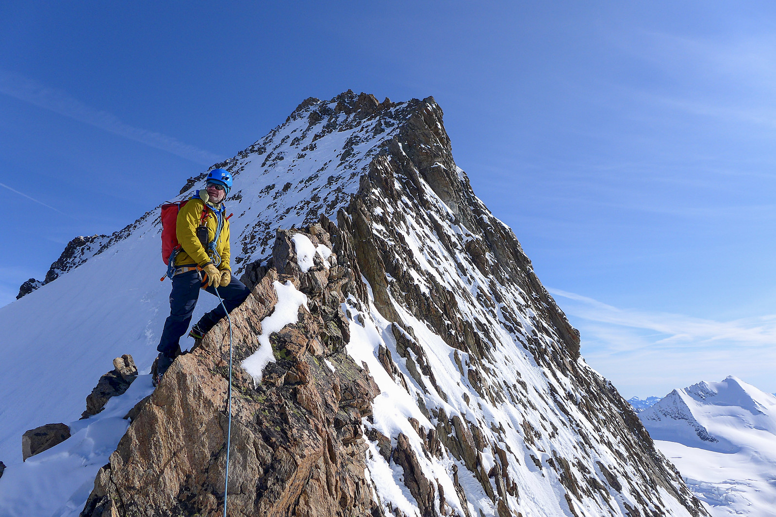
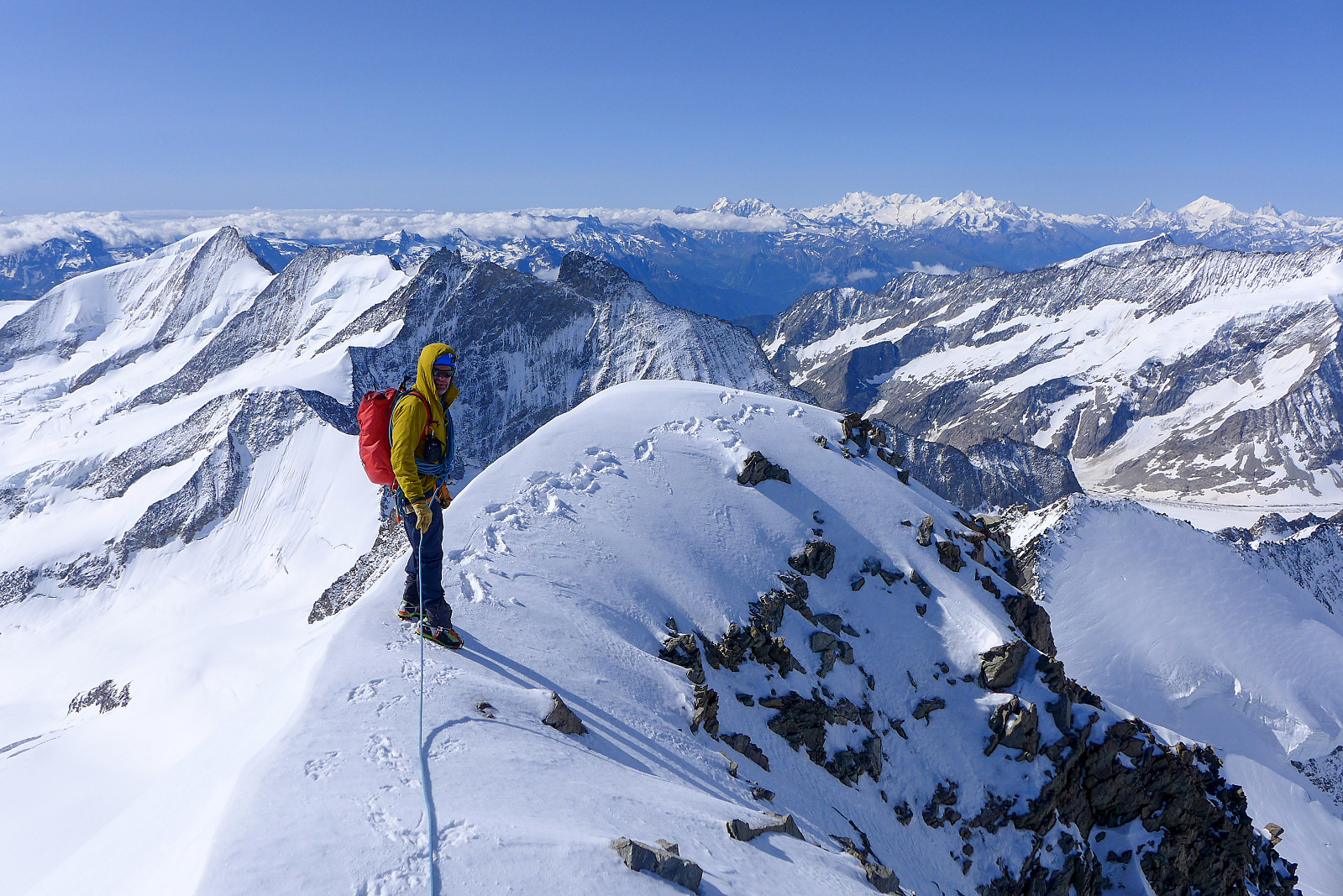
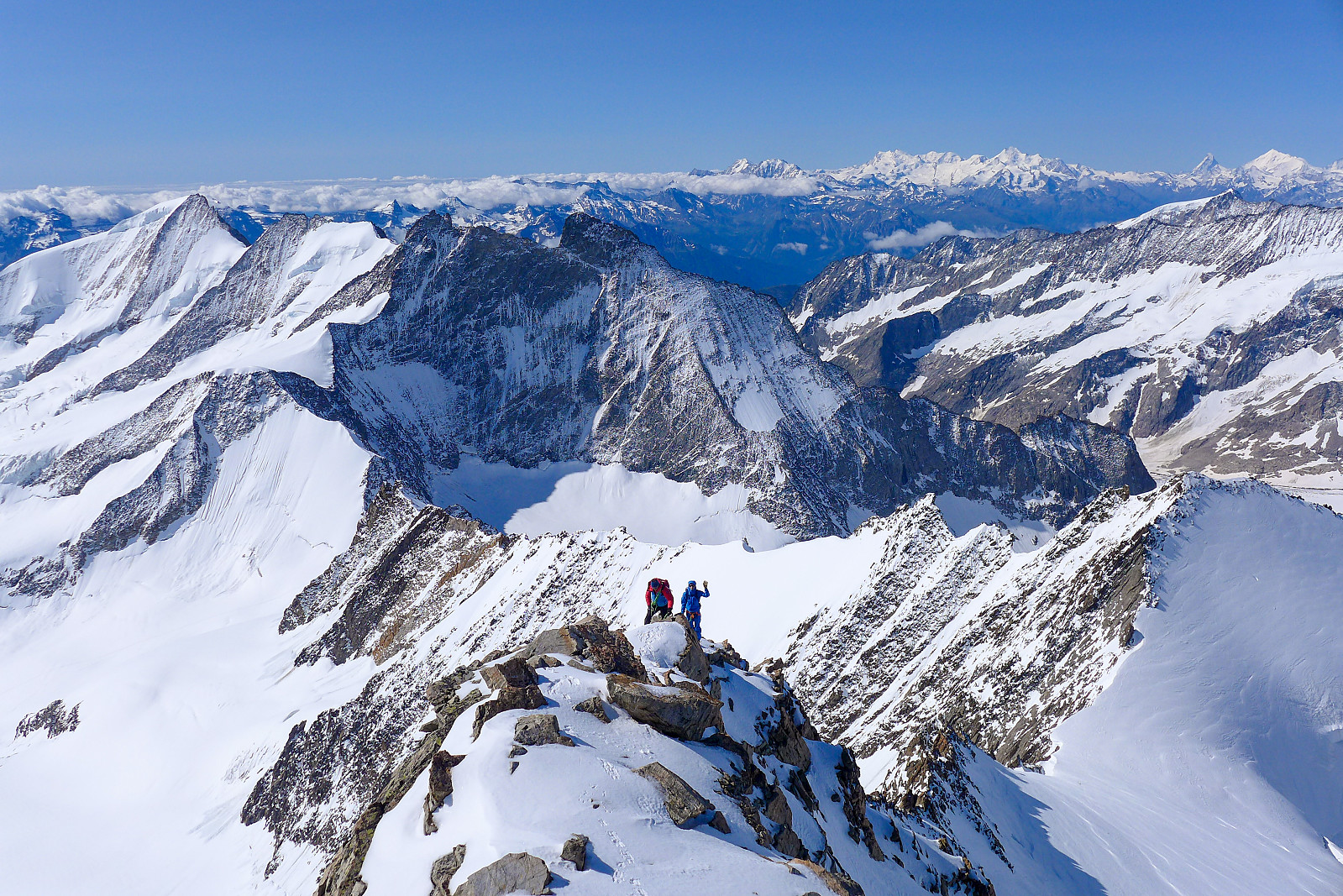
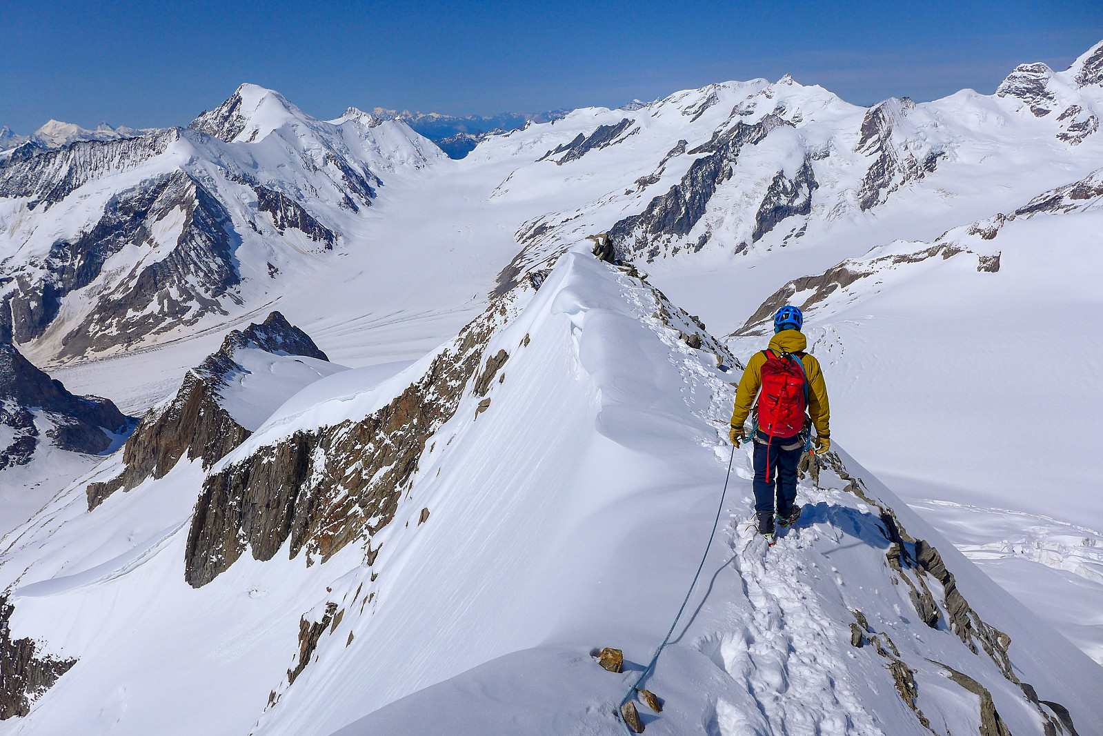
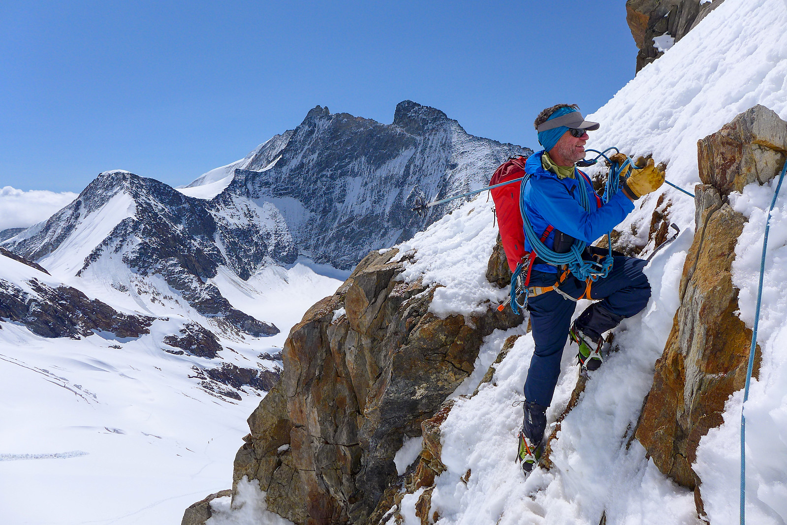
From the southwest ridge of the Grunegghorn we got our first glimpse of the impressive west face and southwest ridge of the Gross Grunhorn, but it still looked a long way off. The ridge up to the Grunegghorn was in mixed condition, but it was an easy scramble and the snow was nice and firm especially on the north side of the ridge. It was good to be finally moving on something solid again after so many hours of seemingly hopeless trudging in deep crusty snow. By the time we reached the summit of the Grunegghorn it was about 7.30 am and we were alone after having left behind the two Swiss guys who were probably still breaking trail up to the ridge. We definitely weren’t ahead of guidebook time today having been slowed down by the suboptimal snow conditions on the approach, so we didn’t stay long before making a start on the short descent down to the col between the Grunegghorn and Gross Grunhorn. The conditions here were, on the other hand more or less perfect with consolidated snow to kick the crampons into but plenty of rocks providing good handholds to scramble/climb down on. While the snow in the west face of the Gross Grunhorn was pretty hopeless, as soon as we got close to the crest of the ridge the conditions improved again. For a PD+ ridge it felt at the upper end of the grade and was without a doubt one of the best I’ve done so far – airy enough to get a sense of exposure but with solid rock and lots of spikes to climb over and around. In other words, a lot of good fun! The huge space between us and the spectacular peaks surrounding us really gave the ridge an extra sense of airiness. I love ridges :-) It took probably around 1.5 hours to reach the summit of the Gross Grunhorn from the Grunegghorn, and it felt extra special to be setting the first two sets of footprints on the summit since the recent snowfall. It was also warm enough to sit down and eat without a freezing wind to keep us moving, so we took a good break at the top to admire the stunning views around us…. From the Fiescherhorns behind us to the north, to the Schreckhorn and Lauteraarhorn, the majestic Finsteraarhorn to the east and Aletschhorn southwest of us. I think I fell in love with the Bernese Oberland just from gazing at those summit views and it was with a bit of reluctance that we began the descent, reversing the way we came up.

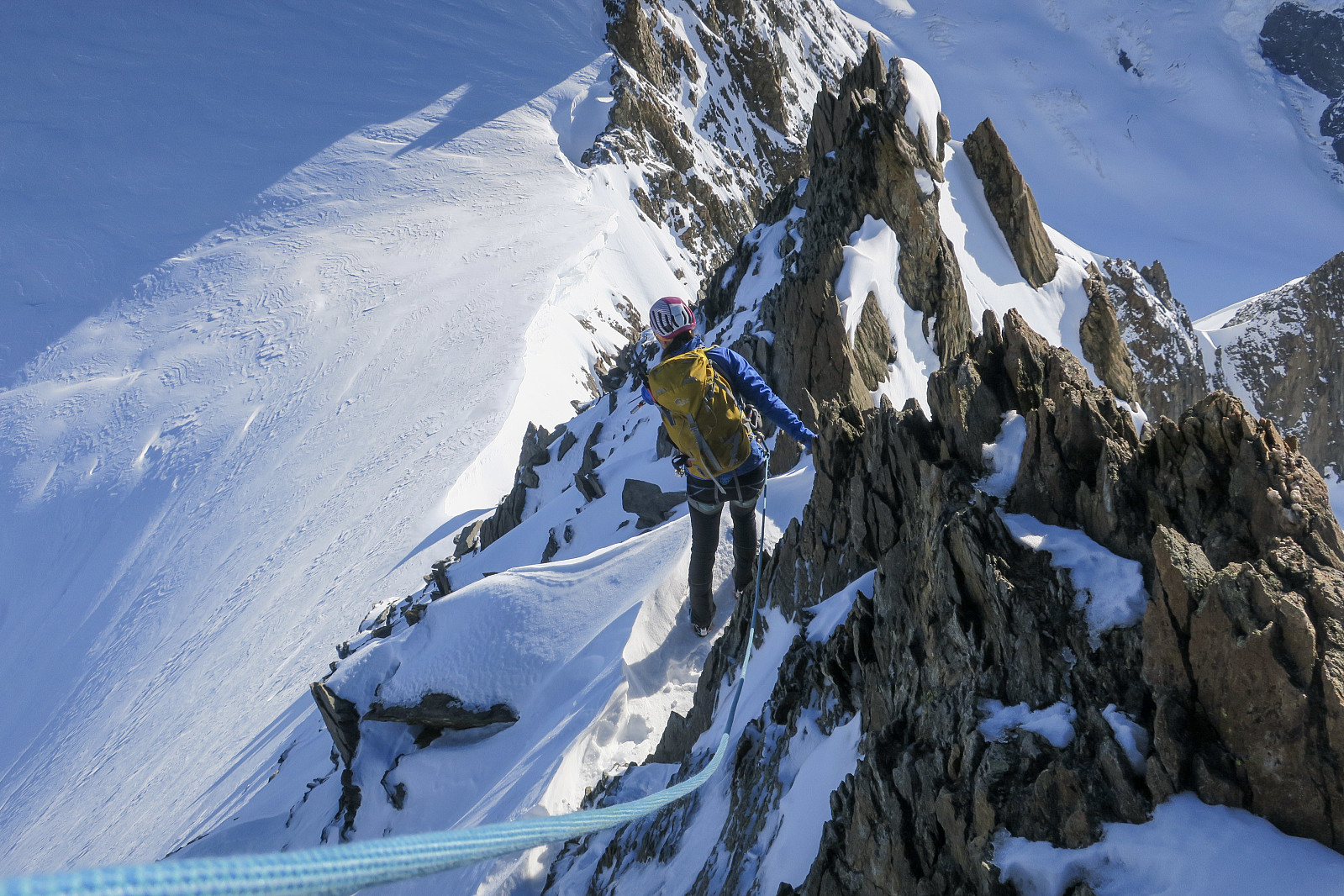

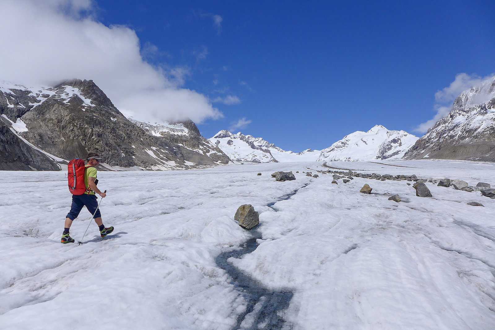
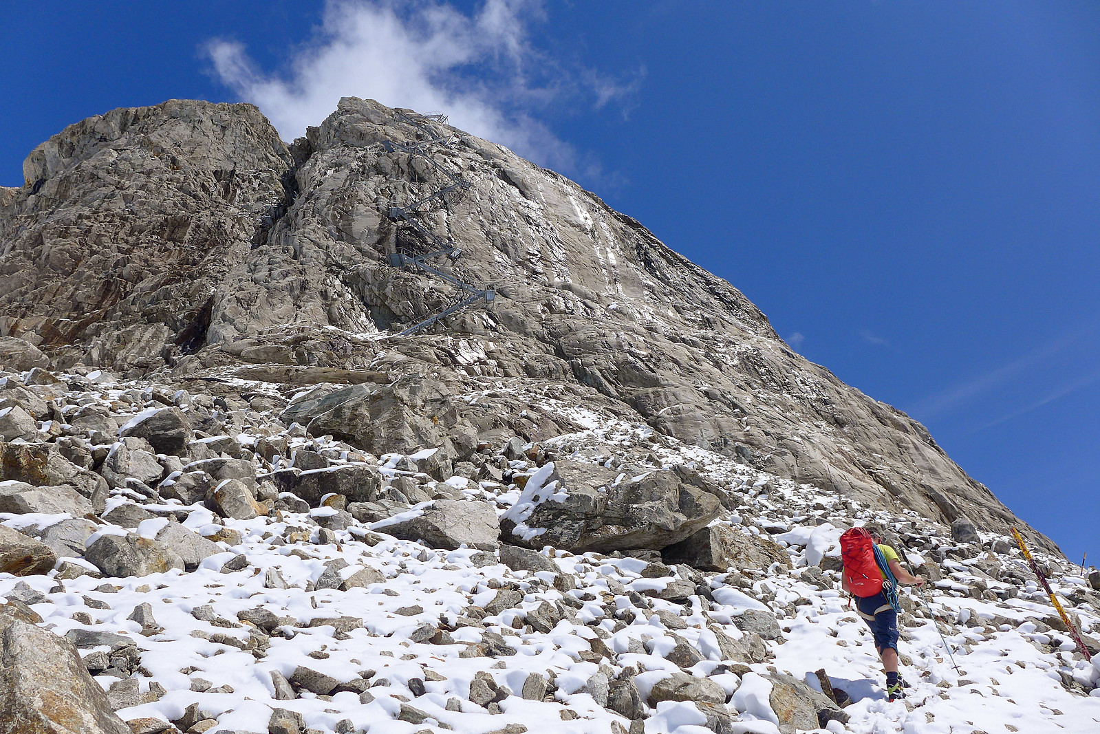
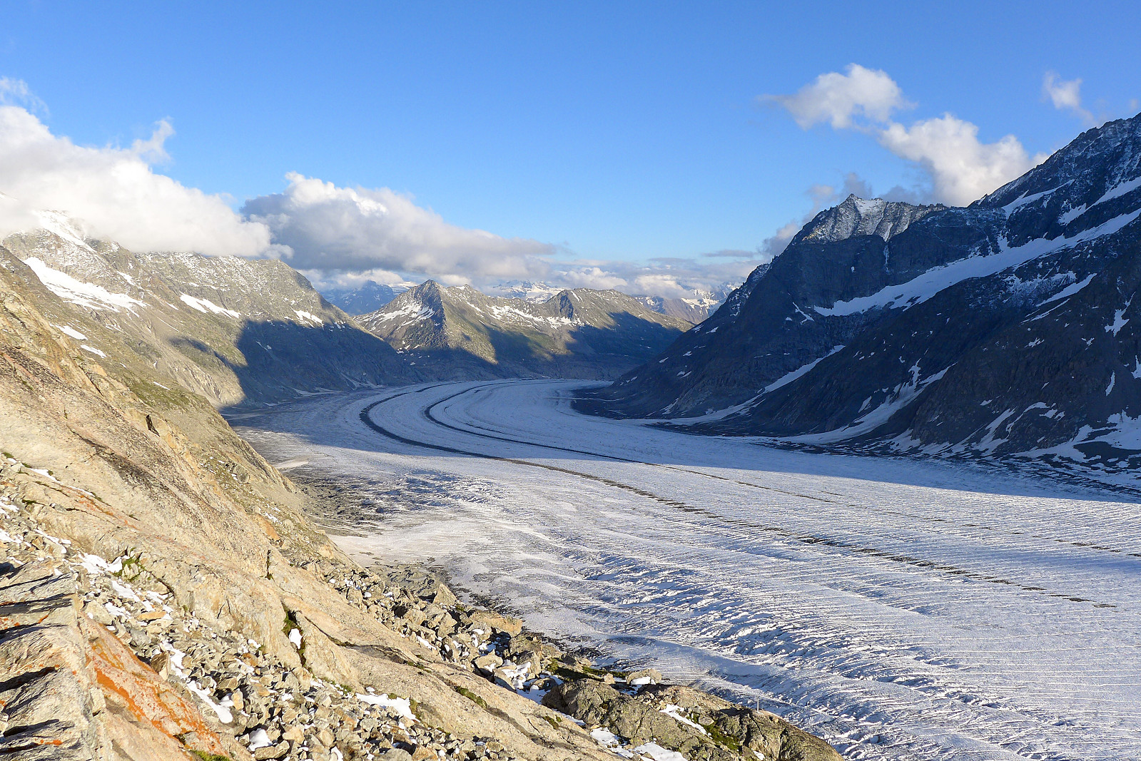
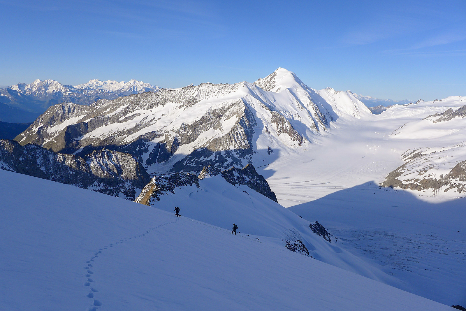
About a third of the way down the ridge we met the two skiers who we’d seen ascend from the west side of the mountain just as we were descending from the Grunegghorn, but other than that, there was no one else around. Just after about halfway down though we took a shortcut and downclimbed from the ridge into the face where we thought it would be quicker to get down on the snow, but as with the rest of the snow on the mountain today it wasn’t particularly helpful snow and took some time to descend. I was extremely glad to get back down to the col and onto the ridge leading back up to the Grunegghorn again. And so we followed the ridge back over the Grunegghorn and down to the nightmare snow slopes. Fortunately there was now a good track going down the snow slopes from the ridge, and it didn’t actually take as much time to get down as I’d anticipated. In some ways the late morning warmth had done us a favour and softened up the crust, so even though we were still trudging down in quite a lot of snow we were at least not having to break through a surface crust first. But the snow condition was nevertheless deteriorating in the heat of the sun now, so we kept up a fairly constant and not-hanging-around kind of pace all the way back down until we hit the main track between the Konkordia hut and the Grunhornlucke. Now all we had left was a slog up to the Grunhornlucke, then a descent down the other side to reach the Finsteraarhorn hut. In my mind I wasn’t expecting it to take too long, but now we were in the heat of the sun and I had run out of drink again it felt like an eternity before the Finsteraarhorn hut came into sight. The final 100m up to the hut from the glacier felt like the crux of the whole day and all that was on my mind was drink, drink and more drink…… but finally we arrived there some 11 hours after leaving the Konkordia hut. Awesome day and awesome mountain!

| Start date | 10.07.2021 03:21 (UTC+01:00 DST) |
| End date | 10.07.2021 14:29 (UTC+01:00 DST) |
| Total Time | 11h 07min |
| Moving Time | 11h 07min |
| Stopped Time | 0h 0min |
| Overall Average | 1.8km/h |
| Moving Average | 1.8km/h |
| Distance | 19.9km |
| Vertical meters | 1,996m |


User comments