
Bishorn East ridge (06.07.2021)

Written by hmsv1 (Hannah Vickers)
| Start point | Turtmann hut (2,488m) |
|---|---|
| Endpoint | Turtmann hut (2,488m) |
| Characteristic | Alpine trip |
| Duration | 10h 03min |
| Distance | 21.6km |
| Vertical meters | 1,961m |
| GPS |
|
| Ascents | Bishorn (4,153m) | 06.07.2021 |
|---|
After having come back from Lyskamm, there looked like there might be a possibility of a new weather window on the tuesday the following week, but it wasn’t going to be a very long weather window, with more bad weather arriving already in the afternoon, ruling out any long and committing routes. After much pondering, checking of weather forecasts and consultations with Martin Moran’s 4000m guidebook I arrived at the conclusion that the East ridge of the Bishorn might be a suitable objective, since it would provide a more interesting line of ascent than the standard easy trudge up from the Tracuit hut, and the descent down the Turtmann glacier would be straightforward and quick(ish) though quite long. I ran the suggestion past Graham and we ended up settling on this as a plan and booked beds at the Turtmann hut for monday night. Whilst I would have preferred to do something a bit more exciting, it seemed like the best option out of all the remaining 4000ers I hadn’t yet been up, given the snowy conditions and lack of sustained good weather to make use of. Research suggested that the East ridge of the Bishorn was most definitely not a popular route up the mountain, so even though it was a bit difficult to find out how current conditions were, there was also a strong possibility we’d not end up in a queue behind any other teams at any point!
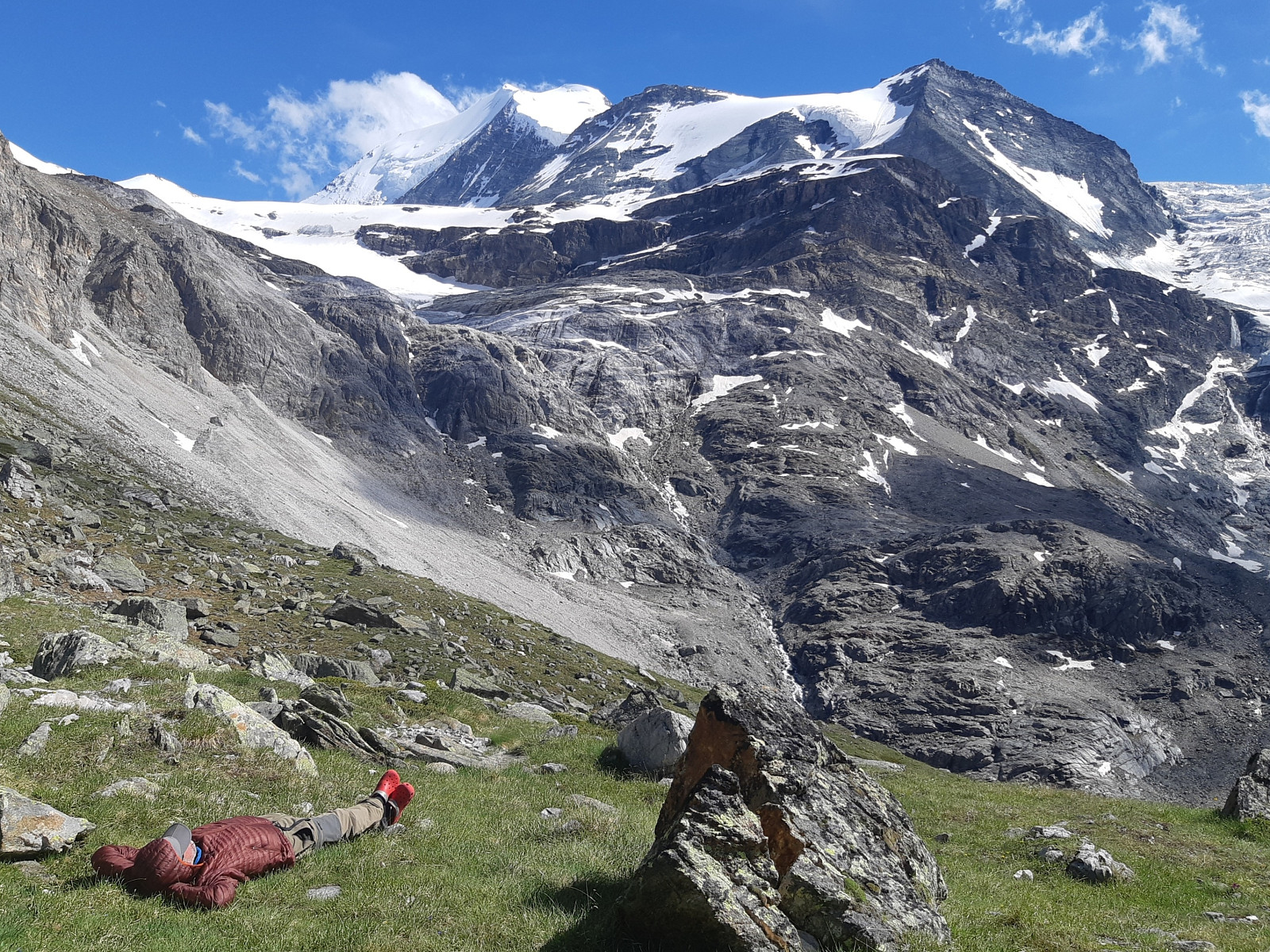
Monday started largely grey but meteoswiss were forecasting brighter skies from mid-afternoon onwards. The drive from Evolene to Turtmann was fairly swift, though the drive up from Turtmann to the road head at the southern end of the Turtmann valley was much less rapid comprising of mainly narrow and winding road with not much in the way of a view. The valley opened up a bit by the time we reached Gruben, the last main settlement before reaching the car park another 3 km down the valley. It turned out you could either pay for the car park with coins or the Easypark app. Neither of us had coins and my phone couldn’t find the car park in the app, so in the end we resorted to driving back to Gruben to have a late morning coffee at the café and get some change to pay for the car park with. We weren’t really in a rush anyway since the walk up to the Turtmann hut was pretty short and we didn’t need to spend all the afternoon there. After successfully getting our parking ticket we began the easy walk up to the hut, first passing by a field of sheep who were being enthusiastically guarded by a lively sheep dog that was keen on barking at us along the entire length of fencing, and then continuing up through the forest on a nice trail. This didn’t last that long though and we were soon above the tree line walking on a very flat track going up to the Turtmannsee, a small-ish reservoir sitting at the foot of both the Turtmann and Brunegg glaciers. From the other side of the Turtmannsee we followed a more rocky/gravel footpath that weaved and zigzagged its way up the hillside toward the hut, which we reached in about 1h 45 after leaving the car park. There was a couple of hours to spare before dinner, so we had a late lunch, drank coffee, looked out the window a bit and once the sunshine arrived a certain mountain guide decided conditions were good for going for a snooze in the grass while I stayed inside to drink yet more decaf coffee. The hut was pretty busy with people, but luckily we ended up getting beds in the loft above one of the dormitories, which also had a sort of trap door above the ladder that later proved handy to shut out any noise from the room below. I was quite impressed with the space utilization here :-) We planned to eat breakfast early again at 3 am, and it seemed like the people in the room below us were also doing the same, so everyone was in bed by about 8.30pm.
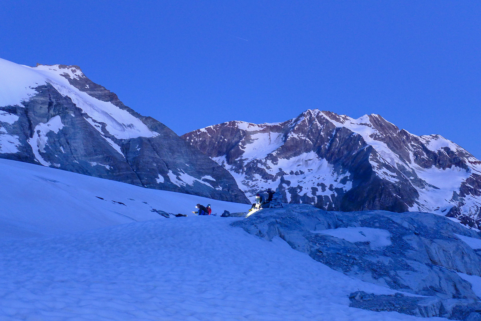
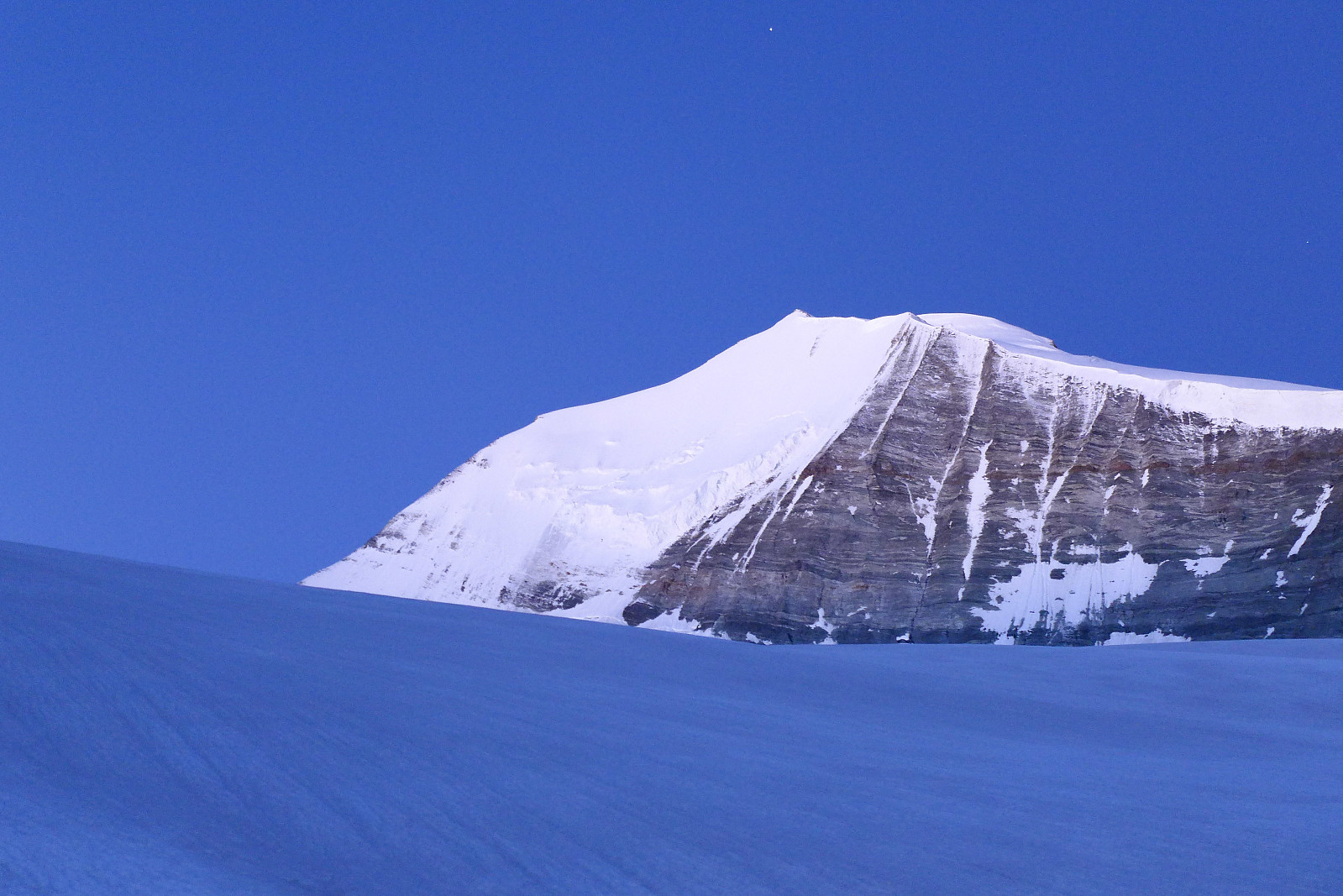
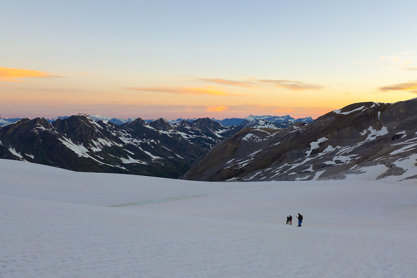
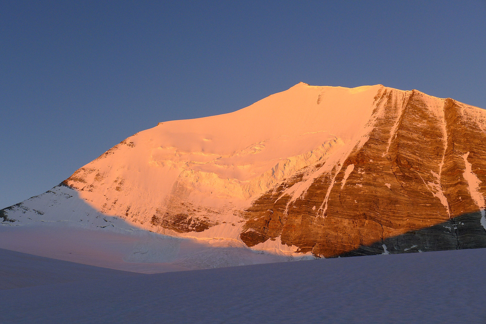
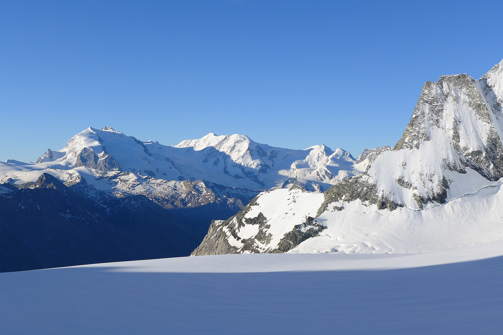
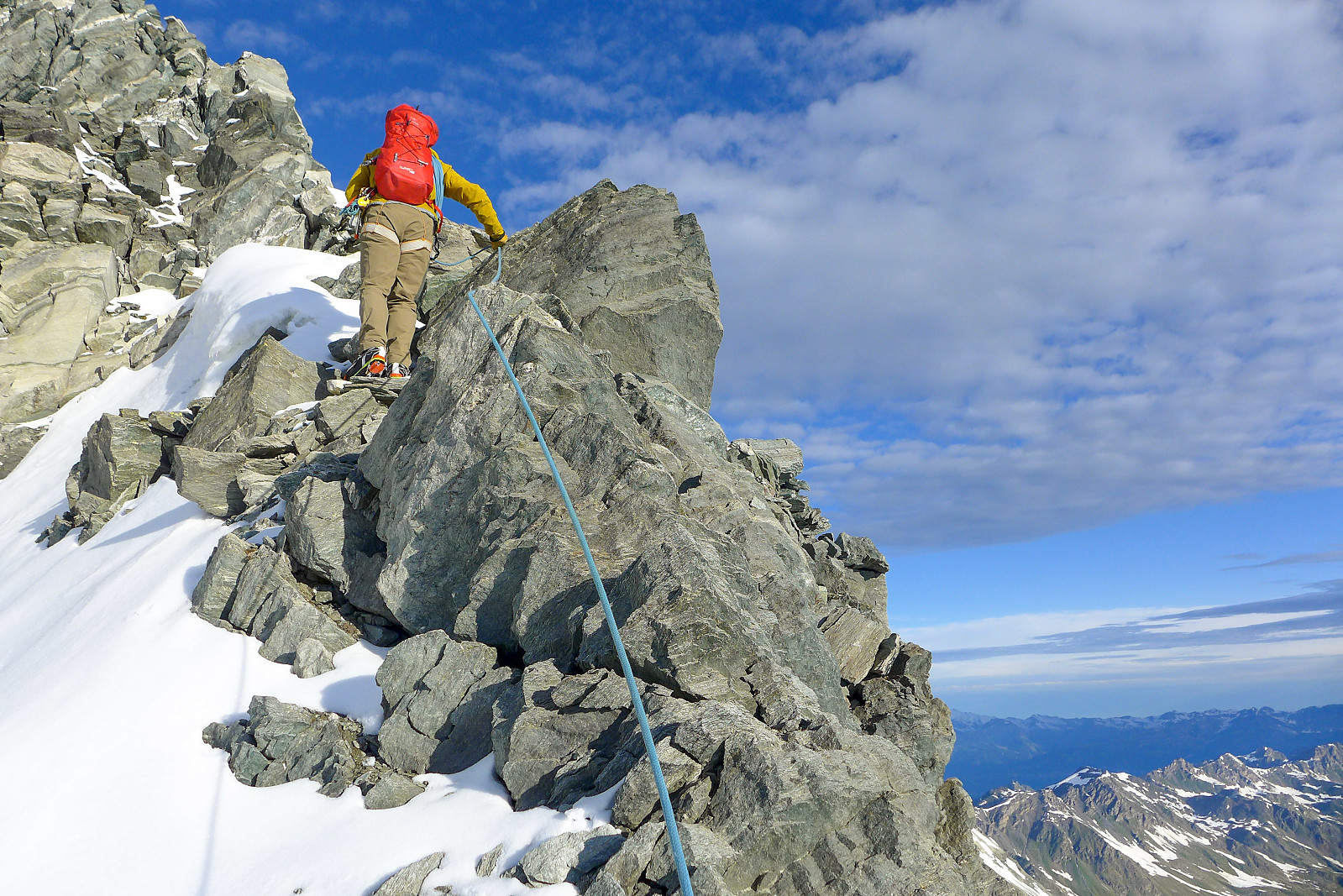
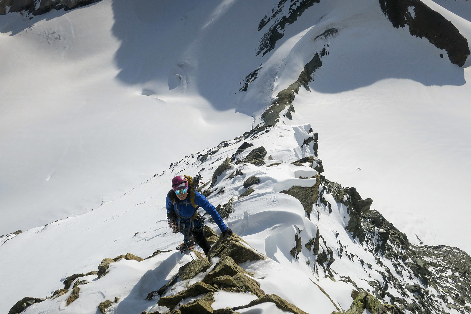
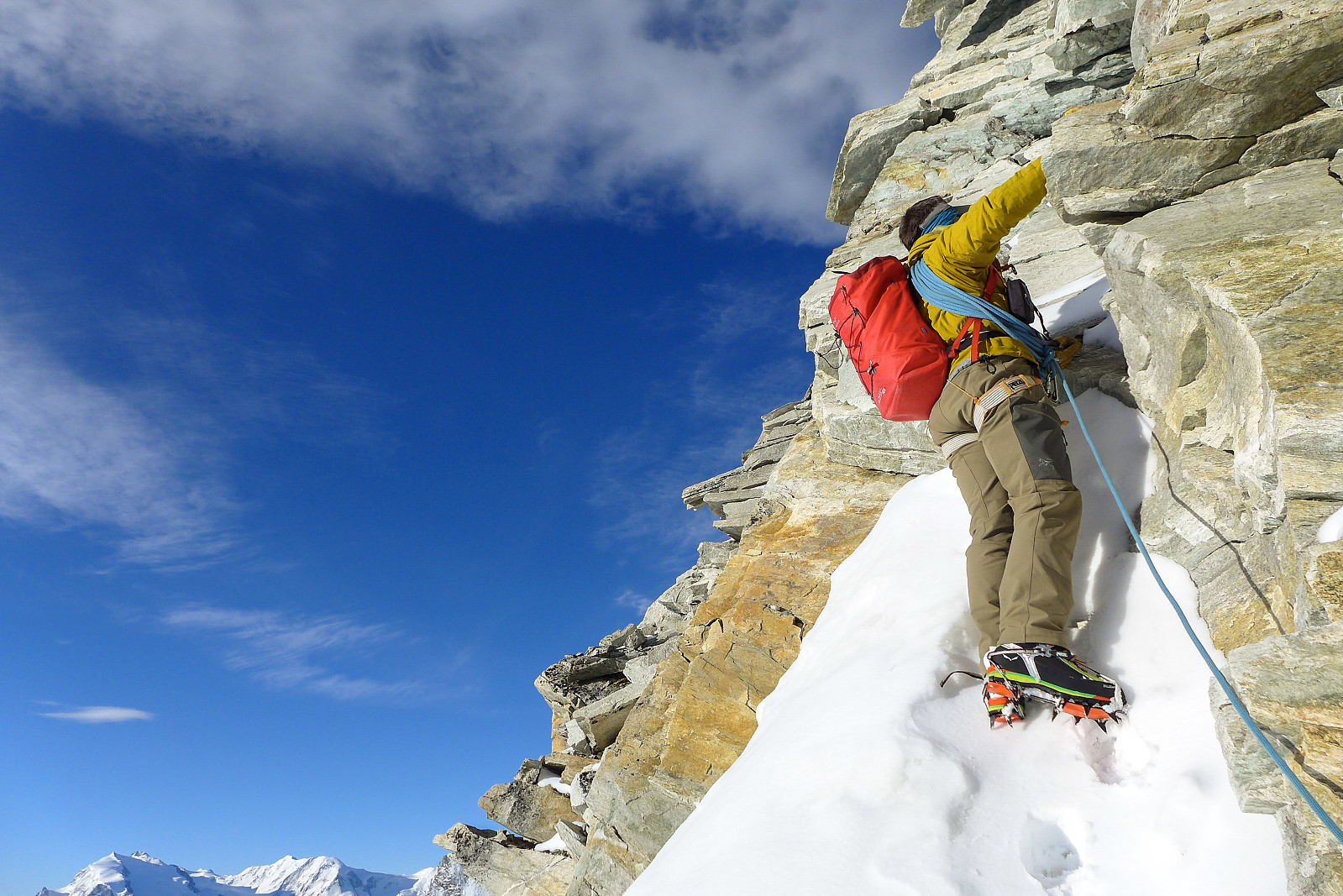
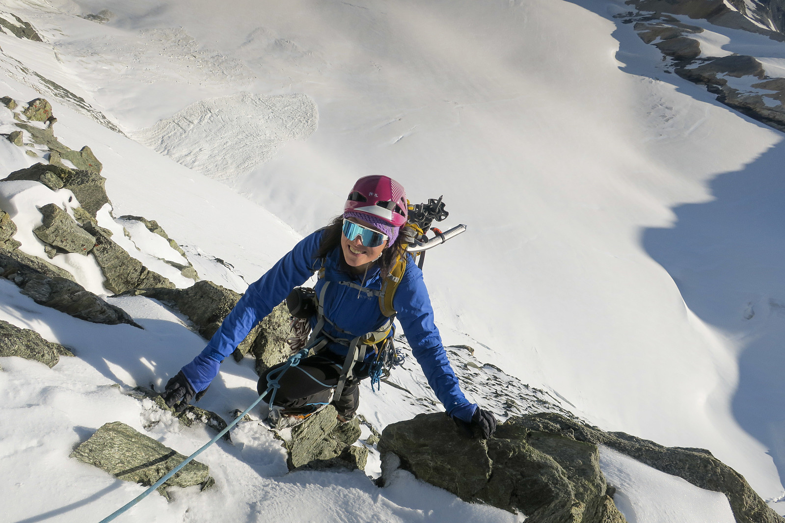
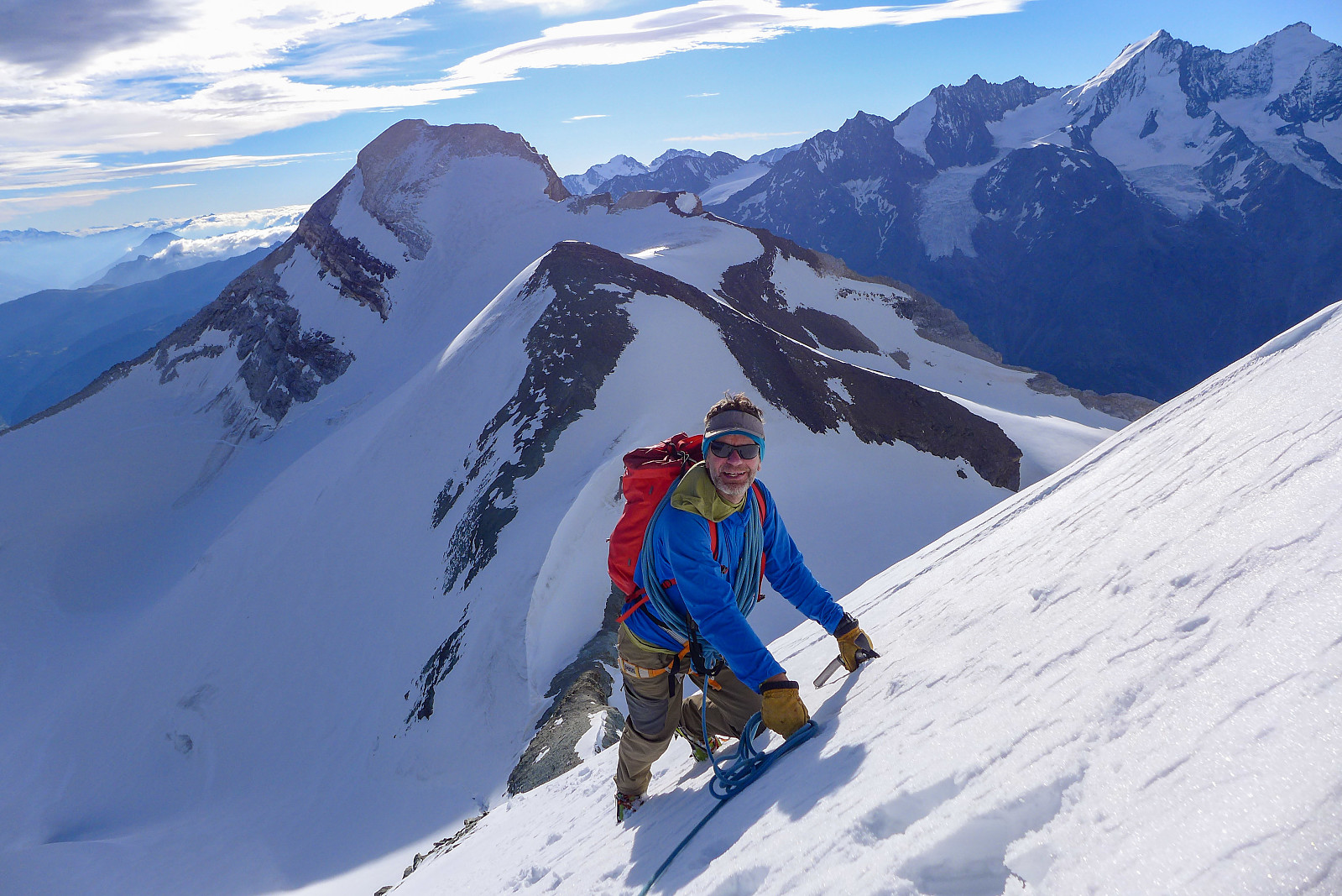
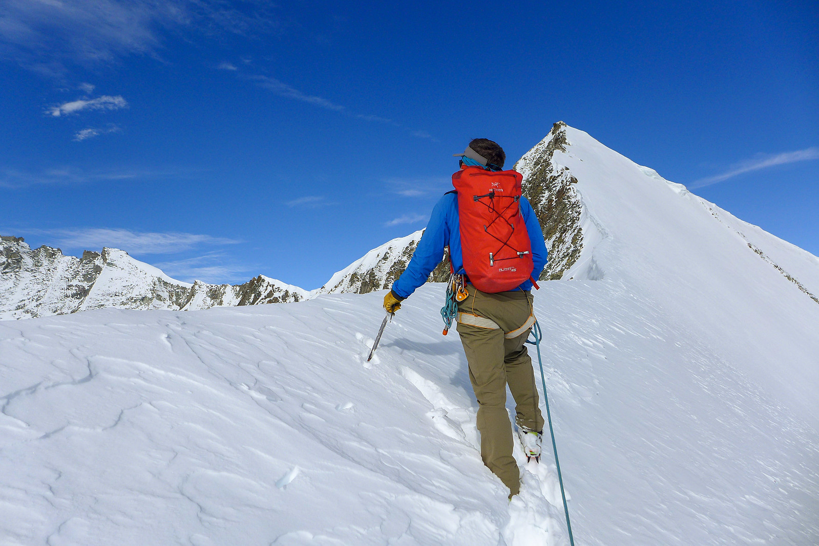
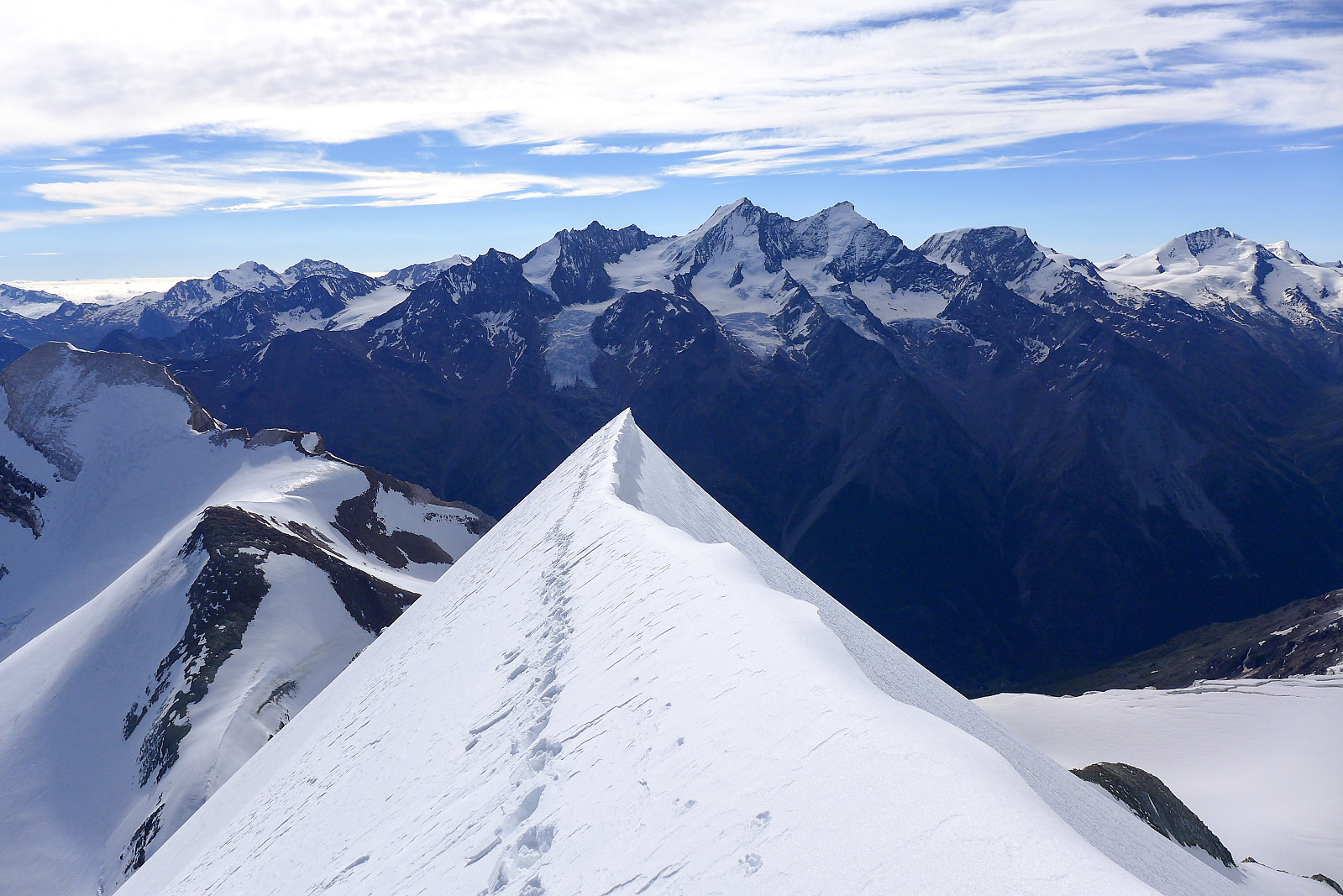
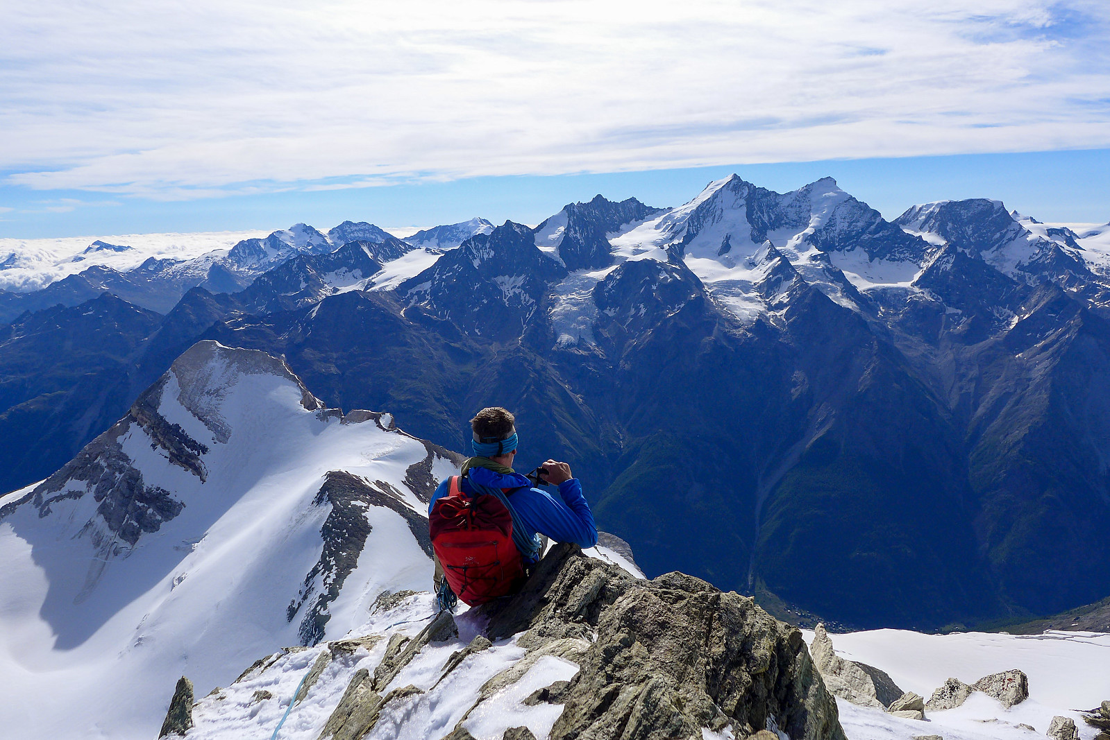
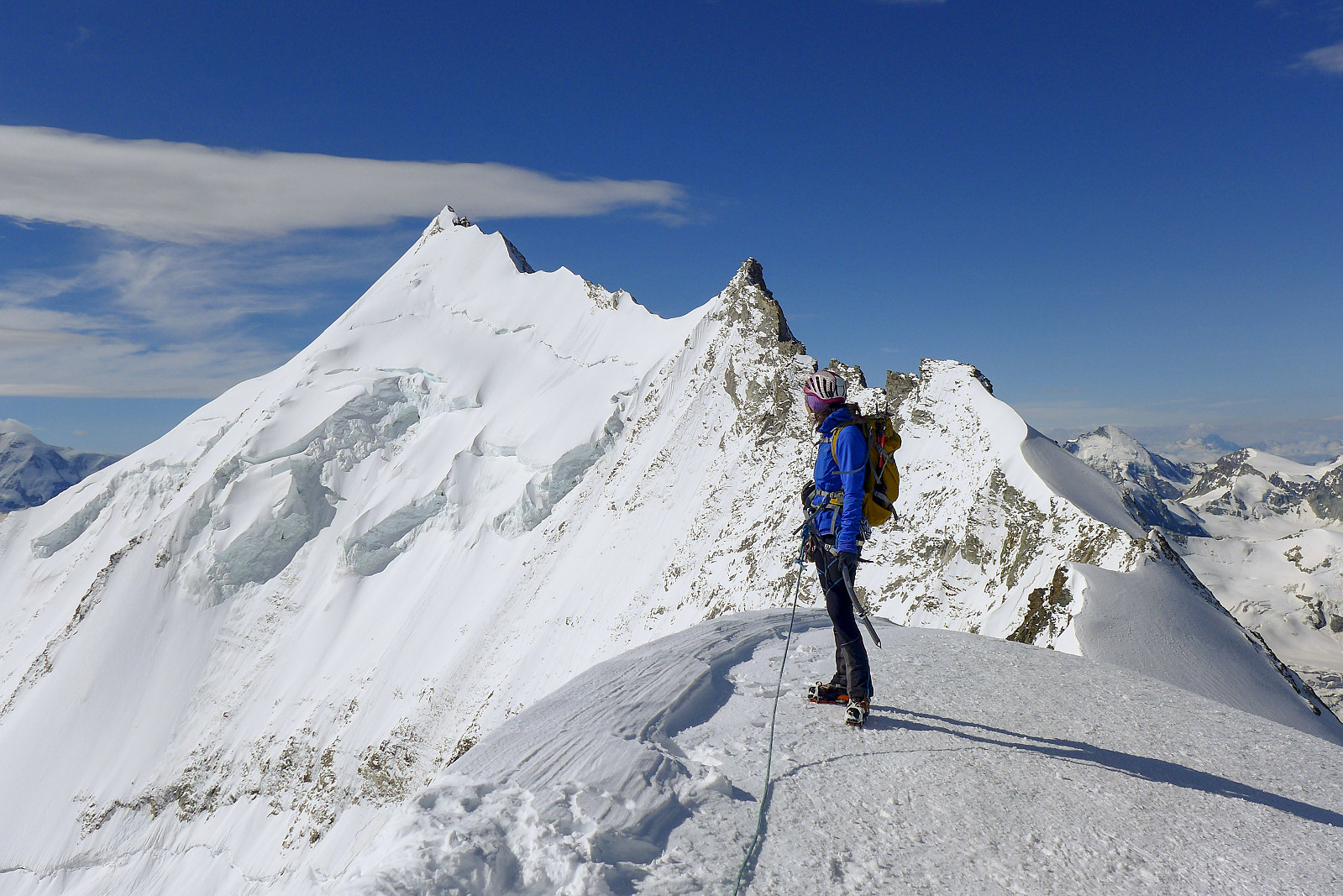
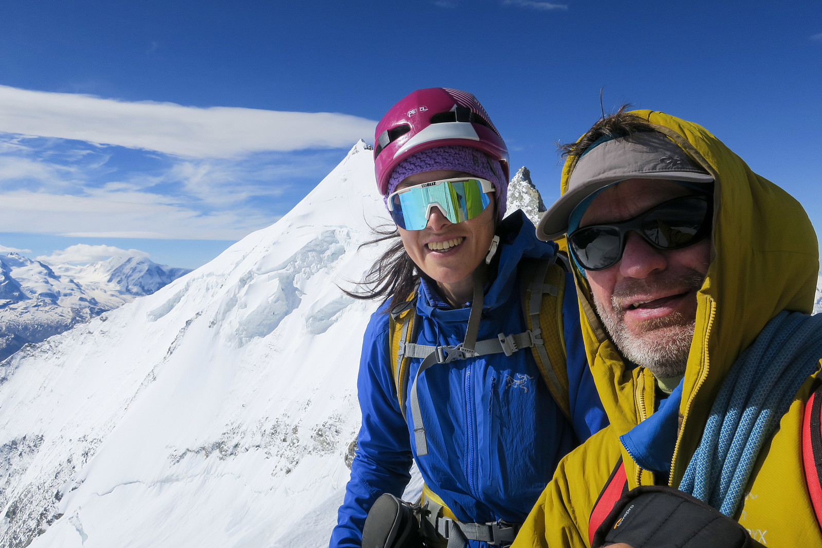
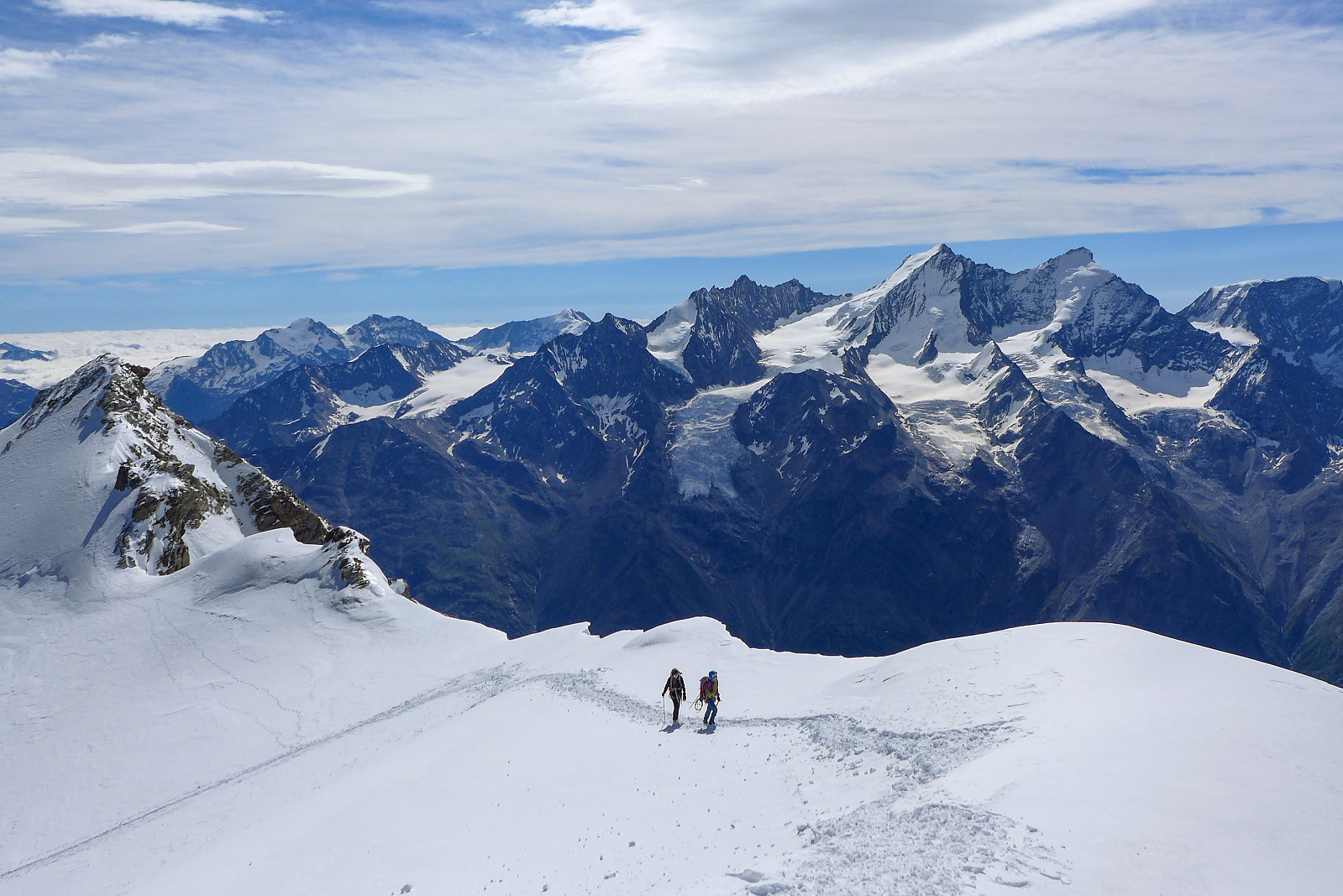
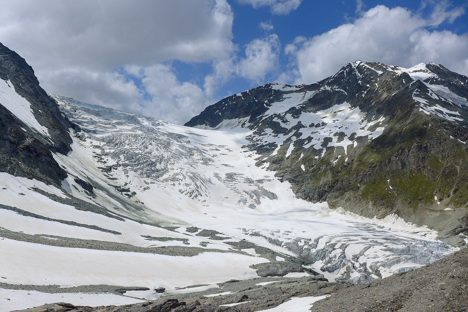
After an OK-ish night’s sleep and an OK-ish breakfast it was time to head out and make our way up the path toward the Brunegg glacier. The air felt pretty warm outside but at the back of my mind I was dreading a lot of wind higher up the mountain which had been forecasted by meteoblue. Thoughts of the freezing cold day doing the Lyskamm traverse with uncontrollable shivering sprang to mind and I was really crossing my fingers that it wouldn’t be quite that bad again..... As with most walk-ins in the dark, the majority of the time was spent looking down at the few metres in front of my feet illuminated by my headtorch and I don’t actually have much recollection of the path or surroundings, other than that it was fairly reasonable to walk on. By dawn we had reached the edge of the Brunegg glacier and could see across to the huge northeast of the Bishorn, with the east ridge running up the left side of the face on the skyline. The sunrise over the northeast face was stunning, lighting up the whole face with a beautiful pinky-orange glow. Definitely a moment worth taking a few photos of! By the time we’d reached the Bisjoch we’d already ascended over 1000m from the hut without having actually done any climbing. I was feeling pretty lethargic by the time we got there, but put it down to not having eaten enough carbohydrates the night before and was nevertheless looking forward to getting on more interesting ground. Compared with the photo in Martin Morans guidebook, the East ridge looked relatively dry, which probably meant there was going to be a fair bit of climbing on dry rock in crampons. We’d read that the rock quality here wasn’t particularly amazing, and this turned out to be a fairly accurate description. It’s definitely a route that needs snow cover to stick the loose rock together, else it probably won’t seem like much fun. Still, the setting is pretty spectacular, offering really awesome views of the Bishorn northeast face to the right of the ridge and the equally huge northeast face of the Weisshorn to the left. Behind us we could look across the Zermatt valley to a very snowy looking Taschhorn-Dom traverse, which was one of the routes that stood high on my wishlist... but the likelihood of it coming into condition seemed pretty slim, based on the weather forecast for the current and following week. The East ridge of the Bishorn itself turned out to be quite straightforward scrambling on mixed ground, and the grade it had been given (AD) seemed overly generous for the actual difficulty - I think I would have given it a PD+? It was still a much better alternative to slogging up the northwest flank though! Finally, a seemingly never-ending trudge up an elegant snow ridge took us directly onto the secondary summit (Point Burnaby) just east of the main summit after some 4.5 hours from the Turtmann hut. We had a second breakfast stop here and observed the troops of people on the main summit before we left and made our way over ourselves. Despite all my initial fears of cold and windy weather, there had in fact only been wind on the summits. The route itself had been more or less wind-free. From the Bishorn summit it was great to look along the entire north ridge of the Weisshorn. I even started to regret having climbed the standard East ridge of the Weisshorn - it would have been a much more interesting outing to traverse the mountain via its North ridge and descend it by the East ridge. Maybe something to go back and do if I ever finish the 4000ers??
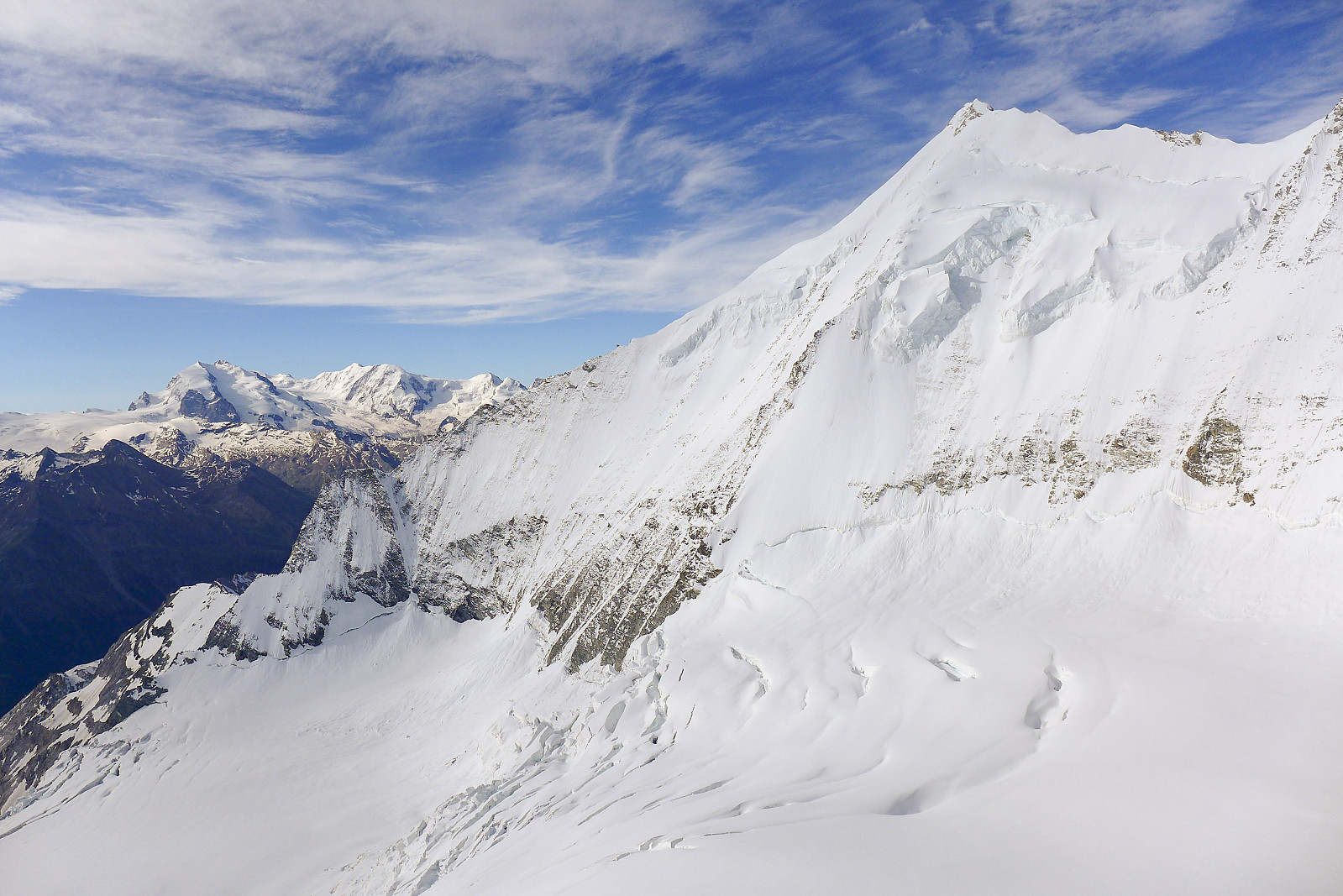
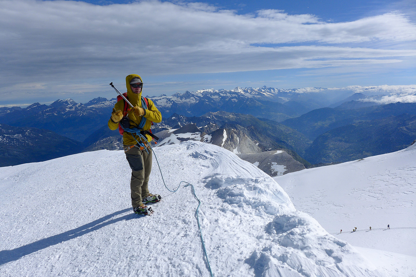
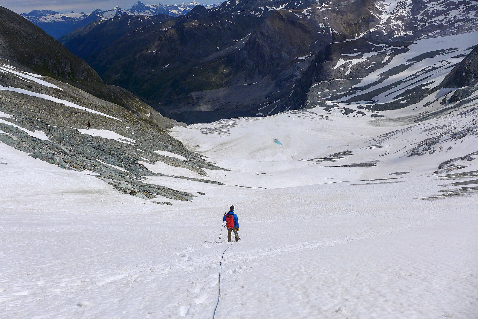
The forecasted bad weather was already making itself visible west of us and it would be only a matter of an hour or so before the Bishorn summit was fully shrouded by low clouds. After some summit selfies we started the march down the well-trodden track in the northwest flank. It at least provided a very efficient way to lose height quickly, so progress was pretty efficient until we reached a plateau at around 3300 m on the Turtmann glacier. Almost suddenly the snow condition changed from being pretty firm to absolutely horrific and rotten. We were wading in places up to our thighs through the most rotten snow ever. Hopeless! Not really knowing how long these conditions were going to last for was probably the worst and I dreaded the thought of having to walk many more kilometres down the glacier if the snow stayed like this -it would take forever! It didn’t help that it was getting pretty hot under the sun at this point either... fortunately the conditions were only really bad across the flattest part of the glacier, and once we changed direction to descend the steeper part of the glacier facing more towards the north, the snow also changed back to being somewhat firmer again, though with the lower altitude and late morning sun it was also pretty soft here too. Not rotten though. After zipping down the lower part of the Turtmann glacier and trending rightwards we took a new break to take off crampons and begin the re-ascent up to the Adlerflue, separating the Turtmann and Brunegg glaciers. There were some blue markings on rocks here and there but had I not been following Graham I probably wouldn’t have known where to look for them. It wasn’t the most obvious path to locate. Anyway, I was on my way to running out of drink by the time we eventually reached the top of the Adlerflue which wasn’t great timing since the hut looked like it was still miles away and I was extremely thirsty. At least it was all going to be downhill now yes?!
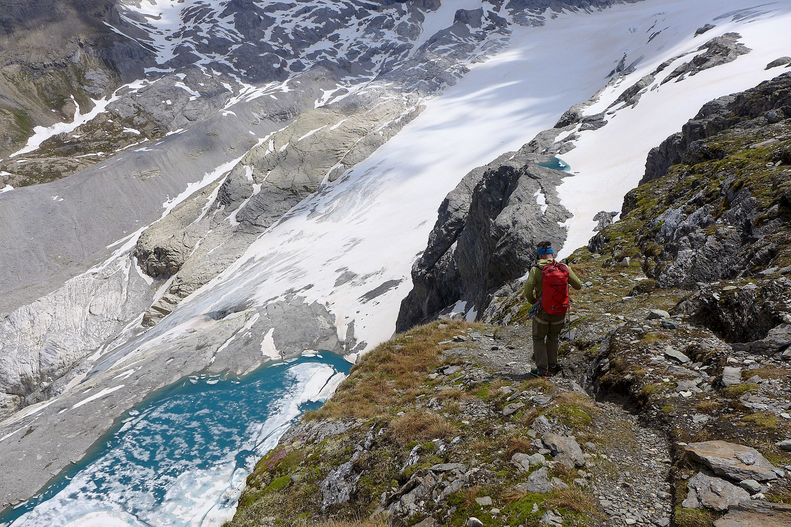
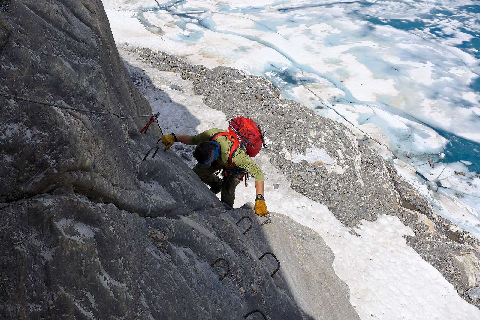
The last part of the descent from the Adlerflue was comparatively slow compared with the kilometers we’d covered on the glacier. But in some ways more fun. There was a steep drop down some cliffs on the northeast side to reach the small glacial lake about 200m below, and in typical Swiss style this problem was solved by a very convenient installment of a series of via ferrata cables and rungs which had to be downclimbed. It was steeper here than the climbing on the East ridge (the rock was probably better too!) - but also a very direct way to reach the lake. Once down at the lake we had to walk a bit back and forth to locate the path and eventually saw out that we’d have to first descend down to and cross a bit of dry glacier at the very bottom part of the Brunegg glacier first, then walk back up the rocks on the other side to (eventually) meet the path that we’d taken earlier in the morning. Had I not filled up my water bottle with a some meltwater from the stream coming off the glacier I would probably have lost the will to live by this point! It did feel like the descent was taking forever in the heat – it wasn’t quite the straightforward walk-down-the-glacier-and-back into-the-hut kind of descent I’d first imagined. Anyway, once we did finally arrive back at the junction where the two paths met, it felt like we were on the homerun and the hut was only a stone’s throw away. Now it was just a matter of descending the gully and walking along the flattish path back to the hut, where my dreams of drinking large quantities of 7up (or whatever the Swiss equivalent was) were fulfilled!
It was already 1.30pm by the time we reached the hut again and dark clouds gave a hint of some very wet weather looming nearby. Meteoswiss were showing rain coming in at around 3pm, so if we didn’t want to get drenched (neither of us had brought waterproofs) then we’d have to make a fairly swift return to the car park! So after a rapid consumption of drink and an equally rapid change to shorts and trainers and repacking of my rucksack, we began the descent back down the path. I think we got lucky because, despite a few drops of rain just after leaving the hut we got back to the car park in about 1 hour in sunshine, and the heavy rain only started once we’d began the journey back to Evolene. Another 4000m peak outing that ended with good timing!
| Start date | 06.07.2021 03:42 (UTC+01:00 DST) |
| End date | 06.07.2021 13:46 (UTC+01:00 DST) |
| Total Time | 10h 03min |
| Moving Time | 10h 03min |
| Stopped Time | 0h 0min |
| Overall Average | 2.2km/h |
| Moving Average | 2.2km/h |
| Distance | 21.6km |
| Vertical meters | 1,961m |


User comments
Woop!
Written by Skippy 07.07.2021 00:36Priority #1 when you come home is to write a good report! :)
Re: Woop!
Written by hmsv1 07.07.2021 06:29Ok ok :-)