
Keipen (18.08.2012)


Geschrieben von hmsv1 (Hannah Vickers)
| Startpunkt | Fjordgårdtunnelen |
|---|---|
| Tourcharakter | Bergtour |
| Tourlänge | 6h 30min |
| Karte |
|
| Besteigungen | Keipen på Senja (938m) | 18.08.2012 |
|---|
This was one trip I had had high hopes for. My mum was visiting me for a few days, and one of the things I really wanted for her to see the absolutely amazing views over Mefjord. Keipen seemed like quite a nice choice of mountain to see it because it is one of the Lenvik Ti på Topp, and I simply assumed that it would not be too difficult a walk to do. Unfortunately, as we drove over from Tromso it was obvious that there was a lot of low cloud to budge before these really fantastic views could be seen from the mountain! It was about midday when we arrived at Botnhamn, and we thought that we'd wait for a little longer before starting the hike because the weather forecast had promised more sun later in the day.
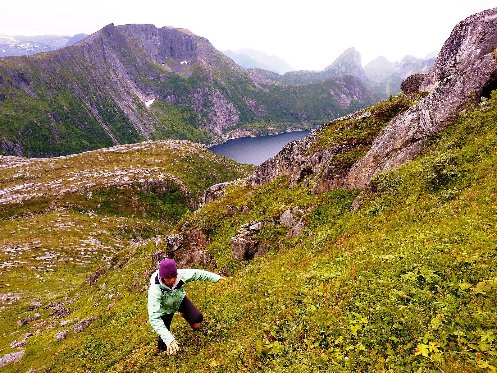
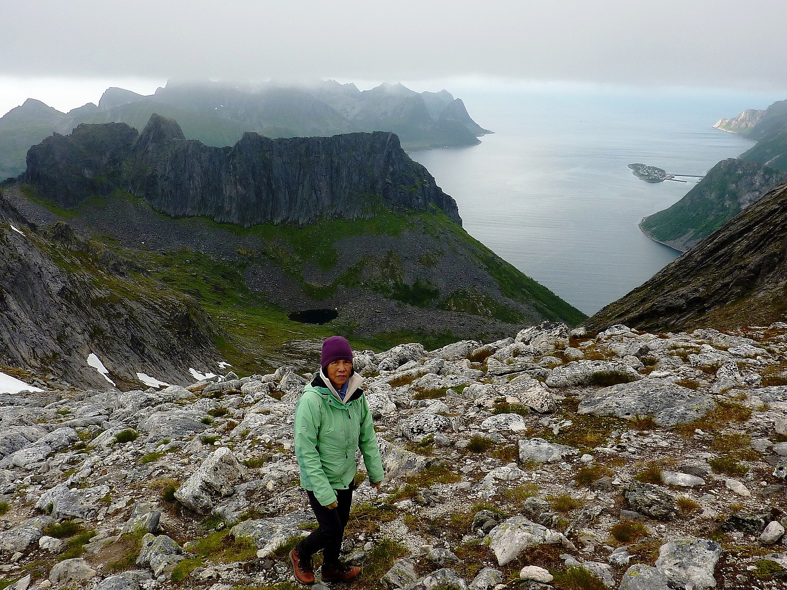
Most of the route descriptions I'd found for Keipen recommend starting from the entrance to the Ørnfjord tunnel, and then heading up to the ridge connecting Grytetippen and Barden and towards the small knoll called Daven which overlooks Ørnfjorden. So at about 14:00 this is exactly what we did. Initially the path from the car park seemed quite obvious to follow, but within 5 minutes of walking it had pretty much disappeared and looking for footprints became the most reliable way of finding a suitable way up to Daven. Fortunately, when we arrived at the ridge, there were some red paint marks on the rock to indicate that we were in fact in the right place. Pity they didn't carry on from there though! The route marked on my turkart (but which was actually an unmarked route) followed the steepest part of the slope up to pt.588 - I thought that perhaps contouring around the mountain a little would make it less steep and intimidating for my mum, but in the end I decided to keep to the suggested route. It proved a bit of an adventure (although rewarded by some good views behind us) - we didn't really find much of a trace of a path where other people might have walked before, and the experience more alike to fighting our way through some tall bushes to get to the top of this crag.
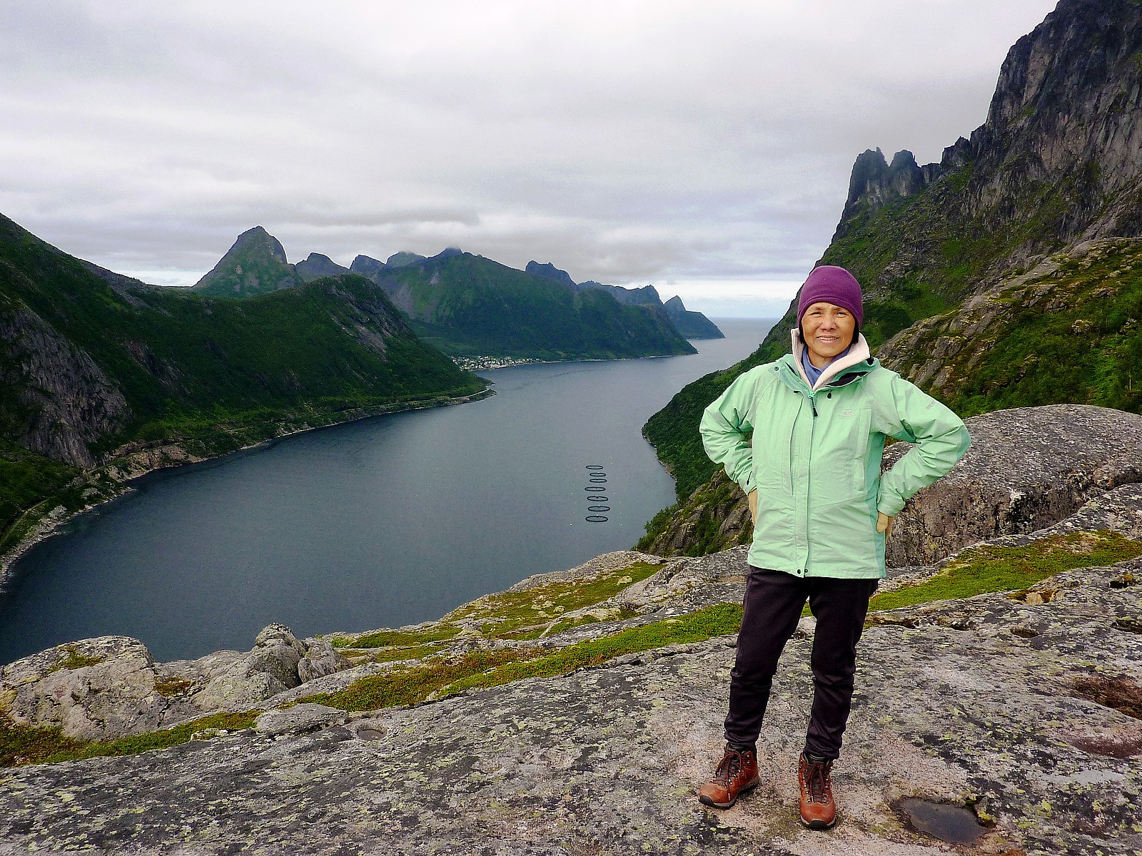
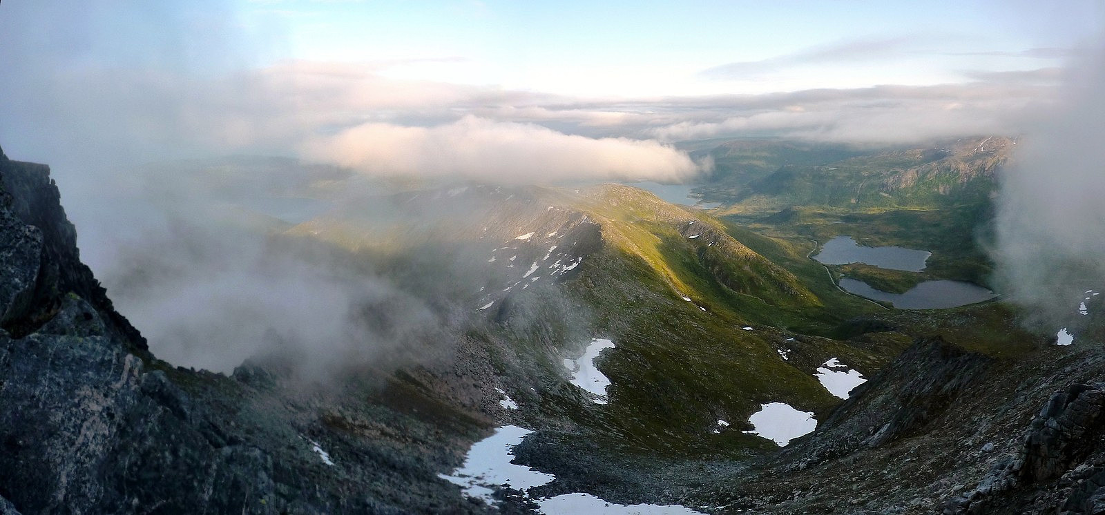
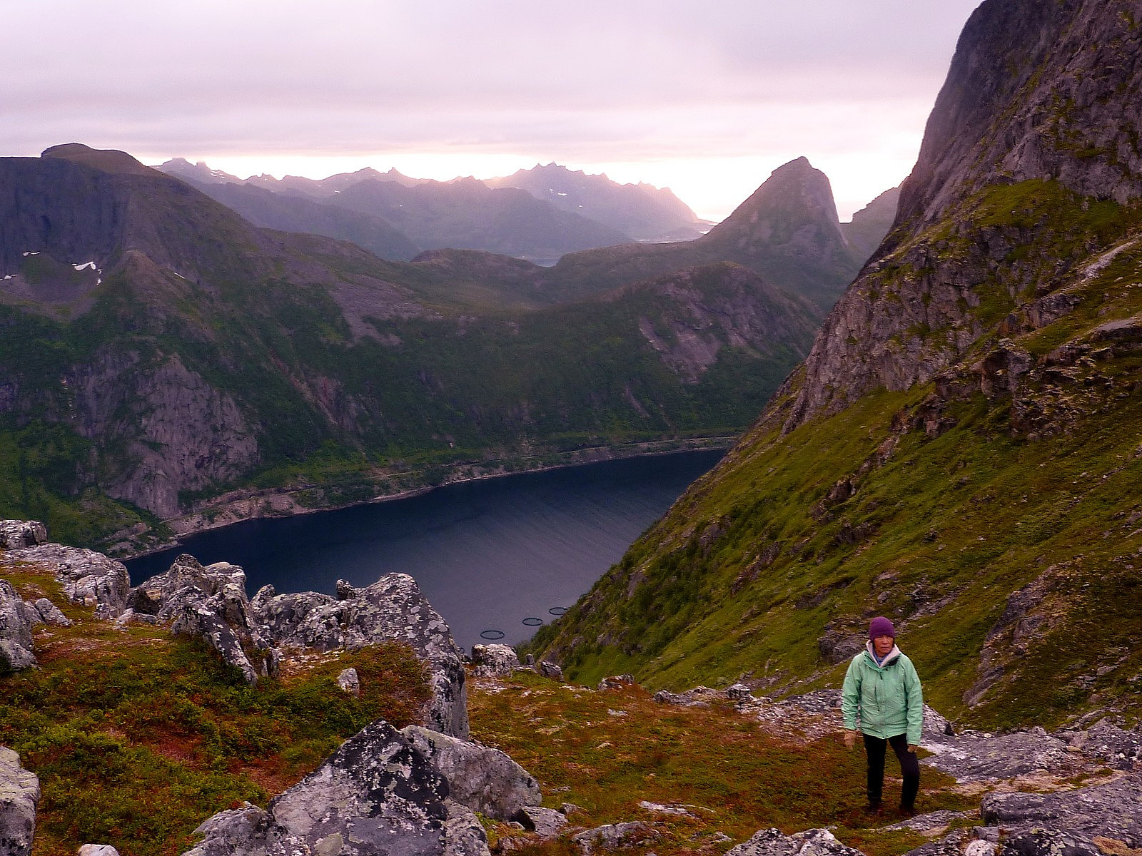
I did at one point wonder whether it was really a wise idea to venture into the unknown, but I tried to disguise the concerns from my mum, otherwise she would have also gotten a lot more worried! I could tell that she didn't feel very comfortable on this kind of ground, but she did a very good job of persevering until we got past it all and onto the much flatter ground leading across to pt.588. We took a generous stop here to eat and drink, and then continued on our way again. Fortunately, by this time, it looked like the fog might even lift above Breidtinden and give us some wonderful views of its impressive east face, but it seemed to be taking a long time for the fog to shift! We also seemed to have found our way onto the Ti på Topp route too, marked by regular splodges of red paint on the rocks. This helped boost both mine and my mum's confidence - simply knowing we were following something and not creating our own path! Nevertheless, we were still only about halfway up the mountain, and had more steep ground to cover. The approach to the dip in the ridge between Grytetippen and Keipen took a very long time. It was more boulder-covered ground and my poor mum had trouble walking up and across this area, presumeably because it was not familiar terrain for walking to her., But as ever she did her best to concentrate and we eventually got up to the ridge, which afforded us some (quite) splendid views over Ørnfjorden/Øyfjorden and the mini-peninsulas stretching way out to the north. At this point we were now at about 700m, so another 250m or so to ascend. Between there and the summit, the fog closed right in on us again and all hopes of a summit view vanished. But quite by surprise, we bumped into another group of 4 female hikers, one of which happened to by Siv - a friend of mine I'd met on an FSG trip! It was a really to see her - we were both as shocked as each other though, not quite expecting the encounter!
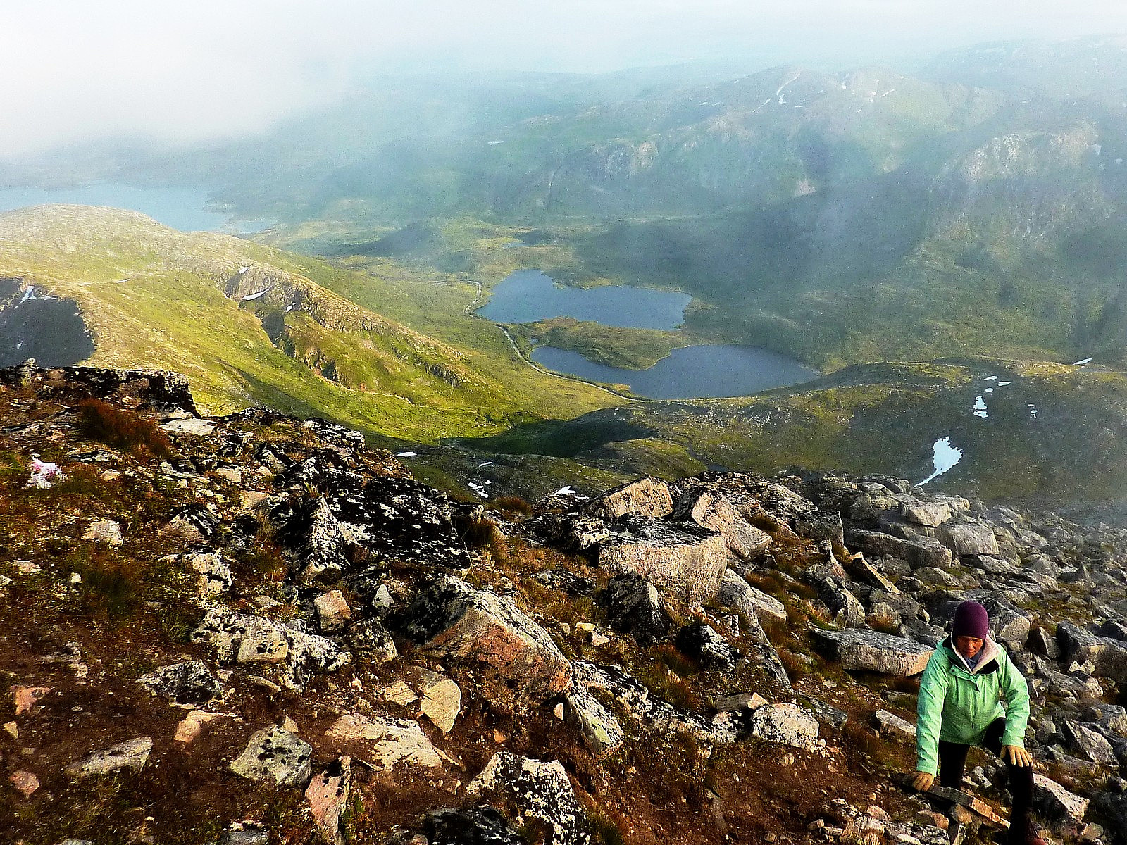
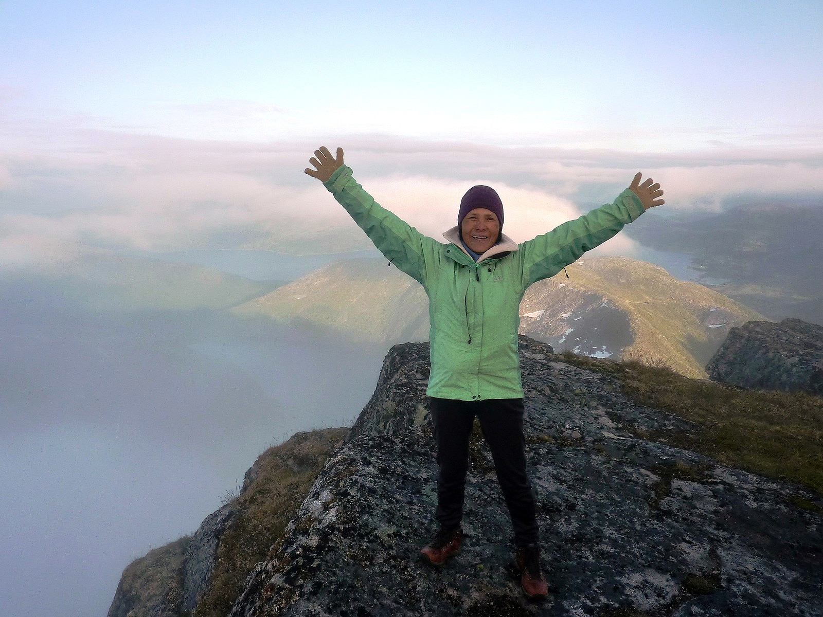
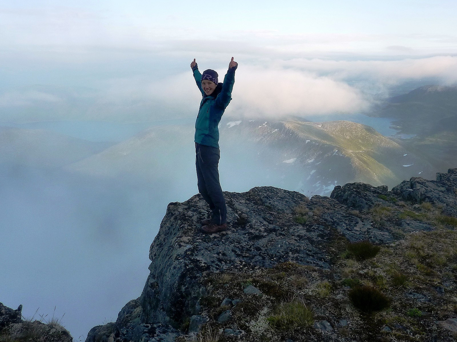
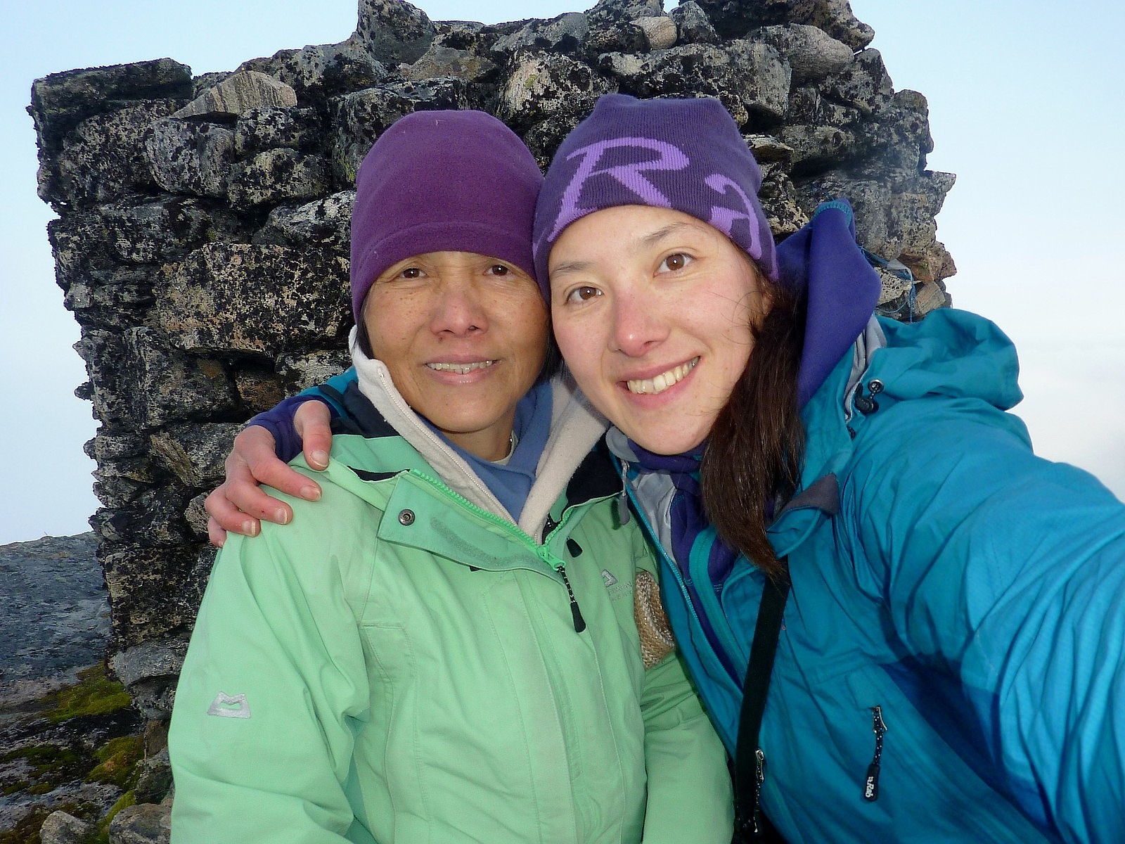
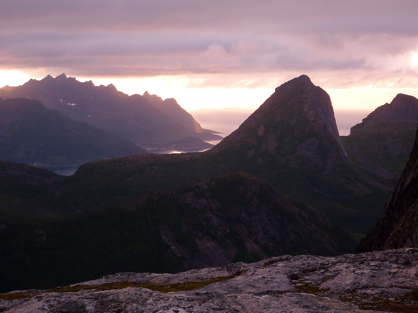
The other three girls were also living in Tromso and were having a camping weekend on Senja. They'd already been to Grytetippen and sat for some hours, apparently waiting for the fog to pass and get a view - but didn't. Then they'd done the same on the top of Keipen too but not had much success on that either. I think they had pretty much given up on the idea of sitting in the cold now and decided to head on back down to the car. After some chatting and catching up with each other, my mum and I continued on the way to the top - which took about another 45 minnutes. We were only partially rewarded for our efforts though - the fog did it's best to tease us by clearing every now and then, and we could see all the way down to Mefjordvatnan in the south - but still nothing to the north. It was a real shame. We signed the summit turboka though, and then had some small snacks to keep us gong for the rest of the way down again.
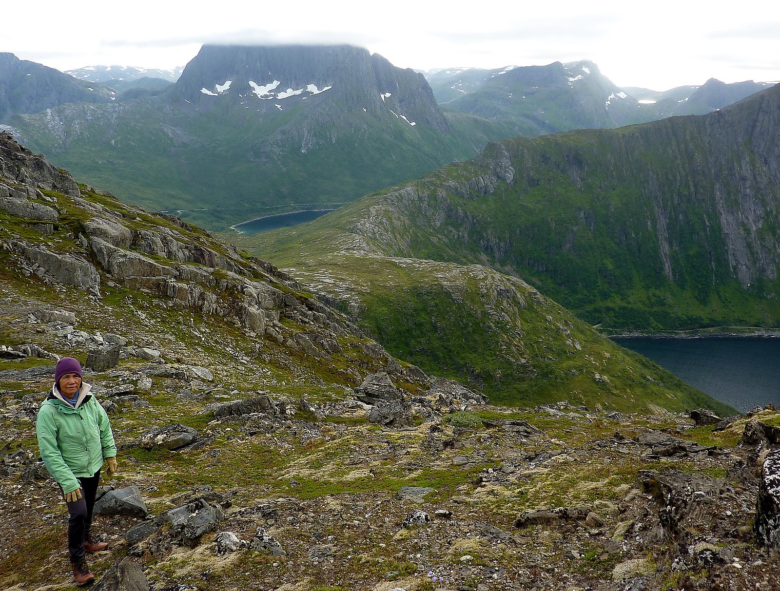
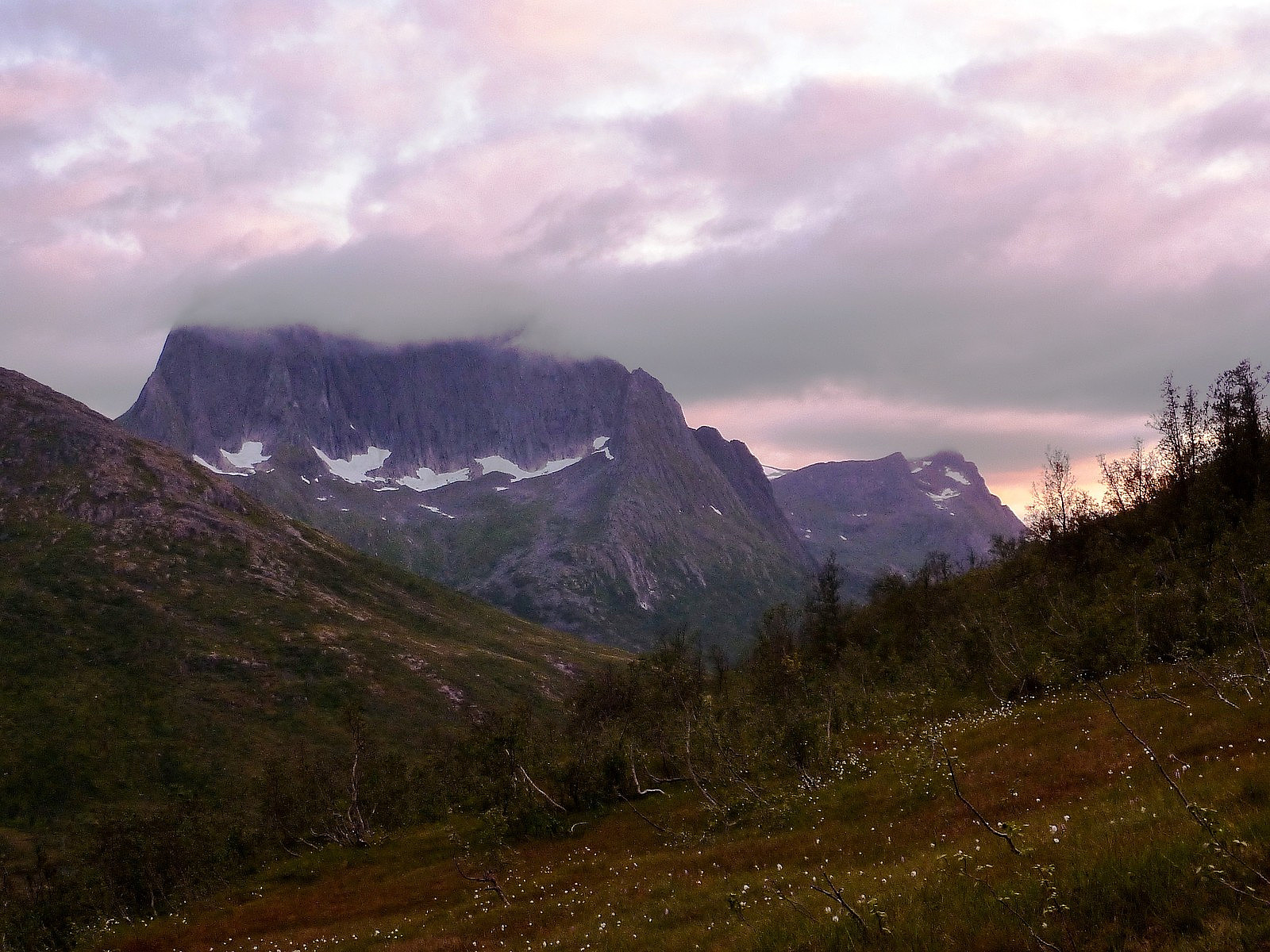
After our experience earlier on the near-vertical bush slopes, I thought it would be wise to try and stick as much as possible to the Ti pa Topp route and look out for the way markings. This did work out for the way back down to pt. 588, which we'd already come up, but from there, trying to follow the route proved much more of a challenge than you'd think. Somehow we lost the way again, and only after whipping out my map and trying to figure out where we were, I saw that we needed to redirect ourselves towards the obvious river valley towards the northeast. I wasn't sure of the best way to get there though, other than simply walking down the ridge we were on and avoiding anything looking too rocky and steep! I could tell that mym mum had the 'very concerned' expression written across her face again, so I tried my best to encourage her and say how well she was doing......Well, I wasn't quite expecting to re-find the path, but somehow we were very lucky to stumble upon it while making our way towards the river valley, and I was very ecstatic to be once again on a marked trail. From there it was easy. Mum was very tired but knowing now were were most of the way down, we tried to keep going and get back to the car as soon as possible. In total we took 4 hours to the top and 2.5 hours down. I did a quick 2km power-walk to get back to the tunnel, and then came back to the road side again to pick up my very exhausted mum. It had ended well though, and even if the fog was still sat stubbornly on top Breidtinden, it still made for a very scenic sunset. The drive down to Mefjord was magical - it was by now about 10pm and the sunlight was dancing off bits of fluffy cloud at the far end of the fjord, creating quite a spectacular palette of glowing colours. One evening to remember for both my mum and me!


Benutzerkommentare