
Austefjellet via Kurlarinden (22.05.2021)

Written by HHauser (Helwig Hauser)

| Start point | Gullfjellsvegen (310m) |
|---|---|
| Endpoint | Gullfjellsvegen (310m) |
| Characteristic | Hike |
| Duration | 3h 30min |
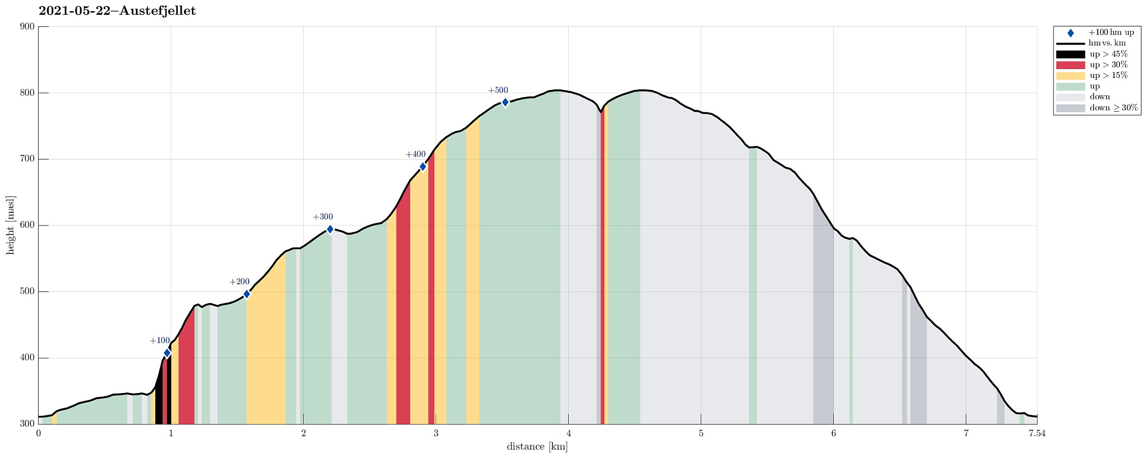
| Distance | 7.5km |
| Vertical meters | 560m |
| GPS |
|
| Ascents | Austefjellet (806m) | 22.05.2021 |
|---|---|---|
| Visits of other PBEs | Osavatnet p-plass (kr) (310m) | 22.05.2021 |
Trip Summary
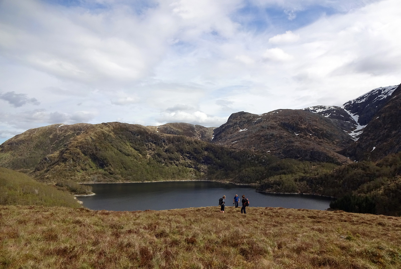
With the goal to do some nice, medium-sized hike, we aimed at Austefjellet, starting from Osavatnet. We thus drove into the direction of Arna (from Bergen), leaving the main road shortly before coming close to Haukelandsvatnet. Driving first towards Unneland, we then continued along Gullfjellsvegen to get up to the parking place in the north of Osavatnet. Walking first along Gullfjellsvegen further eastwards, we came to the place in the west of Taushaugen, where the roads split (with the "main road", Gullfjellsvegen, making a turn to the left, while a minor road continues straight-ahead, into the direction of Kurlatjørna). Following this minor road, we soon after had passed by Kurlatjørna (on our right, south of us), coming to the end of this road (it's continuing behind a closed door and within a tunnel from there). Even though the continuation from there up to Kurlakampen is a bit steep, we still just did that, ending up on the ridge in the east of Kurlatjørna a few minutes later. This ridge, Kurlakampen and further south Kurlarinden, offers very nice views over the valley, including Svartavatnet and Kurlatjørna. Following this ridge further up to Austefjellet (in southwards direction) is then easy and straight-forward. Furthermore, it is kind of convenient that Kurlarinden leads excatly to the top of Austefjellet. After crossing over the top of Austefjellet, we found a nice place just a little south of it for a break (with great views over Dyrdalsvatnet and over to Hausdalshorgi, Slettegga, etc.). After this little break, we then got back up to Austefjellet, heading towards Mjølkehaugen further in the north of Austefjellet. Instead of following the main trail there, however, we first walked further north (to the point, where Snøgjelet starts to become steeper) and connected to the ridge of Mjelkehaugen from there. All this is nice and smooth and the very top of Austefjellet is non-challenging as a whole. After walking down Mjølkehaugen, we then arrived at the parking place north of Osavatnet soon after. All in all, it's worth mentioning that ascending to Austefjellet via Kurlakampen and Kurlarinden is indeed a nice alternative to the otherwise more common trails.
Photos
Selected photos are available as Google photo album.
Useful Resources
See also the related FB-page Hiking around Bergen, Norway.
Petter Bjørstad has a useful page about Austlirinden and also web page WestCoastPeaks.com provides useful information about Austefjellet.
Web page UT.no from the Norwegian Trekking Association recommends a similar hike.


User comments