
Crossing Borga from/to Borgo (02.04.2021)

Geschrieben von HHauser (Helwig Hauser)

| Startpunkt | Borgo (125m) |
|---|---|
| Endpunkt | Borgo (125m) |
| Tourcharakter | Wanderung |
| Tourlänge | 4h 00min |
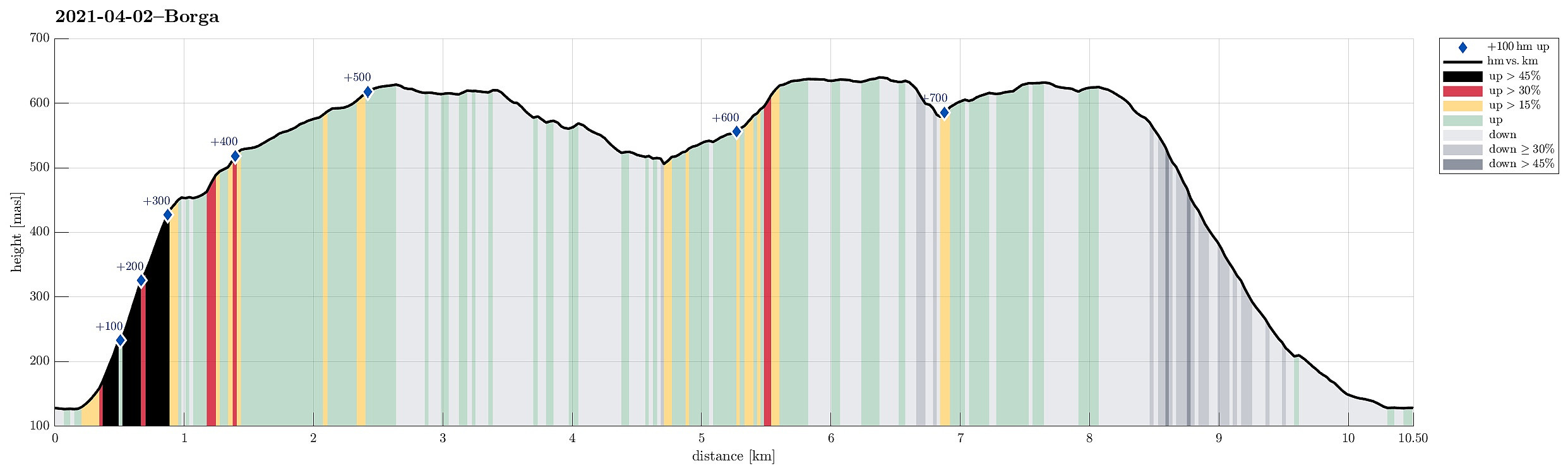
| Entfernung | 10,5km |
| Höhenmeter | 763m |
| GPS |
|
| Besteigungen | Bjørndalssåta (578m) | 02.04.2021 |
|---|---|---|
| Borga (634m) | 02.04.2021 | |
| Grønetua (642m) | 02.04.2021 | |
| Såta (624m) | 02.04.2021 | |
| Vardegga (637m) | 02.04.2021 | |
| Besuche anderer PBE | Kvitnosa (526m) | 02.04.2021 |
| Norhytten (517m) | 02.04.2021 |
Trip Summary
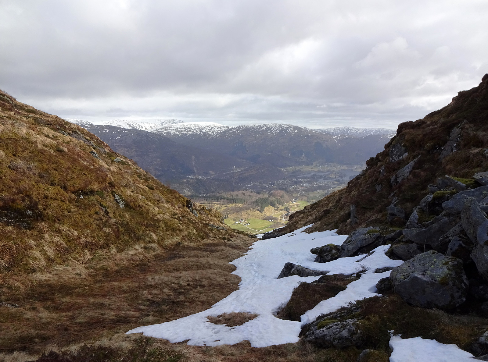
Since it had been a while, since we last were on Borga, we thought that we could pay this nice mountain near Arna another visit. We left Bergen towards the East, passing by Grimevatnet along the way. Near Haukeland, we turned left from Hardangervegen, heading into Langedalen. At Borgo, we parked next to the road and started our hike. From the road we had already double-checked that ascending along the southern (steep) ridge of Borga (south of Kvitnosa) appeared possible (while still a bit challenging). Keeping a little east of the actual ridge, we ascended more or less directly up through some half-open forest. Avoiding cliffs, this way, we managed to straight-forwardly ascend towards Kvitenosa, stepping up over mostly grass in between generously spaced trees. This ascent is indeed quite steep, but with a bit of proper physical condition it's actually enjoyable and a little challenge, also. At about 450mosl, then, we stepped out of the forest, arriving at the first little outpost (right next to the power line). From there, one already enjoys some very nice views towards the south (across Haukelandsvatnet and towards Slettegga and Livarden). From there, it's then just a lovely ridge-hike further up (in northern direction). At many places, one can enjoy really nice views, not only backwards (towards the south), but also across Arna in the east and towards Vidden in the west. After a bit a pleasant hiking, one arrives at Brattegga and from there very soon at Borga. Continuing our crossing of Borga south to north, we then passed by Deilevatnet (on Borga) and arrived shortly after that at Såta (one could call Såta also the northern top of Borga). From there, when knowing about it, one can spot Bjørndalssåta, a little micro-top in the northeast of Såta. A few minutes later, we checked also the views from there (mostly across Arna and towards Osterøy). Once done with Bjørndalssåta (that was quick), we connected with the trail that leads to Norhytten, north of Borga. As we arrived, all others that just had been there before us left and so we could enjoy a lovely short break in the sun there. From there, we then continued up through Skitnedalen and up to Grøntua. Our next goal was then to connect with the main trail across Vidden on Vardegga and with Borgaskaret that we wished to go down thereafter. After passing by Borgavatnet in its northwest, we stepped up to Vardegga (and "into the masses of hikers"). Clearly, we are not used this number of other hikers along the same path anymore, which made us breath out in relief, once we had turned left in Borgaskaret, starting our descent back to Borgo (all by ourselves, again). Altogether, we really enjoyed this hike a great lot, including the steep ascent and the beautiful crossing of Borga with all the nice views from up there.
Photos
Selected photos are available as Google photo album.
Useful Resources
See also the related FB-page Hiking around Bergen, Norway.


Benutzerkommentare