
Stortårnet and Nilskyrkja (21.03.2021)

Geschrieben von HHauser (Helwig Hauser)

| Startpunkt | Dala (5m) |
|---|---|
| Endpunkt | Dala (5m) |
| Tourcharakter | Bergtour |
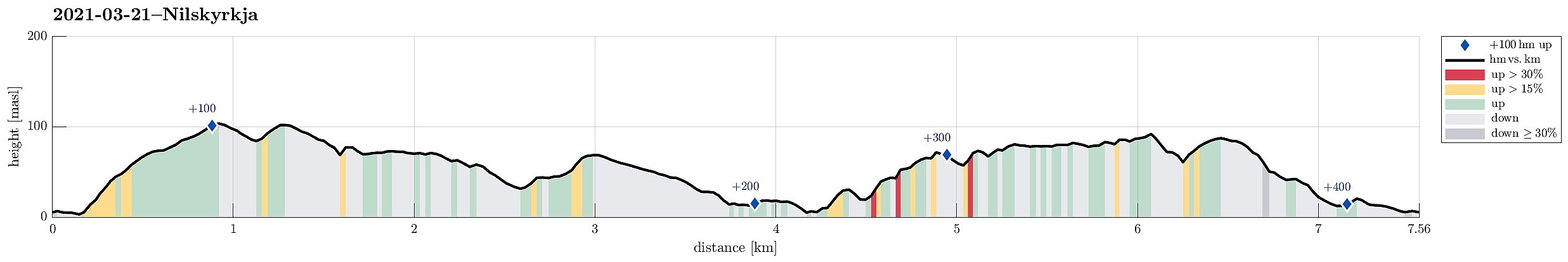
| Tourlänge | 2h 00min |
| Entfernung | 7,6km |
| Höhenmeter | 406m |
| GPS |
|
| Besteigungen | Høgevarden (103m) | 21.03.2021 |
|---|---|---|
| Stortårnet (110m) | 21.03.2021 |
Trip Summary
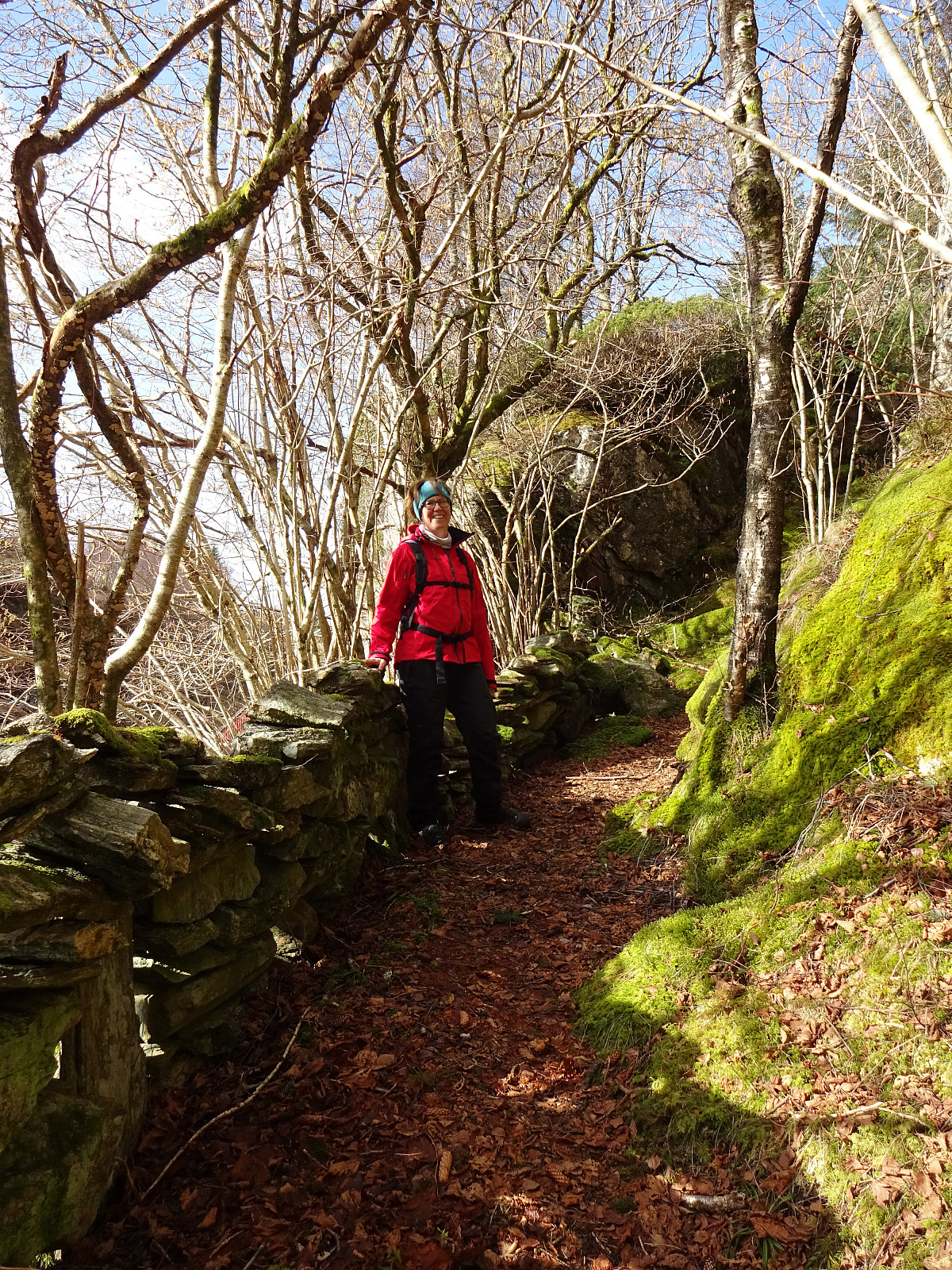
Our idea was to explore the west of Dala, south of Fjell in Øygarden. After driving westwards from Bergen, we turned south once on Sotra. Passing by Fjell, we soon arrived in Dala, where we parked next to the main road. The first (small) hiking goal of the day was Stortårnet in th southwest of Dala. After crossing a playing ground right next to Dalseidet, we started a short ascent (first without any trail). Once above 70mosl, we connected to a simple trail which then lead us to Stortårnet. Before turning back, we first explored the area a little, including the mobile sender mast in the southeast of the top (northwest of Dalatjørna). We then continued northwestwards from Stortårnet, reaching Ærhaugane soon after while walking over the ridge parallel to Trengereidpollen some 75 meters further below in the west. From Ærhaugane, we then thought to cross over to Dalafjellet, on the other, northern side of Dalseidet. Walking in this direction, we got back on a simple road (leading to house with number 52) that brought us down to Dalseidet. Only a few meters into the west from where we had stepped out onto Dalseidet, we found a convenient opportunity to ascend up towards Dalafjellet. Instead of getting right to the top, though, we first followed Nordsjøløypen, about half way up there, extending on an intermediate height southeast-to-northwest along the southwestern side of Dalafjellet. After maybe 150m along this trail, however, we left it to get "all the way up" to Dalafjellet (not very high anyway). We then crossed Dalafjellet in northwestern direction, enjoying some nice sun. From there, we headed northwards, aiming for the west-end of Kyrkjevikvatnet. Crossing over the little stream that comes out of Kyrkjevikvatnet (at the end of the little "finger" at the western side of the lake), we got to the "land bridge" between Kyrkjevikvatnet (in the east) and Kyrkjevika (in the west). After briefly visiting Fjellspollen down there (not utterly beautiful, one could say), we started our way back that should include Nilskyrkja. In order to get there, we had to cross a little valley in the west of Nilskyrkja (and in the north of Kyrkjevikvatnet) that hosts quite a bit of vegetation, including a little forest. Getting through there was not exactly difficult, but still required to bend some branches aside and to find a suitable passage. Instead of heading directly towards Nilskyrkja (which is pretty steep and rocky on its western side), we ascended out of this little valley in northern direction. Once up on the saddle, there, we turned right (into southeastern direction). While the terrain is rugged there, with quite a few rather pronounced steps, it's still well possible to cross over it and to get to Nilskyrkja from there. Once on Nilskyrkja, one can enjoy some nice views, actually. From there, we then followed the high ridge into the direction of Høgevarden, just north of Dala. Høgevarden offers some nice views, as well. From there, it was then just down and back to the car (in order to get down from Høgevarden, we used a slope maybe 150m in the northwest of Høgevarden). All in all, this exploration was rewarding, also without high tops.
Photos
Selected photos are available as Google photo album.
Useful Resources
See also the related FB-page Hiking around Bergen, Norway.


Benutzerkommentare