
Vardetangen (14.03.2021)

Geschrieben von HHauser (Helwig Hauser)

| Startpunkt | Torvneset (15m) |
|---|---|
| Endpunkt | Torvneset (15m) |
| Tourcharakter | Spaziergang |
| Tourlänge | 1h 30min |
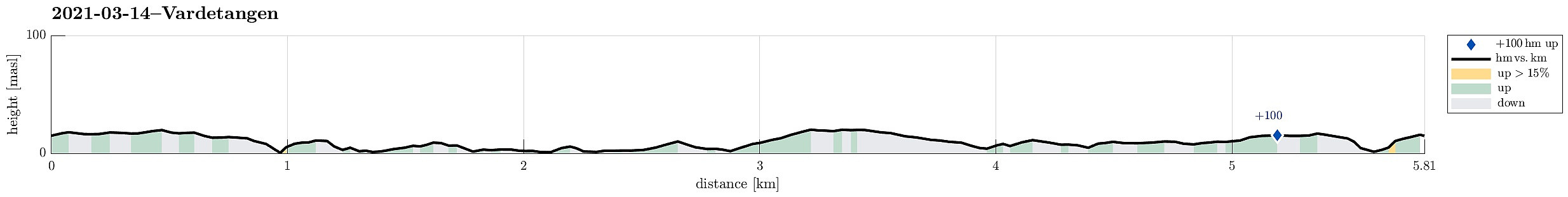
| Entfernung | 5,8km |
| Höhenmeter | 117m |
| GPS |
|
| Besuche anderer PBE | Vardetangen dagsturhytte (9m) | 14.03.2021 |
|---|---|---|
| Vardetangen - Norges vestligste fastlandspunkt (1m) | 14.03.2021 | |
| Vardetangen p-plass (12m) | 14.03.2021 |
Trip Summary
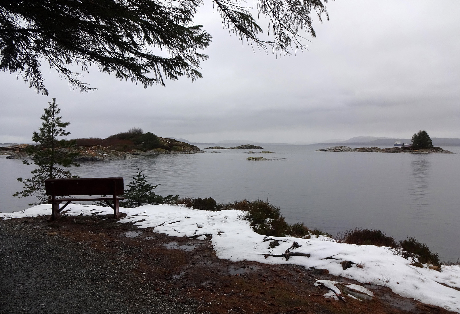
The plan for this all-in-all comparably wet day was to visit Vardetangen, i.e., Norway's western-most point, when disregarding islands. Driving north from Bergen we passed through Knarvik and continued further northwards Lindås and Mongstad. Soon after, we arrived in Austrheim and parked near Torvneset right next to Ervika. From there, it was then a short walk towards Vardetangen, where we recognized that quite a bit had changed since our last visit (the cabin, for ex., is new and also the trail there has been upgraded). After staying at Vardetangen for a short while, we continued towards Årvika along the northern shoreline. There, we used a nice wooden shelter to have a short break with some nice snacks. At last, we completed a little round back to the parking place, coming by Træsvika and Purkebolsvatnet. All in all, this walk was rather short, but still nice with some enjoyable views.
Photos
Selected photos are available as Google photo album.
Useful Resources
See also the related FB-page Hiking around Bergen, Norway.
Web page UT.no from the Norwegian Trekking Association recommends a similar hike.


Benutzerkommentare