
Ranen, Midtfjellet, Grønetua, Vardegga, and Ulskebjørnen (12.12.2020)

Skrevet av HHauser (Helwig Hauser)

| Startsted | Jordalen (40moh) |
|---|---|
| Sluttsted | Jordalen (40moh) |
| Turtype | Fottur |
| Turlengde | 5t 00min |
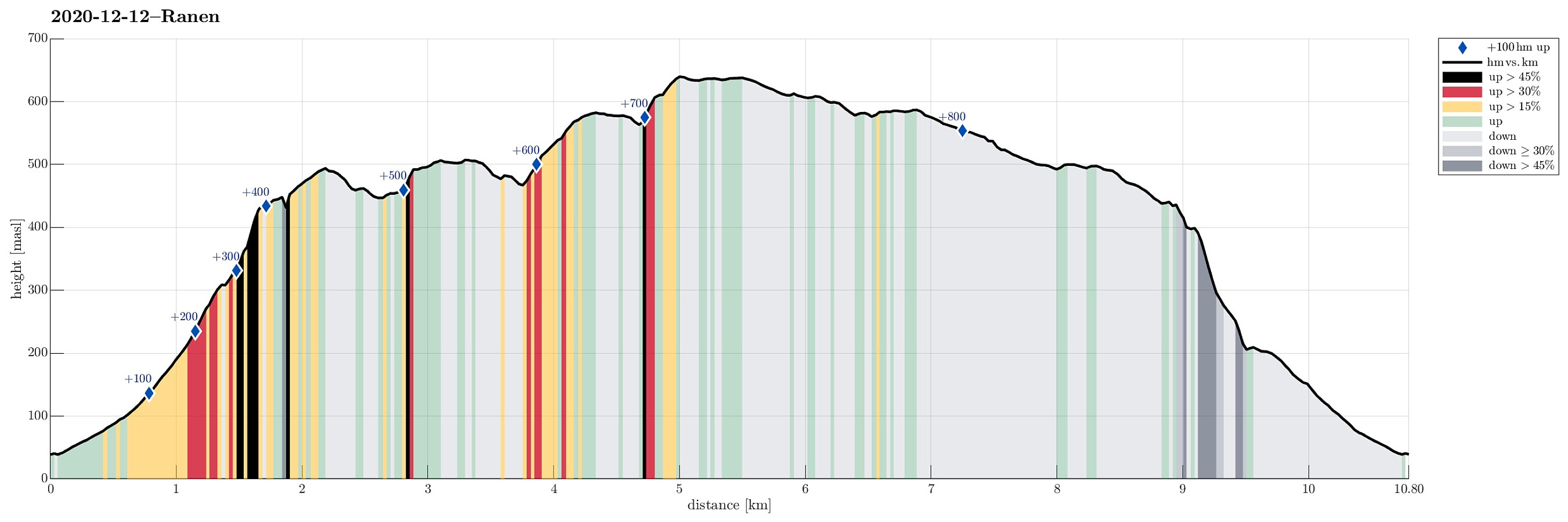
| Distanse | 10,8km |
| Høydemeter | 836m |
| GPS |
|
| Bestigninger | Grønetua (642moh) | 12.12.2020 |
|---|---|---|
| Midtfjellet (510moh) | 12.12.2020 | |
| Ranen (498moh) | 12.12.2020 | |
| Ulskebjørnen (446moh) | 12.12.2020 | |
| Andre besøkte PBE'er | Arnahytten (585moh) | 12.12.2020 |
| Fjellstuen (ruin) (474moh) | 12.12.2020 | |
| Henrik Krohns utsikt (590moh) | 12.12.2020 | |
| Huldraheimen (482moh) | 12.12.2020 | |
| Jordalsveien p-lomme (40moh) | 12.12.2020 | |
| Nissebo (502moh) | 12.12.2020 | |
| Seterly (ruin) (467moh) | 12.12.2020 | |
| Stallane (207moh) | 12.12.2020 | |
| Vikinghytten (586moh) | 12.12.2020 |
Trip Summary
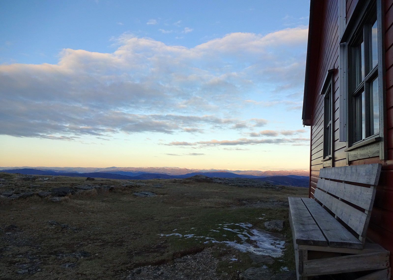
We thought about doing a hike from Jordalen, in the north of Bergen, including Ulskebjørnen (and Vardegga). To give this hike at least something special, we also wished to include Ranen, a somewhat sidelined hill between Rundemanen and Vardegga, right next to Jordalsskaret (in the west of it). While Ranen is no more than just a few gentle steps in northern direction, when coming from the main trail that connects Rundemanen and Vardegga, it really is very steep on its northern side, facing Jordalen. In fact, it gets more and more steep, the furthre north one gets, crossing over Ranshaugane there, and between 200mosl and 400mosl the northern side of Ranen is mostly cliffs that looks impossible (or, at least, very difficult) to cross. After first driving into Jordalen from the north and parking right before the road crosses over the stream that comes down from Jordalsskaret at about 40mosl. From there, we first followed the main trail, heading upwards into the direction of Jordalsskaret. At times, we could look over to Ranen from the trail, inspecting it for an opportunity to ascend up there. While we did check for an ascent option from further down, we already had interpreted the map in that it should be easier possible from a little further up (along the trail to Jordalsskaret). Eventually, we confirmed that ascending the steep northern flank of Ranen from the very bottom appeared to be too difficult (or impossible, actually), and thus followed the trail upwards to about 325mosl, before leaving the trail in southwestern direction and crossing over to the northeastern side of Ranen. There, while still very steep, the ascent was well possible and within short we arrived at Ranshaugane, quite a bit above Jordalen. Instead of heading directly for the "top" of Ranen, we first crossed over to the ridge in the north of Ranen, offering wonderful views into Jordalen! From there, the rest of this hike was more "normal", then. We crossed Ranen (in southeastern direction) until we joined the major trail that comes down there from Rundemanen in the west. Following this trail for a few meters, we got near Midtfjellet. Instead of circling Midtfjellet, following the main trail, we decided to step over it, instead. Starting our crossing of Midtfjellet in the northwest of it, we came by a ruin of a cabin (Seterly), not far from the trail. After ascending Midtfjellet from this ruin, we then followed its "high ridge" in southeastern direction, descending to Huldraheimen near the dam of Øvre Jordalsvatnet. After a short break at Huldraheimen, we crossed the dam and started our ascent to Trappefjellet. Near Norrønavatnet on the top of Trappefjellet, we then decided to turn back and complete our round. To do so, we left the main trail over the main ridge of Trappefjellet and turned towards Grøntua on our left (northeast). After crossing the little valley, which connects Borgavatnet in the southeast and Øvre Jordalsvatnet in the northwest, we ascended to Grønetua (without a trail) and thereby connected to Vardegga, also. Walking back along Vardegga (in northwestern direction) was then really nice, with great views in all directions! Coming by Vikinghytten, we continued into the direction of Ulskebjørnen (via Ørnafjellet). Staying on the high ridge, we circled Ulskebjørnstemma a little below us in the north, we eventually arrived at Ulskebjørnen just before daylight started to cease. We still made it down well (via Stallane) and back to the car before it got really dark. Altogether, this hike was (a) a bit adventurous (ascent to Ranen) and (b) very nice (views from Vardegga)! :-)
Photos
Selected photos are available as Google photo album.
Useful Resources
See also the related FB-page Hiking around Bergen, Norway.
Petter Bjørstad has a useful page about Ulriken and also web page WestCoastPeaks.com provides useful information about Grønetua.
Web page UT.no from the Norwegian Trekking Association recommends another hike from Jordalen to Bergen.


Kommentarer