
Tour Skiing to Mount Alnestinden with my Son Dag (24.10.2020)


Geschrieben von Solan (Atle Solholm)

| Startpunkt | Alnesreset (806m) |
|---|---|
| Endpunkt | Alnesreset (799m) |
| Tourcharakter | Randonnée/Telemark |
| Tourlänge | 3h 31min |
| Entfernung | 6,7km |
| Höhenmeter | 889m |
| GPS |
|
| Besteigungen | Alnestinden (1.663m) | 24.10.2020 12:25 |
|---|
There had been a substantial snowfall a few days ago, and we had lately seen some people sharing online that they had been tour skiing to the summit of Mount Alnestinden in the municipality of Rauma; and so my son and I decided to do the same. The local newspapers reported that there had just been a huge avalanche close to the summit of this mountain, though, but I knew this mountain quite well; and by that I mean well enough to be familiar with an alternative route that we could take to minimize the risk of being caught by an avalanche, if necessary. As we were heading towards Rauma this morning, however, I was a bit curious to see where the avalanche had been taking place, as there was something that didn’t quite add up in the newspaper report. First, the report said that the avalanche had been on the south side of the mountain, while I knew the south side to be way too steep for ordinary skiing, whether uphill or downhill; and I’ve actually never heard of anyone skiing down the cliffs of the south side of this mountain. Second, the avalanche was described in the newspaper as being caused by a huge amount of snow that had been brought there by the wind. This could have been true, but the common ski trail up to the summit of Mount Alnestinden is on the leeward side of the mountain, and so whenever you go tour skiing up that mountain, it's quite likely that there will be at least some amount of wind transported snow along the trail. Moreover, the mountain is sufficiently steep along parts of the trail [i.e. > 30˚], that avalanches occasionally does occur, but at this time the avalanche came after the very first real snowfall of the season, and I therefore didn't find wind transported snow to be a sufficient explanation all by itself. Third, the newspaper spoke of the avalanche as being a slab avalanche, which seemed a bit odd, I have to say; as an avalanche taking place just a day or two after the first substantial snowfall of the season, will usually be a loose snow avalanche.
![Image #3: By our car down by county road 63. Image #4: Putting on the skies at about 800 m.a.m.s.l. Image #5: A "ski selfie" that my son captured just before we set of. Image #6: On the trail up Mount Alnestinden. Mount Bispen [i.e."The Bishop"] and Mount Kongen [i.e. "The King"] are seen in the background. Image #7: Approaching the upper hanging valley east of the summit of the mountain. Image #8: The two cairns on top of the mountain.](https://images1.peakbook.org/images/14939/Solan_20210205_601d8abba3c2f.jpg?p=xtralarge)
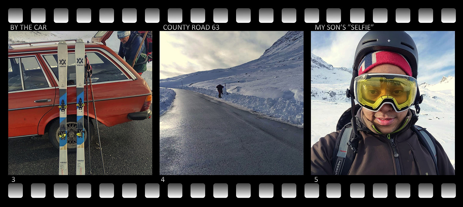
We went by car along county road 650 to the village of Valldalen, and then took route 63 towards the town of Åndalsnes. This road is renown as a tourist route, as it offers a splendid view along its entire extent; and especially so at the steep cliffs of Trollstigen [i.e. "The Troll's Ladder"], where a set of nine hairpin bends [i.e. 180˚ road bends] and two 90˚ bends, takes the road up from Isterdalen Valley to a valley called Stigrøra, where Trollstigen Tourist Center is located, about 500 meters higher up (see map). On this occasion we were approaching the Trollstigen Tourist Center from the other side [i.e. from the south side], however, and we actually stopped at about 800 m.a.m.s.l.; roughly 1.2 km south of, and approximately 100 elevation meters above the tourist center. Road 63 usually closes for the winter season about mid December (depending on how much snow there is), and then Mount Alnestinden becomes a very remote destination that few people bother to visit on skies. It is, however, a popular skiing destination just before the road closes (provided there's enough snow in the mountain); and then even more so after the road is being reopened in May. As for now, the road was still open, and we found a suitable place to park our car by the roadside, and then we embarked upon skiing from there (Images ##3 and 4).
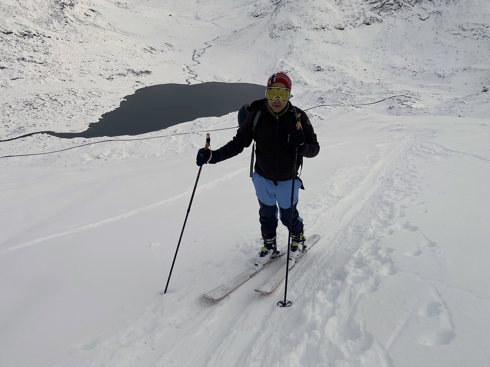
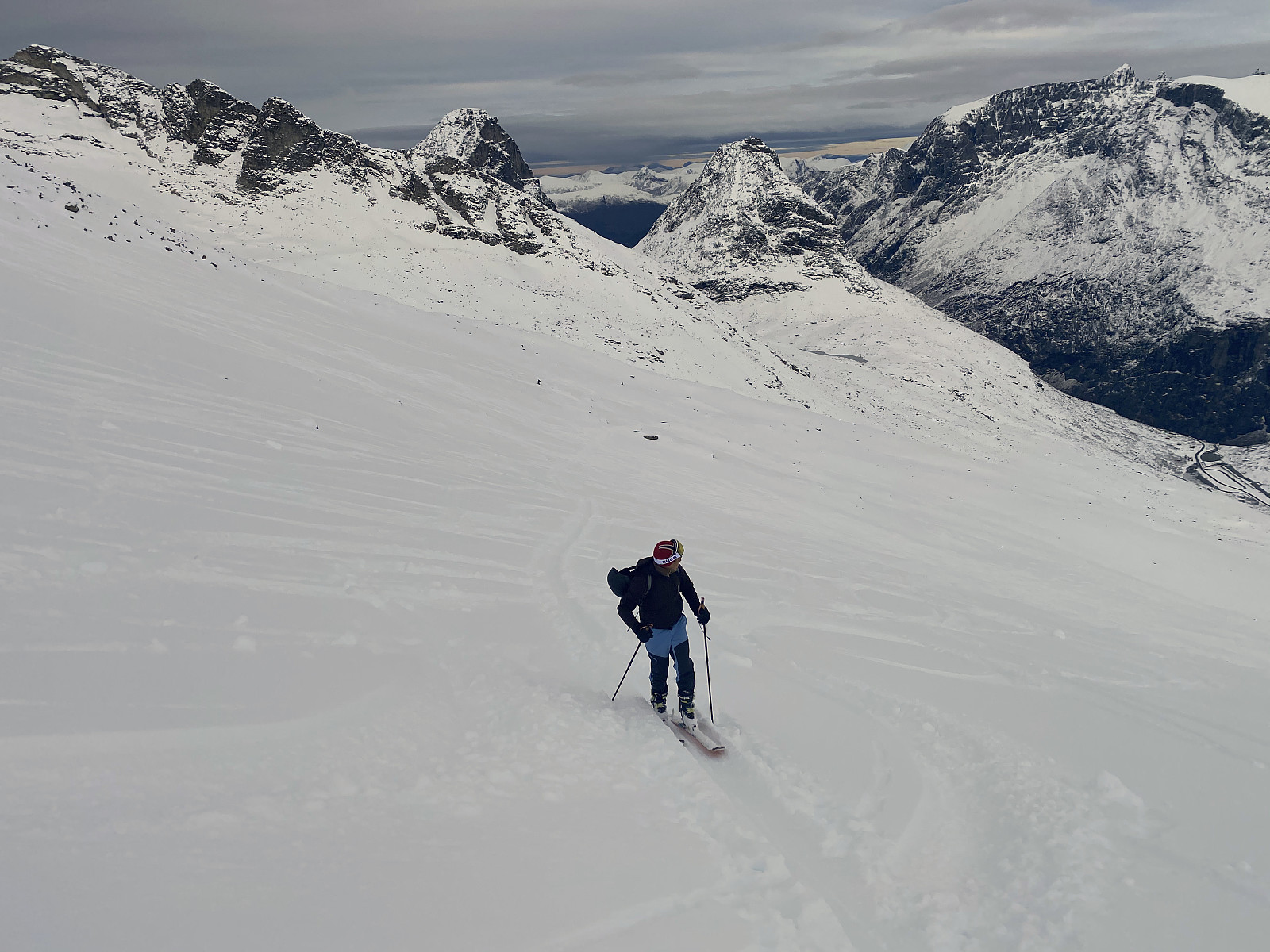
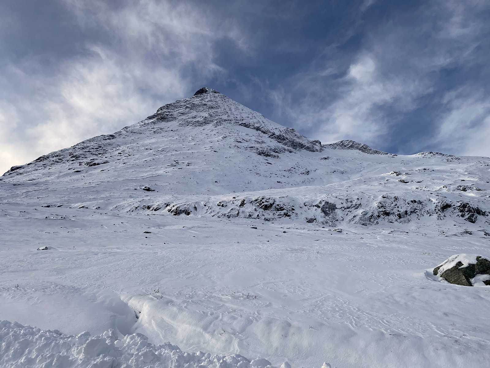
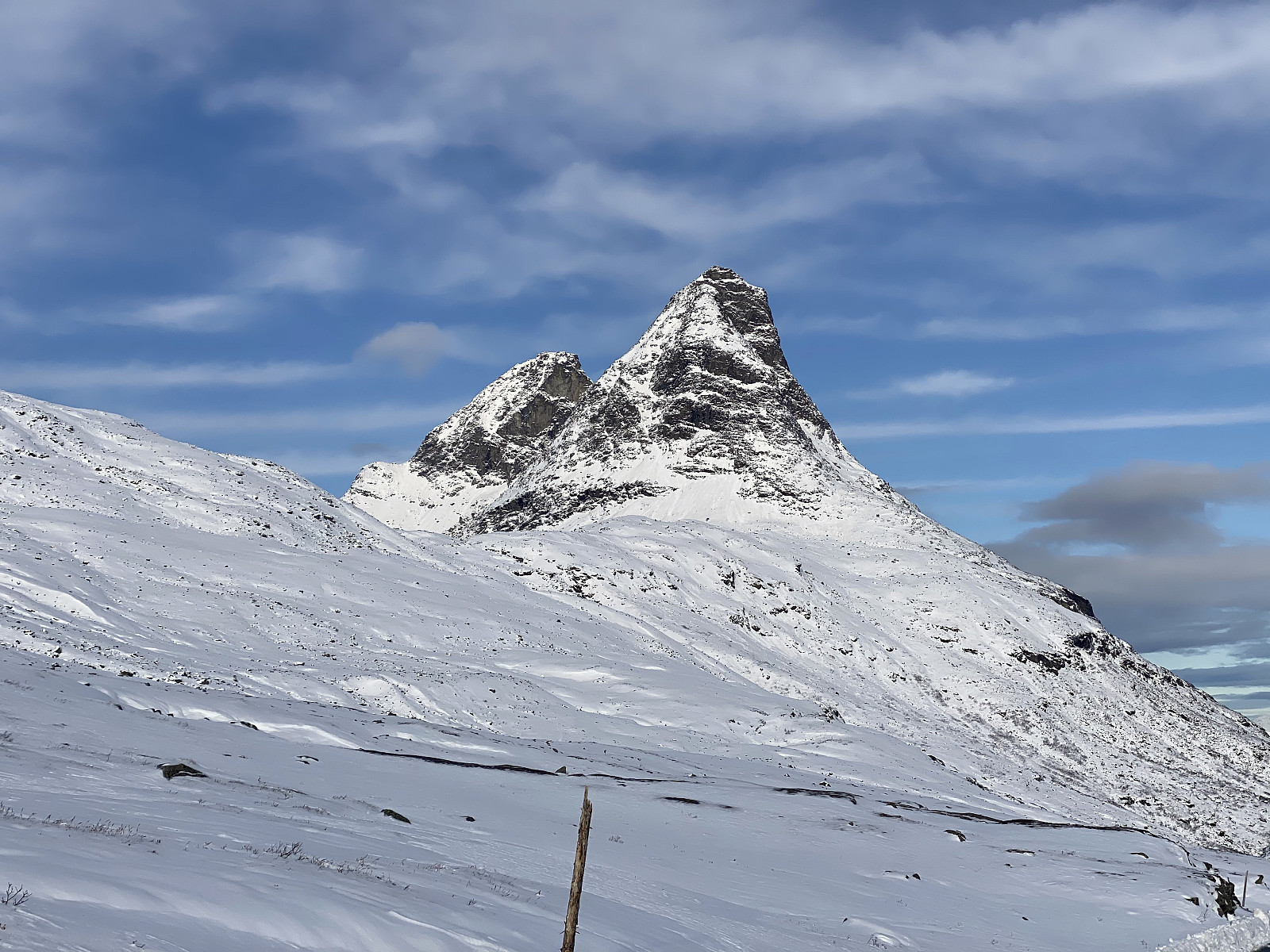
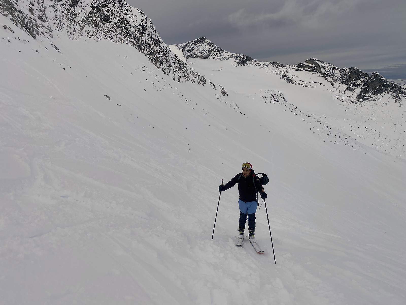
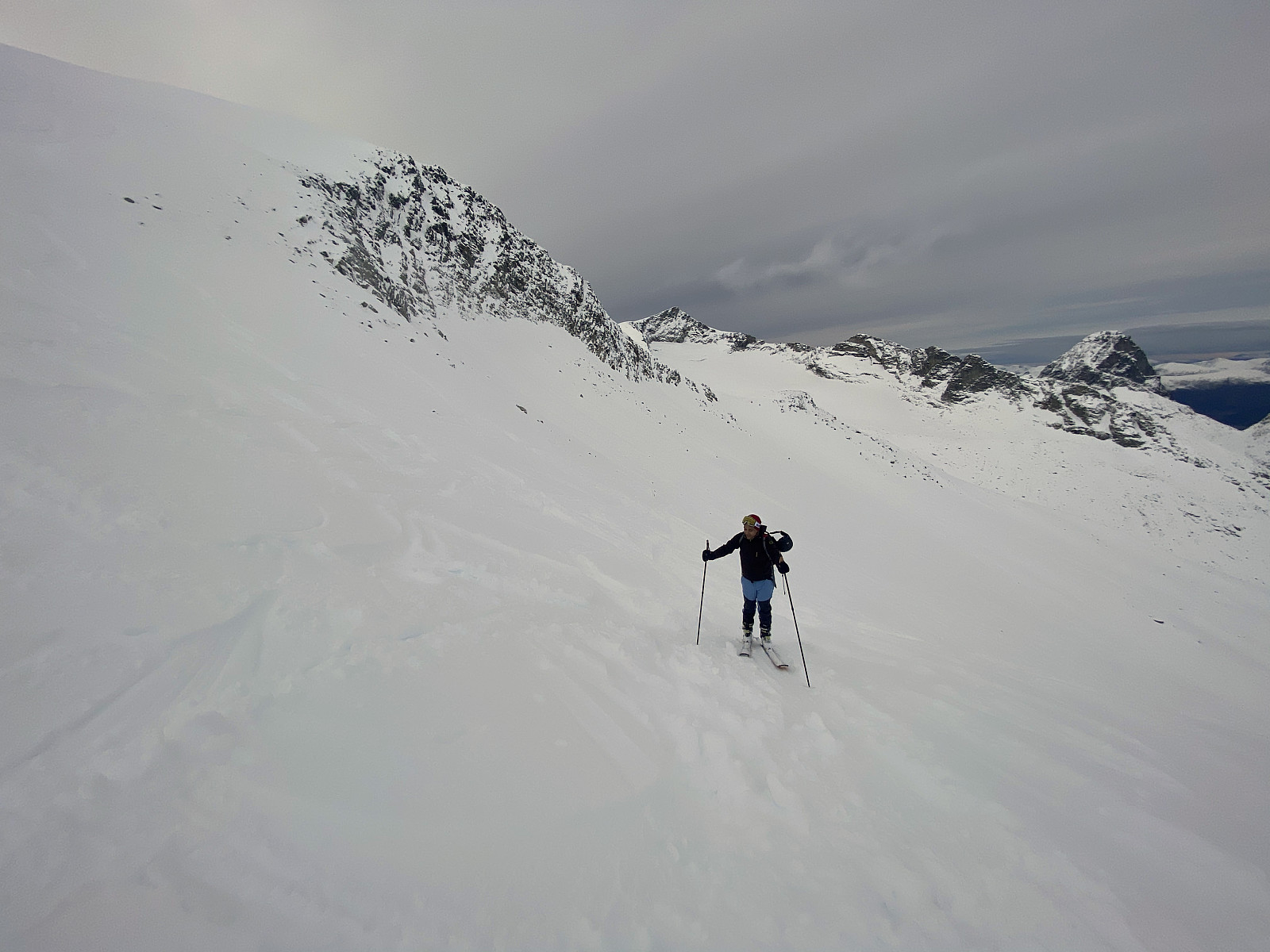
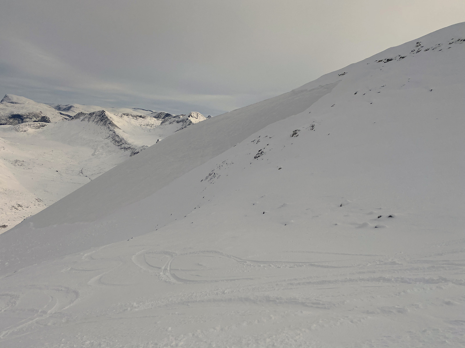
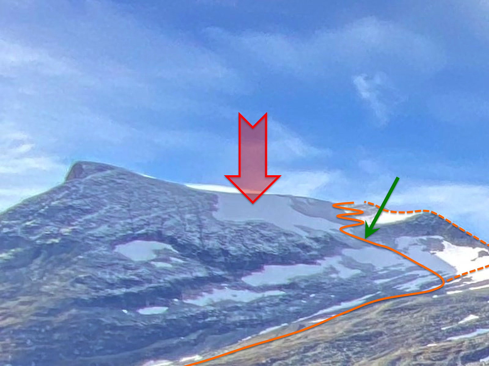
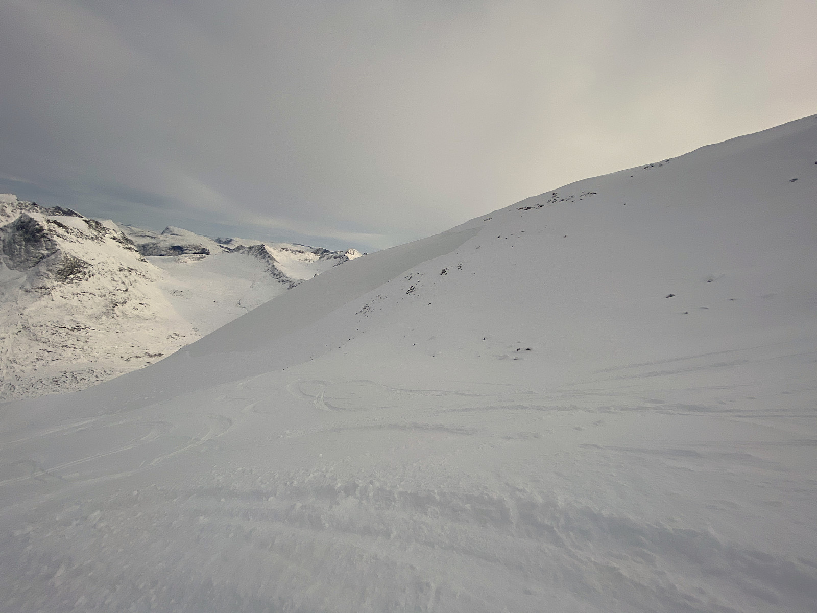
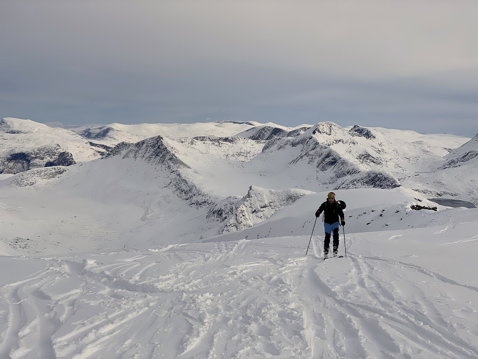
We followed the commonly used route along the north side of the east ridge of the mountain (i.e. along the orange line on image #15). The lower part of the trail [i.e. from 800 m.a.m.s.l. to about 1350 m.a.m.s.l. goes along this slope; and then you usually turn about 90˚ to the left, and go between two mountain knolls (on of which may be seen on images #11 and 12), in order to ascend into a hanging valley on the east side of the summit; a hanging valley extending from about 1500 m.a.m.s.l. all the way to the summit. Now, the steepest part of the trail up Mount Alnestinden is the segment where you ascend between the mentioned two knolls of the mountain (i.e. where my son Dag is located on image #11). Once you're in the hanging valley above this spot (image #12), the trail is no longer so steep. While we were moving up the lower part of the trail on this day, we met some people that had already been at the summit, and were now on their way down from the mountain. When I asked about the avalanche, they explained to me that it had taken place in the upper part of the north side of the east ridge of the mountain. In order to avoid the area, just in case of new avalanches, they had chosen an alternative route up to the summit (i.e. the dotted orange line on image #15). Usually when you ascend Mount Alnestinden on skies, you actually can't use that route, as there's a huge serac, or snow shelf, along most of the length of the north ridge of the mountain; and even when it's broken off, the breaking line might be as high as 4 meters, and you simply won't be able to get upon the ridge, unless you brought with you special equipment for the task [i.e. crampons and ice axes]. At this time, however, there wasn't any snow shelf along the ridge between Mount Alnestinden and Mount Finnan, as we hadn't been having more than one single snowfall since summer; and so it was possible for people to ascend the mentioned ridge, and follow it up to the summit [i.e. the dotted line on image #15].
As we were approaching 1300 m.a.m.s.l., the site of the avalanche became visible; and it immediately dawned upon me how such a large avalanche could have taken place even after just one single snowfall. Usually, there won't be any layers of alternating quality in the snow after just one single snowfall. This particular year, however, we had had very large snowfalls in April and May, followed by a very short summer; and so when it started snowing again in these mountains in october, there were still numerous snow patches every here and there in the mountain, i.e snow remaining from the previous season. I had observed throughout summer, that the east ridge of Mounta Alnestinden was still having a huge snow patch that hadn't melted away (images ## 15-18). It had gradually decreased in size during the summer months, but it was still quite large when I climbed Mount Breitinden along with my son on October 10th (image #16). And now, as we were approaching the site of the avalanche, I realized that the area of the avalanche corresponded exactly with the area of the snow patch that hadn't melted away during summer. So, the real reason for this avalanche was a huge amount of new snow that fell over a very short time span; and when the weight of the new snow became too great, it started sliding upon the old snow that was beneath it. The avalanche was, in other words, a loose snow avalanche, and not a slab avalanche; and it probably didn't have much to do with wind transported snow, as the absence of a serac along the north ridge of the mountain makes it quite unlikely that there was any substantial amount of wind transported snow in the area at this time.
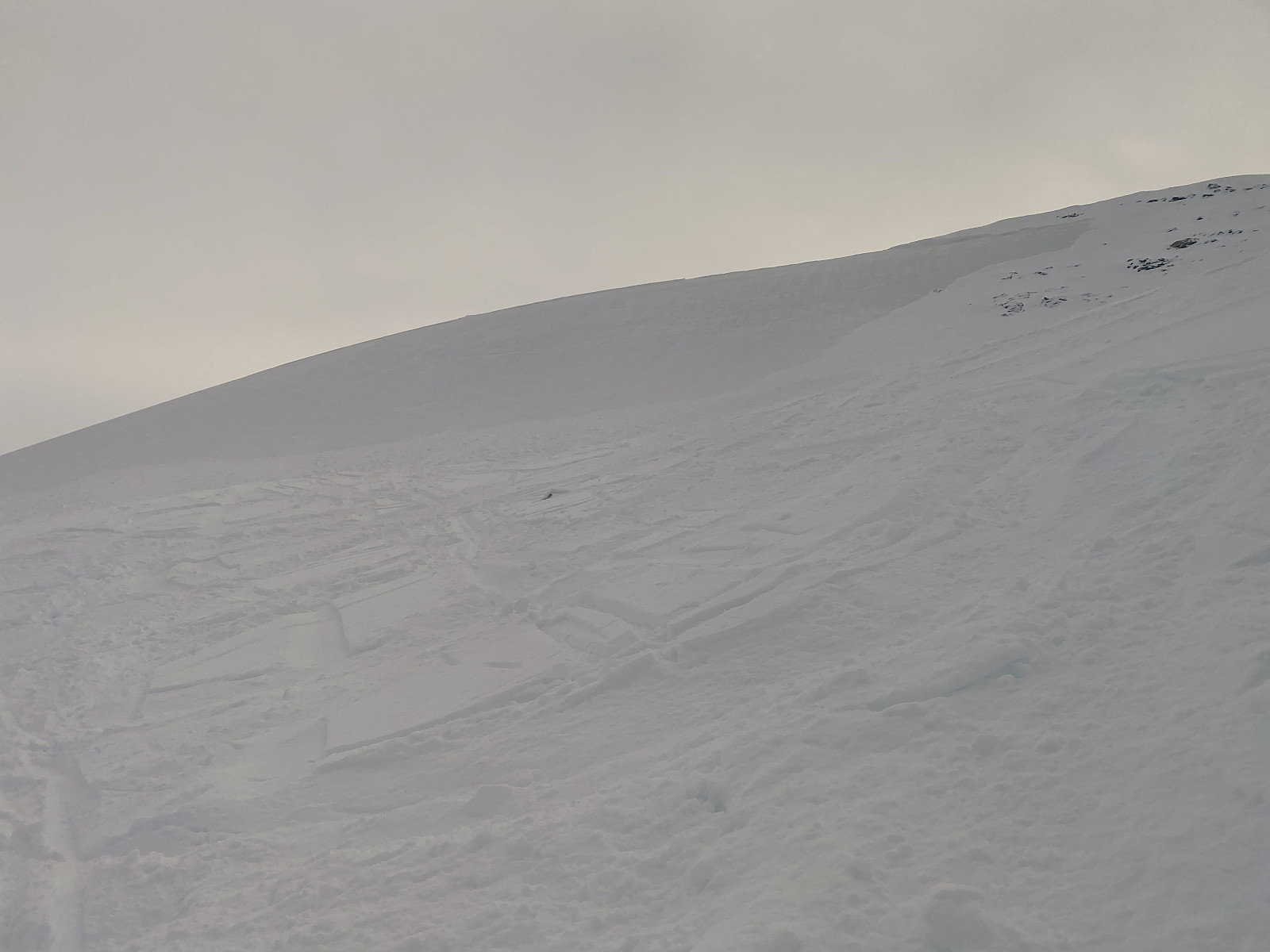
A closer look at images ## 13, 14 and 19, reveals that there are stones visible as coming up through the new snow just to the right of the avalanche; whereas there are no visible stones in the avalanche bed, as the old snow, the snow from last year, is still there, it's just the new snow that actually did slide away. Anyway, the fact that there were so many stones protruding through the snow, also contradicts the claim that there was so much wind transported snow in the area.
![Image #16: The picture of which the previous image is a part. This photo was captured from a rather great distance by the camera of my mobile device during a mountain trek that we (me and my son) made on October 10th, and so the quality of the enlarged segment (i.e. image #15) isn't the best. Apart from the large snow patch on Mount Alnestinden, part of a little glacier is seen on Mount Finnan [i.e. the mountain to the right of Mount Alnestinden], and a very thin layer of new snow above 1300 m.a.m.s.l. may also be discerned on all of these mountains. The road seen in the middle of the picture is county road 63, which is often also referred to as the "Trollstigen Tourist Road".](https://images1.peakbook.org/images/14939/Solan_20210206_601f0982acd13.jpg?p=xtralarge)
![Image #18: This image is one that I shot from the south ridge of Mount Bispen [i.e. "The Bishop"] on August 27th, and it shows the very same snow patch on the east ridge of Mount Alnestinden, although it was much larger then, than on images ## 16 and 17. Due to heavy snowfalls in April and May, this snow patch remained throughout summer.](https://images1.peakbook.org/images/14939/Solan_20210206_601f0f4a20bfc.jpg?p=xtralarge)
It's easy to think that there can't be any layering in the snow after the season's very first snow fall, but an important lesson to learn from this particular avalanche, is that this "rule" doesn't apply if there were still patches of old snow on the ground prior to the season's first snowfall. In other words, it's important to be aware of the risk of an avalanche even after one single snowfall. On the other hand, this all meant that there wasn't any general risk of avalanches in the area at this particular time; and so my son and I decided to ascend the mountain along the regular route. And so, at about 1350 m.a.m.s.l., we turned left, heading towards the hanging valley that separates the north ridge of the mountain from the east ridge; and then ascended between a knoll that is part of the north ridge, and one that is part of the east ridge, and got into the hanging valley at about 1500 m.a.m.s.l. At this spot we were actually quite close to where the avalanche had been taking place, and image #13 was shot from that spot, whereas images ##14 and 19 were shot a little bit higher up in the hanging valley.
Once in the hanging valley between the north ridge and the east ridge, the rest of our ascent was rather straight forward. The tough part of the climb is the climb up to the hanging valley; i.e. the ascent from 1350 to 1500 m.a.m.s.l.; whereas once you're in the hanging valley, the climb is easier. It's still a bit steep, especially if you try to ascend the east ridge, and then follow it to the summit. Ascending the upper part of the north ridge [i.e. above the knoll seen in image # 12] is a bit easier; but most people will choose to go a little zigzagging as they ascend, in order to make the ascent a little bit easier. Once at the summit the view was amazing (see images ## 21 and 22). We didn't remain long at the summit, however; we just removed the skins from underneath our skies, and then embarked upon our descent. It usually takes about two hours or so to ascend this mountain on skies, and then it takes about 15 minutes or so to go back down. On this occasion, however, we used a bit more time than that, in part because it was our first alpine tour skiing trip this season, and so we were a bit out of training; and secondly because there were a lot of stones either protruding through the snow, or stones barely visible just beneath the snow, and so we had to be a bit careful and watch out for stones as we were skiing back down towards our car.
![Image #21: Mount Finnan as seen from the summit of Mount Alnestinden. There's a mountain ridge interconnecting the two mountains [i.e. the north ridge of Mount Alnestinden, or the south ridge of Mount Finnan, if you want].](https://images1.peakbook.org/images/14939/Solan_20210206_601f13fdabe42.jpg?p=xtralarge)
![Image #22: My son Dag on top of Mount Alnestinden [1665 m.a.m.s.l.]. The peaks of Mount Store Trolltind [i.e. "Greater Troll Peak"], Trolltindan ["The Troll Peaks"] and Mount Trollryggen ["The Troll's Back"] are seen above the summit of Mount Storgrovfjellet.](https://images1.peakbook.org/images/14939/Solan_20210206_601f14d2a0bfe.jpg?p=xtralarge)


Benutzerkommentare