
Litje Blåmannen (13.07.2012)


Skrevet av hmsv1 (Hannah Vickers)
| Startsted | Håkøybotn |
|---|---|
| Turtype | Fjelltur |
| Turlengde | 5t 30min |
| Kart |
|
| Bestigninger | Litje-Blåmannen (861moh) | 13.07.2012 |
|---|---|---|
| Botnfjellet (844moh) | 13.07.2012 |
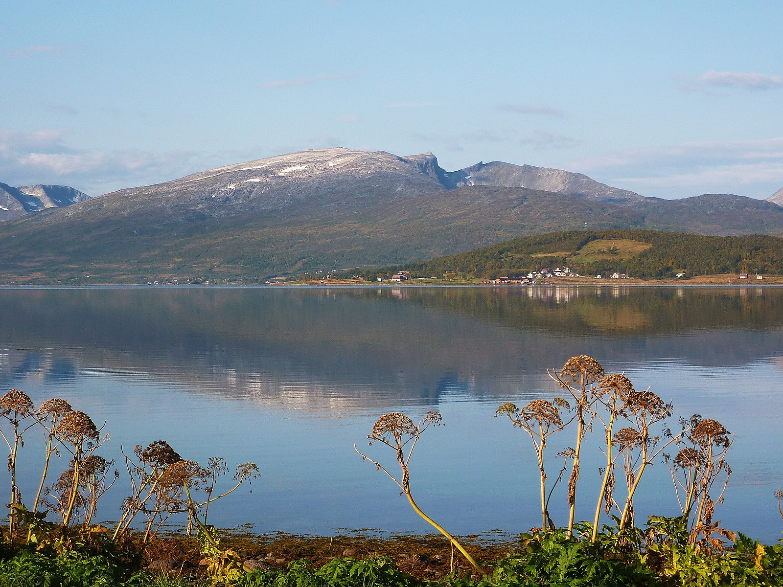
Litje Blåmannen is something of a local monument to Tromsø, in my opinion. Every day I walk to work it is there, plonked straight in front of me and sitting quietly behind the Kvaløya bridge. This mountain has been on my to-do list for a while, simply because I see it all the time and have become a little fixated climbing the mountains I see on a regular basis. Well, today, despite being Friday 13th, seemed like the ideal day to have a go at it. With yr.no forecasting a week of continuous rain from the weekend onwards, I had decided to prioritise the topptur-ing and spend as much time in the remainder of the sunshine as possible. It was a quick drive from Hamna to Håkoybotn, about 20 minutes, and when I arrived into the car park by the ungdomshuset I was the first car there.
The great thing about the Ti på Topp trips is that they are very well marked. It should be almost impossible to go wrong with all the red markers placed so frequently along the trails. So that's another reason why I decided to take a trip up here, since I was by myself for this trip. The downside to the spell of warm weather, with 19 degrees at sea level - were the insects. I lost count of how many flying and crawling things I spotted trying to eat me up, and by the time I reached the top of Rundfjellet after an hour of walking, and also the first Ti på Topp of the trip, I already had several red bite marks on my legs which were itching like crazy. Being my first summer in Tromsø, I hadn't realised that there was such a major infestation of insects. Having only also been back from Kenya for 1 week, I can report that not only is it warmer in arctic Norway, but there are more vicious biting mosquitoes than in East Africa (the comparison applies to Nairobi, at least)!
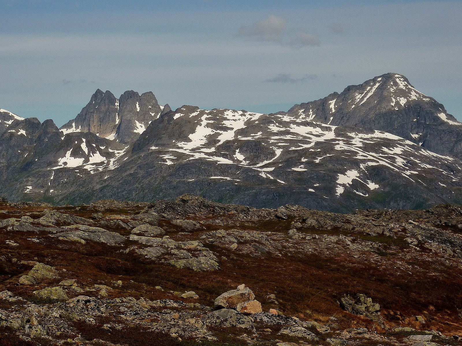
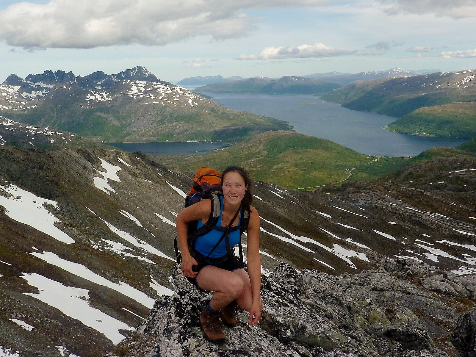
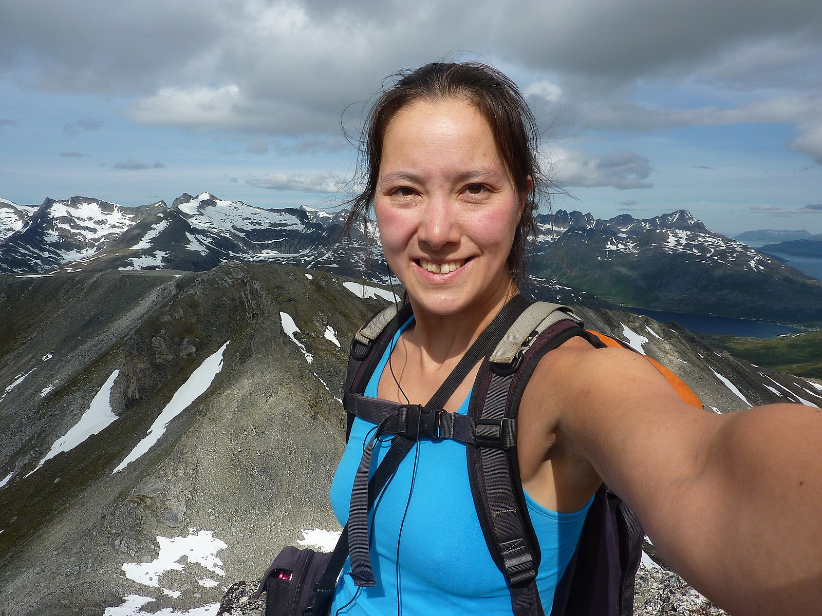
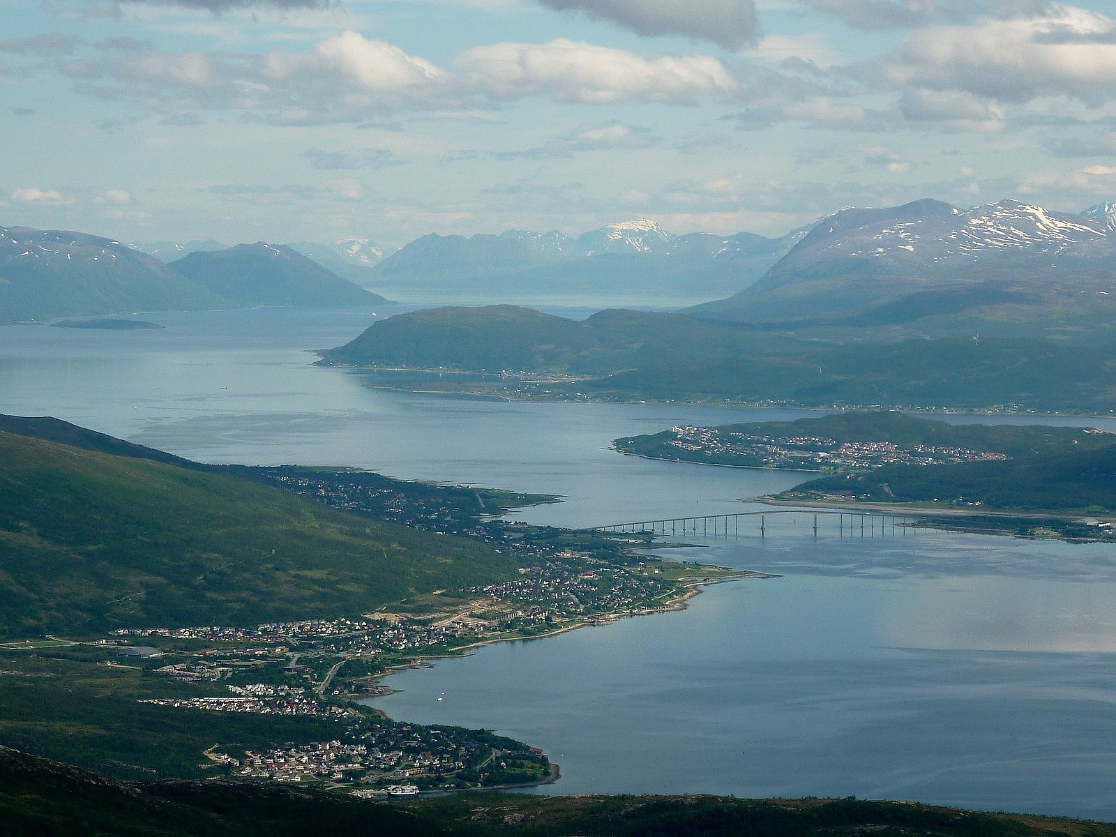
Well, fortunately there was a little more wind by the time I left the station on Rundfjellet, and that helped to stave off any further swarms of biting things for the rest of the ascent to the top of Litje Blåmannen. It was a really great view of Store Blåmannen and the rest of the peaks to the west of it (ones which I haven't yet identified) for the whole of the trip. The route itself was not that interesting in my opinion, but the gardient was so gentle that it was easy to make speedy progress up the mountain and then by the time I was at Botnfjellet there was just a rather flat walk across a jumble of rocks for about 15 minutes to reach the top of Litje Blåmannen proper. I was all alone, having not seen a single other person. A whole vista of peaks popped up as I got to the top, and the views alone compensated for the lack of excitement in the route.
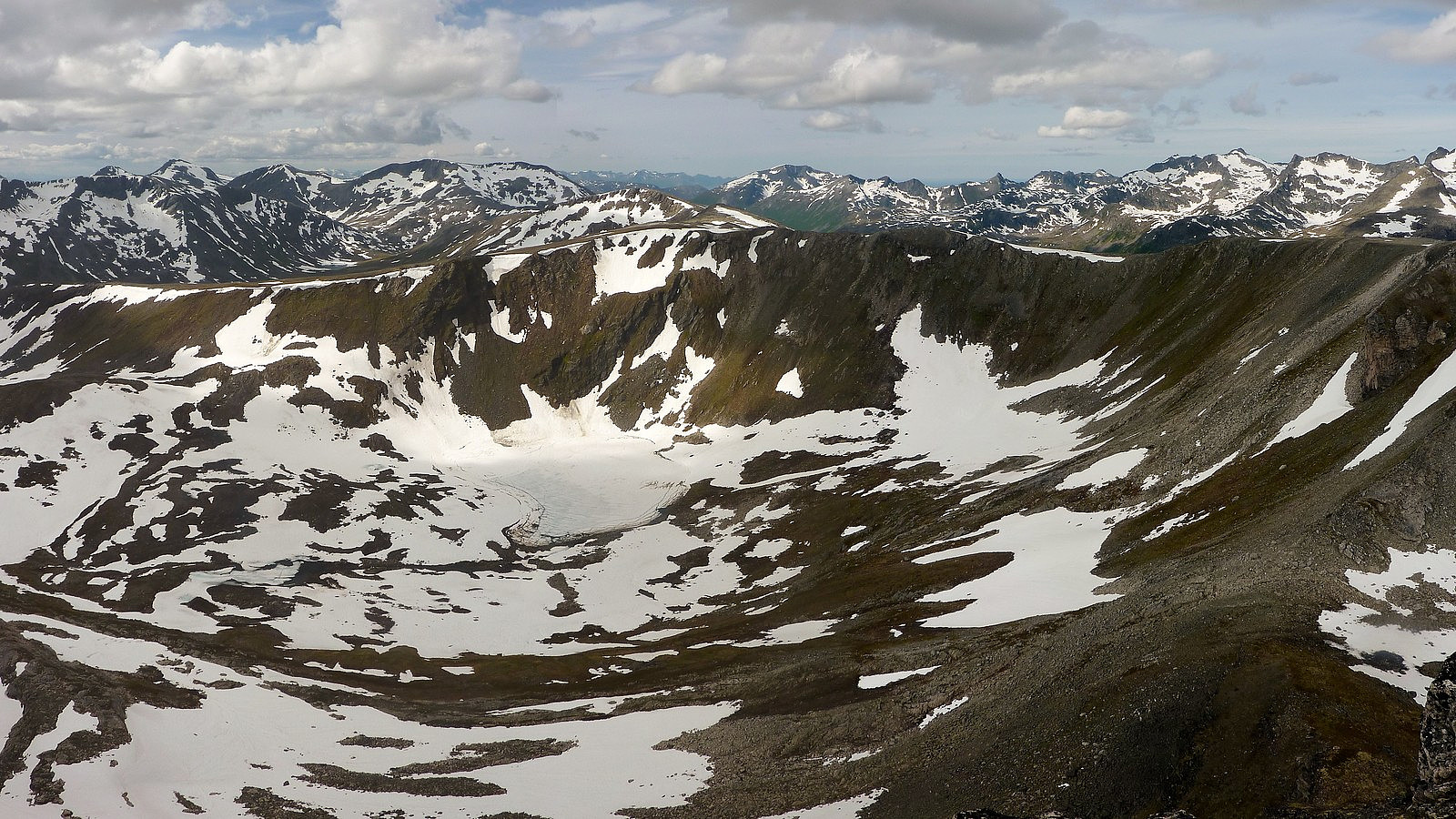
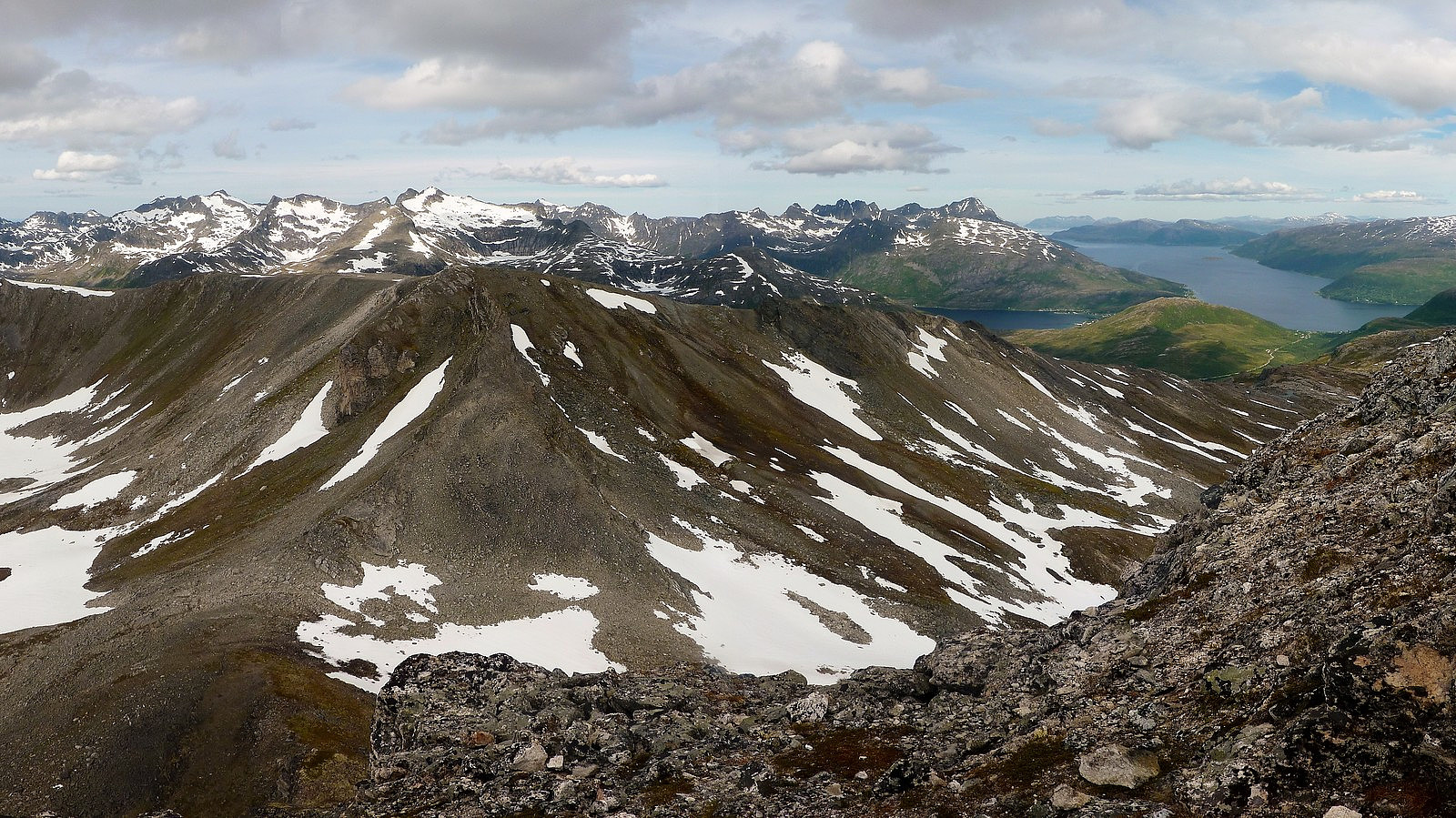
All in all, I must have spent a good 45 minutes at the top having my lunch and just appreciating the tranquility of the summit. There were more clouds today than on the earlier evening trip to Tverrfjellet, but the visibility was still excellent, and I could recognise numerous peaks I'd either ascended on previous occasions, or still had on my to-do list at later dates.
Once again it seemed a shame to have to go back down and leave behind the marvelous mountains in my sight, but it had to be done. The descent, by the same route, took roughly 1.5 to 2 hours, with a few photo breaks along the way. Only when I approached Rundfjellet again I began to encounter several other hikers on their way up. Shame I'd not been in their company earlier!


Kommentarer
It isn't so bad alone
Skrevet av mortenh 14.07.2012 22:13It can actually be great, and certainly more educational than following someone else who knows the way.
A small tip; don't know if that was your intention, but if you want to have a full width panoramic preview picutre you have to crop them slightly more "panoramic" than what you did. I think the ratio is 1:2,5 or 1:3. Everything from there and up gives you a full width panoramic picture in the report when you insert it as medium size.
Nice pictures views and a beautiful day it appears. The slightly modest dice might partly be attributed to the small biting enemies, or???
Re: It isn't so bad alone
Skrevet av hmsv1 15.07.2012 08:02True, yes I did originally piece together about 8 separate photos to make a very long panorama but then the file ends up too big to upload, so I did it as two separate ones.
Probably the trip would score higher if 1) there were no insects and 2) I had people to talk to. I agree its sometimes nice to find your own way, but I often get bored without people to talk to on a trip!