
Mount Kenya (01.07.2012)


Skrevet av hmsv1 (Hannah Vickers)
| Startsted | Sirimon gates, Mount Kenya (2650moh) |
|---|---|
| Sluttsted | Point Lenana (4985moh) |
| Turtype | Fottur |
| Turlengde | 96t 00min |
| Kart |
|
| Bestigninger | Point Lenana (4985moh) | 01.07.2012 |
|---|
A six-day trip with friends from Norway, Germany and Iceland to Point Lenana on Mount Kenya, following the Sirimon route on the ascent and Chogoria route on the descent.
Day 1:
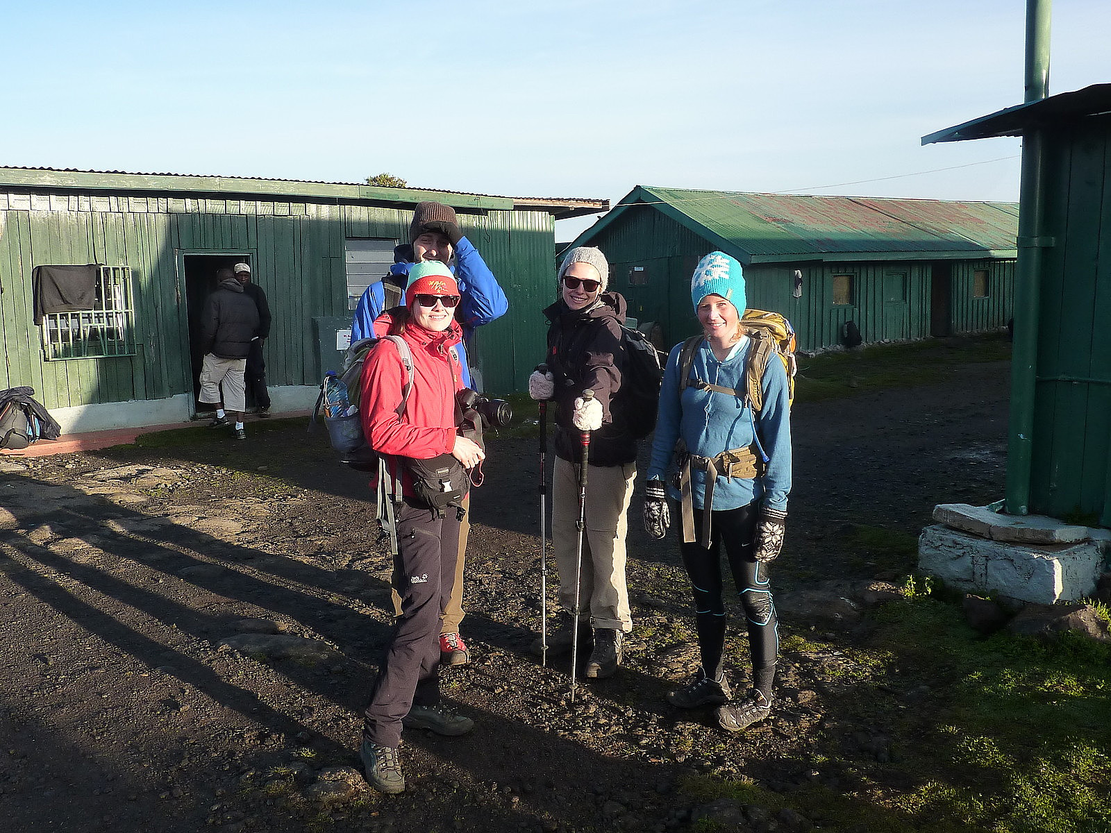
Drove from Nairobi to the Sirimon park gates, a short distance from Nanyuki. Took a 3-hour walk to the Old Moses camp at 3300m where we were staying for 2 nights. Weather was pleasant with a few spots of rain but good visibility.
Day 2: Acclimatisation walk from Old Moses Camp
...To a viewpoint at 3900m looking over the Liki valley. Initially good sunny weather but it clouded over by about 9 or 10am, so we wended up having lunch at the view point in cloud and some light drizzle. Fortunately we got back to the Old Moses camp again before the really heavy downpours of rain started in the afternoon. Nice sunset just before dinner though. Some of the group opted to take Diamox to aid acclimatisation. I didn't. Personally I don't think it is necessary unless you really are suffering!
Day 3: Walked from Old Moses camp to Shipton's camp at 4200m
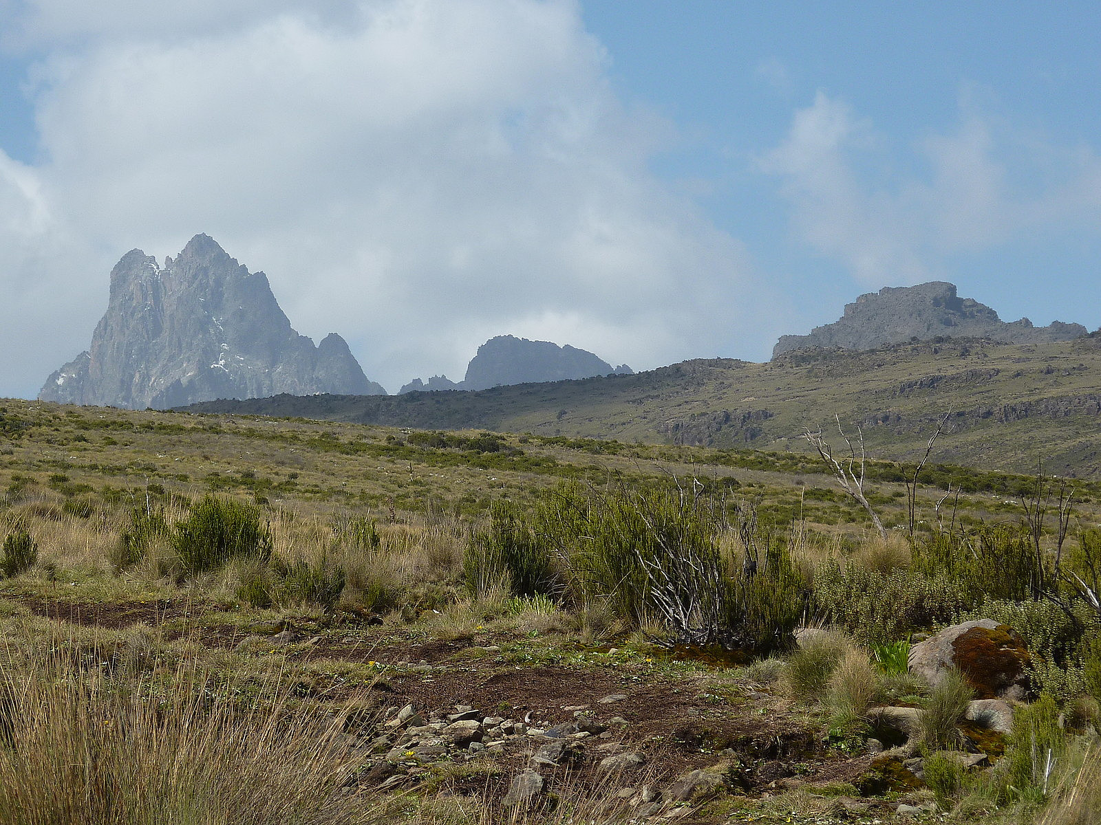
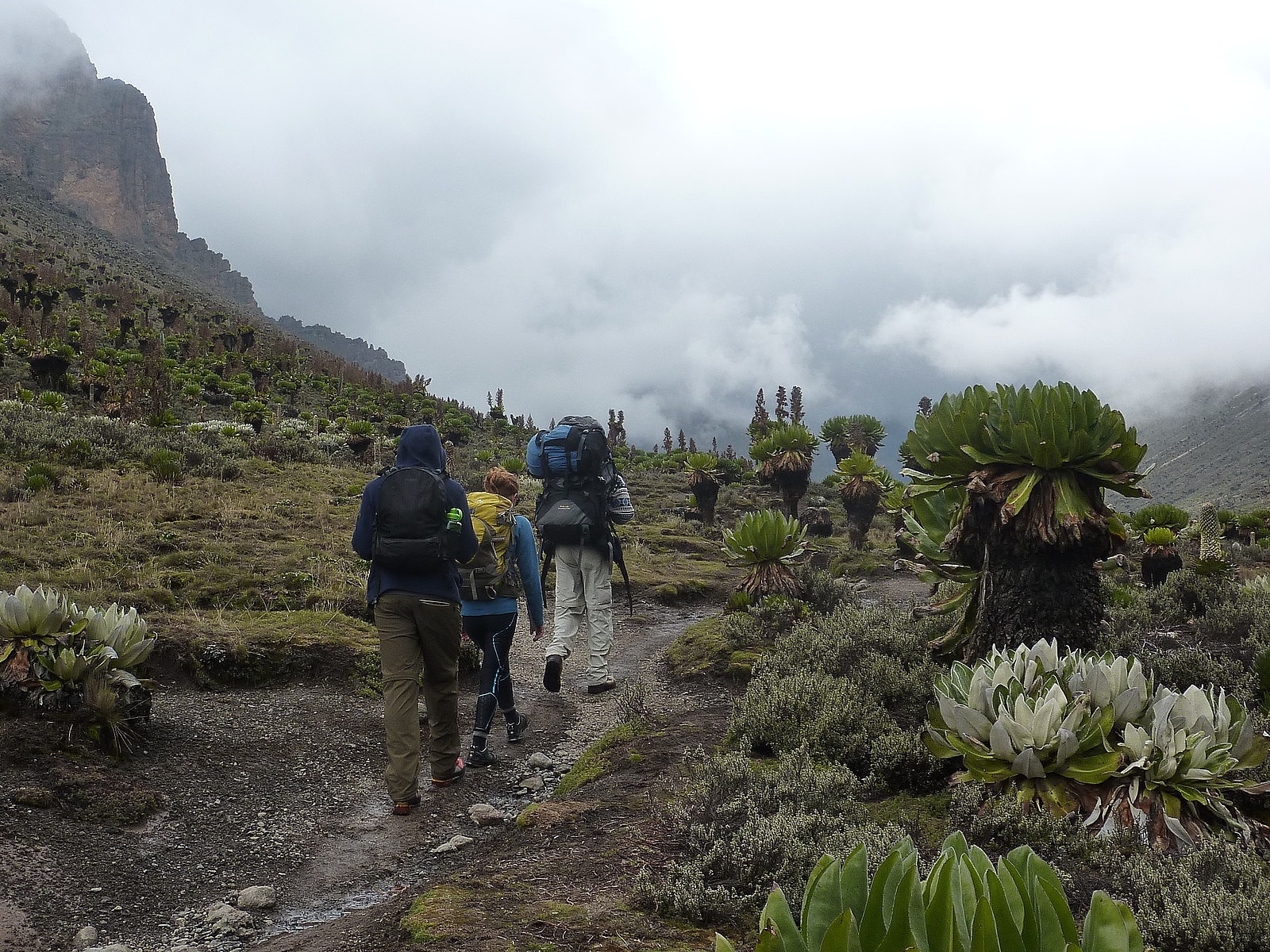
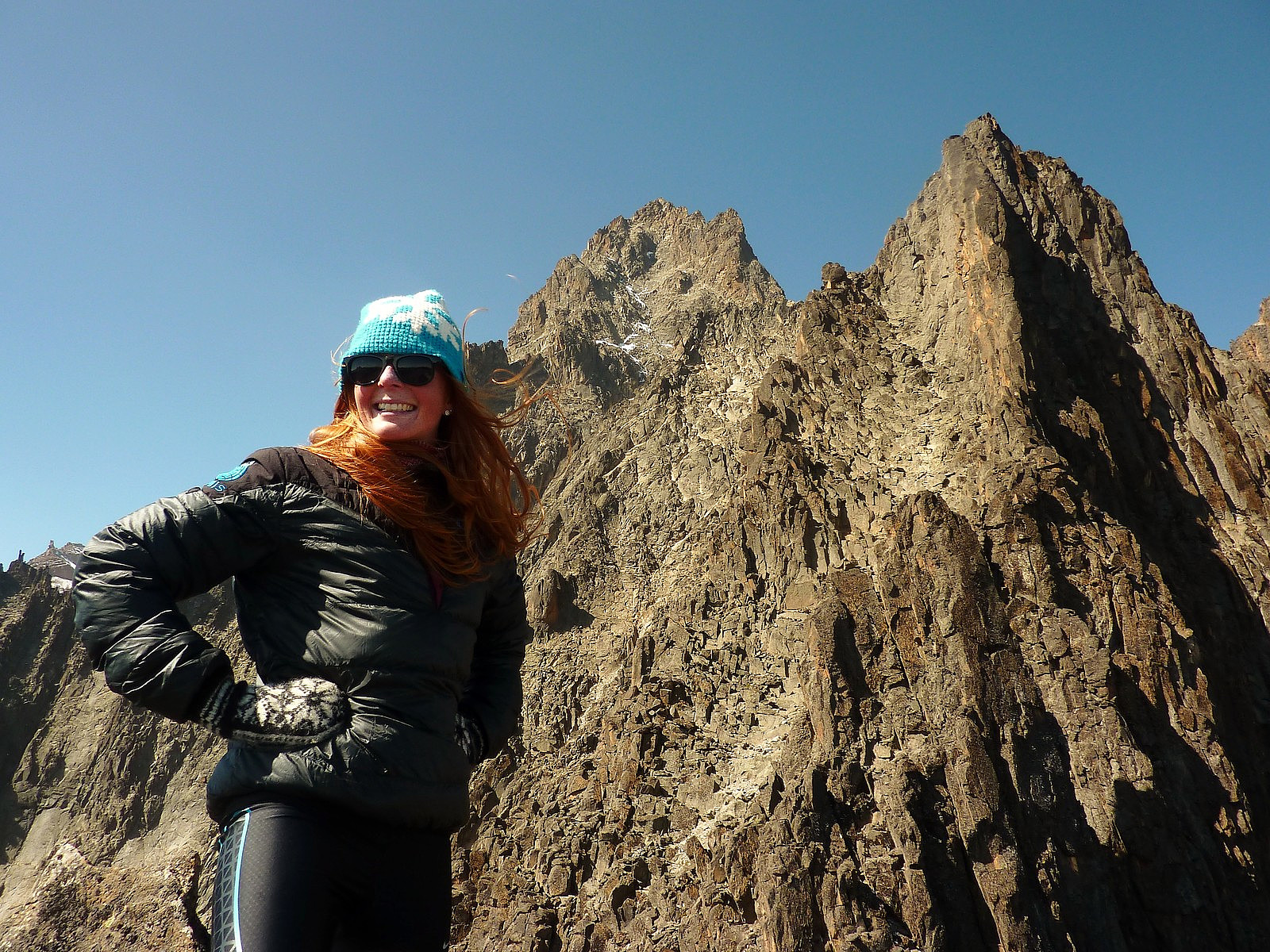
A longer day of about 15km altogether. We eventually walked as two parties, for those who wanted to go a bit faster than others (and thus avoid the afternoon rain again!). We had views until we reached the Mackinder valley, by which time the cloud had rolled in again and we couldn't see the mountain anymore. Some interesting vegetation in the valley though - giant and ostrich lobelia plants and lots of different kinds of colourful birds.
Myself, Sara and Villi reached the camp at about 2.30pm, the rest of the group turned up about an hour later. Unfortunately Martin was feeling the altitude and had been sick on the last hill before the camp. The rain clouds cleared away in the afternoon though and we were treated to some very good views of the mountains surrounding the camp.
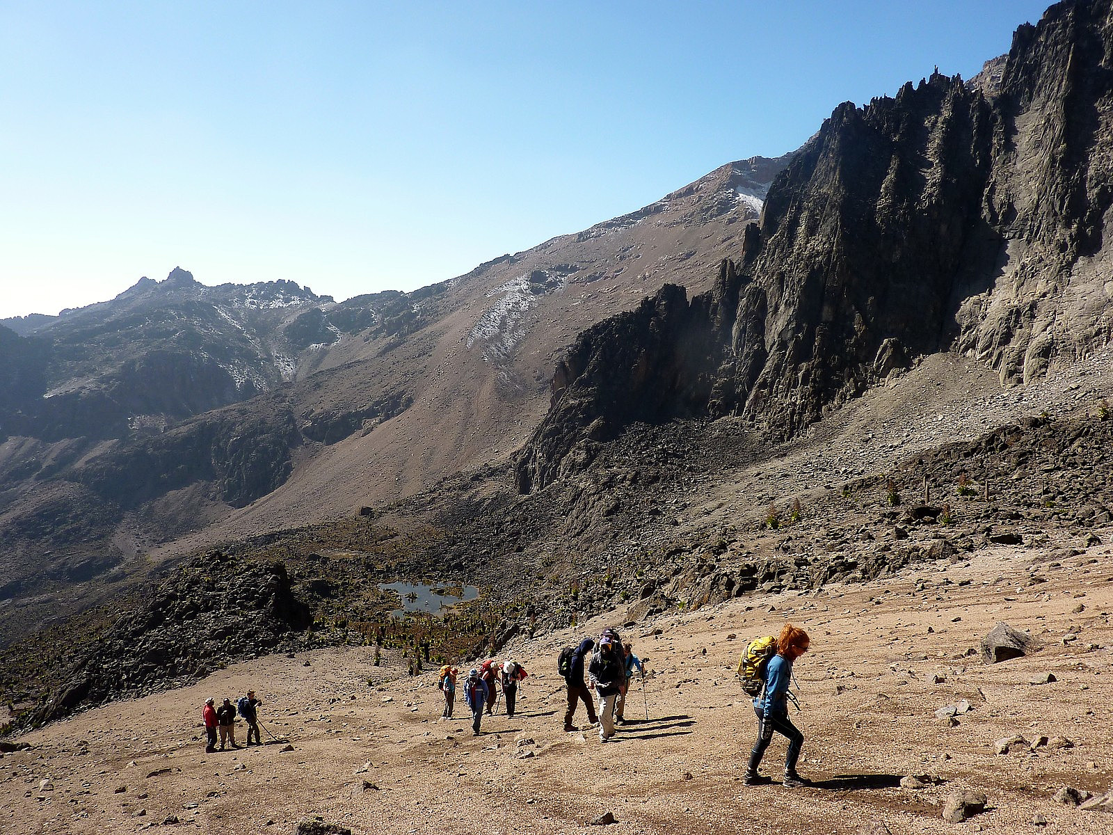
Day 4: Acclimatisation walk from the camp to the Hausberg Col at 4700m
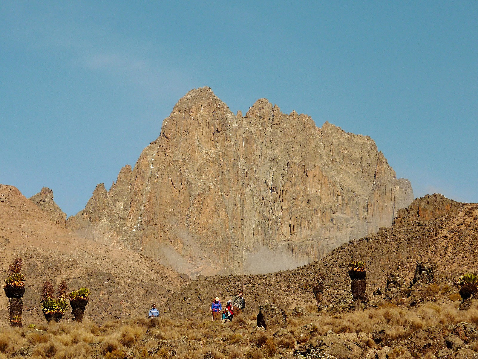
A short but very scenic day, giving us uninterrupted views of Batian and the first glimpse of Point Lenana. Sunshine and blue skies for pretty much the whole day
Day 5: To the summit (a longer trip report!)
After having had a long and relaxing afternoon in warm sunshine on the previous day, we were now faced with having to get out of bed at 2.00am to prepare for the long day ahead, which was basically going to consist of going up to Point Lenana and then walking the 17km back down the Chogoria route to the bandas (huts) in the valley. Unsurprisingly, I hadn't really slept a lot and neither had many of the others in the group; there had been quite a lot of noise well after we'd got into bed so many of us had not really fallen asleep until after about 10.00 or 11.00pm. Nevertheless, after a cup of coffee and a couple of biscuits to eat we were actually quite ready to get out and go for the hike to the top. Point Lenana is by no means the highest or most technical of the summits on Mount Kenya to achieve, but it is the highest one which is accessible to hikers. To reach either Batian or Nelion requires some moderate-grade rock climbing and a lot of time!
Initially when we had started walking at 3.00am the skies were very overcast, and it looked like there might not be any prospect of summit views at all. It also meant that most of us were overdressed because the temperature felt a lot milder than the previous night when the skies had been clear. We stopped quite soon after starting so some of us could sort our our clothes and remove some layers. However, another hour or so later, and we'd actually ascended above the cloud level, so now we were under clear skies and there was a lot more wind, which made it feel very cold! I don't know exactly what the temperature was, but I was wearing a vest top, a windproof fleece and a lightweight down jacket on top (and generally I have a reputation for staying warmer than others!) - so I'm quite sure the wind chill was well below zero.
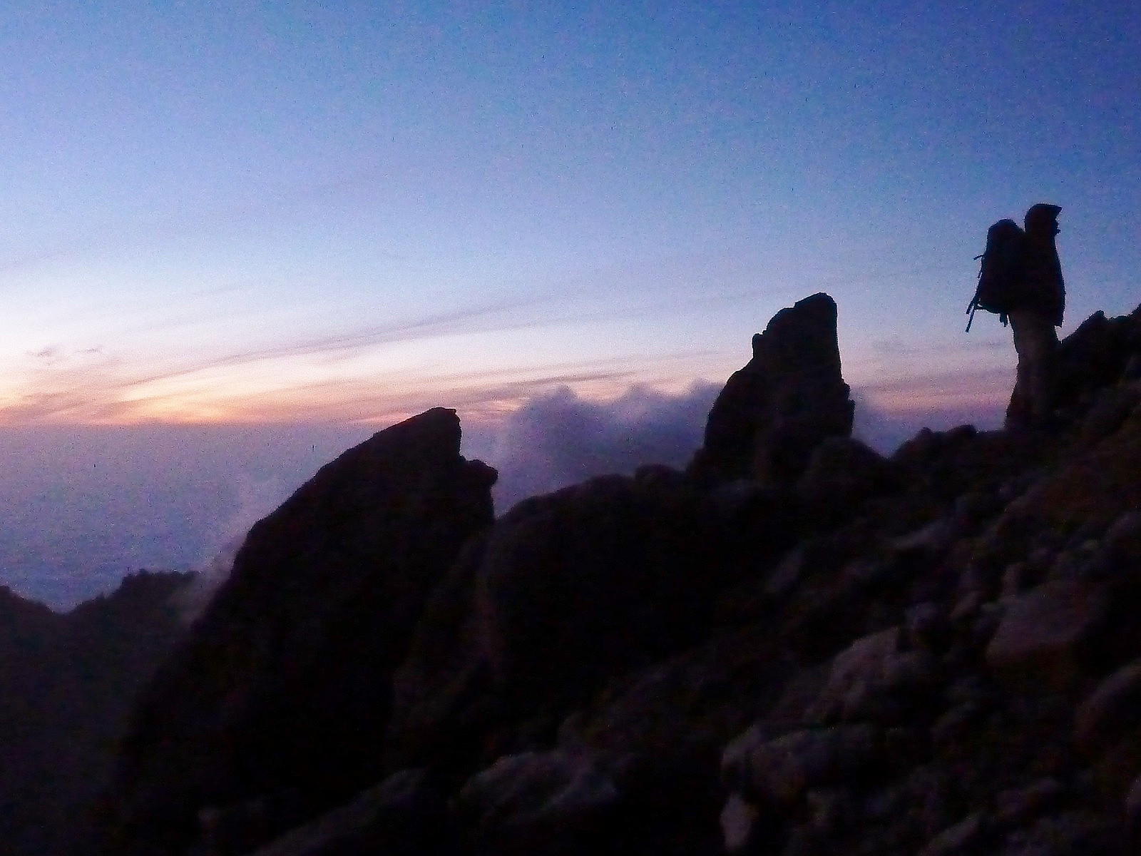
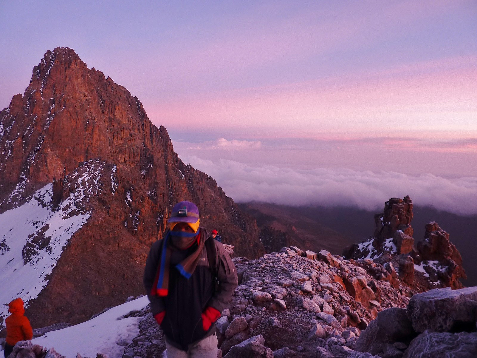
It was still an hour before sun rise and we only had another 250m to ascend to the summit by this point; we'd been making some very good time, considering Martin was still not feeling particularly strong, having not had so much to eat in the past few days. It was quite a spectacular sunrise though, and as we got higher it made for some fantastic views of Batian above the cloud level with the pink and purple skies behind.
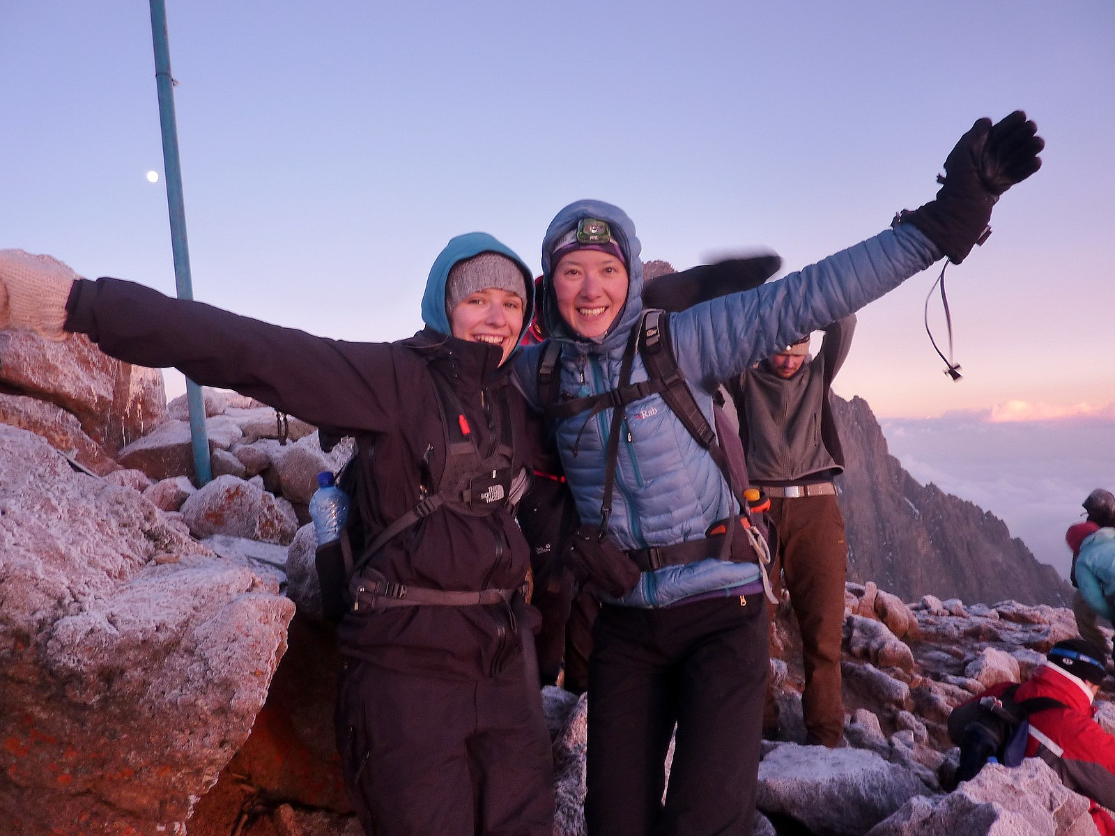
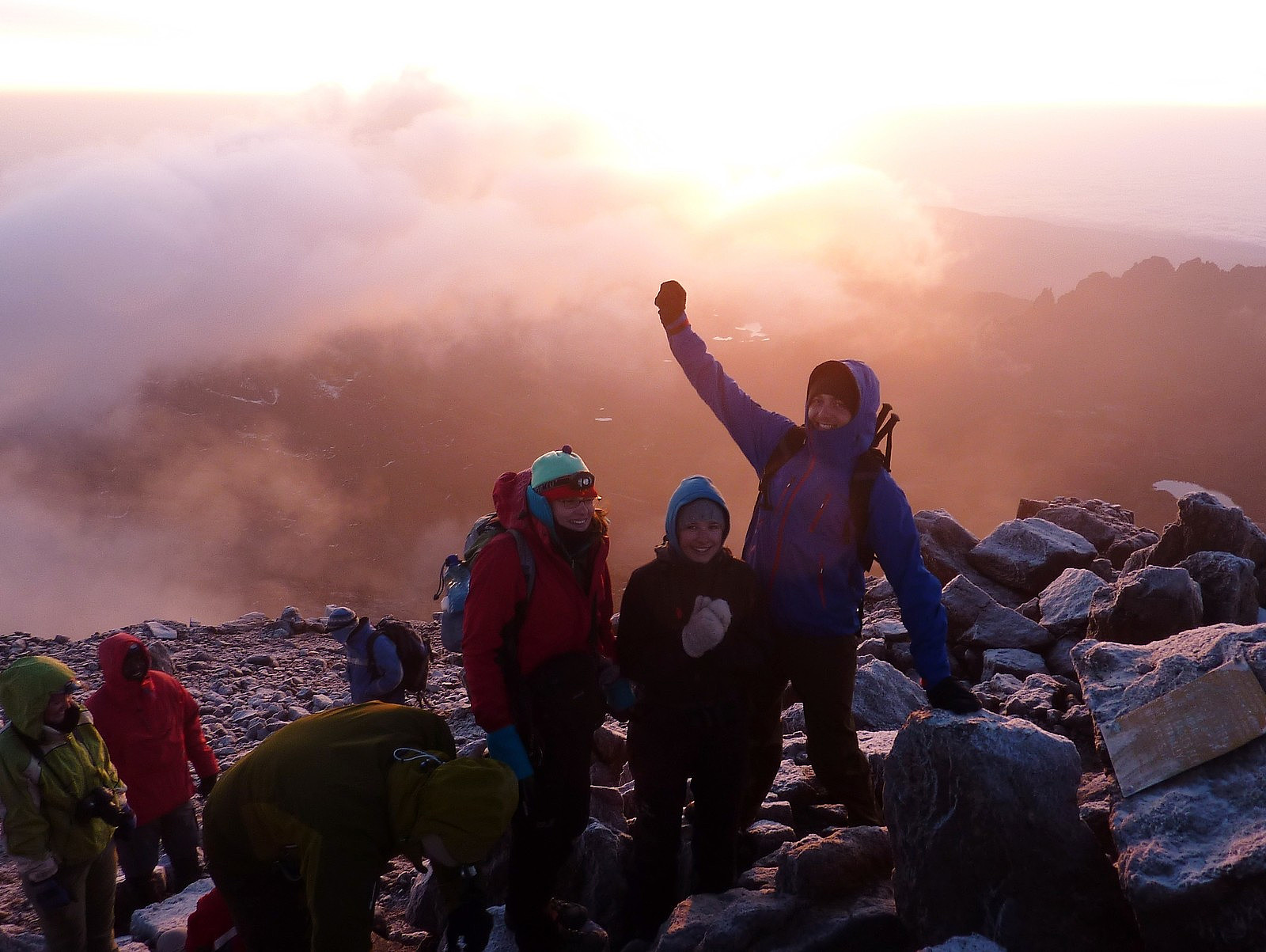
I was pretty mesmerized by the views and stopped quite often to take photos, while others who were really feeling cold decided to keep moving and continue to the top. We all made it though, and there was much feeling of happiness once we'd all met up again and taken some summit photos. It was such a great day already. And I personally got a much better experience than when I'd climbed it in 2001 (with Kilimanjaro) because on this occasion I'd not suffered any altitude sickness. On the last trip I remember having had really awful headaches and feeling nauseous for the entire ascent, so I this time it felt really, really good! So, despite the uncertainty about the weather at the start, it had turned out to be quite a memorable and beautiful view from the top.
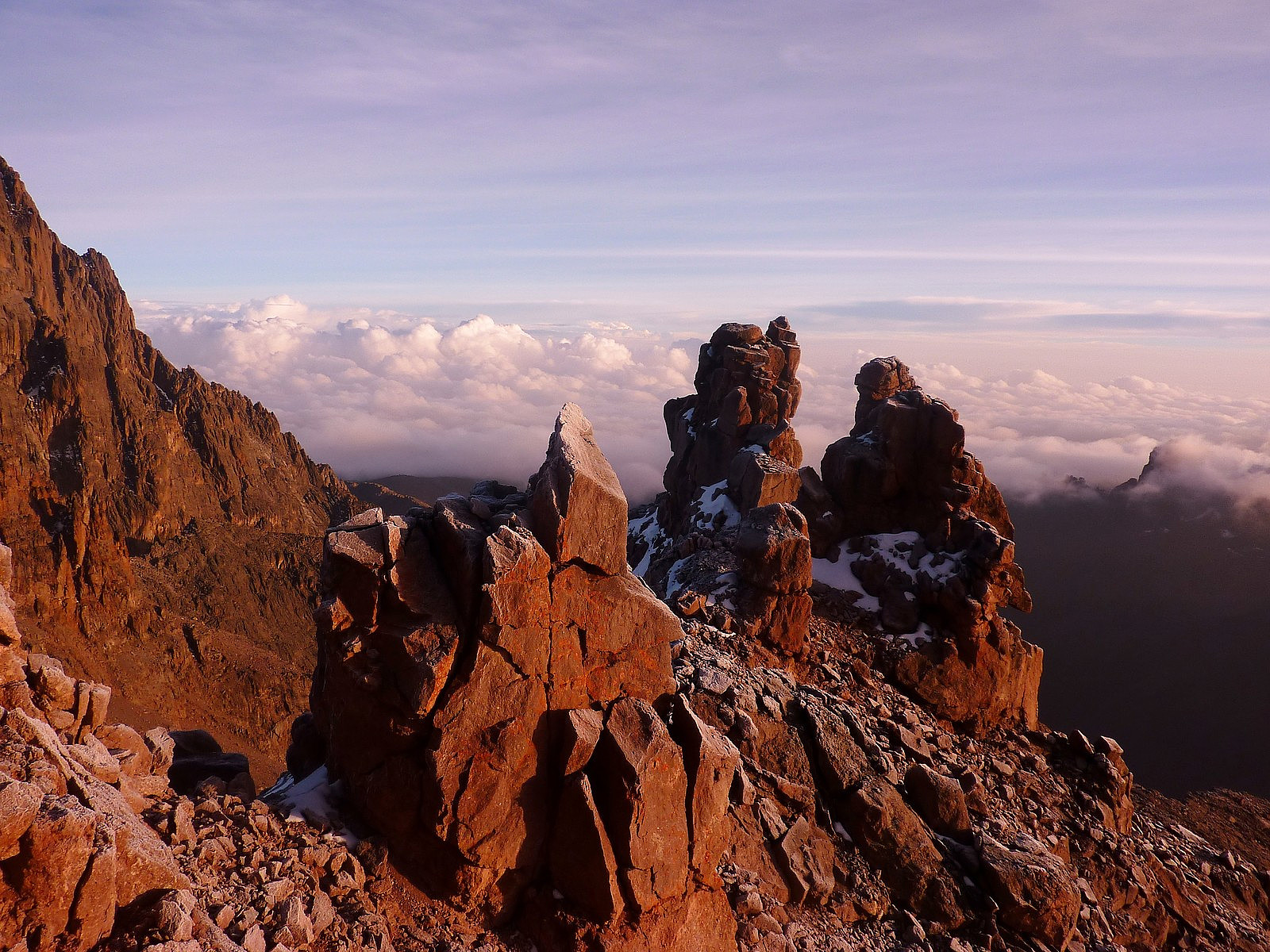
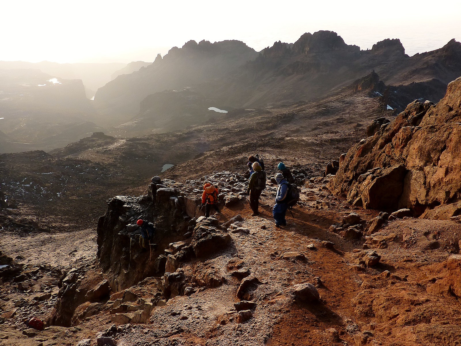
After leaving the summit, we were now faced with a very long 'walk-out', but with the first point of call being the Mintos Hut, where were due to have some breakfast. It was still 2 hours away, but it was easy ground, and downwards all the way. We were also lucky to have really jaw-dropping views of the very outstanding Gorges valley, which had a very different character to that of the Mackinder valley which we had taken on the ascent. Poor martin was still suffering from the altitude and while we had a short stop he was sick again. Most people were pretty quiet by this time too. Some I think were just exhausted, and others were perhaps suffering an adrenaline crash after the excitement of the summit experience! Anyway, it didn't take long until we'd descended down to the plateau at about 4200m, where the hut was situated, the views back up to Point Lenana and Batian were very impressive.
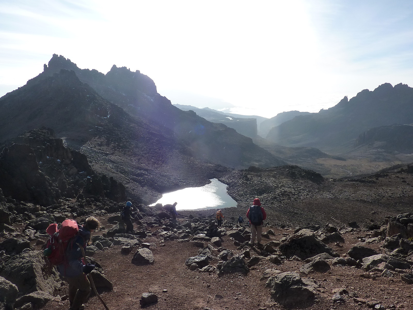
Our breakfast was accompanied by several rock hyraxes as well, who were keen to share the scraps. They look a bit like a beaver, but without a huge tail. Or maybe like a huge guinea pig. Either way, we were just as fascinated by them as they were of our food! It took a long time between leaving the Mintos hut and walking the next 10km to the spot where we took lunch; it was not a straightforward motorway of a path back down the mountain, but instead consisted of some extra re-ascent to gain a ridge which overlooked the Gorges valley. I think it was roughly 2 or 3pm by the time we arrived, very hungry to the lunch spot. After an unusual combination of noodles, baked beans and some bread we continued the rest of the way down to the bandas, by which time we'd reached the level of thick, damp fog and all views had completely disappeared. And that was pretty much the end of the trek; the final day involved a rather thrilling (in a scary way) truck ride on the most unimaginably muddy and pot holed track for 30km to get out of the national park. One which I don't think any of us are likely to forget - but no further trekking. All in all it had been a very worthwhile trip, if only for the last 2 days of the climb. I think the initial approach to get up close to the mountain can get quite tedious at times because the views we got had not been particularly interesting. But from whatever direction or route you take up the mountain this is always the case, because the slower slopes are so gentle, so the feeling of really being amongst the mountain itself doesn't come until you get to over 4000m. Anyway, I give it 5 stars, simply because there are many possibilities to explore different parts of the mountain and the rock is so nice to scramble on. And the views really are super-spectacular.


Kommentarer