
Kjerringafjellet (03.10.2020)

Written by HHauser (Helwig Hauser)

| Start point | Hamlagrøvegen (640m) |
|---|---|
| Endpoint | Hamlagrøvegen (640m) |
| Characteristic | Hike |
| Duration | 4h 30min |
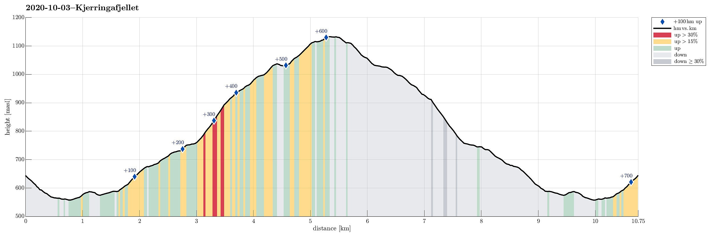
| Distance | 10.8km |
| Vertical meters | 723m |
| GPS |
|
| Ascents | Kjerringafjellet (1,138m) | 03.10.2020 |
|---|
Trip Summary
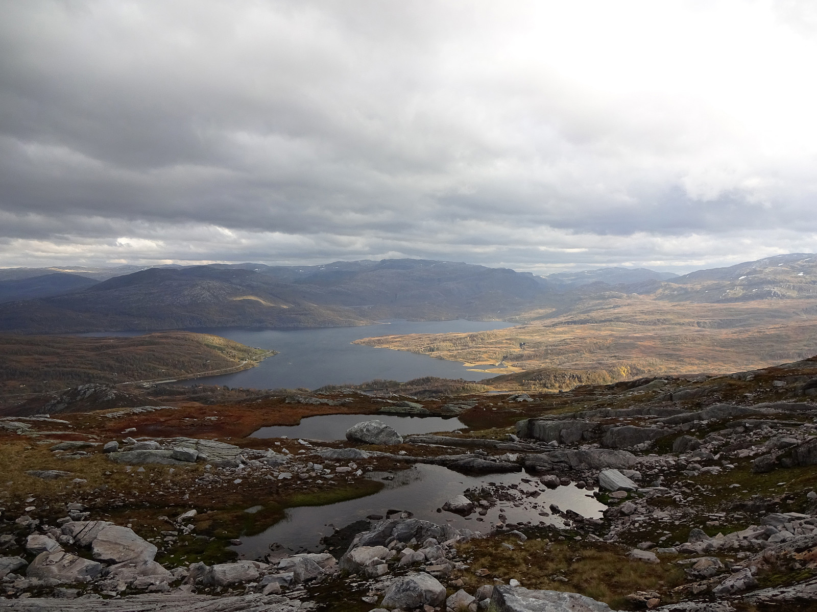
We drove from Bergen to Bergsdalen (via Dale) and parked right where the road through Bergsdalen crosses from Vaksdal district to Voss district. On the southwestern side of the road, we stepped off the parking lot and on to a trail that leads into the direction of Øvretjørni, leading through a field of cabins there. Surrounding Øvretjørni in its northwest, the trail then turns more into a southward direction, aiming for the saddle between Magneknolten and Kjerringafjellet. Once in the west of Magneknolten, the trail surrounds Rjupehaugane in their south until it brings one into a small valley that extens upwards to Hardingskaret in its northwest. Before actually getting there (Hardingskaret), one turns left, again, and towards Kjerringafjellet. A steadily ascending slope leads up to the northeastern heights of Kjerringafjellet. From there, at about 950mosl, one then crosses over to Kjerringafjellet (the terrain is not so steep there, then, but occasionally quite a bit rugged with at times larger rocks lying criss-cross over the mountain. Near the top of Kjerringafjellet, at about 1115mosl, one passes by a particularly large and impressive rock (Kjerringasteinen). Then it's only a few more meters to the south until one stands at the actual top of Kjerringafjellet. To get back, we basically followed the same route (with minor variation).
Photos
Selected photos are available as Google photo album.
Useful Resources
See also the related FB-page Hiking around Bergen, Norway.
Petter Bjørstad has a useful page about Kjerringafjellet and also web page WestCoastPeaks.com provides useful information about Storliknausen, Kjerringafjellet, and Såta.


User comments