
Stav from Hella (24.07.2020)

Written by hbar (Harald Barsnes)

| Start point | Hella fergekai (5m) |
|---|---|
| Endpoint | Sanden (10m) |
| Characteristic | Hillwalk |
| Duration | 8h 20min |
| Distance | 24.7km |
| Vertical meters | 1,863m |
| GPS |
|
| Ascents | Stav (1,458m) | 24.07.2020 |
|---|---|---|
| Trodalseggi (1,456m) | 24.07.2020 | |
| Vassvarden Sør (1,024m) | 24.07.2020 | |
| Visits of other PBEs | Rud (260m) | 24.07.2020 |
| Rudsstølen (732m) | 24.07.2020 | |
| Skare (509m) | 24.07.2020 |
Stav from Hella
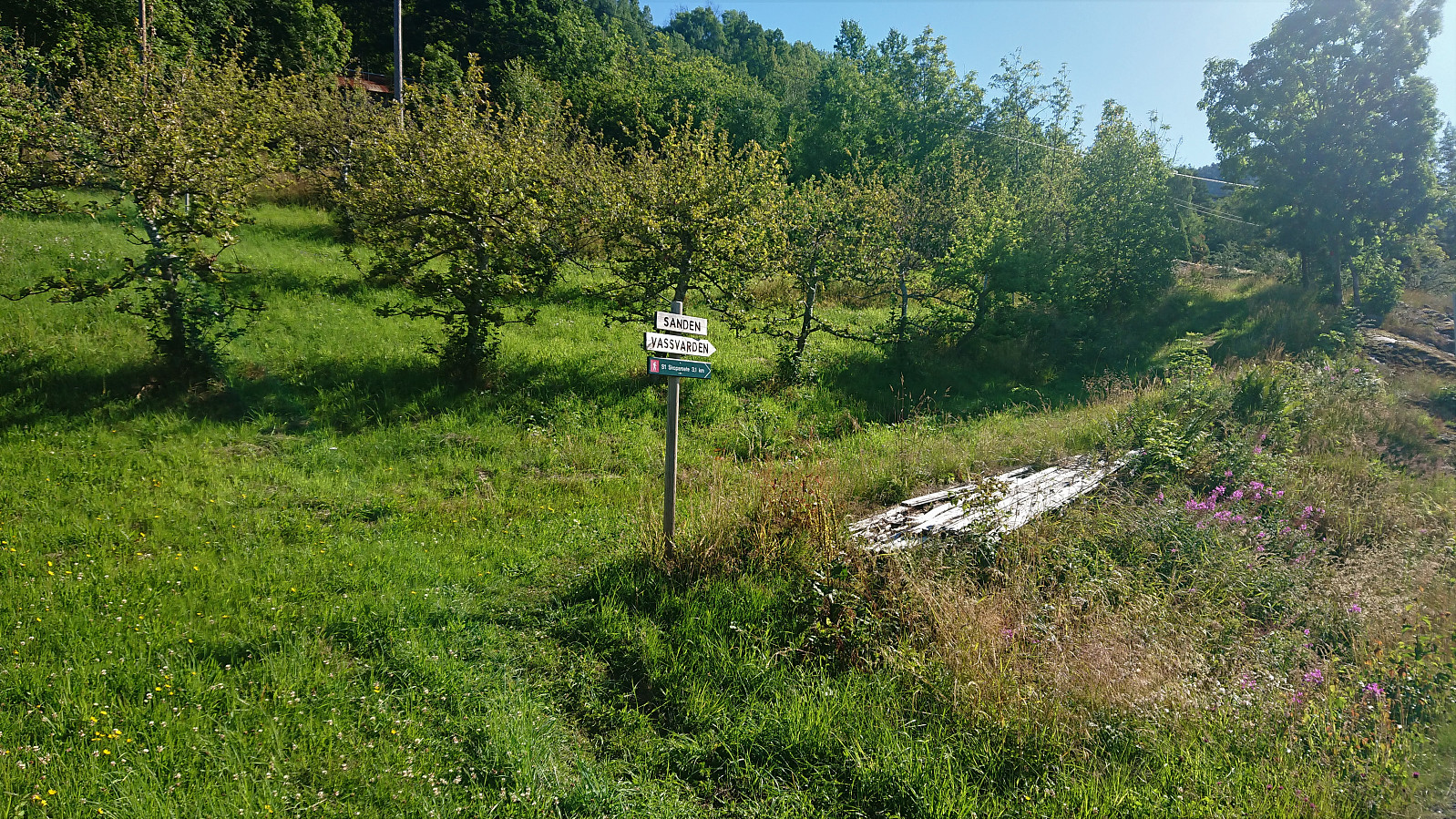
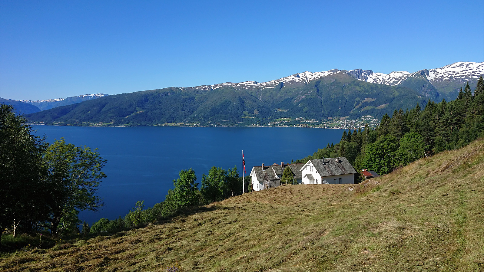
On what would turn out to be a perfect day for hiking, me and my niece started the day by taking the first bus from Sogndal to Hella, where we planned to get off at the stopped called "Hella indre". But for some reason the bus driver did not stop (even though we pressed the stop button), and we therefore had to walk the 800 meters back from the Hella. Here we easily located the marked trailhead for Vassvarden and proceeded to follow the nice winding trail up towards Vestrheim.
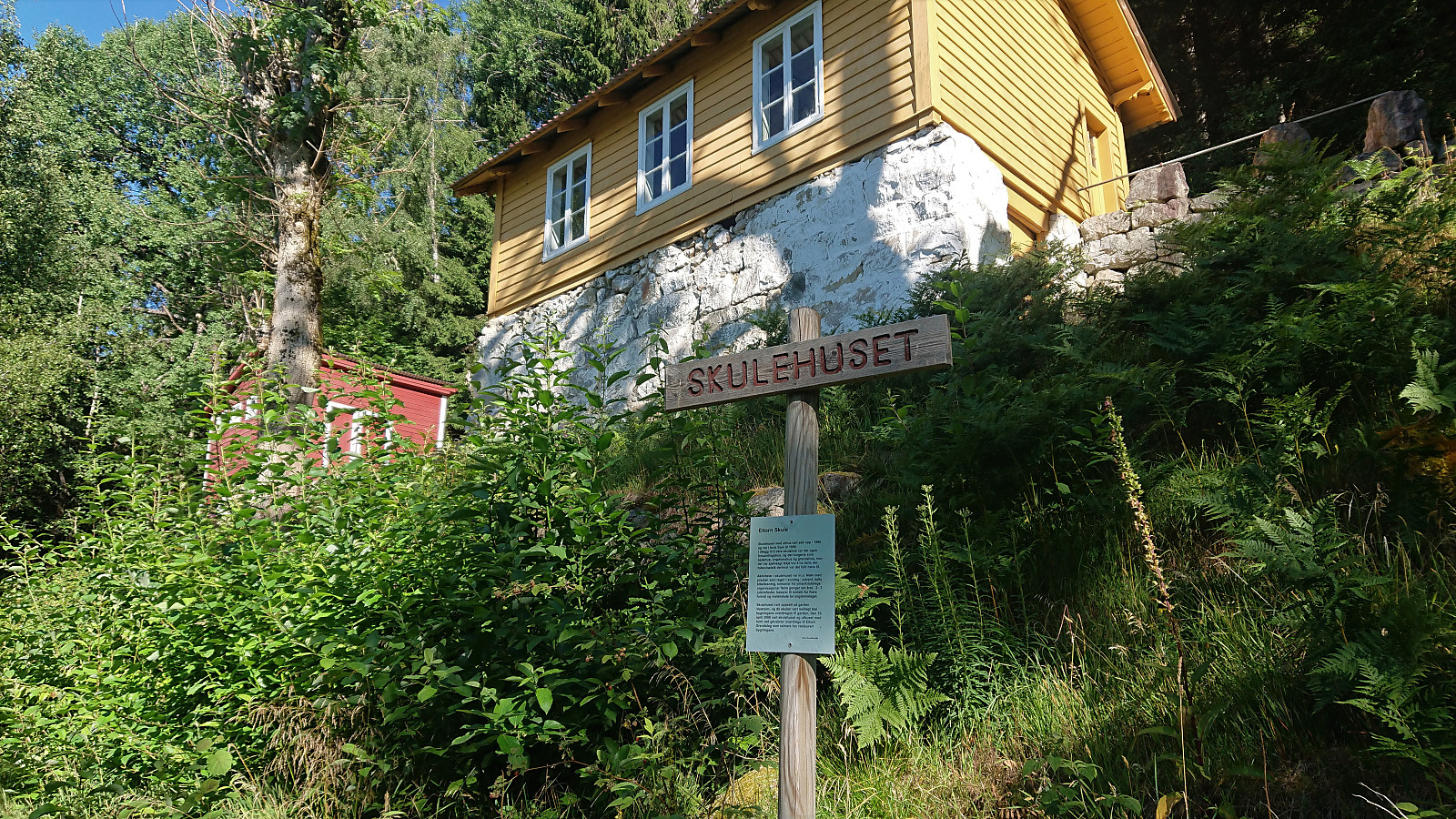
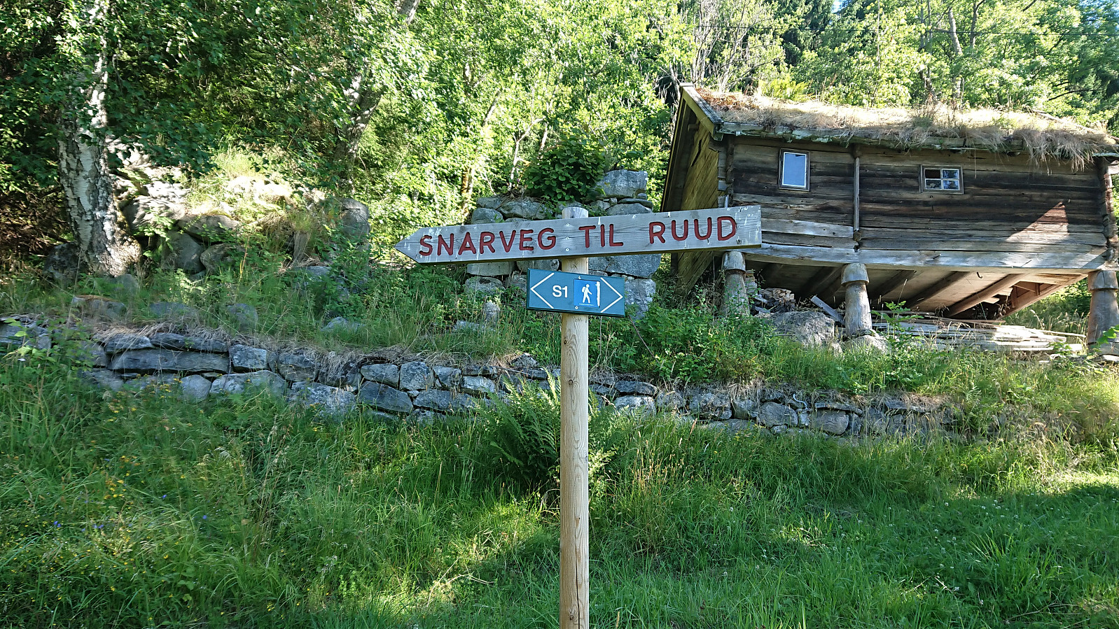
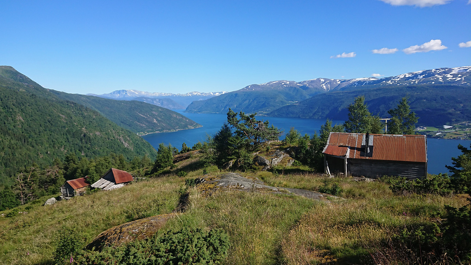
At Vestrheim we came across the old school building and a sign pointing left (i.e. west) for Ruud (or Rud as it was called on the map), our next target. However, this trail quickly started descending and seemed to be heading in the wrong direction. We therefore shortly returned to the old school where we found another sign with "Snarveg to Ruud", i.e. "Shortcut to Ruud", which fit much better with where we wanted to go.
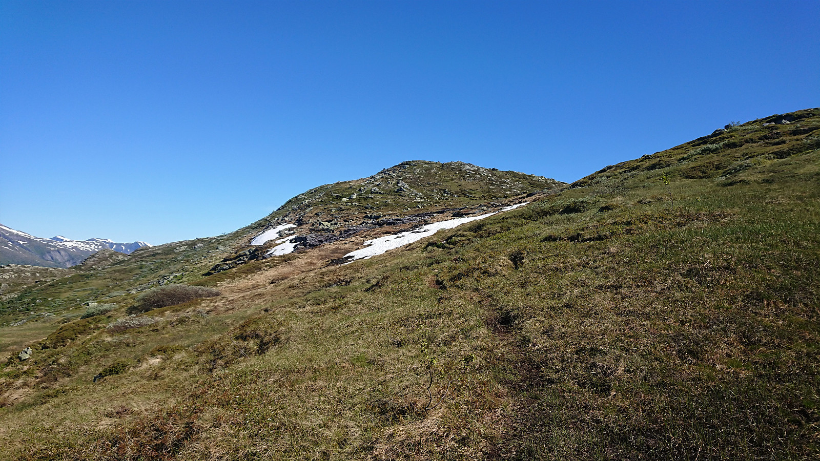
We soon arrived at Ruud, where the trail partly disappeared when crossing the fields behind the farm. The marked trail picked up pretty much where it was indicated on the map though, and we shortly passed Flatane on our way up to Skare. From here on there were fewer trail markers, but the trail was overall easy to follow.
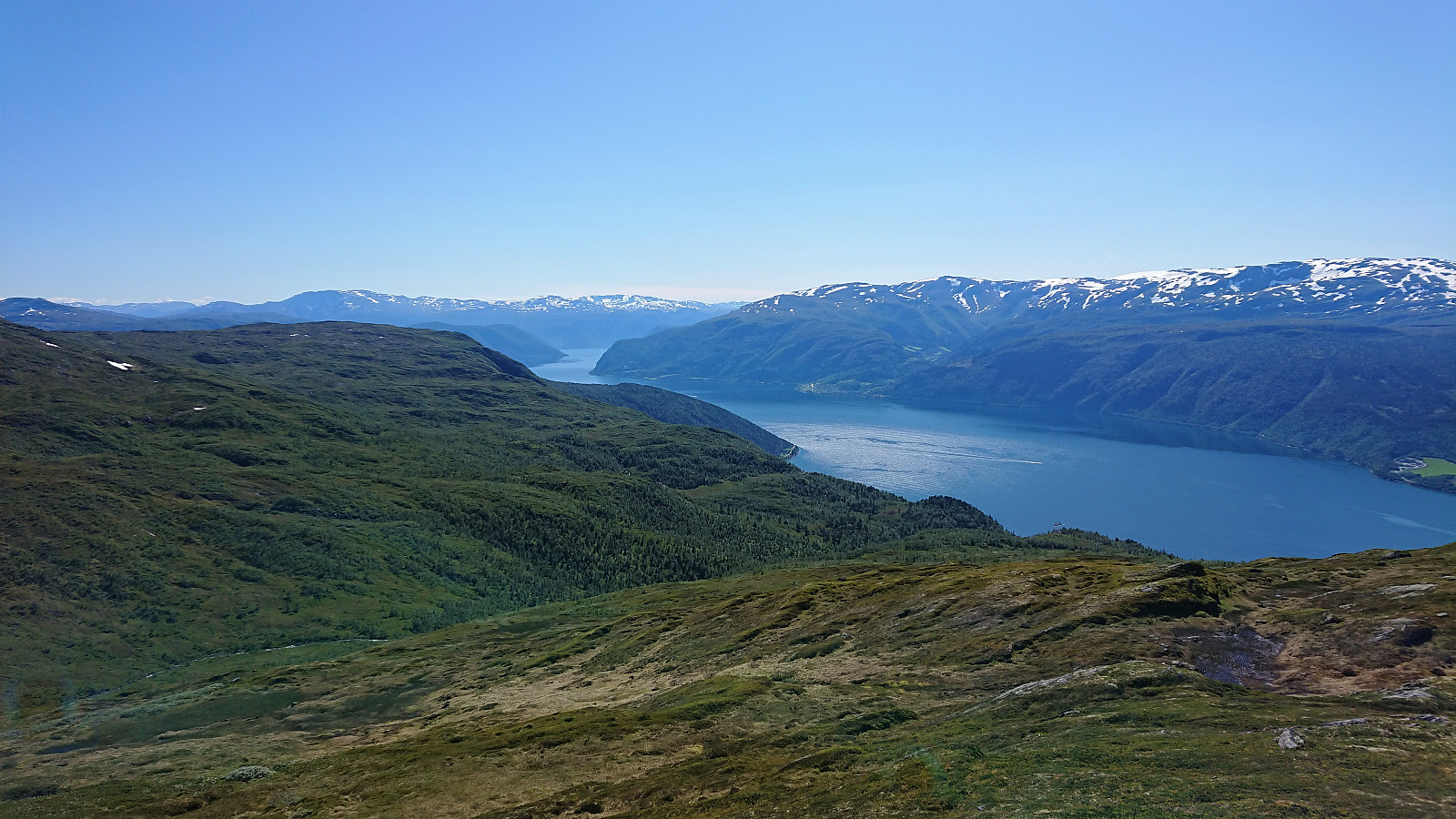
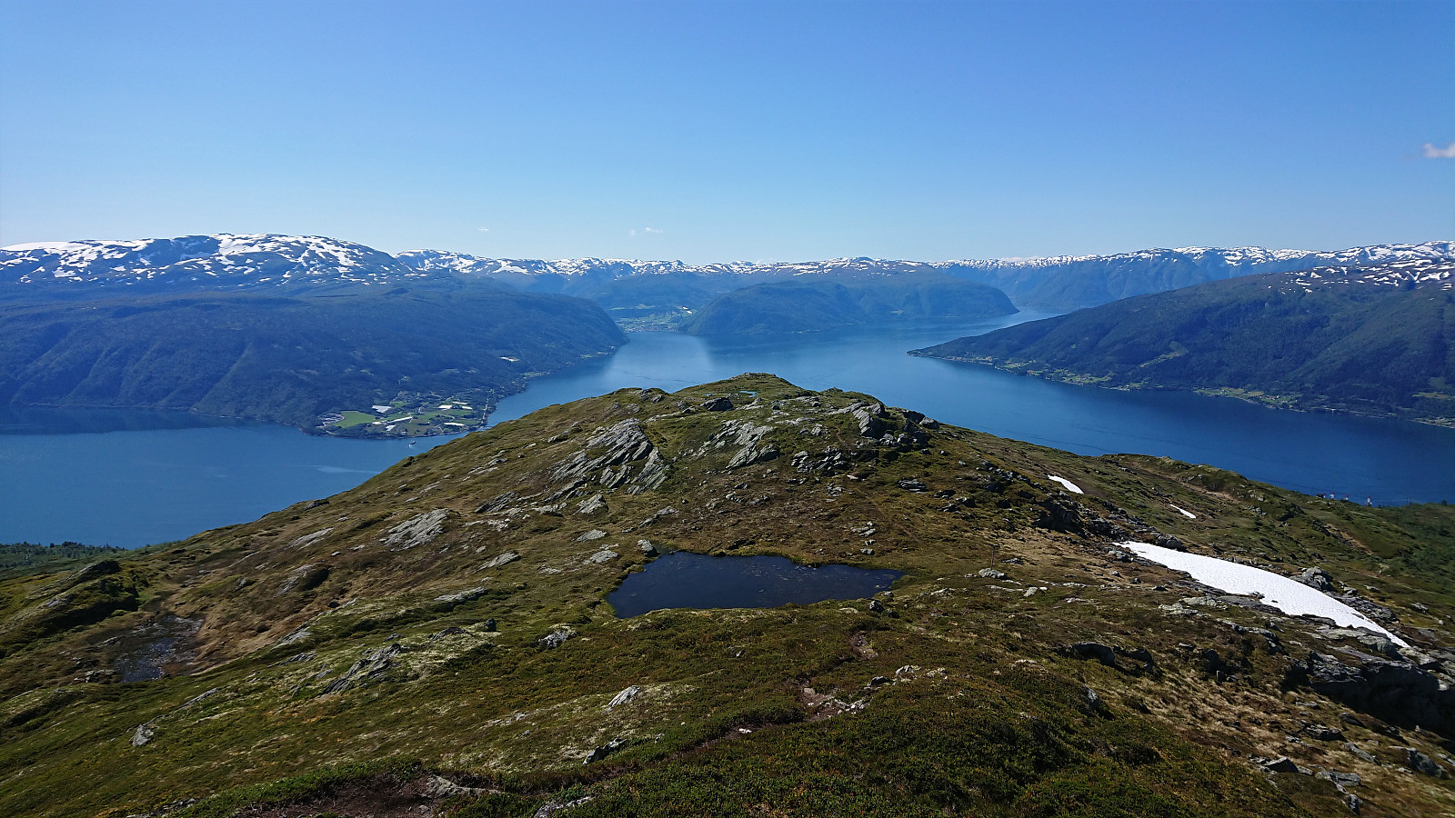
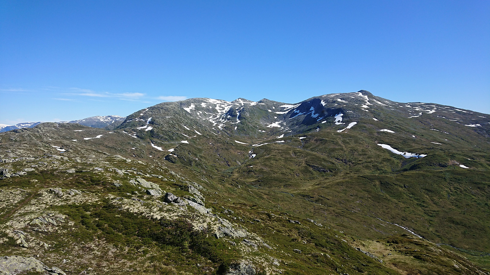
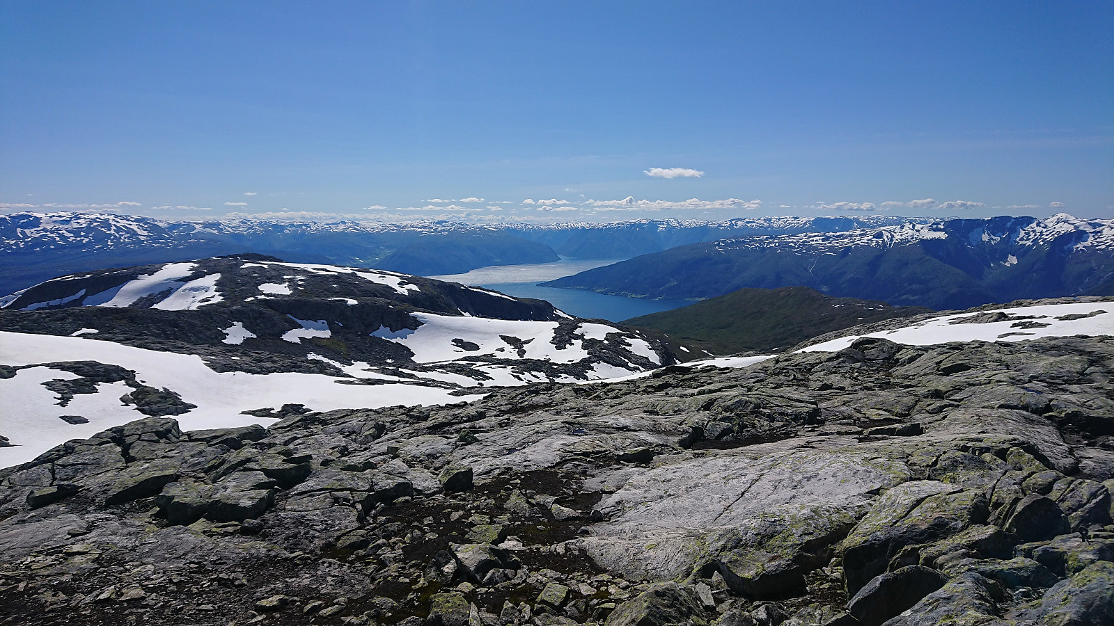
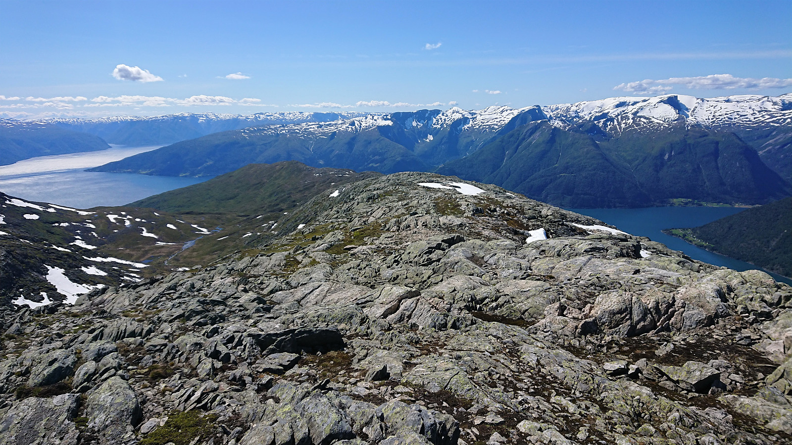
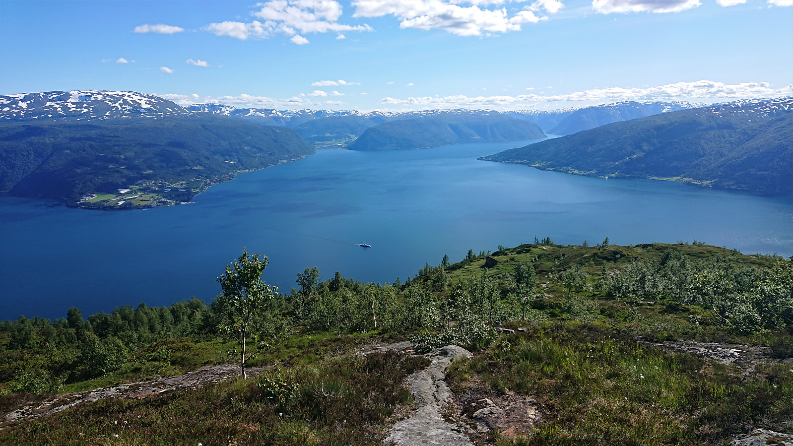
At Rudsstølen we took a short break, before continuing towards Vassvarden, deciding to skip Storeholten, as we assumed the views further up would be even better. The trail turned weaker as we approached Vassvarden and even weaker when continuing north from the large cairn at Vassvarden Sør. Vassvarden Sør did however provide excellent views towards the south, and also included its own visitor register.
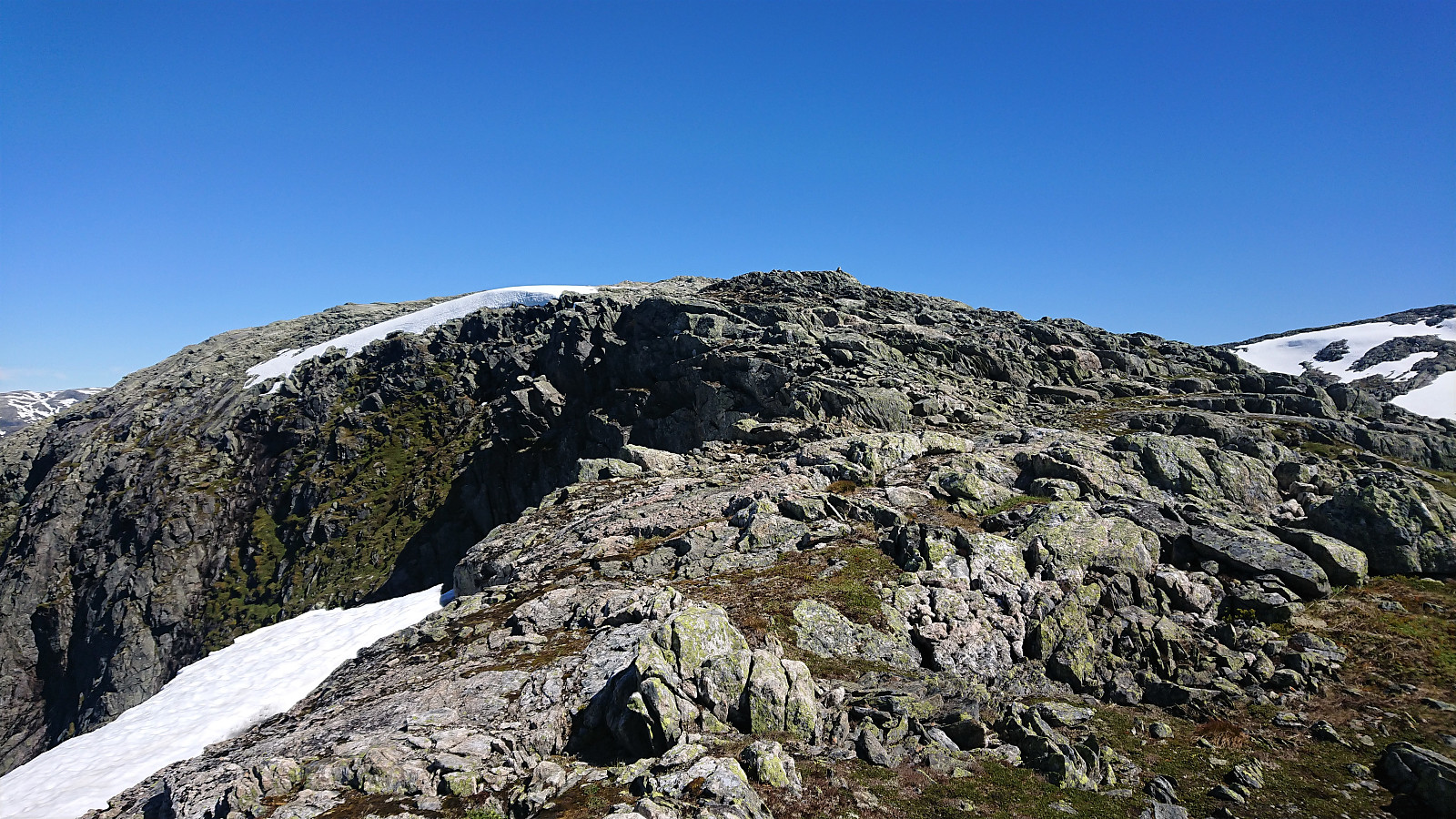
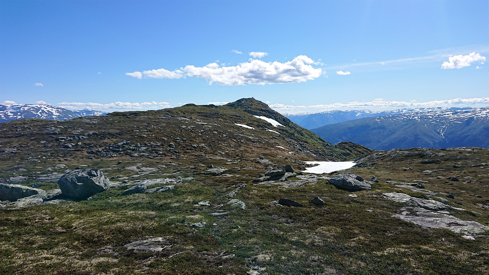
When getting closer to Syringaholten, we decided to make our own shortcut to the start of Trodalseggi, as the trail had now more or less disappeared anyway. Trodalseggi looked steep and narrow from a distance, but when getting closer it was actually neither, and we could easily make our own way up onto the ridge. At times we even followed a weak trail marked with small cairns, but the direction was pretty obvious anyway.
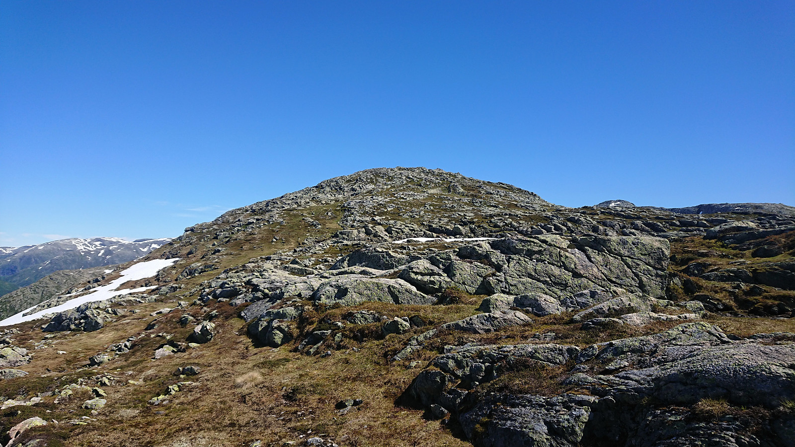
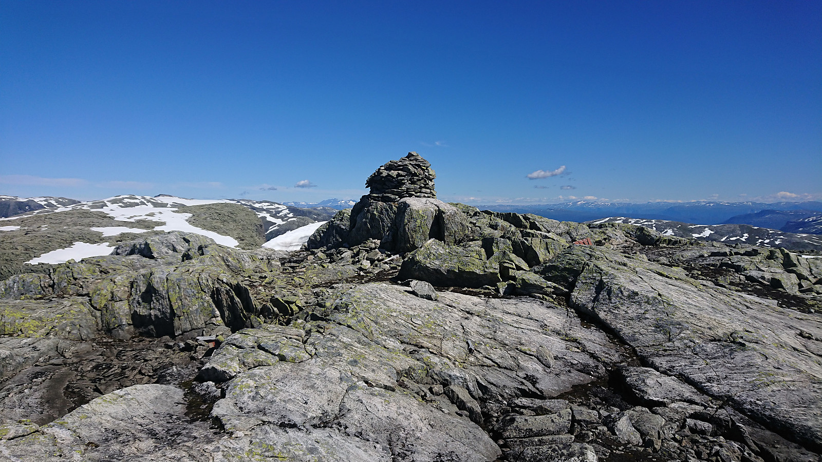
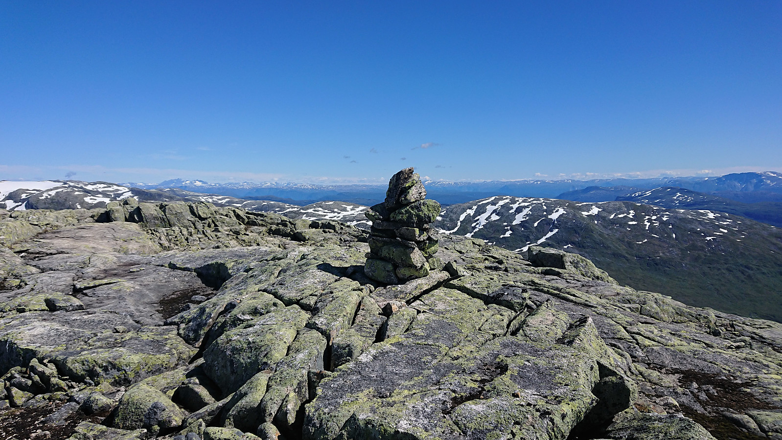
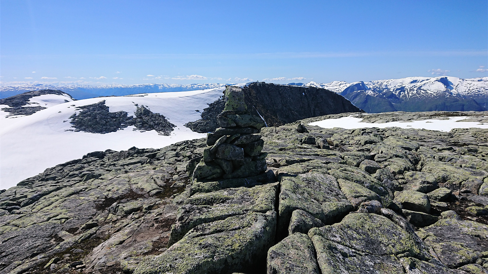
The 1456 summit was therefore reached without any real challenges, and this is most likely what most hikers would refer to as the summit of Stav. On PB this summit is however referred to as Troeggi, given that there is a two-meter higher summit to the northeast. While my niece enjoyed a longer lunch break at the 1456 summit, I therefore continued on my own to the "real" summit.
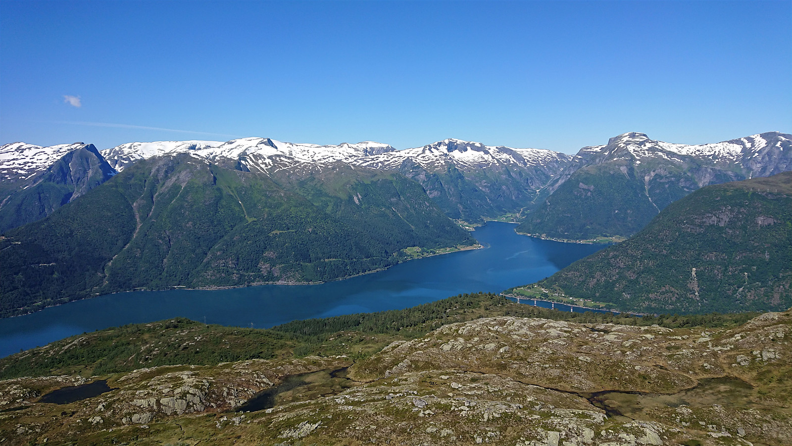
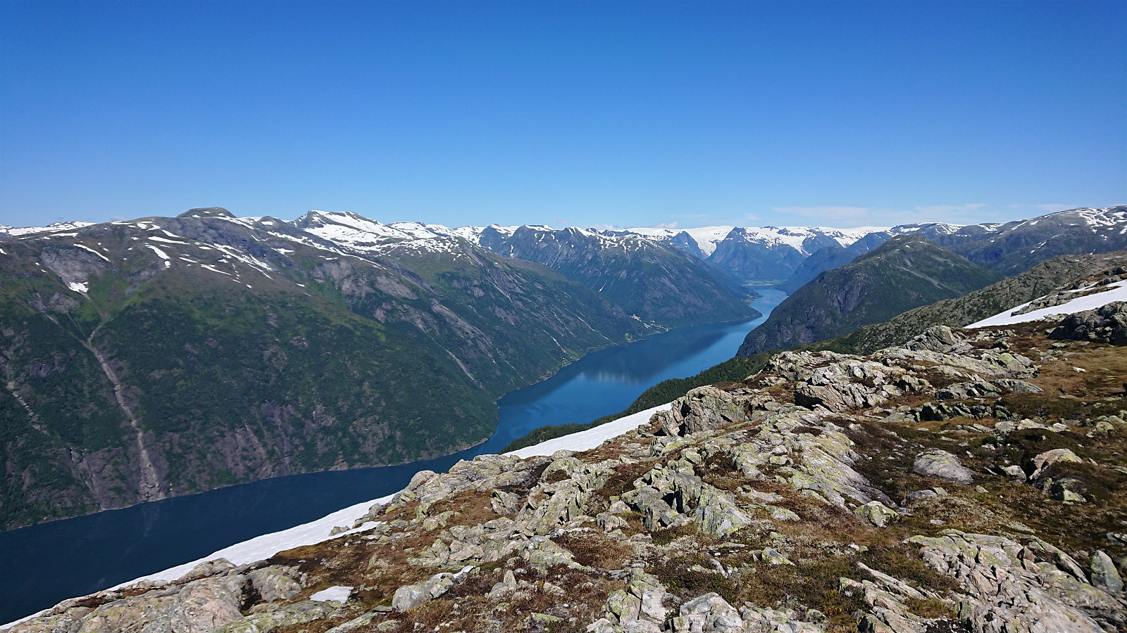
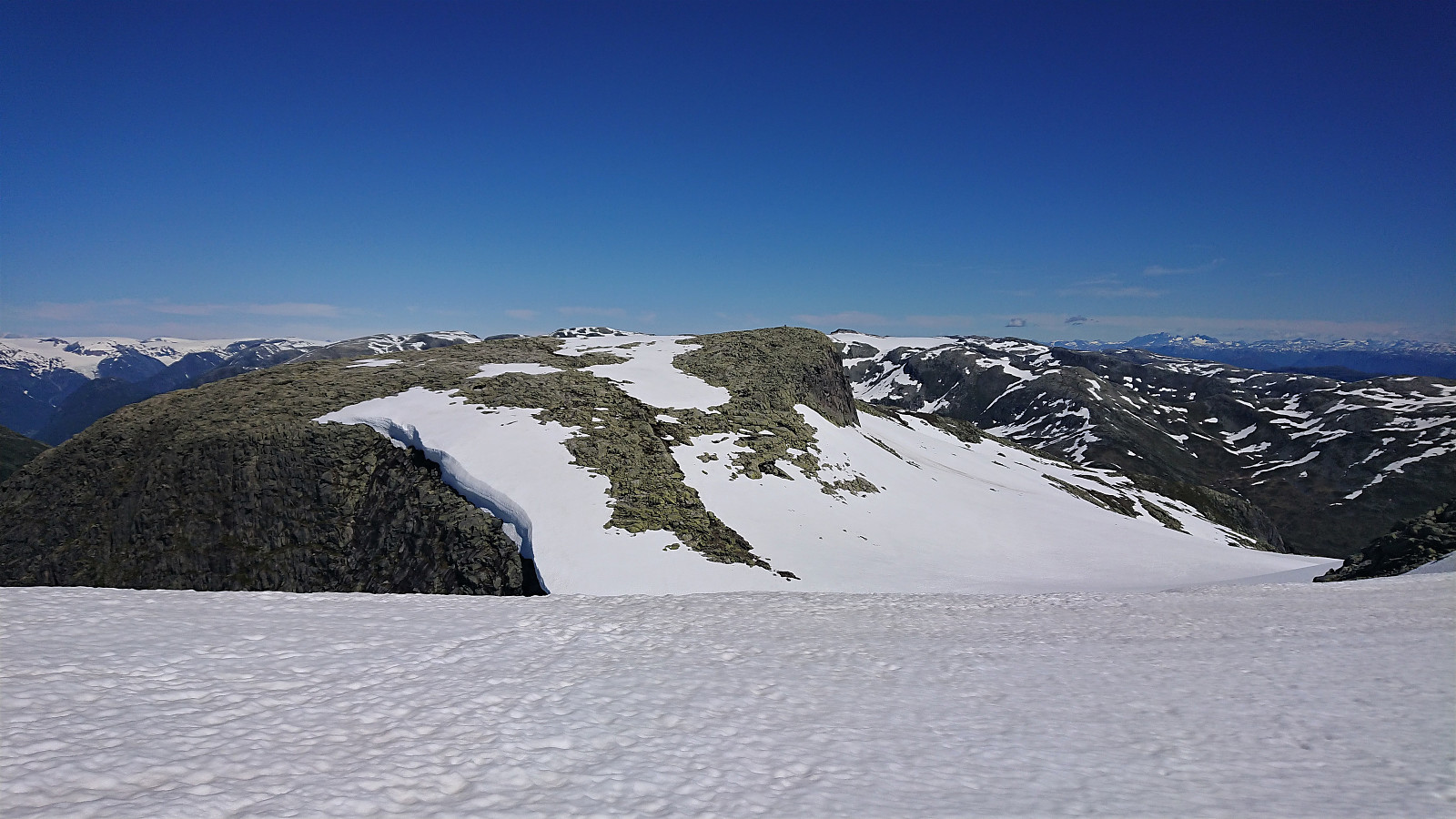
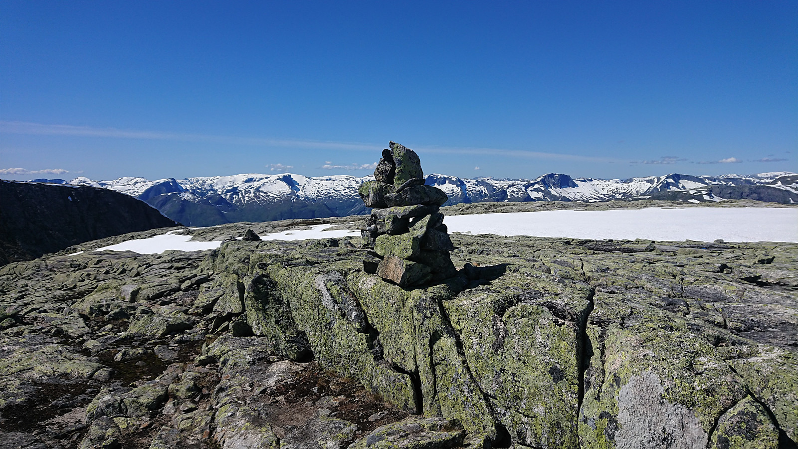
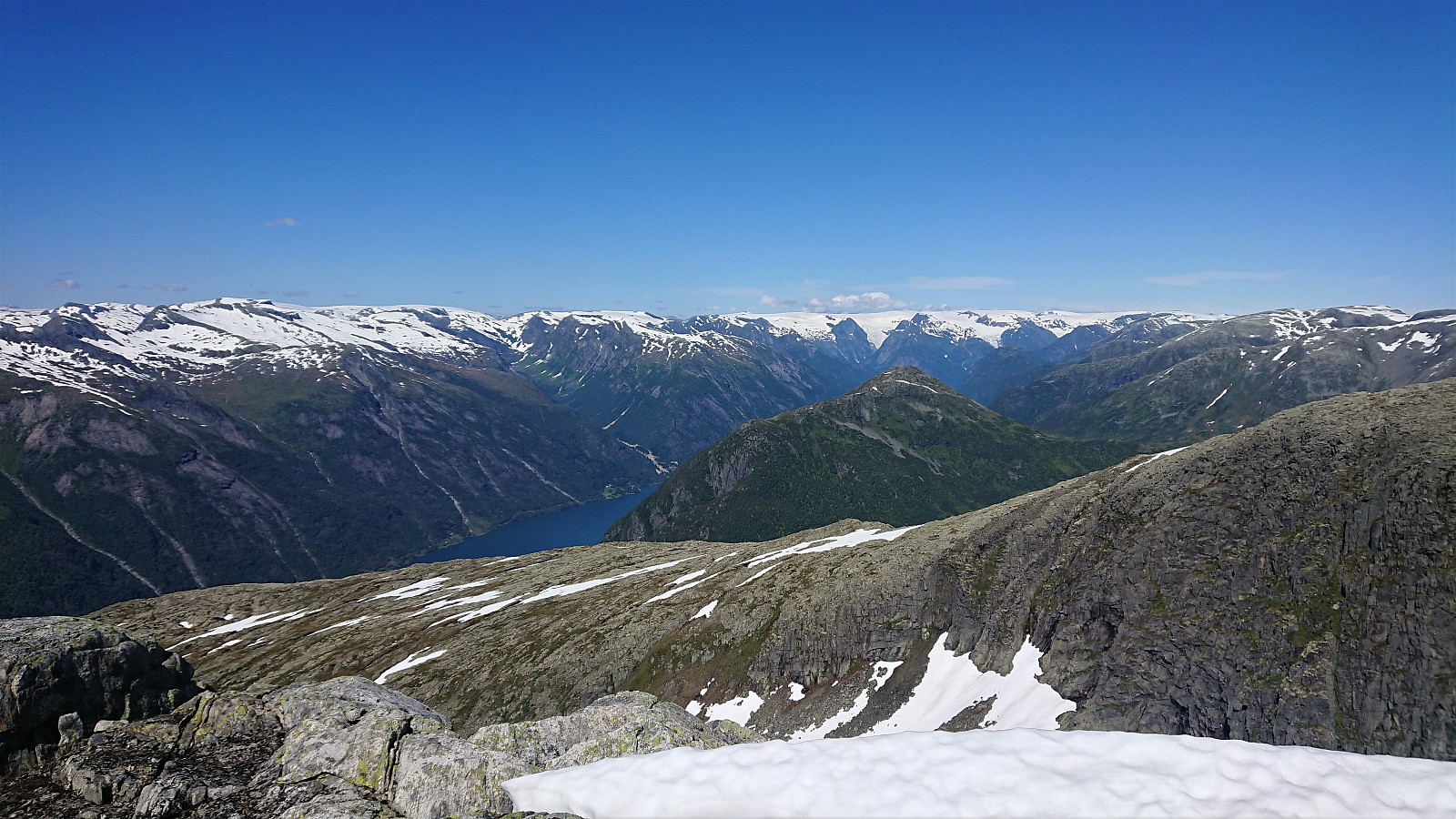
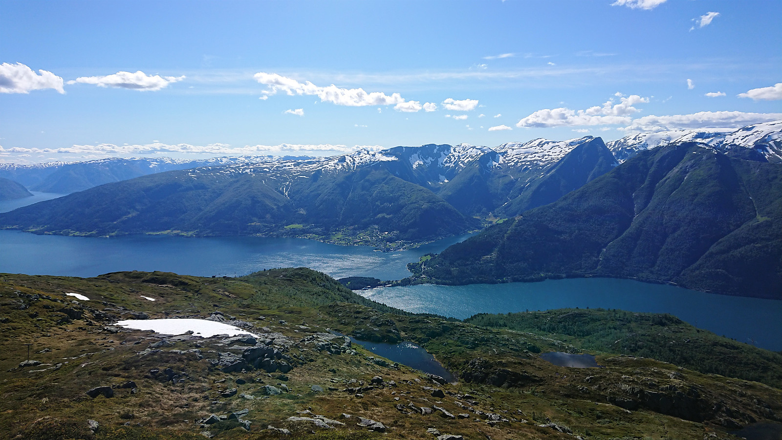
Heading in a straight line was not possible, and I thus first had to make a short detour east. This enabled me to avoid the steepest areas, but the descent into the snow-covered valley (and the later ascent heading back up) still had to be done with care. It did not present any issues though, and I soon arrived at the 1458 summit, which provided great views, although the views back to Sognefjorden were of course now blocked by the 1456 summit.
After a couple of pictures, I return to my niece at the 1456 summit and we started our descent together, following pretty much the same route as we did on the ascent, but this time skipping the walk along the road back to Hella and instead taking the bus directly from the main road at Sanden.
In summary, an excellent hike with spectacular views that can be very highly recommended!


| Start date | 24.07.2020 09:35 (UTC+01:00 DST) |
| End date | 24.07.2020 17:55 (UTC+01:00 DST) |
| Total Time | 8h 20min |
| Moving Time | 7h 35min |
| Stopped Time | 0h 44min |
| Overall Average | 3.0km/h |
| Moving Average | 3.2km/h |
| Distance | 24.7km |
| Vertical meters | 1,863m |


User comments
Great hike, wow!
Written by HHauser 31.07.2020 06:39Not a surprise that you used this nice day for a really nice hike! Supert!
Re: Great hike, wow!
Written by hbar 01.08.2020 18:40Thanks! I see that you took advantage of the nice weather on the same day as well. :)