
Kanadaskogen (13.06.2020)

Skrevet av HHauser (Helwig Hauser)

| Startsted | Varden (45moh) |
|---|---|
| Sluttsted | Varden (45moh) |
| Turtype | Fjelltur |
| Turlengde | 3t 00min |
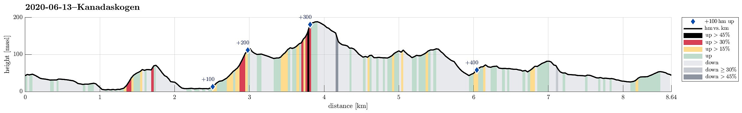
| Distanse | 8,7km |
| Høydemeter | 492m |
| GPS |
|
| Bestigninger | Allestadhaugen (78moh) | 13.06.2020 |
|---|---|---|
| Svartaberget (194moh) | 13.06.2020 | |
| Træshovden (119moh) | 13.06.2020 | |
| Andre besøkte PBE'er | Betelskipet (109moh) | 13.06.2020 |
| Tjørnahuk (91moh) | 13.06.2020 |
Trip Summary
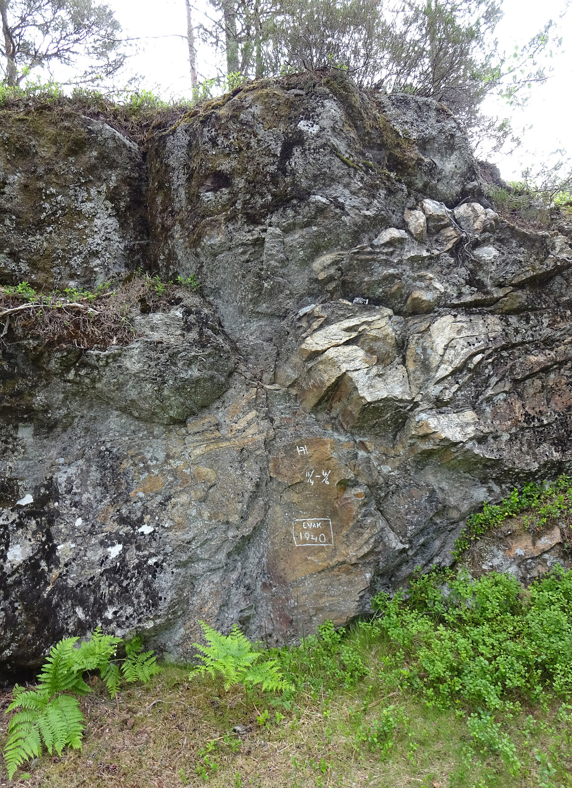
With only limited time at our disposal, we "simply" headed for Kanadaskogen. Passing by Gjeddevatnet (coming from Varden), we stepped upwards from Gjerdsvika. This time, we included Allestadhaugen (between Hesjaholten and Bjørndalsvatnet), before descending to the eastern side of Bjørndalsvatjnet. At the very northern end of Bjørndalsvatnet, where one still finds the remains of some former building, we followed the valley upwards (in northern direction), but just 25 height meters, or so. There, we turned left, first following a trail for a short while, before then continuing "straight" upwards to Træshovden through the forest. At Træshovden, we decided the Svartaberget make up a nice next goal (and off we headed there). Due to its very steep western side, Svartaberget offers amazing views! Instead of returning along a trail, we rounded Svartaberget in its north, turning more and more towards Svartatjørna (approaching it from its northwestern side, eventually). Next, we aimed at the modest heights in the east of Svartatjørna, raising to only about 25 meters above the lake, but with a very steep western flank, offering (again!) nice views; this time over Svartatjørna. On the top of this small ridge, we also paid attention to some engravings on a rock (something like "11/4 - 4/6; EVAK 1940"). After the hike, it was possible to identify this as a war memory (read more about this in Fyllingsdølen, summer 2007 edition; link below). After making a short detour to the very southern end of Svartatjørna, we started our walk back to Varden (west of Storhovden and from there towards Hesjaholten).
Photos
Selected photos are available as Google photo album.
Useful Resources
Archive of Fyllingsdølen at Fyllingsdalen Historielag.
See also the related FB-page Hiking around Bergen, Norway.


Kommentarer