
Evening Løvstakken (26.05.2020)

Geschrieben von HHauser (Helwig Hauser)

| Startpunkt | SPAR Sikthaugen (100m) |
|---|---|
| Endpunkt | SPAR Sikthaugen (100m) |
| Tourcharakter | Bergtour |
| Tourlänge | 1h 30min |
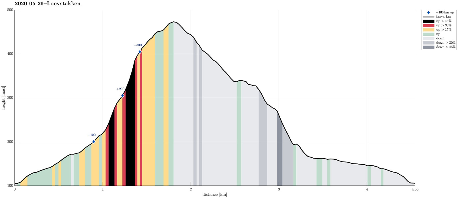
| Entfernung | 4,6km |
| Höhenmeter | 387m |
| GPS |
|
| Besteigungen | Løvstakken (478m) | 26.05.2020 |
|---|---|---|
| Besuche anderer PBE | Fossen (200m) | 26.05.2020 |
Trip Summary
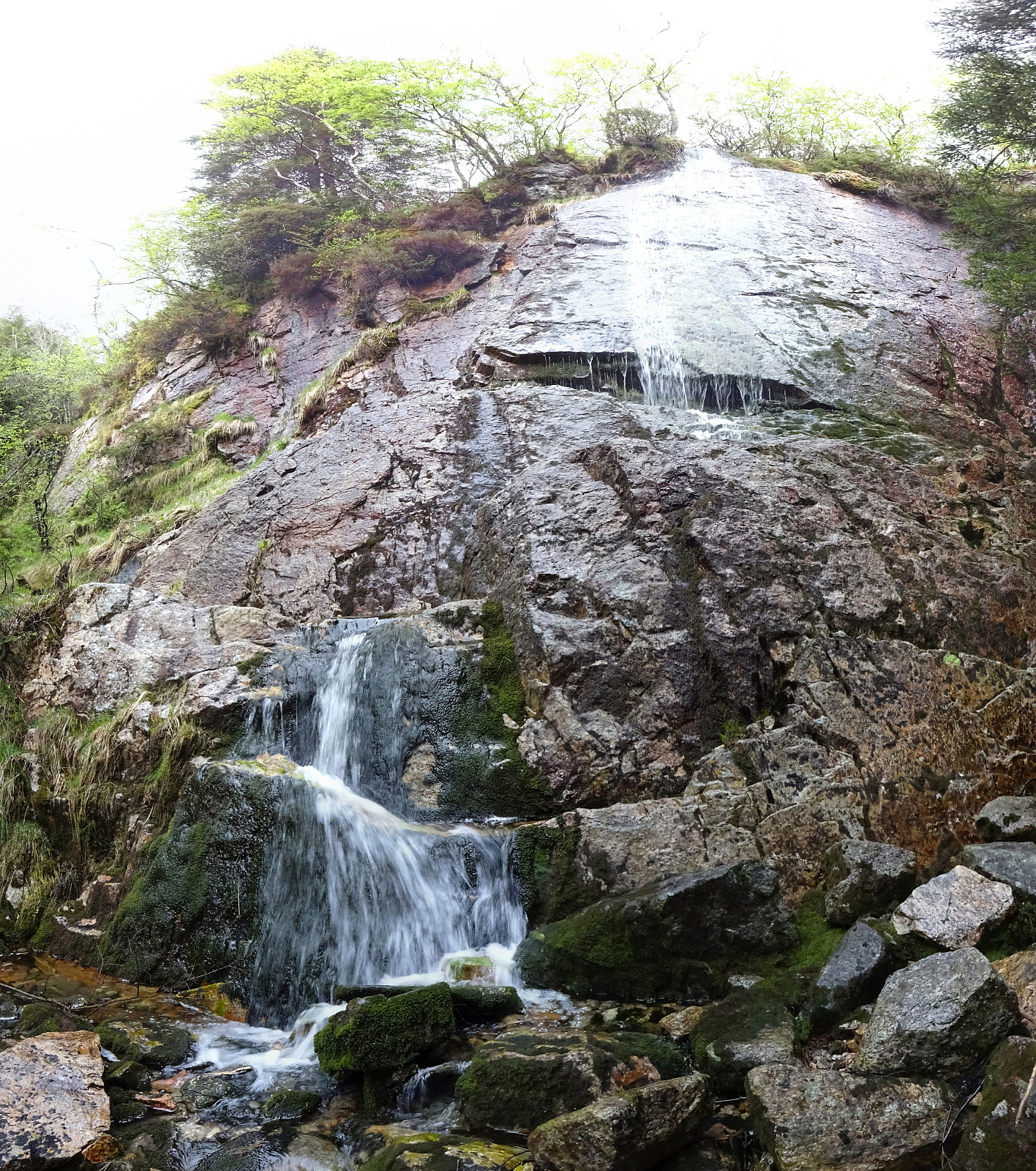
Spontaneously, we decided to do a quick after-work sprint up Løvstakken (the steep way). We parked near the SPAR shop "Sikthaugen" (above Sikthaugen Terrasse) and walked up the pedestrians' connection to Kirsten Flagstads vei. From there, we continued along Rosenlundveien (up to house 43), before taking the trail that ascends steeply underneath the power line in Eastern direction. At about 350mosl, the steepest part of the trail starts (roughly in Northern direction). A bit more the 50 meters higher, one comes out and can enjoy some nice views over Fyllingsdalen. From there, it's then "just" following the trail all to the top of Fyllingsdalen. Definitely a nice alternative of an ascent to Løvstakken! From the top, we then followed the Northern ridge down (into the direction of Ravnefjellet). Before actually getting to Ravnefjellet, we turned left (in Southwestern direction), descending towards Fossen (a nice, little water fall, continuing further into Litlavatnet). After reaching the flats in the East of the two lakes, we followed Krohnegården and then Kirsten Flagstads vei back down to the car. Nice to get out and catch some fresh air! :-)
Photos
Selected photos are available as Google photo album.
Useful Resources
See also the related FB-page Hiking around Bergen, Norway.
Web page WestCoastPeaks.com provides useful information about Løvstakken.


Benutzerkommentare