
Tåkenuten and Kråkenos (23.05.2020)

Written by HHauser (Helwig Hauser)

| Start point | Bolstad (40m) |
|---|---|
| Endpoint | Bolstad (40m) |
| Characteristic | Hike |
| Duration | 6h 15min |
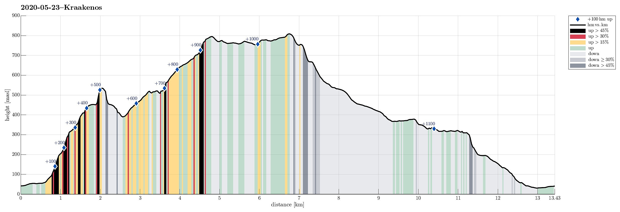
| Distance | 13.4km |
| Vertical meters | 1,152m |
| GPS |
|
| Ascents | Kråkenosi (814m) | 23.05.2020 |
|---|---|---|
| Tåkenuten (801m) | 23.05.2020 |

Trip Summary
Weighing the weather forecast with our wish to make a nice hike, we ended up with Kråkenos as our hiking goal. While this mountain is also well accessible from its eastern side (from Bru near Strandebarm at Hardangerfjorden), we decided to approach it from its western side, i.e., from Øvre Hålandsdalen. To get there, we drove from Bergen first along E16 into the direction of Voss, then along road 49 into the direction of Kvamskogen, before then continuing along road 48 to Eikelandsosen and from there further towards Holdhus a few kilometers in the east of Eikelandsosen. Near Holdhus one needs to take a sharp turn to the left (north) onto an old and narrow road that leads into Øvre Hålandsdalen (after first passing between Gjønavatnet in the north and Skogseidvatnet in the south). Once in Øvre Hålandsdalen, we continued (more and more in northwards direction) until we got to Bolstad. Between Nedre Bolstad and Øvre Bolstad we parked and started our hike.
Bratthusdalen
Since we had planned to make a round, including Kråkenos, we first headed northwards on the road in Øvre Hålandsdalen. At Bratthus, we intended to find a trail that would lead us upward and into Bratthusdalen. While the trail from Nedre Bolstad to Bru (south of Kråkenos) is nicely marked, this is not the case for the trail up Bratthusdalen. Even though we had expected to find the trail head shortly before reaching Bratthus, we could not see anything like a trail head before getting to Bratthus. There, we decided to simply ascend without a trail in order to connect to the trail further up the mountain side. The ascent east of Bratthus is steep, but well possible. At about 115mosl, we tried to check the map (on our mobile phones), just to find out that we did not have any service in this valley. One needs to get quite a bit up and into the forest before there connecting with the trail (it needs to be mentioned that this trail is hard to spot, even for the trained eye!). Seeing every now and then a bit of red marking on a tree, we considered ourselves to be on the right track, at least in the beginning. At about 400mosl, we recognized that we had not seen any marker for a while, understanding that we most likely had departed from the trail. Since we were following some nice deer track on pleasant grounds, we first continued in order to see where this would lead us (still, we did not have any service on our mobile phones, so checking the online map was not possible). At about 450mosl, we enjoyed some nice views down to Øvre Bolstad and Bratthus. We discussed for a moment, whether we should attempt a wild crossing diagonally towards the upper part of Bratthusdalen, even trying a bit of climbing there for a short stretch, before then concluding that this was too risky. We thus headed back the nice deer tracks, connecting again with the trail at about 400mosl. There, however, it was not at all clear, how to continue. After searching quite a bit and trying different directions, we eventually decided to try crossing the stream (towards the north). Due to all the loads of melting water, this was not 100% easy, but with a few wet steps we finally made it to the other side. There, to our satisfaction, we located another trail marker, confirming that we were back on track! :-) Aften then hiking up Bratthusbotnen to something like 520mosl, we turned right (back in southward direction) at about the right spot, following the "trail" along the steep cliffs there. This then brings one "to the next level", i.e., the lower parts of upper Bratthusdalen. There, at about 570mosl, one eventually enters the realm of stones, ice, and water. It's then relatively easy to find the trail leading further upwards (and again in northern direction).
Tåkenuten
Following the marked trail further northwards, we made it to about 680mosl, before leaving the trail and turning eastwards (and towards Tåkenuten). Up to about 730mosl, we stepped conveniently over some big snow fields. Then the ascent to Tåkenuten (still mostly over snow) became steeper and a little more challenging. Still, it was not really any problem to ascent Tåkenuten from its steep, western side. Before actually making it to the top, we used a place right next to one of its upper cliffs to east and drink a little (up there, we had faced harsh winds, suggesting that a break on the top was not an opportunity). Shortly after (it simply wasn't warm enough for a longer break), we had ascended Tåkenuten, seeing Kråkenos on the other side of a nice mountain ridge, extending southwards from Tåkenuten. Knowing about some lakes up there, we aimed at finding the trail that would bring us to Kråkenos. Luckily, we were able to find a good number of yellow marks (even though a lot of the ground up there was covered in snow).
Kråkenos
Following the yellow marks (more or less), walking mostly over snow, we proceeded quickly towards Kråknos further south along the ridge. All in all, this traverse was without any difficulties (just "fighting" the strong winds a little). Not long after leaving Tålenuten, we then came to Kråkenos, enjoying some excellent views in all directions! In the east, we were served with outstanding views over Hardangerfjorden, in the south we looked over to Daurmålsegga, in the west we saw Våkefjellet, and in our back, Tveitakvitingen and Gjønakvitingen were towering (partially in the clouds). Wow, really nice!
Røyndalen
With all the snow still around, it clearly was an interesting question of how to get down from Kråkenos (on its eastern, steep side). After first walking a bit back (in northern direction) to avoid the most steep terrain, we then managed to descend, exploiting that the upper layer of the snow had softened in the recent not-so-very-cold temperatures. Enjoying a couple of nice views on our way down, we felt satisfied that getting down was quite a bit easier than expected. At about 525mosl, we connected to the trail that leads up to Akssete (further north) and from there further up into the direction of Tveitakvitingen. Following this trail, then, we descended via Hestaberget towards the saddle, where we met the trail crossing over from Bolstad (in Øvre Hålandsdalen) to Bru (down at Hardangerfjorden). Thereby, we had connected to the trail that should bring us back to Bolstad (south of Kråkenos). Following this trail, we passed by Skarsdemma and came down to Røyndalsvatnet thereafter. At the very west of this lake we reached the waters, refreshing us with the cold waters there! :-) From there, however, it was then not clear how to proceed and we needed to search a little before we found the right continuation (on the north of Stigatjørna). In the northwest of Stigatjørna then, we came to a trail fork, which indicated the we could follow two trails from there (both down to Bolstad), one including some ladders and another, longer one without. We chose to follow the trail including the ladders (via Stegen) that descends more or less vertically down a major cliff west of Stigatjørna. Eventually, down in Øvre Hålandsdalen, we would read that these ladders were put up some 120 years ago! Once down the ladders, the remaining hike out to Nedre Bolstad was straight forward and easy. And a few minutes later, we also had reached our car, again.
Conclusion
We really were very thankful and glad after this multi-faceted hike. For a second time, already, we had experienced Bratthusdalen as non-trivial. The descend from Kråkenos could easily be a significant challenge, for example, when the snow is hard. Clearly, this hike has much to offer, but it's good to be prepared.
Photos
Selected photos are available as Google photo album.
Useful Resources
See also the related FB-page Hiking around Bergen, Norway.
Web page UT.no from the Norwegian Trekking Association recommends a hike from Bolstand to Kråkenos.


User comments