
Tunesfjellet and Skåldalsfjellet (21.05.2020)

Written by HHauser (Helwig Hauser)

| Start point | Tunestveit (50m) |
|---|---|
| Endpoint | Tunestveit (50m) |
| Characteristic | Hike |
| Duration | 4h 30min |
| Distance | 12.2km |
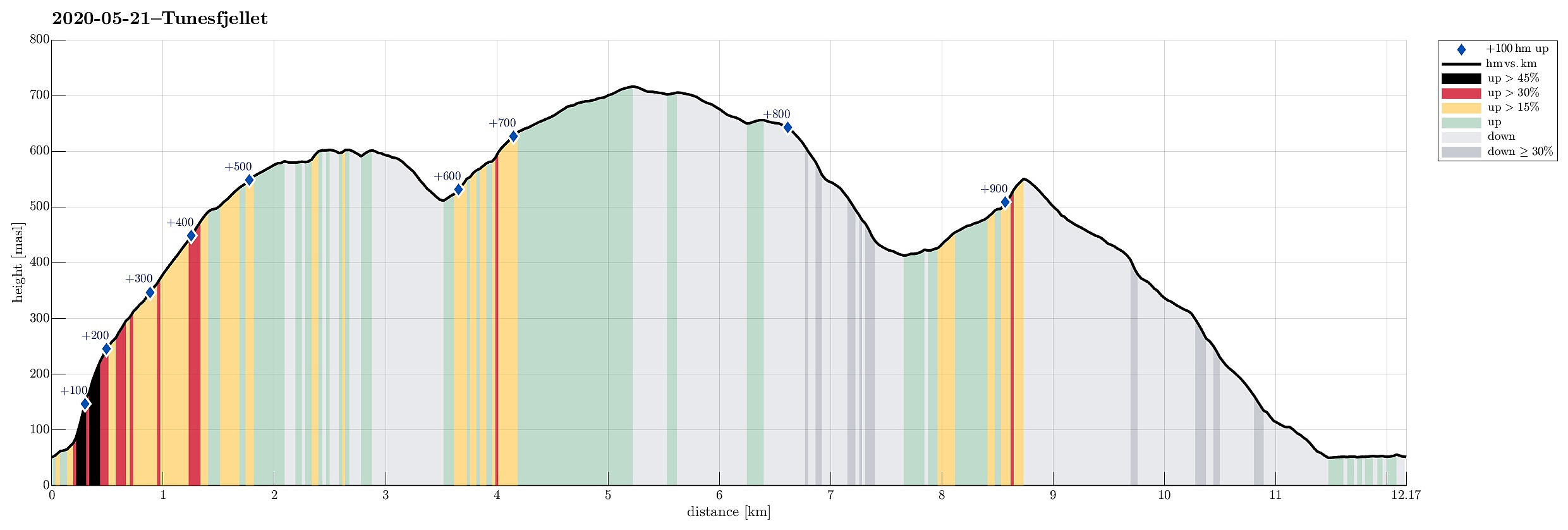
| Vertical meters | 954m |
| GPS |
|
| Ascents | Repparåsen (609m) | 21.05.2020 |
|---|---|---|
| Skåldalsfjellet (718m) | 21.05.2020 | |
| Visits of other PBEs | Repparåsen utsiktspunkt (605m) | 21.05.2020 |
Trip Summary
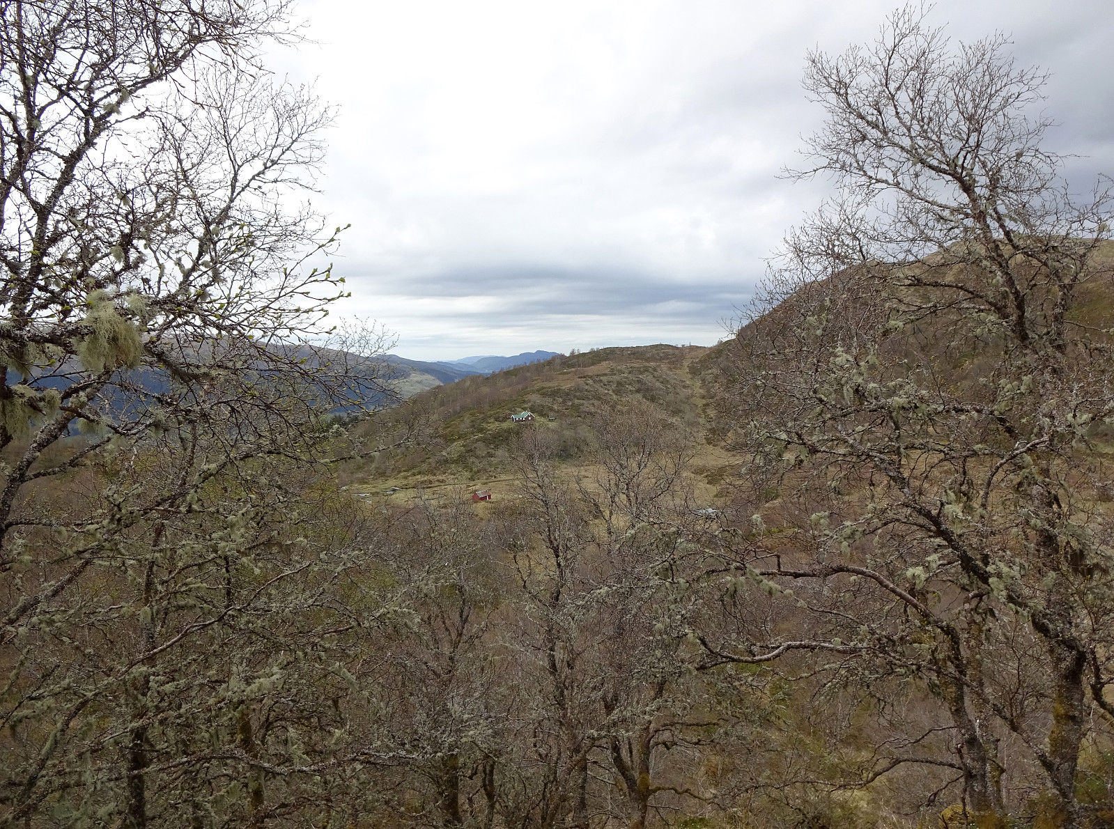
One could say that this hike is a logical continuation of our small research project Gullfjellet from the north, Sørfjorden. :-) We drove from Bergen to Arna and then through the tunnel under Ådnanipa (E16), before taking the very first exit ("Takvam") and turning back along the old road (Tunesvegen) into the direction of Tunes. At Tunestveit, only a few meters from the E16-exit, we parked along the road. We then crossed under E16 (right where it comes out of the tunnel under Ådnanipa, crossing over Tveitaelva there) and continued on an old forest road into the direction of Åsen. All the terrain is very steep there and most parts will not provide any opportunity to continue all the way up. Our map study, however, had suggested that ascending to Åsen on the very eastern side of this narrow valley should work. While the mountain side is also very steep there, it's still reasonably straight-forward to get up to Åsen there. Once on the ridge, it becomes easier to continue in southern direction (towards Tunesfjellet) and from about 275mosl upwards one finds a simple trail, also. The rest of the ascent (via Gullstølane up to Tunesfjellet) is then no problem at all. From about 450mosl upwards one can then choose where to continue (one option that we did not take would be to cross over to Vardegga and ascent to Repparåsen via this ridge). After reaching a little micro-top (between Storhaugen in the west and Repparåsen in the east) and enjoying some first nice views over Reppadalen, we then continued across Repparåsen towards Reppaskaret in the east of Reppadalen, enjoying additional nice views down to Sørfjorden and Osterøy behind it. On the other side of Reppaskaret, we then ascended to Skåldalsfjellet via Reppadalsfløyen. To complete our (very elongated!) round around Reppadalen, we descended from Skåldalsfjellet via Hotten to Reppadalen (this is a very nice alternative to Reppaskaret and can be recommended!). Down in Reppadalen, we crossed over it in the east of Garnessetra, heading first up to Legene and then further up to Storhaugen. From there, we then descended in northern direction across Tunesfjellet and Såta. At about 415mosl, we left the trail along the upper edge of Tunesfjellet and connected diagonally downwards to another trail that runs parallel to Tjovedalsrinden. A bit higher than 300mosl, we entered the forest and followed a nice trail down the ridge (via Rokkane and Snargota). At about 125mosl, we then followed a forest road (diagonally northwards along the mountain side). This brought us to one of the upper houses along Tunesvegen. From there it was then easy to connect down to the "main road" (the old road to Bergen) and along it back to our car. All in all, it was nice to do this hike up Tunesfjellet from Tunes, also including a "round" around Reppadalen, including Skåldalsfjellet. Nice! :-)
Photos
Selected photos are available as Google photo album.
Useful Resources
See also the related FB-page Hiking around Bergen, Norway.
Petter Bjørstad has a useful page about Skåldalsfjellet and also web page WestCoastPeaks.com provides useful information about Skåldalsfjellet, Herlandsfjellet, Repparåsen (Tunesfjellet), and Arnanipa (Ådnanipa).
Web page UT.no from the Norwegian Trekking Association recommends another hike up Tunesfjellet.


User comments