
Kviturhytten (24.05.2020)

Written by hbar (Harald Barsnes)

| Start point | Årstadveien (57m) |
|---|---|
| Endpoint | Ludebryggen (4m) |
| Characteristic | Hillwalk |
| Duration | 2h 17min |
| Distance | 7.3km |
| Vertical meters | 493m |
| GPS |
|
| Visits of other PBEs | Brushytten (412m) | 24.05.2020 |
|---|---|---|
| Kviturhytten (ruin) (265m) | 24.05.2020 |
Kviturhytten
Warning: This hike includes off-trail scrambling in steep terrain. Consider the track with care!
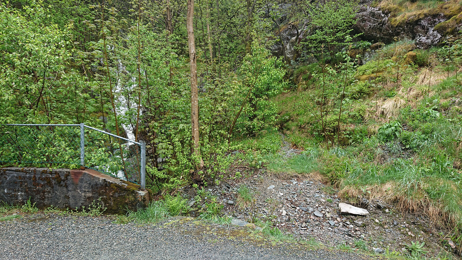
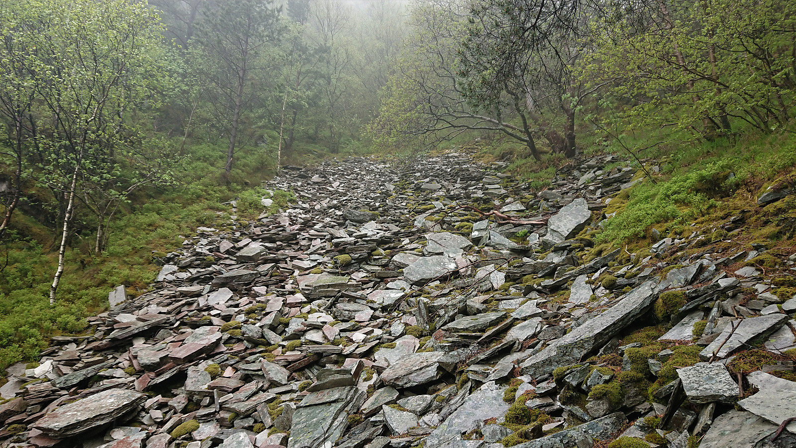
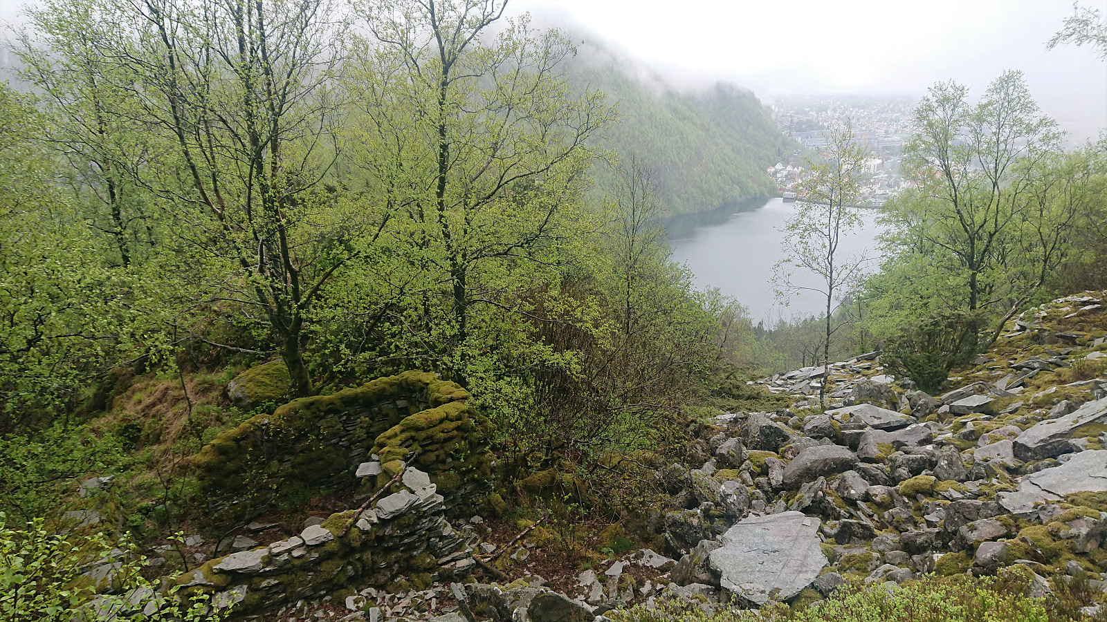
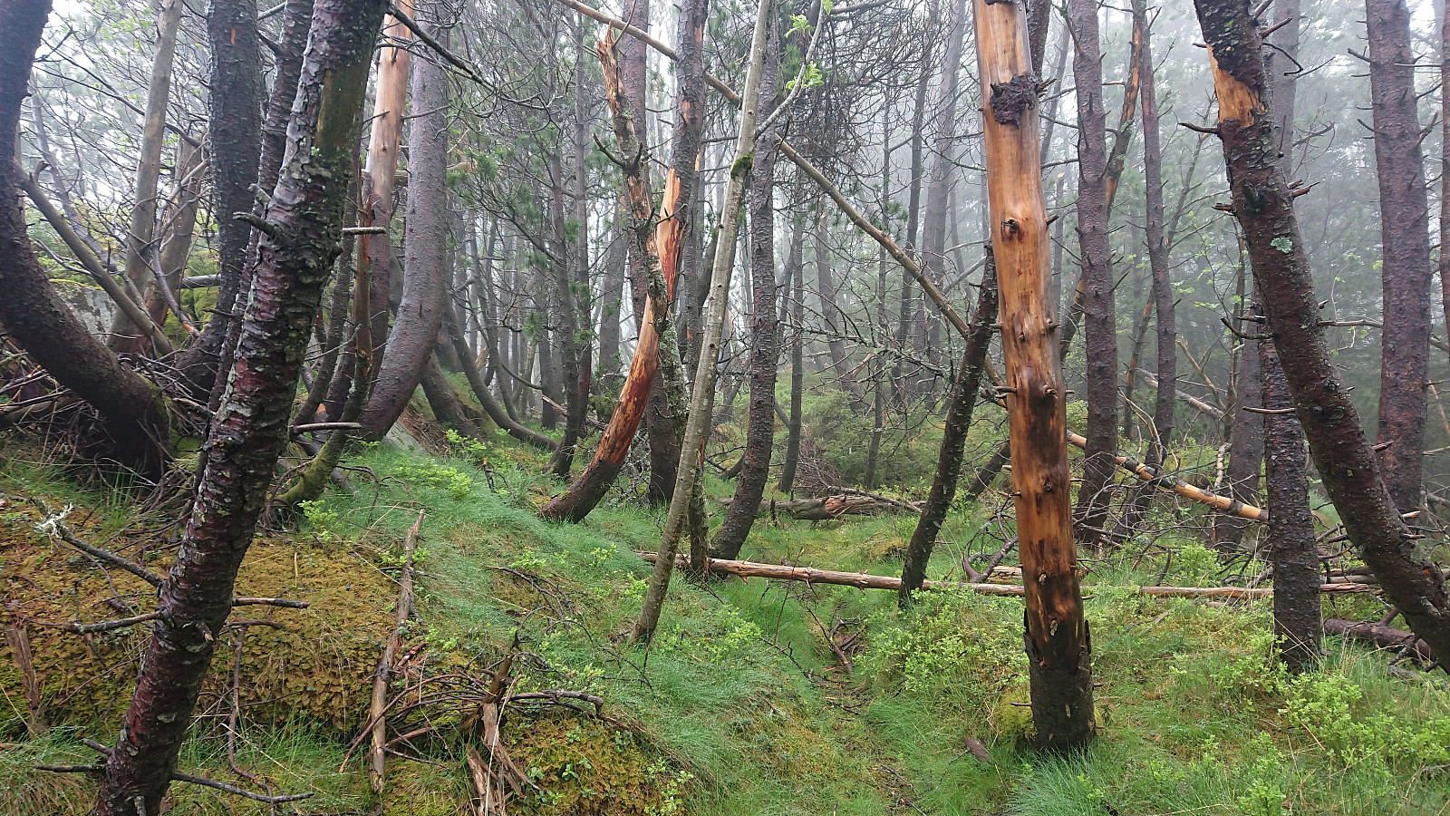
The last cabin ruin in Bergensernes Fjellverden II (BF II) in the area from Sandviksfjellet to Ulriken was what the book refers to as Kviturhytten. After finally locating it on the map, I set out from Årstadveien and followed the road along Svartediket until reaching Kviturbekken. Here I left the road on what almost looked like a trail, following the stream north.
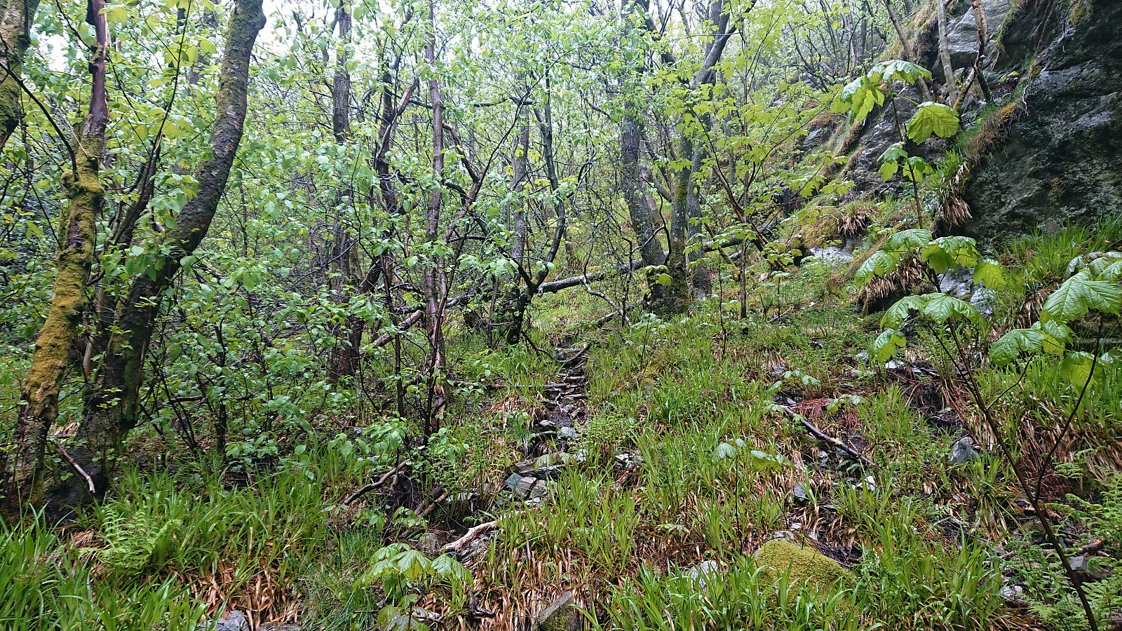
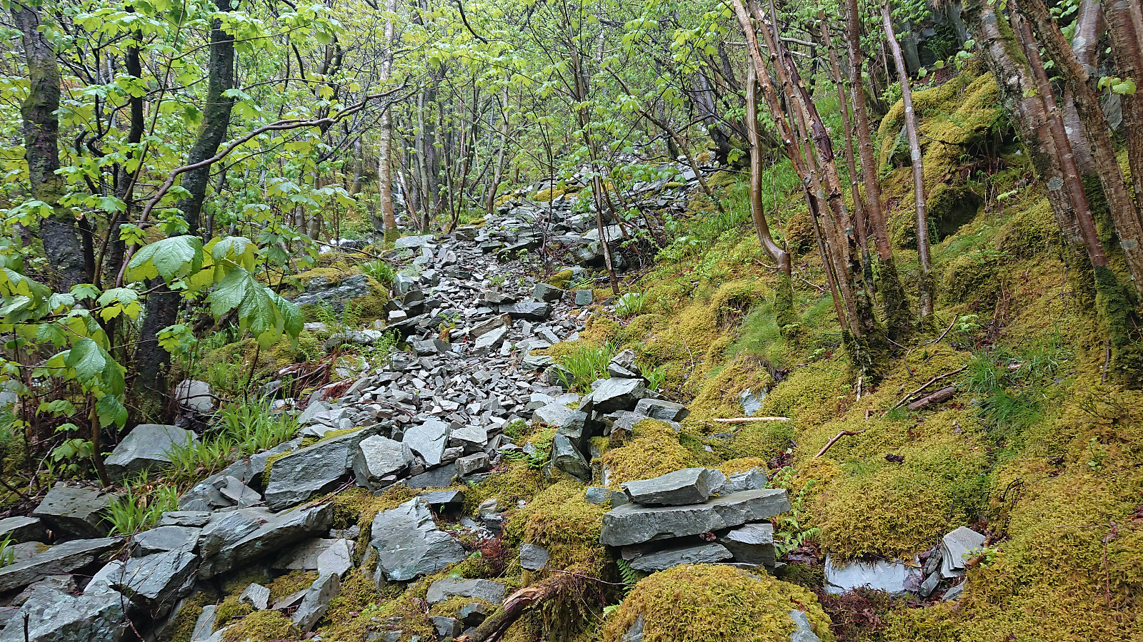
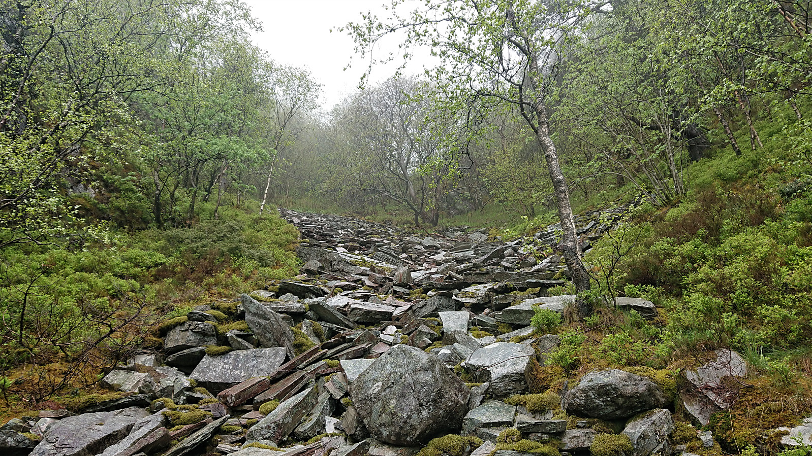
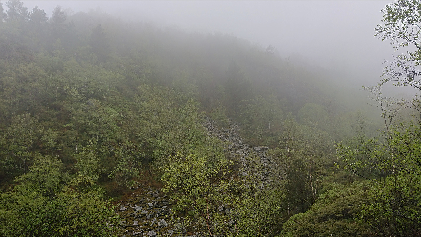
Soon the trail however pretty much disappeared and I was left finding my own way up the steep ascent, with only some deer tracks for guidance. More scrambling than hiking, and with lots of loose small to medium size rocks. There was no real problem making progress though, as long as one was careful.
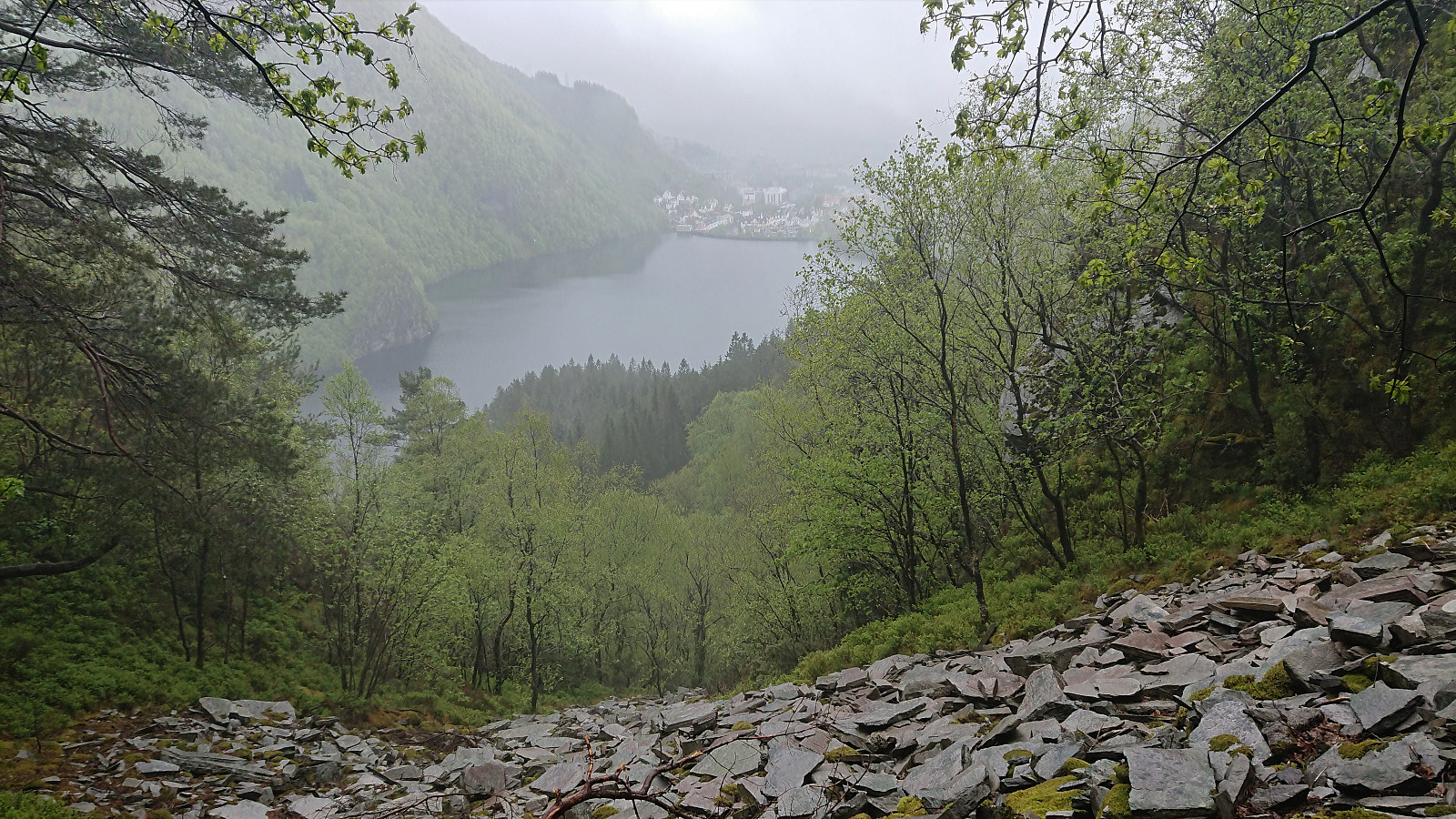
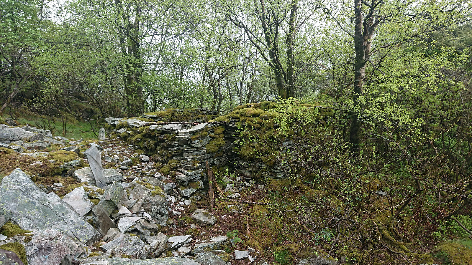
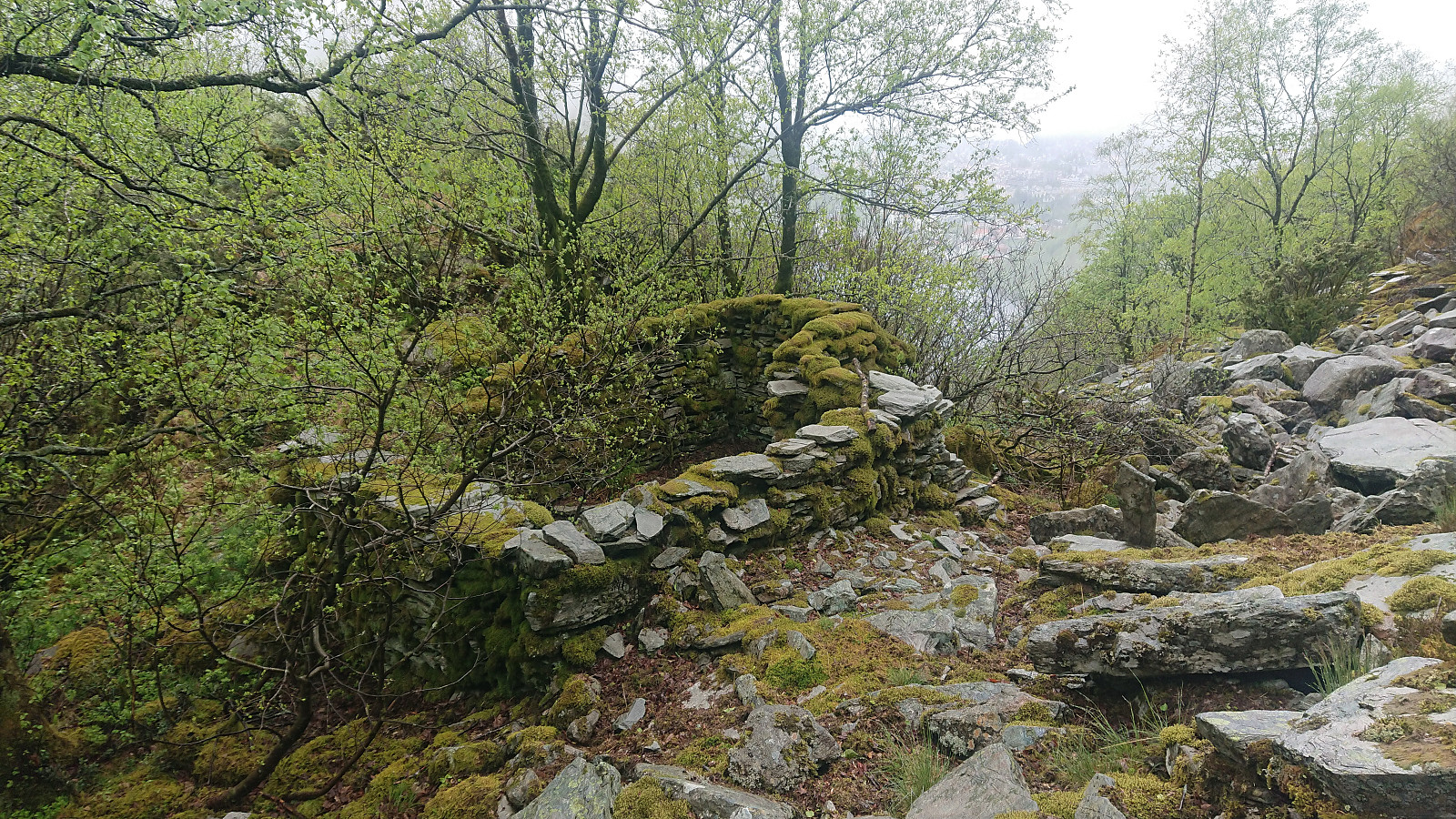
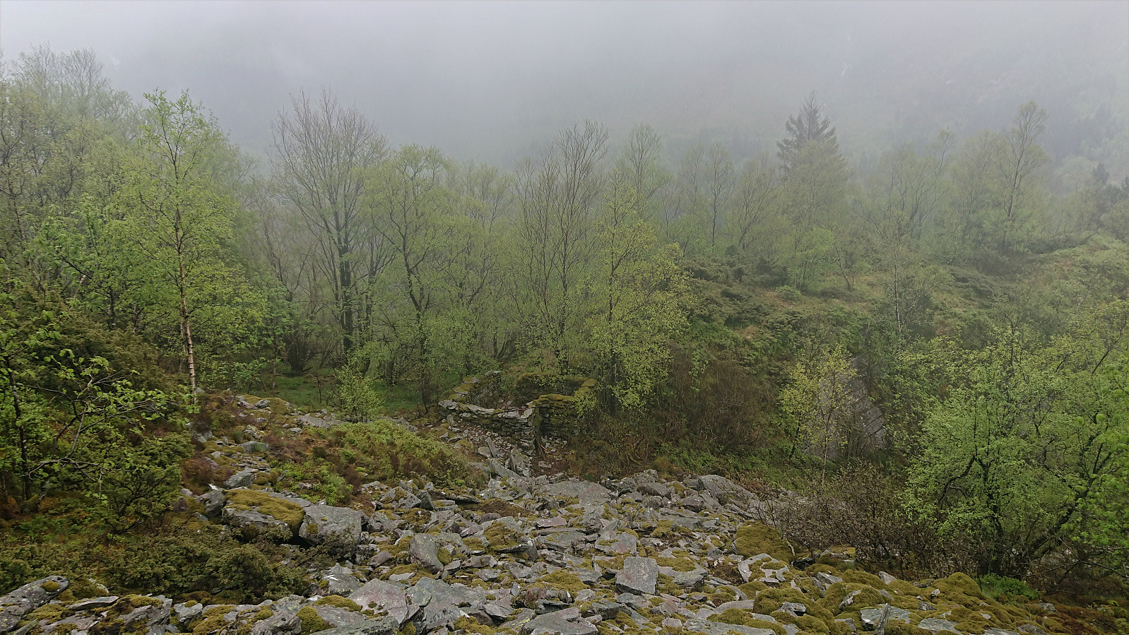
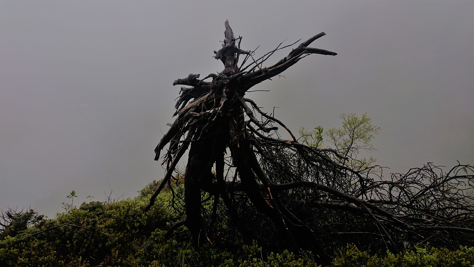
There was a lot more left of the cabin than expected, especially given that in BF II it is written that it is uncertain whether the cabin was ever completed. On the other hand, the views did not live up to what I had hoped for, but that was mainly due to the dense fog. But even if the views are probably very nice on better days, I still cannot imagine thinking that this was a good place to build a cabin. Besides the easy access to building materials I guess.
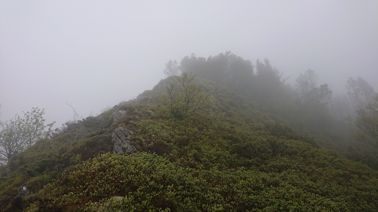
From the ruin, I continued north/northwest, partly following various deer tracks. The first 100 meters or so were quite steep, but did not present any real difficulties. After that the terrain leveled off and the only remaining challenge was getting through all of the many trees partially blocking the way.
In the end, I reached the old trail south of Blåmansveien, which I then followed to the current Blåmansveien. The hike was then concluded by walking down to Ludebryggen for the bus back home.
In summary, an interesting hike that will not be everyone's cup of tea. The views are probably quite good though, if doing the hike in better weather. Note that if following in my footsteps, it is highly recommended to also go in the same direction, given that descending the steep slope will be significantly more challenging.
| Start date | 24.05.2020 16:02 (UTC+01:00 DST) |
| End date | 24.05.2020 18:19 (UTC+01:00 DST) |
| Total Time | 2h 17min |
| Moving Time | 1h 56min |
| Stopped Time | 0h 21min |
| Overall Average | 3.2km/h |
| Moving Average | 3.8km/h |
| Distance | 7.3km |
| Vertical meters | 493m |


User comments
Hulen
Written by Syvfjell 04.11.2023 20:23"Hulen" er vel sprengstoffsbunkeren noen meter over veien, som du ikke gikk inn i, Harald.
Er ikke mange som kjenner til Kviturhytten, men det finnes folk som tar denne turen opp til Midtfjellet oft. Har selv gått opp der flere ganger, og det er spor etter bruk. For en del år siden var stien merket med gule stoff hengende fra treene, og jeg har satt en Geochache i hytten i 2016.
https://www.geocaching.com/geocache/GC6EJFX_kviturhytten?guid=6d548e61-2713-440f-8527-952fdc71c9ba
De trærne du tok bilder av er svarte pga. brann tidlig i 2000-årene. Det er forresten på høyresiden av uren flere steder mellom veien og hytten små vardelignende strukturer som jeg antar var støtter til taubane.
Gratulerer!
Written by knutsverre 25.05.2020 00:14Nok en imponerende oppdagelse som det står respekt av! Og så flotte og velbevart ruiner! Denne må vi besøke en dag i tørt vær!
Re: Gratulerer!
Written by hbar 25.05.2020 00:31Takk! Jeg traff ikke helt på været nei. Men det skapte jo på den annen side sin helt egen atmosfære. :)
Sv: Re: Gratulerer!
Written by Kjell51 25.05.2020 01:38Må gratulere dere begge 2 for en imponerende hytteruinjakt på byfjellene.
For en stund siden vurderte jeg å gå opp der, studerte terrenget oppover fra veien. Ble tilsnakket av en eldre mann som lurte på om jeg hadde tenkt å gå opp der. Han fortalte at det gikk en svak sti et lite stykke oppover til en hule som nå er gjenmurt, videre oppover ville han ikke anbefale. Han var oppvokst ved demningen og kjente terrenget godt. Så du huleinngangen Harald?
Re: Sv: Re: Gratulerer!
Written by hbar 25.05.2020 02:03Ja, tror det. Gikk i alle fall forbi en metaldør på høyre side like etter at jeg forlot grusveien. Men studerte ikke denne nærmere da jeg hadde mer enn nok med å finne ut av hvordan jeg skulle komme meg videre oppover.
Terrenget opp til Kviturhytten (og videre opp til Blåmansveien) er nok ikke for alle nei. Ganske så bratt og store deler er mest en steinrøys. Men ingen luftige eller utsatte partier dersom man følger den ruten jeg tok.