
Ski Touring to Mount Kyrkjetaket [i.e. "The Church Roof"] (18.05.2020)


Geschrieben von Solan (Atle Solholm)

| Startpunkt | Hellerøra Parking Lot (200m) |
|---|---|
| Endpunkt | Hellerøra Parking Lot (200m) |
| Tourcharakter | Randonnée/Telemark |
| Tourlänge | 4h 43min |
| Entfernung | 13,6km |
| Höhenmeter | 1.335m |
| GPS |
|
| Besteigungen | Kyrkjetaket (1.439m) | 18.05.2020 |
|---|---|---|
| Steinberget (981m) | 18.05.2020 | |
| Vestre Steinberget (766m) | 18.05.2020 | |
| Besuche anderer PBE | Hellerøra parkeringsplass (180m) | 18.05.2020 |
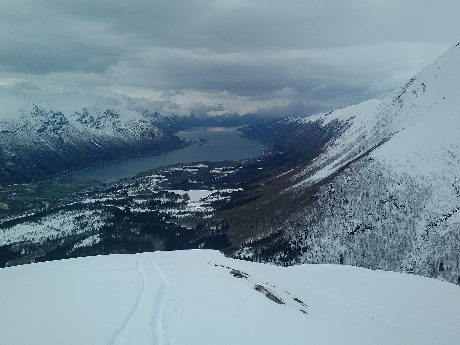
![#1: Image captured while upon the mountain ridge called Steinberget. The mountain to the left is Mount Klauva (1512 m.a.m.s.l.), and the one to the right is Kyrkjetaket (1439 m.a.m.s.l.) [i.e. "The Church Roof]. The two mountains are part of a horse-shoe shaped mountain ridge called "The Horse Shoe Traverse". There are people that have gone the entire Horse Shoe Traverse on ski, but I wouldn't even think of an attempt in this weather.](https://images1.peakbook.org/images/14939/Solan_20200705_5f01bc6e00ae2.jpg?p=xtralarge)
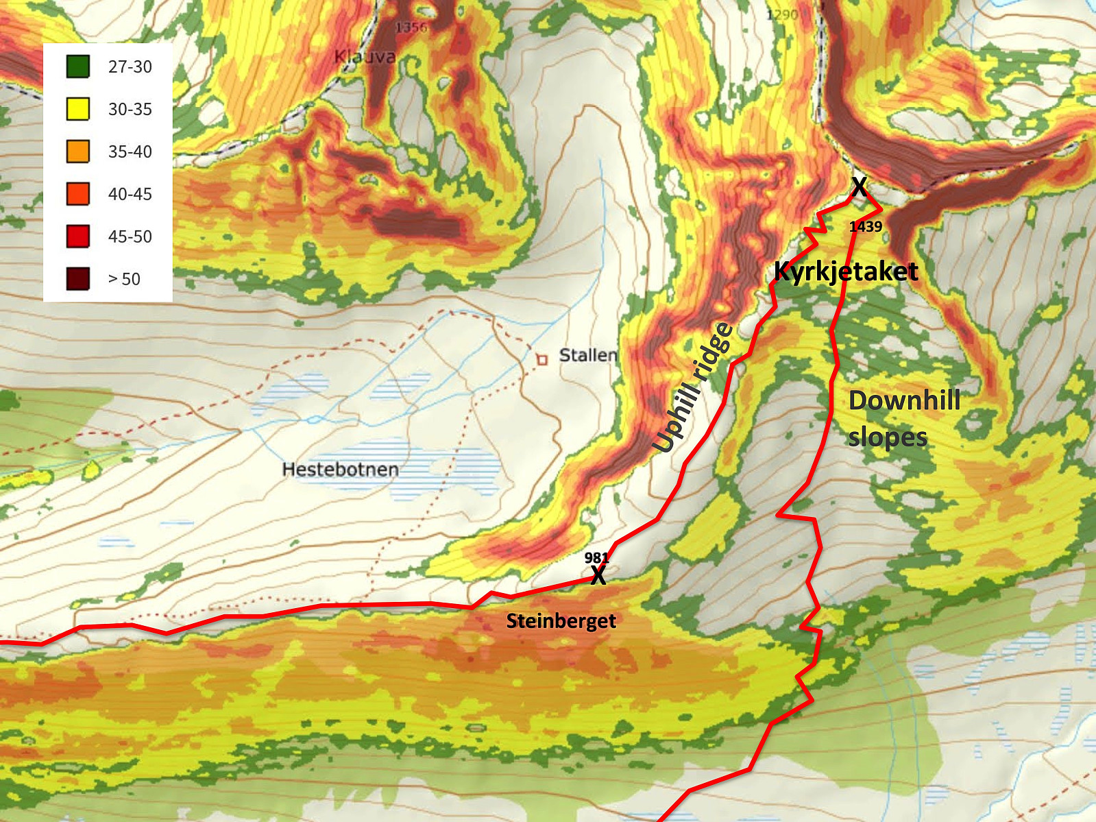
This was my second attempt at ascending Mount Kyrkjetaket [i.e. The Church Roof] in Rauma Municipality in the County of Møre & Romsdal. My first attempt was about two weeks earlier, but then I climbed only up to Mount Steinberget (981 m.a.m.s.l.); where I turned around and went back down due to bad weather conditions and low visibility. It's a common saying in Norway, that There's no shame in turning around, meaning that if the weather's not on your side, it's better to abandon the goal for your ski tour and survive, than to push on, and then die in the attempt to reach the goal. Right now I was having one week off work, and I had been planning to make a new attempt on Mount Kyrkjetaket this week. I had actually been thinking of visiting the mountain on the wednesday or so, but according to the weather forecast it was going to be warmer by then, and there was going to be a heavy snowfall; hence I figured out the risk of avalanches was going to be much less on monday than on wednesday, and so I decided to expedite my ascent on Kyrkjetaket by two days. When climbing Kyrkjetaket, you usually follow a mountain ridge that has an inclination of less than 30°, but when you go downhill skiing on the nice slopes of the broad south side of the mountain, parts of the slopes are >35°, and so it's important to select a day without any high risk of avalanches.
As on my previous attempt, I drove to the parking lot called Hellerøra Parkering, and started skiing from there. On my previous attempt, snow was very scarce in this area, but a lot of snow had been coming since then, hence today snow was abundant, though a little bit wet at the lower altitudes. I started out from the parking lot, and followed the trail up towards the west part of the mountain ridge called Steinberget, just as on my previous attempt at climbing Mount Kyrkjetaket; and as I got higher up the snow became dryer, and better to go skiing upon. I next followed the ridge of Steinberget from west to east. Clouds were coming and going even today, but all in all the weather was much better than it was last time I tried to climb this mountain. On my previous attempt on Kyrkjetaket I turned around at the eastern knoll of Mount Steinberget, but today I could even spot the summit of Kyrkjetaket while I was still on Steinberget; and I could even see three other skiers ahead of me up there, so I decided to continue.
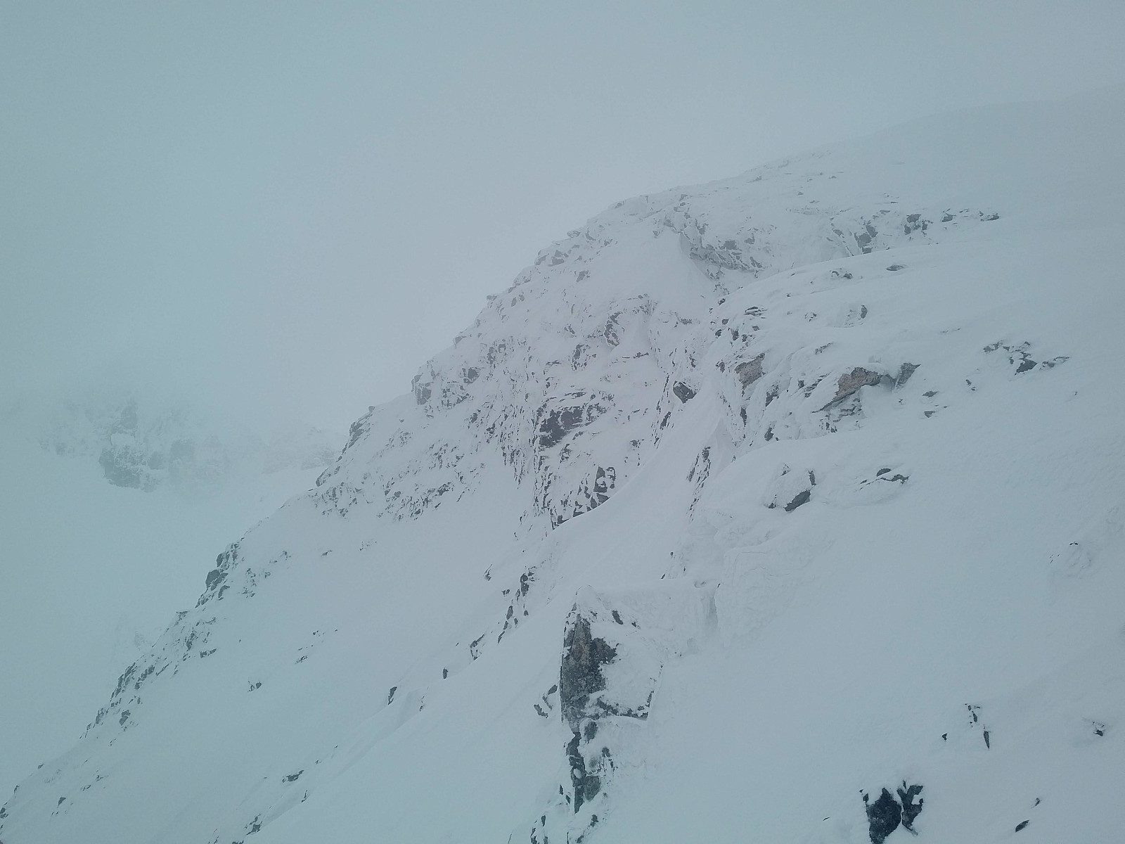
![#4: After you've passed Mount Steinberget, there's a pretty steep climb up to the summit of Kyrkjetaket [i.e. The Church Roof].](https://images1.peakbook.org/images/14939/Solan_20200705_5f01c03fe2365.jpg?p=xtralarge)
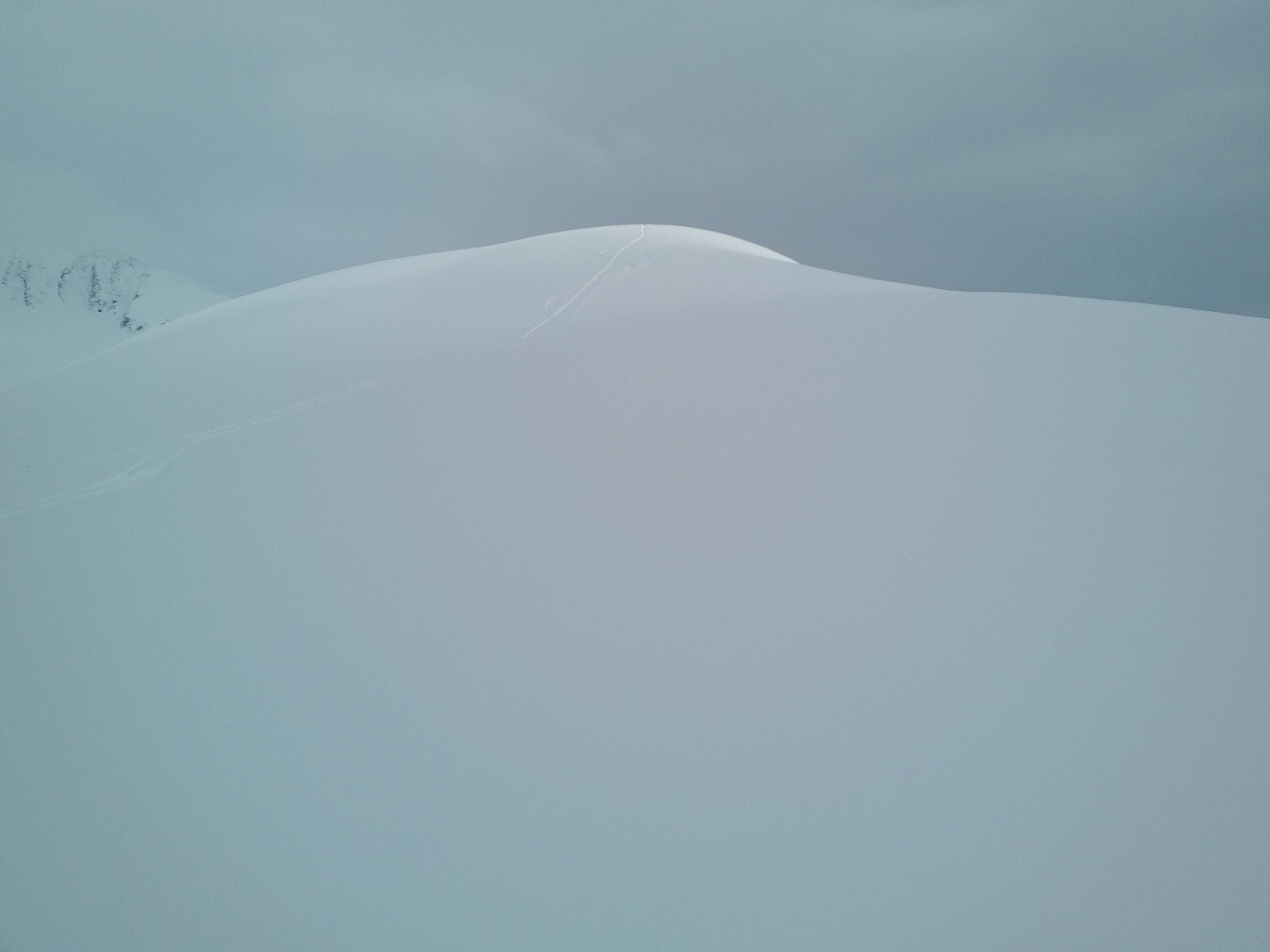
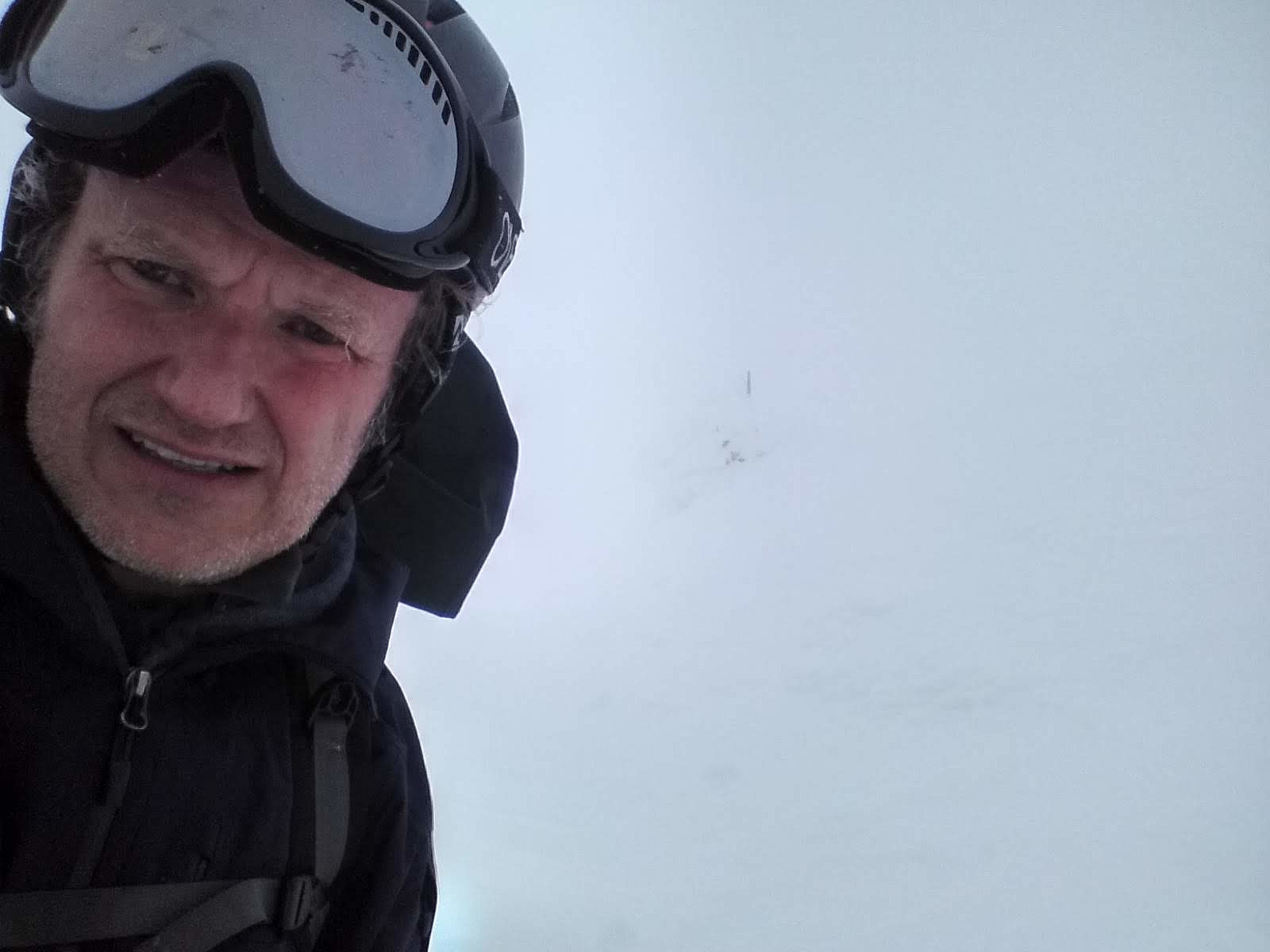
Once you've passed the eastern knoll of Steinberget, it's common to follow a rather steep ridge in a northeast direction up to the summit of Kyrkjetaket (see my GPS tracking). The ridge, or edge itself has an inclination of slightly less than 30° (Image #10), but on the left side of the ridge there's a very steep cliff; and on the right side is the broad south side of the mountain, which is suitable for downhill skiing, and where the slopes are mostly about 30° but in some places somewhere between 35° and 40°. As I continued upwards all three skiers that I had seen ahead of me reached the summit, and then came skiing one by one down the south side of the mountain. I was happy to see that none of them were able to trigger an avalanche, reassuring me it was safe even for me to continue. As I approached the summit, weather worsened, though it was still better, and with better visibility than what I had had when I attempted to climb the mountain two weeks ago. I reached the summit, though, but it was cloudy and windy, and I couldn't see much; hence I only took time to remove the skins from under my skis, and then put on my helmet, before I embarked upon skiing down again (Image #7).

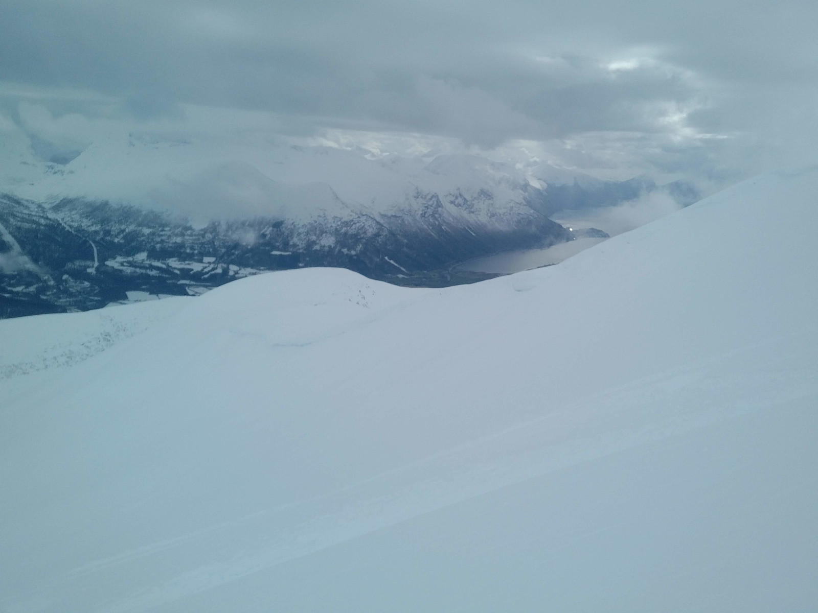
The downhill slopes of the south side of the mountain were a little bit steeper than I was comfortable with. Well, they weren't actually that steep, it's just that I've been Telemark-skiing for many years now, an so I was no longer that acquainted with ordinary downhill skiing. The snow was fabulous however, and the slopes are steepest highest up, hence from about halfway down I was fine. The slopes end in a valley by some cabins at Kavlisetra. From there there's a mountain road down to the parking lot, but they don't plow the road during winter, so you can go skiing on it. The inclination of the road isn't great, however, and by now I was already back down where the snow was quite wet, so my skis weren't sliding any good; hence I had to use my ski poles and a lot of handpower to keep on moving, but I eventually made it back to my car, and drove home, having enjoyed the skiing of the day.


Benutzerkommentare