
There's no Shame in Turning Around (02.05.2020)

Written by Solan (Atle Solholm)

| Start point | Hellerøra Parking Lot (199m) |
|---|---|
| Endpoint | Hellerøra Parking Lot (183m) |
| Characteristic | Randonnée/Telemark |
| Duration | 3h 47min |
| Distance | 9.5km |
| Vertical meters | 805m |
| GPS |
|
| Ascents | Steinberget (981m) | 02.05.2020 |
|---|---|---|
| Vestre Steinberget (766m) | 02.05.2020 | |
| Visits of other PBEs | Hellerøra parkeringsplass (180m) | 02.05.2020 |
The Norwegian Mountain Code [Norw. Fjellvettreglene] is a set of rules made to ensure safe trekking and skiing in the mountains. Rule number 8 in this set of guidelines, reads Don't be ashamed to turn around. The point with this guideline, is that there are times when your survival in the mountains may depend upon your ability to change your plan. Anyone familiar with the changing weather conditions in the mountains, will know this. There are times when pressing on to reach a goal in spite of treacherous weather, and maybe in spite of bad planning, will mean inevitable death, or at least a high risk of death. On this day the weather forecast said weather was going to be cloudy, but otherwise pretty fair.
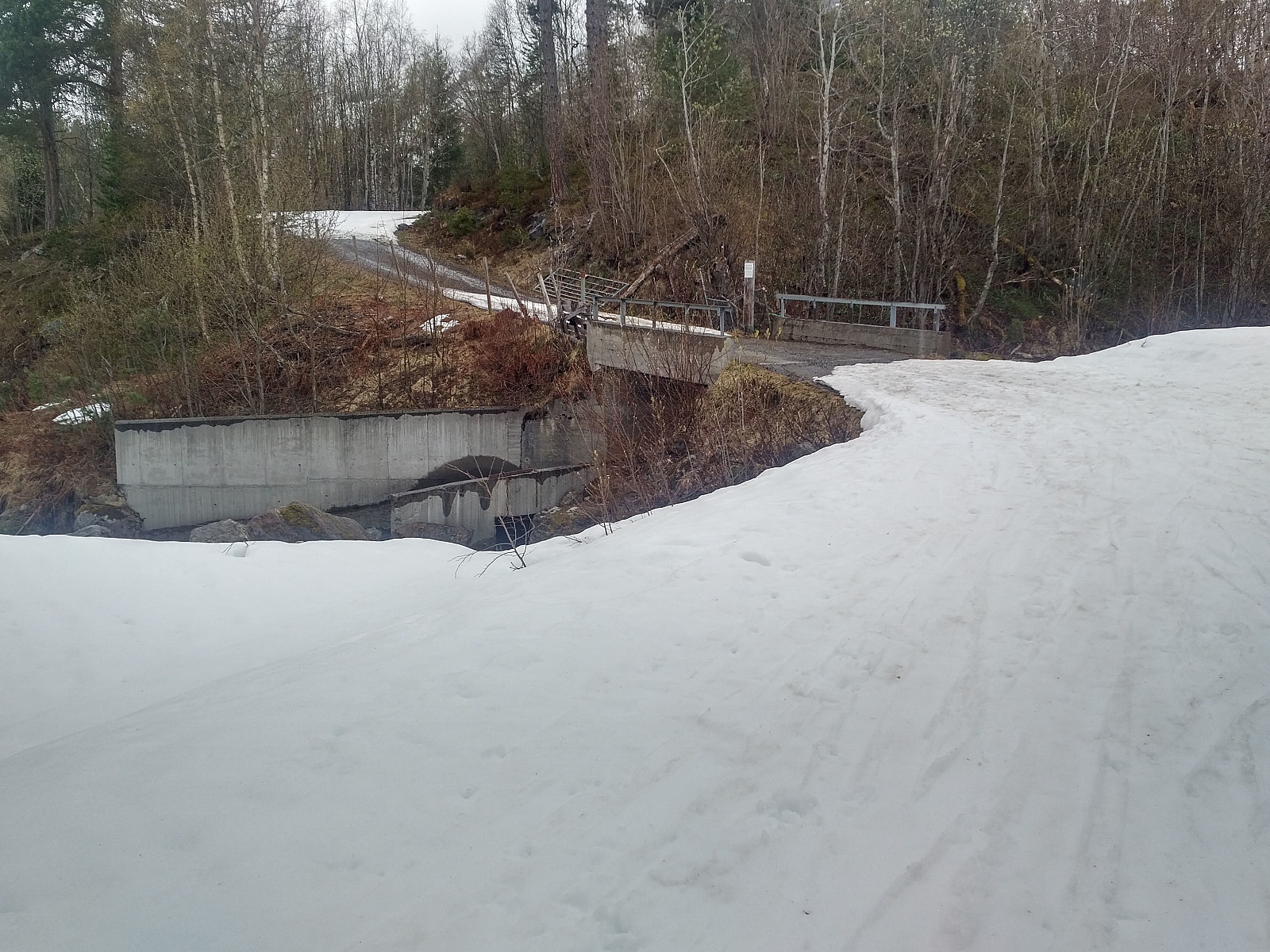
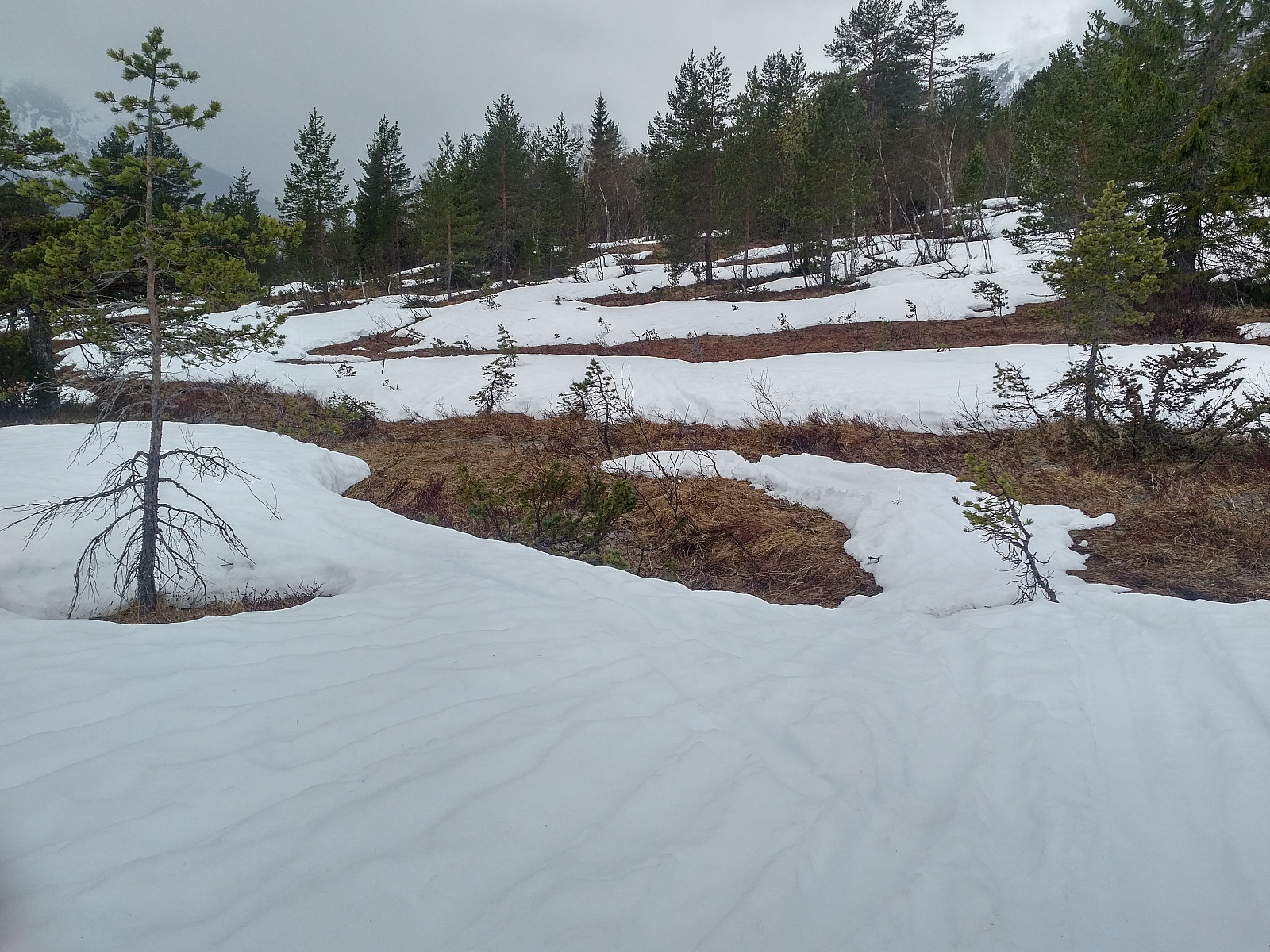
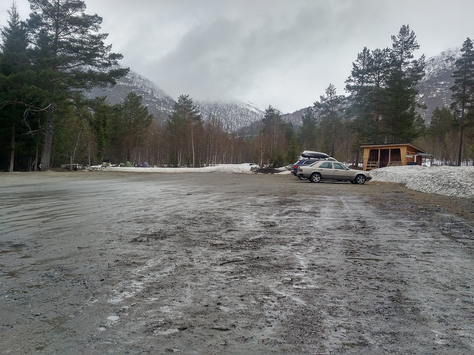
I had desired for a while to ascend Mount Kyrkjetaket [i.e. "The Church Roof"] (1439 m.a.m.s.l.) in Rauma Municipality, and so on this day I set out to do that. I drove to the village of Isfjorden in the end of the fjord carrying the same name, and found the mountain road leading up to the parking lot called Hellerøra Parkeringsplass; and from there I set out skiing. It had been thawing and raining the last week, hence I was a bit excited as to how snow conditions were going to be in the lower part of the planned ascent, but snow was looking great as I left the parking lot. That didn't last very long, however; after about half a kilometer I came to a concrete bridge (image #2) where snow was all gone. I took my skies off, crossed the bridge on foot, and then put the skis back on. After the next turn on the trail, I met to guys that were just coming down from a nearby mountain called Skarven, and asked them about the amount of snow further up the trail. "Well, there's some difficulty in crossing the mire up here," they said, "but thereafter conditions are fine." Conditions proved to be pretty much as they said, and I had to take my skis off once more while crossing the mire (Image #3). I next reached the forest in the hillside. Even here the amount of snow was a bit scarce, but still enough that I could continue without removing my skis again. As soon as I came out of the forest, at about 500 m.a.m.s.l., snow was more plentiful, but then the weather became lousier.
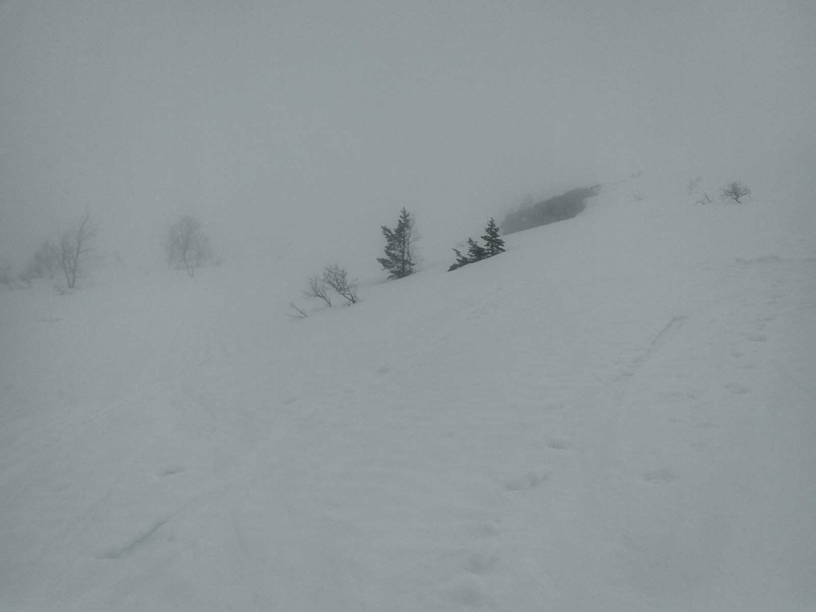
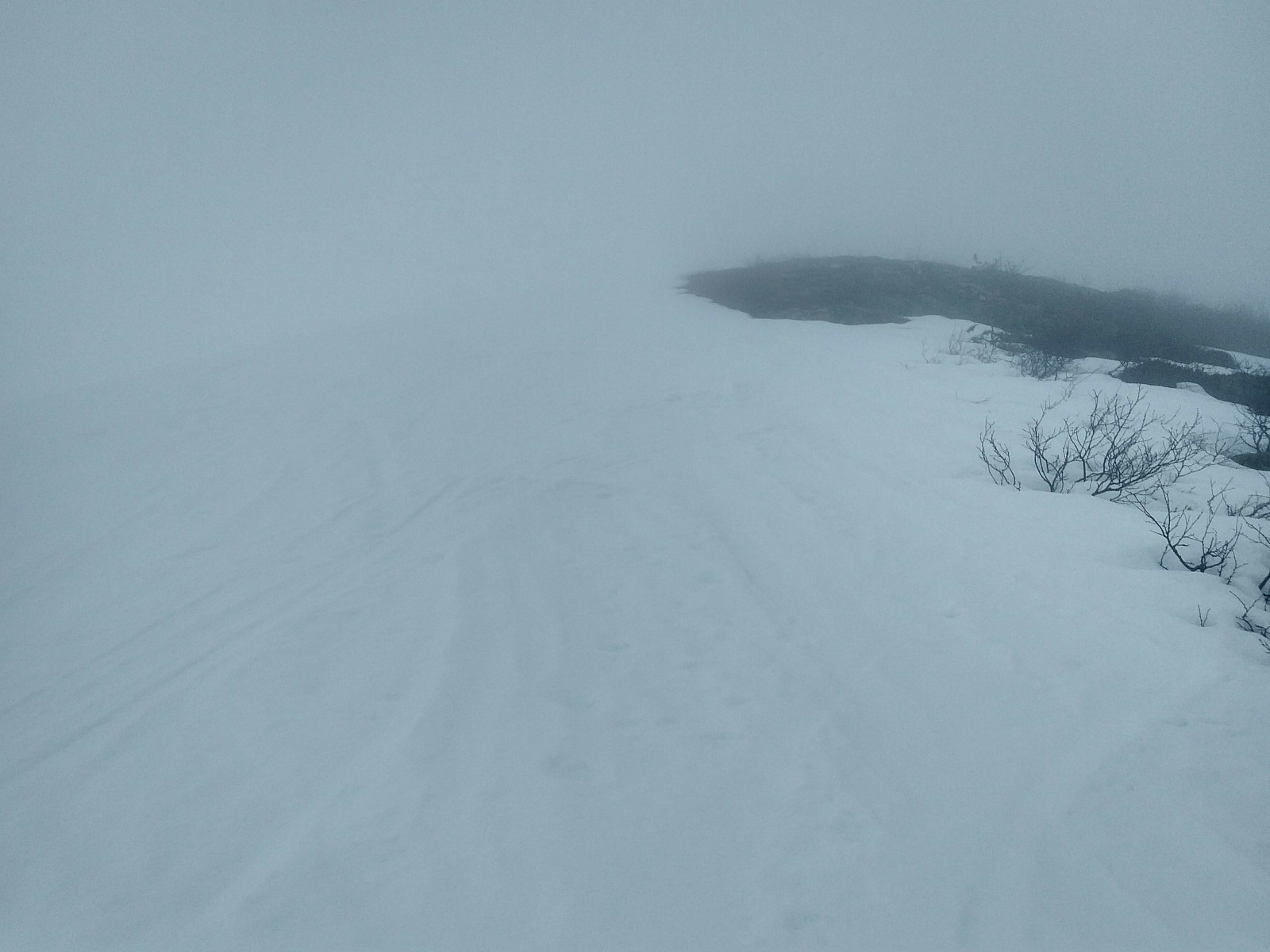
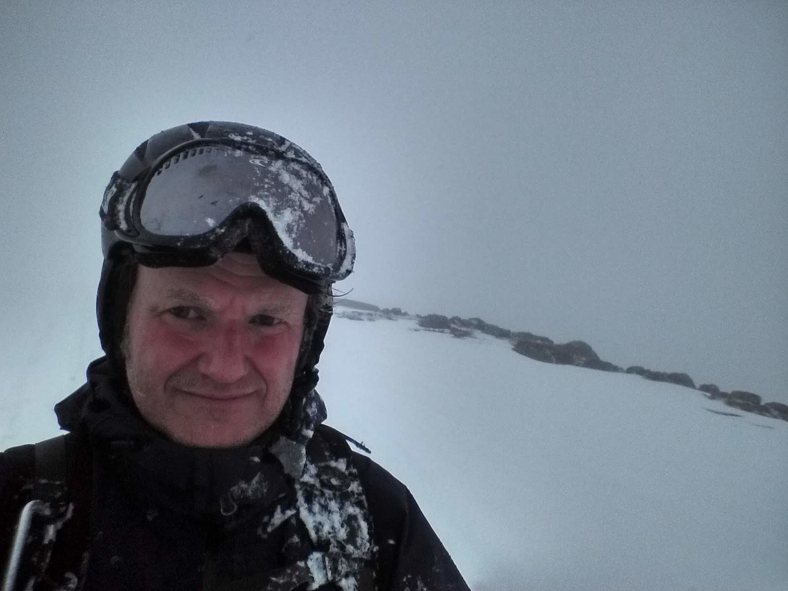
The clouds were hanging roughly down to this altitude. I continued climbing upwards, as I've experienced time and again that you might eventually come above the clouds, and then have nice weather for the rest op your trip. The most commonly used trail up to the summit of Kyrkjetaket goes via a mountain ridge called Steinberget (see map and GPS tracking). I relatively soon reached the west knoll of this ridge. I couldn't see much, apart from some huge stones here and there, that weren't covered by snow; but it seemed pretty easy to continue along the mountain ridge, and I had my GPS with a map that I could check every now and then (Image #7). After a while I reached the cairn that marks the eastern knoll of the mountain ridge (Image #9). From there I knew the ascent was going to be steeper, and with a very steep cliff on the left side; and as I still had almost no visibility whatsoever, I regarded it unsafe to continue, and I therefore decided to turn around and go back to my car.
![#6: As I continued along the ridge called Steinberget, there was not much to see, and I knew there was a steep cliff, especially on the left side of the ridge. #7: Without any visibility, my inReach GPS device from Garmin was the only thing telling me where I actually was. #8: "Selfie" on top of the ridge called Steinberget [i.e. "The Stony Mountain]. #9: A cairn marking the top om Mount Steinberget, though it is actually placed a little bit west of the actual highest point of this mountain ridge.](https://images1.peakbook.org/images/14939/Solan_20200701_5efd0292036bb.jpg?p=xtralarge)
Skiing back down was uneventful. Visibility came back at about 500 m.a.m.s.l., as I came beneath the clouds (Image #11); and made everything a bit easier. I had to take my skis off again at the mire and at the bridge, but soon I was back down at the car. As a workout, the trip had been quite good, but I hadn't reached my goal this day, and so I was quite eager to come back at a later date for a new attempt at ascending Mount Kyrkjetaket on ski.
![#11: As I descended below the clouds, visibility improved, and I could even see the fjord called Isfjorden [i.e. "The Ice Fjord"].](https://images1.peakbook.org/images/14939/Solan_20200701_5efd05473d1fb.jpg?p=xtralarge)


User comments