
Telemark Skiing to Mount Breivikheia in Rauma Municipality (18.04.2020)

Written by Solan (Atle Solholm)

| Start point | Skorgedalen (315m) |
|---|---|
| Endpoint | Skorgedalen (315m) |
| Characteristic | Randonnée/Telemark |
| Duration | 3h 42min |
| Distance | 13.7km |
| Vertical meters | 1,361m |
| GPS |
|
| Ascents | Breivikheia (900m) | 18.04.2020 15:49 |
|---|---|---|
| Øst for Hamreskaret (717m) | 18.04.2020 15:49 | |
| Nyseterskarven (790m) | 18.04.2020 15:49 | |
| Visits of other PBEs | Parkering Skorgedalen (305m) | 18.04.2020 15:49 |
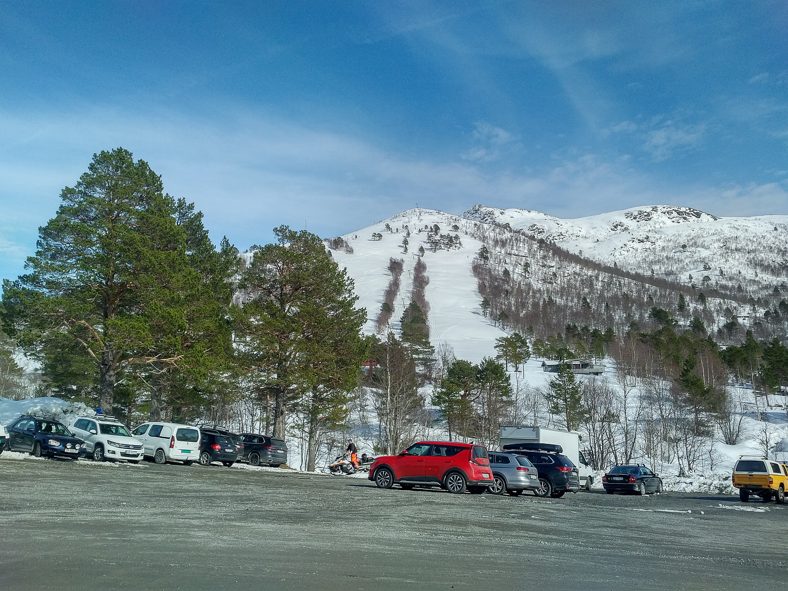
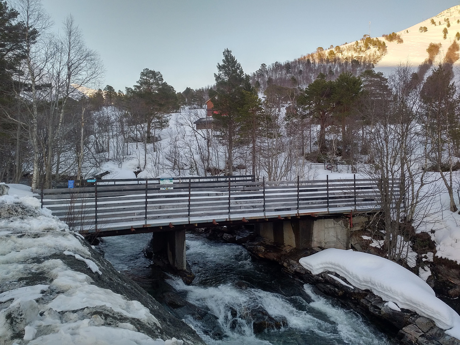
I have lately been skiing a number of the mountains between the two fjords Langfjorden and Romsdalsfjorden [i.e. The Long Fjord and The Rauma Valley Fjord, respektively]. Many of the mountains on the peninsula between these two fjords are readily accessible from the parking lot at the Rauma Ski Center in Skorgedalen Valley, where space for parking is also plentiful. You do have to pay a fee in order to drive up to the parking lot, though. The ski resort was closed at the moment due to the Covid-19 pandemia closedown, but in Norway we were still allowed to use parking lots like this one, and we were still allowed to go hiking and skiing in the mountains, as long as no more than five persons were out there together. I crossed the river Skorgeelva by use of a nice bridge that have been built there (Image #2), and then put on my skis. Under normal circumstances, I would've had to take care not to be in way of any downhill skiers coming down the ski resort slopes at great speed, but due to the current Covid situation there were only a few cross country skiers, and a few alpine tour skiers out there; hence there was plenty of space for us all, so I just went more or less straight up the middle downhill slope.
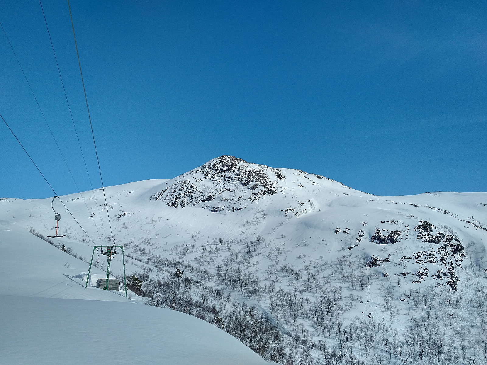
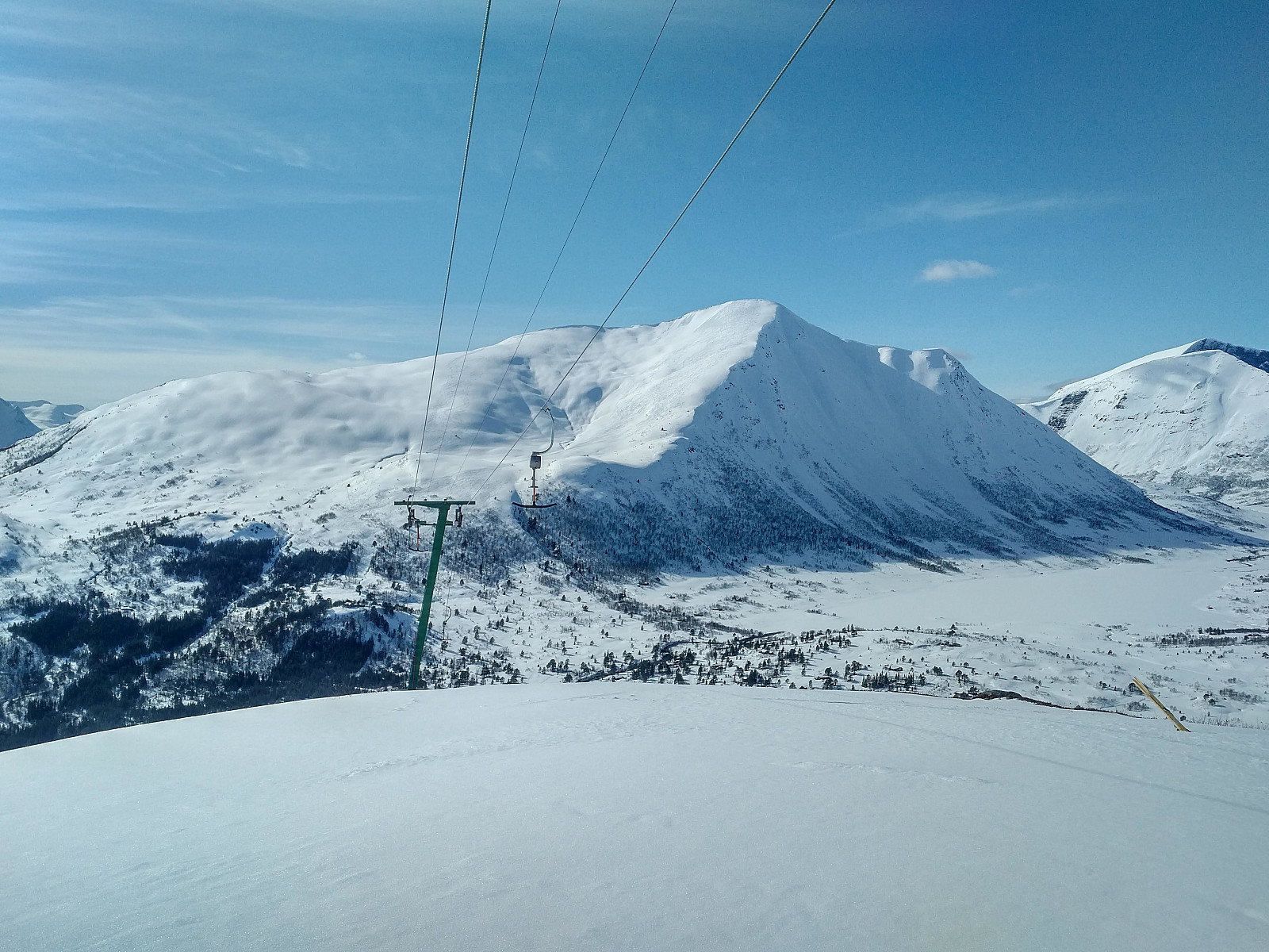
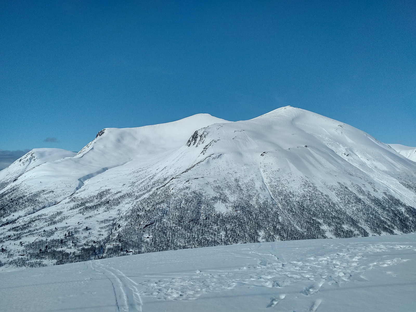
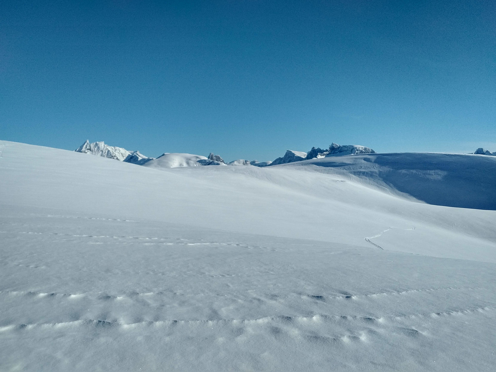
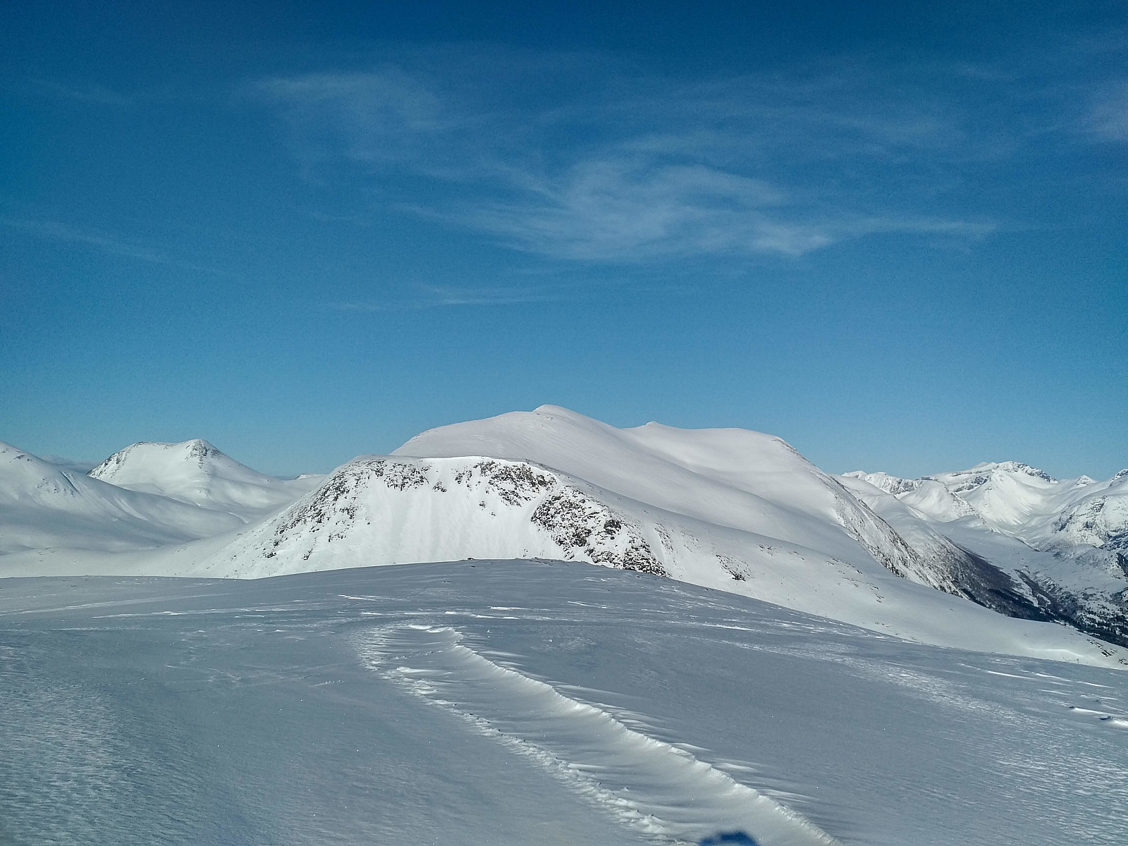
From the parking lot, a prominent mountain knoll called Nyseterskarven is visible. The slopes of the ski resort doesn't lead up to this knoll, however, as the ridge of the ski slopes are separated from the knoll by a little valley called Storstølgrova. The mountain ridge of the ski slopes is continuos with a narrower ridge called Ljøsådalsrøra (after the river Ljøsåa which runs in a valley parallel to the ridge; see the map with my GPS tracking). As I continued up this ridge, I got a very nice view of Mount Smørbottind (1185 m.a.m.s.l.) and Mount Kvasstind (1180 m.a.m.s.l.) on the left hand side (Image #5); and due to the nice weather, I also got a spectacular view of Store Trolltind [i.e. Greater Troll Peak] (1788 m.a.m.s.l.) among a number of other peaks, on the right hand side (Image #6). Store Trolltind is among the peaks that flank Trollveggen [i.e. The Troll Wall], the famous 1000 meter vertical cliff that have drawn a lot of paragliders to the location, and, unfortunately, sealed the fate of many of them.
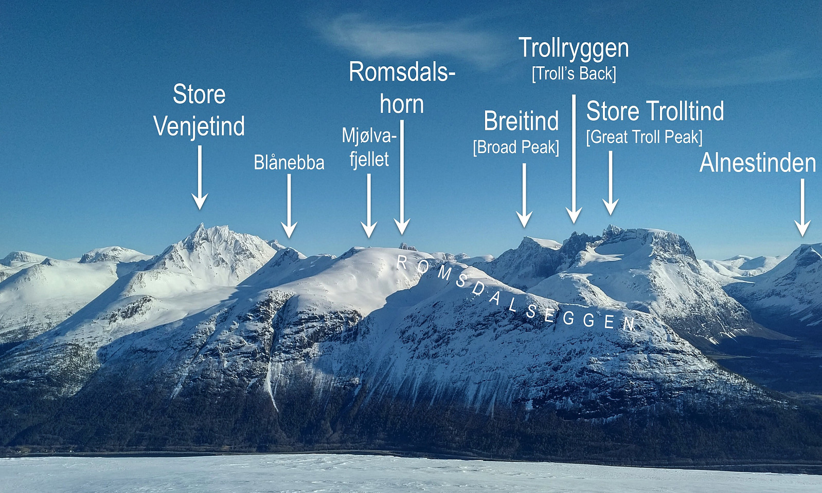
![#6: View towards Store Trolltind ["Greater Troll Peak"] (1788 m.a.m.s.l). To the left of it is seen Mount Trollryggen (1725 m.a.m.s.l.) and Mount Breitind (1797 m.a.m.s.l.).](https://images1.peakbook.org/images/14939/Solan_20200629_5efa586c73763.jpg?p=xtralarge)
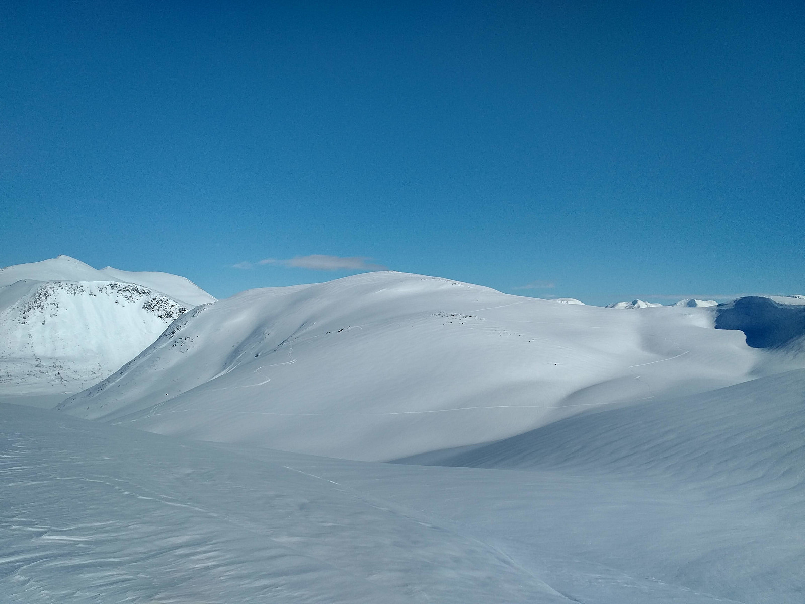
I continued along the mentioned mountain ridge for most of its extent. I could have crossed over to the main mountain, where both Nyseterskarven and the summit of Breivikheia (900 m.a.m.s.l.) are located, at about the highest point of the ridge, but I decided to pick up even a green PBE (Peakbook element) of 717 m.a.m.s.l. before climbing up to Breivikheia, hence I continued down to that spot. The descent down there was only about 90 elevation meters, so I didn't bother to remove the skins from my skis. I thereafter descended even a little bit more, into a valley called Fiskebotnen, and from there I climbed up to the summit of Breivikheia (900 m.a.m.s.l.).
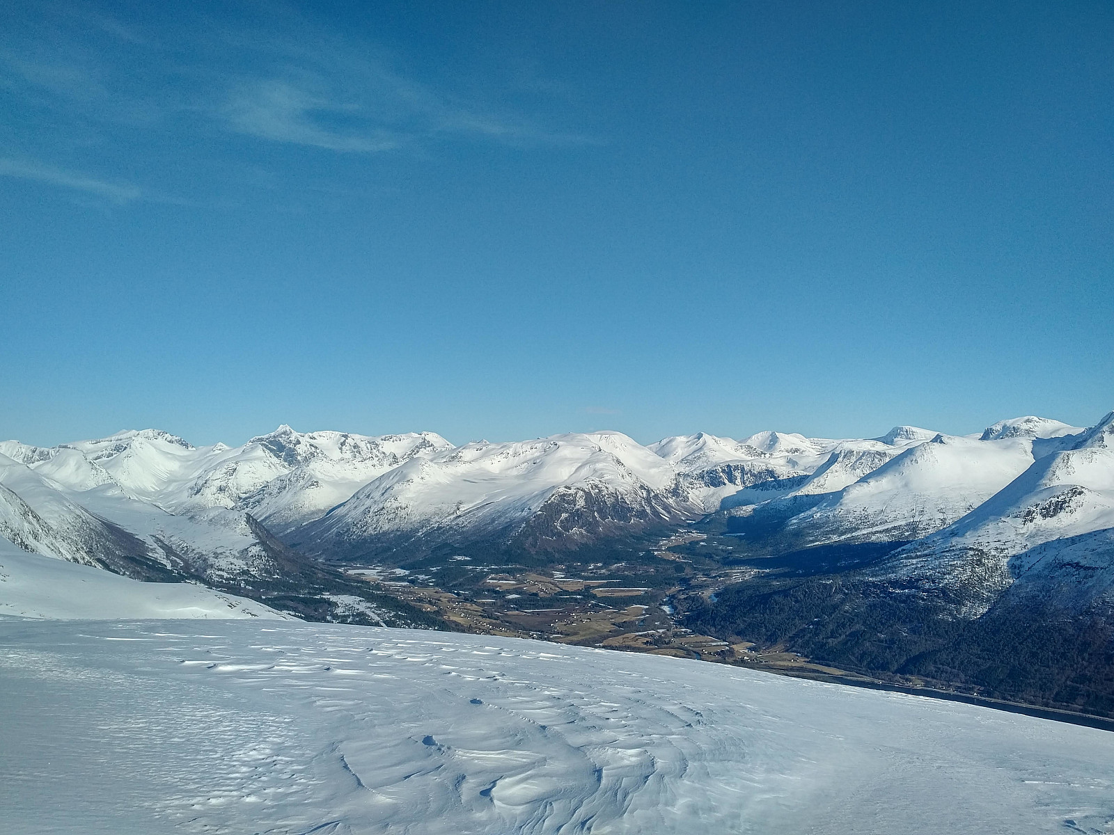
On top of Mount Breivikheia I had some food, and removed the skins from underneath my skis. The summit actually had a very nice view in all directions on a day like this, so I even captured a number of pictures, before I embarked upon my return to the parking lot in Skorgedalen. I descended in a south western direction, and then I had to climb up about 5 elevation meters or so, unto a ridge of the mountain that goes westwards (the ridge seen in the right part of image #8). Ascending 5 meters is a bit tricky when you've removed the skins from your skies, but with extensive use of my arms and my ski poles, I somehow managed. Along the ridge, next, I had to take care not to go too close to the edge on the north side, as I had previously seen that there were huge snow shelves that may break off while you're skiing upon them. I continued down to a little pond about halfway between the peaks of Breivikheia and Nyseterskarven (the pond was covered by ice and snow, so I didn't actually see it, I've only noticed it on the map afterwards). Till this spot, the trail had been going slightly downwards (except for the mentioned 5 elevation meters), though not very steeply; but from now on it was all upwards to get over to the summit of Nyseterskarven; hence I had a short break right there, just in order to take off my skis, put on the skins, and then put the skis back on before I continued to Nyseterskarven.
The climb onto Nyseterskarven wasn't very steep either. All in all, I think a pair of ordinary mountain skis [i.e. broad cross country skis with steel edges] might have been more convenient for the particular trip that I made this day; especially since I then wouldn't have had to take the skins on and off, and also because the slopes that I descended wasn't so steep that you couldn't go there with that kind of skis. Nevertheless, putting the skins back on doesn't actually take that much time, and in the nice and no-windy weather that we had on this day, there wasn't the risk of freezing your fingers while doing that job, either. After admiring the nice view from Nyseterskarven, I crossed over the upper part of Storstølgrova valley (where the valley isn't that deep), back unto the ridge of Ljøsådalsrøra, from where I just followed my own ski trails back down to Skorgedalen valley. If I do ascend Nyseterskarven on skis once again, I will definitely choose a more direct root from this peak down to Skorgedalen valley, as the descent will then be much steeper and more fun. This was my first trip up there, however, and I was a bit afraid that the ski tracks that I saw would lead me to far down in the valley, so that I would have to go on foot, carrying my skis, back up to the parking lot. Nevertheless, as I went down the downhill slopes of the alpine ski resort (Rauma Ski Center), I noticed that all (or at least most) of the tracks coming down from Nyseterskarven eventually joined the slopes of the ski resort further down.


User comments