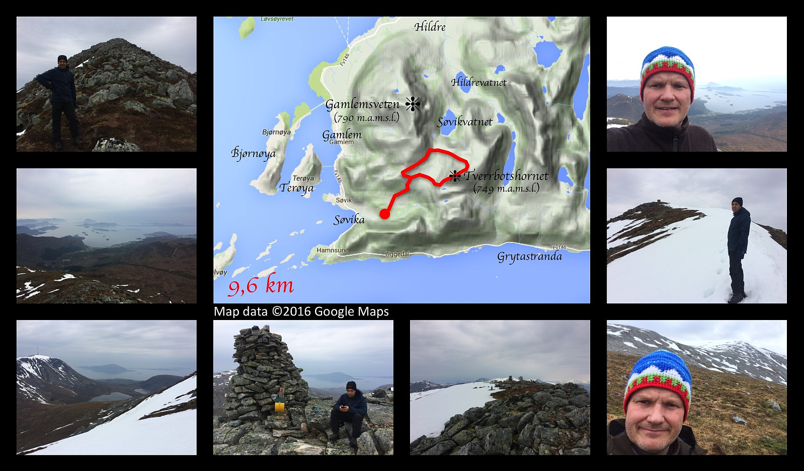
Upper left image: On the mountain edge leading up to the summit of the mountain. Middle image: Our gps-tracking. Upper right and middle left images: View towards the Søvika bay and the ocean. Middle right image: Some snow on the top of the mountain. Lower left image: View to the north. 2nd image lower row: A short brake by the cairn on the summit of the mountain. 3rd image lower row: View towards Mount Hildrehesten. The red spot on one of the stones is a marking of the trail. Lower right image: On our way back down from the mountain.
Hiking to the top of the mount Tverrbotshornet along with my son Dag. We drove to Søvika in Haram municipality, and parked at a parking lot in the valley called Søvikdalen. It's the same parking lot we've been using when visiting Mount Gamlemsveten. The first 1.5 km is the same as when you ascend Gamlemsveten, but then we took off to the right from the Road that climbs Gamlemsveten, crossed a marsh; and then started climbing up along a mountain ridge that leads up to the summit of the mountain. The ridge is quite stony, but otherwise not difficult to climb. The elevation of this mountain is 752 meters above main sea level, and we soon reached the summit. From there we continued about 400 meters in a north east direction, and then made our descent from the mountain in a north west direction down to the watershed area between the valleys Søvikdalen and Hildredalen. From there we continued south west along the marsh that we had crossed when climbing the mountain; next encountered the road that leads to the summit of Mount Gamlemsveten, and followed that road back to the parking lot.


Kommentarer