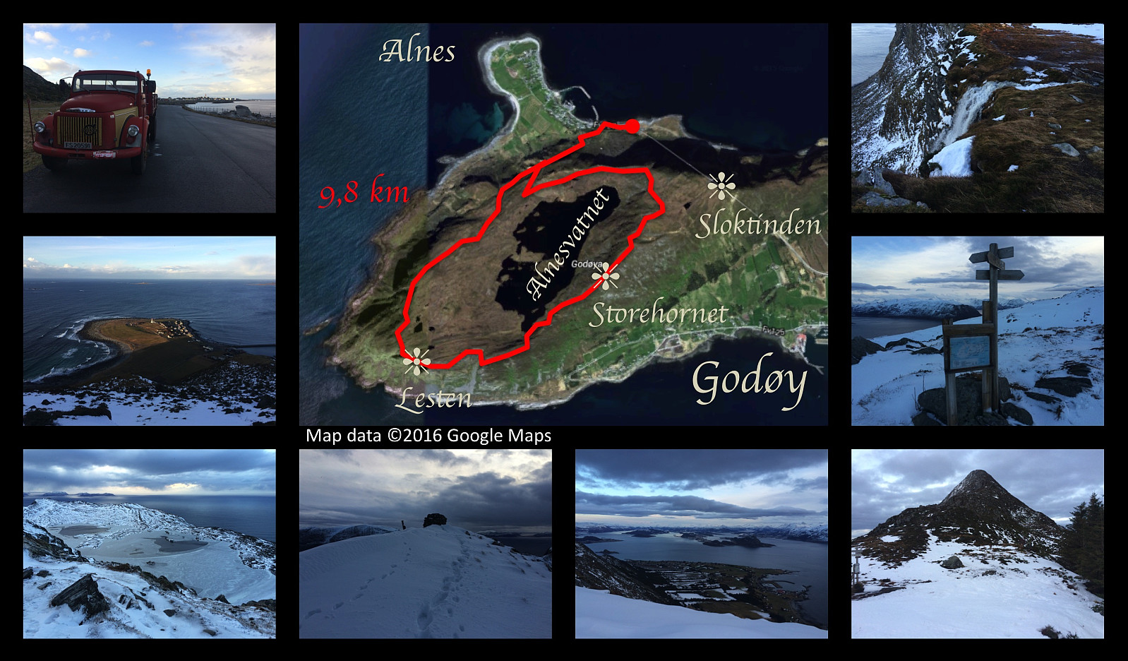
Round trip on the mountain of Godøy Island, including the peaks of Storhornet and Lesten.
I've been hiking to the summits Storhornet and Lesten on the mountain of the island Godøy multiple times. This afternoon I did this trek again. I set out from the relatively new parking lot in the bay called Hestvika [i.e. The Horse's bay]; which is rather spacious, making it possible even to park there with a lorry. I frequently borrow either my wife's car or my son's car when I go trekking, but on this day they were both at work; hence I had to use my truck/lorry, as that's the only vehicle owned by me. I climbed up to the plateau on which lake Alnesvatnet is located, and continued up the ridge just north east of the lake, towards Storhornet. The trail curves southwards, and then southwest as you approach the summit of Storhornet (495 m.a.m.s.l.). From Storhornet it is possible to just continue ahead in southwest direction. The descent that goes that way is rather steep, but if you're a little bit used to mountains, you'll manage well. As you approach the southwest end of lake Alnesvatnet, you'll come down into a pass between the northern and southern sides of the island; and from the bottom of this pass, you start climbing again, this time towards the summit of Mount Lesten. There's a nice trail along the western perimetry of the mountain, and when you've passed Mount Lesten, you just continue along the trail, and it will take you back to were you came up to the plateau of the lake (see Google Earth Image and GPS tracking). The last part of the hike was just the descent form the plateau towards my lorry along the very path that I had been ascending a little bit earlier. It was a wonderful day, but it was a bit cold, the creeks were frozen; and the trail was at places a little bit hard to find as much of it was covered by snow.


Kommentarer