
Climbing the Mountain Overlooking the Chennek Camp Site (24.11.2018)

Geschrieben von Solan (Atle Solholm)

| Startpunkt | Chenneck Camp (3.620m) |
|---|---|
| Endpunkt | Chenneck Camp (3.620m) |
| Tourcharakter | Wanderung |
| Tourlänge | 3h 06min |
| Entfernung | 5,3km |
| Höhenmeter | 4.364m |
| GPS |
|
| Besteigungen | Meche Awoknesh (3.992m) | 24.11.2018 |
|---|---|---|
| Besuche anderer PBE | Chennek (3.625m) | 24.11.2018 |
| Chennek View Point (3.650m) | 24.11.2018 09:14 |
On this morning, I was somehow confined to the Chennek camp site in the Simien Mountains National Park. I had been trekking from the Buyit Ras area via Sankaber, Gich, Imet Gogo and Enatye to Chennek over the previous three days along with my wife, our guide Tadlo, and a ranger. Our original plan had been to continue on to Mount Bwahit, and then even further to the Ambiko camp site and Ras Dashen; but then my wife had become so severely stricken by altitude sickness, that we had had to change our plans. [I'm including this information in my narration, as I believe that ability to change a plan, is a very important ability in mountain trekking and in mountaineering; and there might even be times when your survival will depend upon that ability]. I was still thinking there was a possibility of climbing Mount Bwahit the following day, but I had to realize that the way my wife was feeling right now, she wasn't going to be quite up to it. As long as she remained sitting or lying, she was OK, but as soon as she tried eating, walking, or doing something, the nausea and the headache came back. Nevertheless, we had two more nights in the park that had already been booked and paid for; and we were in agreement that my wife's condition wasn't so bad we needed Dave to come and fetch us earlier than planned.
We had booked a 6 days and 5 nights hike with Dawit (Dave) Yohannes of Ras Dejen Tours. The price per person for such a tour depends largely on the size of the tourist group you're trekking with. I had expressed my wish to Dave in advance, that the group should be consisting of only me and my wife; and he had been able to fulfill that wish of mine, even though I had been booking the trip just about 10 days prior to our hike. I will strongly advice anyone considering a visit to the Simien Mountains: If you want to be in a larger group, whether that be for social reasons, or in order to get the price down; join up with people that you're used to go trekking with, or at least people who's ability in mountain trekking you know in advance! Joining a random group of complete strangers just isn't a good idea. Very well, I've heard of people that were able to get the price all the way down to about € 300 per person for a trip such as ours, just by joining a larger group; but I've also heard of various experiences from people that have gone trekking in such mixed groups. Four friends of mine, who went trekking in the Simiens just a few days before us, ended up in a group where a few group members always complained that the pace of the group wasn't fast enough; while two group members just had to give up, and go back to their homeland because they were unable to keep up with the rest of the group, and also because they were quite severely afflicted with altitude sickness. And then there was an issue of two vegan members of the group, who argued against the slaughter of a goat that the chef had brought along, and which was supposed to be part of the food for the group during the journey. They finally had to have a vote within the group on the issue, before the chef could slaughter the animal. If you're travelling with people of your acquaintance, or at least people that you have communicated with, either by phone or by mail; then such issues will be sorted out in advance of the journey. For our 5 nights and 6 days trek we paid € 750 per person, but the fact that it was just me and my wife in the group (apart from the staff members), made it worth every single penny. There were no other group members to tell us to speed up or walk more slowly; nor anyone to argue with us over the food or other imminent issues.
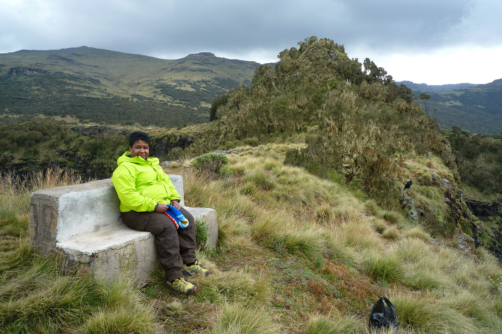
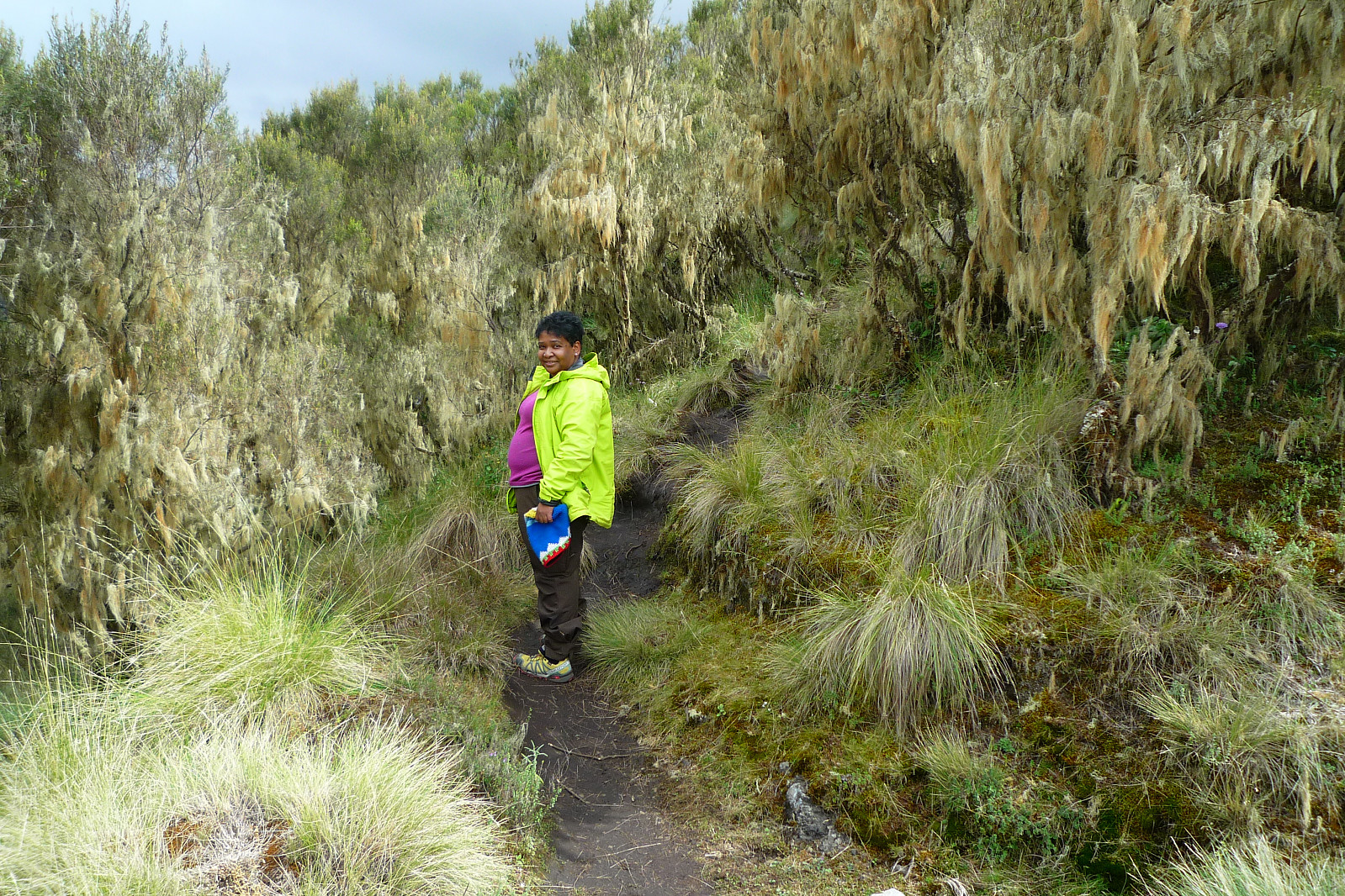
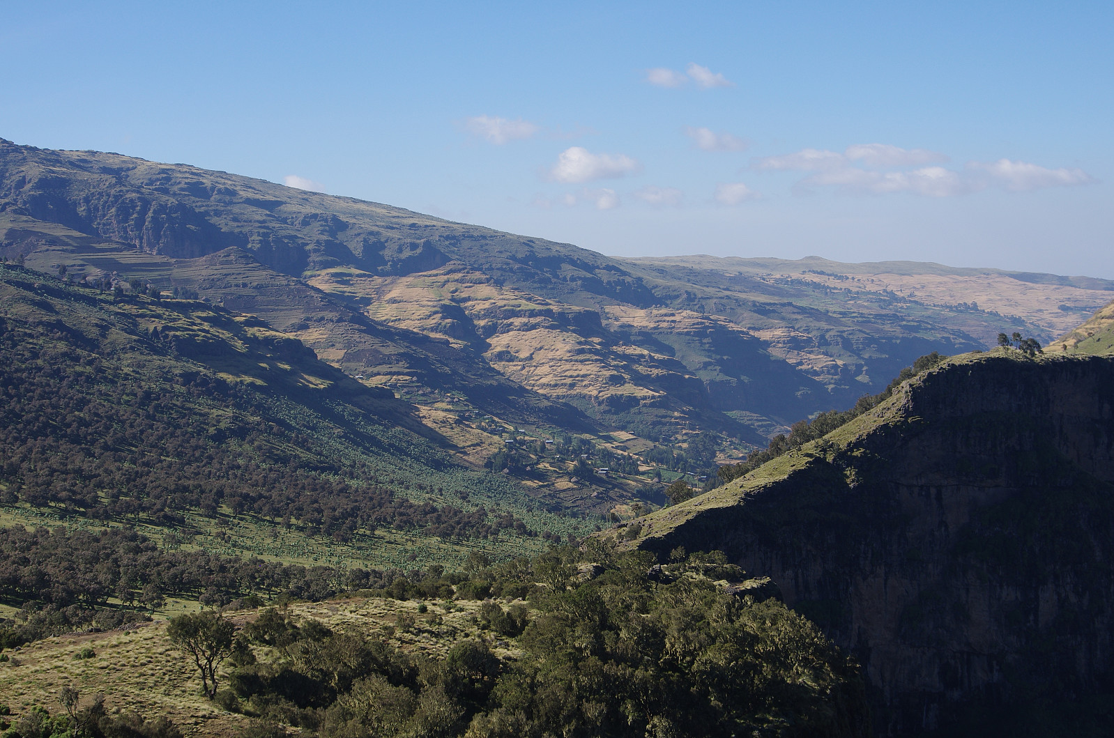
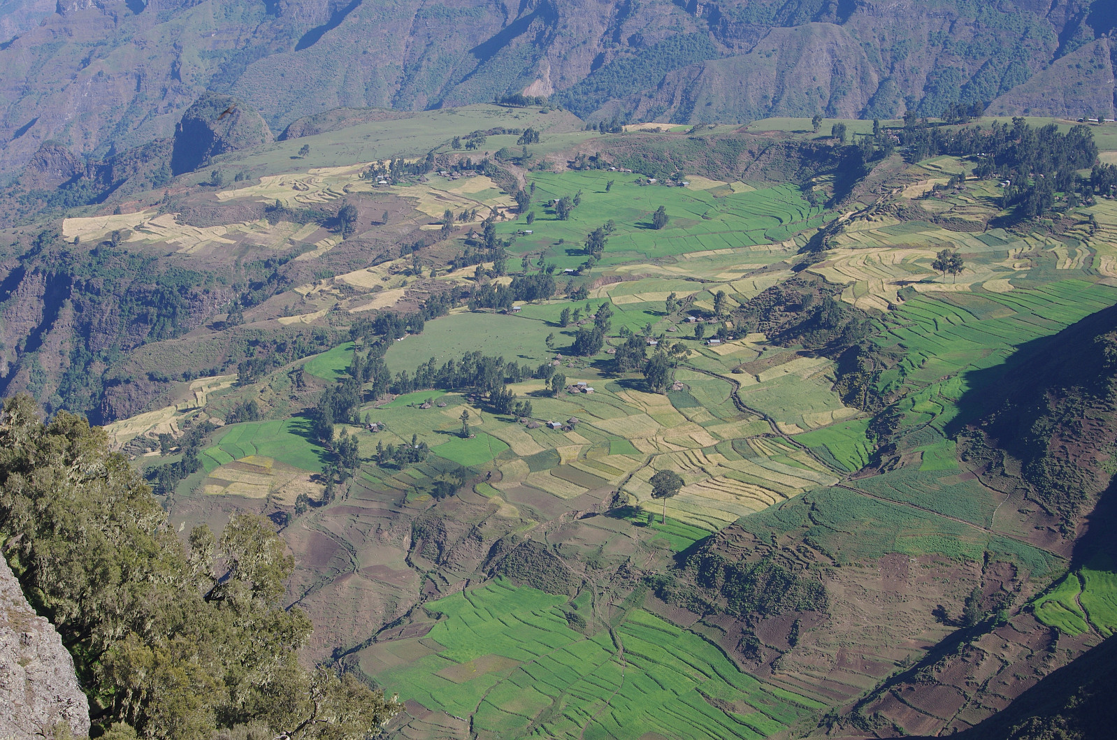
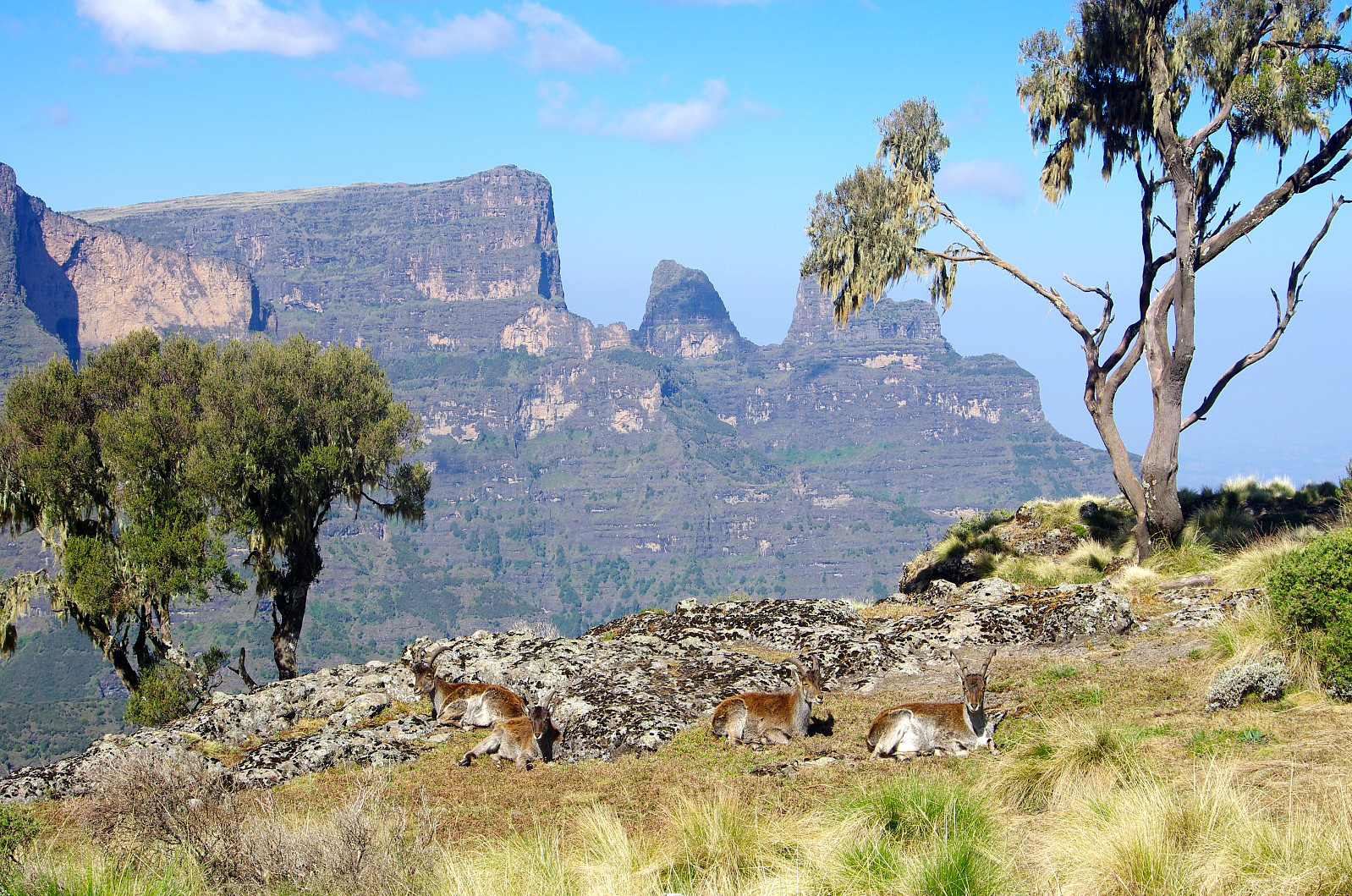
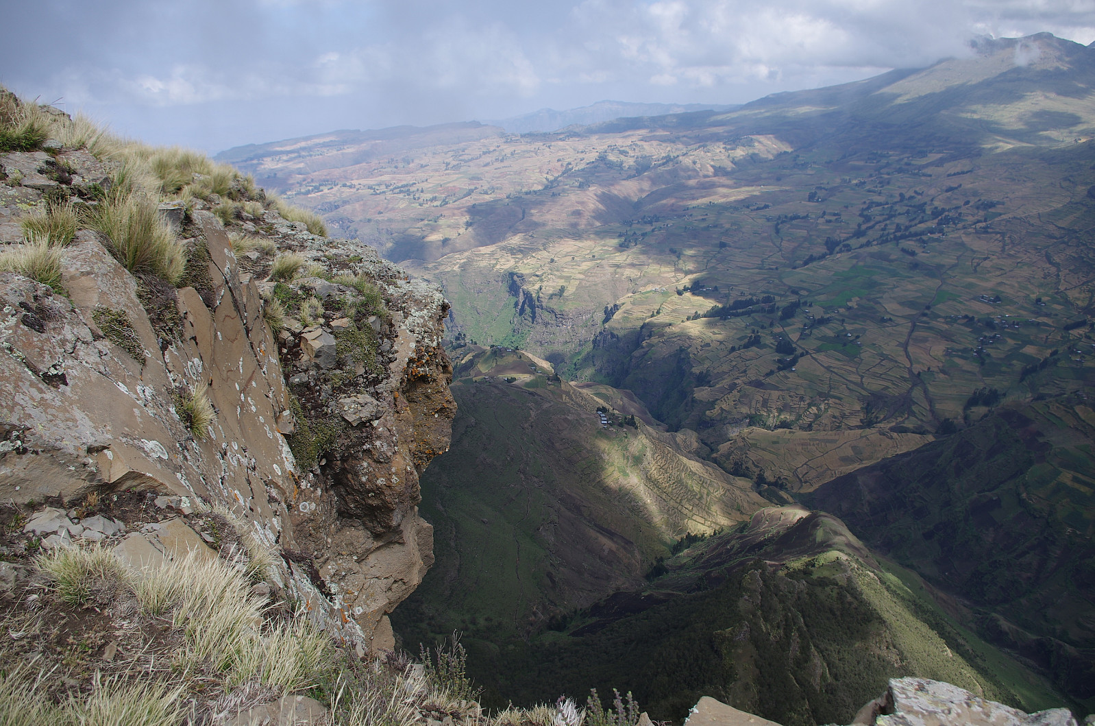
As I was walking around in the Chennek Camp with my DSLR camera this morning, I came across Tadlo, our guide. We had already made a decision to postpone any attempt at climbing Mount Bwahit to the following day, as we had still two more nights in Chennek, and we had also decided not to make any attempt at reaching Ras Dashen; hence Tadlo, the ranger, and the mule drivers were all having a day off, so to say. I told Tadlo I was heading for the viewpoint on the north side of the camp, and he immediately offered to join me, and show me the spots with the nicest views. The Chennek View Point is a little hill, just at the edge of the escarpment towards the lowlands, and the "summit" of this viewpoint is located 20 to 30 meters above the camp, depending on what part of the camp you're referring to. This little hill is, however, part of a mountain ridge that extends down into the lowlands from the plateau on which Chennek is located. Hence, when you go there to have a look at the view, you can either climb up to the top of the hill, or you can follow a trail on the east side of the hill, and end up on another beautiful viewpoint a little lower down on the ridge. The ridge actually continues down in a somewhat step-like fashion, creating even two or three other viewpoints further down. The trail towards the second viewpoint is adorned with beautiful indigenous trees with Lichens hanging like old men's beards from the branches. This viewpoint is located at about the same level as the camp site, hence if you feel like you've done enough climbing, this spot is an alternative to the climb up to the top of the hill. The top view point offered a very nice view over a large part of the landscape, and we could see nicely located villages such as Amiwalka and Sona, with meadows and pastureland around them.
I then spotted another nice viewpoint to the right of us, about half a kilometer east of where we were standing. It was a shelf-like structure located just a little higher than the Chennek viewpoint, but it was "overhanging" the escarpment in such a manner that I thought it would offer an even greater view. I told Tadlo I wanted to go there, and again he opted to come with me. Now, to ensure the safety of the tourists that visit the park, it is prohibited to walk around outside of the camp site without a ranger to protect you. This is not just to protect the tourists from wild animals, it also has a preventive effect; as it keeps thieves and robbers away from the area, people that you would otherwise expect to be drawn to the park with all its rich tourists. So, before leaving the camp area, Tadlo went over to "our" side of the camp, and came back with the ranger, who joined us as we walked over to the next view point.


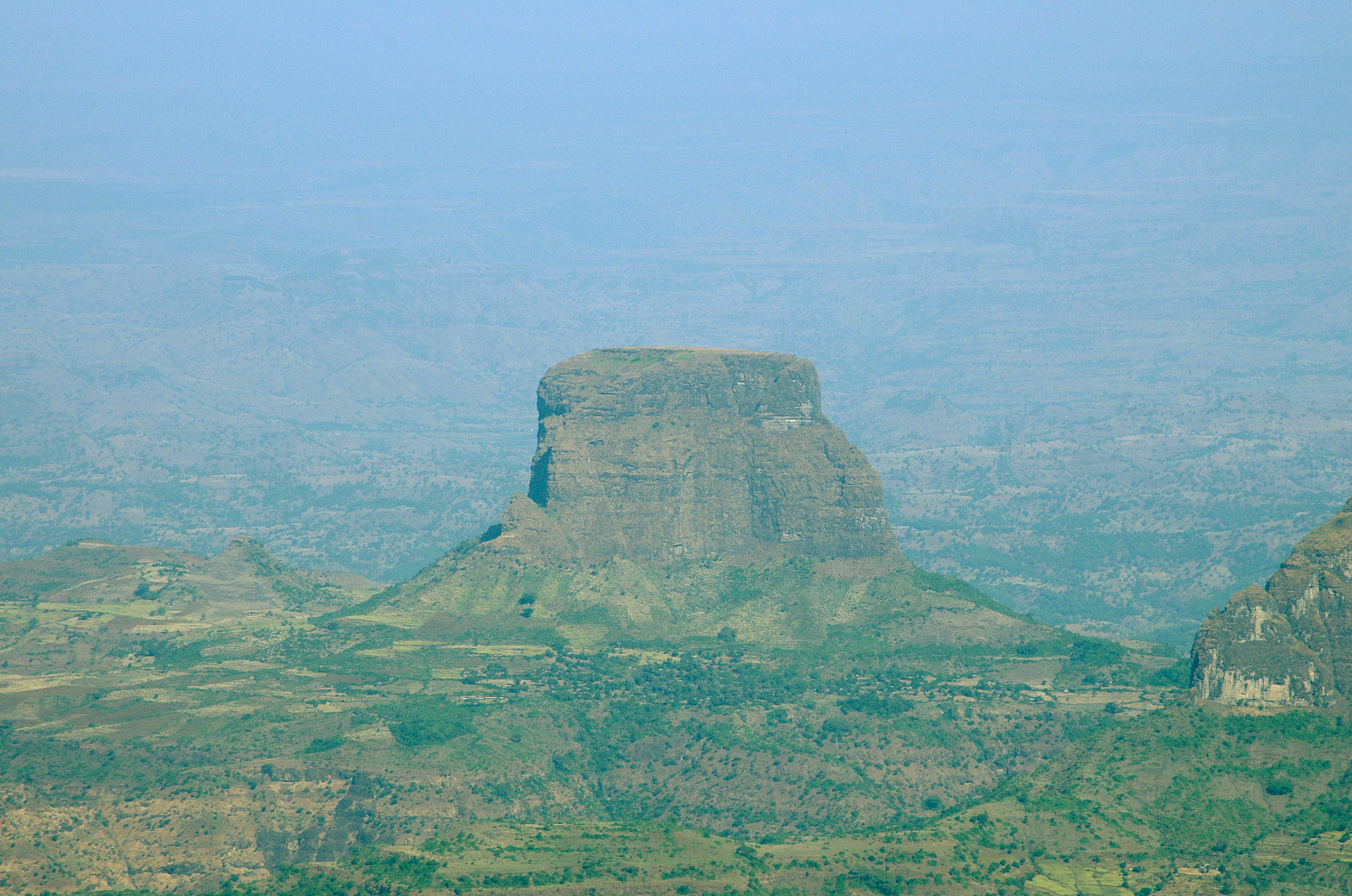
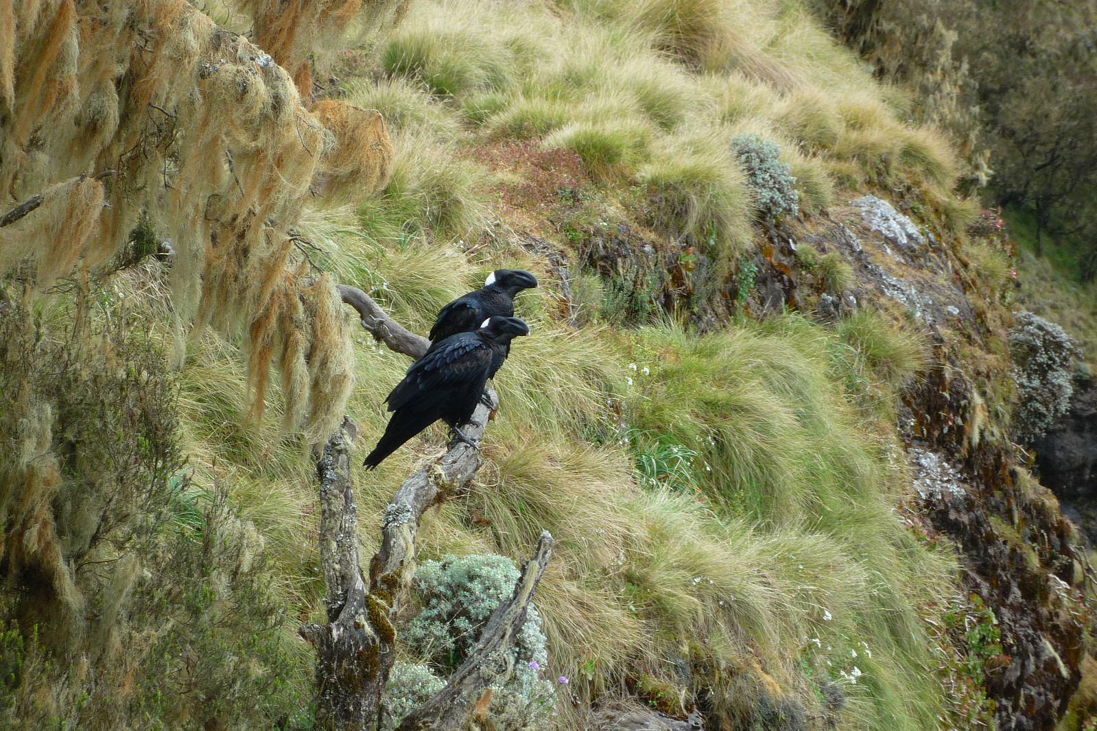
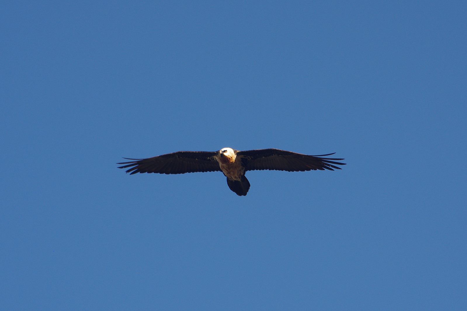
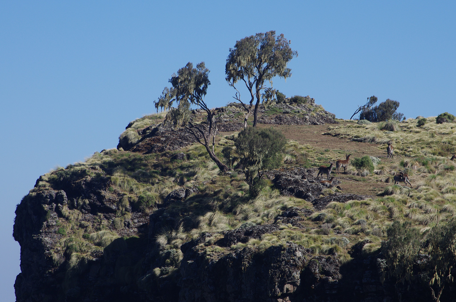
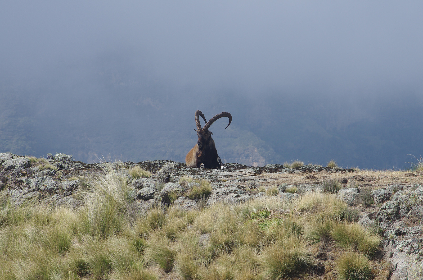
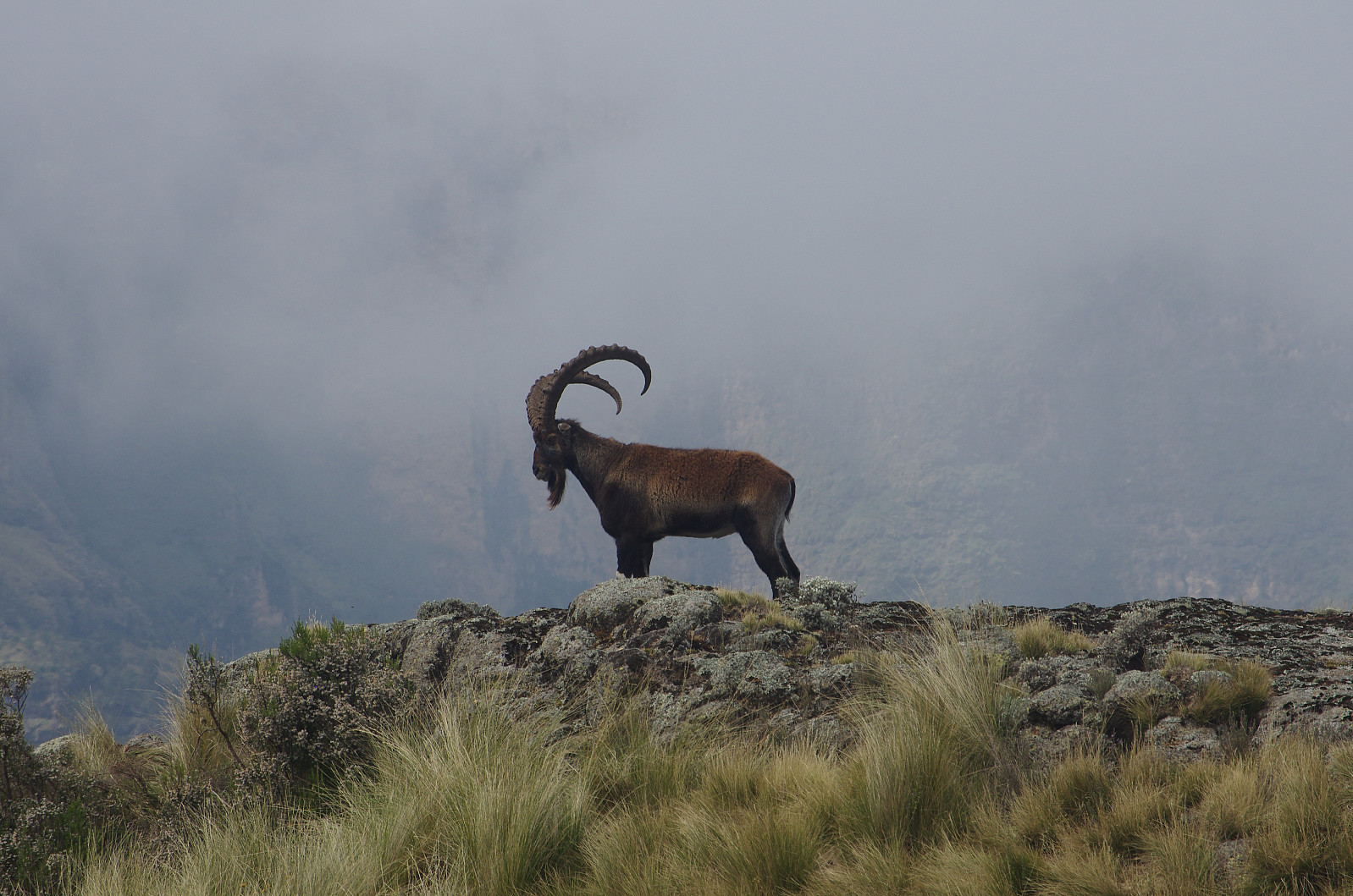
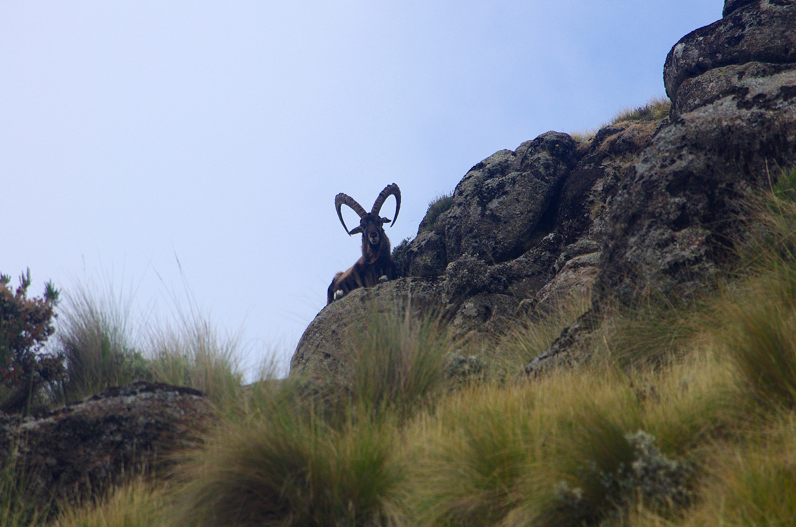
As we approached the shelf-like viewpoint, we saw a group of Swedish tourists that I recognized from the camp. They had encountered a flock of Walia Ibexes right there on the shelf, and now they were all eager to take photos of these beautiful animals. I even captured some images myself, but then the Ibexes started running. From where we were now standing, we could se yet another viewpoint a little bit further to the north east, just a little bit higher up than where we were standing, and we continued up there. This spot offered a very nice view, not just of the lowland, but even towards Mount Silki. We were now very close to a hairpin bend on the road that leads from Chennek, around the south side of Ras Bwahit, and then down into the Mesheha valley, which separates Mount Bwahit from Ras Dashen; and so we climbed up to that road. We followed the road just for a hundred meters or so, and while following the road, we actually met a group of tourists that were heading back to Chennek after summiting Mount Bwahit.
We took off from the road, and followed a trail that went up to a viewpoint about 3820 m.a.m.s.l. At this point there were some gras huts and some large crosses. "There's a Church in there," Tadlo said to me, and pointed towards a cave on the other side the ravine in front of us. He then told me that there is a natural water source, and a little pond inside the cave, and they have made a nice Church around this water. He also explained to me that people with various diseases are coming to the spot on pilgrimage in order to immerse themselves in the water, as they believe it may cure them of their affliction. We didn't ask for an opportunity to visit the cave Church on this occasion, but we tried the very next day. Back in the camp later that day, Tadlo was describing the cave Church as very beautifully adorned on the inside, and when my wife heard about it, she wanted to see it. So after our visit to Ras Bwahit the next morning, my wife, who was then feeling a bit better of her altitude sickness; came with us up to this spot, hoping it would be possible for us to enter the cave Church. The priest who served there, refused to let us in, however. We were told you have to be an Orthodox Christian in order to be allowed in. That is indeed a bit odd, as non-Christian tourists of any religion are allowed into the Churches of Gondar and Lalibella; you just pay a little fee, which they use for maintenance of the Churches and the like, but you're allowed in. Here on Samawasha, or Meche Awoknesh, which I later learned was the names of this little mountain, it was different, however. Whether you will be let in if you are a Protestant Christian, I'm not quit sure; but Jews, Muslims and Roman Catholics were definitely prohibited, according to the priest with whom we spoke.
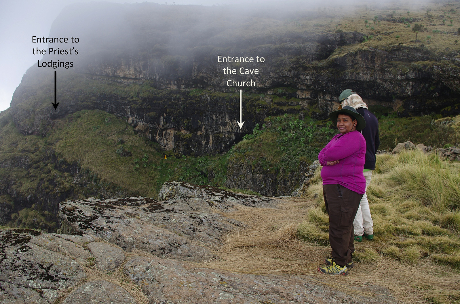
![#14: My wife and Tadlo at the site of the Church Cave, about 3820 m.a.m.s.l. These two images were captured the next day, when my wife came along with us to the site [i.e. after I, Tadlo and the ranger had visited the summit of Bwahit]. The summit area of Meche Awoknesh is seen in the background.](https://images1.peakbook.org/images/14939/Solan_20200528_5ed01bf8e755b.jpg?p=xtralarge)
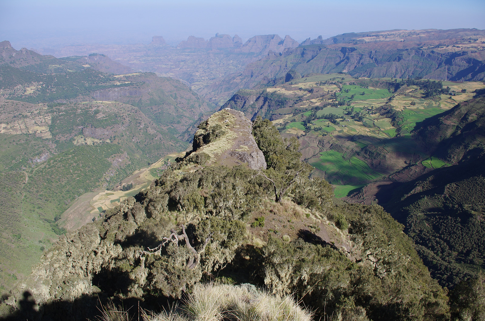
The three of us continued up the mountain side to the right of the ravine and the caves, and then took left towards the escarpment overlooking the lowland. From there we followed the edge up to the summit of the mountain, which was about 4000 m.a.m.s.l. according to the Endomondo tracking app on my cellphone. [I visited the Meche Awoknesh again one year later along with my daughter; and on that occasion we performed multiple measurement, not just with the Endomondo app, but also with my Garmin inReach Explore+, and my daughter's Garmin Sports Watch; and we came to the conclusion that the mountain is probably just a few meters short of 4000 m.a.m.s.l. Moreover, at that time we even climbed down to the notch between this mountain and Bwahit, and measured the vertical separation of the Meche Awoknesh to be only about 33 meters]. From the summit of the mountain, we decided to make our way directly down to the road passing just beneath the summit (see map). We had just started on our descent, however, when Tadlo noticed three large Walia Ibexes just about a 200 meters to the north west of us. All three of them were lying down on a stone, hence only their horns were visible; but the trained eye of a mountain guide had spotted them nevertheless. We tried to move slowly in that direction, hoping to get some close up photo images; but the animals were looking in our direction, and had been keeping an eye on us all the time, hence when we were about 100 meters from them, they suddenly stood up and ran away.
We then turned south west again, made it down to the road; and then followed the road back down towards the camp. As we came down to some hairpin bends on the road, however, Tadlo knew a shortcut allowing us to bypass these bends. We followed his shortcut trail, and then came back onto the road at another bend about two hundred meters further down. We next followed the road for another 300 meters, before we took a shortcut directly into "our" part of the camp at the next bend of the road.


Benutzerkommentare