
Climbing the Meche Awoknesh Mountain (25.11.2019)

Geschrieben von Solan (Atle Solholm)

| Startpunkt | Chenneck Camp (3.620m) |
|---|---|
| Endpunkt | Chenneck Camp (3.620m) |
| Tourcharakter | Wanderung |
| Tourlänge | 2h 21min |
| Entfernung | 5,6km |
| Höhenmeter | 409m |
| GPS |
|
| Besteigungen | Meche Awoknesh (3.992m) | 25.11.2019 |
|---|---|---|
| Besuche anderer PBE | Chennek (3.625m) | 25.11.2019 |

As we had skipped the hike to the village of Amiwalka (see previous tour description), we were now having one day of mountain trekking left, that we had already paid for, despite being back at the Chennek camp site. In my mind we were having two options for this day: We could either climb the Meche Awoknesh mountain, which is located just east of the camp site; or we could go for Mount Enatye, which is west of the camp site. I had previously climbed both of these mountains (i.e. in 2018), whereas my daughter, who was with me on this tour, hadn’t been on any of them. The Enatye must be said to be a mountain by itself, as it has an elevation of 4070 m.a.m.s.l., and a vertical separation of just a little less than 500 meters; though it is located within a mountain range that also includes Imet Gogo, Shayno Sefer, and Bwahit. The Meche Awoknesh, on the other hand, is more like a knoll on the Bwahit Mountain. I knew from my previous visit [See:Climbing the Mountain Overlooking the Chennek Camp Site] that it was about 4000 m.a.m.s.l., but it didn’t have its own map pin here on Peakbook, nor was it marked out on the Swiss produced mountain map that we were having with us; so we didn't know the exact elevation of the mountain, nor the longitude and the latitude of the summit; and actually not even what the vertical separation of the mountain was. So, eager to measure these variables with a real GPS device, I suggested to my daughter that we climb the Meche Awoknesh.
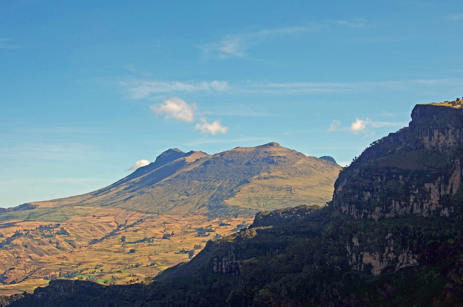
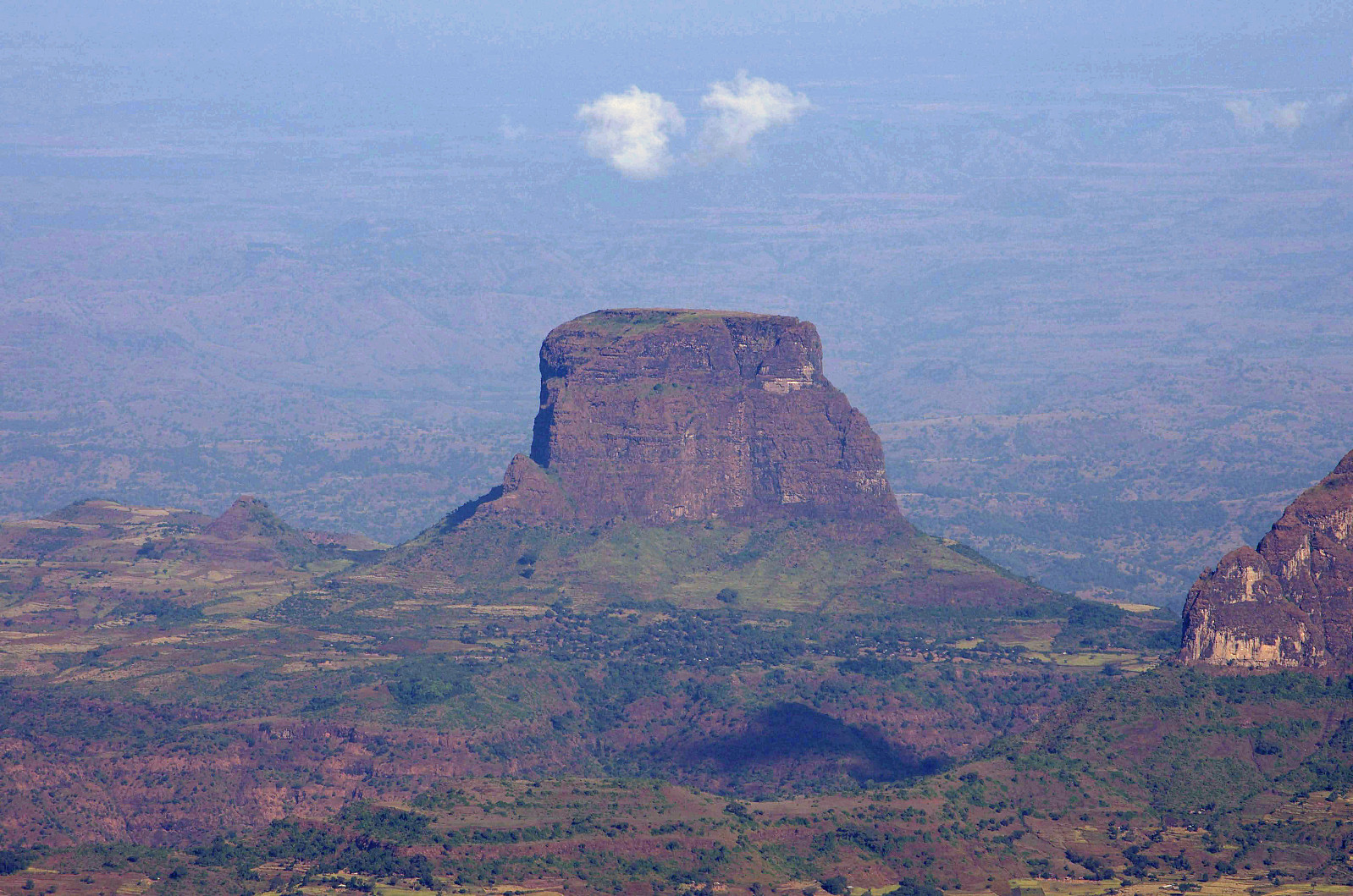
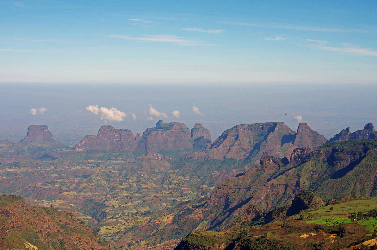
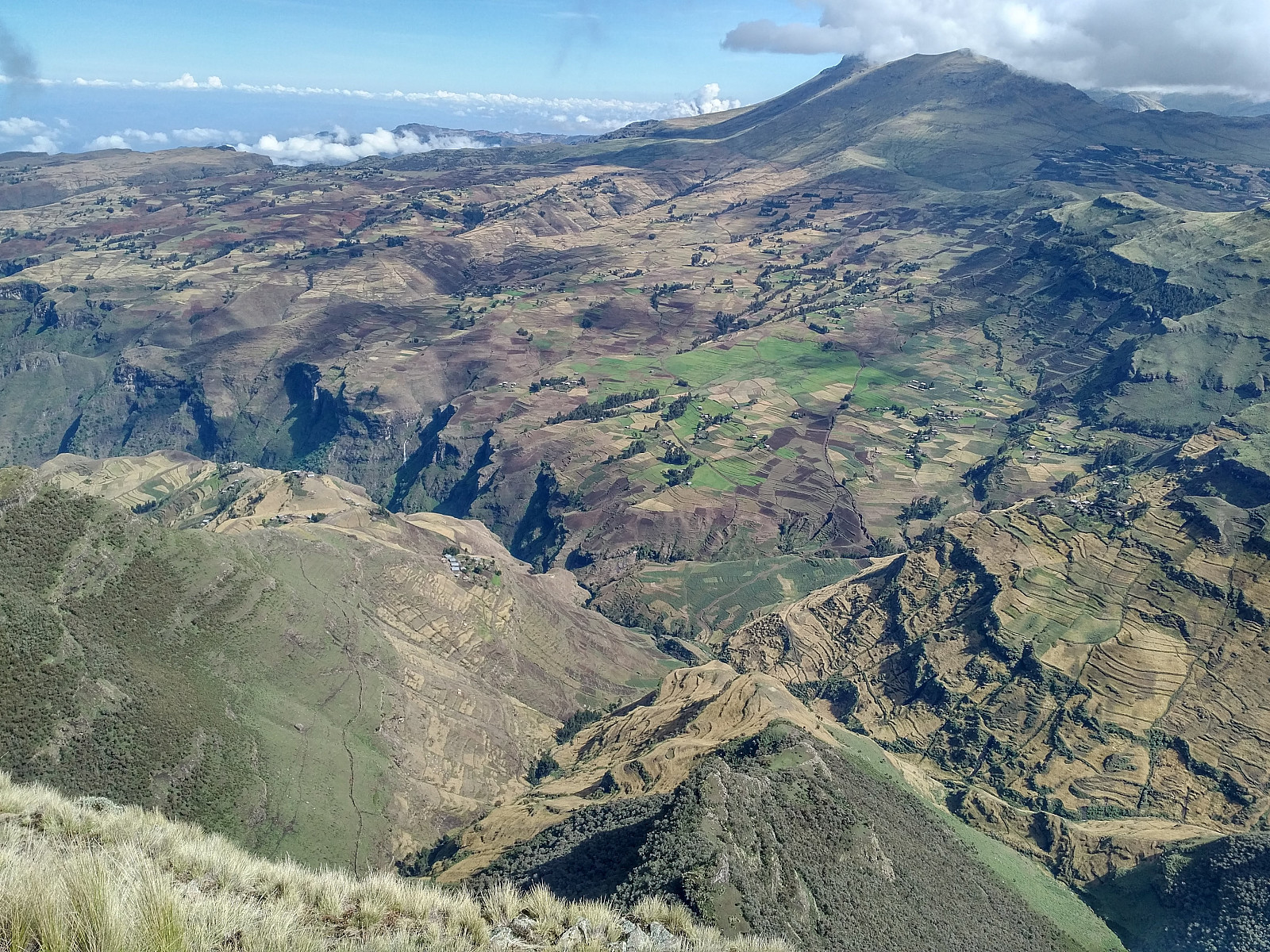
We had plenty of time for such a short trek on this day, so we first took time to go over to the edge of the escarpment just north of the camp site, to have a look at the view over the lowlands north of the Simien Mountains. The landscape that you're overlooking when standing on this spot is mainly an agricultural landscape, with villages scattered in between the green pastures (Images ## 8 & 12). One of the villages that we could see was actually the Amiwalka village that we originally had planned to spend a night at [see: Round Trip in the Simien Mountains], before returning to the Chennek camp site. The steep mountain side beneath us was actually covered by an indigenous forest, but further down the slopes, the agricultural landscape took over (Image #8). In the far, a peculiar mountain range could be seen (Image #6); a mountain range that, according to the map includes the mountains of Hawaza, Amba Toloka and Amba Ton. I haven't been able to find the elevation of Mount Hawaza anywhere online, but judging from the elevation curves on the map, its elevation is around 2400 m.a.m.s.l. The elevation of Amba Toloka and Amba Ton is 2676 and 2873 m.a.m.s.l., respectively. A wish of mine, since I first visited the Simien Mountains in 2018, has been one day to climb the Hawaza mountain.
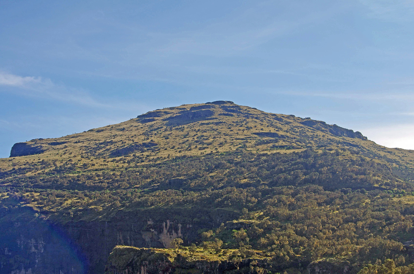
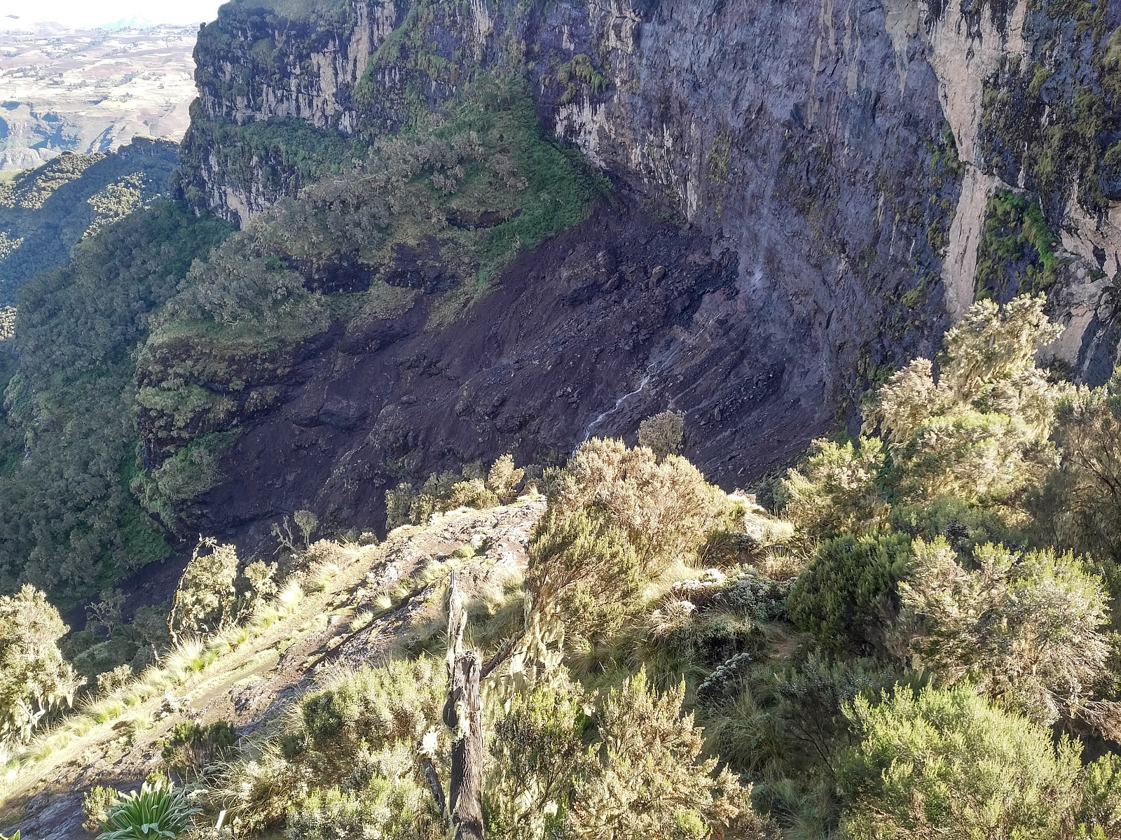
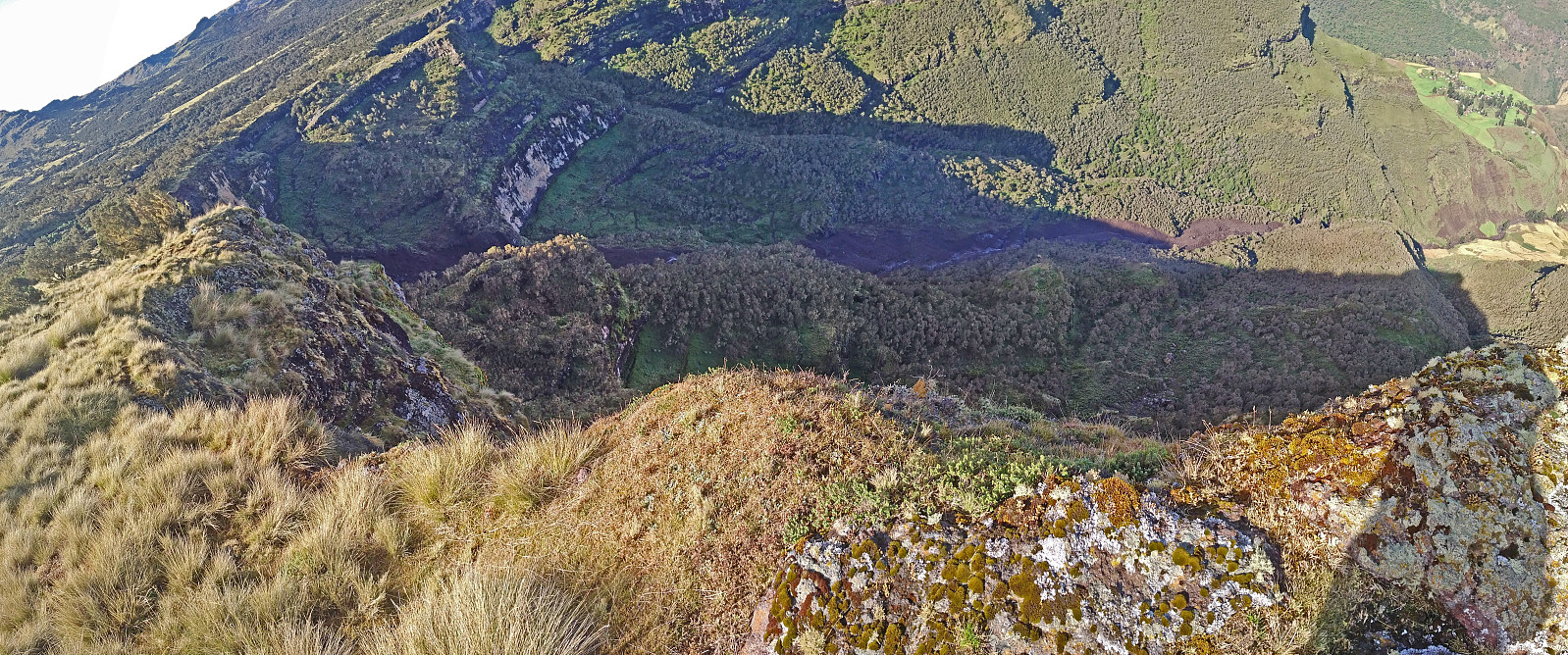
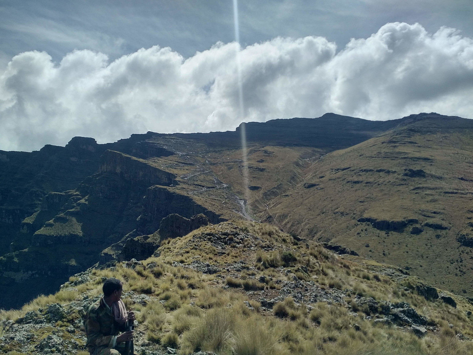
We walked eastwards along the edge of the escarpment, and then a little bit north, towards a nice plateau, where I saw some walia ibexes on my last visit. There were no ibexes on the spot on this particular day, but the plateau still offers a wonderful view over the lowlands. On our way over to the plateau, we could se the huge landslide that we had been told about two days earlier (see previous tour description), and which had prevented us from trekking from Amiwalka back up to Chennek (Images ## 7 & 9). We continued along a trail up to a second plateau, similar to the first one, but slightly higher up; and this one offering an even more magnificent view (Image #10). The trail up to this viewpoint goes very close to the road up the west side of Bwahit, but due to the dense vegetation between the road and the trail, you don't actually see the road from the trail, and since the road isn't actually very heavily trafficked, you don't necessarily hear that there is a road either.
![Image #8: View of the lowlands from the same spot as the previous image. In the far is seen the mountain range that includes the mountains of Hawaza [2400 m.a.m.s.l.?], Amba Toloka [2676 m.a.m.s.l.] and Amba Ton [2873 m.a.m.s.l.].](https://images1.peakbook.org/images/14939/Solan_20210124_600dea65ecbe5.jpg?p=xtralarge)
At about the location of the second plateau view point, the mountain road makes a sharp hairpin bend; and at that very bend, the trail joins the road, so that you have to walk on the road for a little less that 200 meters (see map with GPS tracking). At this point we left the road for a trail on the left side of the road, a trail that I knew, from my previous visit; was leading up to a Cave church located at about 3800 m.a.m.s.l. We soon arrived at the Cave Church site (Image #11). When I was there with my wife in 2018, we asked for permission to visit the Cave Church, and to see it from the inside, but we weren't allowed in, as we weren't Ethiopian Orthodox Christians; and so on this occasion we didn't even bother to ask, but just continued our trek up the mountain side. [Nevertheless, for an exterior view of the Cave Church and the cave that the priests reside in, see my tour description from 2018: Climbing the Mountain Overlooking the Chennek Camp Site].
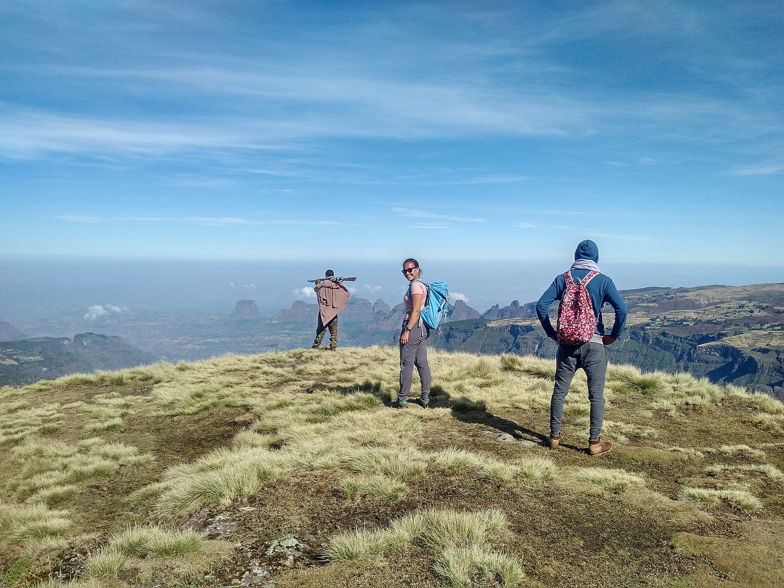
We continued all the way up to the summit of the Meche Awoknesh mountain. My Garmin inReach Explorer Plus showed it to be located at a northern latitude of 13.265503 degrees, and an eastern longitude of 38.207761 degrees. I had been a little bit curious as to whether the summit was above or below 4000 m.a.m.s.l. The elevation seemed to be very close to four thousand meters. Nevertheless, when I subtracted the elevation measured for the Chenneck camp site with the same GPS device from the elevation that I was now measuring for the mountain; I came to an elevation of 3992 m.a.m.s.l., which I believe is as close to the truth as it is possible to get with this equipment.
![Image #11: Standing at the site of the cave Church of the Meche Awoknesh Mountain. [For a better view of the caves, see my tour description from November 24th 2018].](https://images1.peakbook.org/images/14939/Solan_20210124_600df69a5d091.jpg?p=xtralarge)
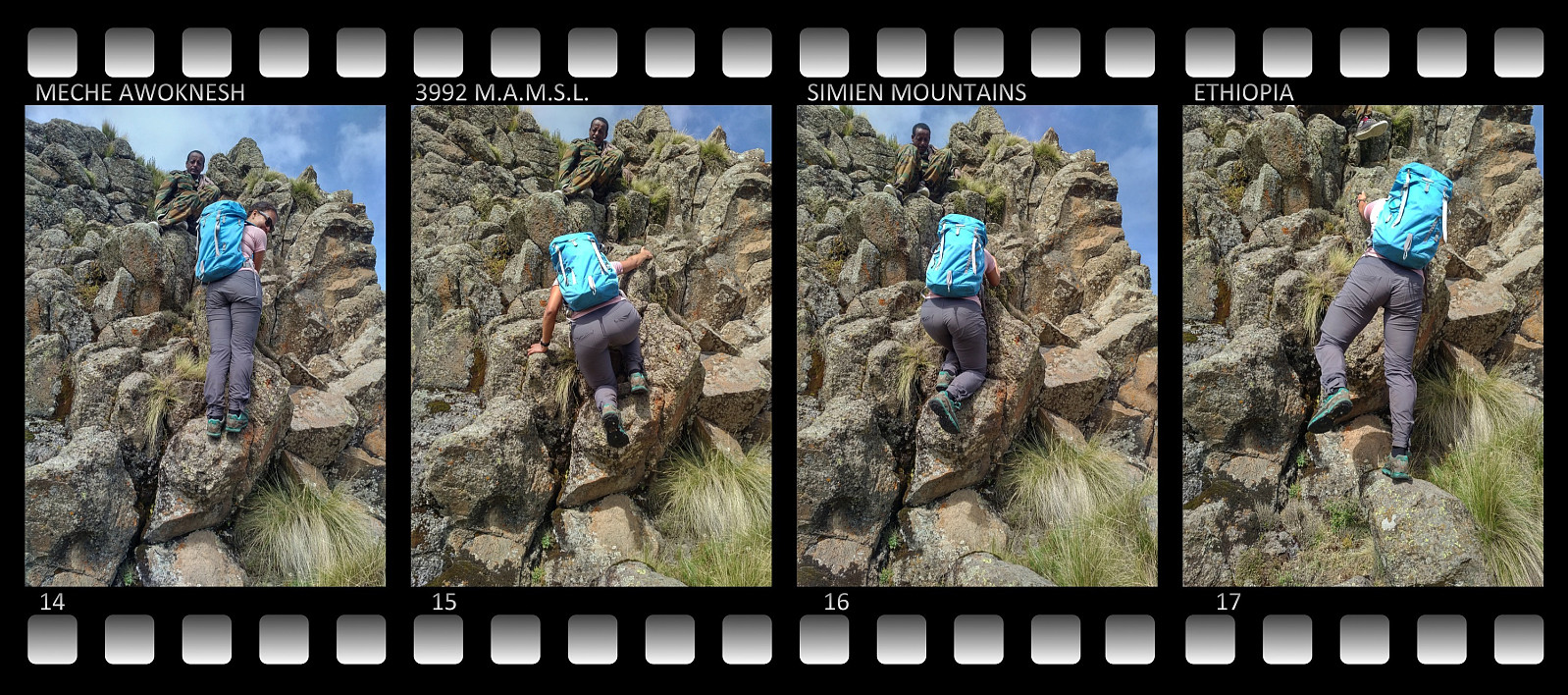
Now, eager to determine even the vertical separation of the Meche Awoknesh, we headed towards the notch between this knoll and the Ras Bwahit (Image #13). Last year, when descending from the Meche Awoknesh, I descended more in a southward direction, but in order to measure the vertical separation of the mountain, I now had to find the lowest point on the highest route between Meche Awoknesh and Bwahit. Finding this point wasn't at all difficult, as it is located along the edge of the escarpment between the highlands and the lowlands. The climb down to this point was a little bit steep only at one single point (Images ##14-17); apart from at this spot, the descent to the lowest point along the edge of the escarpment was actually rather straight forward.
I measured the difference in elevation between the summit of Meche Awoknesh and the lowest point on the ridge/edge between this mountain and the Bwahit to 33 meters. This means that the lowest descent possible from the Meche Awoknesh before you can climb the Bwahit is 33 meters, and this is what's generally referred to as the vertical separation of a mountain. After coming home again, I registered the Meche Awoknesh here on peakbook with the mentioned altitude, latitude, longitude and vertical separation. As the vertical separation is less than a 100 meters, it received a green, and not red map pin (see the Peakbook maps).
From the notch between the Meche Awoknesh and Mount Bwahit, we followed the road down towards the camp site for about 200 meters, then we took a trail down to the left; the same trail that we had used when ascending the Ras Bwahit 5 days earlier. Lower down in the valley, as the trail was joined by one of the hairpin bends of the road, we followed the road once again for about 300 meters or so (see map); before taking a shortcut into the camp site, to where we knew our tent was, along another trail.


Benutzerkommentare