
Thabana Ntlenyana (03.04.2012)

Written by Gråbein (Tinderangler)

| Map |
|
|---|
| Ascents | Thabana Ntlenyana (3,482m) | 03.04.2012 08:00 |
|---|
Min høyeste topp så langt, og en fantastisk eksotisk opplevelse.
Har man først klart veien til toppen av Sani Pass, som ikke er for pyser eller biler uten 4x4, er det ikke spesislet vanskelig å bestige Thabana Ntlenyana. Har man mulighet til å kjøre ytterligere 8km inn i Lesotho, vest for Sani Pass, til et stort ull-lager, "Wool Shed", har man spart et par timers gange også. Vi startet ihvertfall her, vest for elven, som vi fulgte et stykke oppover, før vi peilet rett mot toppunktet. Etter litt flat gange langs elven, svinger vi nordover opp en dal, til et pass, et par hundre høydemeter ned en ny dal, en elv til krysses og så en lang motbakke. Terrenget er lettgått, men luften forholdsvis tynn hvis man ikke er vant, så hodepine evt. andre tegn på lett høydesyke kan forekomme. Det er en hovedsti å følge det meste av ruten, men det er uendelig med andre tråkk, etter tusenvis av sauer og geiter.
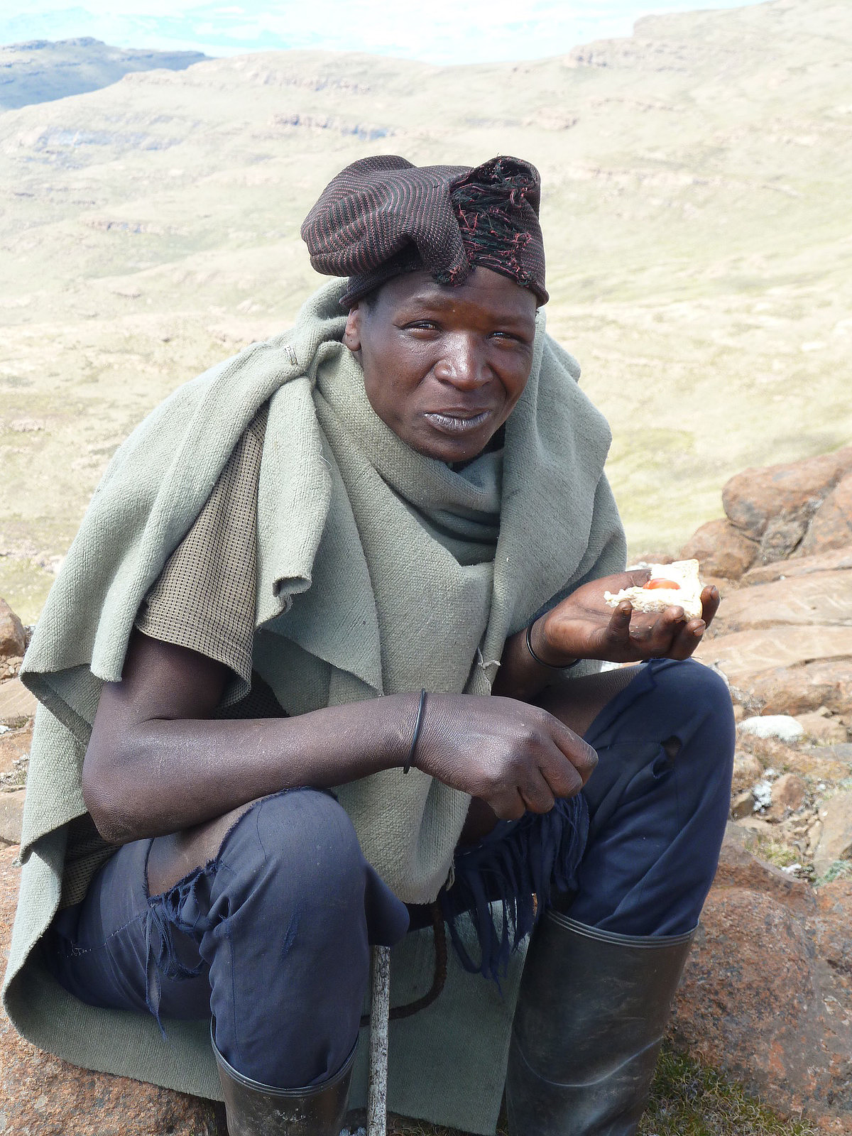
Det mest eksotiske er dog alle gjeterne som til enhver tid følger med deg. De er nysgjerrige og søkende. Vi fikk flere ganger besøk av de, da de synes å være i bra form, og går lange omveier bare for å hilse på. Mest opptatt syntes de å være av penger og røyk. Hadde vi visst, skulle vi kjøpt inn noen sigarettpakker og delt ut. Det hadde de satt pris på. :0)
Vi gikk opp i nydelig vær, minusgrader fra start, men solen tar kraftig, og longs og supertrøye holdt i massevis. Men - været kan skifte fort og det var noen dager gammel snø på toppen! Det hadde regnet over 100mm på en dag, kun dager i forveien, og bakken er delvis våt.
Under www.geocacing.com fant jeg en flott beskrivelse for forberedelse til av turen, samt at vi fikk gode tips, kart og hjelp av Snilen som hadde vært her før oss. Tusen takk til Snilen for kjempe hjelp!
Turen tok oss, ca. 8 timer, var 24km lang totalt, og vi forserte ca. 1100 høydemeter.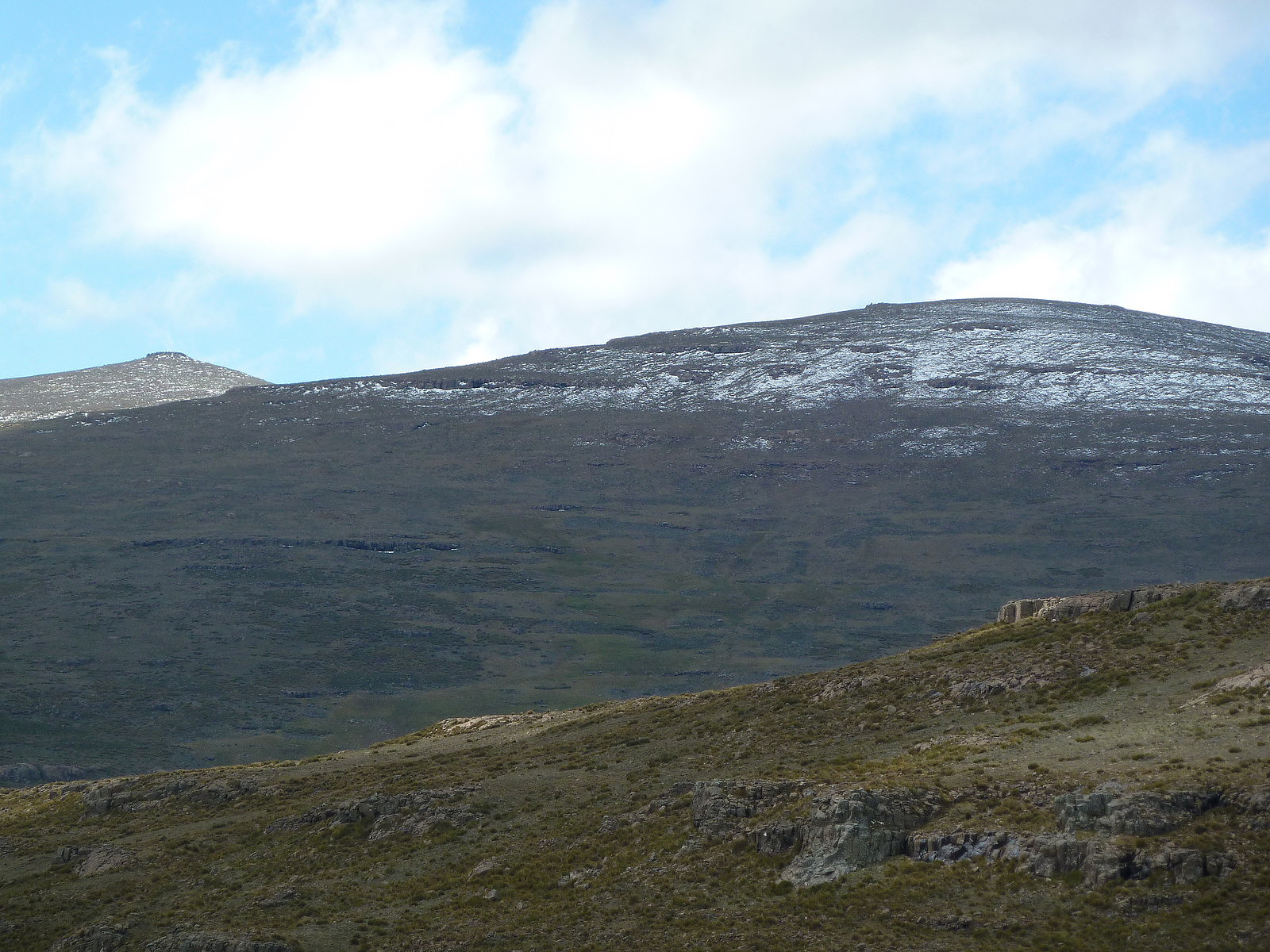
Tillater meg å gjengi deler av geocach-postens tekst under, da den ikke lengre er åpen for "uinnvidde":
''"This event location is on top of a mountain and it is probably one of the highest events ever held in Africa. No other cache in South Africa is higher than this one. The final climax of the event is in the form of a 10 minutes quick snack on top of the mountain and a group photo. You can only log this event when you made it to the top, or else it will be unfair to the other cachers. Difficulty is a 1 but terrain is a 5. Difficulty is a 1 due to the fact that you can hire a porter at Sani to carry your stuff. If you are really lazy you can also hire a Basotho horse for this trip and he will take you to the peak. The focus of this event is on a geocaching event and you will have to find your own way to get a porter or a horse. If you do select a porter or a horse please stay with the group.To attend this event you need to climb to 3482 meters ASL. You will start at Sani Top Chalets at a height of 2882 meters ASL. To get to the event you will need about 9 hours to the peak and back, estimated round trip is about 25 km. could be more, could be less. I was here a long time ago so maybe I lost some details and hopefully not the direction. It will not be funny to end on the wrong peak. If it does happen please refrain from beating the cache owner senseless. Straight line will be about 9 km. But we are not going straight; we will stroll around, up and down and then straight up for the final assault. After all we want to enjoy the scenery so why rush it and we also want to make sure our bodies are getting used to the height. We will ascend slowly and we will descend fast. The final ascend will be slow for sure but straight up.
I smoke 40 cigarettes a day and I am on my way to this mountain, so a person with average fitness should be able to jog pass me. Please refrain from doing that. If the going is tough then focus your eyes in front of you and take small steps and think about something nice. In return you will be standing on the second highest peak south of Kili and you will be able to share your experiences with a group of geocachers, very few geocachers achieved this one. We will stay together as a group and we will accept the pace of the slowest walker as our pace. There are no medals for the first one on top.
1. Special Caution: (Mountain Sickness)
At this height it is possible that you could experience mountain sickness in some sort or another. It can happen to anybody and at any fitness level on this mountain. The air is quite thin and you will be breathing deeper than normal. That is normal also the burning sensation in your lungs is normal. Please do not smoke while doing this trip, you need all of the oxygen in your blood. You can have one on top of the mountain. Dehydration could accelerate mountain sickness so make sure that you have enough energy drinks and energy bars. Also make sure you have enough white gold, you never know. There are no safe water points such as rivers and dams on this trial.
I will lead the group and if I do notice severe symptoms of mountain sickness I will not allow you to proceed any further. If the symptoms are above acceptable risk, you will go lower and you will wait for the group to return.
Symptoms of mountain sickness (mild stage)
Headaches is the primary indicator and if this is in combination/s with the below than you could suffer from mountain sickness, inform the cache owner immediately.
§ Lack of appetite, nausea, or vomiting
§ Fatigue or weakness even when rested.
§ Dizziness or light-headedness
§ Pins and needles
§ Shortness of breath upon exertion
§ Nosebleed
§ Persistent rapid pulse
§ Drowsiness
§ General malaise
§ Peripheral edema, which is the swelling of hands, feet, and face, the Oros man effect.
§ Running tummy
2. Special Caution: (Weather)
Weather can change quickly and all types of weather can be experienced. It can be as hot as hell, it can snow, the wind could pick up to 80 km/hr plus, it can rain, lightening can occur without warning and mist can isolate you - you need to prepare for all. You have to carry sun block and sunglasses with you. Make sure you have thermal underwear with you, something warm and something that can protect you from wind and rain. Your boots must be good and it must support the ankle and non-slip. You need a good rucksack, which is waterproof. Pack the heavy things on top close to your shoulders; make sure it does not swing on your back. Preferably there must be a strap on your chest and one on the stomach to keep it from swinging. Make use of a walking stick. Always carry two plasters, due to the possible cold you could suffer from nipple rash, use the plasters to cover them if needed. If the weather conditions are not favourable we will carry our sleeping bags. Always carry a small torch or headlamp with you."''


User comments
Missing title
Written by Snilen 16.05.2012 00:09Så fint at dere fikk en fin tur. Bare hyggelig å dele litt erfaringer.