
Climbing Mohn's Peak and Rander's Peak with my Daughter (23.09.2017)


Skrevet av Solan (Atle Solholm)

| Startsted | Melbøsætra (210moh) |
|---|---|
| Sluttsted | Melbøsætra (210moh) |
| Turtype | Alpintur |
| Turlengde | 6t 50min |
| Distanse | 13,6km |
| Høydemeter | 1695m |
| GPS |
|
| Bestigninger | Mohns Topp (1353moh) | 23.09.2017 |
|---|---|---|
| Randers Topp (1414moh) | 23.09.2017 | |
| Andre besøkte PBE'er | Melbøsætra parkering (210moh) | 23.09.2017 11:49 |
| Mohns renne (1200moh) | 23.09.2017 11:49 |

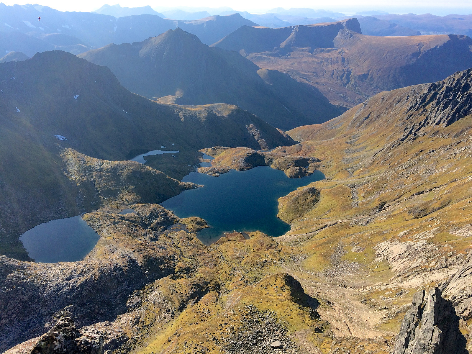
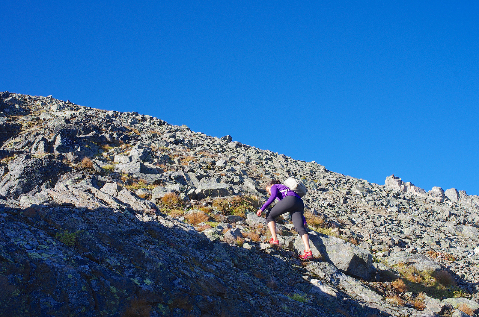
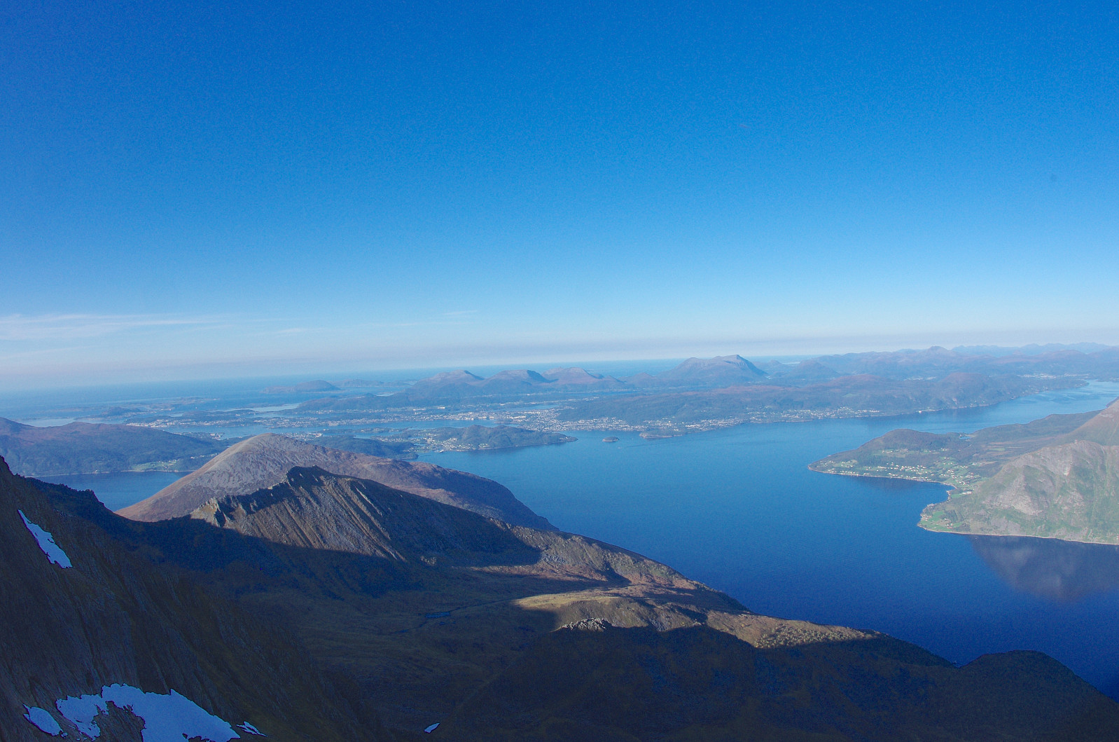
In the Sunnmøre shire in western Norway, there is a beautiful and somewhat secret valley called Molladalen. The valley is hidden between hight, steep mountains (Image #1), and in this respect reminds me of the valley Plain Awful in Carl Barks' story Lost in the Andes, in which Donald Duck and his nephews launch an expedition into the Andes mountains. Molladalen is, however, everything but awful, and it's not located quite as remotely as Barks' fictional valley. You may actually drive passed quite close to Molladalen without noticing it, and without knowing it is there. The valley is a hanging valley that to the west opens into the larger and deeper valley Barstaddalen, whereas the other sides of the valley (south, north and east) are surrounded by steep mountains with sharp peaks. Due to this special location, Molladalen gives access to a number of surrounding peaks and mountains, and it is therefore a camping site cherished by both hikers and climbers.
My daughter Vår vaarsolholm (Vår Solholm) and I drove this morning to the fjord Storfjorden, to a location called Sunde, from where we went by ferry across the fjord to the ferry quai called Festøy. From the other side of the fjord, we continued to Barstadvika, where we took a road to the left, and drove up Barstaddalen Valley to a place called Melbøsætra, located at 210 m.a.s.l. in the upper part of this valley. The bottom of Molladalen is located about 800 m.a.s.l., and to get there you have to climb the 600 altitude meters from Melbøsætra and up. Once you're up in Molladalen, you'll notice there's a beautiful lake up there, called Storevatnet [i.e. "The Big Lake"]. The surrounding vegetation is quite scarce, and mainly constituted of moss and heather; as the valley is located above the timberline that we have at this latitude. On this beautiful day, between 20 and 30 tents had been erected in the valley, by mountaineers that were there for the weekend. Most tents were located quite close to the waterside, making it easy to fetch water for preparation of food and beverages. The number of tents at the location will vary considerably with the current weather, and with whether people are having a day off or not. I've heard people tell me they have at some occasions counted as many as 100 tents in the valley.
We walked past the tents, then past the lake, and then started climbing up toward a chute called Mohn's Chute. The track in the chute was easy to follow, but the chute got steadily steeper, and there were a lot of loose stones along the track. We met quite a number of people that were heading back down to their camp site in Molladalen, as we were heading upwards. Spending the night tenting in Molladalen, they had been able to start trekking and climbing much earlier in the morning than we had been able to do. What stroke me, was that every single one of them was wearing a climber's helmet. Some of them were even carrying a climber's rope with them. I didn't feel bad about not having a rope with me, as I figured these people were probably climbing much steeper peaks than we intended to do; but realizing that stones were falling down the mountain side every now and then, I really did feel bad about not bringing one helmet for my daughter, and one for myself.
![#6: On Årsnesbreen Glacier, heading towards Rander's Peak. The very narrow peak far back in the left of the image, called "Bladet" [i.e. "The Blade"], is cherished by climbers.](https://images1.peakbook.org/images/14939/Solan_20191227_5e054cb65e2c6.jpg?p=xtralarge)

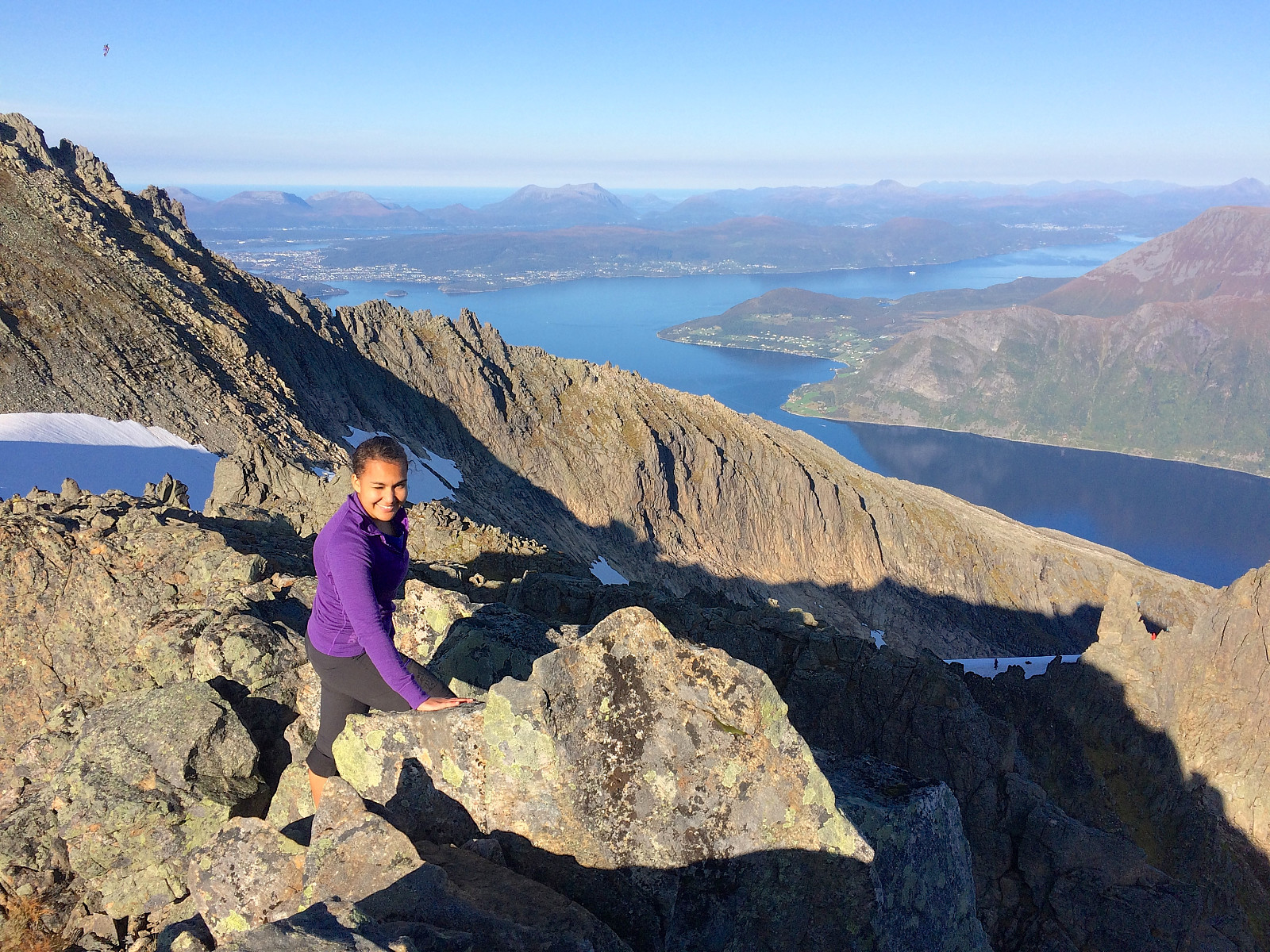
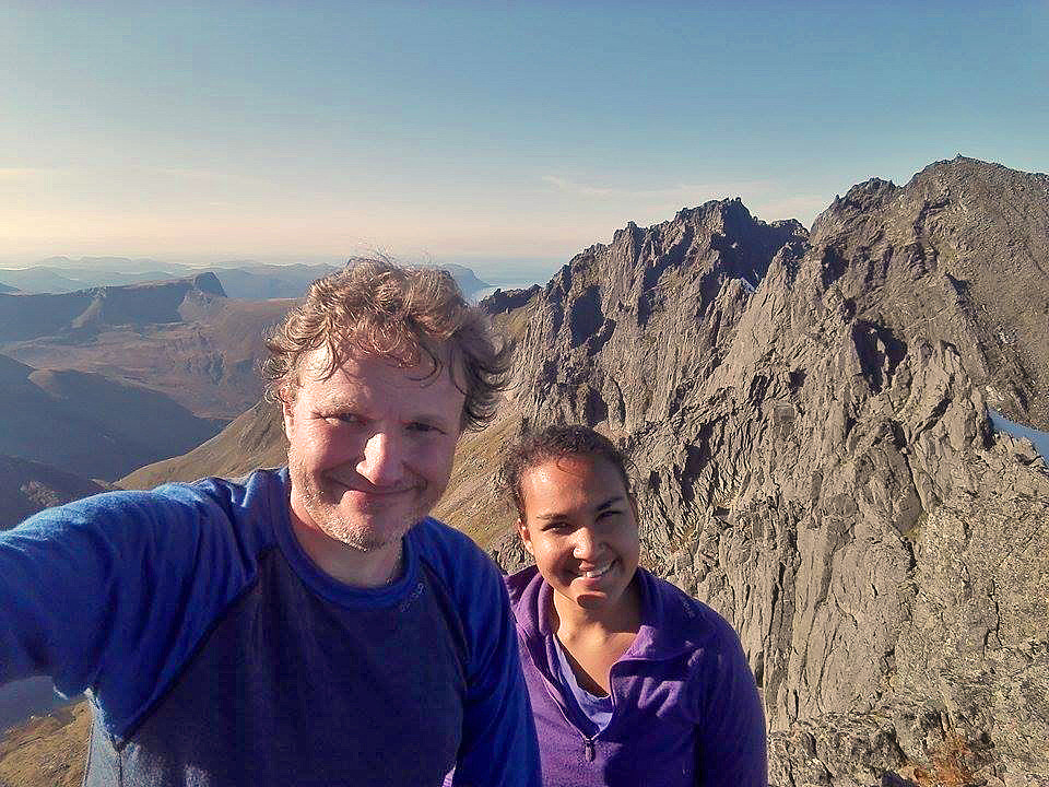
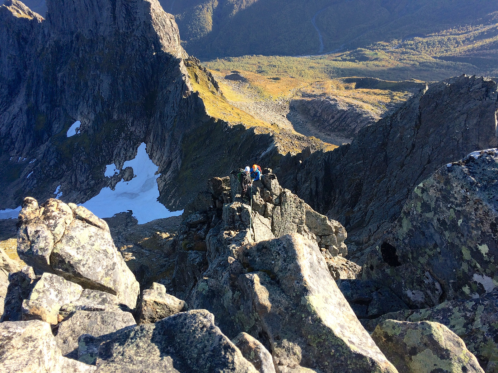
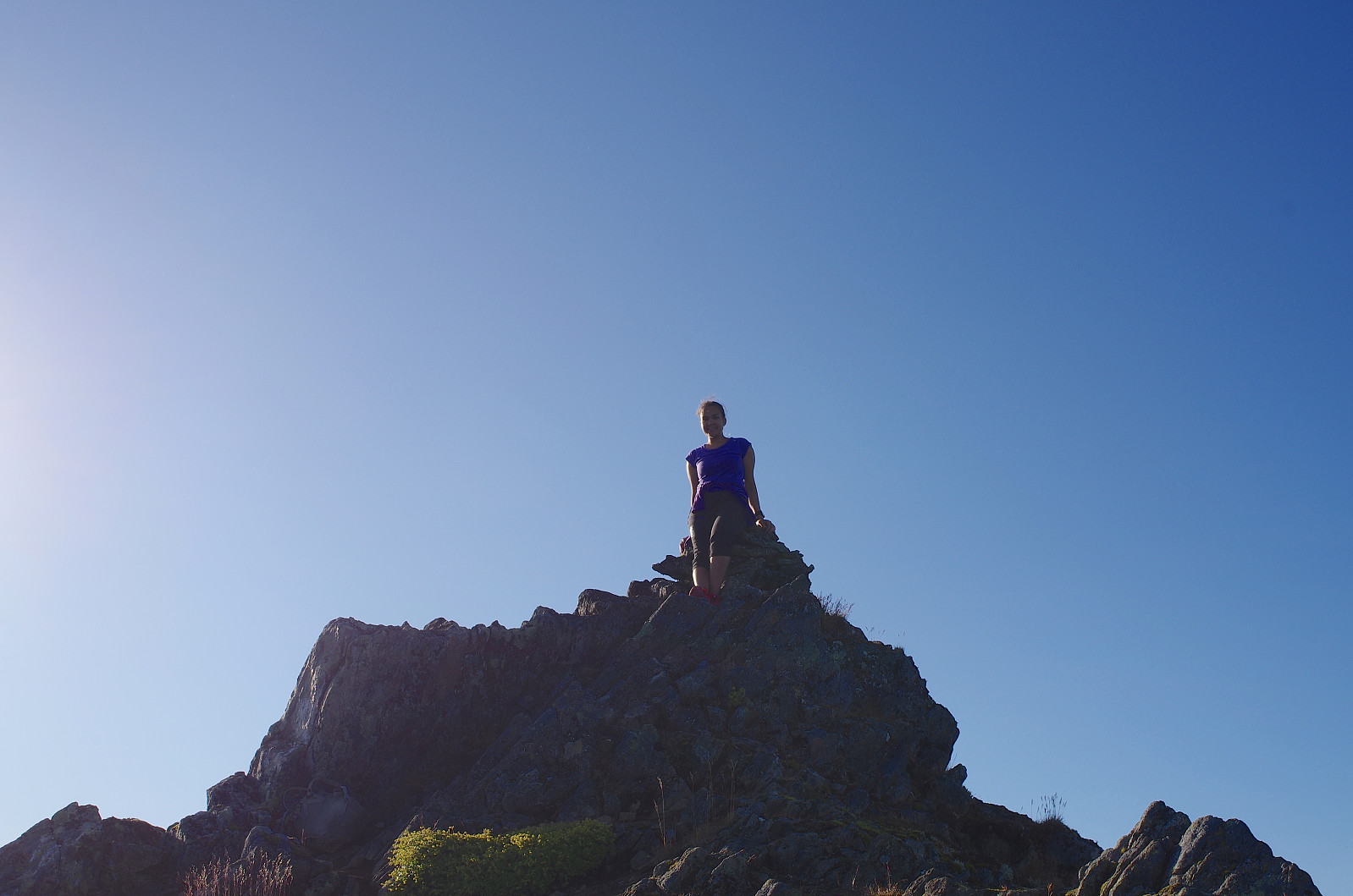
We were quite exhausted as we arrived at the top of Mohn's Chute, so we sat down and had our lunch, as well as some chocolate, before we continued. One local climber that we spoke with while eating, warned us against continuing to Rander's Peak, unless we had with us crampons for the crossing of the glacier. "In order to climb Rander's Peak from here", he explained, "you have to cross the Årsnesbreen Glacier, and now that it is already passed midday, the top layer of the glacier, which have partly been thawing during the morning hours, will tend to freeze again, hence if you slip while crossing the glacier, you may actually end up sliding all the way down along the extent of the glacier, and end up being killed when you hit the stones at the bottom end of it." Having received this advice, we decided to climb Mohn's Peak, which was rather close, instead. The edge leading up to Mohn's Peak was very narrow, however, and the mountainside extremely steep on both side, hence a misguided step could make you fall several hundred meters (Image #3). We left our backpacks before embarking on the edge, thinking the chance of falling down would be a little bit less if we avoided carrying anything heavy. Little by little we made our way up to the summit of Mohn's Peak (Image #4). While up there, we suddenly heard a number of voices below us, and when I looked down over the edge of the summit, there was a group of three climbers, that was attempting to climb Mohn's Peak up the rather steep southern face of the mountain (Image #5).
We climbed back down from Mohn's peak to where we had left our backpacks. By now the chocolate and the lunch that we had eaten had made us feel less exhausted, and so I started realizing that the advice about not crossing the Årsnesbreen Glacier probably was a little bit exaggerated. "A lot of people have crossed this upper edge of the glacier today," I said to my daughter, "so there must be a path or trail of footprints in the glacier, which we may follow across it without any risk of sliding down the glacier, even if it has started freezing again." We decided at least to go over to the glacier and have a look for ourselves. On our way down to the glacier, we passed not far from a narrow pinnacle called Bladet [i.e. "The Blade"]. Around 20 men and women were standing around this pinnacle, and seemed to be climbing it one at a time, and then rappelling down before the next one in the line was allowed to climb. This pinnacle is very much cherished by local climbers, I have later learned. Me and my daughter regarded ourselves more as hikers than as climbers, however, and none of us actually had any experience in climbing with ropes etc. back then, so we just continued towards the glacier and towards Rander's Peak.
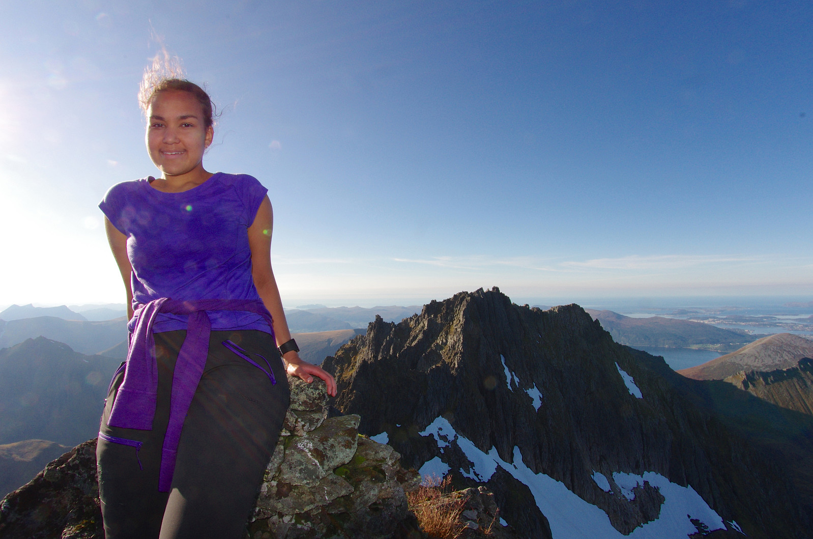
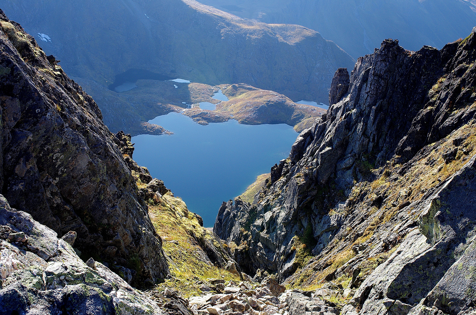
There actually was a track of deep footprints across the glacier as I had suspected, and our crossing of the glacier was quite uneventful (Image #6). We then climbed the remaining 120 elevation meters or so, from the glacier up to the summit of Rander's Peak; and while doing that, the view became more and more impressive. During this climb we encountered another chute leading down to Molladalen on the left side (Image #9). Back at home after our trek, I checked it out on maps and tour descriptions, and it turns out this chute, which is called Kruttårn-renna [i.e. "The Gunpowder-Tower Chute", from a nearby pinnacle called "The Gunpowder-Tower" for some reason], is an alternative way from Molladalen to Rander's Peak. I did notice that the trail did split in two in the lower part of Mohn's Chute. Had I been aware of it in advance, we could have taken the left trail at this point, thus bypassing Årsnesbreen Glacier on our way up to Rander's Peak. On the other hand, if we had done that, we would of course have missed Mohn's Peak, witch was definitely also worth a visit. At the summit of Rander's Peak we could se not the full length, but still very much of the length of the beautiful fjord Hjørungfjorden, which is a side arm of the fjord Storfjorden; and to the west we could se all the way to the Atlantic Ocean, with the many islands along the coast of Norway (Image #11, #12 & #13). For our climb back down to our car, we used pretty much the same track as we had used for the climb, i.e. we went down to the glacier, then crossed the glacier along the same route as before, next climbed down Mohn's Chute, and then followed the path through Molladalen Valley and down to Melbøsætra in Barstaddalen Valley.


Kommentarer