
Veten and Varden on Eldsfjellet (10.11.2019)

Written by HHauser (Helwig Hauser)

| Start point | Skjelangervegen (20m) |
|---|---|
| Endpoint | Skjelangervegen (20m) |
| Characteristic | Hike |
| Duration | 3h 00min |
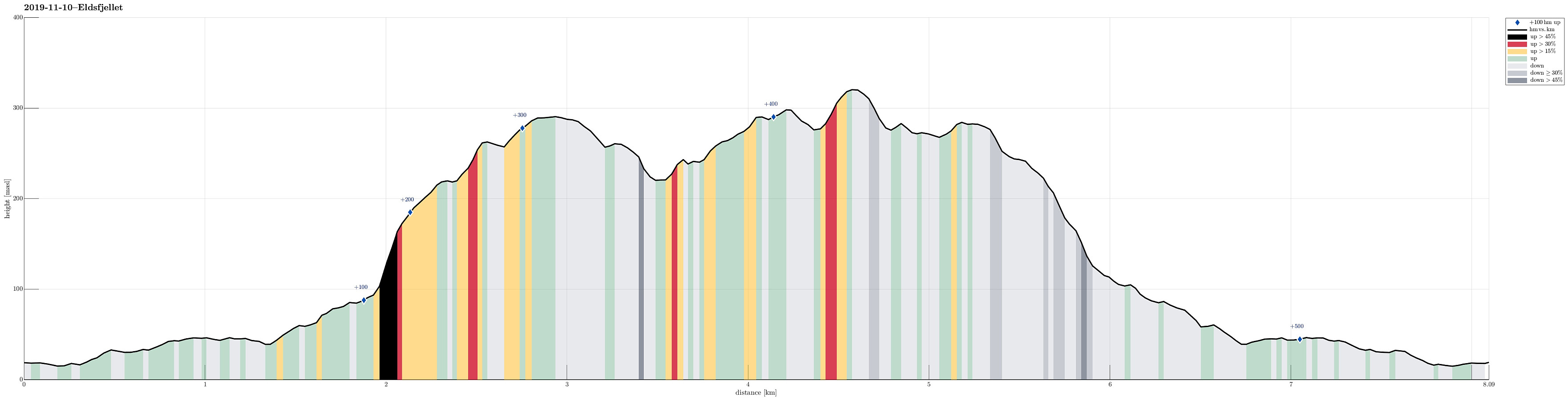
| Distance | 8.1km |
| Vertical meters | 514m |
| GPS |
|
| Ascents | Eldsfjellet (324m) | 10.11.2019 |
|---|---|---|
| Eldsfjellveten (294m) | 10.11.2019 |
Trip Summary
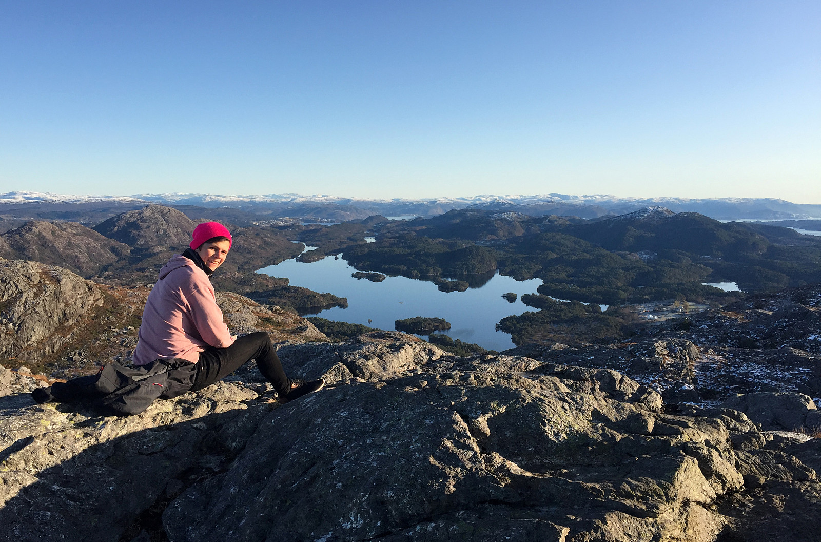
Starting from Bergen, we drove northwards, first, crossing over Nordhordlandsbrua on road E39. On the other side, instead of further following the main road, we turned left and onto road 564 that extends in northwestern direction on the southwestern side of Holsnøy. Eldsfjellet is found quite far in the northwest of Holsnøy and we aimed at parking near Skurtveit, only a bit after coming through Vikebø at Rosslandspollen. Close to Svehaugane, just a few meters up from the sea at Rosslandsvegen, we found a parking opportunity near a place, where apparently the bus also turns around. From there, we started our hike along Skurtveitvegen, first. We followed some minor roads to a point right in the south of Storatjørna from where a trail is starting in northern direction. Passing by Storatjørna on its western side, we hiked northwards, reaching a relatively steep part that leads up to Trippesteintjørna. At this little lake, we continued towards Veten in northwestern direction. After a short stay at Veten, enjoying some very nice views in all directions, we followed another trail down, passing by Trippesteintjørna again (now in its north). From there, we followed a trail in eastern direction, which brought us to Varden, i.e., the other main top of Eldsfjellet. Also there, one has very nice views in many directions (Eldsfjellet is standing quite separated from its surrounding, offering lots of nice views). From Varden, we then started our hike back, following a trail, which passes by Midtvarden in the southeast of it. Once the trail ascends a little onto another hill in the south of Midtvarden, it becomes hard to find (and we in fact lost it there). Without any trail, we followed our intuition of expecting a possibility for descending further in parallel to the major southern cliff of Ravnefjellet. Even though the terrain is a slightly bit challenging there, one can still find a reasonable connection (north of Storatjørna) back to the trail that we had taken up to Veten there earlier. Back on the trail, we then simply followed it back to Jonsokkhøyen and from there back to the car along Skurtveitvegen. All in all, we enjoyed a very nice winter day and some really nice views from the top(s) of Eldsfjellet!
Photos
Selected photos are available as Google photo album.
Useful Resources
See also the related FB-page Hiking around Bergen, Norway.
Petter Bjørstad has a useful page about Eldsfjellet and also web page WestCoastPeaks.com provides useful information about Eldsfjellet and Veten.
Web page UT.no from the Norwegian Trekking Association recommends a similar hike.


User comments