
Lyderhorn from Lyderhornsveien (03.11.2019)

Skrivet av HHauser (Helwig Hauser)

| Utgångspunkt | Lyderhornsveien (50m.ö.h.) |
|---|---|
| Slutpunkt | Lyderhornsveien (50m.ö.h.) |
| Turtyp | Fotvandring |
| Tidsåtgång | 2t 00min |
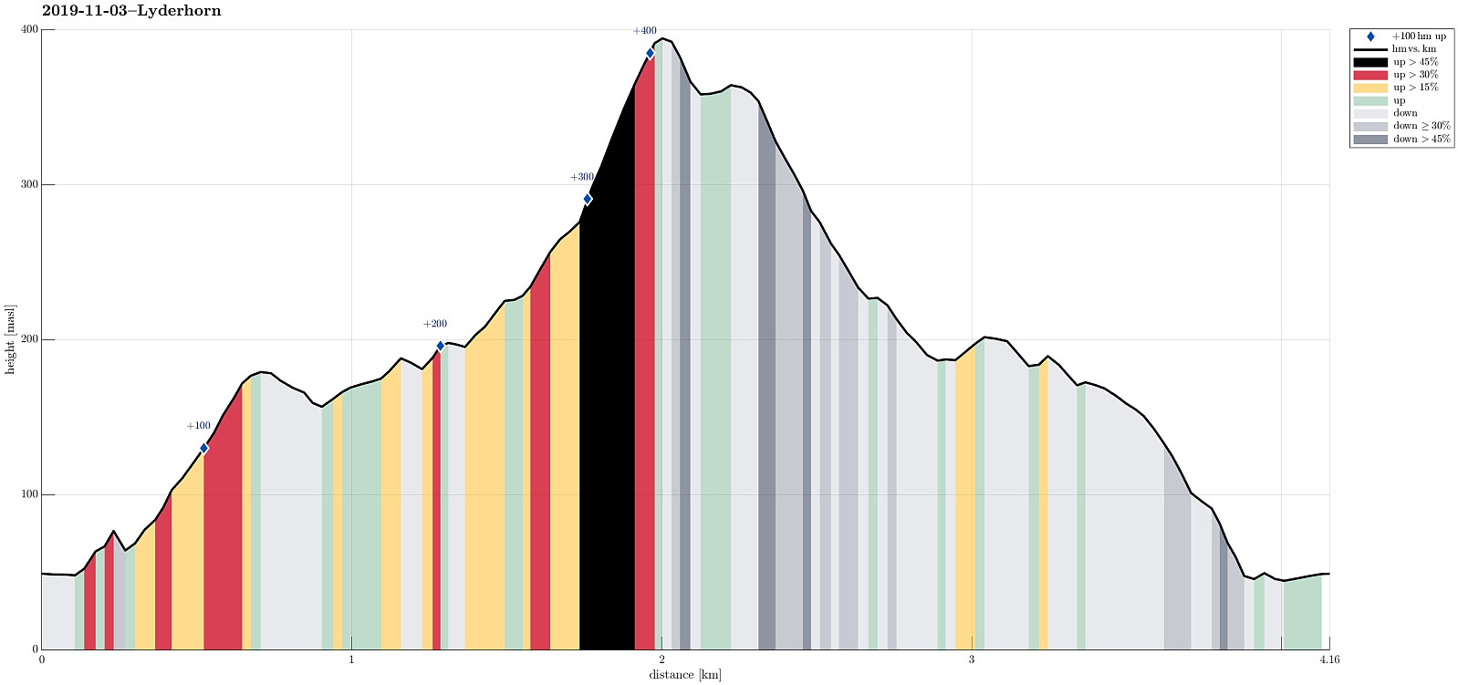
| Avstånd | 4,2km |
| Höjdmeter | 461m |
| GPS |
|
| Bestigningar | Lyderhorn (396m.ö.h.) | 03.11.2019 |
|---|---|---|
| Skarpafjellet (180m.ö.h.) | 03.11.2019 |
Trip Summary
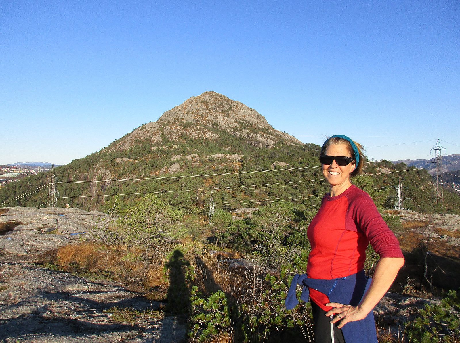
With a bit of time and a wonderful November Sunday, we headed for Lyderhorn to get some fresh air. In order to do at least a bit of new research, we decided to try a new ascent (via Skarpafjellet). We parked the car right next to Lyderhornsveien where also an animal clinic is found (near Lyderhornsveien 293). From there we had seen on the map that a trail should start and then lead diagonally upwards in southwestern direction (passing below some cliffs first), before one would be high enough to ascent further to Skarpafjellet (then in northern direction) without any major difficulties. When getting started, however, we got the impression that the owners of the property nearby the trail-head were clear in that they not wish anyone to actually use this trail. Not interested in having any controversy about this, we instead followed the road further upwards until the point, where it would continue into a tunnel. There we stepped into the forest and found an easy connection, parallel to the cliff, to the trail. Once on the trail, we easily made it to about 100mosl from where the continuation is straight-forward and non-trivial (even without any trail). Soon later, we stood on Skarpafjellet and appreciated the view towards Lyderhorn in the north. From there, we then continued on a trail that first leads down to the saddle north of Skarpafjellet (with Grøvledalen to the west), before then continuing further into the direction of Lyderhorn. Near Små-Lyderhorn, where also another major trail from Kjøkkelvik/Olderdalen comes up, we continued along the direct (and steep) ascent to Lyderhorn. The top of Lyderhorn, then, we shared with a number of other hikers, also enjoying this beautiful November day! To get back down, we decided to follow another trail (more to the southeast and directly to the south). We followed a little group of hikers, thinking that they would go down the same trail, until it became clear that they did not exactly know the direction. Having gone a little too much to the east (instead of south-east), we also were a little confused for a moment. Ending up on a little nose only about 30 height-meters below Lyderhorn (right east of it), we then understood that we needed to cross over (in southern direction) to get back on the trail that we had aimed for. Even though the terrain is quite steep there, this traverse was still well-doable and soon later we were back on track. Following down the trail was then straight-forward (even though we once again lost our trail for a few meters further down). A little later, we then arrived at the saddle north of Skarpafjellet, again, and took the trail towards the east (and steeply down) from there. All this was then easy with a good trail, bringing us down to one of the new roundabouts near the highway-crossing southeast of Lyderhorn. From there it was then only a few minutes back to the car. All in all, we could enjoy a lot of nice November sun on this hike! :-)
Photos
Selected photos are available as Google photo album.
Useful Resources
See also the related FB-page Hiking around Bergen, Norway.
Web page WestCoastPeaks.com provides useful information about Lyderhorn and Ørnafjellet
and also Petter Bjørstad has a page about Lyderhorn.
On Bergentopp 200 there is a page (in Norwegian) about Lyderhorn.


Kommentarer