
Skrott, Glynt and Geitafjellet (27.10.2019)

Skrevet av hbar (Harald Barsnes)

| Startsted | Fitjadalen (275moh) |
|---|---|
| Sluttsted | Fitjadalen (275moh) |
| Turtype | Fjelltur |
| Turlengde | 6t 49min |
| Distanse | 15,4km |
| Høydemeter | 1323m |
| GPS |
|
| Bestigninger | Geitafjellet (1257moh) | 27.10.2019 |
|---|---|---|
| Glynt (1253moh) | 27.10.2019 | |
| Skrott (1319moh) | 27.10.2019 | |
| Andre besøkte PBE'er | Breidablik (1163moh) | 27.10.2019 |
| Fitjadalen p-plass (273moh) | 27.10.2019 |
Skrott, Glynt and Geitafjellet
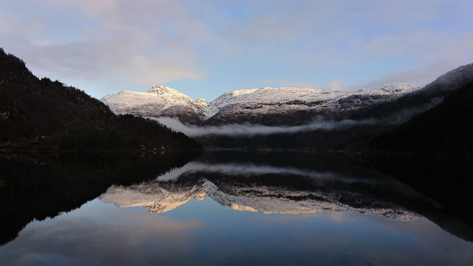
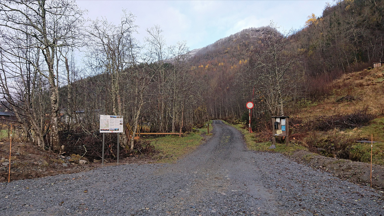
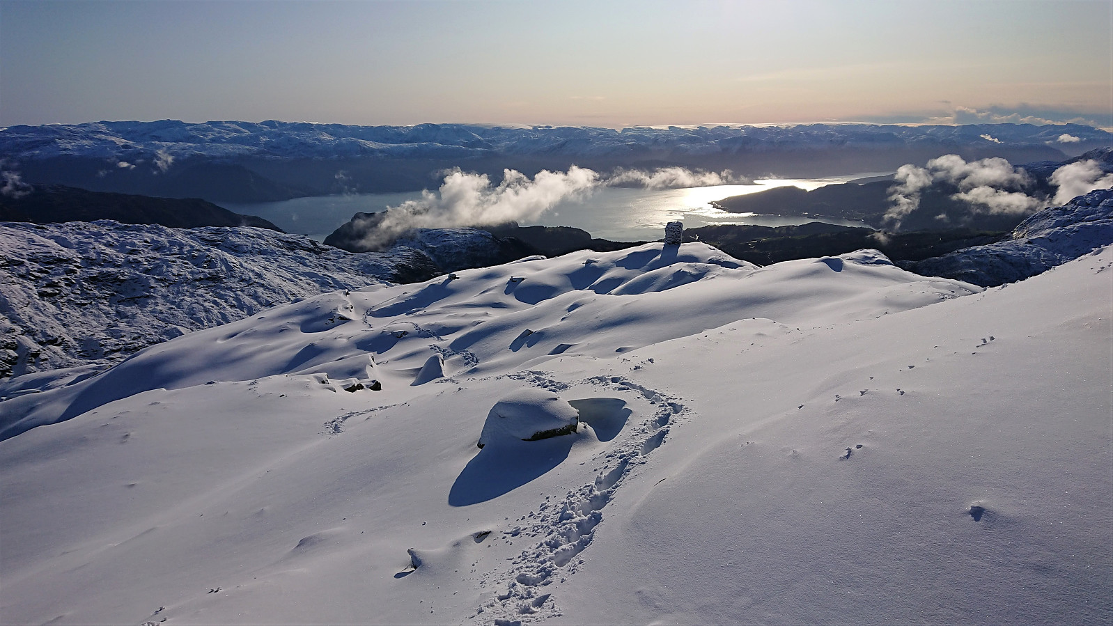


On what would turn out to be a perfect late October day for hiking, me and Endre (Fjellsamleren (Endre Myrdal Olsen)) drove early from Bergen to Fitjadalen, were we started our ascent from the parking lot just after nine, following the marked trail. At about 600 meters we came across the first real snow, and from there on the amount continued to increase the further up we got.
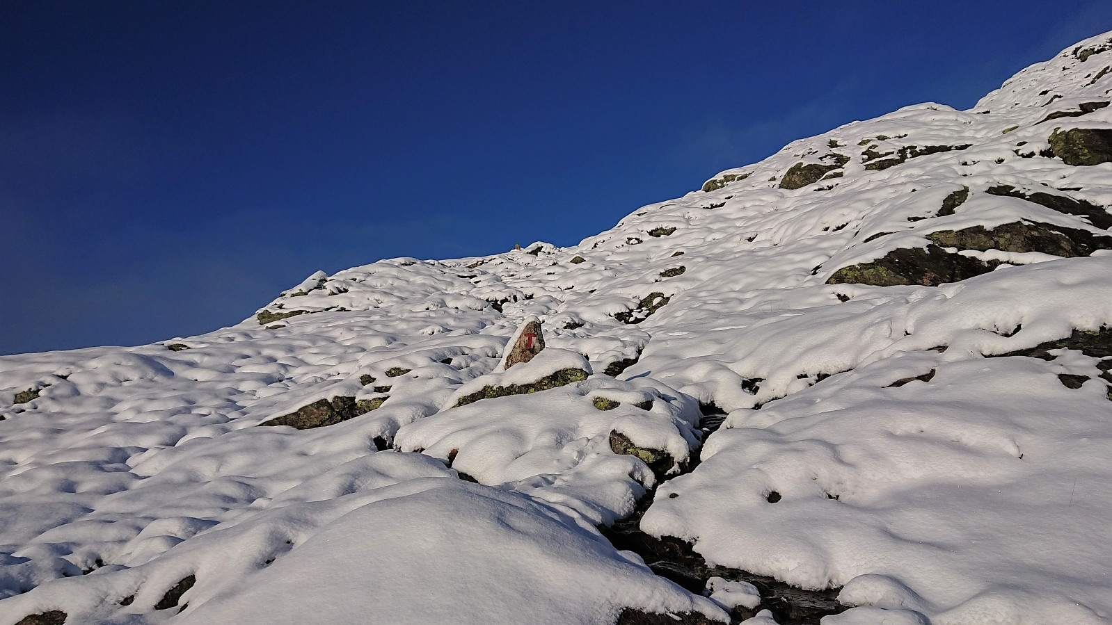
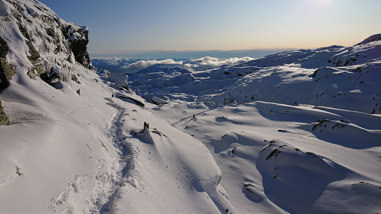
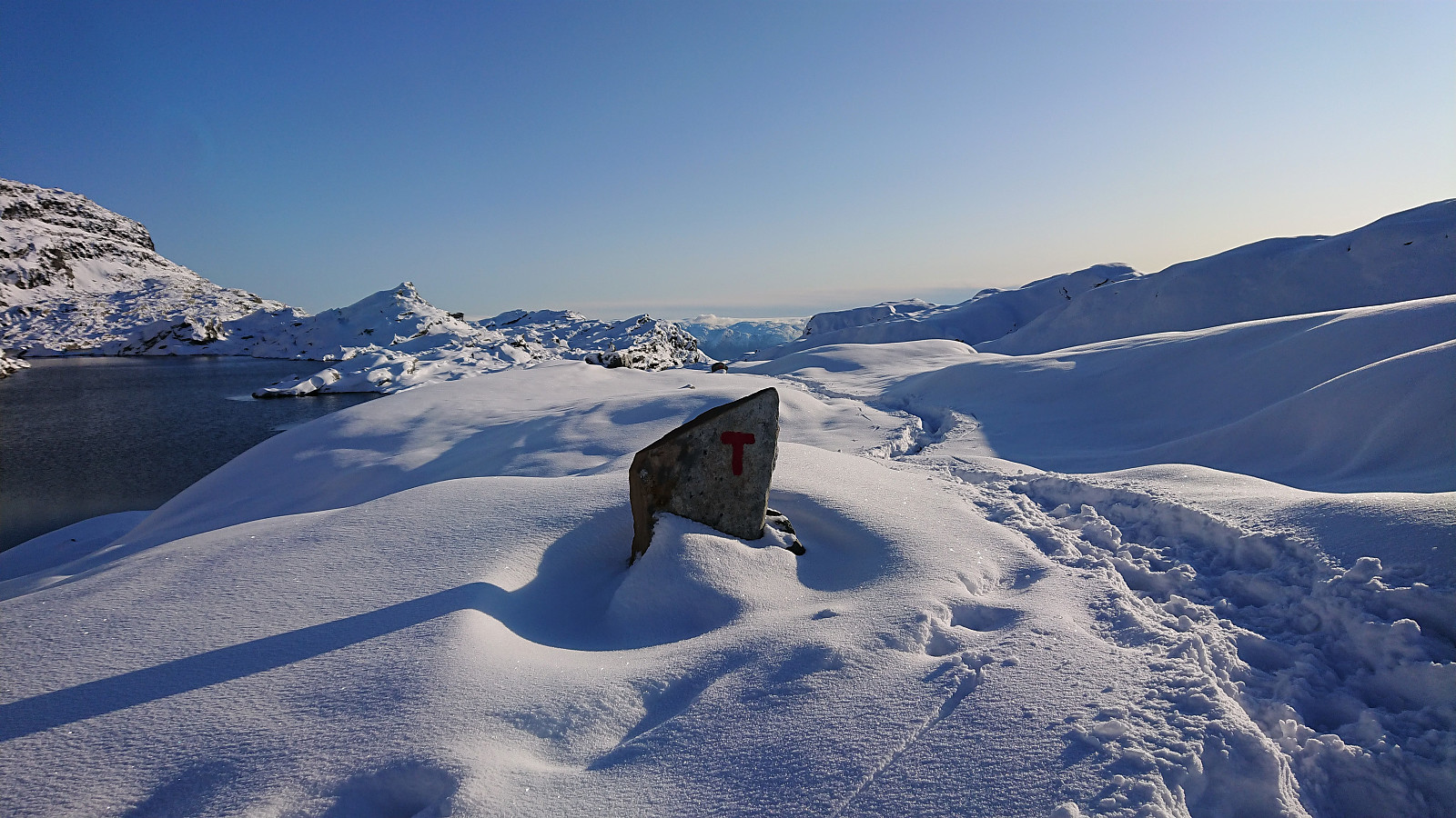
There were some partially hidden footprints in the snow, most likely from the day before, but we were the first hikers this morning, and thus had to make our own path (following the red T’s) up the mountainside. The progress was therefore slower than expected, as we kept sinking deeper and deeper into the snow.
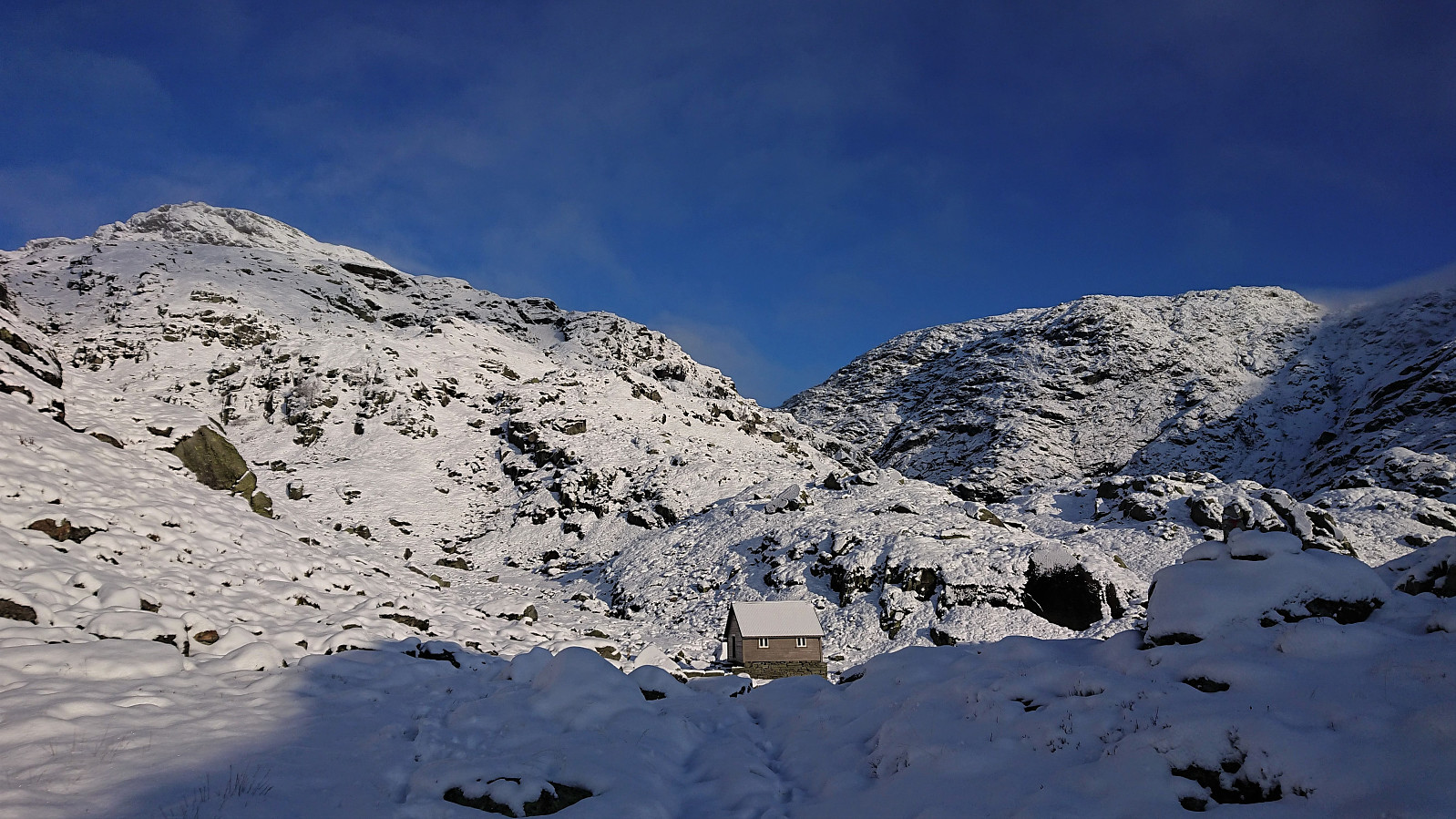
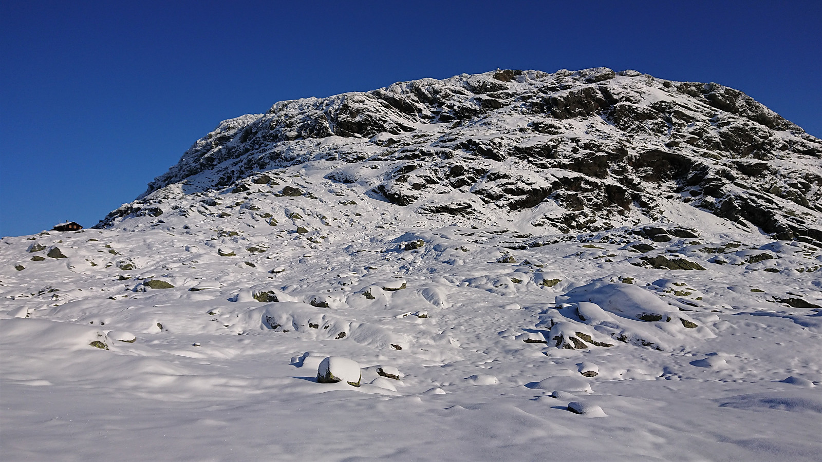
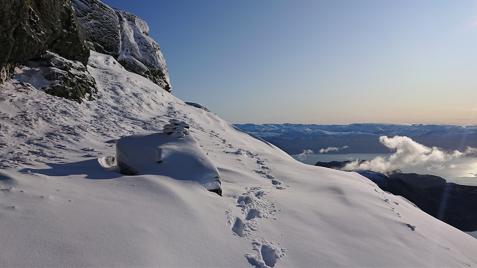
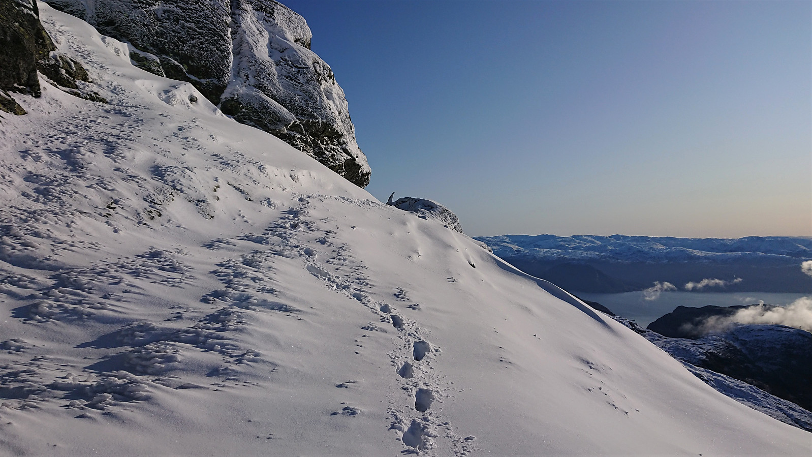
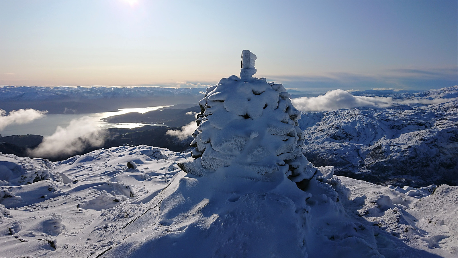
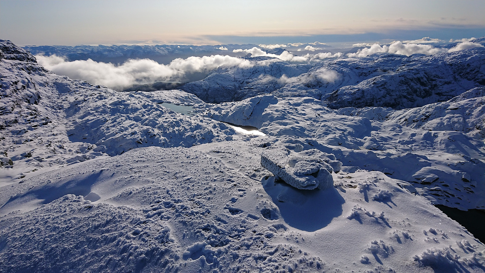
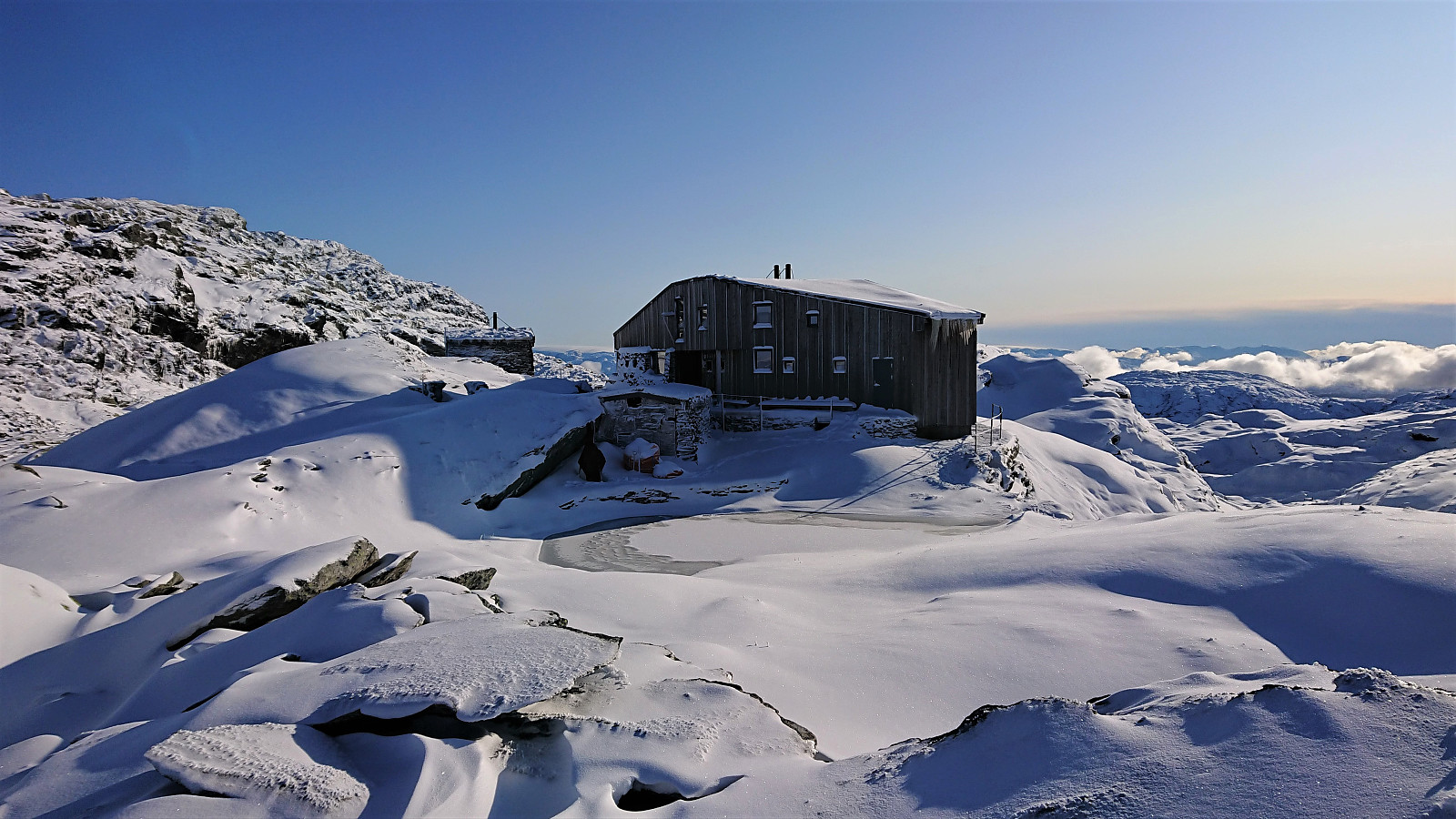
At the cabin southwest of Skrott we left the main trail to Breidablik and instead followed the cairns towards the summit. Here there were no footprints at all, but it was still relatively easy to spot the cairns showing the way. Note that the last stretch before the trail turns north, follows a relatively narrow ledge with a steep descent to the south. One should therefore take special care if traversing this route in more difficult conditions.
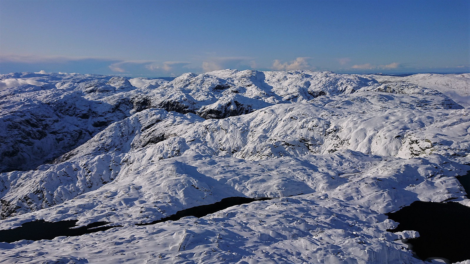
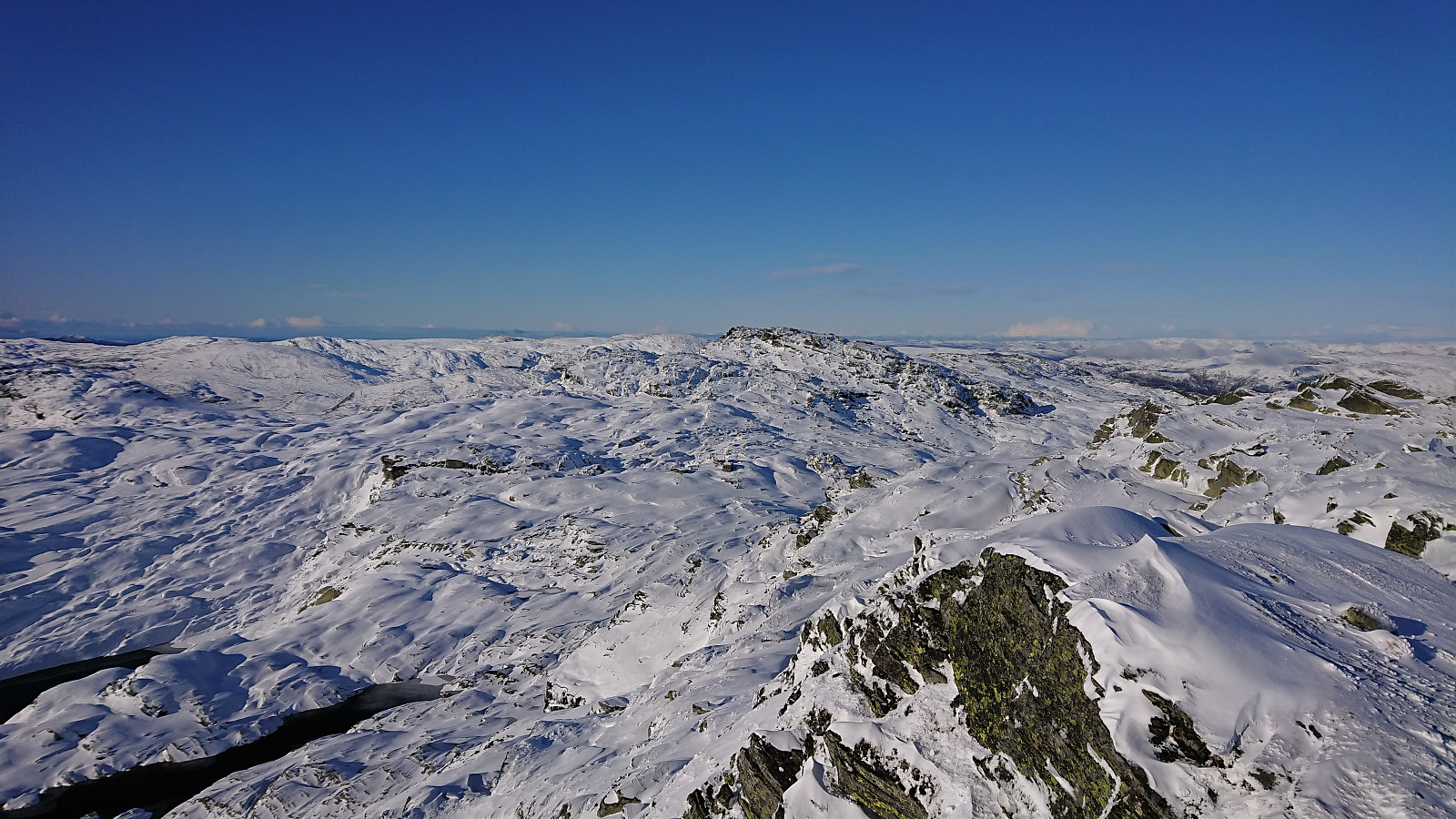
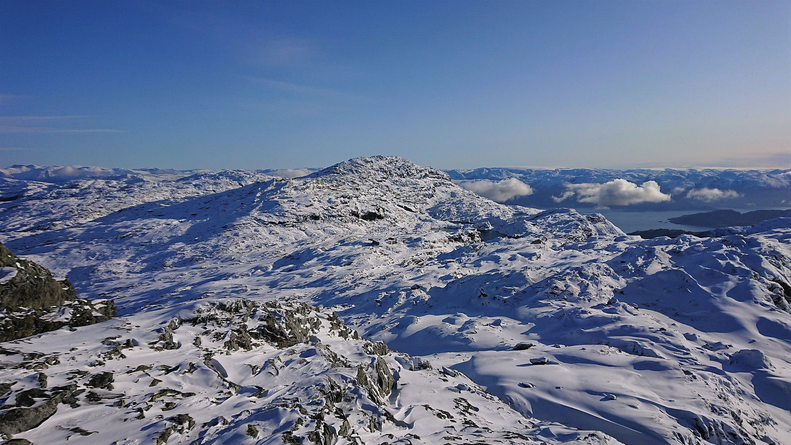
From there on, reaching the summit was straightforward. Excellent panoramic views from the summit. Clearly worth the long climb. We had originally planned to also visit Manfjellet, but after inspecting the terrain in that direction, and considering the deep snow, it quickly became apparent that this would take significantly more time and effort than we had thought. We therefore discarded this option and instead continued north along the ridge.
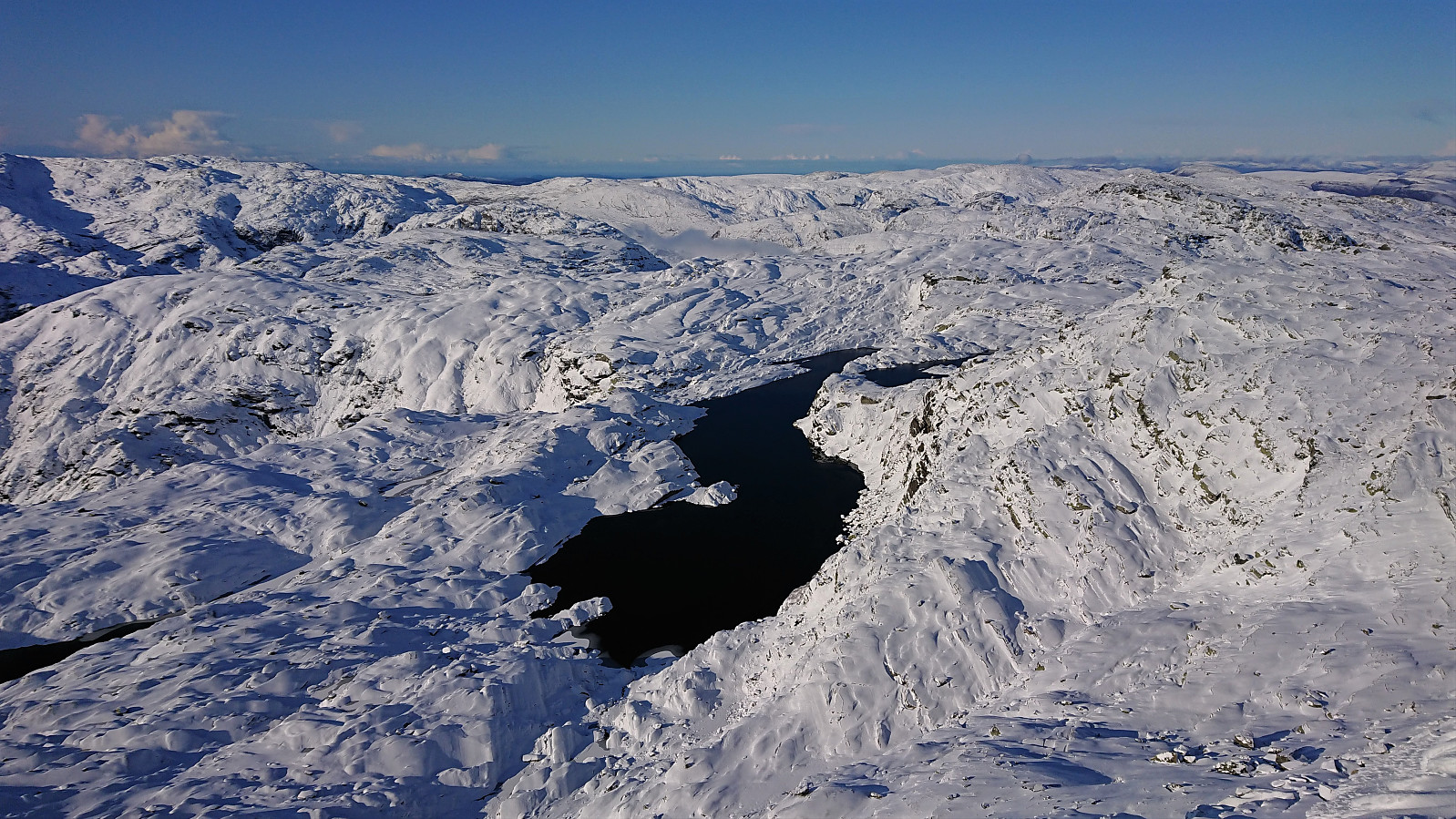
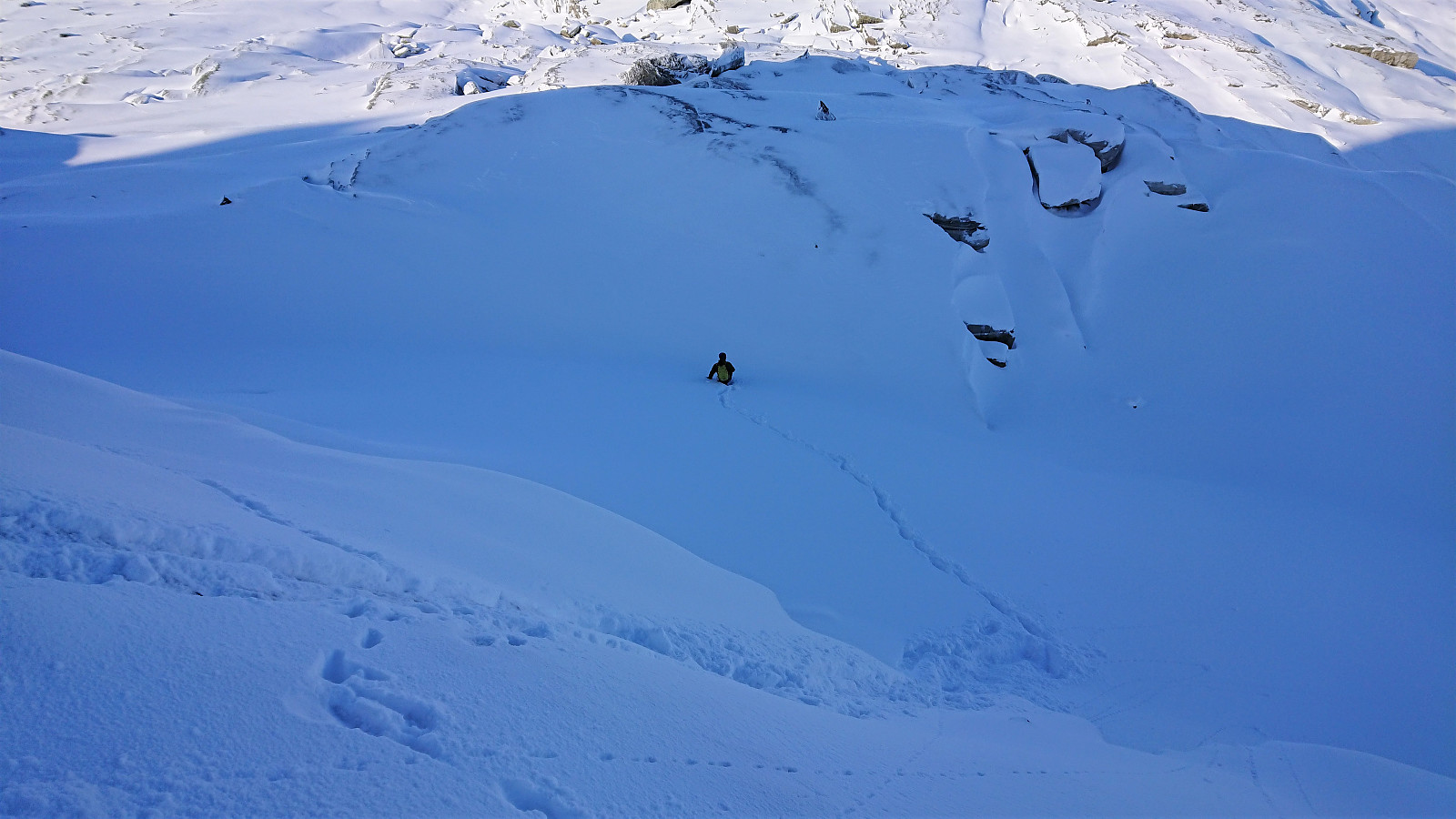
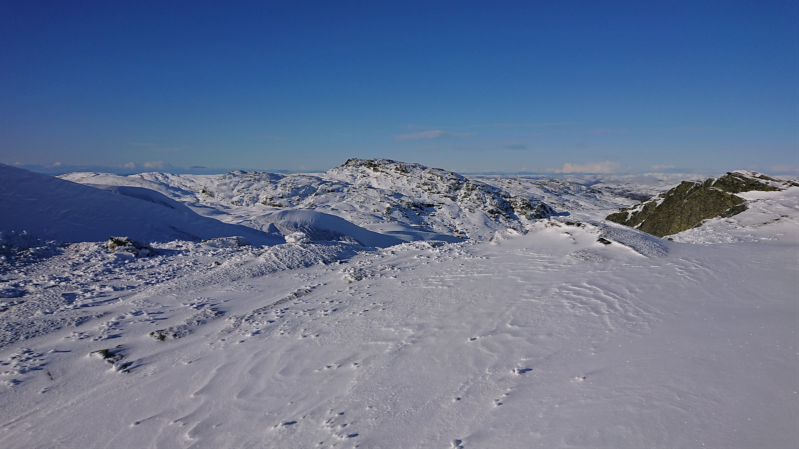
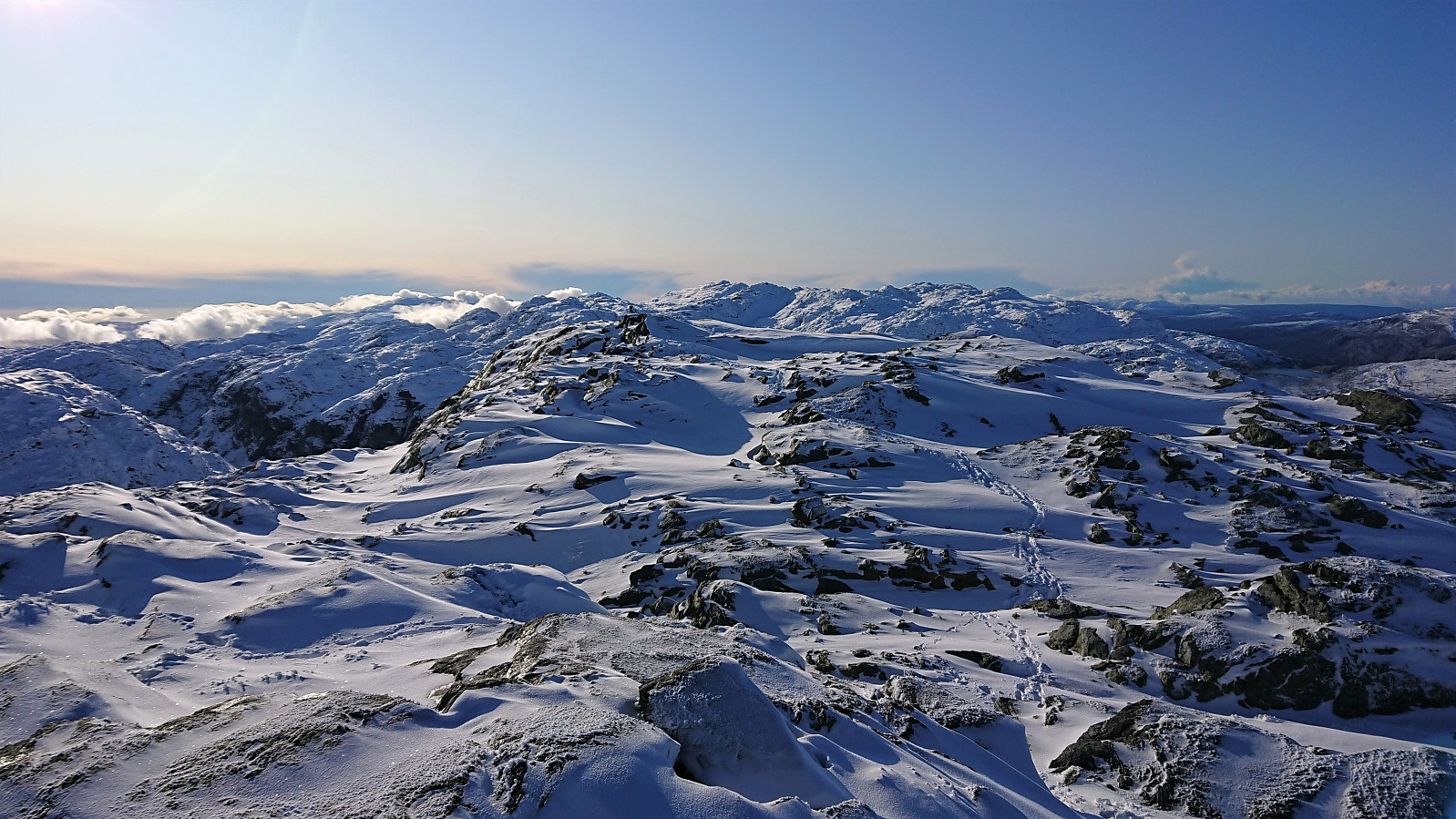
There is supposed to be a trail along the ridge, but apart from the occasional cairn sticking out of the snow, we did not see much trace of it. The direction was rather obvious anyway, and the deep snow provided us with a much easier descent into the valley between Skrott and Glynt, as we could simply slide down areas that would otherwise most likely have been too steep to hike.
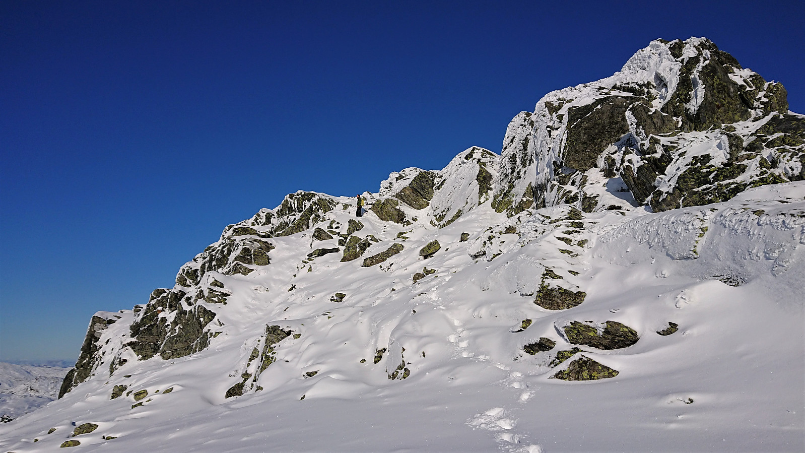
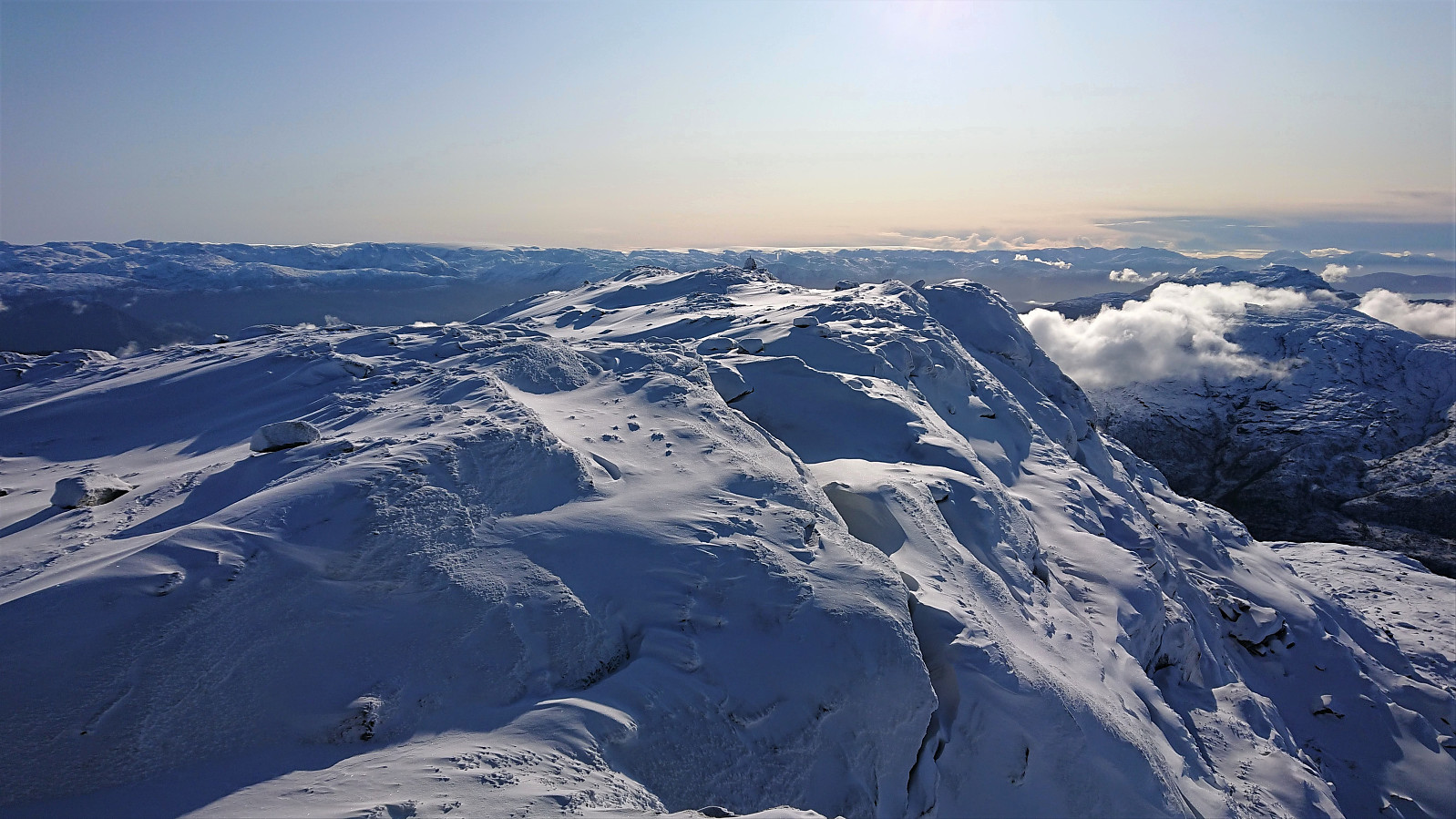
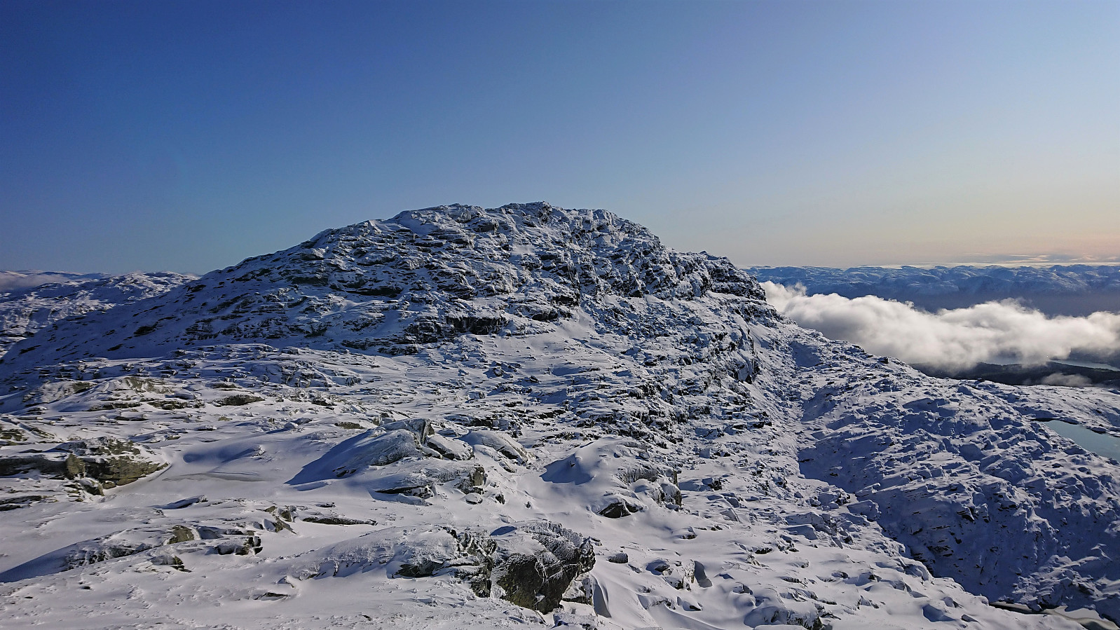
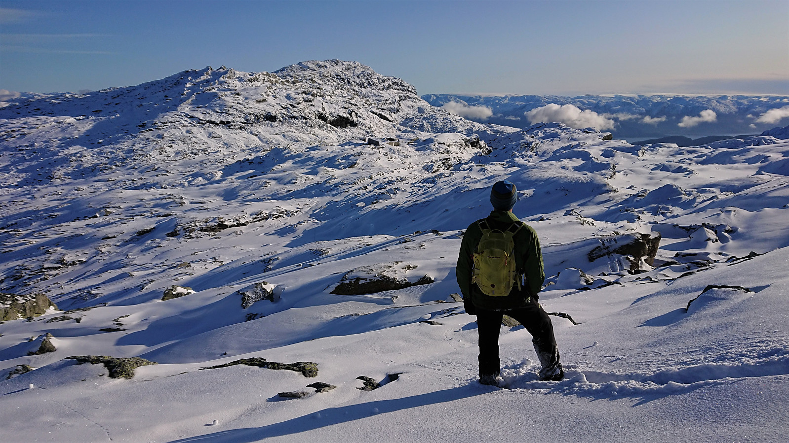
Next, we ascended to Glynt, for some excellent views towards both Breidablik and our next goal of Geitafjellet. The trail was still hidden under the snow, but given the odd cairn we were able to follow it pretty closely anyway. No trails or cairns to Geitafjellet itself, but with just a little bit of light climbing we managed to reach the summit without any difficulties, visiting two potential summits, given that it is not really clear which of the two is higher.
Our initial plan had been to continue west and descend via Honskursdalen, with the goal of also including a visit of Kjetilsnuten. But given that the hike had already taken a lot longer than expected, and being much tougher due to the deep snow, we decided to instead return via the main trail passing by Breidablik and leave Kjetilsnuten for a future hike.
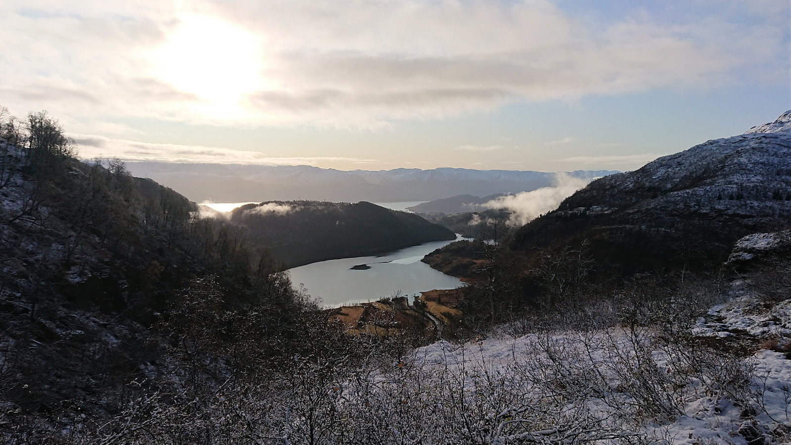
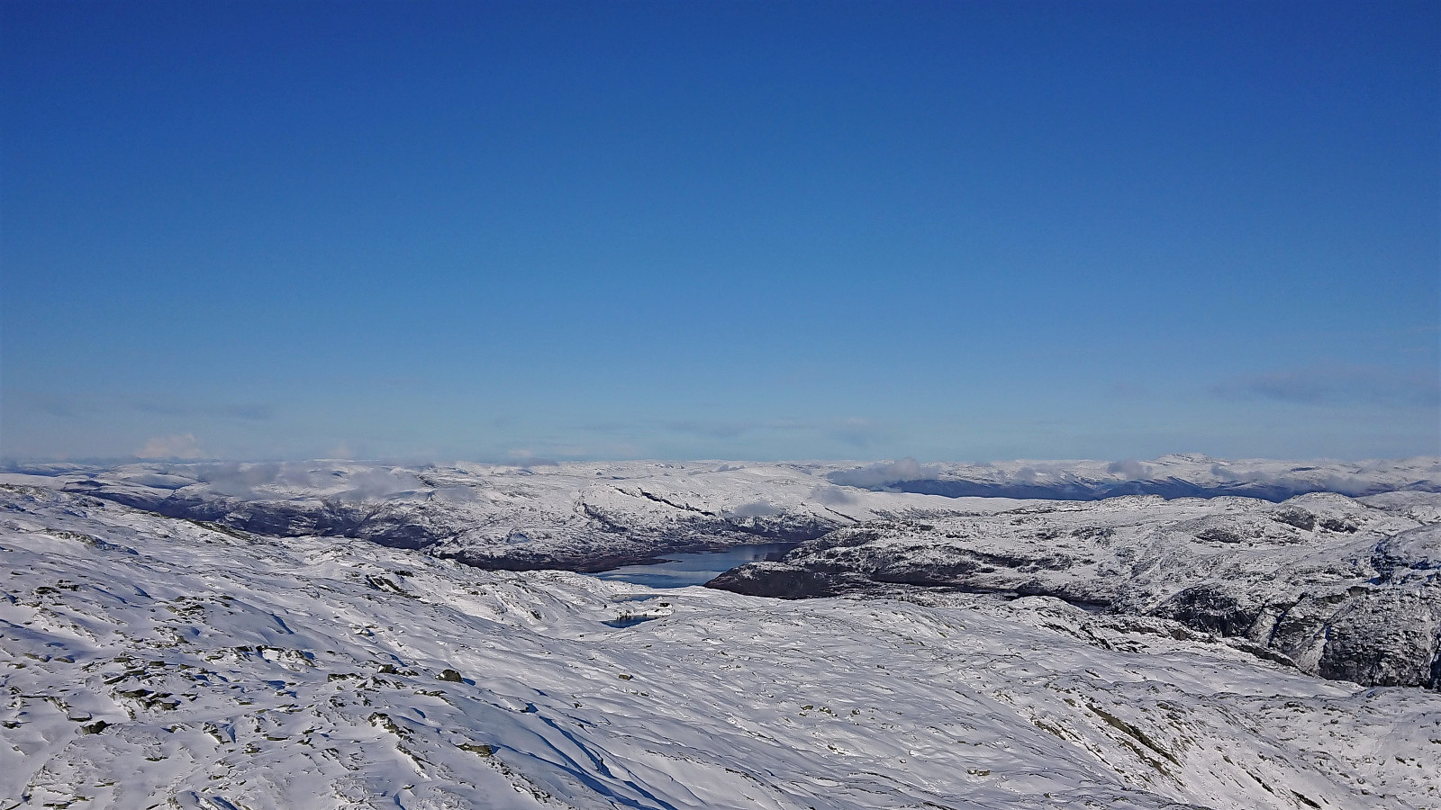
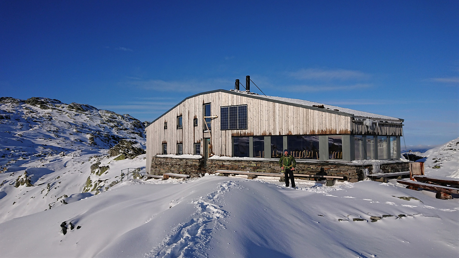
The benches in front of Breidablik provided an excellent location for our lunch break, with the thermometer indicating +18 degrees (with next to no wind) in the sun, compared to the -2 degrees in the shade behind the cabin. Overall it felt and looked a lot more like a late Easter holiday than the end of October.
Upon leaving Breidablik we followed the very nicely marked trail back down to Fitjadalsvatnet. And for the first time of the day we did not have to create our own path in the snow, as Breidablik had clearly been visited by several other hikers while we made our trip across Skrott. The progress was therefore quite good, getting even better as the trail finally started descending more rapidly after passing the cabin southwest of Skrott. But the further down we got, the muddier the trail also became. We actually started missing the deep snow we had been struggling with for most of the day.
In summary, an excellent hike in perfect conditions and with spectacular views along the way. And while the snow clearly made the hike much tougher than it would otherwise have been, it also greatly contributed to making it into an unforgettable experience. Highly recommended!


| Starttidspunkt | 27.10.2019 09:13 (UTC+01:00) |
| Sluttidspunkt | 27.10.2019 16:02 (UTC+01:00) |
| Totaltid | 6t 49min |
| Bevegelsestid | 5t 19min |
| Pausetid | 1t 30min |
| Snittfart totalt | 2,3km/t |
| Snittfart bevegelsestid | 2,9km/t |
| Distanse | 15,4km |
| Høydemeter | 1323m |


Kommentarer