
Dent d'Hérens (20.07.2019)

Written by hmsv1 (Hannah Vickers)
| Start point | Rifugio Aosta (2,758m) |
|---|---|
| Characteristic | Alpine climbing |
| Duration | 8h 35min |
| Distance | 21.0km |
| Vertical meters | 2,974m |
| GPS |
|
| Ascents | Dent d'Hérens (4,171m) | 20.07.2019 |
|---|
After returning to Courmayeur from the Torino hut the plan was to stay somewhere in Italy for the night so we could head straight to the Dent d’Herens the following day. We’d initially planned to book some beds at the Prarayer refuge which is about 1 hour along the walk in to the Aosta refuge, but we instead opted to go all the way back to Evolene since most people were away at huts so the chalet would be empty and quiet!! It turned out to be a good choice, at least for me since I woke up the next day feeling very well rested and ready for the 3-hour drive back into Italy and up to the Lago di Place Moulin where the long walk in began. It was another warm and sunny day, in contrast to the clouds that meteoblue had forecasted, so I was somewhat dreading having to do a long walk up to the hut with a heavy rucksack under hot sunshine. It didn’t turned out to be that awful though.
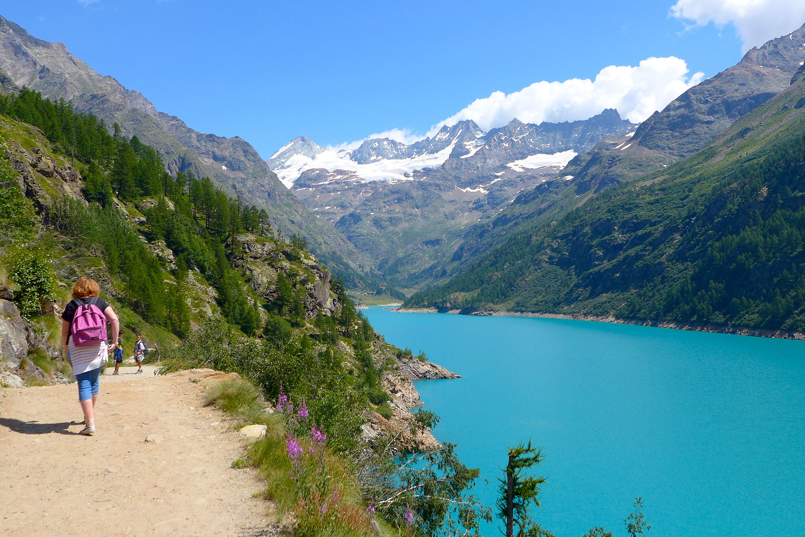
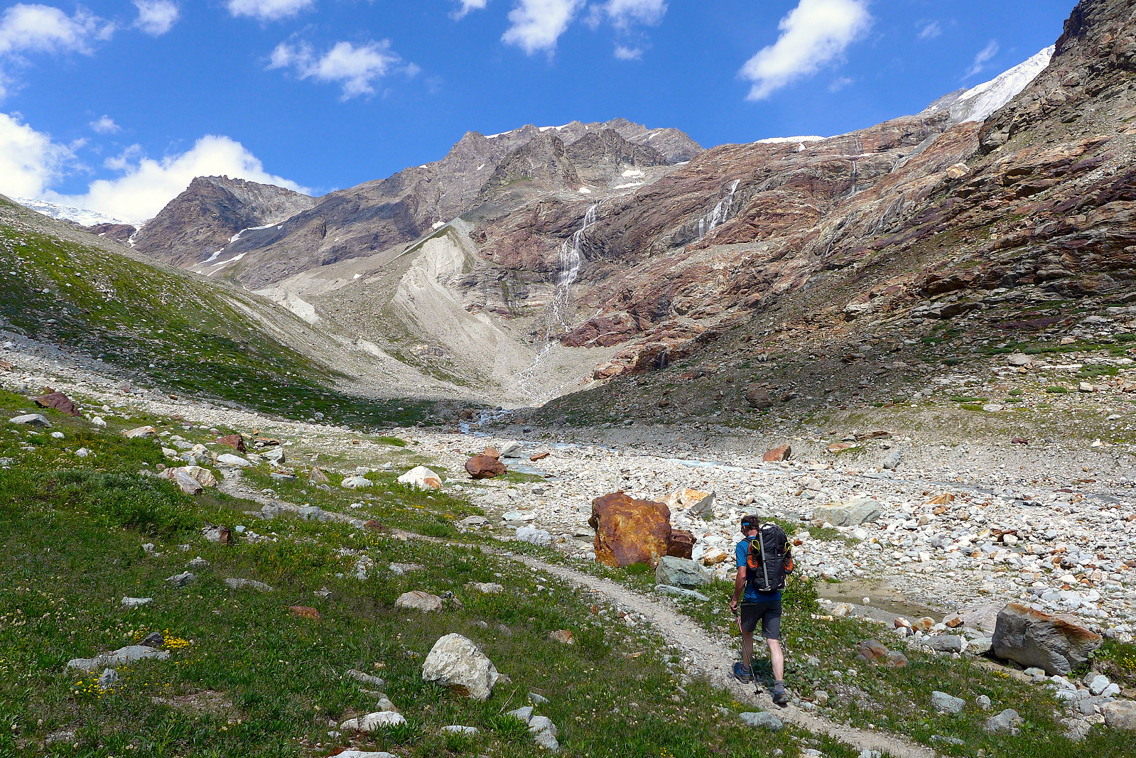
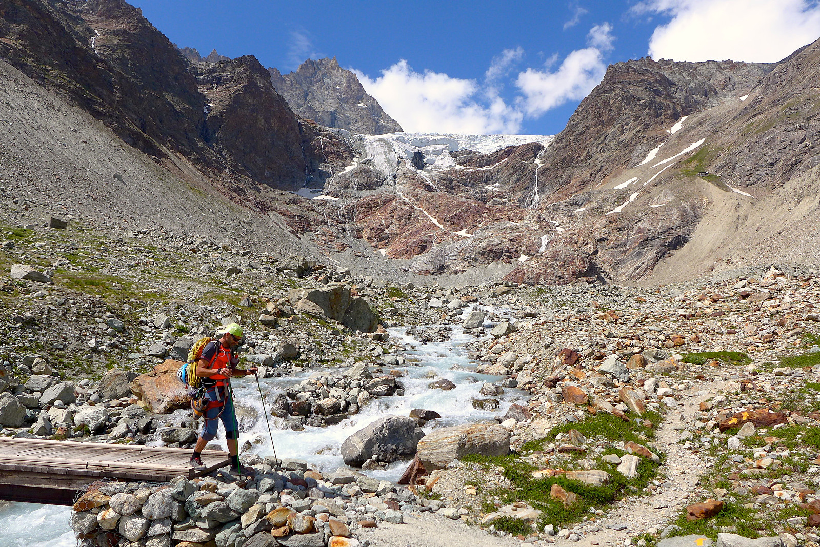
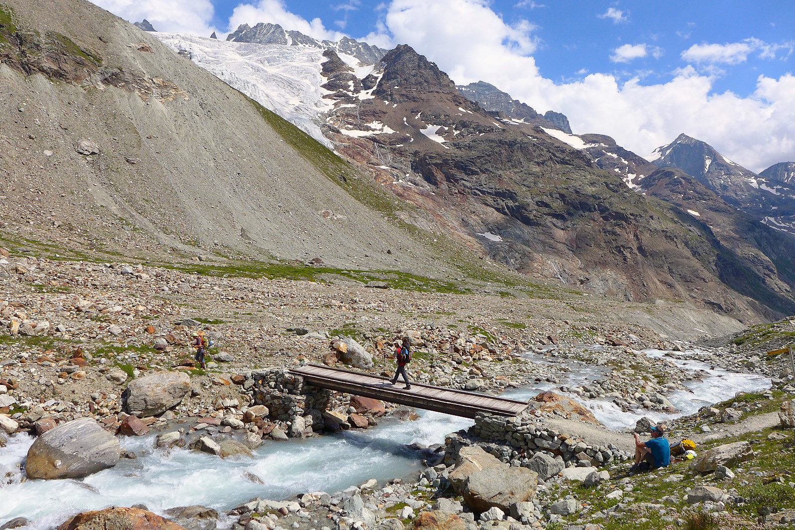
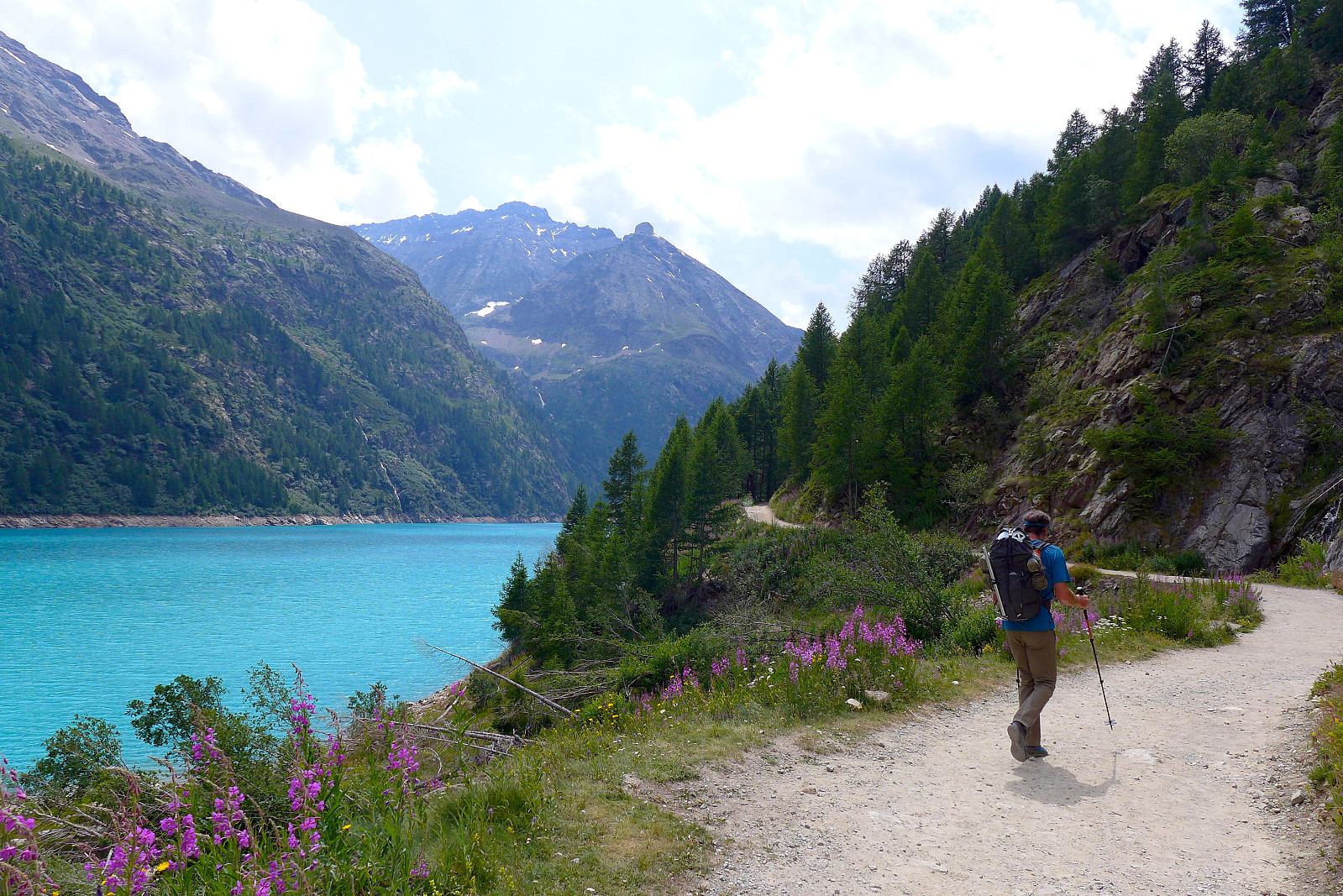
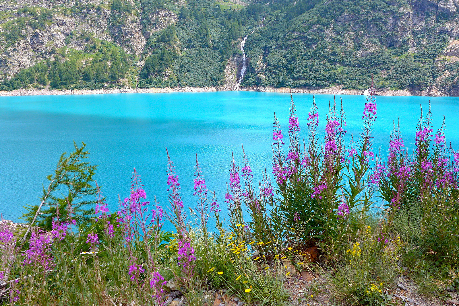
It was late morning when we began to walk, and despite the heat the stunning blue colour of the lake and purple flowers decorating its edge were a good distraction, as too were the mountains surrounding it. We walked pretty slowly as well which made the 4.5 hour walk up to the hut go by pretty easily – there wasn’t much rush to get up to there anyway. Several climbers had passed us on bikes which was clearly a good idea to get the first part of the trail done quickly. We took a stop at the Prarayer refuge for some cold drinks and snacks before continuing on and up the valley in a northeasterly direction. The path was well marked and easy to follow, maybe not quite as gently-angled as a well manufactured Swiss path but still good. Along the way we passed a huge tree with a trunk which was 1.5m in diameter and >500 years old, but I guess that may have been the only attraction on the walk in. The trail rose gently and followed the river for a lot of the way and we took a final break just before crossing the bridge and hiking up the last steeper section which went up a loose stony mountainside and across a moraine ridge to the hut which was situated in a cool location east of and below the Tsa de Tsan glacier.
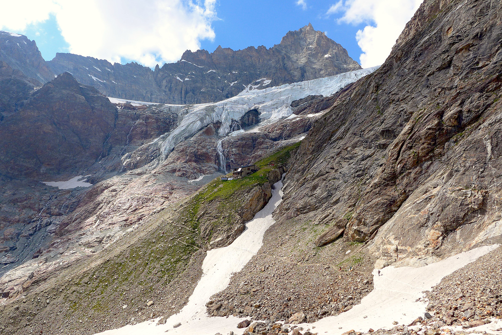
The Aosta hut is relatively small and has space for something like 30 people and is run by two super chilled-out Italian brothers who seem to have a talent and passion for making génépi in large quantities! When we arrived we got a small cup, after dinner we got another and when we came down from the Dent d’Herens the next day we got handed yet another serving of the stuff….. I didn’t personally end up loving the taste (bit too strong for my liking) but it was worth trying anyway, if not just to be polite :) As with typical Italian huts, the dinner was generous and started off with a large plate of pasta, followed by some meat and mashed potato and a fruit salad for desert. And then it was time to go to bed and try and get some sleep before another early start with breakfast at the slightly later time of 2.30am. It was fairly warm in the dormitory and there was a bit of light snoring activity going on, but I think I got a few quick naps before the alarm went. It didn’t however make eating breakfast at 2.30 feel any more normal or civilized though! Several teams were pretty efficient and got out the hut before we did and I was probably the last out but we were nevertheless starting the walk in by 3am which wasn’t exactly late either. It was noticeably mild outside and clearly t shirt weather for the walk-in, though I had several jackets packed in case we got chilly weather up high like we’d had on the Rochefort traverse.
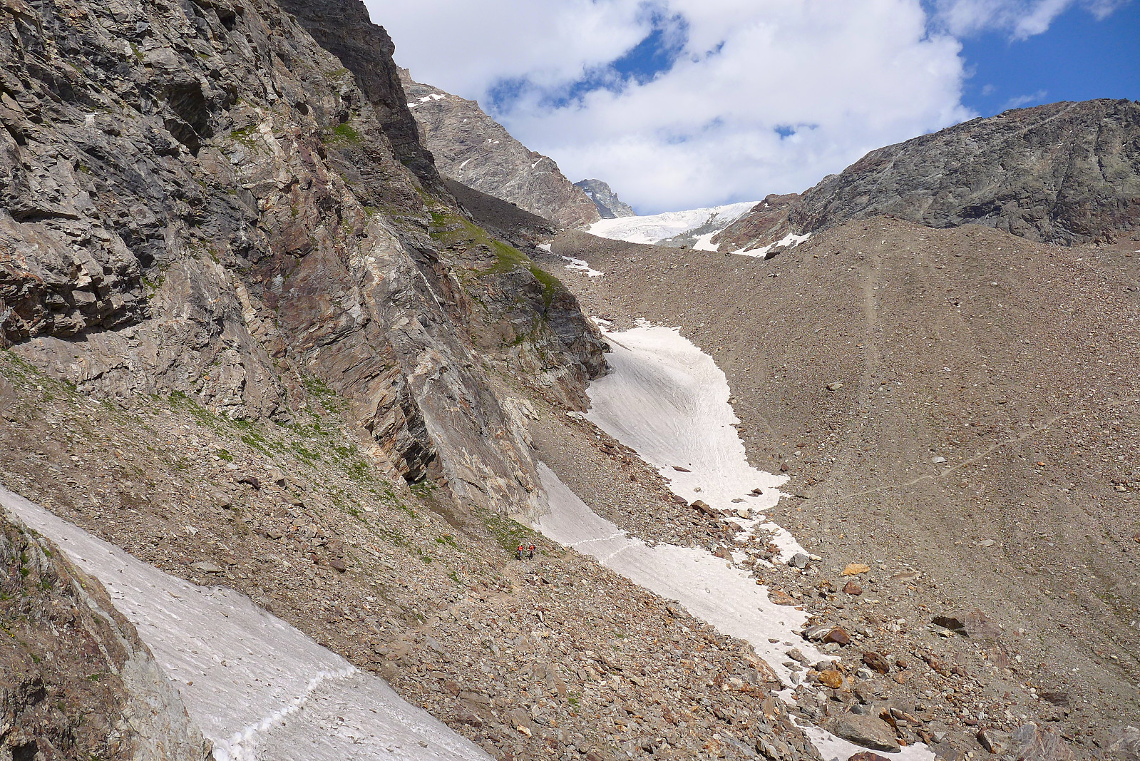
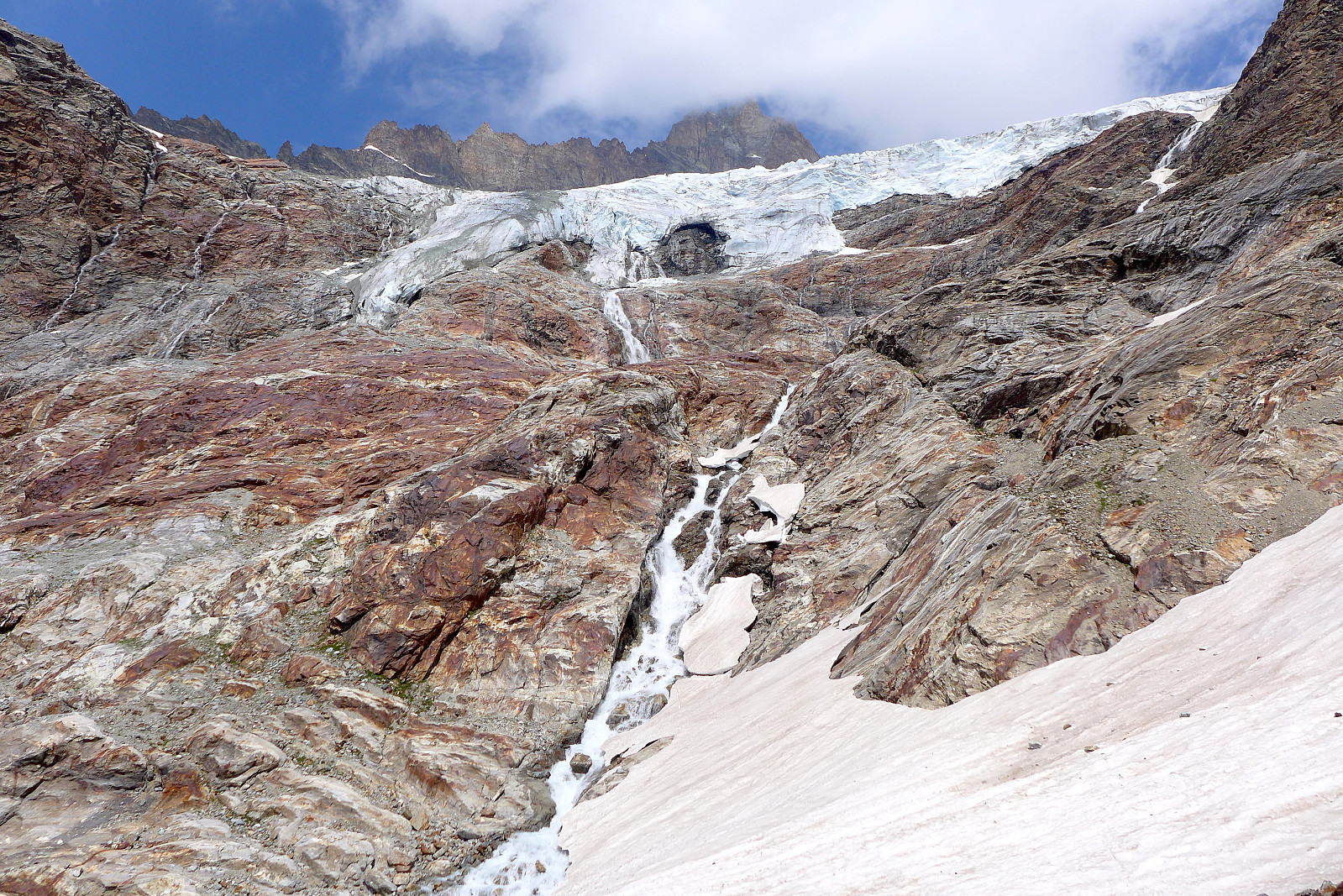
We descended a bit from the hut back down the same trail we used on the walk in, before cutting up steeply to the left to follow some sort of moraine ridge up towards the Grand Murailles glacier. As with all other alpine starts at this time of morning, we plodded slowly and steadily and quite silently too. Soon after starting up the moraine path we passed a group or two who’d left before us, but after that we didn’t have anyone in front of us and we made our way across the lower part of the glacier without crampons and unroped since it was a pretty mellow slope and no crevasses around. I guess it was around ½ hour into the day when we put on gear, since the slope of the glacier steepened and there were some crevasses starting to show up. Some other climbers chose not to, but I guess that’s their choice………
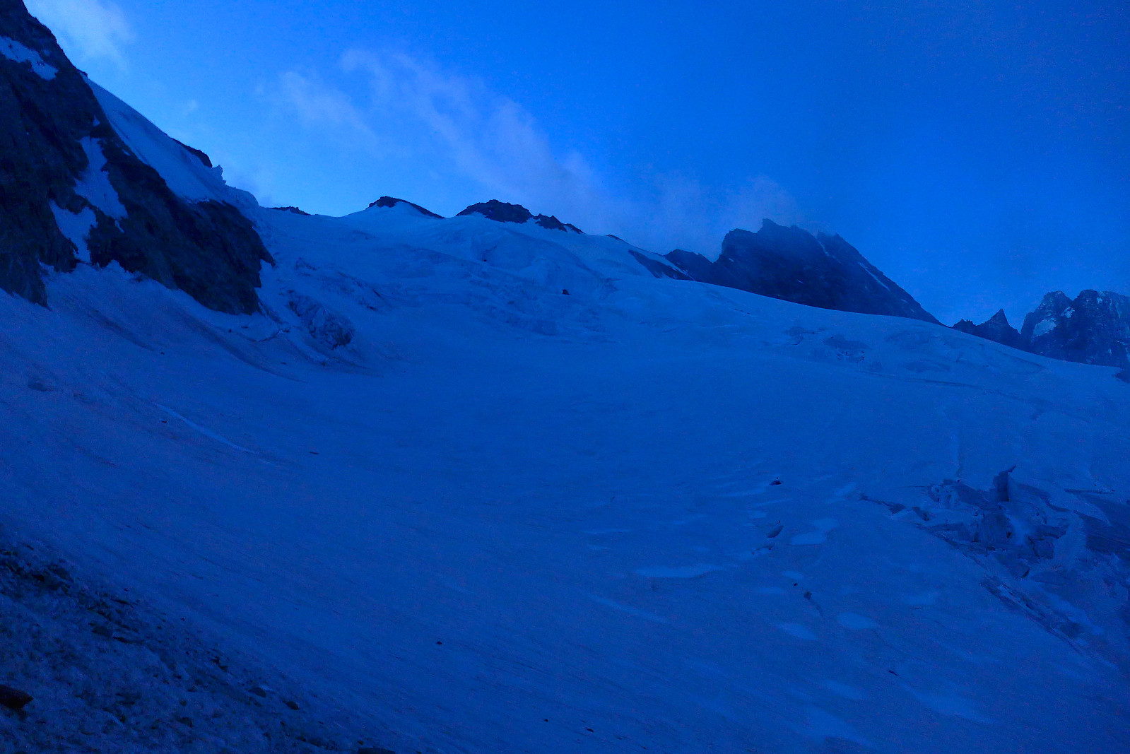
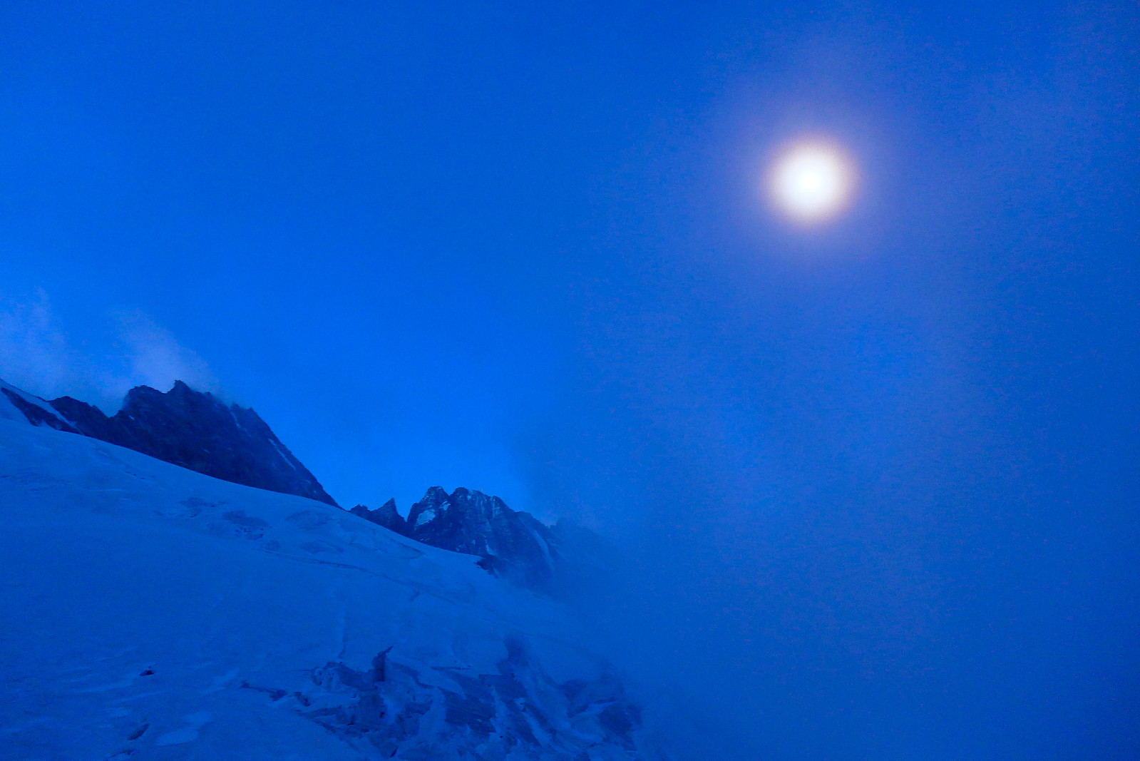

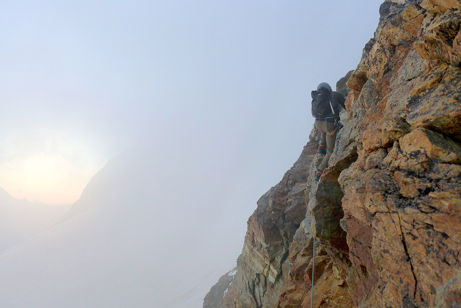
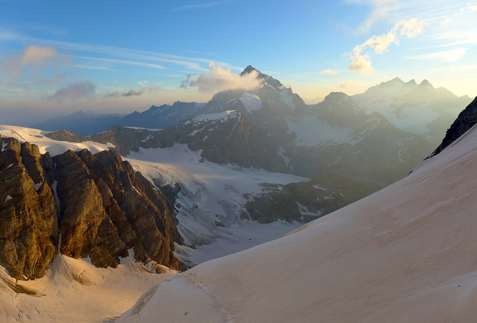
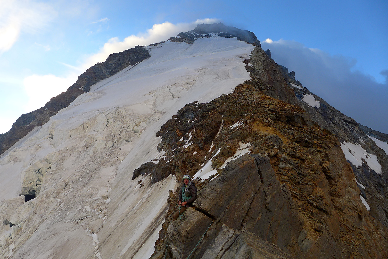
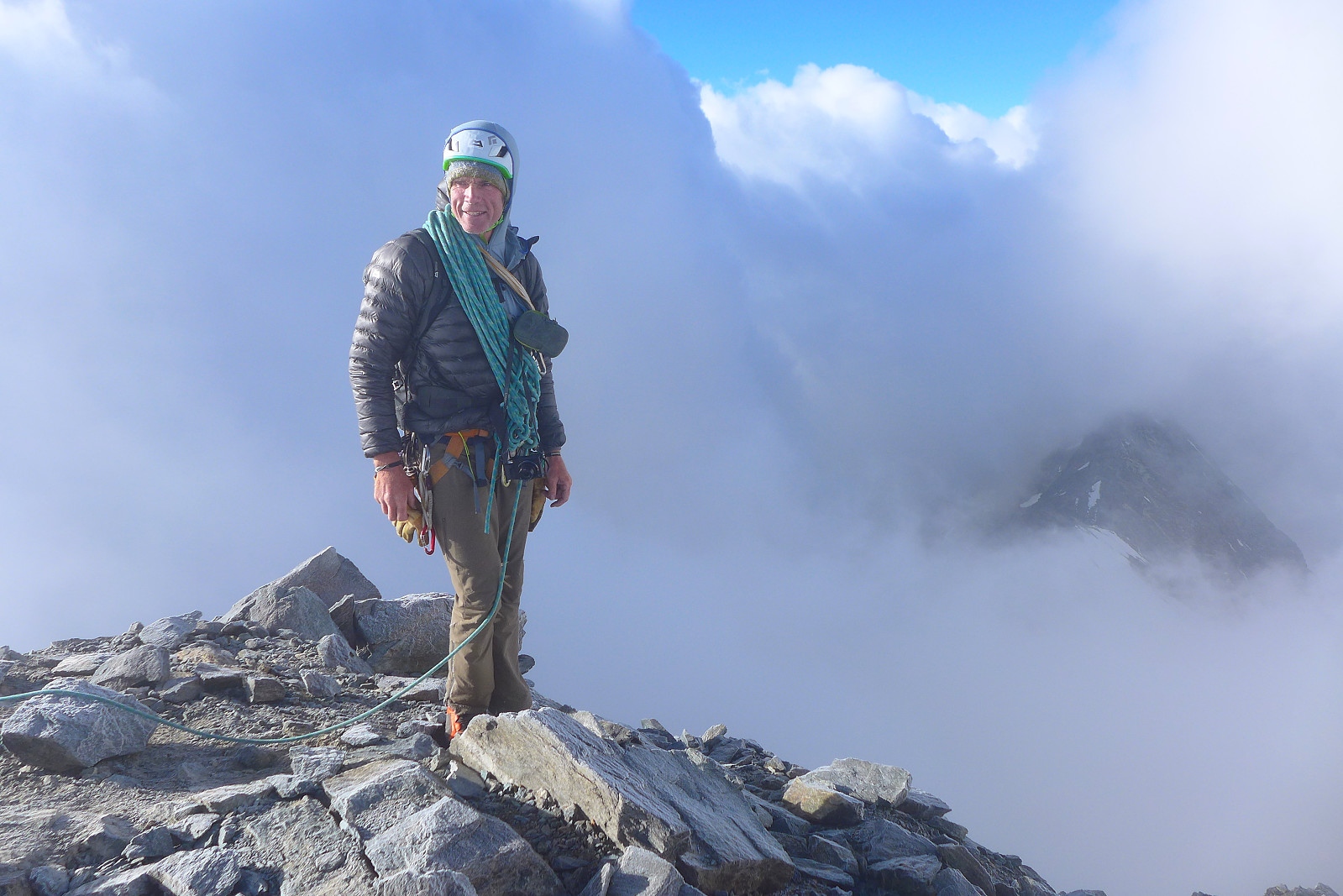
It took around 2 hours to reach the start of the fixed chains (ca. 3500m) that ascended a series of slabs leading up to a notch in the west ridge where the route started proper. Crampons came off here and some jackets got put on. It turned out to be a bit more strenuous than I expected to pull up the fixed chains, but it was nevertheless an efficient way of getting up to the ridge, certainly if there had been more groups going up at the same time. By the time we arrived at the notch in the ridge there was a fierce wind blowing across the ridge, so pretty much all of my unused jackets got put on there, plus mitts! At least the easy part was done in the dark and now it was near sunrise so we could climb the ridge without headtorches. Unfortunately there was an intermittent fog which I couldn’t figure out if it was going to blow over or stay, so there was no dramatic sunrise this morning. We did however get a great view across to the Dent Blanche which looks amazing from pretty much every angle. The first part of the ridge was easy scrambling, though sometimes not on very solid rock and we moved together for much of the time. Shortly after the initial part of the ridge we had to traverse around the left (north) side of the ridge which under dry conditions would have felt quite straightforward but this morning the rock was damp and ever so slightly slippery which made the traverse feel more delicate and exposed than it otherwise would have been. But it was fairly good rock and followed by some airy climbing on the crest of the ridge. The first rocky part of the west ridge was soon over too quickly and we found ourselves at the start of the snow flanks guarding the left side of the ridge. Under good conditions it would probably be a quick cramponing job straight up towards the final upper section of the ridge, but this morning it was surprisingly icy and felt just as delicate as traversing the slippery rock had been. Good thing we both had fairly sharp crampons for this, but it took a bit more time than if the snow had been just that bit more penetratable. There wasn’t just the issue of ice but there were also several crevasses around, some which had suspiciously weak snow bridges.
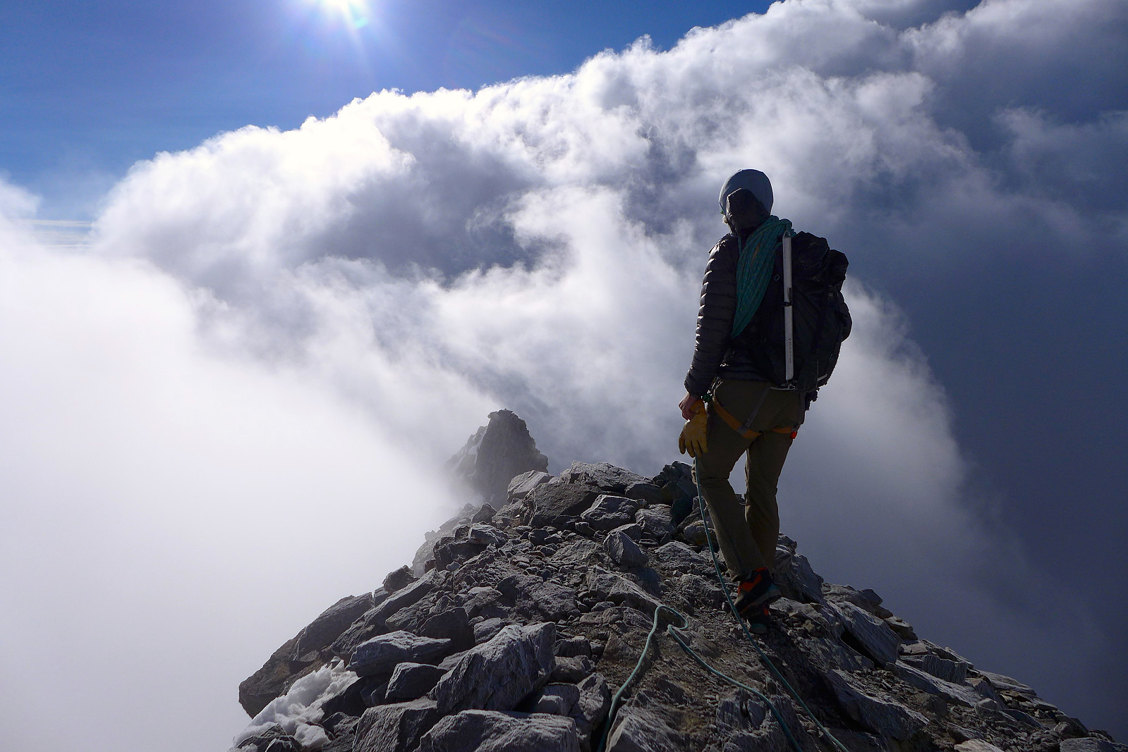
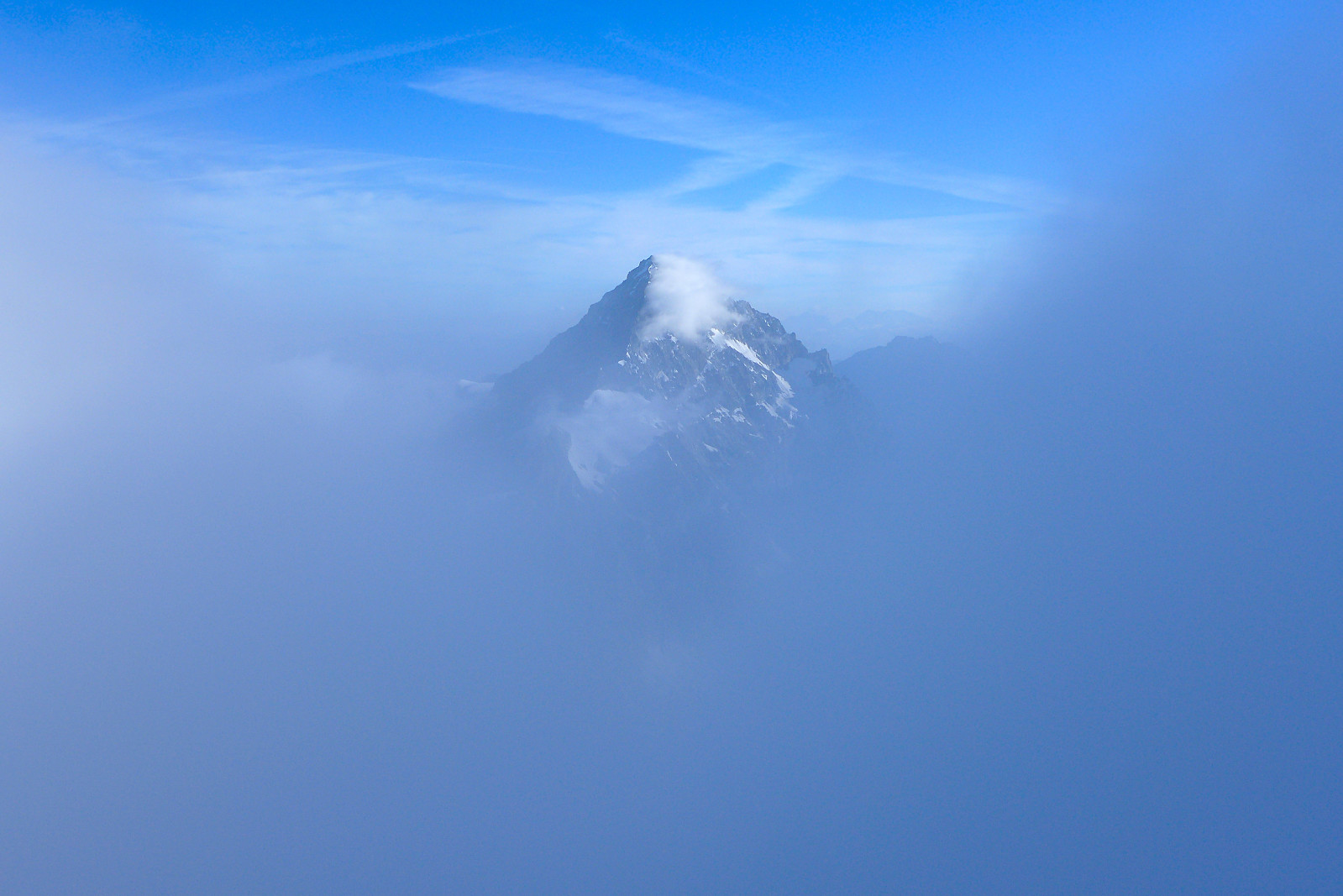
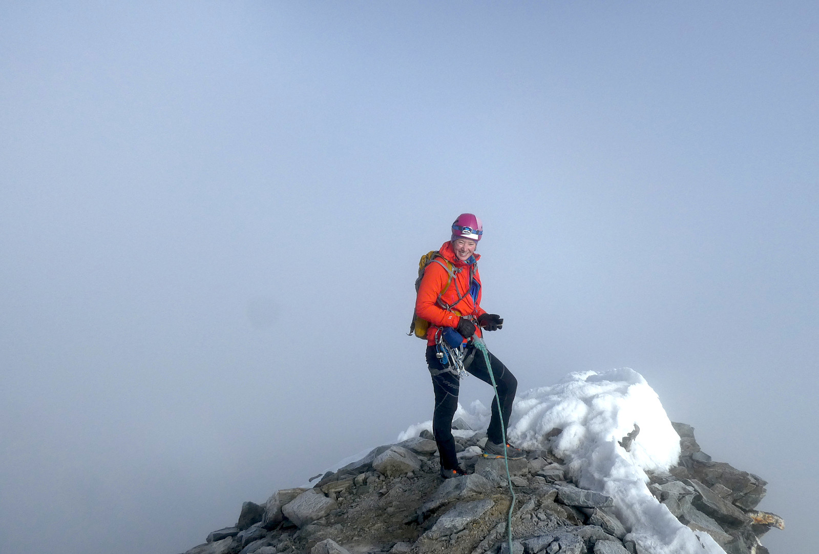
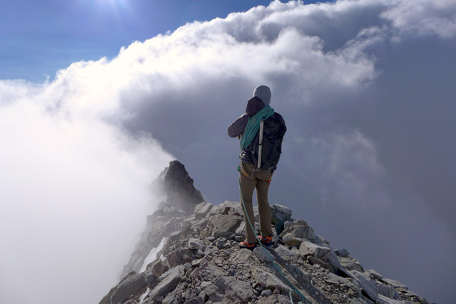
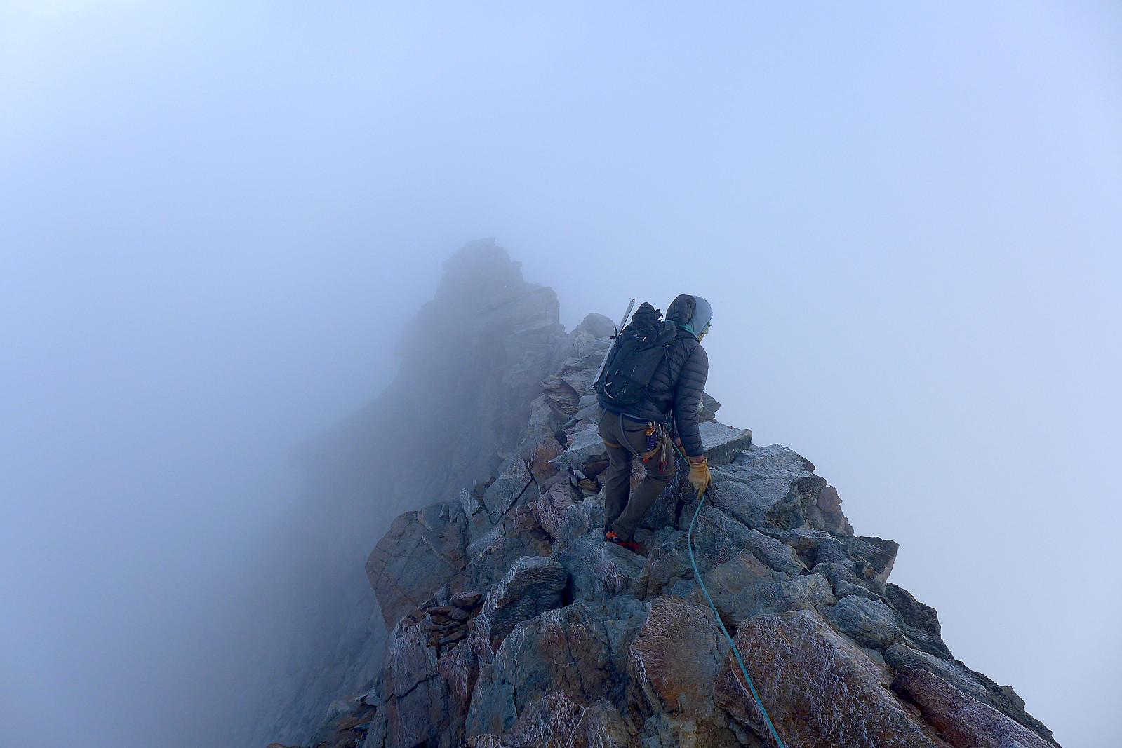
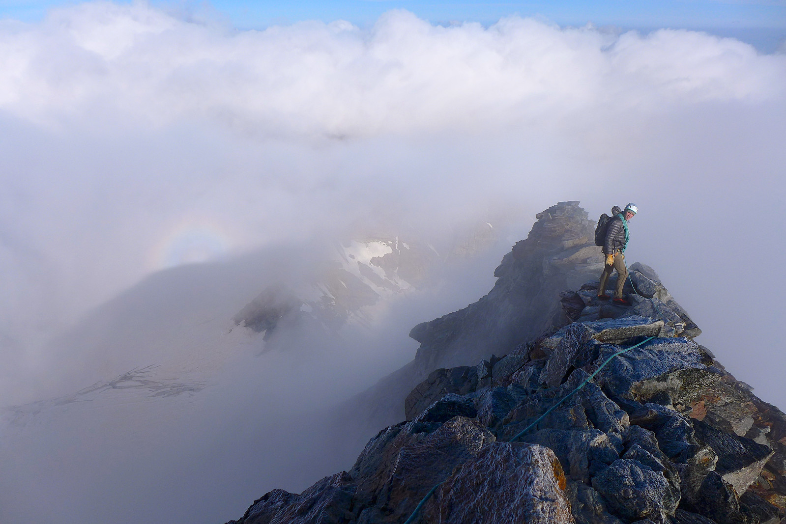
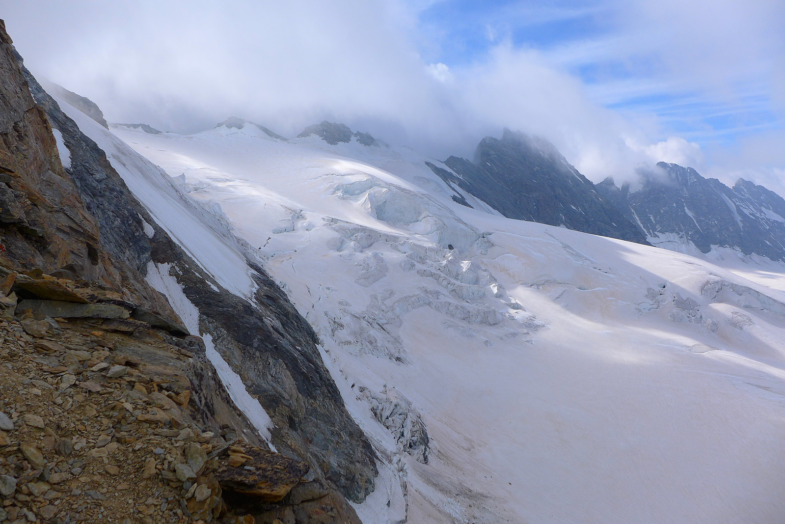
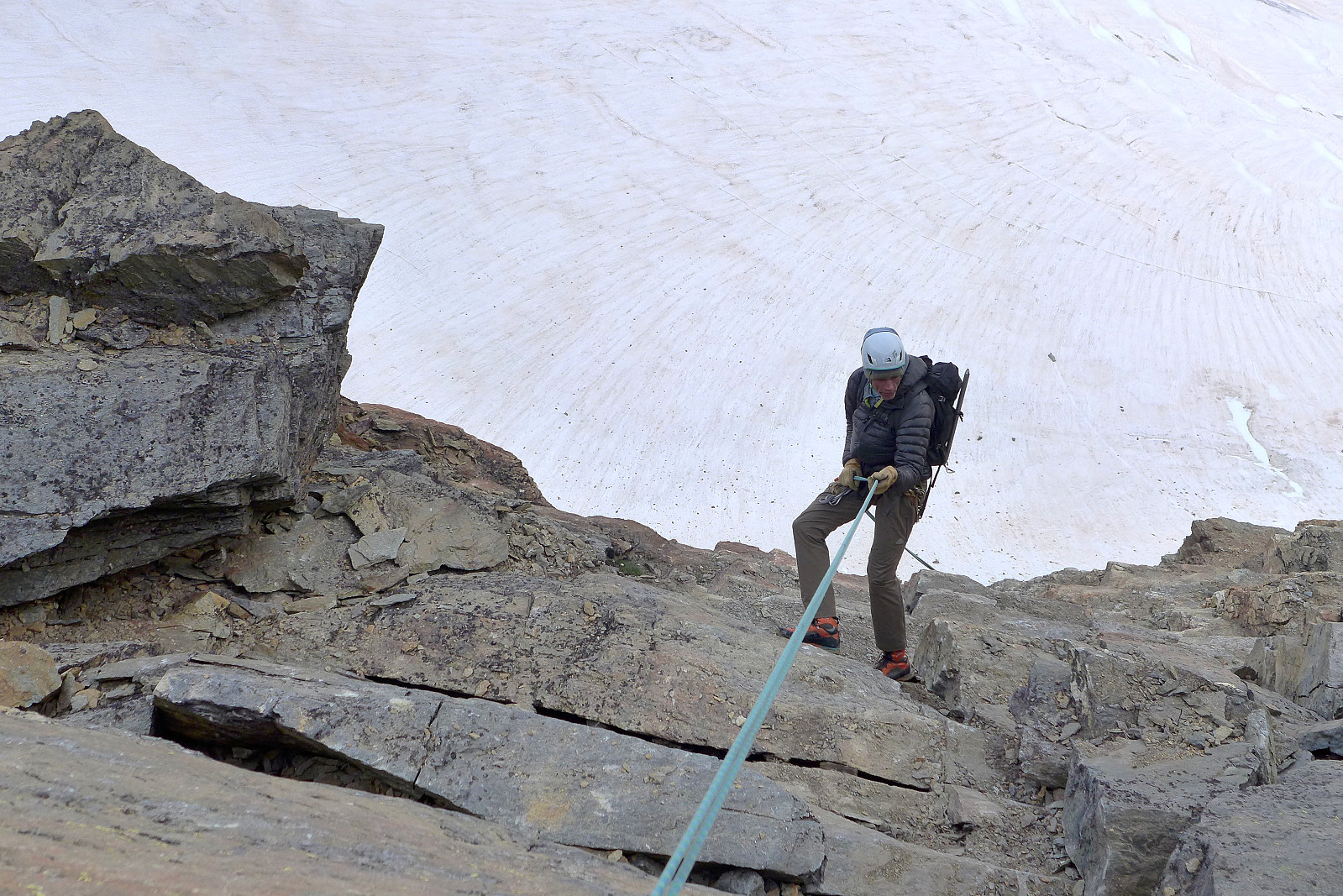
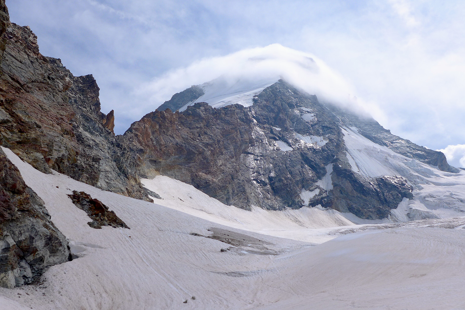
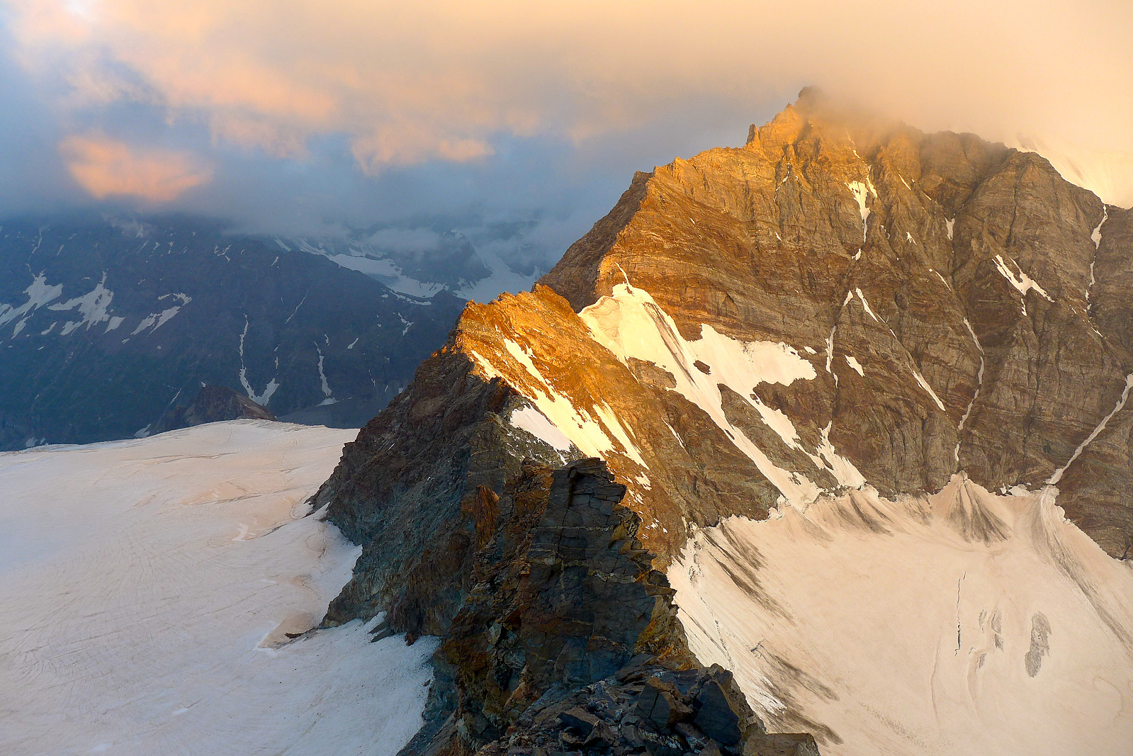
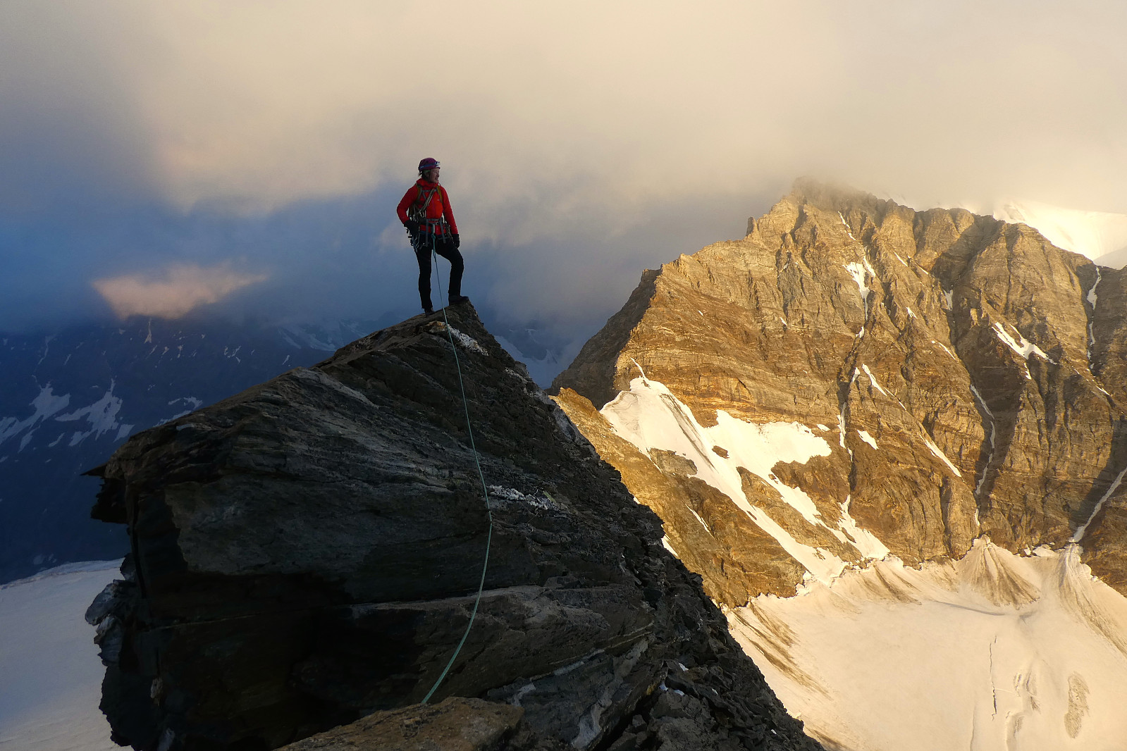
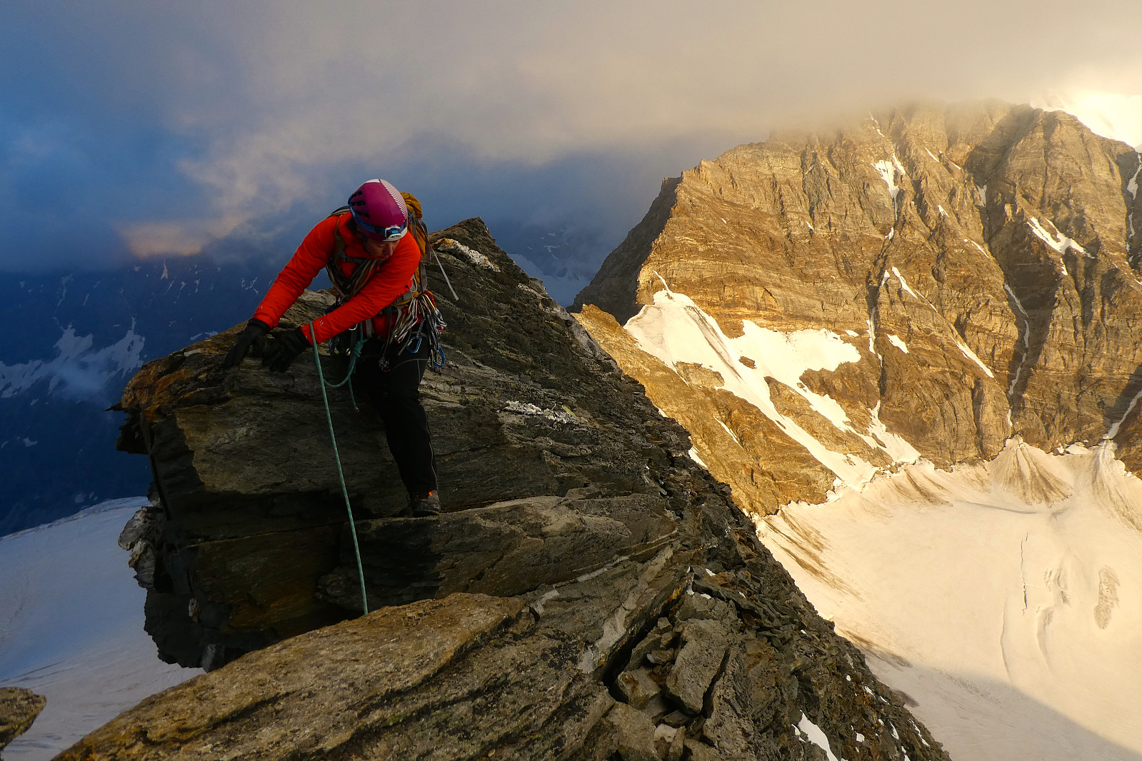
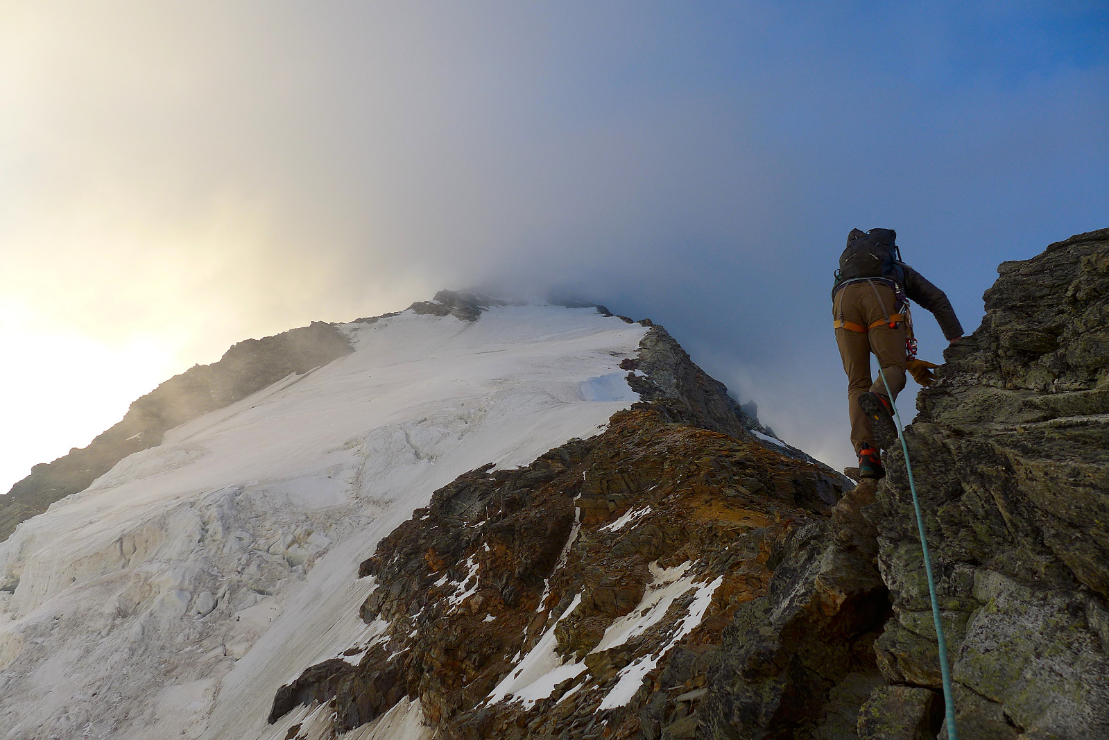
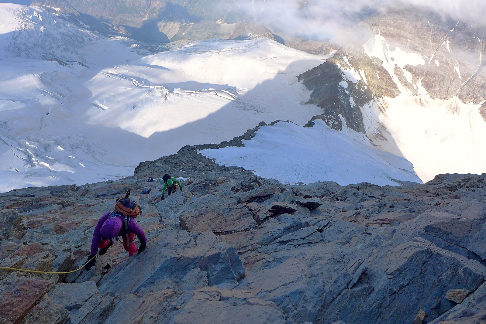
Eventually we both agreed that retreating back to the somewhat loose rock at the right hand edge of the snow flank was a better option than shortroping up steep icy slopes and we continued up this for the remainder of the ridge. There was a vague “trail” in the rock anyway, so I guess we definitely weren’t the first to have gone there. It eventually transitioned from loose to more solid pleasant and easy scrambling, before finally finishing with easy climbing and an exposed, verglassed narrow ridge up to the summit where we arrived after 5 hours. Delicate seemed to be a good overall description of conditions on the ridge this morning! Sadly the transient fog seemed to be not so much transient anymore and more permanently parked on the summit of the Dent d’Herens so we didn’t get much of an interrupted view across to the Matterhorn and the rest of the Valais peaks. There was enough wind to blow the clouds quite dramatically away every now and then, at least enough to give us a short-lived glimpse of the sun and the tops of only the very highest peaks surrounding the Dent d’Herens which was a nice consolation. After some time waiting around it was obvious that the cloud wasn’t going anywhere fast so we started to make our way back down the ridge. I guess I may need to come back and climb this mountain again in better weather! The descent was fairly quick once we’d gotten down from the verglassed part of the summit ridge. We basically followed the rock as far as possible, meeting a few climbers along the way who we’d passed earlier in the morning and who were still on their way up. Fortunately we only had to put on crampons for a short descent back down the icy snow slopes, though it was a bit time consuming to have to really stamp down hard and make sure the crampon spikes bit into the ice. For some short sections we faced in and downclimbed where it was icy and a bit steep for walking. Good thing there wasn’t too much of it to get back down to the rock again. We’d heard that there were a series of abseil posts going down the south side of the ridge which bypasses the initial part of the west ridge and allows a descent to be made straight down to the glacier. This basically started a short distance below where we left the snow and initially it seemed like a good and quick option, but after about 3 abseils it was obvious that the rock was pretty loose in most of the face, and not a great option if there are other teams of climbers descending the face at the same time. It would be quite easy to knock off a rock here and there and that could well land on someone :( The other option is to downclimb the ridge the same way as we’d done up, probably the one to recommend after having tested the abseil route.
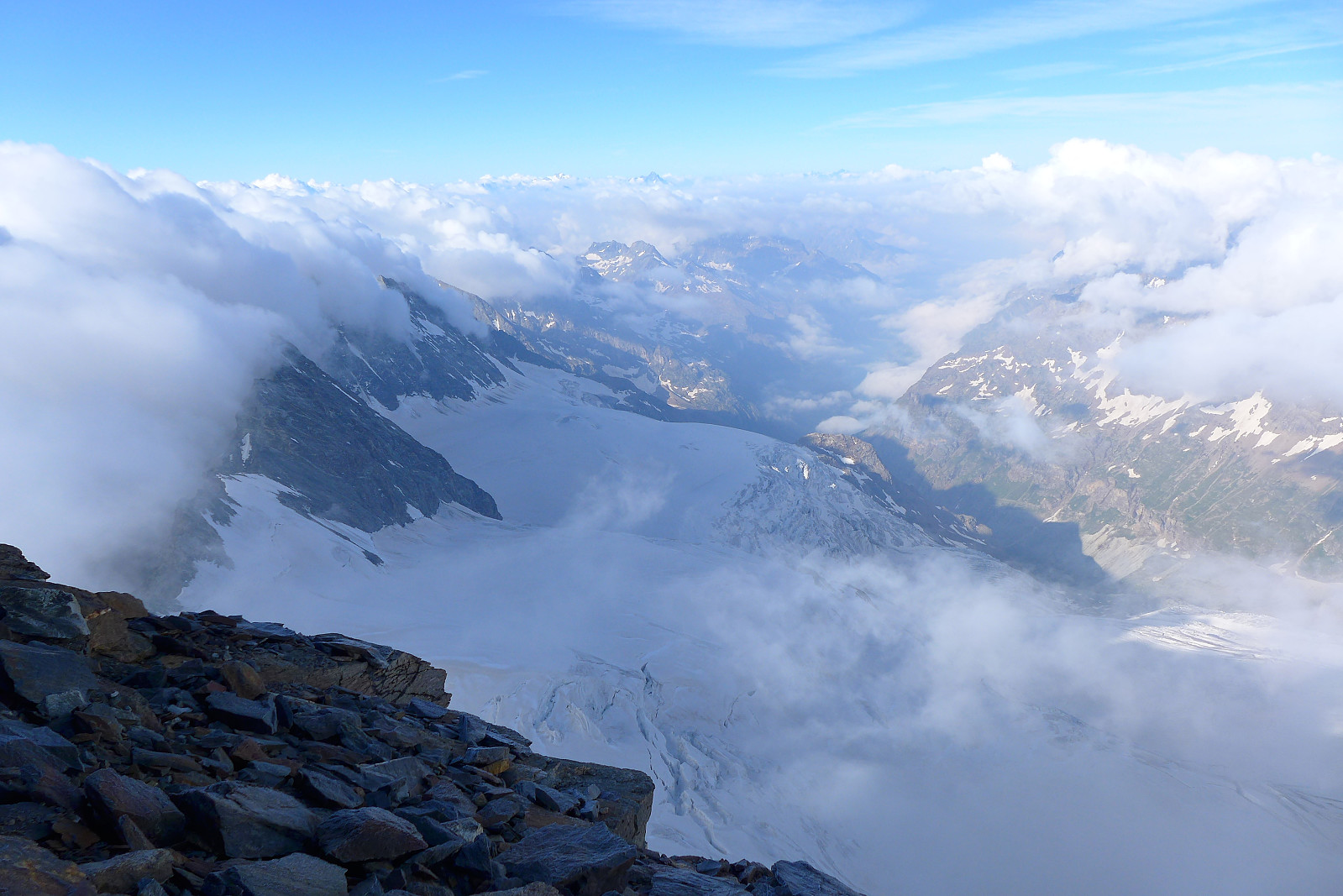
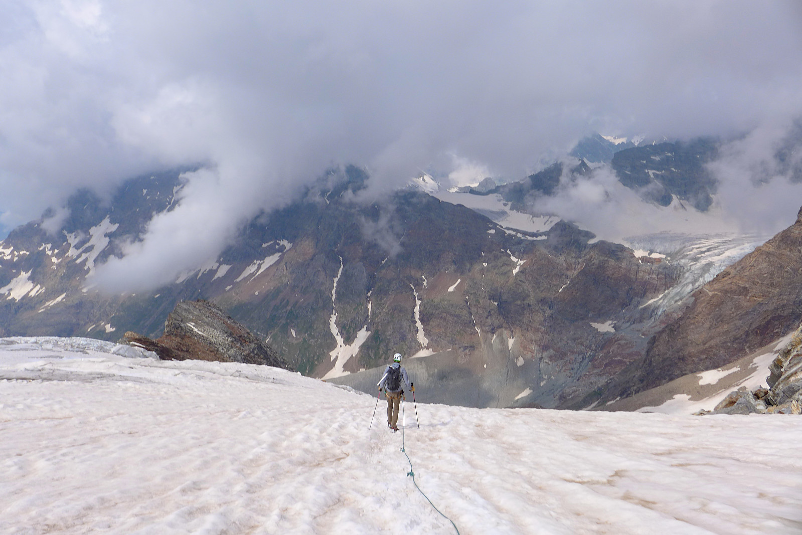
Anyway, after about 6 abseils we were back down on the Grand Murailles glacier again and the rest of the descent was an easy plod back down the same way we’d come, though now in poorer snow. Despite the cloud cover it was still warm enough to soften up the snow into a useless mush in places, so it was definitely an advantage to be descending this as early in the day as possible. The snow plodding was efficient though and quite soon we were back down at the start of the moraine trail going back to the hut, where we arrived at 11.30am and got welcomed with yet more genepi! Somewhat frustratingly the cloud had now cleared completely off the summit of the Dent d’Herens, so it seemed we were just unlucky with the timing. But I think I would definitely go back and do the west ridge again some time in the future, though it would have to be on a completely clear day with dry rock and more snow than ice!
So all that was left was to repack the rucksacks, change into shorts again and begin the very long walk back to the car at the dam by the Lago di Place Moulin. We left the hut shortly after midday and got back down to the Prarayer refuge about 2 hours later. I drank 2 cans of Coke zero here (had been walking in a zombie-like state for a while, so it was necessary) and Tim also got his required dose of caffeine before we embarked on the final long flat walk along the lake. Pretty as it was, I don’t think lake appreciation was really on my mind for the last part of the walk out. Just getting back to the car park was the sole goal :) It was about another hour of walking before we did finally get back and a good feeling when we did. It had been a fairly long day on the move all the time until now but we’d visited another fine summit which had felt a bit more remote than some of the other more easily accessed ones. I think I’ll still have to come back for the views though!
The GPS data seemed to overestimate the elevation gain which was more like 1400m….
| Start date | 20.07.2019 03:07 (UTC+01:00 DST) |
| End date | 20.07.2019 11:42 (UTC+01:00 DST) |
| Total Time | 8h 35min |
| Moving Time | 6h 26min |
| Stopped Time | 2h 08min |
| Overall Average | 2.4km/h |
| Moving Average | 3.3km/h |
| Distance | 21.0km |
| Vertical meters | 2,973m |


User comments
Spennende
Written by Olepetter 11.08.2019 11:14å følge deg på dine eventyr i Alpene! Du har nevnt snorking på hyttene som et irriterende moment også tidligere. Jeg har funnet ut at det er mulig å stenge omtrent alle lyder ute ved å benytte ørepropper OG bose headsett (aktiv støydemping) i tillegg. Men da må jeg ligge på ryggen hele tiden. Det gir en kjærkommen fristund fra all støy, og mulighet for søvn, men tar litt plass i sekken, da...
Re: Spennende
Written by hmsv1 11.08.2019 16:58Takk for tipset :) Ja jeg er litt over gjennomsnitt plaget av snorking og bruke jo ørepropper, men de klarer ikke å stenge ut all støy selv om det blir dempet til en viss grad... neste gang skal jeg vurdere en bose headsett i tillegg, det hadde vært sååå deilig å ikke høre noen ting i sovesalen!
Sv: Re: Spennende
Written by Olepetter 11.08.2019 18:22Ja, prøv det, for du vil bli OVERRASKET over hvor effektivt det er når det brukes sammen! Men husk at ørepropper er ferskvare, så du må bytte dem ut med jevne mellomrom. (Jeg synes de beste er de gule ekspanderende fra firmaet 3M. Finner ikke disse lenger på noen apotek i Norge, men handler dem på Internett. Bytter dem etter 2-3 måneders bruk.)